Wikimedi'Òc
Modes d'emploi

Cet album fait partie des albums
Cet album photos contient les sous-albums suivants :


Cement & tank wagons, Goods shed, Darlington Railway Preservation Society, Darlington 30.06.2009 P6300099 (10192726754).jpg - Ultra7

Redmire railway station on the Wensleydale Railway 23 June 2009.jpg - Ultra7

Tin Tabernacle at Thorlby - geograph.org.uk - 1396771.jpg - File Upload Bot (Magnus Manske)

UltimateLifthills.jpg - Sarion

Lyndale Garage, Gargrave - geograph.org.uk - 1397374.jpg - File Upload Bot (Magnus Manske)

Lobb Ghyll Viaduct.jpg - Slick-o-bot

Hunmanby Lock up June 209 (Nigel Coates).jpg - File Upload Bot (Magnus Manske)

Old road direction signs, Cracoe - geograph.org.uk - 1351620.jpg - File Upload Bot (Magnus Manske)

B1253 towards Octon Crossroads - geograph.org.uk - 1335009.jpg - GeographBot

B1253 towards Octon Crossroads - geograph.org.uk - 1335031.jpg - GeographBot

Cow Close Hill - geograph.org.uk - 1333030.jpg - GeographBot

Crane off Coach Street - geograph.org.uk - 1338577.jpg - GeographBot

Croome Dale Plantation - geograph.org.uk - 1335000.jpg - GeographBot

Crop Field near West Lutton - geograph.org.uk - 1334988.jpg - GeographBot

Farmland, Little Pasture - geograph.org.uk - 1335011.jpg - GeographBot

Farmland near Ling farm - geograph.org.uk - 1335036.jpg - GeographBot

Field Boundary, Helperthorpe Pasture - geograph.org.uk - 1335021.jpg - GeographBot

Field Boundary - geograph.org.uk - 1334975.jpg - GeographBot

Field Entrance, Weaverthorpe Pasture - geograph.org.uk - 1335044.jpg - GeographBot

Field Entrance - geograph.org.uk - 1333886.jpg - GeographBot

Green Lane, Weaverthorpe - geograph.org.uk - 1333992.jpg - GeographBot

Green Lane to High Field - geograph.org.uk - 1335013.jpg - GeographBot

Malton Lane, West Lutton - geograph.org.uk - 1334980.jpg - GeographBot

Minor Road Towards Butterwick - geograph.org.uk - 1335059.jpg - GeographBot

Minor Road Towards Cowlam Grange - geograph.org.uk - 1335001.jpg - GeographBot

Minor Road Towards Sledmere - geograph.org.uk - 1334986.jpg - GeographBot

Minor Road Towards Sledmere - geograph.org.uk - 1334990.jpg - GeographBot

Minor Road Towards Sledmere - geograph.org.uk - 1334994.jpg - GeographBot

Minor Road Towards Weaverthorpe - geograph.org.uk - 1335012.jpg - GeographBot

Minor Road Towards Weaverthorpe - geograph.org.uk - 1335035.jpg - GeographBot

Minor Road Towards Weaverthorpe - geograph.org.uk - 1335041.jpg - GeographBot

Rievaulx Abbey - geograph.org.uk - 1334289.jpg - GeographBot

The Star Inn, Weaverthorpe - geograph.org.uk - 1334019.jpg - GeographBot

Track to Dotterel Cottage Farm - geograph.org.uk - 1334042.jpg - GeographBot

Track to Ling Farm - geograph.org.uk - 1335054.jpg - GeographBot
A clear path - geograph.org.uk - 1342539.jpg - GeographBot

All Change. - geograph.org.uk - 1342814.jpg - GeographBot

All Saints, Girsby - geograph.org.uk - 1342977.jpg - GeographBot

Church Wynd, Burneston - geograph.org.uk - 1344044.jpg - GeographBot

Crakehall Primary School - geograph.org.uk - 1342216.jpg - GeographBot

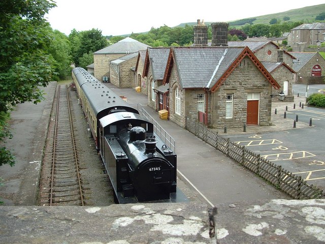
Crakehall Station - geograph.org.uk - 1342217.jpg - GeographBot

Exelby Pinfold - geograph.org.uk - 1343658.jpg - GeographBot

Exelby Smithy - geograph.org.uk - 1343629.jpg - GeographBot

Field Boundary at Crossley Wood - geograph.org.uk - 1347640.jpg - GeographBot

Footbridge over River Skirfare - geograph.org.uk - 1346452.jpg - GeographBot

Grassington Bridge - geograph.org.uk - 1344866.jpg - GeographBot

Jowland Winn - geograph.org.uk - 1347641.jpg - GeographBot

New Bridge at Kettlewell - geograph.org.uk - 1346424.jpg - GeographBot

Only Ghost Trains Stop Here Now. - geograph.org.uk - 1342905.jpg - GeographBot

Sinderby's Derelict and Soon To Be Demolished Railway Station Building. - geograph.org.uk - 1342883.jpg - GeographBot

Sinderby Station's Combined Kitchenette and Gymnasium - geograph.org.uk - 1342844.jpg - GeographBot

Sinderby Station Awaits its Fate. - geograph.org.uk - 1342865.jpg - GeographBot

St. Lambert's Church, Burneston. - geograph.org.uk - 1345155.jpg - GeographBot

St John's Church, Dalton - geograph.org.uk - 1349121.jpg - GeographBot

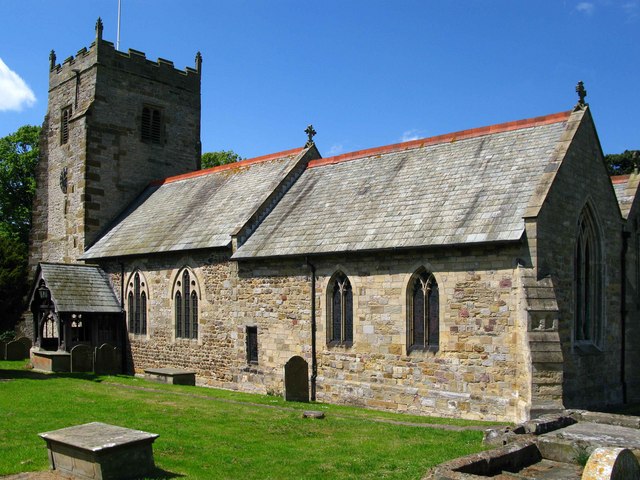
St Lambert's, Burneston - geograph.org.uk - 1345857.jpg - GeographBot

St Lambert's, Burneston - geograph.org.uk - 1345865.jpg - GeographBot

St Lambert's, Burneston - geograph.org.uk - 1345872.jpg - GeographBot

Staithes, North Yorkshire. - geograph.org.uk - 1348103.jpg - GeographBot

The A6131 at New Town, Skipton - geograph.org.uk - 1347484.jpg - GeographBot

The Green Dragon - geograph.org.uk - 1343649.jpg - GeographBot

Wesleyan Methodist Chapel - geograph.org.uk - 1343619.jpg - GeographBot

White Cross - geograph.org.uk - 1343000.jpg - GeographBot

Ye Jolly Farmers Inn - geograph.org.uk - 1349122.jpg - GeographBot

A165 Roundabout - geograph.org.uk - 1355245.jpg - GeographBot

A Nidderdale Farmstead - geograph.org.uk - 1351444.jpg - GeographBot

A riot of colours - fields on the slope of Staxton Hill - geograph.org.uk - 1357544.jpg - GeographBot

A swift hunting on Buckden Pike - geograph.org.uk - 1351773.jpg - GeographBot
All Saints, Pickhill - geograph.org.uk - 1355966.jpg - GeographBot

All Saints, Pickhill - geograph.org.uk - 1355993.jpg - GeographBot

All Saints, Pickhill - geograph.org.uk - 1356999.jpg - GeographBot

All Saints Church - Church Hill - geograph.org.uk - 1359651.jpg - GeographBot

All Saints Graveyard - Church Hill - geograph.org.uk - 1359655.jpg - GeographBot

Bowling Green - Recreation Ground - The Fairway - geograph.org.uk - 1359011.jpg - GeographBot

Brigholme Barn - geograph.org.uk - 1351577.jpg - GeographBot

Buckden Pike trig point and cairn with Pen-y-ghent on the horizon - geograph.org.uk - 1351782.jpg - GeographBot

Carousel Walk - The Fairway - geograph.org.uk - 1358990.jpg - GeographBot

Church of the Holy Nativity, Eastfield - geograph.org.uk - 1355229.jpg - GeographBot

Crop Field North of Starr Carr Farm - geograph.org.uk - 1354231.jpg - GeographBot

Crop Field with Poppies, Seamer - geograph.org.uk - 1354306.jpg - GeographBot

Deighton Avenue - Eversley Court - geograph.org.uk - 1358954.jpg - GeographBot

Eller Bottoms - geograph.org.uk - 1353979.jpg - GeographBot

Falsgrave Road, Scarborough - geograph.org.uk - 1355186.jpg - GeographBot

Farmland near the A170 - geograph.org.uk - 1355173.jpg - GeographBot

Field Drain near Starr Carr Farm - geograph.org.uk - 1354227.jpg - GeographBot

Field Entrance, beside the A1039 - geograph.org.uk - 1354084.jpg - GeographBot

Field access track, Cracoe - geograph.org.uk - 1351774.jpg - GeographBot

Field of Winter Barley - geograph.org.uk - 1350225.jpg - GeographBot

Fields on Givendale Rigg - geograph.org.uk - 1350769.jpg - GeographBot

Fields on Givendale Rigg - geograph.org.uk - 1350771.jpg - GeographBot

Finkle Hill - from Kirkgate - geograph.org.uk - 1357603.jpg - GeographBot

Footpath to Hebden - geograph.org.uk - 1357574.jpg - Geograph Update Bot

Gate toUpper Winskill Farm - geograph.org.uk - 1355598.jpg - GeographBot

Goat Scar Lane - geograph.org.uk - 1357559.jpg - GeographBot

Hall Garth Mews - Kirkgate - geograph.org.uk - 1357580.jpg - GeographBot

Henry's Mews - Kirkgate - geograph.org.uk - 1357572.jpg - GeographBot

Hilltop Manor Care Home - Finkle Street - geograph.org.uk - 1357634.jpg - GeographBot

House on Stepney Drive - geograph.org.uk - 1355181.jpg - GeographBot

Howe Postbox - geograph.org.uk - 1357001.jpg - GeographBot

Low Street - from Kirkgate - geograph.org.uk - 1357614.jpg - GeographBot

Old guide post, Cracoe - geograph.org.uk - 1351656.jpg - GeographBot

Pastures East of Upper Winskill - geograph.org.uk - 1357543.jpg - GeographBot

Pickhill Station - geograph.org.uk - 1355106.jpg - GeographBot

Post Office and Store - Low Street - geograph.org.uk - 1358215.jpg - GeographBot

Presbytery - St Joseph the Worker - Church View - geograph.org.uk - 1358222.jpg - GeographBot

Roundabout Skipton - geograph.org.uk - 1357988.jpg - GeographBot

Ruined squeeze stile - geograph.org.uk - 1357560.jpg - Geograph Update Bot
Settrington Beacon on Beacon Wold - geograph.org.uk - 1357436.jpg - GeographBot
Sherburn Library - off Finkle Street - geograph.org.uk - 1357625.jpg - GeographBot

Skipton High Street - geograph.org.uk - 1357995.jpg - GeographBot

The Leeds Arms - geograph.org.uk - 1351065.jpg - GeographBot

The Leeds Hotel - geograph.org.uk - 1351063.jpg - GeographBot

Tinkers' Lane - geograph.org.uk - 1357491.jpg - Geograph Update Bot
Trig point on Beacon Wold - geograph.org.uk - 1355601.jpg - GeographBot
VR Postbox - geograph.org.uk - 1354051.jpg - GeographBot

Welcome to Pickhill - geograph.org.uk - 1355108.jpg - GeographBot

You've got to be quick to catch a swift - geograph.org.uk - 1351748.jpg - GeographBot

Bridge over the beck at Kettlewell - geograph.org.uk - 1365967.jpg - GeographBot

Brompton Stables - geograph.org.uk - 1364028.jpg - GeographBot

Field Near Prospect Farm - geograph.org.uk - 1369831.jpg - GeographBot

Fields towards Hollingworth Spring - geograph.org.uk - 1369977.jpg - GeographBot

Phone box in Settle - geograph.org.uk - 1369879.jpg - GeographBot

St Joseph's, Newby - geograph.org.uk - 1364821.jpg - GeographBot

St Mary's, Thornton Watlass - geograph.org.uk - 1363708.jpg - GeographBot

Starbotton Village - geograph.org.uk - 1365980.jpg - GeographBot

Track by the side of a reservoir - geograph.org.uk - 1365503.jpg - GeographBot

Upper Settle and Settle - geograph.org.uk - 1365499.jpg - GeographBot

View from Upper Settle - geograph.org.uk - 1365489.jpg - GeographBot

West Front of Hovingham Hall - geograph.org.uk - 1363986.jpg - GeographBot

Wighill Church - geograph.org.uk - 1365465.jpg - GeographBot

All Saints Church, Wykeham - geograph.org.uk - 1379272.jpg - GeographBot

Bridges from Settle to Giggleswick over the Ribble - geograph.org.uk - 1370143.jpg - GeographBot

Cottage by the Green, East Marton - geograph.org.uk - 1377411.jpg - GeographBot

Cottages, Ruston - geograph.org.uk - 1379253.jpg - GeographBot

Crop Field, Allison Wold Farm - geograph.org.uk - 1378921.jpg - GeographBot

Crop Field North of Sherburn Cut - geograph.org.uk - 1379110.jpg - GeographBot
Dales Museum, Hawes - geograph.org.uk - 1378601.jpg - GeographBot

Diesel Railcar (DMU) at Redmire Station - geograph.org.uk - 1378631.jpg - GeographBot

Farm Buildings, Allison Wold - geograph.org.uk - 1378905.jpg - GeographBot

Farm Track, Sherburn Ings - geograph.org.uk - 1379141.jpg - GeographBot

Field Drain, Sherburn Ings - geograph.org.uk - 1379134.jpg - GeographBot

Field Entrance - geograph.org.uk - 1379829.jpg - GeographBot

Field Entrance North East of Phoenix House Farm - geograph.org.uk - 1379206.jpg - GeographBot

Field North of the A64 - geograph.org.uk - 1378977.jpg - GeographBot

Gated Field Entrance - geograph.org.uk - 1379805.jpg - GeographBot

Giggleswick Station - geograph.org.uk - 1370172.jpg - GeographBot

Giggleswick Station - geograph.org.uk - 1370175.jpg - GeographBot

Giggleswick Station - geograph.org.uk - 1370179.jpg - GeographBot

Leander approaching Skipton - geograph.org.uk - 1375440.jpg - GeographBot

Minor Road Towards Sherburn - geograph.org.uk - 1378900.jpg - GeographBot

Minor Road Towards Sherburn - geograph.org.uk - 1378912.jpg - GeographBot

Minor Road Towards Sherburn - geograph.org.uk - 1378918.jpg - GeographBot

Minor Road Towards Wykeham - geograph.org.uk - 1379147.jpg - GeographBot

North of Leyburn from Cross head Bank - geograph.org.uk - 1375604.jpg - GeographBot

Pavement on Low Midge Hills - geograph.org.uk - 1375252.jpg - GeographBot

Private road to Fair Oaks farm - geograph.org.uk - 1378679.jpg - GeographBot

Selby, Market Cross - geograph.org.uk - 1372231.jpg - GeographBot

Selby, Market Cross - geograph.org.uk - 1372240.jpg - GeographBot

Selby, Market Cross - geograph.org.uk - 1372282.jpg - GeographBot

Selby, Market Lane - geograph.org.uk - 1372211.jpg - GeographBot

Settrington Service Reservoir - geograph.org.uk - 1376587.jpg - GeographBot

Single track line in Newton Dale - geograph.org.uk - 1376535.jpg - GeographBot

Sleights Road leaves the woods - geograph.org.uk - 1376527.jpg - GeographBot

The footbridge near Levisham Church - geograph.org.uk - 1376519.jpg - GeographBot

The stream near Levisham Church - geograph.org.uk - 1376515.jpg - GeographBot

Towards the Shawl from Cross Head Bank - geograph.org.uk - 1375612.jpg - GeographBot

Track to Potter Brompton Farm - geograph.org.uk - 1378925.jpg - GeographBot

A corner of Kettlewell - geograph.org.uk - 1387215.jpg - GeographBot

Bridge at Settle over the Ribble - geograph.org.uk - 1384318.jpg - GeographBot

Captain Cook Square - geograph.org.uk - 1386122.jpg - GeographBot

Clapham Station - geograph.org.uk - 1384521.jpg - GeographBot

Clapham Station - geograph.org.uk - 1384525.jpg - GeographBot

Clapham Station - geograph.org.uk - 1384532.jpg - GeographBot

Giggleswick Station - geograph.org.uk - 1384428.jpg - GeographBot

Helwith Bridge Quarry - geograph.org.uk - 1384205.jpg - GeographBot

Near Sulber pot Limestone - geograph.org.uk - 1386296.jpg - GeographBot

Newby - geograph.org.uk - 1384559.jpg - GeographBot

Newby - geograph.org.uk - 1384575.jpg - GeographBot

Newby - geograph.org.uk - 1384579.jpg - GeographBot

Newby - geograph.org.uk - 1384584.jpg - GeographBot

Parting of the ways - geograph.org.uk - 1387264.jpg - GeographBot
Ribblehead Viaduct from Broadrake - geograph.org.uk - 1382168.jpg - GeographBot

Ribblehead Viaduct from Broadrake - geograph.org.uk - 1382195.jpg - GeographBot

Ribblehead Viaduct from Broadrake - geograph.org.uk - 1382202.jpg - GeographBot

Ribblehead Viaduct from Ivescar - geograph.org.uk - 1382091.jpg - GeographBot

Ribblehead Viaduct from Ivescar - geograph.org.uk - 1382106.jpg - GeographBot

Ribblehead Viaduct from Ivescar - geograph.org.uk - 1382141.jpg - GeographBot

Ribblehead Viaduct from Ivescar - geograph.org.uk - 1382147.jpg - GeographBot

Ribblehead Viaduct from Ivescar - geograph.org.uk - 1382164.jpg - GeographBot

Ribblehead Viaduct from Parker's Moss - geograph.org.uk - 1382476.jpg - GeographBot

Stackhouse - geograph.org.uk - 1384298.jpg - GeographBot

Stackhouse - geograph.org.uk - 1384302.jpg - GeographBot

Stackhouse - geograph.org.uk - 1384305.jpg - GeographBot

Stackhouse - geograph.org.uk - 1384308.jpg - GeographBot

The ford, Gayle - geograph.org.uk - 1383770.jpg - GeographBot

The perfect summer scene - geograph.org.uk - 1383690.jpg - GeographBot

Town Head - geograph.org.uk - 1387284.jpg - GeographBot

View south-east from near Stirton - geograph.org.uk - 1388865.jpg - GeographBot

Winterscales Beck at Gunnerfleet Farm - geograph.org.uk - 1382508.jpg - GeographBot

Zarina's tearoom, New Lane - geograph.org.uk - 1387289.jpg - GeographBot

Barn with canalside access - geograph.org.uk - 1395491.jpg - GeographBot

Bog Lane sewage treatment works - geograph.org.uk - 1390336.jpg - GeographBot

Brook Street - demolition site - geograph.org.uk - 1395353.jpg - GeographBot

Brook Street swing bridge - geograph.org.uk - 1395345.jpg - GeographBot

Broughton Road bridge over the railway - geograph.org.uk - 1391254.jpg - GeographBot
Common back yard with washing - geograph.org.uk - 1395449.jpg - GeographBot

Culvert Lane - geograph.org.uk - 1391153.jpg - GeographBot

Culvert Lane - overgrown - geograph.org.uk - 1391198.jpg - GeographBot

Culvert Lane passing under the canal - geograph.org.uk - 1391205.jpg - GeographBot

Eller Beck looking downstream from the canal bridge - geograph.org.uk - 1395336.jpg - GeographBot

Emergency phone on the A65 at Thorlby - geograph.org.uk - 1397222.jpg - GeographBot

Field adjacent to the A65 at Stirton - geograph.org.uk - 1390325.jpg - GeographBot

Flat grasslands in the Aire Valley near Skipton - geograph.org.uk - 1391161.jpg - GeographBot

Gate into the pasture - geograph.org.uk - 1397278.jpg - GeographBot

Heslaker Farm - geograph.org.uk - 1395617.jpg - GeographBot

Inghey old bridge (1) - geograph.org.uk - 1395598.jpg - GeographBot

Inghey old bridge (2) - geograph.org.uk - 1395603.jpg - GeographBot
Late spring flowers on Bog Lane - geograph.org.uk - 1390337.jpg - GeographBot

Level crossing at Niffany - geograph.org.uk - 1391228.jpg - GeographBot

Line of electricity poles across the Aire valley - geograph.org.uk - 1395564.jpg - GeographBot

Manor Farm, Thorlby - geograph.org.uk - 1396775.jpg - GeographBot

New steps adjacent to Dewhursts Mill - geograph.org.uk - 1395402.jpg - GeographBot

Niffany water pumping station - geograph.org.uk - 1395591.jpg - GeographBot

Overgrown stile - geograph.org.uk - 1390326.jpg - GeographBot

Pipe bridge across the canal - geograph.org.uk - 1395440.jpg - GeographBot

Raikes Road - geograph.org.uk - 1395205.jpg - GeographBot

Roundabout at the junction of the A59 and A65 - geograph.org.uk - 1390324.jpg - GeographBot

Scarborough fire station - geograph.org.uk - 1394815.jpg - GeographBot

Sheep on the Aire flood plain - geograph.org.uk - 1395545.jpg - GeographBot

Skipton fire station - geograph.org.uk - 1395412.jpg - GeographBot

Stone arch bridge for farm traffic - geograph.org.uk - 1397310.jpg - GeographBot

Stone barn with upper level - geograph.org.uk - 1390328.jpg - GeographBot

Tall tree with sheep - geograph.org.uk - 1390327.jpg - GeographBot

Tarn House lodge - geograph.org.uk - 1390334.jpg - GeographBot

The Midland line at Niffany - geograph.org.uk - 1391242.jpg - GeographBot

Thorlby canal swing bridge in action - geograph.org.uk - 1397242.jpg - GeographBot

Traffic lights for cattle on the A65 - geograph.org.uk - 1397212.jpg - GeographBot
Transmitter above the A65 - geograph.org.uk - 1390335.jpg - GeographBot

Typical scenery in Airedale - geograph.org.uk - 1391185.jpg - GeographBot

White Hills Lane - geograph.org.uk - 1390332.jpg - GeographBot

White Hills golf driving range - geograph.org.uk - 1390333.jpg - GeographBot

Field of wild flower from near Bruntscar towards Ingleborough - geograph.org.uk - 1409616.jpg - GeographBot

Limestone pavement backed by Pen-y-ghent - geograph.org.uk - 1409575.jpg - GeographBot

Approach to Hackness from Everley - geograph.org.uk - 1425382.jpg - GeographBot

Cockrah Foot - geograph.org.uk - 1425376.jpg - GeographBot

The entrance to Edge Dell - geograph.org.uk - 1425957.jpg - GeographBot

A hare - geograph.org.uk - 1509412.jpg - GeographBot
Danby railway station - geograph.org.uk - 1599293.jpg - GeographBot

Thornaby railway station - Platform 1 - geograph.org.uk - 1598607.jpg - GeographBot

Thornaby railway station - Platform 2 - geograph.org.uk - 1598611.jpg - GeographBot

Thornaby railway station car park - geograph.org.uk - 1598602.jpg - GeographBot

Ana Cross on Spaunton Moor - geograph.org.uk - 1608494.jpg - GeographBot

Church of St Mary and St Laurence in Rosedale Abbey - geograph.org.uk - 1607177.jpg - GeographBot

Fields and stone walls - geograph.org.uk - 1650302.jpg - GeographBot

Field Marshall no 16384 SIIIA (ex french) at Newby 2009 - IMG 2545.jpg - Bdk

John Deere 6630 Premium at Newby 2009 - 2473.jpg - Bdk

Heslaker Farm - geograph.org.uk - 1395617 (cropped).jpg - Saga City

Mike Harding fishing in the River Ribble near Settle. A series of photographs for his book, A Guide to tying North Country Flies, published by Aurum Press. (11964052785).jpg - Fæ

Field of dreams (4101981560).jpg - Herkuleshippo

Rape field (3646724299).jpg - Herkuleshippo

Rape field with poppies (3646722185).jpg - Herkuleshippo

Ferris Wheel in Scarborough (3603824438).jpg - Herkuleshippo

Ferris Wheel in Scarborough (3603010151).jpg - Herkuleshippo

Harrogate cenotaph (6156671829).jpg - Ham II

Rations (3644297086).jpg - Dvaderv2

Queen Margaret's School, York UK.jpg - Mwilkinson-queenmargarets