Wikimedi'Òc
Modes d'emploi

Cet album fait partie des albums


Cowsinfieldedit.jpg - Pulsar.co.nr

Cowsinfieldedit2.jpg - Pulsar.co.nr
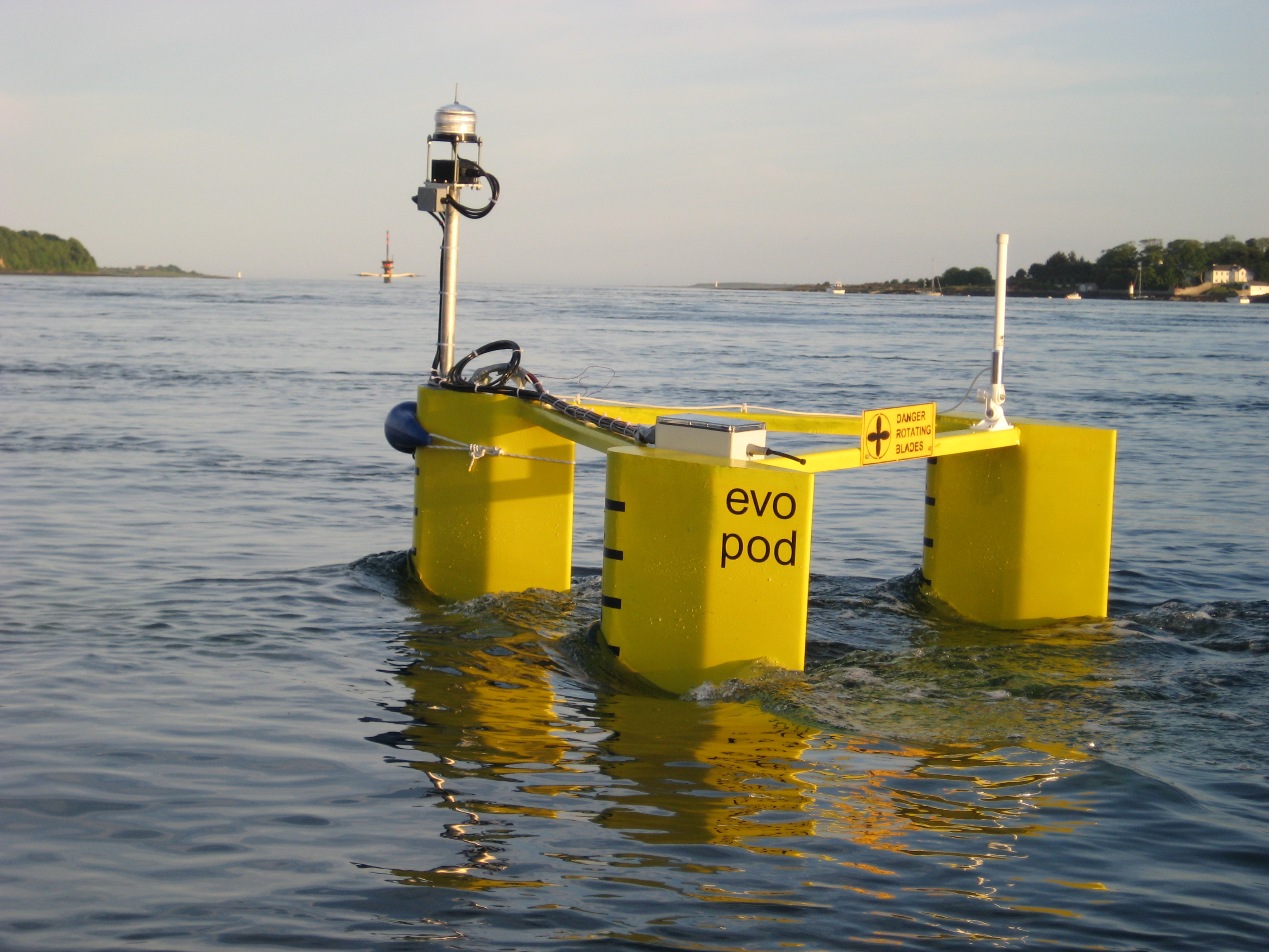
Evopod in Strangford Lough 2008.jpg - Mindlessworker

Classic Coaches mini coach Mercedes Benz in Strangford, County Down 19 June 2008.jpg - Ultra7
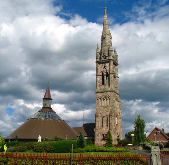
St Colmcille's church, Holywood, County Down.jpg - Asarlaí

'The Salty Dog', Bangor (detail) - geograph.org.uk - 831827.jpg - GeographBot

Bangor marina (6) - geograph.org.uk - 833457.jpg - GeographBot

Church of Our Lady of the Assumption, Newcastle - geograph.org.uk - 830510.jpg - GeographBot

Floats and shackles, Strangford - geograph.org.uk - 839581.jpg - GeographBot

Gate near Portaferry - geograph.org.uk - 839161.jpg - GeographBot

Lane, bangor - geograph.org.uk - 830882.jpg - GeographBot

Old cottage at Drumkeeragh - geograph.org.uk - 834090.jpg - GeographBot

Princetown Avenue, Bangor - geograph.org.uk - 833388.jpg - GeographBot

Princetown Road, Bangor - geograph.org.uk - 833379.jpg - GeographBot

Rollerblading by Bangor marina - geograph.org.uk - 833453.jpg - GeographBot

Rural phone box near Portaferry - geograph.org.uk - 837655.jpg - GeographBot

Slieve Donard - geograph.org.uk - 830112.jpg - GeographBot

Temporary lifeboat station, Portaferry - geograph.org.uk - 837982.jpg - GeographBot

The Ballyquintin Road near Portaferry - geograph.org.uk - 837796.jpg - GeographBot

The Castlewellan Road near Dromara (2) - geograph.org.uk - 833906.jpg - GeographBot

The Castlewellan road at Drumkeeragh - geograph.org.uk - 833961.jpg - GeographBot

The Mountain Road near Dromara - geograph.org.uk - 834124.jpg - GeographBot

Trinity Presbyterian Church, Bangor - geograph.org.uk - 833400.jpg - GeographBot
Tyrone's Ditches Presbyterian Church - geograph.org.uk - 836499.jpg - GeographBot

Benraw mountain - geograph.org.uk - 845600.jpg - GeographBot

By Bangor Boat to the Gobbins (2) - geograph.org.uk - 849884.jpg - GeographBot

Sign by Bangor marina - geograph.org.uk - 844426.jpg - GeographBot

Survey vessel 'Lia' arriving at Bangor - geograph.org.uk - 847322.jpg - GeographBot
The Drumadonnell River near Ballyward - geograph.org.uk - 845458.jpg - GeographBot

The Fruitvalley Road near Ballyward - geograph.org.uk - 845515.jpg - GeographBot

Track near Ballyward - geograph.org.uk - 845489.jpg - GeographBot

Coach, Strangford - geograph.org.uk - 850922.jpg - GeographBot

Killough harbour (1) - geograph.org.uk - 851137.jpg - GeographBot

Killough harbour (2) - geograph.org.uk - 851160.jpg - GeographBot

St Colmcille's, Holywood - geograph.org.uk - 856018.jpg - GeographBot

Stella Maris Street, Strangford - geograph.org.uk - 850928.jpg - GeographBot

Terrace, Church View, Holywood - geograph.org.uk - 856852.jpg - GeographBot

Terrace, High Street, Holywood - geograph.org.uk - 856835.jpg - GeographBot

The Downpatrick Road, Strangford - geograph.org.uk - 850943.jpg - GeographBot

Fishing boats off Bangor - geograph.org.uk - 860826.jpg - GeographBot

The "West Express" at Warrenpoint - geograph.org.uk - 860056.jpg - GeographBot

The 'Lord Nelson', Ballyholme Bay, Bangor - geograph.org.uk - 863723.jpg - GeographBot

Fishing on Derryleckagh Lake - geograph.org.uk - 1092873.jpg - GeographBot

Green-belt Farmyard, Dromara Road, Dromore - geograph.org.uk - 1253728.jpg - GeographBot

Donard forest, Newcastle - geograph.org.uk - 1348817.jpg - GeographBot