Wikimedi'Òc
Modes d'emploi

Cet album fait partie des albums
Cet album photos contient les sous-albums suivants :


Palace of Westminster from Roque's map (1745).jpg - Manchot sanguinaire~commonswiki
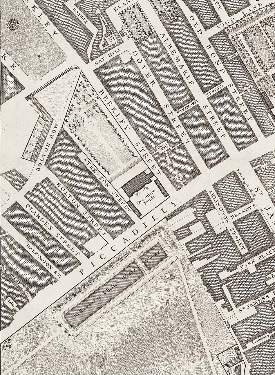
Devonshire House on John Rocque's 1746 map of London.jpg - Bhoeble~commonswiki

Northumberland House Rocque.jpg - Merchbow~commonswiki

Marlborough House Rocque edited.jpg - Merchbow~commonswiki

Leicester Square Rocque edited.jpg - Merchbow~commonswiki

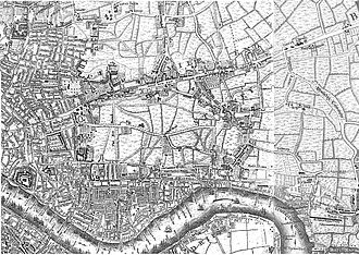
East End 1745 Roque Map.jpg - Mahlum
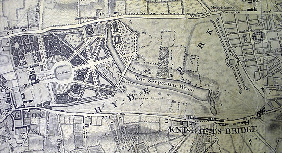
Rocque map Serpentine.jpg - Iridescent
1745 Roque Map.jpg - Isaac Sanolnacov
Rocque x1746.jpg - Hempen jig

Rocque Vauxhall and Westminster.png - Iridescent

Rocque Battersea.png - Iridescent

Northumberland House on John Rocque's 1746 map of London edited.jpg - File Upload Bot (Magnus Manske)

North Southwark 1746.png - Iridescent

Grub street map.jpg - Parrot of Doom

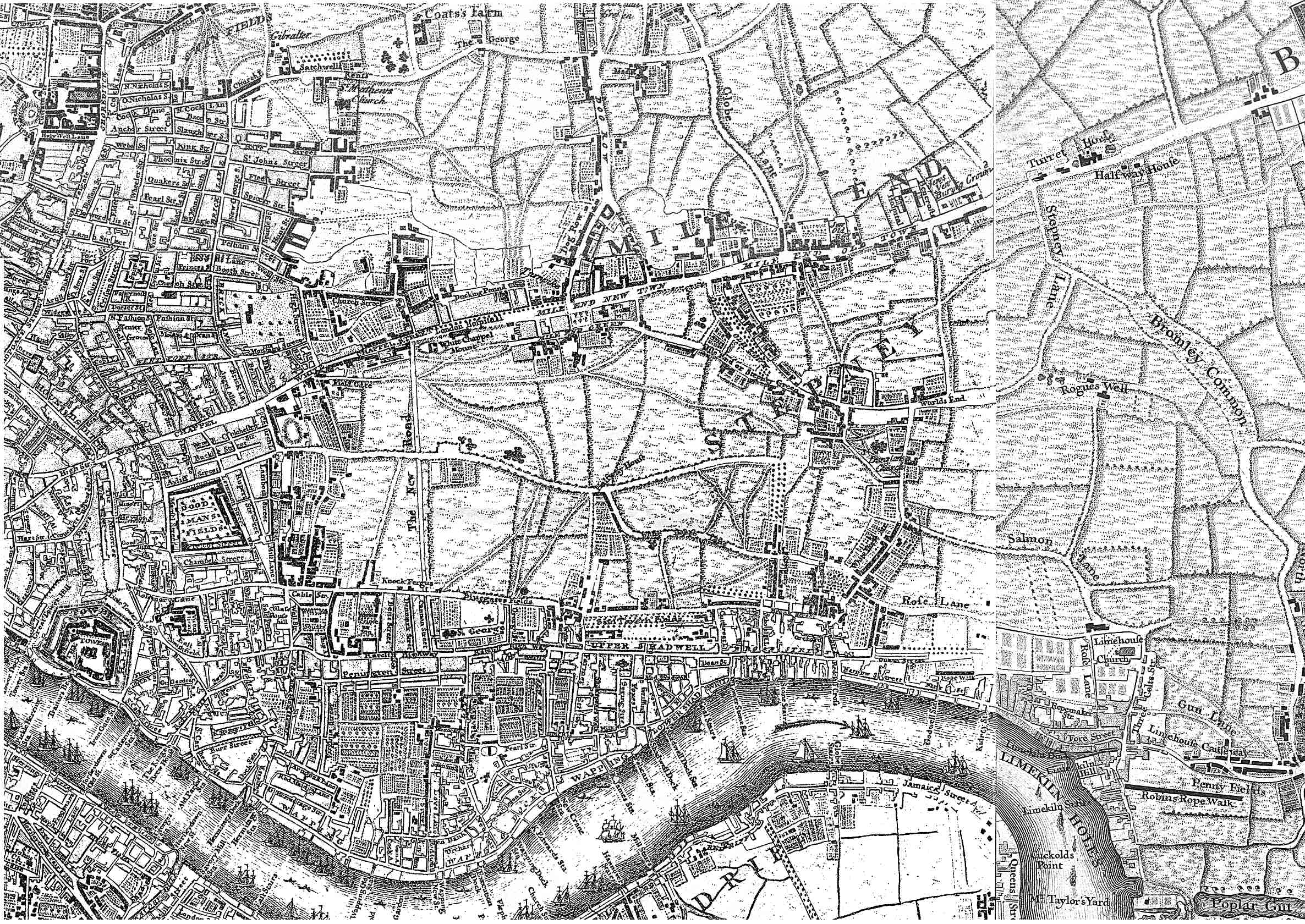
Rocque's Map of London 1741-5.jpg - MikeCalder

Exchange Alley - London.jpg - File Upload Bot (Magnus Manske)

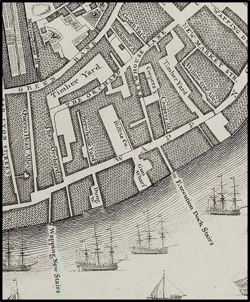
John rocque house of lords gunpowder plot.jpg - Parrot of Doom
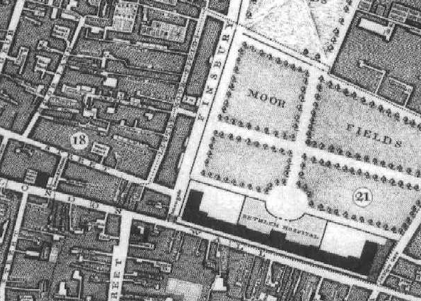
Rocque e1 MoorgateCrop.jpg - Cantons-de-l'Est

Maps Of Old London Rocque.jpg - Keith Edkins

1746 Fleet Market Roque.jpg - Delusion23

Rocque 1746. St George's Fields.svg - Thincat
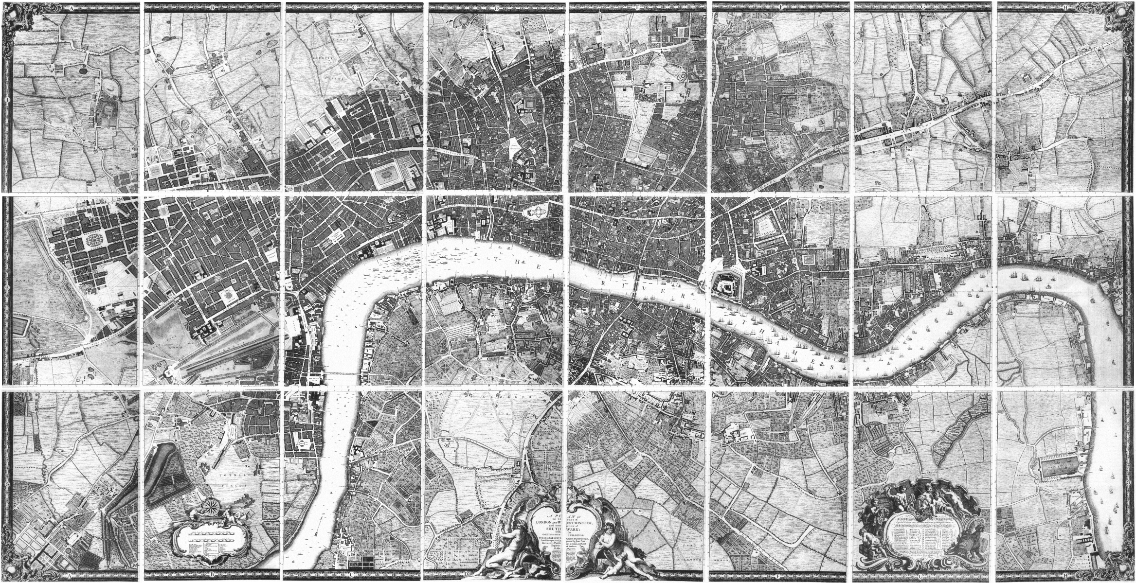
John Rocque's Map of London, 1746.png - Thincat

Key for index of John Rocque 1746 map of London.svg - Thincat
Goodman's Field.jpg - Noodleki

Image taken from page 1149 of 'Old and New London, etc' (11190453896).jpg - Jheald
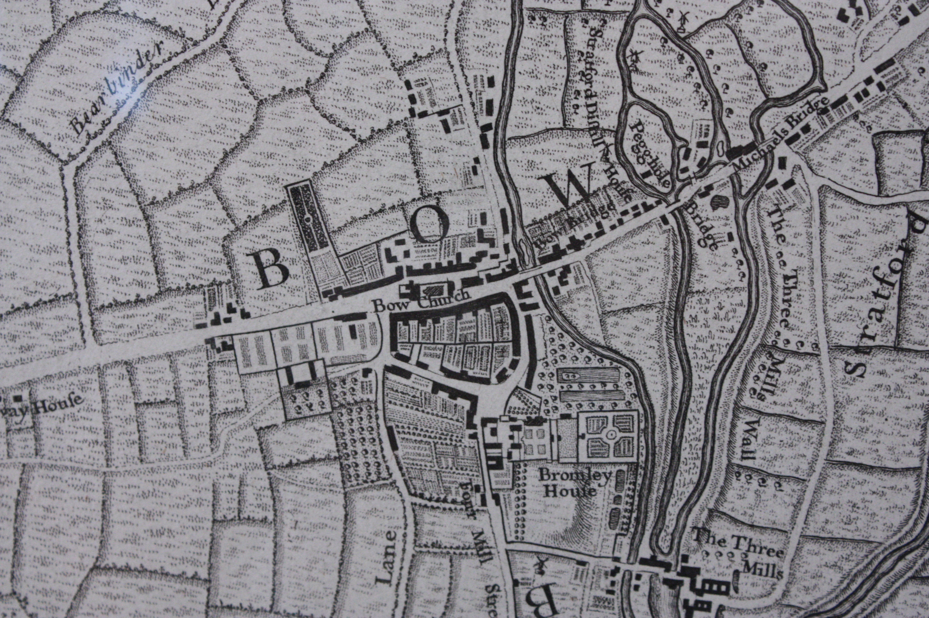
Bow as shown on John Rocque's map of London, 1747.JPG - Stephencdickson
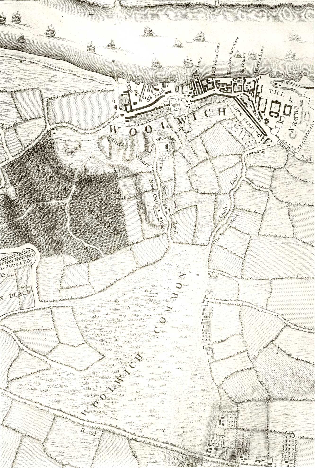
Map of Woolwich, 1746.jpg - Kleon3

Map of Woolwich, 1746 - detail.jpg - Kleon3
Roque 1746 Apollo Court Fleet Street.tif - Ucypanp

Map of Woolwich, 1740s.jpg - Kleon3

Map of Woolwich, 1740s (cropped).jpg - Kleon3

Goodman's fields on Roque's map 1746.png - Leutha
Swan with Two Necks, John Rocque’s map of 1746.jpg - Belbury

Image taken from page 984 of 'Old & New London. By W. Thornbury and Edward Walford. Illustrated' (11240928284).jpg - Artix Kreiger 2

Image taken from page 167 of 'Old & New London. By W. Thornbury and Edward Walford. Illustrated' (11242987343).jpg - Artix Kreiger 2

Image taken from page 1155 of 'Old & New London. By W. Thornbury and Edward Walford. Illustrated' (11242661483).jpg - Artix Kreiger 2

Image taken from page 1082 of 'Old & New London. By W. Thornbury and Edward Walford. Illustrated' (11242345333).jpg - Artix Kreiger 2

116 of 'The London Burial Grounds. Notes on their history from the earliest times to the present day ... Illustrated' (11300663965).jpg - Artix Kreiger 2

Rocque Map 1746 Cornhill.png - Leutha
Great Maze Pond Plaque London SE1 (3).jpg - Spudgun67

Great Maze Pond Plaque London SE1 (2).jpg - Spudgun67

Great Maze Pond Plaque London SE1 (1).jpg - Spudgun67
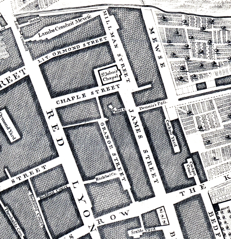
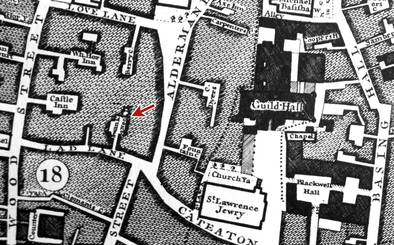
Rugby Street and James Street on John Rocque's map of 1746.jpg - Philafrenzy

A fragment of Roque's map (1746) showing the location of Whitechapel Mount.png - Ttocserp

Rocque 1746 extract.jpg - Ttocserp

A New and Accurate Survey Of the Cities of London and Westminster, the Borough of Southwark... Page d'index & Page de liste des souscripteurs - By John Rocque... - btv1b53011729c (1 of 2).jpg - Gzen92Bot

A New and Accurate Survey Of the Cities of London and Westminster, the Borough of Southwark... Page d'index & Page de liste des souscripteurs - By John Rocque... - btv1b53011729c (2 of 2).jpg - Gzen92Bot

Plan of the cities of London and Westminster - btv1b53010693v.jpg - Gzen92Bot

A New and Accurate Survey of the Cities of London and Westminster, the borough of Southwark, with the country about it four nineteen Miles in Length, and thirteen in Depth - By John Rocque, Surveyor ; R.... - btv1b5971477t (01 of 19).jpg - Gzen92Bot

A New and Accurate Survey of the Cities of London and Westminster, the borough of Southwark, with the country about it four nineteen Miles in Length, and thirteen in Depth - By John Rocque, Surveyor ; R.... - btv1b5971477t (02 of 19).jpg - Gzen92Bot

A New and Accurate Survey of the Cities of London and Westminster, the borough of Southwark, with the country about it four nineteen Miles in Length, and thirteen in Depth - By John Rocque, Surveyor ; R.... - btv1b5971477t (03 of 19).jpg - Gzen92Bot