Wikimedi'Òc
Modes d'emploi

Cet album fait partie des albums
Cet album photos contient les sous-albums suivants :


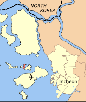


Inchon islands.svg - Amble

Inchon islands 2.svg - Tomchen1989

Modo location.svg - Amble

Sido location.svg - Amble

Sindo location.svg - Amble

Inchon islands 2-ko.svg - Tomchen1989
Inchon islands 2-ko.png - Albamhandae

Shelling of north korea in 2010.PNG - Garam

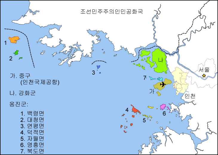
Western 5 islands ko.png - Albamhandae

Incheon islands-fr.svg - Treehill

Yeonpyeong island-fr.svg - Treehill

Inchon islands 2-ja.svg - Tomchen1989

Shelling of north korea in 2010 ja.PNG - Garam

Inchon islands 2-ru.jpg - Elmor

朝韩争议区(延坪岛附近).svg - Ras67

Map of the shelling of Yeonpyeong.svg - Tomchen1989

Map of Korean maritime border.svg - Selket

Map of west maritime border.png - Garam

Map of the shelling of Yeonpyeong2.svg - Gapo

Muido-location.png - Asfreeas

Jangbong-do island.jpg - Smiley.toerist

Muuido Island from Ferry Dock.jpg - Keneckert

Cabana at Hanagae Beach, Muuido.jpg - Keneckert
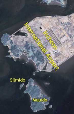
Silmido map.jpg - Hyolee2

Silmido map nasa world wind.jpg - FastilyClone

실미도바다건너기 44997529.jpg - Solvaram

Five West Sea Islands in Korean and English.jpg - 김지성1

소무의도.jpg - Gongoni

Incheon Gugsabong view.jpg - LT sfm

Distant view of Incheon International Airport.jpg - LT sfm

The Complete Map of Sim-bu (Ganghwa-bu).jpg - 秋霖驟雨

202304 Palmido Island Aerial View.jpg - MNXANL