Wikimedi'Òc
Modes d'emploi

Cet album fait partie des albums


The outlines of the cloister and kitchen on the south-west side of the abbey - geograph.org.uk - 3876962.jpg - GeographBot

The ruined Cistercian Abbey of Inch - geograph.org.uk - 3877000.jpg - GeographBot
Inch Abbey (geograph 183149).jpg - Whoosher
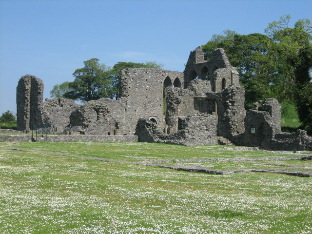
Inch abbey near Downpatrick - geograph.org.uk - 740083.jpg - File Upload Bot (Magnus Manske)

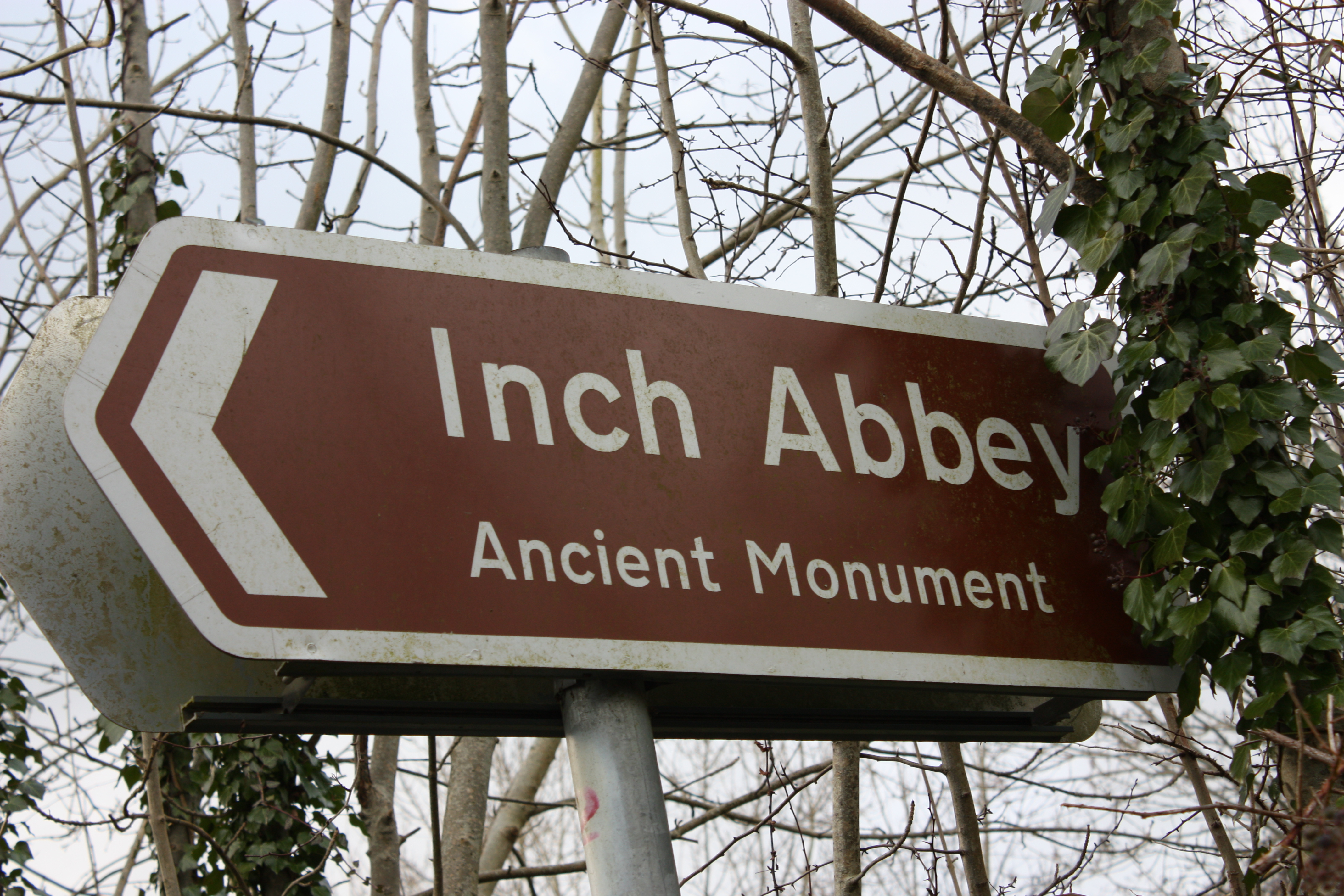
Inch Abbey sign, Downpatrick, February 2010.JPG - Ardfern

Inch Abbey gate, Downpatrick, February 2010.JPG - Ardfern

Inch Abbey, Downpatrick, February 2010.JPG - Ardfern
Inch Abbey direction sign, Downpatrick, February 2010.JPG - Ardfern

Inch Abbey, Downpatrick, March 2010 (01).JPG - Ardfern

Inch Abbey, Downpatrick, March 2010 (02).JPG - Ardfern

Inch Abbey, Downpatrick, March 2010 (03).JPG - Ardfern

Inch Abbey, Downpatrick, March 2010 (04).JPG - Ardfern
Inch Abbey, Downpatrick, March 2010 (05).JPG - Ardfern

Inch Abbey, Downpatrick, March 2010 (06).JPG - Ardfern

Inch Abbey, Downpatrick, March 2010 (07).JPG - Ardfern

Inch Abbey, Downpatrick, March 2010 (08).JPG - Ardfern

Inch Abbey, Downpatrick, March 2010 (09).JPG - Ardfern

Sign to Inch Abbey - geograph.org.uk - 900311.jpg - GeographBot

Gate, Inch Abbey (2) - geograph.org.uk - 1462154.jpg - GeographBot

Gate, Inch abbey (3) - geograph.org.uk - 1462383.jpg - GeographBot

Piscina in Inch Abbey, Downpatrick.jpg - Ck234

Inch Abbey Plaque.jpg - Peter Clarke
The Round Towers of Ulster (continued) (IA jstor-20608798).pdf - Fæ
The Abbey of Inch- County of Down (IA jstor-30002773).pdf - Fæ

The A7 (Belfast Road) approaching the Quoile Bridge - geograph.org.uk - 3597277.jpg - GeographBot

The ruined Inch Abbey viewed from the New Bridge on the Belfast Road - geograph.org.uk - 3873329.jpg - GeographBot

The Perceval-Maxwell Vault at Inch Abbey - geograph.org.uk - 3874461.jpg - GeographBot

Barrel shaped burial vault at Inch Abbey Grave Yard - geograph.org.uk - 3874494.jpg - GeographBot

Inch Abbey Graveyard - geograph.org.uk - 3874519.jpg - GeographBot

Entrance gate to the Inch Parish Graveyard at Inch Abbey - geograph.org.uk - 3874570.jpg - GeographBot

Family vaults at Inch Abbey Graveyard - geograph.org.uk - 3874581.jpg - GeographBot

The Casement family plots at Inch Abbey Grave Yard - geograph.org.uk - 3874583.jpg - GeographBot

Entrance to the lane leading to Inch Abbey from Inch Abbey Road - geograph.org.uk - 3874992.jpg - GeographBot

Parting of the ways - geograph.org.uk - 3875011.jpg - GeographBot

Lane leading to Inch Abbey - geograph.org.uk - 3875017.jpg - GeographBot

The gates of Inch Graveyard and the entrance to Inch Abbey - geograph.org.uk - 3875039.jpg - GeographBot

The ruins of Inch Abbey from the north - geograph.org.uk - 3875990.jpg - GeographBot

Plaque in the chancel of Inch Abbey - geograph.org.uk - 3876017.jpg - GeographBot

The northern facade of Inch Abbey, Downpatrick - geograph.org.uk - 3876027.jpg - GeographBot

Inch Abbey Graveyard from the south - geograph.org.uk - 3876036.jpg - GeographBot

The nave of the ruined Inch Abbey - geograph.org.uk - 3876083.jpg - GeographBot

The great east window of Inch Abbey - geograph.org.uk - 3876091.jpg - GeographBot

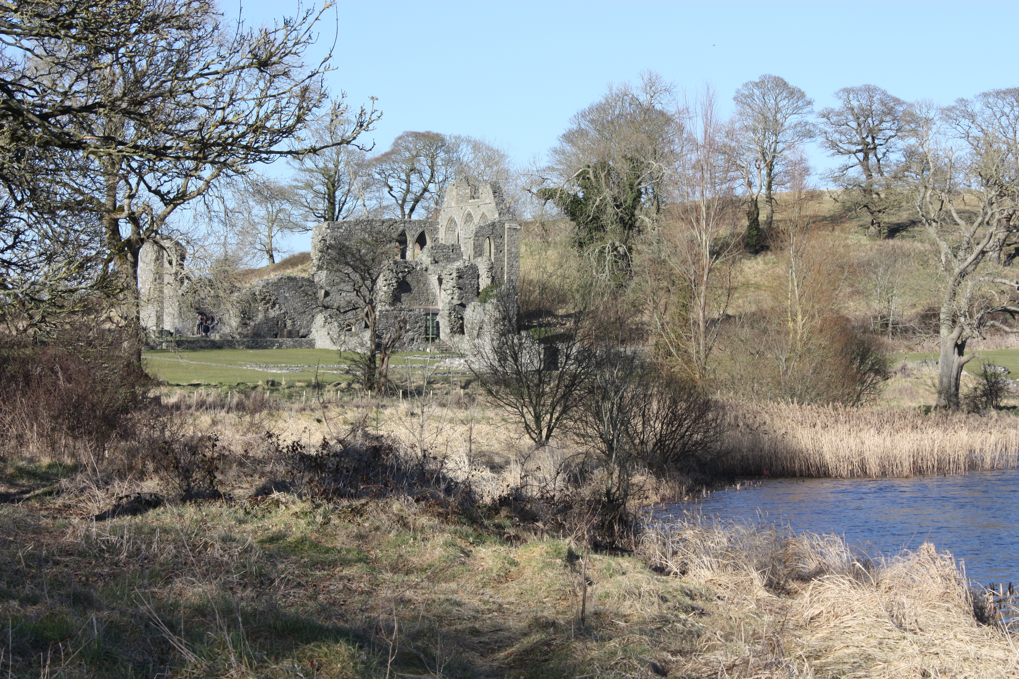
The Quoile River from Inch Abbey - geograph.org.uk - 3876129.jpg - GeographBot
The ruined north transept of Inch Abbey - geograph.org.uk - 3876923.jpg - GeographBot
The walls of the north transept and chancel of Inch Abbey viewed from the north - geograph.org.uk - 3876929.jpg - GeographBot

The ruined nave and chancel of Inch Abbey - geograph.org.uk - 3876939.jpg - GeographBot

The outline of the cloister of Inch Abbey - geograph.org.uk - 3876949.jpg - GeographBot

The bakehouse, the well and the guesthouse at Inch Abbey - geograph.org.uk - 3876973.jpg - GeographBot

Weeping willow at Inch Abbey - geograph.org.uk - 3876984.jpg - GeographBot

Remains of the bakehouse and well at Inch Abbey - geograph.org.uk - 3876988.jpg - GeographBot

The ruins of Inch Abbey from the west - geograph.org.uk - 3876995.jpg - GeographBot

Inch Abbey - Downpatrick - geograph.org.uk - 4672109.jpg - GeographBot

Bank Holiday picnicers at the ruined Inch Abbey at Downpatrick - geograph.org.uk - 5790241.jpg - GeographBot

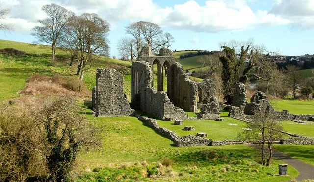
The ruined Cistercian Inch Abbey near Downpatrick - geograph.org.uk - 5791076.jpg - GeographBot

The Abbey of Inch, County of Down, 1833 (IA jstor-30002773) (page 1 crop).jpg - Broichmore

The Abbey of Inch- County of Down. The original Abbey-church, 1833 (IA jstor-30002773) (page 2 crop).jpg - Broichmore

A view of the old Abbey of Downpatrick, before it was rebuilt, anno 1790 (continued) (IA jstor-20608798) (page 3 crop).jpg - Broichmore

Inch Abbey - geograph.org.uk - 7239183.jpg - GeographBot

Inch Abbey - geograph.org.uk - 7239185.jpg - GeographBot

Inch Abbey - geograph.org.uk - 7239192.jpg - GeographBot

Inch Abbey - geograph.org.uk - 7239196.jpg - GeographBot

Inch Abbey - geograph.org.uk - 7239200.jpg - GeographBot

Inch Abbey - geograph.org.uk - 7239205.jpg - GeographBot

Inch Abbey - geograph.org.uk - 7239220.jpg - GeographBot

Inch Abbey - geograph.org.uk - 7239229.jpg - GeographBot

Inch Abbey - geograph.org.uk - 7239233.jpg - GeographBot

Inch Abbey - geograph.org.uk - 7239238.jpg - GeographBot

Inch Abbey - geograph.org.uk - 7239241.jpg - GeographBot

Inch Abbey and Down Cathedral - geograph.org.uk - 7239243.jpg - GeographBot

Inch Abbey - geograph.org.uk - 7239246.jpg - GeographBot