Wikimedi'Òc
Modes d'emploi

Cet album fait partie des albums
Cet album photos contient les sous-albums suivants :


Arriva bus 2685 VDL SB200 Wrightbus Pulsar CX58 EVG in Wigan, Greater Manchester 15 November 2008.jpg - Ultra7

Ince in Makerfield - Ince Arches.jpg - Skinsmoke

Buttercup Meadow - geograph.org.uk - 8206.jpg - GeographBot

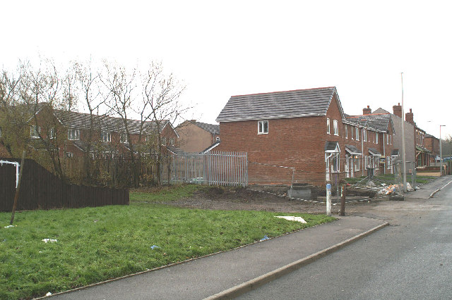
New residential development in Poolstock - geograph.org.uk - 1487.jpg - GeographBot

Amberswood Community Woodland - geograph.org.uk - 52955.jpg - GeographBot

Ambleside Bank Assessment Unit, High Street, Ince - geograph.org.uk - 79175.jpg - GeographBot

Bakery, now closed, north of Britannia Bridge canal bridge, Lower Ince - geograph.org.uk - 79520.jpg - GeographBot

Boundary, Mile and Datum Stone, on old railway bridge, Warrington Road, Spring View - geograph.org.uk - 79489.jpg - GeographBot

Britannia Bridge Community Primary School, Lower Ince - geograph.org.uk - 79514.jpg - GeographBot

Burgess Street and Ince Cemetery, Lower Ince - geograph.org.uk - 78906.jpg - GeographBot

Close-up, Boundary, Mile and Datum Stone, on old railway bridge, Warrington Road, Spring View - geograph.org.uk - 79491.jpg - GeographBot

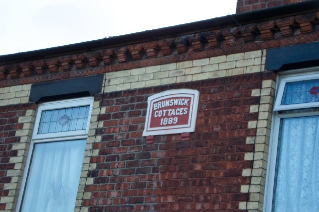
Date inscription, Britannia Bridge canal bridge - geograph.org.uk - 78895.jpg - GeographBot

Detail of Cemetery Lodge, showing locally-made clock - geograph.org.uk - 78784.jpg - GeographBot

Giant hogweed on the Leeds and Liverpool Canal bank, Lower Ince - geograph.org.uk - 78899.jpg - GeographBot

Great War Cenotaph in Ince Cemetery - geograph.org.uk - 78776.jpg - GeographBot

Mab's Cross Primary School - geograph.org.uk - 46837.jpg - GeographBot
Marsh orchids on waste ground between Warrington Road and Marlborough Avenue - geograph.org.uk - 78827.jpg - GeographBot

Minewater Treatment Plant - geograph.org.uk - 50471.jpg - GeographBot

All changed - geograph.org.uk - 85603.jpg - GeographBot

Bird's eye view - geograph.org.uk - 85197.jpg - GeographBot

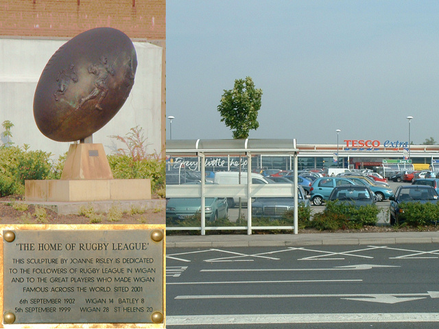
Supermarkitsch - geograph.org.uk - 52968.jpg - GeographBot

Bridge upon which the milestone sits - geograph.org.uk - 83180.jpg - GeographBot

Britannia Bridge School in cherry blossom time - geograph.org.uk - 85367.jpg - GeographBot

The field where the orchids grew - geograph.org.uk - 78829.jpg - GeographBot

Changing the lie of the land, no.2 - geograph.org.uk - 85592.jpg - GeographBot

Changing the lie of the land - geograph.org.uk - 85590.jpg - GeographBot
Whatever Happened to Central Park^ - geograph.org.uk - 47047.jpg - GeographBot
Cleared site of 232-240 Warrington Road, revealing St. Mary's Church - geograph.org.uk - 83869.jpg - GeographBot

A few of the many - geograph.org.uk - 95579.jpg - GeographBot

Britannia Bridge School Early Years Department - geograph.org.uk - 94113.jpg - GeographBot

Change of use - geograph.org.uk - 91686.jpg - GeographBot

Green goddess sweeps in - geograph.org.uk - 85738.jpg - GeographBot

Groundwork on the Clinic site - geograph.org.uk - 85236.jpg - GeographBot

Convergence - geograph.org.uk - 97069.jpg - GeographBot

Health and Safety - geograph.org.uk - 85111.jpg - GeographBot

Houses on the corner of Warrington Road and Burgess Street - geograph.org.uk - 83858.jpg - GeographBot
Hung - geograph.org.uk - 85213.jpg - GeographBot

In a hurry - geograph.org.uk - 85204.jpg - GeographBot

Installing a new landmark - geograph.org.uk - 85365.jpg - GeographBot
It doesn't take long.... - geograph.org.uk - 85269.jpg - GeographBot

Kids' den in the woods - geograph.org.uk - 85112.jpg - GeographBot

Laying a new gas pipe in Ince Green Lane - geograph.org.uk - 85310.jpg - GeographBot

End of the colliery line - geograph.org.uk - 97072.jpg - GeographBot

Lifting in units for temporary Surgery - geograph.org.uk - 83185.jpg - GeographBot

Even more wishful thinking on Junction Terrace - geograph.org.uk - 93816.jpg - GeographBot
Lost glories - geograph.org.uk - 85201.jpg - GeographBot

Making safe - geograph.org.uk - 85373.jpg - GeographBot

Man and Industry - geograph.org.uk - 83293.jpg - GeographBot

Former Centenary Primitive Methodist Chapel - geograph.org.uk - 93735.jpg - GeographBot

More abandoned railways - geograph.org.uk - 83181.jpg - GeographBot

Moss Pits Disasters Memorial - geograph.org.uk - 86007.jpg - GeographBot

Nearly not there - geograph.org.uk - 85275.jpg - GeographBot

Ince Brook - geograph.org.uk - 94129.jpg - GeographBot

Picking at No. 240 Warrington Road, a former Surgery - geograph.org.uk - 83864.jpg - GeographBot

Industrial archaeology detective work - geograph.org.uk - 94131.jpg - GeographBot

Junction Terrace - geograph.org.uk - 93737.jpg - GeographBot
Junction Terrace Date Plate 1 - geograph.org.uk - 93811.jpg - GeographBot

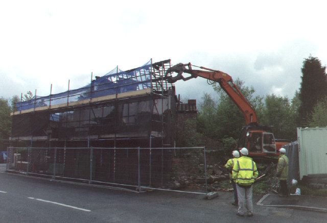
Preparing 226-230 Warrington Road for demolition - geograph.org.uk - 85265.jpg - GeographBot

Putting it back straight... - geograph.org.uk - 85119.jpg - GeographBot

Rebuilding - geograph.org.uk - 85121.jpg - GeographBot

Roofs off 232-240 Warrington Road - geograph.org.uk - 83862.jpg - GeographBot

Magpies in Lancashire - geograph.org.uk - 93755.jpg - GeographBot

Seasonal hike - geograph.org.uk - 89748.jpg - GeographBot

No Licence to thrill any more - geograph.org.uk - 93810.jpg - GeographBot

Temporary Surgery in Hilton Street. Convenience Store on Warrington Road behind. - geograph.org.uk - 83186.jpg - GeographBot

Terrace on Manley Street - geograph.org.uk - 85733.jpg - GeographBot

Testing the ground on the site of the new clinic - geograph.org.uk - 82229.jpg - GeographBot

The earth moves - geograph.org.uk - 85234.jpg - GeographBot

The new clinic, housing the Doctors' Surgeries - geograph.org.uk - 83292.jpg - GeographBot

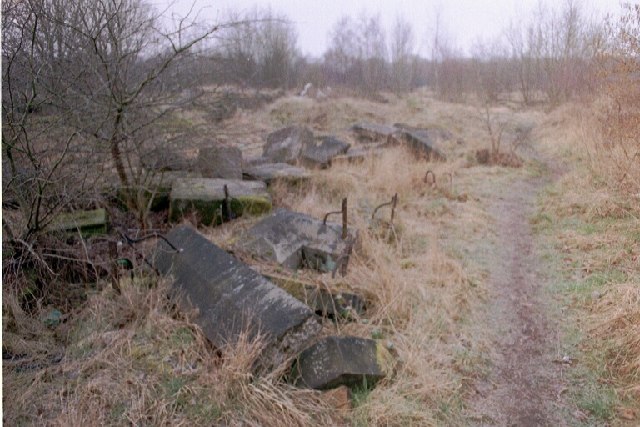
The past uncovered - shaft of Crow Orchard Pit - geograph.org.uk - 86760.jpg - GeographBot

The remains of 232-240 Warrington Road - geograph.org.uk - 83865.jpg - GeographBot

The steel frame for the new Clinic - geograph.org.uk - 85287.jpg - GeographBot

Tranquil beside the West Coast Main Line.... - geograph.org.uk - 83148.jpg - GeographBot

Up and away - geograph.org.uk - 85245.jpg - GeographBot

Vacant possession - geograph.org.uk - 85281.jpg - GeographBot

Walking the line - geograph.org.uk - 85109.jpg - GeographBot

West Coast Main Line, Lower Ince - geograph.org.uk - 85997.jpg - GeographBot

Cemetery canter - geograph.org.uk - 111538.jpg - GeographBot
Westwood Lane, new houses - geograph.org.uk - 86763.jpg - GeographBot

Track of canal branch - geograph.org.uk - 93753.jpg - GeographBot

Tranquil "Trenchies" - geograph.org.uk - 94130.jpg - GeographBot

Wasteland into wonderland - geograph.org.uk - 97068.jpg - GeographBot

21st Century Logging-02 - geograph.org.uk - 129640.jpg - GeographBot

21st Century Logging-03 - geograph.org.uk - 129643.jpg - GeographBot

21st Century Logging-04 - geograph.org.uk - 129645.jpg - GeographBot

21st Century Logging - geograph.org.uk - 129636.jpg - GeographBot

Wishful thinking on Junction Terrace - geograph.org.uk - 93813.jpg - GeographBot

Changing scene - geograph.org.uk - 144914.jpg - GeographBot

A573-A577 junction - geograph.org.uk - 158117.jpg - GeographBot

Can't see the trees for the wood - geograph.org.uk - 158105.jpg - GeographBot

Council housing renovation (1), Eaton Terrace - geograph.org.uk - 158079.jpg - GeographBot

Council housing renovation (2), Westwood Lane, south side - geograph.org.uk - 158080.jpg - GeographBot

Council housing renovation (3), Westwood Lane, north side - geograph.org.uk - 158082.jpg - GeographBot

Winter shadows - geograph.org.uk - 131728.jpg - GeographBot

Flying Squad, Wigan style - geograph.org.uk - 158059.jpg - GeographBot

Dead centre line - geograph.org.uk - 164922.jpg - GeographBot

I hope it works for you - geograph.org.uk - 158075.jpg - GeographBot

Improving the townscape - geograph.org.uk - 158102.jpg - GeographBot

Magnificent Magnolia - geograph.org.uk - 158083.jpg - GeographBot

Plaque commemorating George Orwell - geograph.org.uk - 158109.jpg - GeographBot

Public artwork of the past... sadly neglected - geograph.org.uk - 158133.jpg - GeographBot

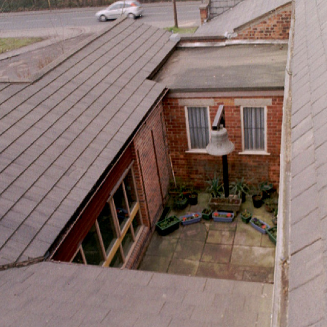
Rear of Warrington Road premises - geograph.org.uk - 158095.jpg - GeographBot

Water causeway - geograph.org.uk - 144917.jpg - GeographBot

The market is king on Sovereign Road (1) - geograph.org.uk - 158122.jpg - GeographBot

The market is king on Sovereign Road (2) - geograph.org.uk - 158126.jpg - GeographBot

Yes, but is it art^ - geograph.org.uk - 158071.jpg - GeographBot

Ince St. Mary's CofE Controlled School - geograph.org.uk - 259201.jpg - GeographBot

Lilac Gardens,off Woodville Road, Spring View - geograph.org.uk - 367946.jpg - GeographBot

Lower end of Woodville Road, Spring View - geograph.org.uk - 367953.jpg - GeographBot

Railway Bridge, Cemetery Road, Lower Ince - geograph.org.uk - 367979.jpg - GeographBot

South-East corner, St. Mary's CofE School - geograph.org.uk - 366101.jpg - GeographBot

Southern end of Warrington Road, Spring View - geograph.org.uk - 366631.jpg - GeographBot

The quick way from Repton to Marlborough - geograph.org.uk - 366089.jpg - GeographBot

Where Coal was once King - geograph.org.uk - 365972.jpg - GeographBot

"The Devil's Bridge" - geograph.org.uk - 375483.jpg - GeographBot

Baverstock Close, off Redbrook Road, Lower Ince - geograph.org.uk - 377974.jpg - GeographBot

Bridge over the WCML, Westwood Lane, Lower Ince - geograph.org.uk - 370167.jpg - GeographBot

Cemetery Road, Lower Ince - geograph.org.uk - 370155.jpg - GeographBot

Chapel Close, Lower Ince - geograph.org.uk - 375541.jpg - GeographBot

Do not adjust your set - geograph.org.uk - 376335.jpg - GeographBot

End of Redbrook Road - geograph.org.uk - 370389.jpg - GeographBot

Former Nursery, Winifred Street, Lower Ince - geograph.org.uk - 377120.jpg - GeographBot

Inside the "Devil's Bridge" - geograph.org.uk - 375488.jpg - GeographBot

Junction of Westwood Lane, right, with Wellington Street left, Lower Ince - geograph.org.uk - 370091.jpg - GeographBot

Manchester Junction, from Taylors Lane Bridge, Spring View - geograph.org.uk - 376319.jpg - GeographBot

Superannuated, but still useful - geograph.org.uk - 375503.jpg - GeographBot

The "New Road System", from the other side - geograph.org.uk - 370071.jpg - GeographBot

Westwood Grange, Chapel Street, Lower Ince - geograph.org.uk - 375530.jpg - GeographBot

Westwood Lane, at its junction with Mount View, Lower Ince - geograph.org.uk - 370189.jpg - GeographBot

Caught in the act - geograph.org.uk - 384950.jpg - GeographBot

Daffs time, Warrington Lane, Wigan - geograph.org.uk - 384945.jpg - GeographBot

First in Lower Ince - geograph.org.uk - 384969.jpg - GeographBot

Last post (of the week), Darlington Street East, Wigan - geograph.org.uk - 384946.jpg - GeographBot

Looking over the boundary at Britannia Bridge, Warrington Road - geograph.org.uk - 384965.jpg - GeographBot

British Waterways Offices at Wigan - geograph.org.uk - 557578.jpg - GeographBot
Clearing skies over the Leeds and Liverpool Leigh Branch - geograph.org.uk - 557563.jpg - GeographBot

Crow Orchard Terrace, Wilding Street, Lower Ince - geograph.org.uk - 552523.jpg - GeographBot

Harvey Street, Lower Ince - geograph.org.uk - 552931.jpg - GeographBot

Hatfield Close, Spring View - geograph.org.uk - 555799.jpg - GeographBot

Hathaway Walk, Spring View - geograph.org.uk - 555797.jpg - GeographBot

Last houses in Warrington Road, Spring View - geograph.org.uk - 552886.jpg - GeographBot

Looking South down Hey Street, Spring View - geograph.org.uk - 552635.jpg - GeographBot

Marlvern Crescent from Marlborough Avenue, Spring View - geograph.org.uk - 554938.jpg - GeographBot

Mount View, Lower Ince - geograph.org.uk - 553222.jpg - GeographBot

Oxburgh Road, Spring View - geograph.org.uk - 555796.jpg - GeographBot

School's (down and) out^ - geograph.org.uk - 553234.jpg - GeographBot

Sharp Street, Lower Ince - geograph.org.uk - 553243.jpg - GeographBot

St Clement Street, Spring View - geograph.org.uk - 552642.jpg - GeographBot

Winstanley Place, Lower Ince - geograph.org.uk - 552517.jpg - GeographBot

Boundary changes - geograph.org.uk - 675035.jpg - GeographBot

Pie factory bites the dust - geograph.org.uk - 675043.jpg - GeographBot

The Last Post - geograph.org.uk - 771055.jpg - GeographBot

The end is nigh - geograph.org.uk - 771067.jpg - GeographBot

After the fire-01 - geograph.org.uk - 805037.jpg - GeographBot

After the fire-02 - geograph.org.uk - 805038.jpg - GeographBot

Worth a second look - geograph.org.uk - 802158.jpg - GeographBot

After the fire-03 - geograph.org.uk - 827808.jpg - GeographBot

After the fire-04 - geograph.org.uk - 828032.jpg - GeographBot

Only a bite or two left - geograph.org.uk - 827807.jpg - GeographBot

End of the road for this geograph - geograph.org.uk - 833637.jpg - GeographBot

Nothing doing - geograph.org.uk - 845065.jpg - GeographBot

Changing styles - geograph.org.uk - 858091.jpg - GeographBot

Decorated Brick Terrace - geograph.org.uk - 851005.jpg - GeographBot

Dobson Park Way - geograph.org.uk - 850985.jpg - GeographBot

Look East, young man. - geograph.org.uk - 853179.jpg - GeographBot
On a clear day...-02 - geograph.org.uk - 853098.jpg - GeographBot

Sign of the times-02 - geograph.org.uk - 867921.jpg - GeographBot

Sign of the times - geograph.org.uk - 867920.jpg - GeographBot

Community Improvement - geograph.org.uk - 876440.jpg - GeographBot

Former canal workers' homes - geograph.org.uk - 878442.jpg - GeographBot

Greener over the fence^ - geograph.org.uk - 878382.jpg - GeographBot

Sign of the times-01 - geograph.org.uk - 876422.jpg - GeographBot

Top deck, route 658-02 - geograph.org.uk - 875978.jpg - GeographBot

Top deck, route 658-03 - geograph.org.uk - 875987.jpg - GeographBot

Top deck, route 658-04 - geograph.org.uk - 875992.jpg - GeographBot

One door closes... - geograph.org.uk - 907548.jpg - GeographBot

Railway wars - geograph.org.uk - 914843.jpg - GeographBot

Bench overlooking Westwood Flash - geograph.org.uk - 927687.jpg - GeographBot

Cyclist and Cherry Trees - geograph.org.uk - 922234.jpg - GeographBot
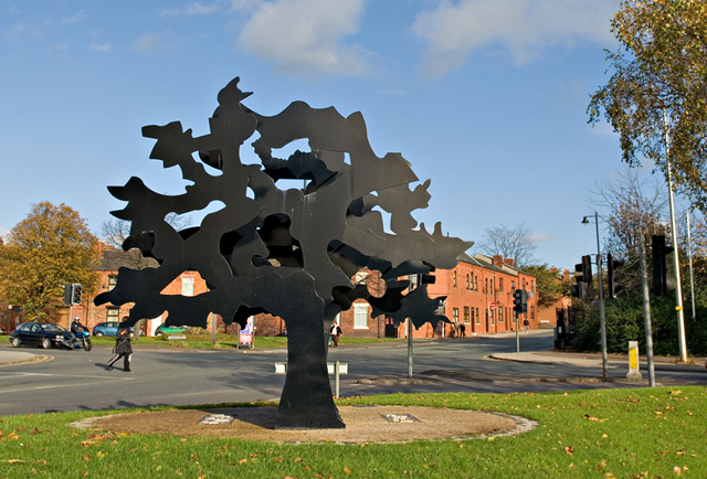
Metal Tree - Public Art - geograph.org.uk - 928428.jpg - GeographBot

Walmsley Street from Darlington St East - geograph.org.uk - 928445.jpg - GeographBot

Back to basics - geograph.org.uk - 931569.jpg - GeographBot

Birket Bank - geograph.org.uk - 933507.jpg - GeographBot

Pies galore^ - geograph.org.uk - 931566.jpg - GeographBot

Back to basics - geograph.org.uk - 941001.jpg - GeographBot

Changes - geograph.org.uk - 954752.jpg - GeographBot

A chimney-pot of gold^ - geograph.org.uk - 964118.jpg - GeographBot

Restoring the image-01 - geograph.org.uk - 964104.jpg - GeographBot

Restoring the image-02 - geograph.org.uk - 964109.jpg - GeographBot

Restoring the image-03 - geograph.org.uk - 977721.jpg - GeographBot

Restoring the image-04 - geograph.org.uk - 980825.jpg - GeographBot

Brand new Geograph-01 - geograph.org.uk - 997434.jpg - GeographBot

En route to Martinmere - geograph.org.uk - 1002930.jpg - GeographBot

Restoring the image-05 - geograph.org.uk - 1002913.jpg - GeographBot

Restoring the image-06 - geograph.org.uk - 1011632.jpg - GeographBot

Time to be thankful - geograph.org.uk - 1011627.jpg - GeographBot

Installing new play equipment - geograph.org.uk - 1044044.jpg - GeographBot

Restoring the image-08 - geograph.org.uk - 1042234.jpg - GeographBot
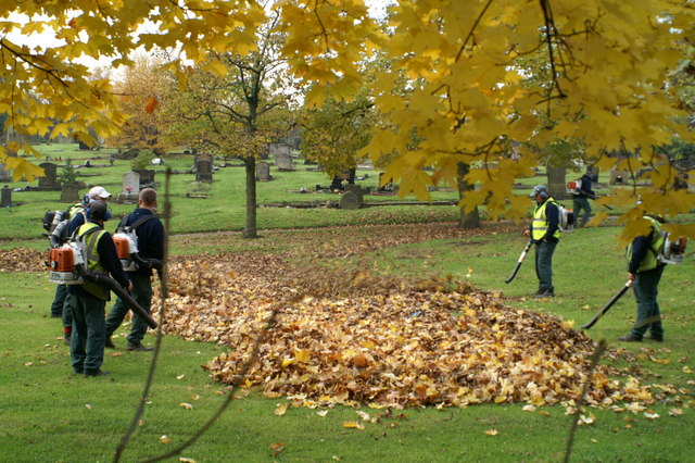
The Autumn round-up - geograph.org.uk - 1042244.jpg - GeographBot

These you have missed - geograph.org.uk - 1042249.jpg - GeographBot

Former glory restored - geograph.org.uk - 1084540.jpg - GeographBot

In the bleak mid-winter - geograph.org.uk - 1100858.jpg - GeographBot

New public notice-board on Warrington Road, Lower Ince - geograph.org.uk - 1100911.jpg - GeographBot

Revelation - geograph.org.uk - 1100864.jpg - GeographBot

Path through the woods - geograph.org.uk - 1116247.jpg - GeographBot

Daffs in bloom on Highfield Grange Avenue, Marus Bridge - geograph.org.uk - 1235358.jpg - GeographBot

Another closed pub - the White Swan - geograph.org.uk - 1257556.jpg - GeographBot

Bridge carrying the Wigan-Manchester line over Manchester Road, the A577 - geograph.org.uk - 1337895.jpg - GeographBot

Bridge over the Whelley Loop Line - geograph.org.uk - 1335095.jpg - GeographBot

Country Lane in Higher Ince - geograph.org.uk - 1335090.jpg - GeographBot

Cycleway on the former Whelley Loop Line - geograph.org.uk - 1335114.jpg - GeographBot
Cycleway signpost - geograph.org.uk - 1335122.jpg - GeographBot

Diversion - geograph.org.uk - 1599924.jpg - GeographBot
Lion - geograph.org.uk - 1599930.jpg - GeographBot

Open space at Ince-in-Makerfield, taken from Spindlehurst Road - geograph.org.uk - 1706821.jpg - GeographBot

Wigan Springs Branch Junction geograph-2730629-by-Ben-Brooksbank.jpg - Chevin

Wigan Up freight approaching Springs Branch Junction geograph-2769012-by-Ben-Brooksbank.jpg - Chevin

Tree on Birkett Street, Wigan.JPG - Rept0n1x

Ince Plaice, Wigan.JPG - Rept0n1x

Shops on Warrington Road, Lower Ince.JPG - Rept0n1x

Green space at Lower Ince, Wigan (1).JPG - Rept0n1x

Green space at Lower Ince, Wigan (2).JPG - Rept0n1x

Ince Surgery and Chemists.JPG - Rept0n1x

Smithy Green, Higher Ince.JPG - Rept0n1x

Ince Post Office.JPG - Rept0n1x

27 of 'Explosions in Coal Mines. (With nine plans.)' (11125280806).jpg - Artix Kreiger 2

Country Lane, Higher Ince, 2020.jpg - Lankyrider

Swan Meadow Road crosses the River Douglas - geograph.org.uk - 1984049.jpg - GeographBot

The railway bridge over Warrington Road at Ince - geograph.org.uk - 2050236.jpg - GeographBot

Hands - geograph.org.uk - 2102304.jpg - GeographBot

The path by Common Nook - geograph.org.uk - 2102366.jpg - GeographBot

Western Mills, wigan - dining halls - geograph.org.uk - 2244056.jpg - GeographBot

Wigan and Leigh Magistrates Court - geograph.org.uk - 2274416.jpg - GeographBot

Chapel Lane Railway Bridge - geograph.org.uk - 2274434.jpg - GeographBot

Elizabeth Mill Destroyed by Fire - geograph.org.uk - 2274470.jpg - GeographBot

Elizabeth Mill Destroyed by Fire - geograph.org.uk - 2274474.jpg - GeographBot

Damping Down - geograph.org.uk - 2274481.jpg - GeographBot

Remains of Moss Hall Farm - geograph.org.uk - 2601539.jpg - GeographBot

Road junction with Manchester Road - geograph.org.uk - 2601548.jpg - GeographBot

Amberswood Common, Ince-in-Makerfield - geograph.org.uk - 2654030.jpg - GeographBot

Foot path, Amberswood Common - geograph.org.uk - 2654032.jpg - GeographBot

Foot path, Amberswood Common - geograph.org.uk - 2654034.jpg - GeographBot

Foot path, Amberswood Common - geograph.org.uk - 2654038.jpg - GeographBot

Amberswood Common - geograph.org.uk - 2735130.jpg - GeographBot

Daffodils on the Green - geograph.org.uk - 2871983.jpg - GeographBot

A577, Manchester Road - geograph.org.uk - 2872000.jpg - GeographBot

Hands - geograph.org.uk - 2872021.jpg - GeographBot

Rail Bridge, Manchester Road - geograph.org.uk - 2872029.jpg - GeographBot

A580 eastbound as it crosses the Bridgewater Canal - geograph.org.uk - 2983033.jpg - GeographBot

Path on dismantled railway, Lower Ince - geograph.org.uk - 3334378.jpg - GeographBot

Manchester Road (A577), Higher Ince - geograph.org.uk - 3334583.jpg - GeographBot

40 Scholes, Wigan - geograph.org.uk - 3370016.jpg - GeographBot

Another rubbish photograph (2112) - geograph.org.uk - 3573754.jpg - GeographBot

Westwood Cemetery - geograph.org.uk - 4213691.jpg - GeographBot

Railway looking north - geograph.org.uk - 4213693.jpg - GeographBot

Westwood Way - geograph.org.uk - 4213696.jpg - GeographBot

Wigan Enterprise Park - geograph.org.uk - 4271119.jpg - GeographBot

Replacement Water Tower - geograph.org.uk - 4634360.jpg - GeographBot

Wigan gas works - geograph.org.uk - 5029237.jpg - GeographBot

Field between Makerfield Way and the railway - geograph.org.uk - 5029243.jpg - GeographBot

Taylor's Lane Railway Bridge - geograph.org.uk - 5045050.jpg - GeographBot

Makerfield Way - geograph.org.uk - 5110885.jpg - GeographBot

Old Railway - geograph.org.uk - 5111268.jpg - GeographBot

Approaching Carr Lane from Wigan Flashes Nature Reserve - geograph.org.uk - 5314543.jpg - GeographBot

Disused Chapel at Ince Cemetery (geograph 6217483).jpg - Sic19

Phoenix Way, Ince - geograph.org.uk - 5547647.jpg - GeographBot

Rio 3 in 1, Lower Ince - geograph.org.uk - 5547665.jpg - GeographBot

Ince Green Lane, Ince - geograph.org.uk - 5547690.jpg - GeographBot

St Helens bus in Lower Ince - geograph.org.uk - 5547697.jpg - GeographBot

Queen Elizabeth II pillarbox, Warrington Road, Lower Ince - geograph.org.uk - 5547704.jpg - GeographBot

Banner Street, Lower Ince - geograph.org.uk - 5547709.jpg - GeographBot

A573 direction sign, Lower Ince - geograph.org.uk - 5547775.jpg - GeographBot

Chapel Street, Ince-in-Makerfield - geograph.org.uk - 5549271.jpg - GeographBot

Ince Plaice, Ince - geograph.org.uk - 5549514.jpg - GeographBot

Harvey Street, Ince - geograph.org.uk - 5549518.jpg - GeographBot

Telecoms cabinet on an Ince corner - geograph.org.uk - 5549584.jpg - GeographBot

Zebra crossing, Warrington Road, Ince-in-Makerfield - geograph.org.uk - 5550361.jpg - GeographBot

South side of Warrington Road railway bridge, Ince-in-Makerfield - geograph.org.uk - 5550387.jpg - GeographBot

North side of Warrington Road railway bridge, Ince-in-Makerfield - geograph.org.uk - 5550391.jpg - GeographBot

This way to Beesley ^ Fildes, Ince-in-Makerfield - geograph.org.uk - 5550397.jpg - GeographBot

Welcome to a world of Ultra HD, Ince-in-Makerfield - geograph.org.uk - 5550408.jpg - GeographBot

Across Britannia Bridge, Ince-in-Makerfield - geograph.org.uk - 5550412.jpg - GeographBot

Warrington Road houses, Ince-in-Makerfield - geograph.org.uk - 5550414.jpg - GeographBot

Former Shepherds Arms pub, Ince-in-Makerfield - geograph.org.uk - 5550421.jpg - GeographBot

Metal structure, Lower Ince - geograph.org.uk - 5554246.jpg - GeographBot

Green between Hilton Street and Chorley Street, Ince - geograph.org.uk - 5554277.jpg - GeographBot

Autumn colours on an Ince corner - geograph.org.uk - 5554286.jpg - GeographBot

Welcome to Ince - geograph.org.uk - 5554356.jpg - GeographBot

Children's playground, Ince - geograph.org.uk - 5554362.jpg - GeographBot

Westwood Lane, Lower Ince - geograph.org.uk - 5721634.jpg - GeographBot

Path North of Westwood Lane, Lower Ince - geograph.org.uk - 5721637.jpg - GeographBot

Path South of Westwood Lane, Lower Ince - geograph.org.uk - 5721646.jpg - GeographBot

Path South of Westwood Lane, Lower Ince - geograph.org.uk - 5721649.jpg - GeographBot

Disused Chapel at Ince Cemetery - geograph.org.uk - 5721694.jpg - GeographBot

Path between Cemetery Road and Westwood Lane - geograph.org.uk - 5721704.jpg - GeographBot

Springs Branch Junction, Lower Ince - geograph.org.uk - 5721717.jpg - GeographBot

Industrial unit at Springs Branch Junction, Lower Ince - geograph.org.uk - 5721722.jpg - GeographBot

Disused Railway Tracks at Lower Ince - geograph.org.uk - 5721727.jpg - GeographBot

Small Pond South of Springs Branch Junction - geograph.org.uk - 5721730.jpg - GeographBot

Railway Bridge South of Liverpool Junction, Lower Ince - geograph.org.uk - 5721734.jpg - GeographBot

Under the railway bridge South of Liverpool Junction - geograph.org.uk - 5721739.jpg - GeographBot

Path following dismantled railway line North of Wigan Borough Cemetery boundary - geograph.org.uk - 5721778.jpg - GeographBot

Cycle path following route of former railway - geograph.org.uk - 7522185.jpg - GeographBot

Old Milestone by the A573, Warrington Road, Spring View - geograph.org.uk - 6035850.jpg - GeographBot

Disused Catholic ^ Dissenters Chapel in Ince Cemetery - geograph.org.uk - 7647202.jpg - GeographBot

Disused Protestant Chapel - Ince Cemetery - geograph.org.uk - 7647209.jpg - GeographBot

War Memorial - Lower Ince Cemetery - geograph.org.uk - 7647214.jpg - GeographBot