Wikimedi'Òc
Modes d'emploi

Cet album fait partie des albums


Polska1912.jpg - Julo
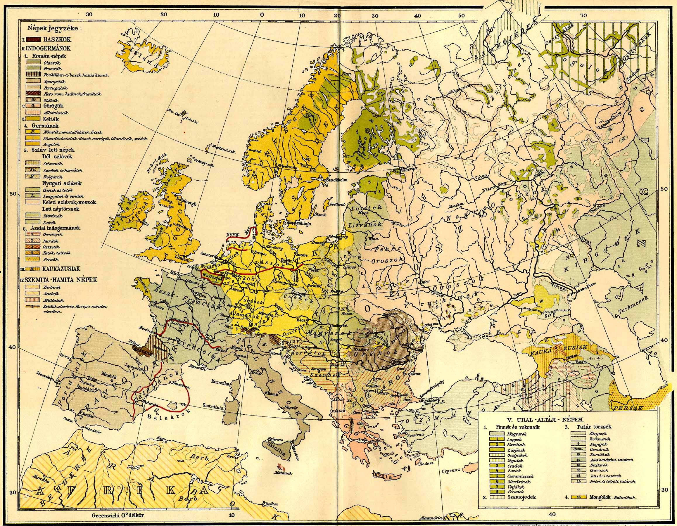
Europe ethnic map 1897 (hungarian).jpg - Olahus
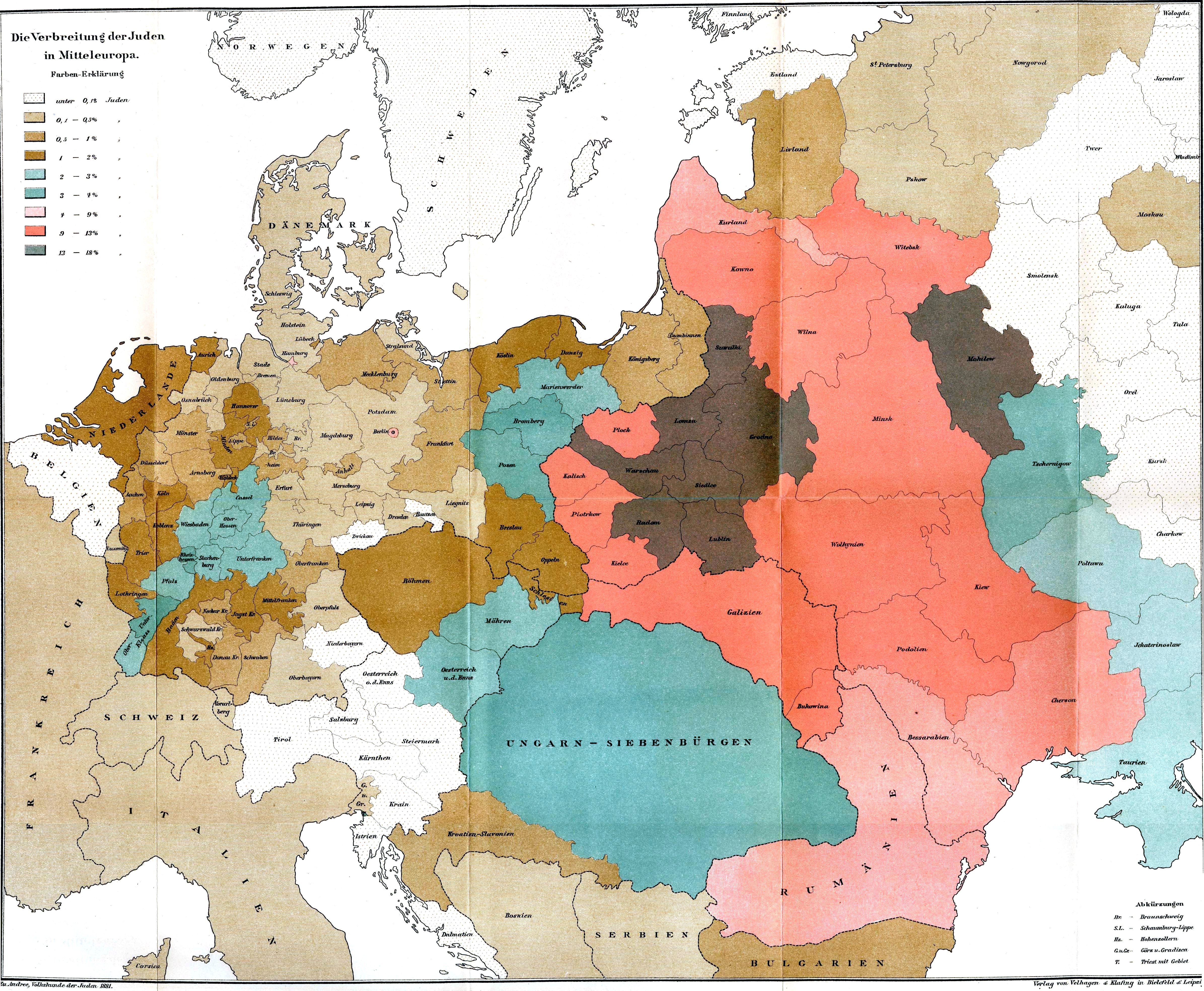
Juden 1881.JPG - Alex:D

Mapa rozsiedlenia ludności polskiej na terenie Litwy w 1929.jpg - Bornholm

Atlas of population of the West Russian region of confessions 1864.jpg - Bogomolov.PL

Congress Poland and Lithuanian governorates - by Alexander Voschinin - 1851 AD.jpg - Pracar

Litauen BV042512936.jpg - Romcjg

Litauen BV042518396.jpg - Renata3

Litauen BV044875323.jpg - H.bauer26
Этнографическая карта Европейской России.jpg - Барабас