Wikimedi'Òc
Modes d'emploi

Cet album fait partie des albums


Albania-ethnique1898.jpg - Mladifilozof

Stammesgebiete Nordalbanien 1918.png - Decius

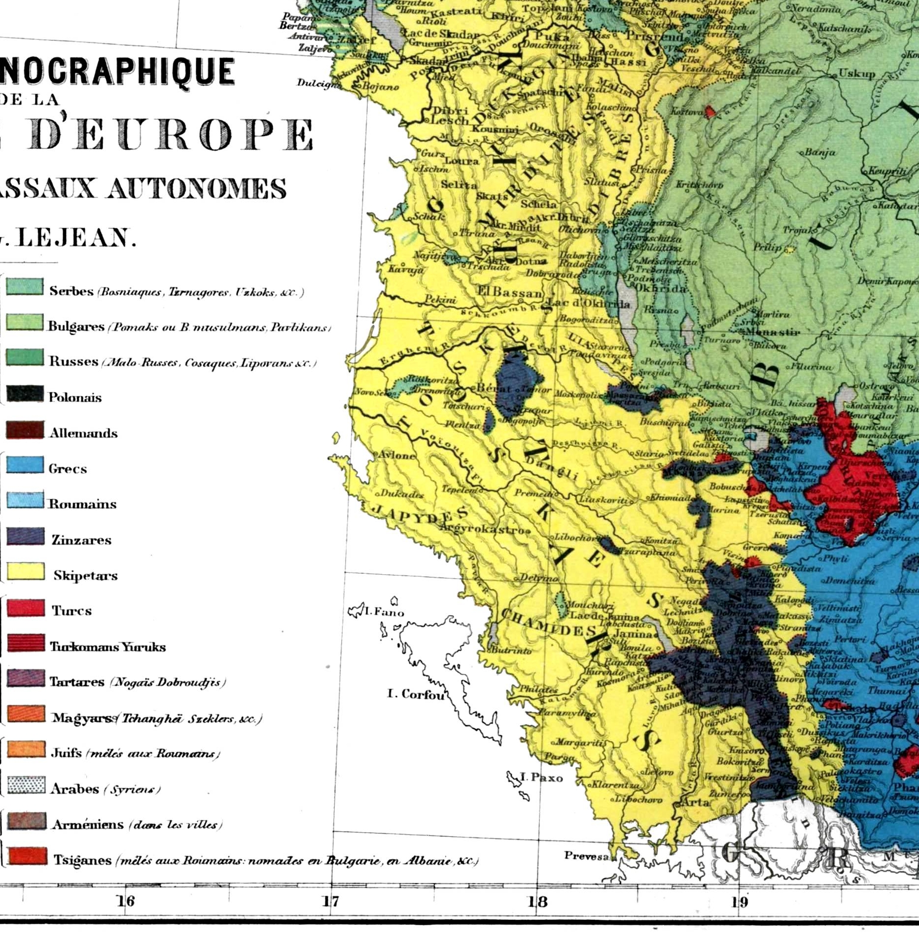
Ethnographic map of Macedonia, G. Lejean (ca. 1861).jpg - Electionworld
Balkans-ethnique.JPG - Alex:D

The Historical Atlas, 1911 – Distribution of Races in the Balkan Peninsula and Asia Minor.jpg - Beao
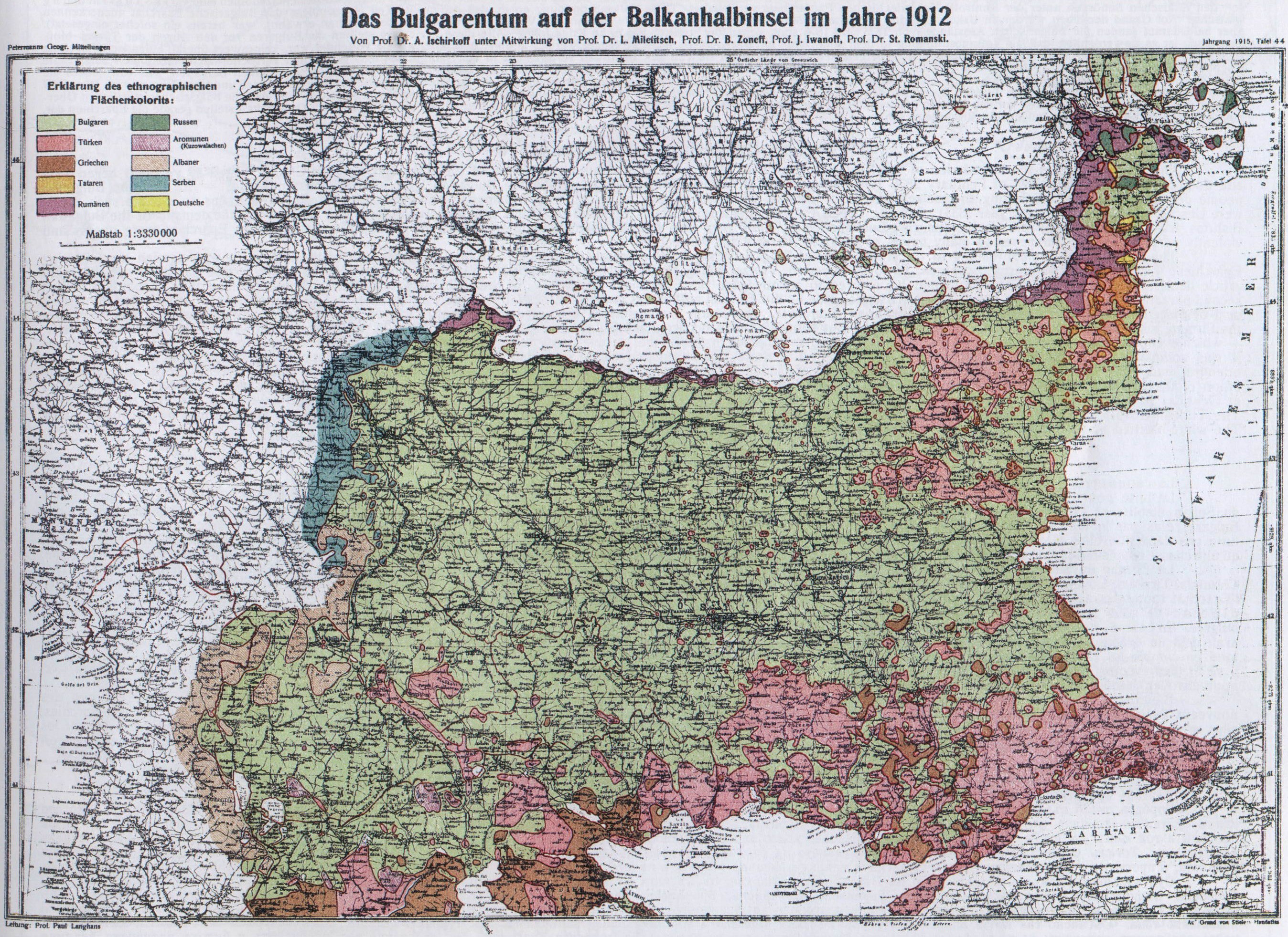
Bulgarians in 1912.jpg - Olahus
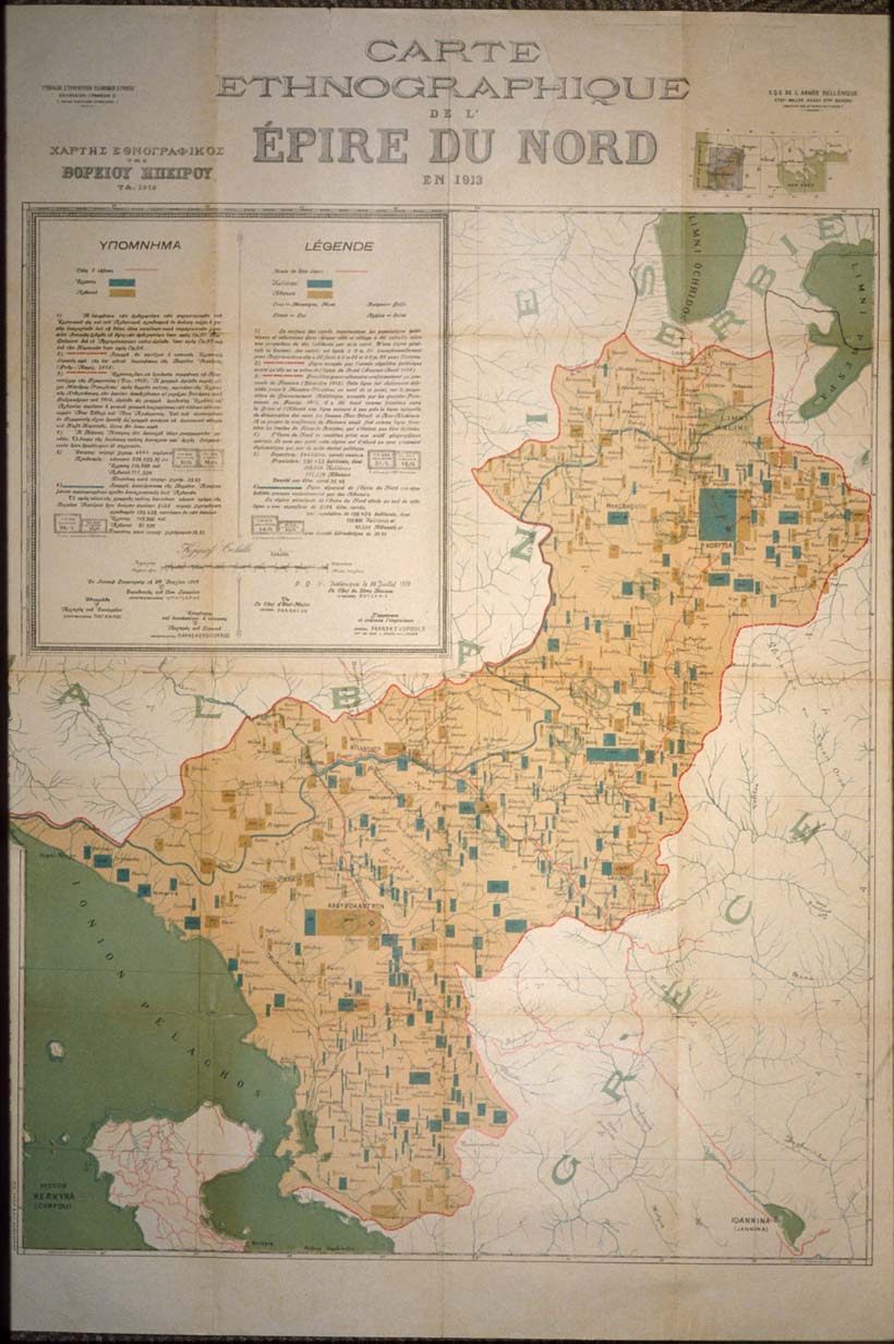
EpireDuNOrd1913.jpg - Megistias
Greece ethnic 1897.JPG - Olahus

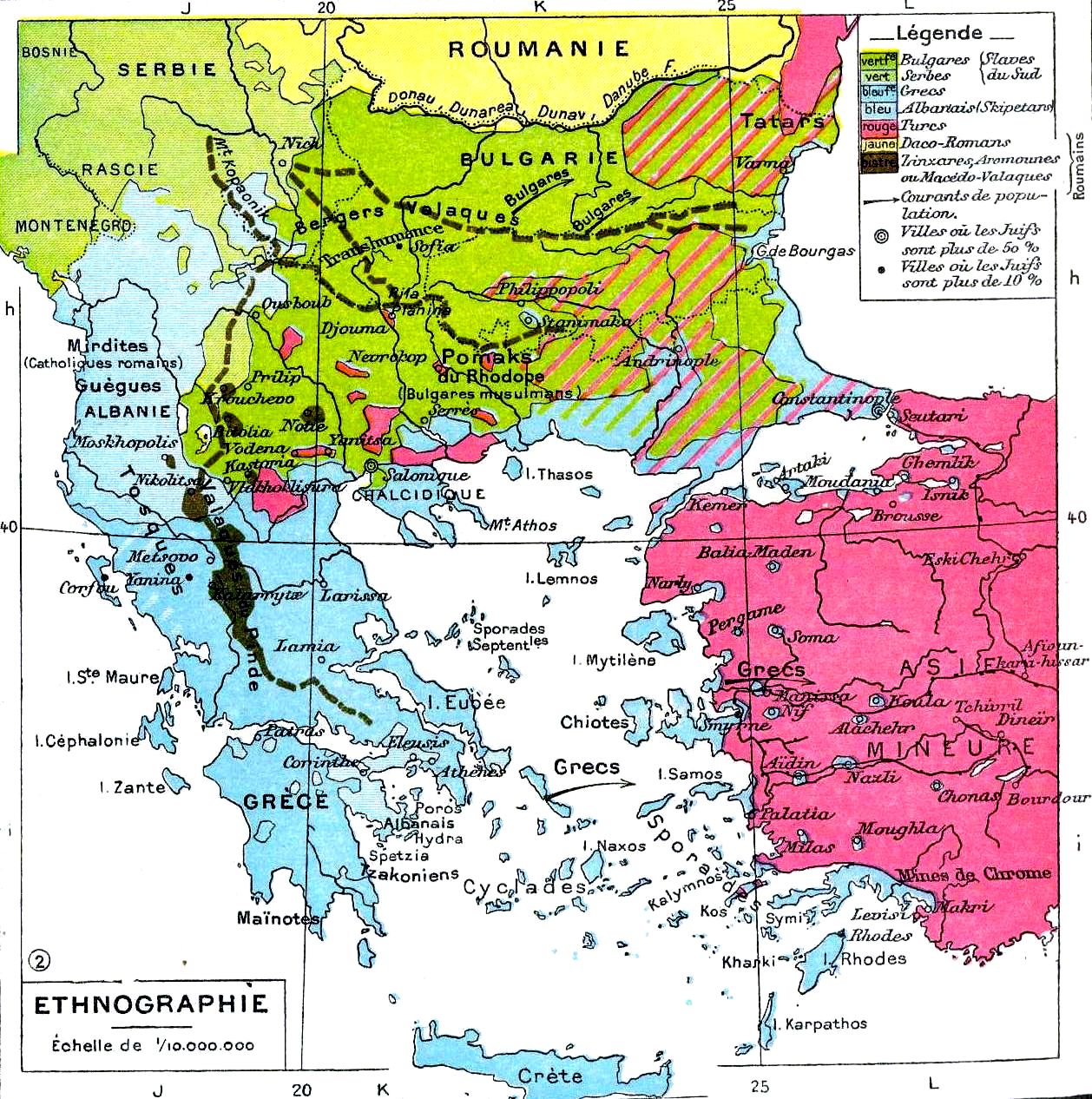
RizMap22.jpg - Lantonov

The Balkan Peninsula, Distribution of Races. EB 1911.png - Keith Edkins
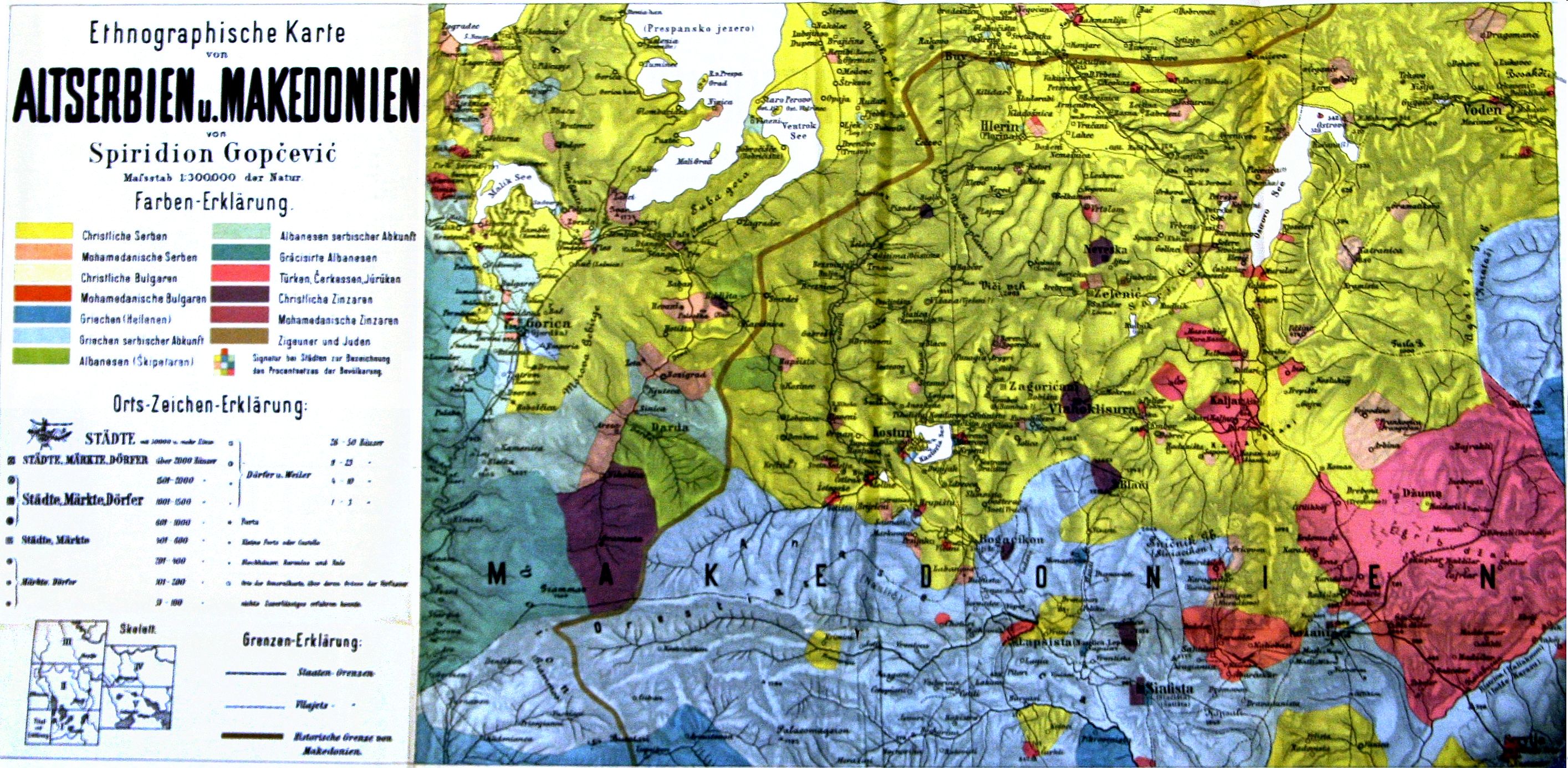
Altserbien-und-Makedonien-map.jpg - Alex:D

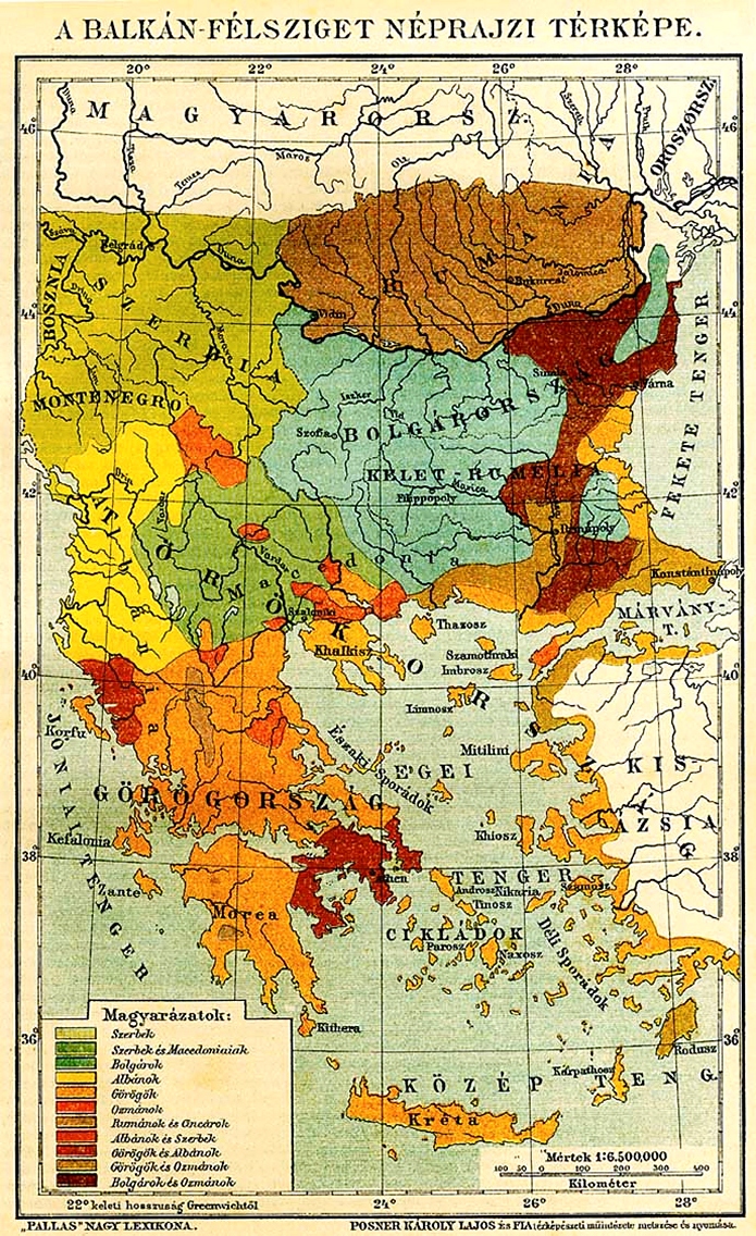
Ethnographic map of the South Balkans, Pallas Nagy Lexikon, 1897.jpg - Olahus
NationalitiesOfSoutheasternEuropePallasNagyLexikon.jpg - Alexandar.R.~commonswiki

Southwestern Balkans 1890.JPG - Alex:D

Ethnographic map of Epirus, based on P. Aravandinos, 1878.jpg - Alex:D

EthnicAlbania1911.jpg - Mladifilozof

Serbrumelia18thc.png - Ajdebre
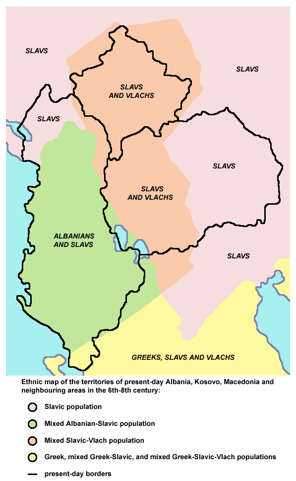
Albania kosovo macedonia 6 8 century.png - WikiEditor2004

AnachronisticMapBalkans.png - Megistias

Carte ethnographique de la Péninsule balkanique, cropped.jpg - WikiEditor2004
Balkans-ethnic (1861) (2).jpg - Albanianp

Religious map of Albania in 1915.png - Valonea

Anachronistic Map of the Balkans (English).svg - MaryroseB54

Carte ethnographique de l'Albanie - 1913.jpg - AceDouble
Carte ethnographique de l'Albanie LOC 88694253.tif - Fæ
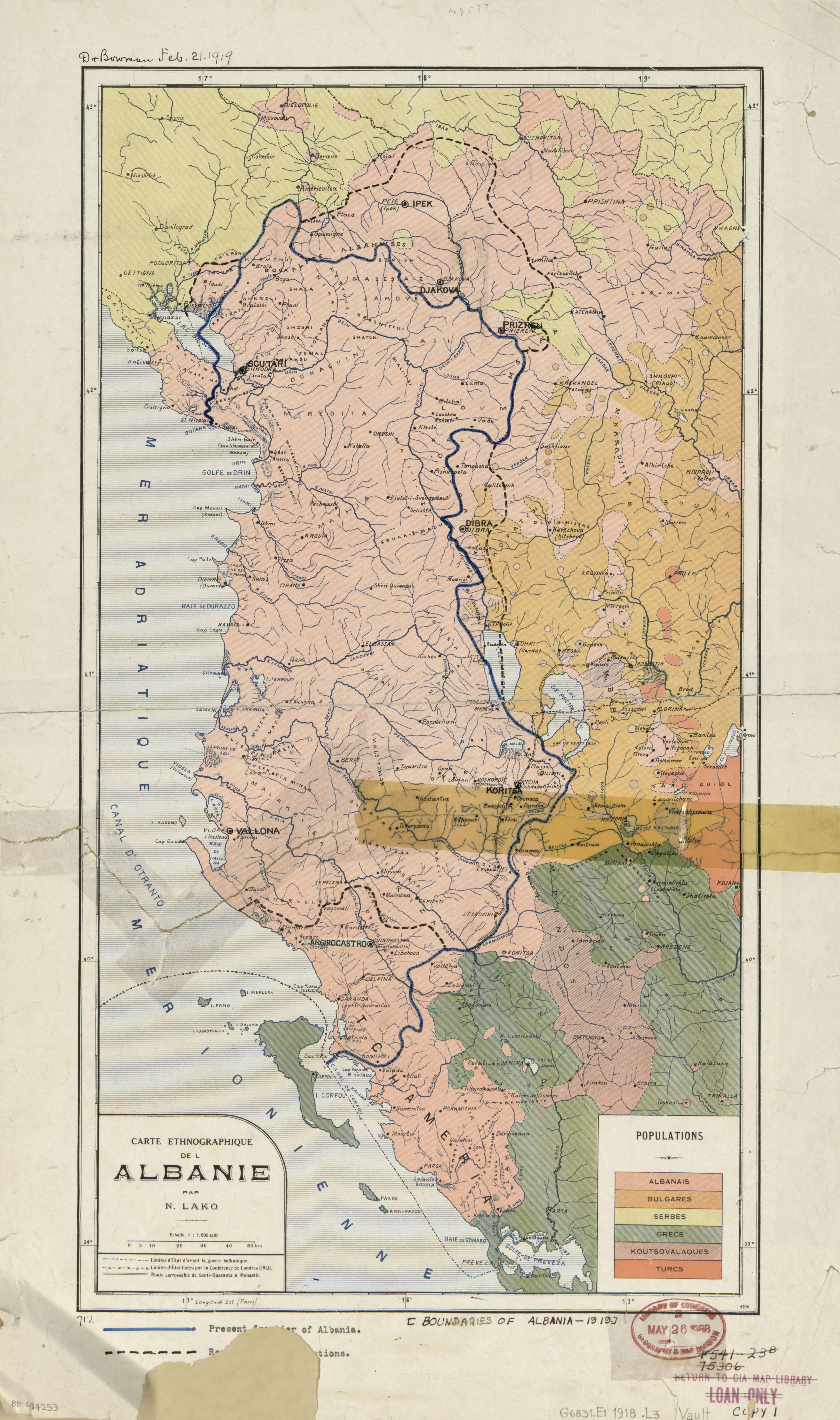
Carte ethnographique de l'Albanie LOC 88694253.jpg - Fæ

Albanien BV042747800.jpg - H.bauer26

Ethnographic map of the central Balkans, ca. 1900.png - Kromid

Ethnic groups in the Balkans 1913 (138699859).jpg - Redaktor GLAM

Ethnic groups in Albania 1913 (138699859).jpg - Redaktor GLAM