Wikimedi'Òc
Modes d'emploi

Cet album fait partie des albums
Cet album photos contient les sous-albums suivants :


Corps-engineers-archives bonneville dam looking east.jpg - Peteforsyth

Eighteenmile island.jpg - W.marsh

ColumbiaRiverRowenaView.jpg - Cacophony

Historic Columbia River Highway 100.svg - NE2

HAER HCRH OR-36-D-10.jpg - NE2

HAER HCRH OR-36-D-11.jpg - NE2

America's Great Highway.jpg - NE2

Historic Columbia River Highway (original).svg - NE2

Historic Columbia River Highway 100 (no overlaps).svg - NE2

Historic US 30 (Oregon).svg - CouvGeek

HCRH milepost 35.jpg - NE2

Columbia River Highway with guardrail.jpg - File Upload Bot (Magnus Manske)

Samuel Lancaster plaque.jpg - Rotatebot

Columbia River Highway at Crown Point.jpg - Werewombat

Bridge over HCRH.jpg - NE2

Rowena Oregon.jpg - Tedder

Eighteenmile Island - Columbia River Gorge.jpg - Werewombat

Independence Day parade 2009 - Corbett Oregon.jpg - Werewombat

Multnomah County deputy - Corbett Oregon.jpg - Werewombat
HCRH keystone logo.png - File Upload Bot (Magnus Manske)

CRH Memaloose Overlook winter.jpg - Werewombat

CRH Rowena Plateau vernal pool.jpg - Werewombat
CRH Toothrock Viaduct ca 1920.jpg - Werewombat

CRH MP 58.jpg - Werewombat

CRH MP 58 oblique.jpg - Werewombat

Rock Formation (Hood River County, Oregon scenic images) (hooDA0071).jpg - Smallbot

Columbia River (Wasco County, Oregon scenic images) (wascDA0049).jpg - Smallbot

Columbia River (Wasco County, Oregon scenic images) (wascDA0015).jpg - Smallbot

Columbia River (Wasco County, Oregon scenic images) (wascDA0022).jpg - Smallbot

Historic Route 30 Sign.jpeg - Akampfer

Shepperds Dell on the Columbia River Highway (3679660008).jpg - File Upload Bot (Magnus Manske)

Waterfall (10558485633).jpg - File Upload Bot (Magnus Manske)

Biking the HCRH (10558248116).jpg - File Upload Bot (Magnus Manske)

National Historic Civil Engineering Landmark Columbia River Scenic Highway 1984.jpg - Khamar
CRH abandoned RR grade - The Dalles Oregon.jpg - Ipoellet
Working to clear slide (14204853748).jpg - Tm

Drill (14259331247).jpg - Tm

Slide repair (14445777595).jpg - Tm

Making progress (14204826609).jpg - Tm

Taking a quick break (14391469365).jpg - Tm

Slide on Historic Columbia River Highway (14354210924).jpg - Tm

"Columbia River from Crown Point", Oregon, c1916 (11794815443).jpg - Jmabel

Crown Point and Vista House, Columbia River Highway, Oregon (69070).jpg - Junkyardsparkle

Horsetail Falls. 205 feet. Columbia River Highway, Oregon (69086).jpg - Junkyardsparkle

Damaged Support (15741605477).jpg - Wilfredor

Winding Down (5268153522).jpg - Wilfredor

Lily (3610761274).jpg - Wilfredor

Columbia River Gorge, ca 1913 (BAR 130).jpeg - BMacZeroBot

Columbia River from Crown Point and Vista House, Oregon, ca 1913 (BAR 233).jpeg - BMacZeroBot

Vista House, Columbia River Highway, Oregon (23884096162).jpg - Tony Webster

CRHHD 1 Multnomah County.png - Ipoellet

CRHHD 2 Hood River County.png - Ipoellet

CRHHD 3 Wasco County.png - Ipoellet

170812 Columbia River From Portland Women's Forum.jpg - Maninhatphoto
1916 advertisement "Union Pacific System" "Summer Vacation Fares to the Great Pacific Northwest Oregon Washington" in the Boston Evening Transcript on April 25, 1916 (page 20) (cropped).jpg - Ooligan

N.Y. tourists on Columbia River Highway LCCN2014701260.jpg - Fæ
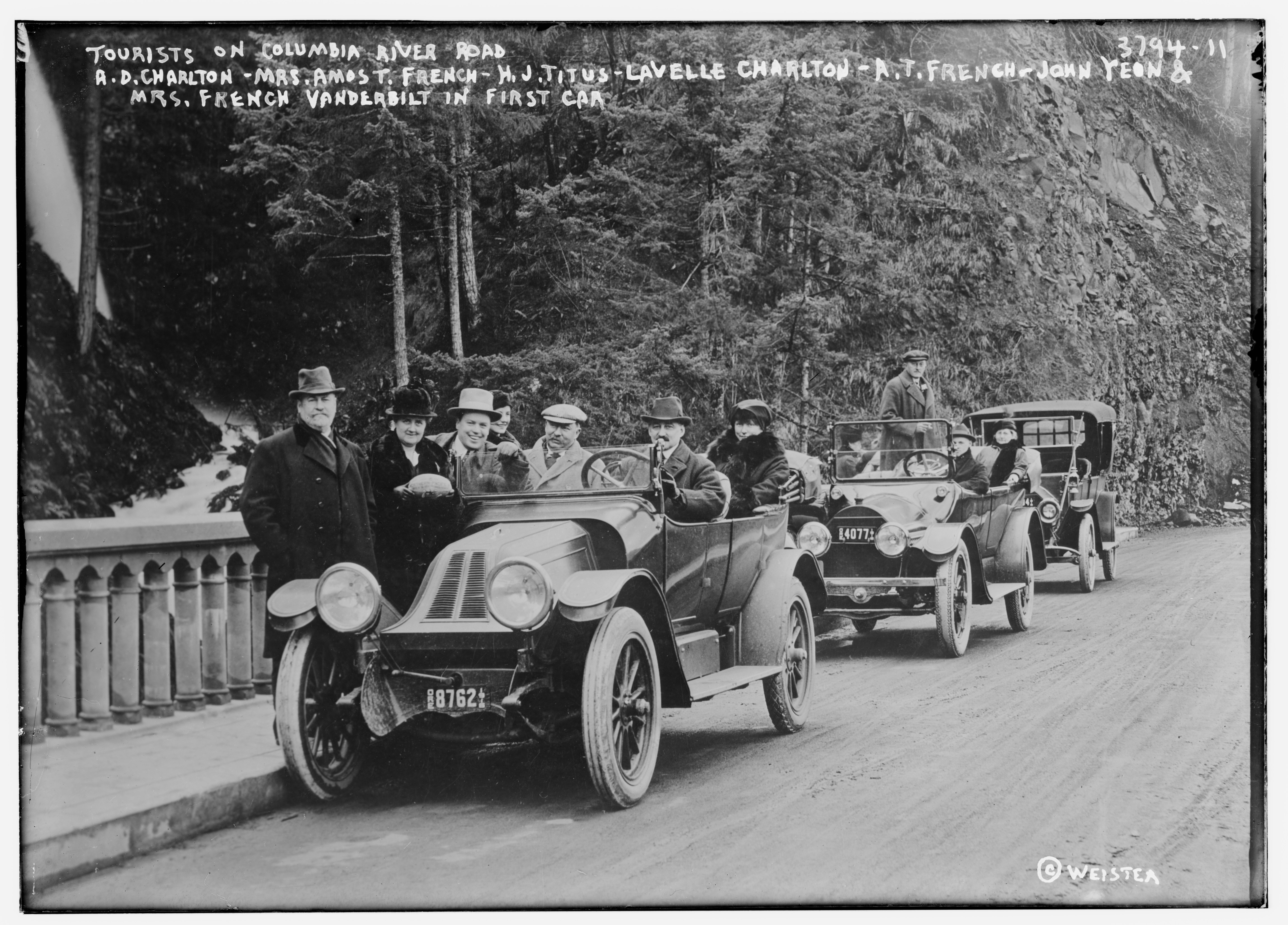
Tourists on Columbia River Road - A.D. Charlton - Mrs. Amos T. French - H.J. Titus - Lavelle Charlton - A.T. French - John Yeon & Mrs. French Vanderbilt in first car LCCN2014701263.jpg - Fæ
Columbia - America's Great Highway.djvu - Peteforsyth
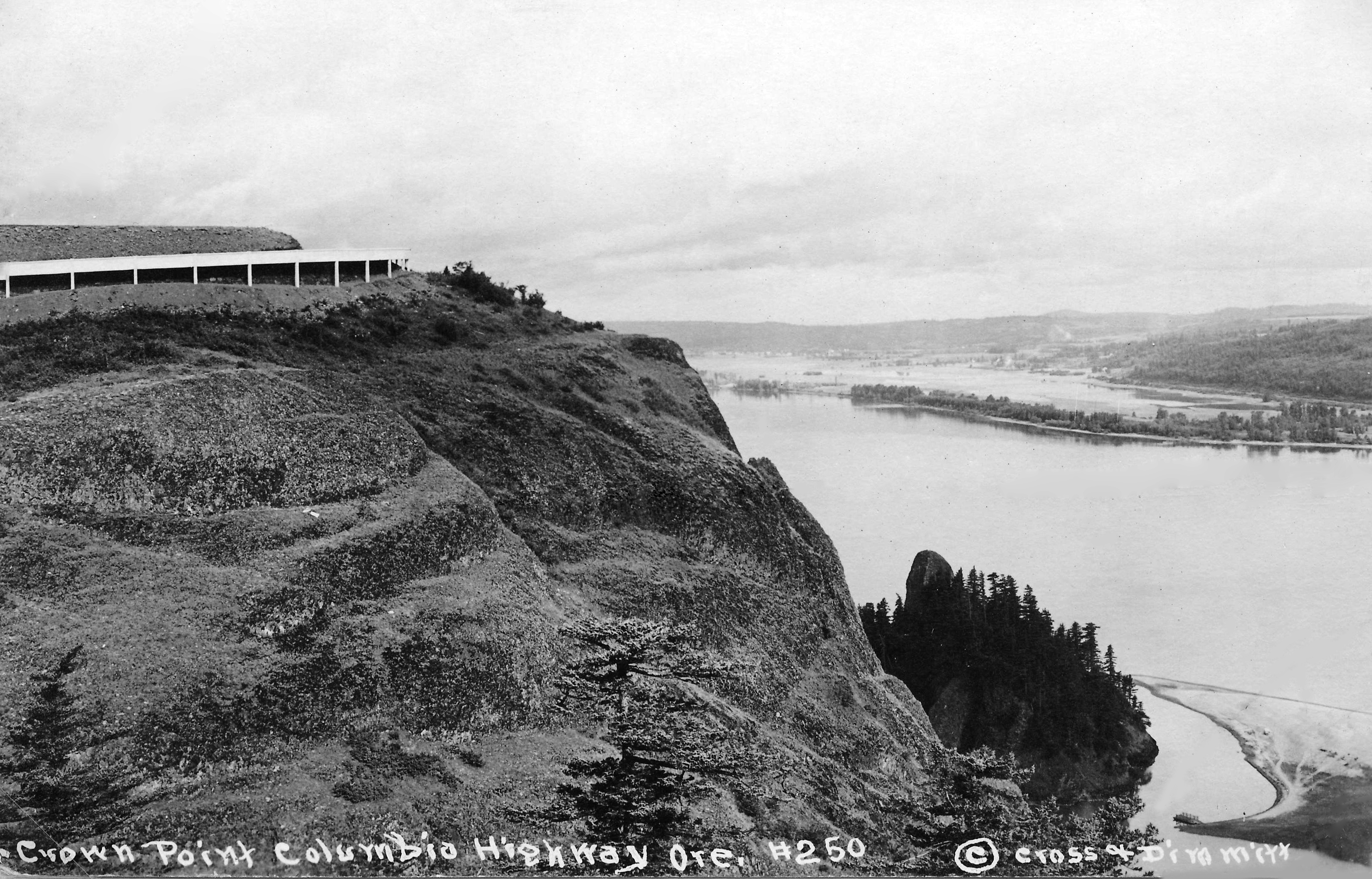
250 Crown Point Columbia Highway by C&D (22314286248).jpg - Tyler ser Noche

455 Crown Point CRH (22513031311).jpg - Tyler ser Noche

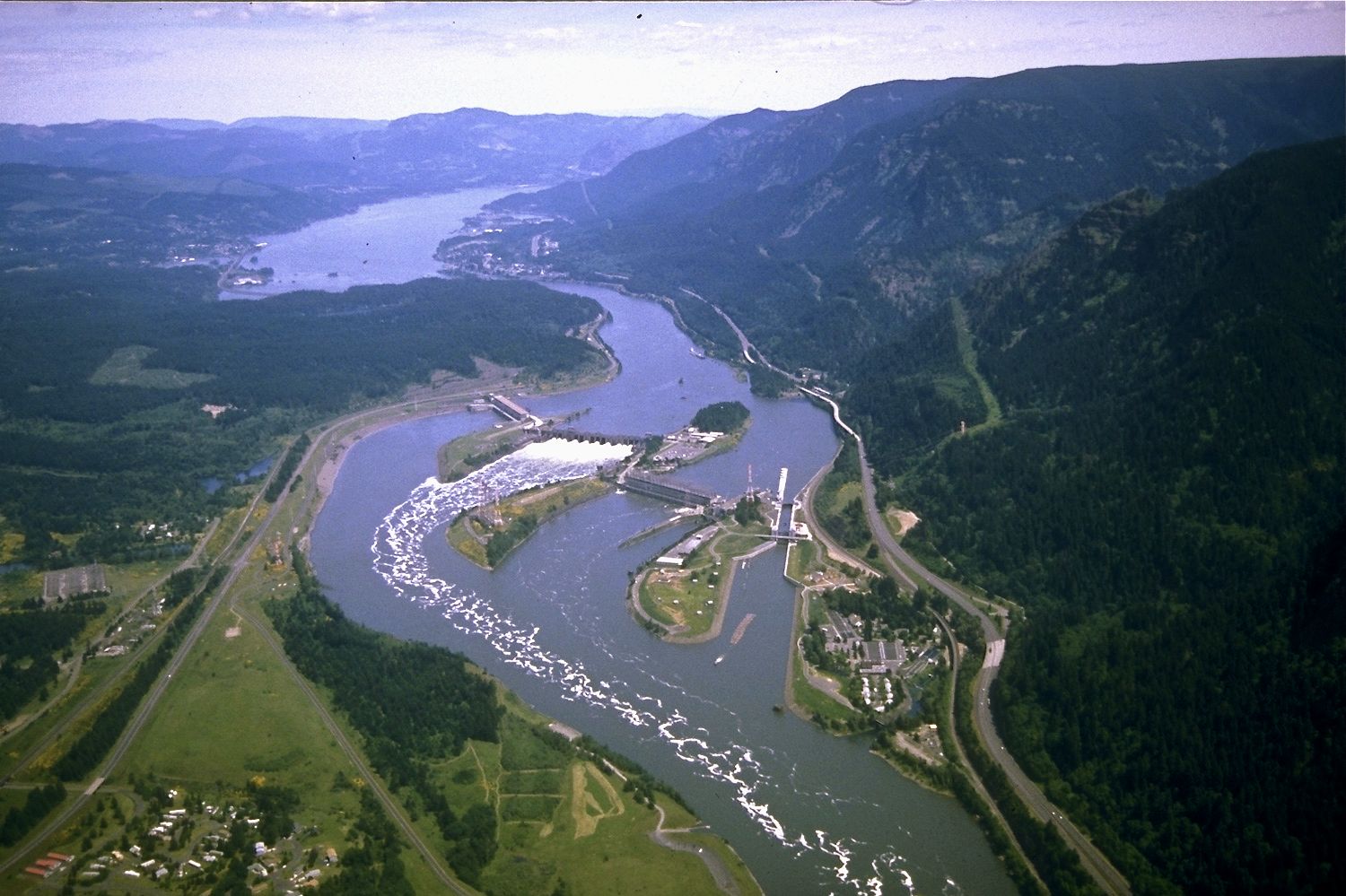
872 Bonneville Dam From CRH by Andrews (22513003331).jpg - Tyler ser Noche

Wahkeena Falls on the Columbia River Highway, Oregon, circa 1917 (AL+CA 1778).jpg - BMacZeroBot

Bridge and automobiles outside Hazelwood ice-cream shop near Multnomah Falls, Columbia River Highway, Oregon, between 1916 and (AL+CA 1780).jpg - BMacZeroBot

Visitors at Shepperd's Dell Bridge on the Columbia River Highway, near Bridal Veil, Oregon, circa 1921 (AL+CA 1804).jpg - BMacZeroBot

Visitors at Shepperd's Dell Bridge on Columbia River Highway near Bridal Veil, Oregon, circa 1920 (AL+CA 1948).jpg - BMacZeroBot

Salmon fish wheels on the Columbia River with Castle Rock in the background, Oregon, circa 1917 (AL+CA 1663).jpg - BMacZeroBot

Scenic viewpoint on the Columbia River Highway, Oregon, circa 1917 (AL+CA 1714).jpg - BMacZeroBot

Automobile crossing bridge adjacent to basalt rock wall on the Columbia River Highway, Oregon, between 1912 and 1922 (AL+CA 1716).jpg - BMacZeroBot

Forest Hall Roadhouse near Bridal Veil, Oregon, circa 1917 (AL+CA 1793).jpg - BMacZeroBot
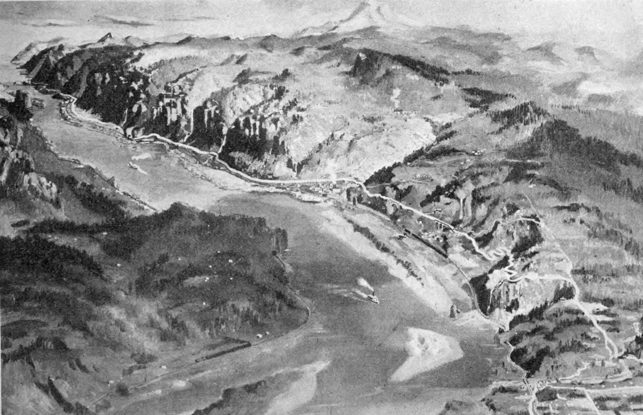
Columbia River Highway planning painting.png - Peteforsyth

Abandoned segment - HCRH Oregon.jpg - Ipoellet

National Scenic Byway - Historic Columbia River Highway (Oregon) - NARA - 68886612 (page 1).jpg - US National Archives bot

National Scenic Byway - Historic Columbia River Highway (Oregon) - NARA - 68886612 (page 2).jpg - US National Archives bot

National Scenic Byway - Historic Columbia River Highway (Oregon) - NARA - 68886612 (page 3).jpg - US National Archives bot

Historic Columbia River Highway - Bicycling on Historic Columbia River Highway - NARA - 7719275.jpg - US National Archives bot

Historic Columbia River Highway - Bridge on the Byway - NARA - 7719247.jpg - US National Archives bot

Historic Columbia River Highway - Bus Outside Visitor Center at West Trailhead - NARA - 7719237.jpg - US National Archives bot

Historic Columbia River Highway - Crown Point and Interpretive Sign - NARA - 7719255.jpg - US National Archives bot

Historic Columbia River Highway - Curves Ahead on the Historic Columbia River Highway - NARA - 7719267.jpg - US National Archives bot

Historic Columbia River Highway - Driving the Historic Columbia River Highway - NARA - 7719225.jpg - US National Archives bot

Historic Columbia River Highway - Driving the Historic Columbia River Highway - NARA - 7719226.jpg - US National Archives bot

Historic Columbia River Highway - Entrance Sign near Troutdale Home - NARA - 7719272.jpg - US National Archives bot

Historic Columbia River Highway - Hairpin Curve on the Rowena Loops - NARA - 7719276.jpg - US National Archives bot

Historic Columbia River Highway - Hikers on the Historic Columbia River Highway - NARA - 7719228.jpg - US National Archives bot

Historic Columbia River Highway - Hikers on the Historic Columbia River Highway - NARA - 7719230.jpg - US National Archives bot

Historic Columbia River Highway - Historic Bridge on the Columbia River Highway - NARA - 7719283.jpg - US National Archives bot

Historic Columbia River Highway - Hood River Bridge - NARA - 7719223.jpg - US National Archives bot

Historic Columbia River Highway - Inside the Visitor Center at the Sign for Mark O. Hatfield West Trailhead - NARA - 7719243.jpg - US National Archives bot

Historic Columbia River Highway - Interpretation Outside the Visitor Center at the West Trailhead - NARA - 7719240.jpg - US National Archives bot

Historic Columbia River Highway - Interpretive Sign and Vista House at Crown Point - NARA - 7719248.jpg - US National Archives bot

Historic Columbia River Highway - Interpretive Sign at Rowena Loops Overlook - NARA - 7719227.jpg - US National Archives bot

Historic Columbia River Highway - Interpretive Sign on Historic Columbia River Highway - NARA - 7719229.jpg - US National Archives bot

Historic Columbia River Highway - Interpretive Sign on Historic Columbia River Highway - NARA - 7719260.jpg - US National Archives bot

Historic Columbia River Highway - Island in the Columbia River - NARA - 7719221.jpg - US National Archives bot

Historic Columbia River Highway - Making Their Feelings Known - NARA - 7719257.jpg - US National Archives bot

Historic Columbia River Highway - Mark O. Hatfield West Trailhead and Visitor Center - NARA - 7719242.jpg - US National Archives bot

Historic Columbia River Highway - Memaloose Overlook Sign - NARA - 7719261.jpg - US National Archives bot

Historic Columbia River Highway - On the Rowena Loops - NARA - 7719268.jpg - US National Archives bot

Historic Columbia River Highway - Outside the Visitor Center at the West Trailhead - NARA - 7719238.jpg - US National Archives bot

Historic Columbia River Highway - Outside the Visitor Center at the West Trailhead - NARA - 7719239.jpg - US National Archives bot

Historic Columbia River Highway - Overlook on the Columbia River - NARA - 7719234.jpg - US National Archives bot

Historic Columbia River Highway - Overlooking "Chicken Charlie's Island" - NARA - 7719219.jpg - US National Archives bot

Historic Columbia River Highway - Panels Outside the Visitor Center - NARA - 7719244.jpg - US National Archives bot

Historic Columbia River Highway - Parking Area Beside Roadway at Multnomah Falls - NARA - 7719245.jpg - US National Archives bot

Historic Columbia River Highway - Pedestrian Bridge over Eagle Creek on the Historic Columbia River Highway - NARA - 7719218.jpg - US National Archives bot

Historic Columbia River Highway - Portland Women's Forum Entrance Sign - NARA - 7719262.jpg - US National Archives bot

Historic Columbia River Highway - Raised Highway Design - NARA - 7719279.jpg - US National Archives bot

Historic Columbia River Highway - Shadows on the Trail - NARA - 7719235.jpg - US National Archives bot

Historic Columbia River Highway - Sharing the Road - NARA - 7719273.jpg - US National Archives bot

Historic Columbia River Highway - Shepperd's Dell - NARA - 7719256.jpg - US National Archives bot

Historic Columbia River Highway - Sign for Bridal Veil Falls - NARA - 7719250.jpg - US National Archives bot

Historic Columbia River Highway - Sign for Latourell Falls - NARA - 7719249.jpg - US National Archives bot

Historic Columbia River Highway - Sign for Lewis and Clark State Recreation Area - NARA - 7719252.jpg - US National Archives bot

Historic Columbia River Highway - Sign for Mark O. Hatfield West Trailhead and Visitor Center - NARA - 7719241.jpg - US National Archives bot

Historic Columbia River Highway - Starvation Creek - NARA - 7719215.jpg - US National Archives bot

Historic Columbia River Highway - Stone Railing on the Historic Columbia River Highway - NARA - 7719231.jpg - US National Archives bot

Historic Columbia River Highway - Stone Railing on the Historic Columbia River Highway - NARA - 7719236.jpg - US National Archives bot

Historic Columbia River Highway - Stonework on the Rowena Loops - NARA - 7719269.jpg - US National Archives bot

Historic Columbia River Highway - Tour Group Having Lunch at Eagle Creek Recreation Area on the Historic Columbia River Highway - NARA - 7719280.jpg - US National Archives bot

Historic Columbia River Highway - Two-posted Interpretive Sign on the Historic Columbia River Highway - NARA - 7719254.jpg - US National Archives bot

Historic Columbia River Highway - Verdant Forest Overhanging Interpretive Sign - NARA - 7719259.jpg - US National Archives bot

Historic Columbia River Highway - White Railings on the Byway - NARA - 7719277.jpg - US National Archives bot

Historic Columbia River Highway - White Railings on the Historic Columbia River Highway - NARA - 7719271.jpg - US National Archives bot

Historic Columbia River Highway - Windsurfers on the Columbia River - NARA - 7719224.jpg - US National Archives bot

Historic Columbia River Highway - Windsurfing, a Popular Sport on the Columbia River - NARA - 7719286.jpg - US National Archives bot

Historic Columbia River Highway - Wood and Stone Railings on the Highway - NARA - 7719232.jpg - US National Archives bot
Eastward View from Vista House upper deck.jpg - Son of RML

Historic Columbia River Highway, OR - Bridge near Latourell Falls.jpg - Jrozwado

Columbia River Gorge from the Vista House.jpg - AStrayEcho

Tooley Lake pan 2347.jpg - Chris Light

Columbia River Highway plaque at Chanticleer Point 01.jpg - Jmabel

Columbia River Highway, Sheppard's Dell - DPLA - 3e1d0b003c055a5f113e913c17a5d3ce.jpg - DPLA bot

Columbia River Gorge Crown Point January 2017.jpg - Z3lvs

Mosier, Oregon from North Washington State side of Columbia River.jpg - Taromsky

Inspiration Point on the Columbia River Highway, Oregon, circa 1929 (AL+CA 1792).jpg - BMacZeroBot