Wikimedi'Òc
Modes d'emploi

Cet album fait partie des albums


Cathie Black Visits Hillcrest High School, December 13, 2010.jpg - FlickreviewR
Cathie Black Visits Hillcrest High School, December 13, 2010 CROPPED.png - Delaywaves
Plate 34- Bounded by Bischoff Pl., Lott Lane, Flushing Avenue, Lathrop Avenue, Park Avenue, Highland Avenue, Grand Avenue, Hillside Avenue, (Jamaica Estates) Madison Avenue, (Long Island NYPL1516380.tiff - Fæ
Queens, V. 1, Double Page Plate No. 9; Part of Jamaica, Ward 4; (Map bounded by Hutton Ave., Park Ave., Hardenbrook Ave., Fulton St., Kaplan Ave.) NYPL1954521.tiff - Fæ

From the Q25 04 - Hillcrest HS.jpg - Tdorante10

Parsons Highland Av 87th Rd 04 - Hillcrest HS.jpg - Tdorante10

Parsons Highland Av 87th Rd 05 - Hillcrest HS.jpg - Tdorante10

Parsons Highland Av 87th Rd 06 - Hillcrest HS.jpg - Tdorante10

Parsons Highland Av 87th Rd 02 - Hillcrest HS.jpg - Tdorante10

Parsons Highland Av 87th Rd 03 - Hillcrest HS.jpg - Tdorante10

Parsons Highland Av 87th Rd 10 - Hillcrest HS.jpg - Tdorante10

Parsons Highland Av 87th Rd 11 - Hillcrest HS.jpg - Tdorante10

Parsons Bl 87th Av 155th St 02 - P.S. 86.jpg - Tdorante10

Parsons Bl IND td 02 - Mezzanine.jpg - Tdorante10

Plate 34 - Jamaica (1909 Bromley Atlas of Queens) Crop.jpg - Tdorante10

Plate 34 - Jamaica (1909 Bromley Atlas of Queens) - Jamaica Normal School (Hillcrest HS).jpg - Tdorante10

Plate 34 - Jamaica (1909 Bromley Atlas of Queens) - Flushing–Jamaica Streetcar Map 01.jpg - Tdorante10
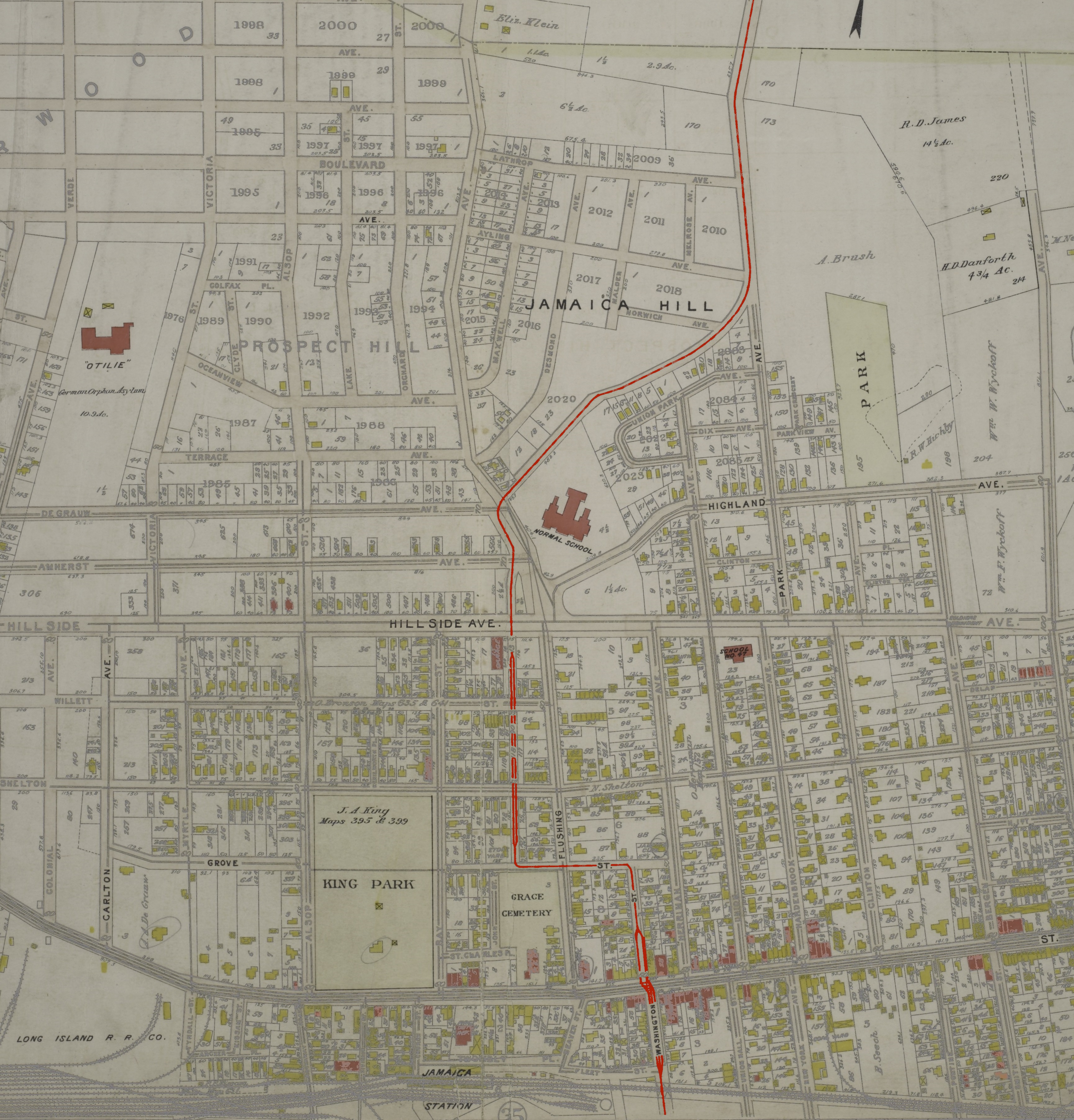
Plate 34 - Jamaica (1909 Bromley Atlas of Queens) - Flushing–Jamaica Streetcar Map 03.jpg - Tdorante10

Plate 34 - Jamaica (1909 Bromley Atlas of Queens) - Flushing–Jamaica Streetcar Map 02.jpg - Tdorante10

Plate 34 - Jamaica (1909 Bromley Atlas of Queens) - Flushing–Jamaica Streetcar Map 04.jpg - Tdorante10