Wikimedi'Òc
Modes d'emploi

Cet album fait partie des albums


Hidatsa tribe.jpg - Left Hook~commonswiki

Hidatsa01.png - Nikater

Bozeman Trail, the forts and the Indian territories.jpg - Naawada2016
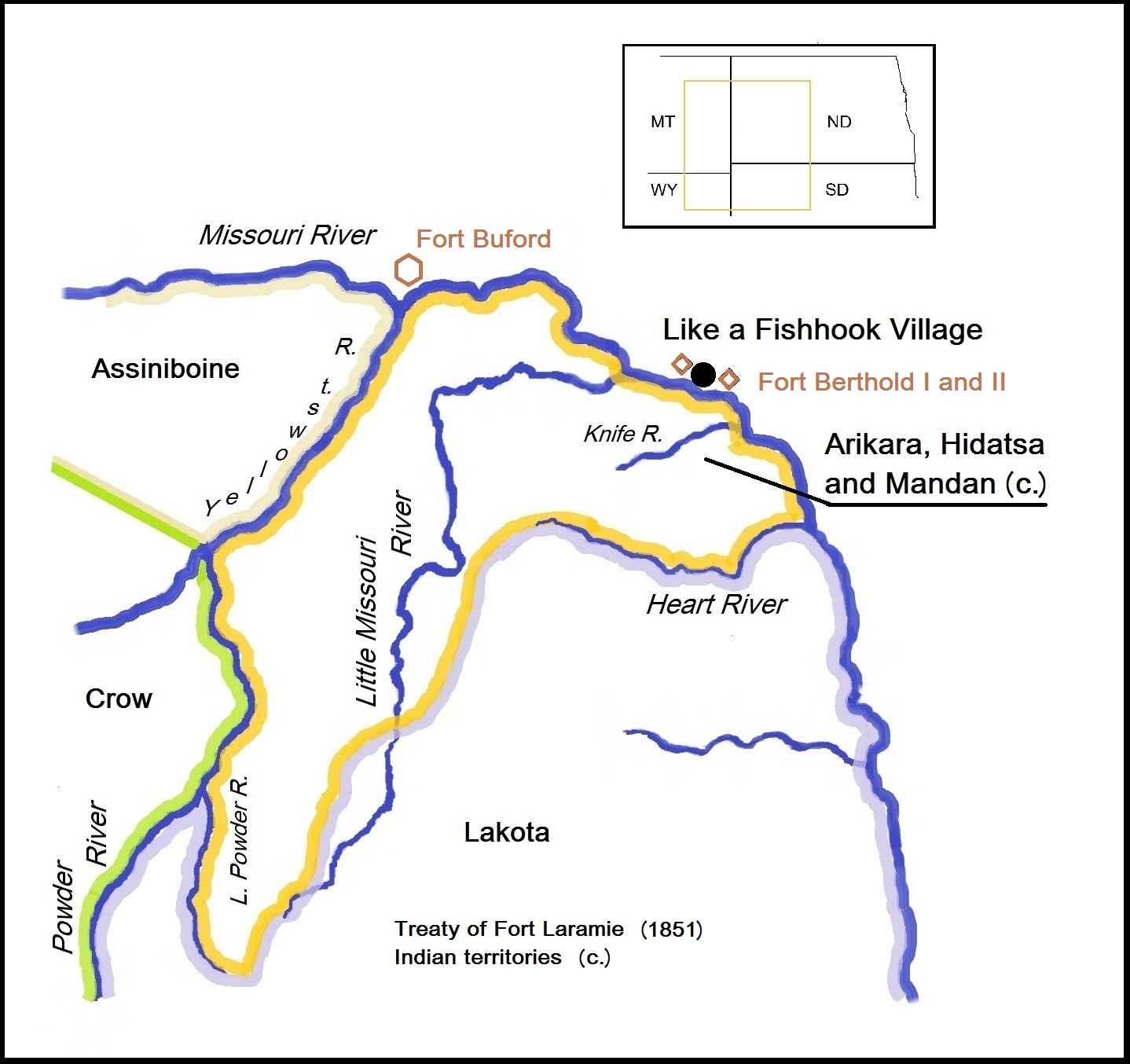
Arikara, Hidatsa and Mandan territory, 1851. Like a Fishhook Village, Fort Berthold I and II and Fort Buford.png - Naawada2016

Arikara, Hidatsa and Mandan 1851 treaty territory. (Area 529, 620 and 621 south of the Missouri).png - Naawada2016

Garden Coulee village of Hidatsa chief Crow Flies High.png - Naawada2016

Crow Flies High village (1884) and the Fort Berthold reservation.png - Naawada2016

Crow Flies High village and the Fort Berthold reservation, 1886.png - Naawada2016

Map with the route of a Crow Indian camp and Francois-Antoine Larocque in 1805.png - Naawada2016

Hidatsa migration to the Missouri and (likely) first settlements.png - Indianertosset

Some Indian villages burned by the Sioux, cirka 1780-1862.png - Indianertosset
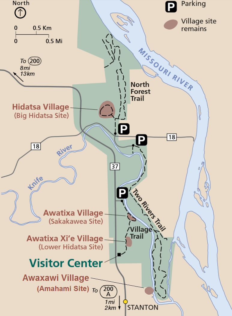
Knife River Indian Villages National Historic Site map.png - Indianertosset

Big Hidatsa Site (32ME12).png - Indianertosset

Map of 32ML2 Like-a-Fishhook Village, Fort Berthold 1 and 2 and vicinity.png - Indianertosset

Map of some gardens South East of Like-a-Fishhook Village near Missouri River, North Dakota.png - Indianertosset

Map. Sites at Knife River Indian Villages, ND.jpg - Indianertosset

Map of Molander Site, North Dakota.png - Indianertosset

Map with Hidatsa villages, AD 1100-1885.png - Indianertosset