Wikimedi'Òc
Modes d'emploi

Cet album fait partie des albums
Cet album photos contient les sous-albums suivants :


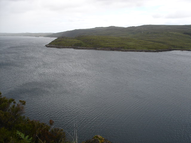
Perth Harbour - geograph.org.uk - 563485.jpg - Geograph Update Bot

Red Head - geograph.org.uk - 3218.jpg - GeographBot

Rubh' an Teampaill - geograph.org.uk - 18490.jpg - GeographBot

Rubha Aird na Ba - geograph.org.uk - 28523.jpg - GeographBot
Rubha Thurnaig - geograph.org.uk - 28525.jpg - GeographBot

Yacht Passing Rubha Fiart on Lismore - geograph.org.uk - 21807.jpg - GeographBot

Da Head o da Taing - geograph.org.uk - 39660.jpg - GeographBot

Burghead - geograph.org.uk - 54289.jpg - GeographBot

Headland at Cleadale - geograph.org.uk - 37327.jpg - GeographBot

Geal Chreagan - geograph.org.uk - 55330.jpg - GeographBot

Finniness Peninsula, Finniness Island, Loch Ken - geograph.org.uk - 71284.jpg - GeographBot

Na Tairbh - geograph.org.uk - 37575.jpg - GeographBot

Natural Arches Roinn a Roidh - geograph.org.uk - 35198.jpg - GeographBot

Ness of Duncansby - geograph.org.uk - 35279.jpg - GeographBot

Looking south along the Kintyre Peninsula, from Torrisdale Bay. - geograph.org.uk - 62499.jpg - GeographBot

Rubh Aird an Anail - geograph.org.uk - 30976.jpg - GeographBot

Rubha na Crannoig - geograph.org.uk - 37329.jpg - GeographBot

Near Cape Wrath - geograph.org.uk - 53349.jpg - GeographBot
Old Man's Pow, Kirkandrew Bay - geograph.org.uk - 69685.jpg - GeographBot

Red Head, Eday and Grey Head, Calf of Eday - geograph.org.uk - 60740.jpg - GeographBot

Promontory on Loch Glashan, Mid Argyll - geograph.org.uk - 71795.jpg - GeographBot

Rubh' Aird an Sturra - geograph.org.uk - 40465.jpg - GeographBot

Rora Head, Hoy, Orkney - geograph.org.uk - 60736.jpg - GeographBot

Red Head, Eday - geograph.org.uk - 59527.jpg - GeographBot

Rubha Sughar, Skye - geograph.org.uk - 61338.jpg - GeographBot

Sron Creag na Ceapaich - geograph.org.uk - 44707.jpg - GeographBot

Sron na Carra - geograph.org.uk - 47137.jpg - GeographBot

Society Point - geograph.org.uk - 56358.jpg - GeographBot

Ard Skinid headland, Talmine, Sutherland - geograph.org.uk - 83119.jpg - GeographBot

The Auks and Englishman's Cut, Eday - geograph.org.uk - 61154.jpg - GeographBot

Waternish Point - geograph.org.uk - 58759.jpg - GeographBot

Acairseid an Rhubha - geograph.org.uk - 103430.jpg - GeographBot

Natural Arch, Culkein - geograph.org.uk - 82446.jpg - GeographBot

Dun na h-Airde - geograph.org.uk - 103526.jpg - GeographBot

Sron an Droma - geograph.org.uk - 99164.jpg - GeographBot

Portable radio operation from NG 31 - geograph.org.uk - 102408.jpg - GeographBot

Rubha nam Brathairean - geograph.org.uk - 100257.jpg - GeographBot

Sandy Hirst - geograph.org.uk - 105852.jpg - GeographBot

Torr Mor - geograph.org.uk - 96695.jpg - GeographBot

Sron Geodh'an Tairbh - geograph.org.uk - 102128.jpg - GeographBot

Sron na Faire Moire - geograph.org.uk - 102125.jpg - GeographBot

Talisker Point - geograph.org.uk - 107900.jpg - GeographBot

North Sutor - geograph.org.uk - 133611.jpg - GeographBot

Promontory south of Oskaig - geograph.org.uk - 136825.jpg - GeographBot

Sgeir Mhor - geograph.org.uk - 136912.jpg - GeographBot

Sutors Stacks - geograph.org.uk - 133614.jpg - GeographBot

A'Bheirigh - geograph.org.uk - 165395.jpg - GeographBot

Gob na Hoe - geograph.org.uk - 166216.jpg - GeographBot

Hoe Rape - geograph.org.uk - 166213.jpg - GeographBot

Promontory - geograph.org.uk - 155117.jpg - GeographBot

North Eriskay - geograph.org.uk - 119697.jpg - GeographBot

Rubha Bheanachain - geograph.org.uk - 164198.jpg - GeographBot

Rubha Voreven - geograph.org.uk - 164171.jpg - GeographBot

Rubha na Tragha - geograph.org.uk - 164179.jpg - GeographBot

Toward Rubha nam Fear headland - geograph.org.uk - 162641.jpg - GeographBot

View of North Sutor - geograph.org.uk - 112908.jpg - GeographBot

Houses by Sron Fhionn - geograph.org.uk - 175938.jpg - GeographBot

Rocks at Fishnish Point - geograph.org.uk - 175254.jpg - GeographBot

Hairy Ness, Eyemouth - geograph.org.uk - 191450.jpg - GeographBot

Headland at Eyemouth - geograph.org.uk - 191455.jpg - GeographBot

Headland just south of Muasdale. - geograph.org.uk - 198543.jpg - GeographBot

Loch Morar - Roinn a'Ghiubhais - geograph.org.uk - 189305.jpg - GeographBot

Loch Morar - Roinn a'Ghiubhais from the east - geograph.org.uk - 189308.jpg - GeographBot

More Nameless things - geograph.org.uk - 192105.jpg - GeographBot

Rubha Gainmheine - geograph.org.uk - 183301.jpg - GeographBot

Rubha Garbh-ard - geograph.org.uk - 185772.jpg - GeographBot

Rubha Mor - geograph.org.uk - 192099.jpg - GeographBot

Rubha Ruadh on Scarp - geograph.org.uk - 190107.jpg - GeographBot

Rubha na Mòine - geograph.org.uk - 194545.jpg - GeographBot

Sron Urraidh - geograph.org.uk - 198281.jpg - GeographBot

Trees at Rubha Camas an t-Salainn - geograph.org.uk - 185574.jpg - GeographBot

Kayaking past Rubha na Earba - geograph.org.uk - 200652.jpg - GeographBot

Yellow Craig, Coldingham - geograph.org.uk - 191473.jpg - GeographBot

Creag Mhor - geograph.org.uk - 223626.jpg - GeographBot

Gallie Craig rocks - geograph.org.uk - 215830.jpg - GeographBot

Aird Breac - geograph.org.uk - 233914.jpg - GeographBot

Geodha an Leth-roinn - geograph.org.uk - 227560.jpg - GeographBot

An t-Aigeach headland at Loch Eriboll - geograph.org.uk - 232844.jpg - GeographBot

Auchinhoan Head with the mist shrouded Ailsa Craig left in the distance. - geograph.org.uk - 248127.jpg - GeographBot

Myroch Point - geograph.org.uk - 215716.jpg - GeographBot

Moyl headland from Hestan Island - geograph.org.uk - 229431.jpg - GeographBot

Point of Lag - geograph.org.uk - 214717.jpg - GeographBot

Ru Chorachan headland (centre) from Ru Idrigill,Uig - geograph.org.uk - 224224.jpg - GeographBot
Manish Point, Ensay - geograph.org.uk - 230423.jpg - GeographBot

Rubha Dubh Chamais, Rona - geograph.org.uk - 231251.jpg - GeographBot

Southern tip of Ensay - geograph.org.uk - 230435.jpg - GeographBot

Ard Beag - geograph.org.uk - 262420.jpg - GeographBot

Ardentinny, Shepherds Point - geograph.org.uk - 261204.jpg - GeographBot

Buttock Point, Isle of Bute - geograph.org.uk - 261689.jpg - GeographBot

Headland near the Old Castle of Wick - geograph.org.uk - 260146.jpg - GeographBot

North Sutor - geograph.org.uk - 260301.jpg - GeographBot

South Sutor - geograph.org.uk - 260308.jpg - GeographBot

Wild Goats at Carradale Point - geograph.org.uk - 277477.jpg - GeographBot

Towards Gob Uisgebrigh - geograph.org.uk - 283965.jpg - GeographBot

Solitary sheep - geograph.org.uk - 290634.jpg - GeographBot

Rubh a' Phuirt Bhig - geograph.org.uk - 313836.jpg - GeographBot

Rubha Tràigh an Dùin - geograph.org.uk - 315681.jpg - GeographBot

Car Ness from Shapinsay Ferry - geograph.org.uk - 322168.jpg - GeographBot

Rubha Bàn - geograph.org.uk - 334420.jpg - GeographBot

Surfs up, Reed Point - geograph.org.uk - 336863.jpg - GeographBot

Houton Head - geograph.org.uk - 345271.jpg - GeographBot

Down From Rubha Lamanais - geograph.org.uk - 351041.jpg - GeographBot

Rubha Lamanais - geograph.org.uk - 351038.jpg - GeographBot

Fast Castle - geograph.org.uk - 365002.jpg - GeographBot

Looking east along the top of Scotland - geograph.org.uk - 370031.jpg - GeographBot

An Dornaidh and Loch Duntechaig - geograph.org.uk - 386907.jpg - GeographBot

Deil's Dyke Headland - geograph.org.uk - 380045.jpg - GeographBot
Mull of Cara - geograph.org.uk - 394332.jpg - GeographBot

Mull of Cara - geograph.org.uk - 395623.jpg - GeographBot

Red Head - geograph.org.uk - 395140.jpg - GeographBot

The Headland, Castlehill Point - geograph.org.uk - 398821.jpg - GeographBot

Point of Stoer - geograph.org.uk - 409244.jpg - GeographBot

Stanger Head - geograph.org.uk - 405206.jpg - GeographBot

Sgeir Lang - geograph.org.uk - 419094.jpg - GeographBot

Rubha nam Pléac - geograph.org.uk - 423318.jpg - GeographBot

Sròn a' Mhill - geograph.org.uk - 429835.jpg - GeographBot

Ceann a' Gharaidh. - geograph.org.uk - 444608.jpg - GeographBot

Rubha Thornais - geograph.org.uk - 444218.jpg - GeographBot

Rubha na Leacaig - geograph.org.uk - 442821.jpg - GeographBot

Rubha Áird na Machrach - geograph.org.uk - 444223.jpg - GeographBot

Sliddery Point - geograph.org.uk - 445921.jpg - GeographBot

Tanker - geograph.org.uk - 447323.jpg - GeographBot

A' Chiste Dubh - geograph.org.uk - 457164.jpg - GeographBot

Headland near Pocan Smoo - geograph.org.uk - 450454.jpg - GeographBot

Pocan Smoo - geograph.org.uk - 450447.jpg - GeographBot

Rubh an Lionaidh - geograph.org.uk - 454459.jpg - GeographBot

Rubha na Marraidh - geograph.org.uk - 453017.jpg - GeographBot

Rubha na h-Àirde Droighniche - geograph.org.uk - 454405.jpg - GeographBot

Sròn an Droma - geograph.org.uk - 455872.jpg - GeographBot

Rubha na Traighe - geograph.org.uk - 469609.jpg - GeographBot

Kildavanan Point - geograph.org.uk - 471180.jpg - GeographBot

North Head, Wick Bay - geograph.org.uk - 479185.jpg - GeographBot

Rubha Cladh Eòin - geograph.org.uk - 470097.jpg - GeographBot

Headland on Loch Hourn - geograph.org.uk - 487927.jpg - GeographBot

Rocky headland at the eastern end of Macharioch Bay - geograph.org.uk - 484780.jpg - GeographBot

Brough of Deerness from the West - geograph.org.uk - 491361.jpg - GeographBot

Promontory near Rubha Dubh Ard - geograph.org.uk - 490970.jpg - GeographBot

Rubha Dubh Ard - geograph.org.uk - 491048.jpg - GeographBot
Rubha Sloc an Eòrna - geograph.org.uk - 491213.jpg - GeographBot

Rubha Sloc an Eòrna - geograph.org.uk - 491222.jpg - GeographBot

Rubha Port Scolpaig - geograph.org.uk - 506730.jpg - GeographBot

Rubha Shildinis - geograph.org.uk - 502614.jpg - GeographBot

Rubha na Beirghe - geograph.org.uk - 503143.jpg - GeographBot

Bay of Keisgaig - geograph.org.uk - 519145.jpg - GeographBot

Langa Ness - geograph.org.uk - 513979.jpg - GeographBot

Lochside Point. - geograph.org.uk - 519585.jpg - GeographBot

Small Headland Near Ballygroggan. - geograph.org.uk - 517305.jpg - GeographBot

A fishing boat rounds Lamba Ness - geograph.org.uk - 527523.jpg - GeographBot

Blue Mull - geograph.org.uk - 525639.jpg - GeographBot

Headland on Muck - geograph.org.uk - 528718.jpg - GeographBot

Rocks at Kilmory - geograph.org.uk - 520458.jpg - GeographBot

Spoo Ness - geograph.org.uk - 525662.jpg - GeographBot

A profile of Grey Head, Calf of Eday. - geograph.org.uk - 530461.jpg - GeographBot

Across the headlands of West Sand Wick bay towards West Sandwick broch - geograph.org.uk - 533626.jpg - GeographBot

Aith Ness - geograph.org.uk - 534775.jpg - GeographBot

Barth Head, South Ronaldsay. - geograph.org.uk - 533466.jpg - GeographBot

Burgh Head, Stronsay. - geograph.org.uk - 531499.jpg - GeographBot

Ceann a'Chreagain - geograph.org.uk - 530041.jpg - GeographBot

Halcro Head, South Ronaldsay. - geograph.org.uk - 532219.jpg - GeographBot

Hamera Head and Mid Head from Whalsay ferry - geograph.org.uk - 533442.jpg - GeographBot

Headland below Hill of Taing - geograph.org.uk - 538776.jpg - GeographBot

Malcolm's Head from the west - geograph.org.uk - 531235.jpg - GeographBot

Old Head, South Ronaldsay. - geograph.org.uk - 533514.jpg - GeographBot

Red Head on Eday lives up to its name. - geograph.org.uk - 530459.jpg - GeographBot

Rocky Promontory, Longa Island - geograph.org.uk - 532835.jpg - GeographBot

Rounding Brough Ness. - geograph.org.uk - 532282.jpg - GeographBot

Sròn na Caillich - geograph.org.uk - 532077.jpg - GeographBot

Headland at Kebister - geograph.org.uk - 548417.jpg - Cropbot

Loch Naver Promontory - geograph.org.uk - 548226.jpg - GeographBot

Siaram Bostadh - geograph.org.uk - 546055.jpg - GeographBot

Hoga Ness - geograph.org.uk - 556190.jpg - GeographBot

North end of Ham Ness - geograph.org.uk - 557268.jpg - GeographBot

Swinna Ness - geograph.org.uk - 553755.jpg - GeographBot

Brough Taing - geograph.org.uk - 563099.jpg - GeographBot
Gob Hais - geograph.org.uk - 562755.jpg - GeographBot

Rhuba an Trilleachain - geograph.org.uk - 568177.jpg - GeographBot

Across Loch Fyne - geograph.org.uk - 578690.jpg - GeographBot

Aird Dalbeg - geograph.org.uk - 573280.jpg - GeographBot

Artificial promontory - geograph.org.uk - 578689.jpg - GeographBot

Artificial promontory at Furnace quarry - geograph.org.uk - 578691.jpg - GeographBot

Binsness and Findhorn Bay - geograph.org.uk - 579308.jpg - GeographBot

Dalchenna Point - geograph.org.uk - 577938.jpg - GeographBot

Pennymore Point - geograph.org.uk - 578133.jpg - GeographBot

Toft Ness - geograph.org.uk - 573009.jpg - GeographBot

The end of Lambaness - geograph.org.uk - 586021.jpg - GeographBot

Creag Ard on Tanera More, with Stac Pollaidh and Cul Mor behind - geograph.org.uk - 594999.jpg - GeographBot

Dunnet Head, trig point, wartime ruins, lighthouse - geograph.org.uk - 596844.jpg - GeographBot

Camp on the cliffs - geograph.org.uk - 604876.jpg - GeographBot

North coast of Lismore - geograph.org.uk - 601058.jpg - GeographBot

Rubh' an Aoil - geograph.org.uk - 607457.jpg - GeographBot

Rubha Bàn - geograph.org.uk - 601042.jpg - GeographBot

The headland at Castlecraig - geograph.org.uk - 609777.jpg - GeographBot

Brough Head - geograph.org.uk - 628307.jpg - GeographBot

Coastline between Ashaig and Kyleakin - geograph.org.uk - 626318.jpg - GeographBot

Creagile viewed from the ferry - geograph.org.uk - 625746.jpg - GeographBot

Kebock Head - geograph.org.uk - 623922.jpg - GeographBot

Toe Head - geograph.org.uk - 624130.jpg - GeographBot

Creag Mhor A Chabag - geograph.org.uk - 639684.jpg - GeographBot

Ness of West Sandwick - geograph.org.uk - 630078.jpg - GeographBot

Rubha Thurnabhaigh - geograph.org.uk - 639654.jpg - GeographBot

Stac and Beinn Mhor - geograph.org.uk - 639666.jpg - GeographBot

Coast West of Lower Killeyan - geograph.org.uk - 665365.jpg - GeographBot

Ness of Ramnageo - geograph.org.uk - 676717.jpg - GeographBot
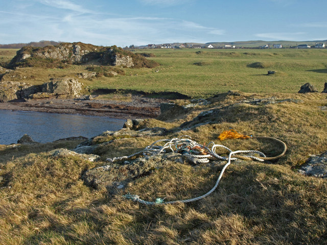
Tangled Ropes - geograph.org.uk - 689238.jpg - GeographBot

An Doirlinn - geograph.org.uk - 700256.jpg - GeographBot

Headland on Loch Maree - geograph.org.uk - 703121.jpg - GeographBot

Carsaig Bay, Isle of Mull - geograph.org.uk - 718531.jpg - GeographBot

Headland, Loch Moidart - geograph.org.uk - 717817.jpg - GeographBot

Lamba Ness - geograph.org.uk - 738112.jpg - GeographBot

Craig an Airgid - geograph.org.uk - 752127.jpg - GeographBot

Leum an Fheigh - geograph.org.uk - 751346.jpg - GeographBot

Barra Head - geograph.org.uk - 761562.jpg - GeographBot

Talisker Point - geograph.org.uk - 863399.jpg - GeographBot

Cruden Bay.jpg - Astronautilus

Headland east of Rubha na h-Easgainne - geograph.org.uk - 891754.jpg - GeographBot
Headland and wave-cut platform - geograph.org.uk - 1091125.jpg - GeographBot

A' Ghlasaird headland Isle of Muck - geograph.org.uk - 1379648.jpg - GeographBot

A 'Chabag - geograph.org.uk - 1439283.jpg - GeographBot

Cairnhead at half-tide - geograph.org.uk - 1444011.jpg - GeographBot

Causeway to Rubha Liath - geograph.org.uk - 1461341.jpg - GeographBot

Panorama south-west of White Hill - geograph.org.uk - 1716618.jpg - GeographBot

Chapel Head.jpg - Flickr upload bot