Wikimedi'Òc
Modes d'emploi

Cet album fait partie des albums
Cet album photos contient les sous-albums suivants :


B5094 School for the Deaf - geograph.org.uk - 52417.jpg - GeographBot

B5358 - geograph.org.uk - 52418.jpg - GeographBot

Blossoms Lane - geograph.org.uk - 116032.jpg - GeographBot

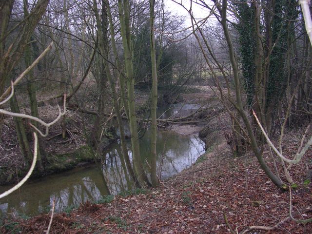
River Dean - geograph.org.uk - 130686.jpg - GeographBot

River Dean at Handforth Bridge - geograph.org.uk - 130692.jpg - GeographBot

Teeing off! - geograph.org.uk - 130669.jpg - GeographBot
River Dean - geograph.org.uk - 116014.jpg - GeographBot

River Dean - geograph.org.uk - 116015.jpg - GeographBot
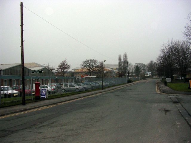
Stanley Green Industrial Estate - geograph.org.uk - 116016.jpg - GeographBot

"Brook Farm" , Handforth - geograph.org.uk - 343494.jpg - GeographBot

Handforth Village looking south - geograph.org.uk - 341025.jpg - GeographBot

Spath Brook, Handforth, Cheshire - geograph.org.uk - 343464.jpg - GeographBot

Spath Lane - Footpath - geograph.org.uk - 343475.jpg - GeographBot

The A5358 main route into Handforth - geograph.org.uk - 341016.jpg - GeographBot

Tunnel under the railway at Handforth - geograph.org.uk - 343484.jpg - GeographBot

Rainbow over the Peaks - geograph.org.uk - 357810.jpg - GeographBot

New office block, Epsom Avenue, Stanley Green - geograph.org.uk - 1352220.jpg - GeographBot

"Lakeland" domestic appliance emporium - geograph.org.uk - 1460591.jpg - GeographBot

Caffè LATTE, and Tesco 'express' in the Precinct - geograph.org.uk - 1535972.jpg - GeographBot

The Peter Herd 'Deli' in the Handforth Precinct - geograph.org.uk - 1534933.jpg - GeographBot

Handforth, River Dean - geograph.org.uk - 1549895.jpg - GeographBot

Handforth, open space - geograph.org.uk - 1549909.jpg - GeographBot

Handforth Bridge - geograph.org.uk - 1549881.jpg - GeographBot

Marks and Spencer store, Handforth Dean, Cheshire - geograph.org.uk - 1614988.jpg - GeographBot

Greyhound Inn, Handforth c.1905.jpg - Delusion23

The Railway pub, B5358 Station Road, Handforth (geograph 4524444).jpg - EP111

Woodstock Court, Handforth - panoramio.jpg - Panoramio upload bot

Tatton Road, Handforth - panoramio.jpg - Panoramio upload bot

Delamere Road, Handforth - panoramio.jpg - Panoramio upload bot

The Mermaid, Handforth - Saturday 13th March 2010 - panoramio.jpg - Panoramio upload bot

Nice view of the overspill estate in Handforth - panoramio.jpg - Panoramio upload bot

Delamere Road, Handforth - panoramio - WythenshaweMike.jpg - Panoramio upload bot

Row of Manchester overspill houses, Handforth - panoramio.jpg - Panoramio upload bot

Delamere Road, Handforth - panoramio - WythenshaweMike (1).jpg - Panoramio upload bot

Shop parade along Wilmslow Road - Saturday 13th March 2010 - panoramio.jpg - Panoramio upload bot

Nice pic of Plumley Road shops & flats from the rear side - panoramio.jpg - Panoramio upload bot

Tabley Road, Handforth - panoramio.jpg - Panoramio upload bot

Plumley Road, Handforth - panoramio.jpg - Panoramio upload bot

Manchester overpsill homes in Colshaw Farm - panoramio.jpg - Panoramio upload bot

Footbridge over the A555, Manchester..jpg - Benjamin Shaw

Pavilion in Meriton Road park (geograph 5927333).jpg - Garuda3

Handforth Parish Council, 2019.svg - Gazamp

B5358-A555 Roundabout - geograph.org.uk - 2096136.jpg - GeographBot

Waggon and Horses bowling green - geograph.org.uk - 2372933.jpg - GeographBot

Freemason's Arms, Handforth - geograph.org.uk - 2373217.jpg - GeographBot

Wilmslow road, Handforth - geograph.org.uk - 2456602.jpg - GeographBot

Traffic lights on Wilmslow Rd near Handforth Station - geograph.org.uk - 2475044.jpg - GeographBot

Brereton Road, Handforth - geograph.org.uk - 2475051.jpg - GeographBot

Handforth Bypass - geograph.org.uk - 2573896.jpg - GeographBot

Handforth Industrial Estate - geograph.org.uk - 2810869.jpg - GeographBot

Freemasons Arms, Handforth - geograph.org.uk - 2813191.jpg - GeographBot

The Railway, Handforth - geograph.org.uk - 2813206.jpg - GeographBot

New retirement homes, Wilmslow Road - geograph.org.uk - 2990795.jpg - GeographBot

Hall Road, Handforth - geograph.org.uk - 3035014.jpg - GeographBot

Path from Hall Wood to Hall Road - geograph.org.uk - 3035029.jpg - GeographBot

River Dean and subway under the A34 - geograph.org.uk - 3035043.jpg - GeographBot

Footbridge over River Dean - geograph.org.uk - 3035054.jpg - GeographBot

Bluebell Cottage - geograph.org.uk - 3035070.jpg - GeographBot

Lane to Blossoms Turkey Farm - geograph.org.uk - 3035080.jpg - GeographBot

Farm Buildings - geograph.org.uk - 3035086.jpg - GeographBot

House at the end of Dairy House Lane - geograph.org.uk - 3035113.jpg - GeographBot

Looking North on Dairy House Lane - geograph.org.uk - 3035121.jpg - GeographBot

Cattle in a Cheshire Field - geograph.org.uk - 3035472.jpg - GeographBot

Derelict Dairy House - geograph.org.uk - 3035498.jpg - GeographBot

Pond near Fitness Centre - geograph.org.uk - 3035521.jpg - GeographBot

The Western (Handforth) Entrance to the Total Fitness Centre - geograph.org.uk - 3035536.jpg - GeographBot

Footbridge over the A34 - geograph.org.uk - 3035557.jpg - GeographBot

A34 Roundabout for Handforth Dean - geograph.org.uk - 3035581.jpg - GeographBot

Path to Blossoms Lane - geograph.org.uk - 3035600.jpg - GeographBot

Track to Hall Road from the A34 footbridge - geograph.org.uk - 3035616.jpg - GeographBot

Bolshaw Farm Lane, Heald Green - geograph.org.uk - 3206299.jpg - GeographBot

Stanley Green Retail Park - geograph.org.uk - 3214583.jpg - GeographBot

A34, Wilmslow-Handforth Bypass at Gilbent - geograph.org.uk - 3214585.jpg - GeographBot

A34, Gilbent Roundabout - geograph.org.uk - 3214586.jpg - GeographBot

Earl Road, Stanley Green - geograph.org.uk - 3214589.jpg - GeographBot

Stanley Green, Earl Road - geograph.org.uk - 3214590.jpg - GeographBot

Stanley Green Retail Park - geograph.org.uk - 3214593.jpg - GeographBot

Handforth Dean Shopping Centre - geograph.org.uk - 3281405.jpg - GeographBot

Warehouse by the West Coast Main Line, Handforth - geograph.org.uk - 3705264.jpg - GeographBot

Industrial unit, Handforth - geograph.org.uk - 3705266.jpg - GeographBot

Wilmslow Road at Station Road junction - geograph.org.uk - 4035851.jpg - GeographBot

Wilmslow Road nears the A555 roundabout - geograph.org.uk - 4035865.jpg - GeographBot

Twice bypassed - geograph.org.uk - 4068505.jpg - GeographBot

Car-park at Handforth Dean - geograph.org.uk - 4094661.jpg - GeographBot

Footbridge over the Wilmslow-Handforth Bypass at Handforth Dean - geograph.org.uk - 4145714.jpg - GeographBot

Ruins of Farmhouse, Dairy House Lane - geograph.org.uk - 4411501.jpg - GeographBot

Ruins of Dairy House Farm - geograph.org.uk - 4411505.jpg - GeographBot

Road to Total Fitness - geograph.org.uk - 4411511.jpg - GeographBot

Blossoms Farm - geograph.org.uk - 4411560.jpg - GeographBot

Blossoms Lane, Woodford - geograph.org.uk - 4411565.jpg - GeographBot

Woodford, Blossoms Lane - geograph.org.uk - 4411568.jpg - GeographBot

Farmland off Blossoms Lane - geograph.org.uk - 4411571.jpg - GeographBot

Woodford, Blossoms Lane - geograph.org.uk - 4411576.jpg - GeographBot

Woodford, Blossoms Farm - geograph.org.uk - 4411581.jpg - GeographBot

Handforth, Freemasons Arms - geograph.org.uk - 4686984.jpg - GeographBot

This Way to a Healthy Life - geograph.org.uk - 4788108.jpg - GeographBot

Stream in Handforth Dean - geograph.org.uk - 4897256.jpg - GeographBot

Trampoline centre - geograph.org.uk - 4897261.jpg - GeographBot

Trampoline centre - geograph.org.uk - 4897264.jpg - GeographBot

Fitness club - geograph.org.uk - 4897277.jpg - GeographBot

A6MARR - geograph.org.uk - 5064357.jpg - GeographBot

A6MARR - geograph.org.uk - 5064366.jpg - GeographBot

A6MARR - geograph.org.uk - 5064371.jpg - GeographBot

Lakeland - geograph.org.uk - 5075473.jpg - GeographBot

Royal Schools for the Deaf - geograph.org.uk - 5075478.jpg - GeographBot

Lakeland - geograph.org.uk - 5340917.jpg - GeographBot

Manchester Airport Relief Road construction - geograph.org.uk - 5340919.jpg - GeographBot

Handforth at night - geograph.org.uk - 5340921.jpg - GeographBot

The Handforth Lodge - geograph.org.uk - 5343498.jpg - GeographBot

Grass verge and bus stop - geograph.org.uk - 5343510.jpg - GeographBot

War memorial on Wilmslow Road - geograph.org.uk - 5343511.jpg - GeographBot

Morning in Handforth - geograph.org.uk - 5343513.jpg - GeographBot

Towards Station Road - geograph.org.uk - 5343814.jpg - GeographBot

Shops on Wilmslow Road - geograph.org.uk - 5343816.jpg - GeographBot

Sagars Road - geograph.org.uk - 5343818.jpg - GeographBot

Along Sagars Road - geograph.org.uk - 5348049.jpg - GeographBot

Track to Deandale Farm - geograph.org.uk - 5348054.jpg - GeographBot

Farmland near Spurs Lodge - geograph.org.uk - 5348122.jpg - GeographBot

Track leading to Clay Lane - geograph.org.uk - 5348124.jpg - GeographBot

Meeting Clay Lane - geograph.org.uk - 5348129.jpg - GeographBot

Along Clay Lane - geograph.org.uk - 5348133.jpg - GeographBot

Shopping parade, Handforth - geograph.org.uk - 5724256.jpg - GeographBot

Railway track, Handforth - geograph.org.uk - 5724273.jpg - GeographBot

Railway at Handforth - geograph.org.uk - 5724281.jpg - GeographBot

Manchester Airport Eastern Link Road (A555) - geograph.org.uk - 5937879.jpg - GeographBot

Link road heading to join the westbound A555 - geograph.org.uk - 5937971.jpg - GeographBot

Lakeland kitchenware store - geograph.org.uk - 5959063.jpg - GeographBot

Stanley Green Retail Park - geograph.org.uk - 5959066.jpg - GeographBot

Handforth Dean - geograph.org.uk - 6241232.jpg - GeographBot

Handforth Dean - geograph.org.uk - 6241242.jpg - GeographBot

W Robinson and Sons farm, Heald Green, Greater Manchester - geograph.org.uk - 6559705.jpg - GeographBot

W Robinson and Sons farm, Heald Green - geograph.org.uk - 6559715.jpg - GeographBot

The Freemasons Arms, Handforth - geograph.org.uk - 6659387.jpg - GeographBot

Public footpath near Grange Farm, Handforth - geograph.org.uk - 6805613.jpg - GeographBot

Handforth Station - geograph.org.uk - 7401039.jpg - GeographBot

Handforth Station - geograph.org.uk - 7401041.jpg - GeographBot