Wikimedi'Òc
Modes d'emploi

Cet album fait partie des albums
Cet album photos contient les sous-albums suivants :


Hagley Road (1) - geograph.org.uk - 325035.jpg - GeographBot

Hagley Road (2) - geograph.org.uk - 325046.jpg - GeographBot

A mile from the centre of Birmingham on the Hagley Road - geograph.org.uk - 1605997.jpg - GeographBot

Calumet Photographic - Hagley Road, Edgbaston (14779140325).jpg - Ultra7

Five Ways Cobalt House - panoramio.jpg - Panoramio upload bot

Plough ^ Harrow - panoramio.jpg - Panoramio upload bot

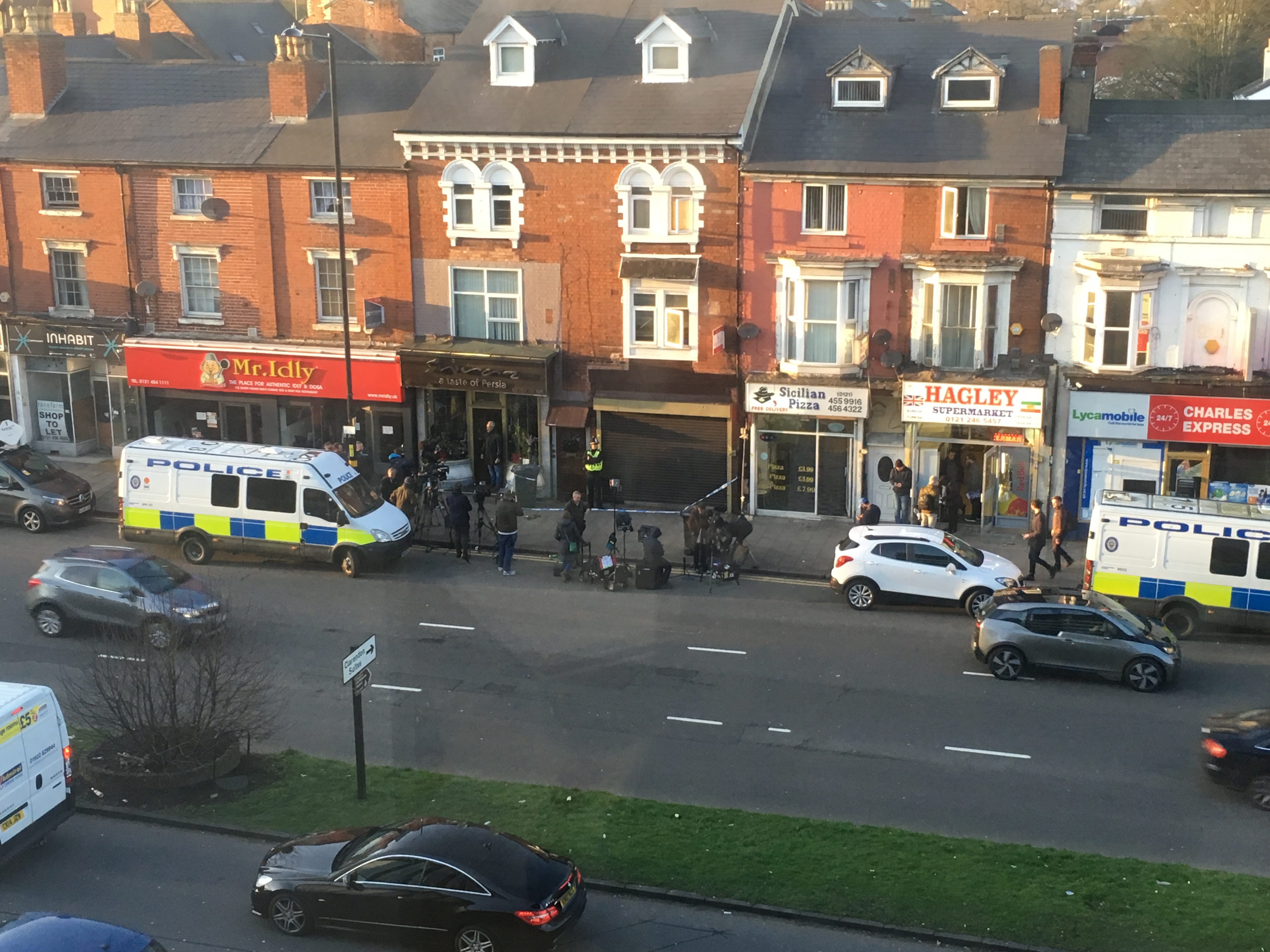
Birmingham Hagley Road Flat Media and Police on 2017-03-23 11.27.45.jpg - Whizzyfingers

Birmingham Hagley Road Flat Media and Police on 2017-03-23 13.28.27.jpg - Whizzyfingers

Birmingham Hagley Road Flat Media and Police on 2017-03-23 11.27.45-1.jpg - Whizzyfingers

Birmingham Hagley Road Flat Media filming 2017-03-23 16.11.19.jpg - Whizzyfingers

Birmingham Hagley Road Flat Media and Police on 2017-03-23 17.45.24.jpg - Whizzyfingers
Birmingham Hagley Road Flat Media and Police on 2017-03-23 17.45.31.jpg - Whizzyfingers

Birmingham Hagley Road Flat Media van on 2017-03-23 16.11.08.jpg - Whizzyfingers

TGI FRiday balloons on Hagley Road Birmingham - 2018-02-16 - Andy Mabbett - 01.jpg - Pigsonthewing

TGI FRiday balloons on Hagley Road Birmingham - 2018-02-16 - Andy Mabbett - 02.jpg - Pigsonthewing

Tricorn House 2013.jpg - Bs0u10e01

Hagely Road Tri-gate building.jpg - KianMaz

Hagley Road Junction.jpg - KianMaz
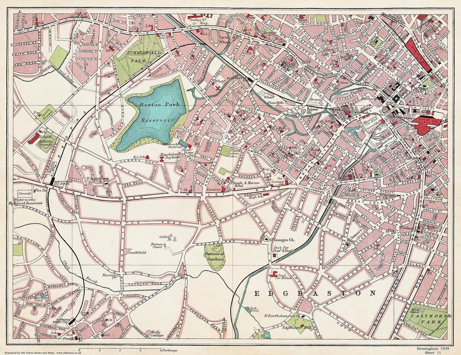
Street Atlas of Birmingham - 1939 - Sheet 11 - Edgbaston (north) area.jpg - Pigsonthewing

Hagley Road, Birmingham - geograph.org.uk - 5506529.jpg - GeographBot

Hagley Road, Birmingham - geograph.org.uk - 5506744.jpg - GeographBot

New Survey of the Borough of Birmingham - 1855 - Sheet 158.png - DaxServer

New Survey of the Borough of Birmingham - 1855 - Sheet 159.png - DaxServer

New Survey of the Borough of Birmingham - 1855 - Sheet 160.png - DaxServer

New Survey of the Borough of Birmingham - 1855 - Sheet 161.png - DaxServer

New Survey of the Borough of Birmingham - 1855 - Sheet 162.png - DaxServer

New Survey of the Borough of Birmingham - 1855 - Sheet 163.png - DaxServer