Wikimedi'Òc
Modes d'emploi

Cet album fait partie des albums
Cet album photos contient les sous-albums suivants :


Graslandtypen oekogramm.png - Zirpe~commonswiki

Tussock New Zealand.jpg - 2000

E7829-Shu-steppe.jpg - Vmenkov
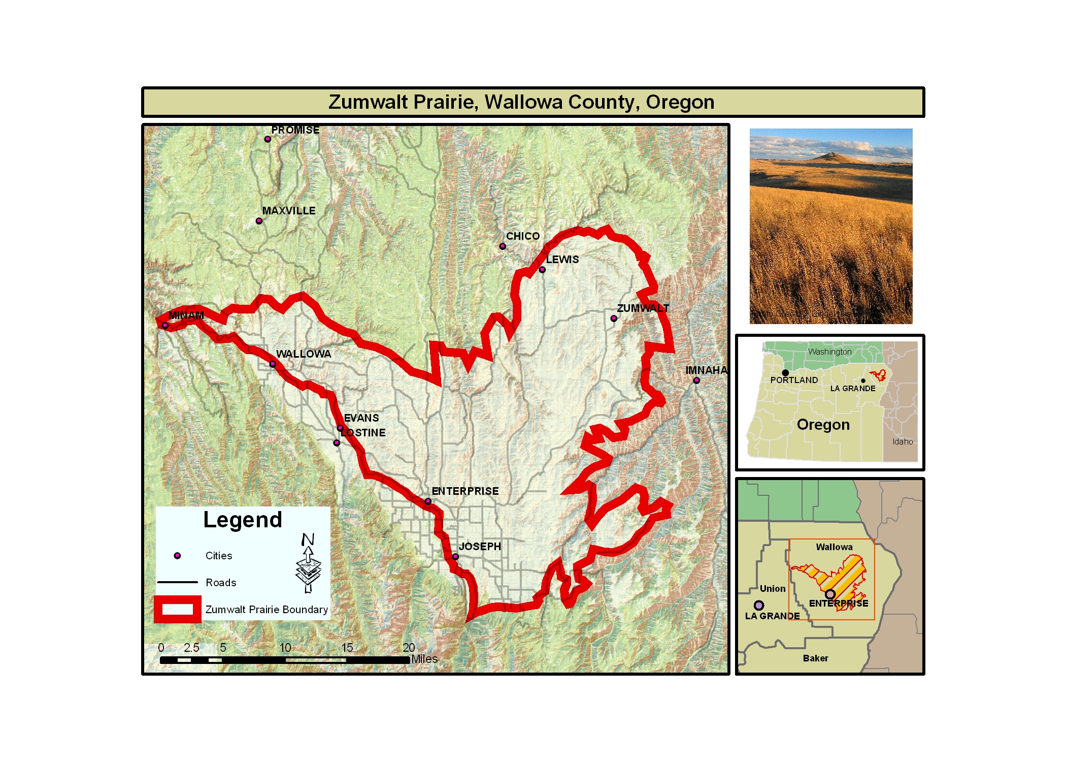
Zumwalt overviewsmall.jpg - Vssj~commonswiki

LihueCale063.JPG - Claudio Elias

Pastizal en Emboscada.jpg - Judas Priest88

Missouri Coteau (656541298).jpg - File Upload Bot (Magnus Manske)

GermanMillsSettlersPark2.jpg - Raysonho

Astana-steppe-7748.jpg - Vmenkov

Canada wildrye head.JPG - Dehaan

Cock-tailed Tyrant (Alectrurus tricolor) perched, distant.jpg - MPF

Kavyl092.JPG - I.Sáček, senior

Mottey.jpg - Nepahwin
Balka Orlinskaya-20060825.JPG - MFF666

HK Lantau Island 欣澳道 Sunny Bay Road 20070616-08.JPG - Summa06

九曲黄河第一湾1.JPG - Zhangmoon618

The River Bain near Bain House - geograph.org.uk - 44361.jpg - GeographBot

Ancient Grassland Hengistbury Head Dorset - geograph.org.uk - 184296.jpg - GeographBot

Grass fields in the Perry Valley - geograph.org.uk - 188293.jpg - GeographBot

Open Grassland - geograph.org.uk - 208170.jpg - GeographBot

Grassy cliff tops of Leeon on Rousay - geograph.org.uk - 233485.jpg - GeographBot

Lythro Filipenduletea.JPG - Bernd Sauerwein

Рябь течения.jpg - Ras67

Rough Grassland in Allt Gwyddgwion - geograph.org.uk - 238324.jpg - File Upload Bot (Magnus Manske)

Gespa.jpg - Jordimascarell
PrairieGrasses.jpg - BotMultichill

Grassland at Llwynbrain - geograph.org.uk - 256329.jpg - GeographBot

W-GL mit Kräutern 2.jpg - File Upload Bot (Magnus Manske)

Major habitat type CAN USA.svg - Cephas

Converse county Douglas.jpg - Wusel007

NAMAP.jpg - Birkr
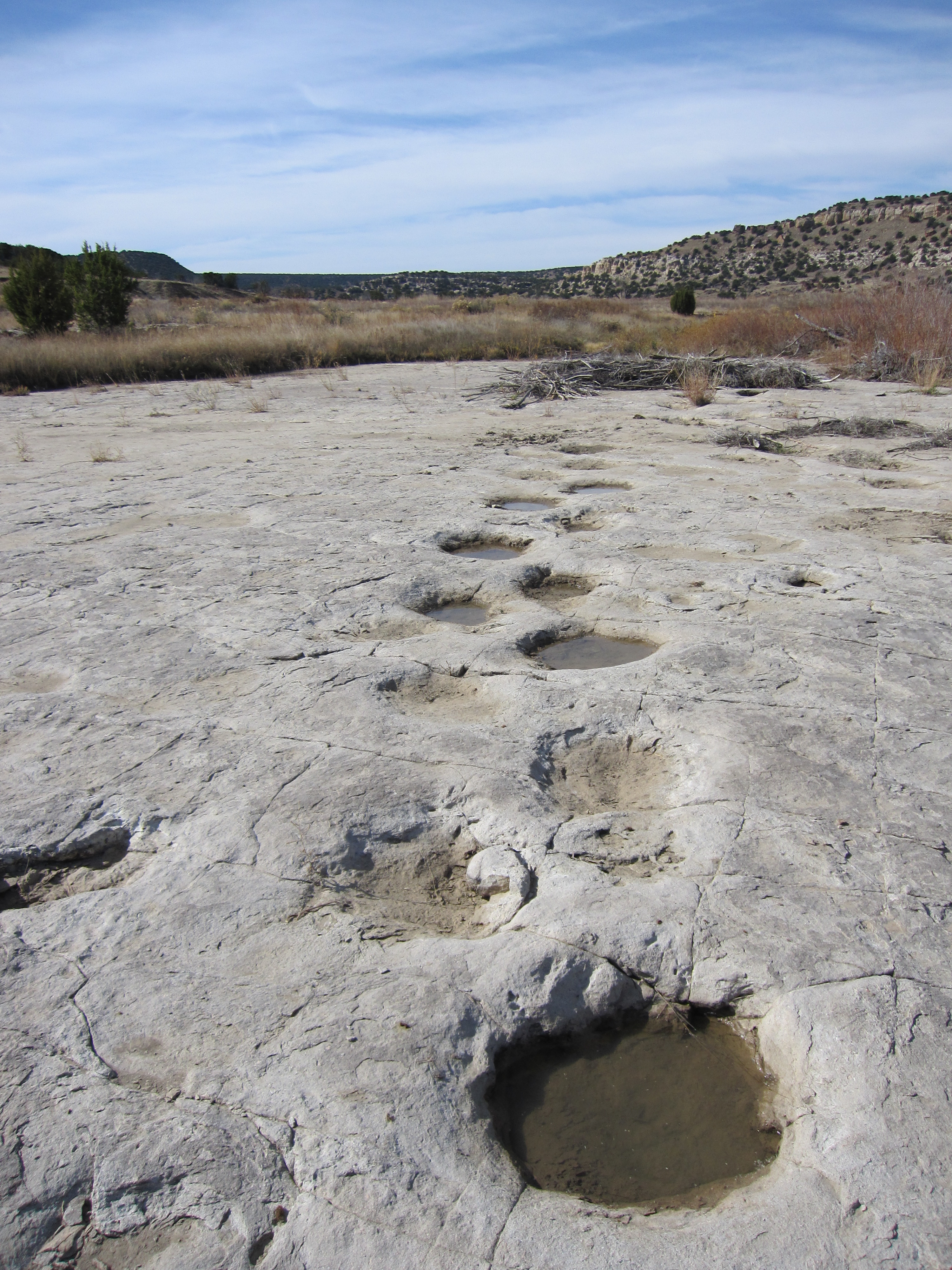
Brontosaurus tracks.jpg - FlickreviewR

Bridleway to Nunwell - geograph.org.uk - 469664.jpg - GeographBot

3 Stripes - geograph.org.uk - 476078.jpg - GeographBot

Bellyhack Wood - geograph.org.uk - 479568.jpg - GeographBot

Burn of Slogan - geograph.org.uk - 479414.jpg - GeographBot

Craigs of Slogan - geograph.org.uk - 479409.jpg - GeographBot

Cut grass near Dill's Copse - geograph.org.uk - 473383.jpg - GeographBot

Grass near Parkers Lodges - geograph.org.uk - 470791.jpg - GeographBot

Grassland near Cliff Farm - geograph.org.uk - 478625.jpg - GeographBot

Green green grass - geograph.org.uk - 473373.jpg - GeographBot

Stripeside - geograph.org.uk - 479564.jpg - GeographBot

The edge of Chaddesley Wood - geograph.org.uk - 472039.jpg - GeographBot

Coastal Grassland near Horden - geograph.org.uk - 488136.jpg - GeographBot

Hell Wath Nature Reserve - geograph.org.uk - 485834.jpg - GeographBot

Hell Wath Nature Reserve - geograph.org.uk - 485835.jpg - GeographBot

On Corton Ridge - geograph.org.uk - 487109.jpg - GeographBot

Coastal Grassland - geograph.org.uk - 496341.jpg - GeographBot

Boggy grassland - geograph.org.uk - 505044.jpg - GeographBot

Auchleuchrie - geograph.org.uk - 522255.jpg - GeographBot

Grass, Kilbirnie Loch. - geograph.org.uk - 521771.jpg - GeographBot

Grass - geograph.org.uk - 521726.jpg - GeographBot

Grassland by Bramblehurst Farm - geograph.org.uk - 534969.jpg - GeographBot

Grassland by Deerleap Wood - geograph.org.uk - 538502.jpg - GeographBot

Mown upland hayfield - geograph.org.uk - 534505.jpg - GeographBot

Farmland north of Montgomery - geograph.org.uk - 540773.jpg - GeographBot

Grassland near Scrabster - geograph.org.uk - 548419.jpg - GeographBot

Mysterious grassed area next to "The Woodlands" - geograph.org.uk - 547414.jpg - GeographBot

The edge of the moor - geograph.org.uk - 547618.jpg - GeographBot
Dried trees and grassland - geograph.org.uk - 558817.jpg - GeographBot

Grassland below Birchen Edge - geograph.org.uk - 551436.jpg - GeographBot

Grassland near Mucknell Farm - geograph.org.uk - 557574.jpg - GeographBot

Grassland to the south of woodland - geograph.org.uk - 558553.jpg - GeographBot

Great Orme - geograph.org.uk - 559932.jpg - GeographBot

Hall Farm, sheep pasture - geograph.org.uk - 559003.jpg - GeographBot

Rough Grassland, Pikedaw Hill - geograph.org.uk - 557830.jpg - GeographBot

Grass Land and Trees, Nant Carfan, Ceredigion - geograph.org.uk - 565588.jpg - GeographBot

Grassland with cattle grazing - geograph.org.uk - 560484.jpg - GeographBot

Kinlochspelve - geograph.org.uk - 569394.jpg - GeographBot

Rough grass on Pennan Head - geograph.org.uk - 562916.jpg - GeographBot

Steep grazing at Holehouse - geograph.org.uk - 562595.jpg - GeographBot

Farmland south of South Thorness Farm - geograph.org.uk - 572686.jpg - GeographBot

Farmland south of South Thorness Farm - geograph.org.uk - 572693.jpg - GeographBot

Grassland, Luskentyre - geograph.org.uk - 579324.jpg - GeographBot

Grassland south of Yarmouth Road - geograph.org.uk - 570648.jpg - GeographBot

Sheep grazing Clawdd Offa (Offa's Dyke) - geograph.org.uk - 579840.jpg - GeographBot

The Afon Hafren (River Severn) flood plain - geograph.org.uk - 579202.jpg - GeographBot

Dry dairy cows (not in milk) near Maerdy Farm - geograph.org.uk - 580910.jpg - GeographBot

Grass by Great Western Road - geograph.org.uk - 587632.jpg - GeographBot

Grass reseed at Varchoel - geograph.org.uk - 580968.jpg - GeographBot

Grassland near Llwyn - geograph.org.uk - 580942.jpg - GeographBot

Grassland near Newtown - geograph.org.uk - 580480.jpg - GeographBot

Rough grassland to the north of the track to Lochmuir - geograph.org.uk - 588396.jpg - GeographBot

Sheep grazing near Trewern Hall - geograph.org.uk - 580986.jpg - GeographBot

Bogless above Balnahard Wood - geograph.org.uk - 597063.jpg - GeographBot

Dairy cows at Dongray Hall - geograph.org.uk - 593301.jpg - GeographBot

Down Place - geograph.org.uk - 602137.jpg - GeographBot

Grassland Near Radmoor - geograph.org.uk - 601653.jpg - GeographBot

Somewhere quiet to practise - geograph.org.uk - 609792.jpg - GeographBot

Tom's Wood, near Southorpe - geograph.org.uk - 602000.jpg - GeographBot

Dried grassland on the banks of the river Leven - geograph.org.uk - 612862.jpg - GeographBot

Little-used footpath north-west of Tunstead - geograph.org.uk - 624896.jpg - GeographBot

Loch of Park - geograph.org.uk - 623586.jpg - GeographBot

A green area near Canterbury city centre - geograph.org.uk - 647231.jpg - GeographBot
Cottongrass River - geograph.org.uk - 645040.jpg - GeographBot

South-east of Albury - geograph.org.uk - 669456.jpg - GeographBot

Above Scolla Wick - geograph.org.uk - 676703.jpg - GeographBot
Chelsfield Green - geograph.org.uk - 678611.jpg - GeographBot

Lady Hill - geograph.org.uk - 674023.jpg - GeographBot

Rough grassland on Thistle Hill - geograph.org.uk - 674003.jpg - GeographBot

Dunnet Links - geograph.org.uk - 688230.jpg - GeographBot

Rough Grassland on Flint Hill - geograph.org.uk - 688031.jpg - GeographBot

The Dell - geograph.org.uk - 683385.jpg - GeographBot

The start of Romney Marsh at Port Lympne - geograph.org.uk - 686311.jpg - GeographBot

Improved grasslands at Carnguwch Bach - geograph.org.uk - 706814.jpg - GeographBot

Ridge and Furrow agriculture, Coton - geograph.org.uk - 703970.jpg - GeographBot

Grass and heathland looking towards Ocknell Inclosure, New Forest - geograph.org.uk - 711219.jpg - GeographBot

Limbo, near Honeygeo - geograph.org.uk - 711428.jpg - GeographBot

Hall Hill, near West Keal - geograph.org.uk - 720340.jpg - GeographBot

Drainage ditch - geograph.org.uk - 732479.jpg - GeographBot

Grass bank - geograph.org.uk - 748932.jpg - GeographBot

Grassland under restoration. - geograph.org.uk - 756658.jpg - GeographBot

Grassland under restoration 2 - geograph.org.uk - 756659.jpg - GeographBot

Land Use Change - geograph.org.uk - 779772.jpg - GeographBot

Grassland, Bathville - geograph.org.uk - 844833.jpg - GeographBot

Poor quality grassland - geograph.org.uk - 864288.jpg - GeographBot

25th July and this hay still hasn't been cut - geograph.org.uk - 896281.jpg - GeographBot
A scrub covered mound before being cleared - geograph.org.uk - 1064659.jpg - GeographBot

Ard grassland - geograph.org.uk - 1149105.jpg - GeographBot

Grassland above Overton - geograph.org.uk - 1335473.jpg - GeographBot

Duchie's Piece, Aldbury Nowers Nature Reserve - geograph.org.uk - 1347745.jpg - GeographBot

Grassland Near The Burf - geograph.org.uk - 1400554.jpg - GeographBot

Grassland near Aysgarth Upper Falls - geograph.org.uk - 1409552.jpg - GeographBot

An area of grassland between Clatteringshaws Loch and a forestry road - geograph.org.uk - 1410088.jpg - GeographBot

Approaching Whiteford Burrows - geograph.org.uk - 1417310.jpg - GeographBot

Grass not Trains - geograph.org.uk - 1411359.jpg - GeographBot

Grassland east of Ermin Way - geograph.org.uk - 1421641.jpg - GeographBot

A by-product of grassland improvement - geograph.org.uk - 1670263.jpg - GeographBot

Chile (10), Patagonia, Laguna Blanca, Estancia near the Laguna.JPG - Loranchet

Some food.jpg - Eugenio Hansen, OFS

Użytki zielone.jpg - Wojtekskalski

Iselwiese Arosa.jpg - Andres Passwirth

Papillons prairies.jpg - Lamiot

Адонис волжский2.JPG - Miavl

Frühlingswiese mit Löwenzahn und Vergissmeinnicht 1483a.jpg - Belladonna*
Avatars Abode Panoramic.jpg - File Upload Bot (Magnus Manske)

Kwandagrassland.jpg - File Upload Bot (Magnus Manske)

Abra chaco.jpg - Juan238

AntelopeValleyCAgrassland.JPG - OgreBot

Negri-Nepote Temperate Grasslands in New Jersey.jpg - SamuelFreli

Cisticola habitat IMG 1363 2 - Lip Kee.jpg - タチコマ robot

Rieden - Bergwiese.JPG - Franzfoto

Barren (2148585124).jpg - File Upload Bot (Magnus Manske)

NA-savanna-map.gif - Steepcone

FiatPandapic.18.jpg - Geonidiusz
NRCSCT01006 - Connecticut (1673)(NRCS Photo Gallery).tif - Smallbot
A view of a field in the foreground with wind turbines and city scape in the background.jpg - Fæ

Guadalupe mountains.jpg - Fæ

Mitchell grass downs.jpg - Mark Marathon

Grasslands towards Melbourne CBD, Solomon Heights.jpg - Vko329500

SanJose,Tarlacjf3889 11.JPG - Ramon FVelasquez

SanJose,Tarlacjf3889 10.JPG - Ramon FVelasquez

Sheepjf3897 10.JPG - Ramon FVelasquez

Tall Grass Preserve Signage.JPG - Words in the Wind

Åskan är på ingång (9411592106).jpg - File Upload Bot (Magnus Manske)

U Hřbitova, strom v trávě.jpg - Juandev

U Hřbitova, pohled.jpg - Juandev

Steppa of Delibltska pescara, Serbia.JPG - Zambiii85

Pogled na Sar planinski masiv.JPG - Dusan Gundelj

Prairie wildflowers (6991617141).jpg - File Upload Bot (Magnus Manske)

Snow approaches grasslands (6565984165).jpg - File Upload Bot (Magnus Manske)
Boulders&trains(byJoeriRömer).jpg - Tuvalkin

Cows being prepared for medication 02.jpg - Samsule2

Grasslands near Mrzlo Polje.jpg - Weraasd

Imereti, Georgia — Sachkhere.jpg - Giorgi Balakhadze

Imereti, Georgia — Sachkhere Grassland.jpg - Giorgi Balakhadze

草原1.JPG - Jane933090

CSIRO ScienceImage 1770 Australian Landscape.jpg - File Upload Bot (99of9)

CSIRO ScienceImage 1771 Australian Landscape.jpg - File Upload Bot (99of9)

Dybowskia.jpg - Nico Sequeira 98
MilneDamConservationPark10.jpg - Raysonho

NPP Kleneč (013).jpg - Juandev

NPP Kleneč (015).jpg - Juandev

NPP Kleneč (019).jpg - Juandev

NPP Kleneč (025).jpg - Juandev

NPP Kleneč (027).jpg - Juandev

ふうせん (4687625012).jpg - Benzoyl

Carrancas - Mirante da Serra.JPG - Ivolindbergh

Prairie landscape.jpg - Rachel.merrick

Samwan0284.jpg - SteinsplitterBot

Samwan0285.jpg - SteinsplitterBot

View from Dyrhólaey (20593764268).jpg - DuDuct

From Dyrhólaey (20467459518).jpg - DuDuct

Green Iceland II (20188913400).jpg - Adamant1

Green Iceland (20188923528).jpg - Adamant1

Iceland or Greenland? (20185988312).jpg - DuDuct

Ordinary Landscape.jpg - Nebiyu.s

Gladbeck - Halde Im Brauck 21 ies.jpg - Ies
Gellert Hill Conservation Area. Orom Street's Grassland park (E). - Budapest.JPG - Globetrotter19

Gellert Hill Conservation Area. Orom Street's Grassland park (NW). - Budapest.JPG - Globetrotter19

Gellert Hill Conservation Area. Orom Street's Grassland park (NE). - Budapest.JPG - Globetrotter19

Gellert Hill Conservation Area. Orom Street's Grassland park. - Budapest.JPG - Globetrotter19

UP Diliman near the Admin Building Nov 2007 - panoramio.jpg - Panoramio upload bot

UP Diliman near C.P. Garcia St. Nov 2007 - panoramio.jpg - Panoramio upload bot

Grassland, Hungary - panoramio.jpg - Panoramio upload bot

Vegetation on the Maleta Plateau in Mmuock-Leteh.jpg - Fotang

PipewortPondGrassland.JPG - Marcusmax
Feuchte Frühjahrswiese im Elstertal.jpg - Couraco

Kimberleys.jpg - Jezsel

Kuduremukha-NationalPark Grassland.jpg - Manu gangadhar

Kudremukh National park.jpg - Vaibhav d78

Banni Grasslands Day.jpg - Probablydhruv

B (343).jpg - SubhajitHimalaya

घास स्थल्.jpg - Sanskaar gupta

Озеро Верхопуйское - panoramio.jpg - Panoramio upload bot
Զորականի սիրուն կովերը՞.jpg - Կարինե Փանոսյան

Grassland in forest area.jpg - Vishwamitra Manav

Grace of corbett national park -3.jpg - Mohsinsayyedn

Indian Black Beauty.jpg - Niraj Gawand

Saline grassland on the Tisza plain.jpg - Jozefsu

Farm Views.jpg - Ryanj93

درختان گردو.jpg - Yalda belarak

Nad jeziorem Wielimie - panoramio - geo573.jpg - Panoramio upload bot

Nad jeziorem Wielimie - panoramio - geo573 (6).jpg - Panoramio upload bot

Araignées, insectes et fleurs de la forêt de Moulière (Les Agobis) (28942792111).jpg - NahidHossain

Water reservoir - panoramio.jpg - Panoramio upload bot
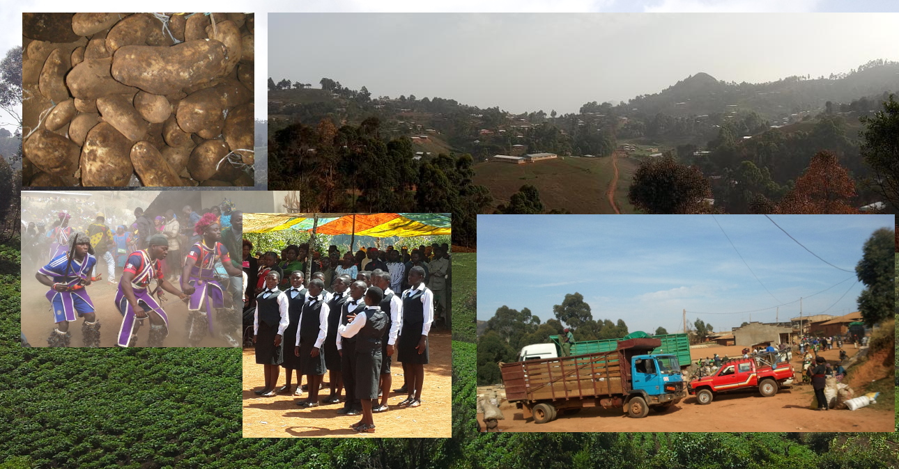
Mmuock Leteh collage.jpg - Fotang

IndianGazelle DSC0950.jpg - Shankar Raman

Grassland DSC0699.jpg - Shankar Raman

After action review (5474032879).jpg - Fæ

Marshmaster wets the line (5474626532).jpg - Fæ

Marshmaster drives along fire line (5474027369).jpg - Fæ

Laurel, MD- Burn boss Steven Hubner of the U.S. Fish and Wildlife Service carries a tool during a controlled burn at Patuxent National Research Refuge. (5474026309).jpg - Fæ
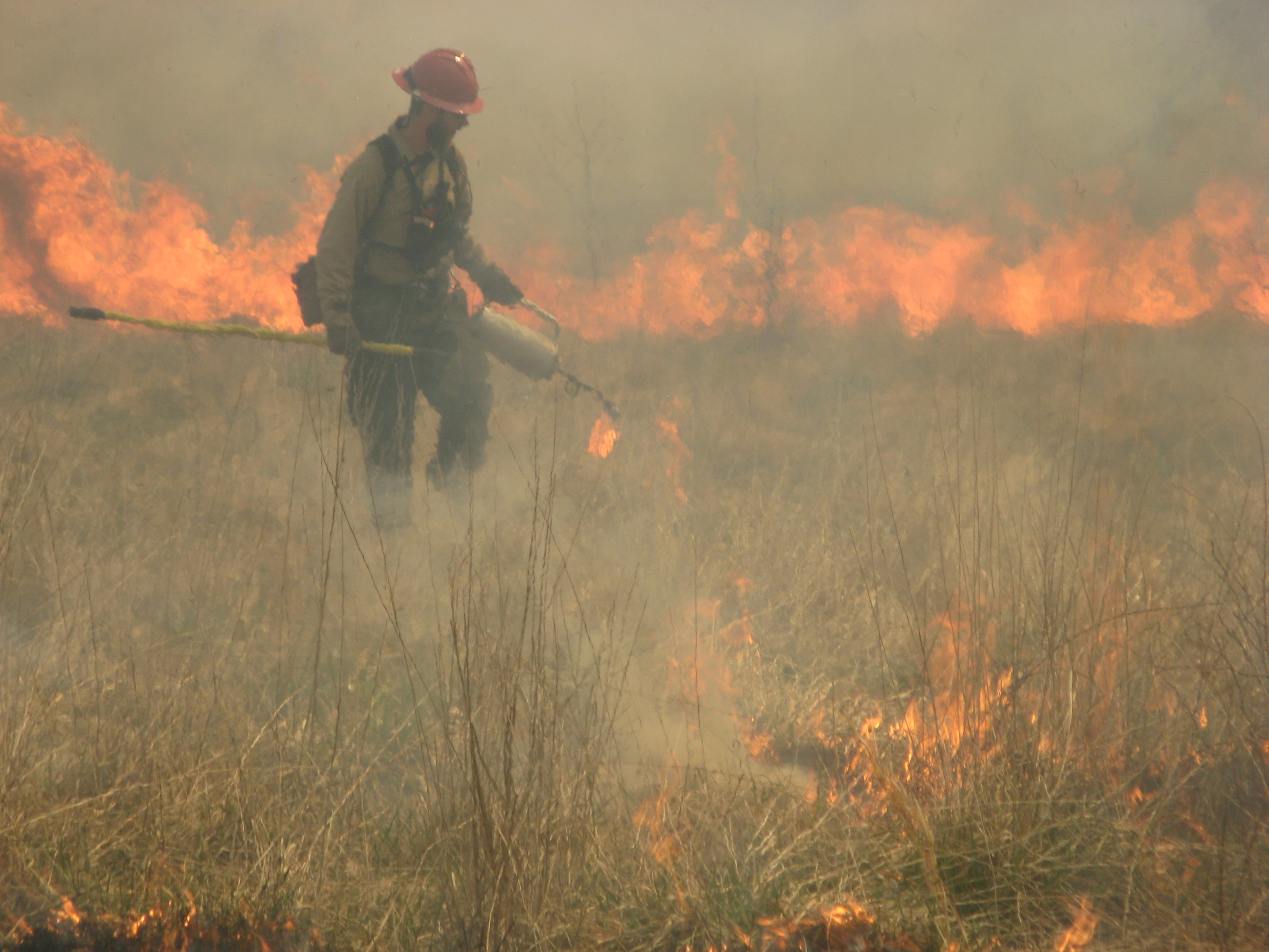
Firing with drip torch (5474025751).jpg - Fæ

Laurel, MD- Poised with lit drip torches, firefighters are ready to light a controlled burn at Patuxent National Research Refuge. (5474615694).jpg - Fæ

Laurel, Maryland, April 14, 2012- Firefighter Steve Stack from Blackwater National Wildlife Refuge pulls a hose to help maintain a fire line around a controlled burn. The burn, at Patuxent Research (7087305041).jpg - Fæ

Breathing Fire Back into the Land (7087305277).jpg - Fæ

Patuxent Research Refuge Controlled Burn (7087305563).jpg - Fæ

Patuxent's Water Tender in Action (6941235516).jpg - Fæ

Fire Consumes Brush (7087306369).jpg - Fæ

Successful Controlled Burn (6941237140).jpg - Fæ

Lighting Grassland Burn (6941237980).jpg - Fæ

Marshmaster Holds the Line (6941238196).jpg - Fæ

Grassland Field after Controlled Burn (6941238812).jpg - Fæ

ارتفاعات تالش.jpg - Zeinab sadat rabbani

An early water distribution system.jpg - Knobby983

Pequena Lagoa que somente enche na época das chuvas - SP-345 Rodovia Pref. Fábio Talarico - panoramio.jpg - Panoramio upload bot

A hill covered with green grass.jpg - Panoramio upload bot

Fanny Stuart and children, Indian Prairie near Lake Okeechobee (9470354307).jpg - Fæ

Unidentified Seminole men on horseback- Indian Prairie near Lake Okeechobee, Florida (9494987502).jpg - Fæ

Fanny Stuart and Susie Tiger, Indian Prairie near Lake Okeechobee, Florida (9505139024).jpg - Fæ

Dębiny, płonąca łąka - panoramio.jpg - Panoramio upload bot

Imnavait Creek.jpg - Fjellrype

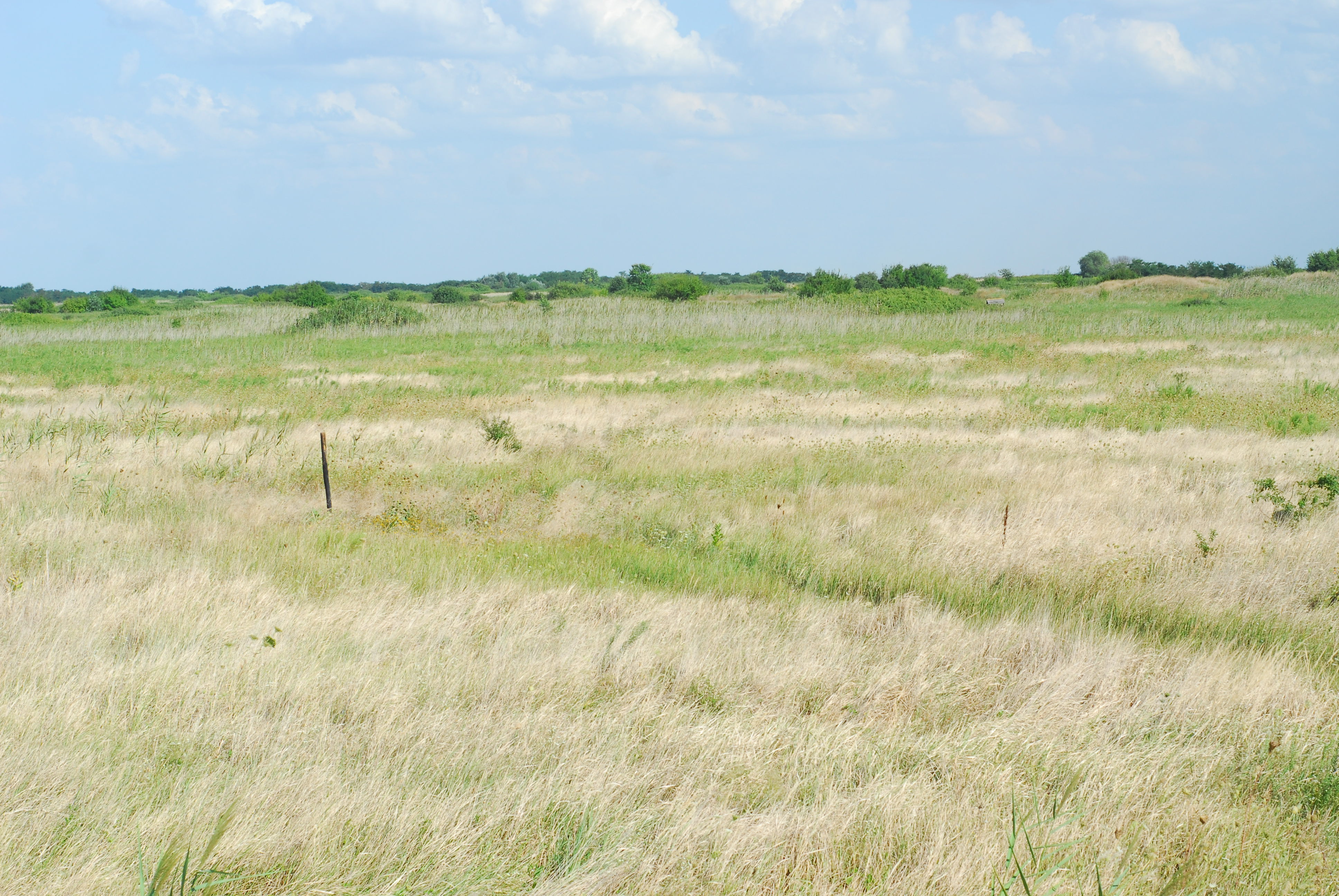
Nature Reserve Meadows of Great Bustard (panoramic view of the grassland).jpg - Jozefsu

Nature Reserve Meadows of Great Bustard, grazing cattle.jpg - Jozefsu

Nature Reserve Meadows of Great Bustard, the Visitor's Centre from distance.jpg - Jozefsu

Nature Reserve Meadows of Great Bustard, Amanita sp. mushroom.jpg - Jozefsu
Kocovat4.jpg - Jozefsu

Colorado Road 69 - panoramio.jpg - Panoramio upload bot

Wild Grass Phoenix.jpg - NWSPhoenix

Endless Stations 93 - Backlit Fuzzy Flowers.jpg - Bennos80

Endless Stations 95 - Soft Breeze, Soft Light.jpg - Bennos80

Endless Stations 181 - Hill Flow.jpg - Bennos80

The Catlins 032 (33472031845).jpg - Akbys

Indian Fox 2 at Rajkot.jpg - Dhaval Vargiya

Indian Hare Rajkot.jpg - Dhaval Vargiya

Indian Fox at Rajkot.jpg - Dhaval Vargiya

Road by the dry grasslands (Unsplash).jpg - Fæ

Boys will be boys. (Unsplash).jpg - Fæ

Paperbarks and Grasses on Lake Edge.jpg - Kanemorley

Maralgol Lake. Photo by Uzeyir Mikayilov 2.jpg - UzeyirMikayil

Grassland. Img.jpg - Kumar sunil 17

Sleeping Rhinos.jpg - Mainak.birder

Vegetasi pada Musim Hujan di Bandung, Jawa Barat, Indonesia.jpg - Jaka firman purnama

Zarosniete dawne oczko wodne na Pojezierzu Wielkopolskim.jpg - Torrosbak

IMAG0741.jpg - PAgrawal

FISHERS OF RIVER HADEJIA JIGAWA STATE.jpg - Sani Ahmad Usman

Grasslands in Heshigten Banner.jpg - Muzzleflash

Herdsman in Heshigten Banner.jpg - Muzzleflash

Glenn Carstens-Peters 2016-08-05 (Unsplash 14-F8DTBKpU).jpg - Fæ

NRCSIA03001.jpg - C6ghyt4r

Comic Grassland and Livestock.jpg - Vikastiss

An evening blue sky (37294947851).jpg - Junior Jumper
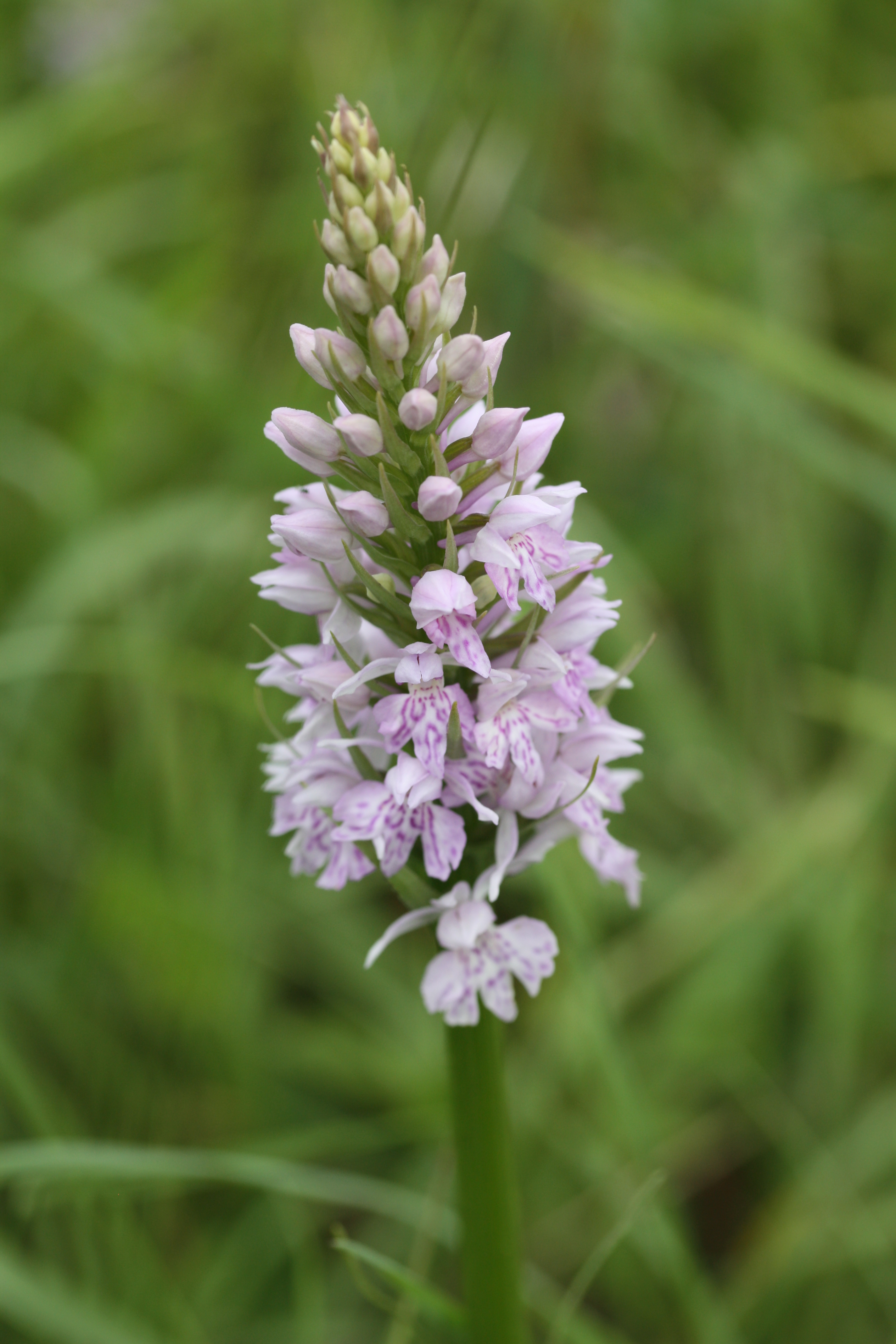
Common Spotted Orchid, Dactylorhiza fuchsii (5360796893).jpg - Junior Jumper

Quaking Grass, Briza media (8894124515).jpg - Junior Jumper

Marjoram (24683845402).jpg - Junior Jumper

Dehesa de Tablada.jpg - CarlosVdeHabsburgo

Tablada.jpg - CarlosVdeHabsburgo
Chain O'Lakes State Park.jpg - LittleT889

Lone wolf.jpg - Jmaccccc

The Misty Mountain.jpg - Roopa Bhat

Bengal florican.jpg - Daudabdullah
Gemeente Wijchen biedt grasland te koop aan.webm - 1Veertje

Unilorin dam3.jpg - Kenogenic

Aufgelassene Sandentnahme mit Trockenrasen 4003.jpg - Kresspahl

Elephant (106032371).jpg - Rodrigo.Argenton

Grassland (31041765).jpeg - DarwIn

500px photo (221831851).jpeg - Rodrigo.Argenton

Freshhh (201145177).jpeg - Rodrigo.Argenton

Trawa (64593435).jpeg - DarwIn

Google Entrance Plate.jpg - 384

Agrostis livade košanice IMG 4441.jpg - Sdjurovic

Agrostis livade košanice IMG 4487.jpg - Sdjurovic

Briza media from limestone grassland in Boho.jpg - Youngbohemian

Oldhamstocks Village Hall (geograph 5892150).jpg - Junior Jumper

Common Crane in the fog.jpg - UdayKiran28

Common Crane flight.jpg - UdayKiran28

Eastern Imperial Eagle landscape.jpg - UdayKiran28

Grasslands in Jim Corbett.jpg - Japleenpasricha

Altyn Tagh grassland and snow.jpg - Sebastian Wallroth

Hulun Buir.jpg - Emmazzye

Dragonfly in Habitat.jpg - Shashank Prabhakar

Chain O'Lakes Banner.jpg - SelfieCity

Dairy Cows at Rearing Unit Manggala.jpg - Hammam.afiq

कुंदा गवत...2.jpg - Sahebrao999

Scheele Preserve grassland.jpg - Mbrickn
LWT Ecologist Tony Wileman transect survey GT anthill meadow.jpg - Chiswick Chap

Cornfield,.jpg - Shuvo1995
Grassland in Wilson Prom.jpg - Stitch0718

Green Environment.jpg - Emmigren

Honcques Laus read John Stuart Mill's Utilitarianism on June 28, 2019.jpg - Lomoint

McCone Geography.jpg - Wolfpoint

बोंडी गवत.jpg - Sahebrao999

Lalinačka slatina u blizini Niša, Srbija (22).jpg - Aporia.j

Tree Unsplash.jpg - Vikarna
Burgess Field Nature Park view 1.jpg - Jpbowen
Burgess Field Nature Park view 2.jpg - Jpbowen

Burgess Field Nature Park view 3.jpg - Jpbowen

Burgess Field Nature Park view 4.jpg - Jpbowen

Burgess Field Nature Park view 5.jpg - Jpbowen

Indian courser (Cursorius coromandelicus) Photograph by Shantanu Kuveskar.jpg - Shantanu Kuveskar

Xerothermic meadow.jpg - Adeletron 3030

Grassland in Europe.jpg - Lachrichri

A view of Horton Plains National Park.jpg - Avsameera

A view of a small tree in the Horton Plains National Park grassland.jpg - Avsameera

A tree shaped by the wind at Horton Plains National Park.jpg - Avsameera

A shot capturing the deep blue sky at Horton Plains National Park.jpg - Avsameera

Grassland of Horton Plains National Park captured in a single shot.jpg - Avsameera

A tree blending with the sky filled with clouds at Horton Plains National Park.jpg - Avsameera

A beautiful flower at Horton Plains National Park.jpg - Avsameera

A lonely grassland at Horton Plains National Park.jpg - Avsameera

Beautiful shot captured at Horton Plains National Park.jpg - Avsameera

Utsikt över Laholmsbukten från Englandsdal.jpg - Carlklintner

Seeheimer Düne, Steppenrasen 1.JPG - Thiotrix

Seeheimer Düne, Steppenrasen 2.JPG - Thiotrix

East edge of the Armendaris Malpais - Flickr - aspidoscelis.jpg - Josve05a

North of Armendaris Malpais - Flickr - aspidoscelis.jpg - Josve05a

Near Yates - Flickr - aspidoscelis.jpg - Josve05a

Near Pennington - Flickr - aspidoscelis.jpg - Josve05a

Carbon stored in ecosystems.png - Bikesrcool

Summit Hills - Flickr - aspidoscelis.jpg - Josve05a

Greens Gap Road - Flickr - aspidoscelis.jpg - Josve05a

New Mexico Highway 3 - Flickr - aspidoscelis.jpg - Josve05a

Magredi del Cellina.png - Kltfvg

Lumbai to Pokorisa.jpg - Nicxon.Piaso

Prewitt Landscape.jpg - Kimichip

Railway crossing with red cliffs in background.jpg - Kimichip

Naturdenkmal 84210000067 Halbtrockenrasen.jpg - ThoBel-0043

Khao Yai, Thailand, Tropical grasslands.jpg - Argenberg

Windmills Tirunelveli.jpg - Arunpnair 787

Dry Grassland.jpg - Rollcloud

Farming equipment.jpg - Horst J. Meuter

Wildflowers on Blackland Prairie.jpg - Des Vallee
Prairie Wisconsin.jpg - Des Vallee

Przedgórze Sudeckie.jpg - Kulawik.pl
Przedgórze Sudeckie 2.jpg - Kulawik.pl

Przedgórze Sudeckie 3.jpg - Kulawik.pl

Przedgórze Sudeckie 4.jpg - Kulawik.pl

Przedgórze Sudeckie 5.jpg - Kulawik.pl

A sheep in glasslands.jpg - Contributor2020

Flowerfull grasslands.jpg - Mathew kemboi

Grass and sea on cliff edge.jpg - Folkestonesurvey

2022-03-03 Spaziergang in Tauberbischofsheim 8.jpg - Triplec85

Lago Argentino, flora 1994 14.jpg - LBM1948

Balsamorhiza deltoidea at Glacial Heritage Preserve.jpg - LRFtheLion

Castilleja levisecta bracts.jpg - LRFtheLion

Greenish land with cow.jpg - சீதா லெட்சுமி நாராயணன்

Ranging in orange.jpg - Heartpetals

Woody plant encroachment and thinned land near the Omatako Mountains in Namibia.jpg - Namibiabcbu
Western Sydney Regional Park.jpg - Qumarchi

Valles Pasiegos 1998 02.jpg - LBM1948
Shola forest and grassland.jpg - Davidvraju

Root of a Acacia mellifera bush plant sapling.jpg - Namibiabcbu

Great Grey Shrike got a Sacred place at Telangana State 01.jpg - Shiv's fotografia

Great Grey Shrike got a Sacred place at Telangana State 02.jpg - Shiv's fotografia

Great Grey Shrike got a Sacred place at Telangana State 03.jpg - Shiv's fotografia

Great Grey Shrike got a Sacred place at Telangana State 04.jpg - Shiv's fotografia

Great Grey Shrike got a Sacred place at Telangana State 05.jpg - Shiv's fotografia

Praderas del Cusco.jpg - Alvaromanuelbr

Milwaukee Public Museum November 2022 159 (Africa--Southern Africa--Southern Grasslands- The White-Tailed Gnu).jpg - Michael Barera

Wyoming Horse.jpg - Riding with Carl

Grass Green.jpg - SusuGeo

The Orange Field.jpg - Ntbl

Grasslands with mango trees.jpg - SJasminum

Green trees 01.jpg - SJasminum
Plain Field Meets Forest.jpg - Cpraise

Fertile Plain Land.jpg - Cpraise

Calf grazing in the grassland.jpg - Vaibhav1987patel

The alpha a Indian grey wolf 02.jpg - Shiv's fotografia

The alpha a Indian grey wolf 01.jpg - Shiv's fotografia

Pennisetum purpureum Schumach.png - HIAS

Lush greenery of the Kangla Fort (Kangla Palace), the ancient capital of Kangleipak — a small grassland — early modern era street lamps — old footpath — cloudy sky.jpg - Haoreima
Description of Grassland Curing by the Country Fire Authority, Victoria, Australia.webm - Dhx1
Description and recruitment pitch for volunteer grassland curing observers to the Country Fire Authority, Victoria, Australia.webm - Dhx1

Kakkadumpoyil Kurishumala trekking route.jpg - Athulvis

Kakkadumpoyil Kurishumala View Point.jpg - Athulvis

Kakkadumpoyil Kurishumala trekking route 2.jpg - Athulvis

Kakkadumpoyil Kurishumala trekking route 3.jpg - Athulvis
Kakkadumpoyil Kurishumala View Point 2.jpg - Athulvis

Kakkadumpoyil Kurishumala trekking route 4.jpg - Athulvis

Kakkadumpoyil Kurishumala View Point 3.jpg - Athulvis

Kakkadumpoyil Kurishumala View Point 4.jpg - Athulvis

Kakkadumpoyil Kurishumala View Point 5.jpg - Athulvis

Kakkadumpoyil Kurishumala View Point 6.jpg - Athulvis

Kakkadumpoyil Kurishumala View Point 7.jpg - Athulvis

Kakkadumpoyil Kurishumala View Point 8.jpg - Athulvis
Kakkadumpoyil Kurishumala View Point 9.jpg - Athulvis

Kakkadumpoyil Kurishumala View Point 10.jpg - Athulvis

Kakkadumpoyil Kurishumala View Point 11.jpg - Athulvis

Kakkadumpoyil Kurishumala View Point 12.jpg - Athulvis

Kakkadumpoyil Kurishumala View Point 13.jpg - Athulvis

Kakkadumpoyil Kurishumala View Point 14.jpg - Athulvis

Kakkadumpoyil Kurishumala View Point 15.jpg - Athulvis

Kakkadumpoyil Kurishumala View Point 16.jpg - Athulvis

Kakkadumpoyil Kurishumala View Point 17.jpg - Athulvis

Kakkadumpoyil Kurishumala View Point 18.jpg - Athulvis

Kakkadumpoyil Kurishumala View Point 19.jpg - Athulvis
Kakkadumpoyil Kurishumala View Point 20.jpg - Athulvis

Kakkadumpoyil Kurishumala View Point 21.jpg - Athulvis

Kakkadumpoyil Kurishumala View Point 22.jpg - Athulvis

Kakkadumpoyil Kurishumala View Point 23.jpg - Athulvis
Kakkadumpoyil Kurishumala View Point 24.jpg - Athulvis

Kakkadumpoyil Kurishumala View Point 25.jpg - Athulvis

Kakkadumpoyil Kurishumala View Point 26.jpg - Athulvis
Kakkadumpoyil Kurishumala View Point 27.jpg - Athulvis
Kakkadumpoyil Kurishumala View Point 28.jpg - Athulvis

Kakkadumpoyil Kurishumala View Point 29.jpg - Athulvis

Kakkadumpoyil Kurishumala View Point 30.jpg - Athulvis

Kakkadumpoyil Kurishumala View Point 31.jpg - Athulvis

Kakkadumpoyil Kurishumala View Point 32.jpg - Athulvis

Kakkadumpoyil Kurishumala View Point 33.jpg - Athulvis

Kakkadumpoyil Kurishumala View Point 34.jpg - Athulvis
Kakkadumpoyil Kurishumala View Point 35.jpg - Athulvis

Kakkadumpoyil Kurishumala View Point 36.jpg - Athulvis

Kakkadumpoyil Kurishumala View Point 37.jpg - Athulvis
Kakkadumpoyil Kurishumala View Point 38.jpg - Athulvis

Kakkadumpoyil Kurishumala View Point 39.jpg - Athulvis

Kakkadumpoyil Kurishumala View Point 40.jpg - Athulvis

CRP Grassland site in Chippewa County, Michigan.jpg - Ooligan

A rolling CRP Grasslands hayfield in Chippewa County, Michigan.jpg - Ooligan

Bane Canyon Chino Hills State Park.jpg - Blervis

Chino Hills State Park looking south.jpg - Blervis
Indian Star Tortoise Colouring Sheet (Gujarati).pdf - Malaika the jackal researcher

Summer at Coldwater Spring (6380e289-1dd8-b71b-0b4f-69c968359315).jpg - BMacZeroBot
Beauty of Bajura.jpg - Sunuwargr

Percentage of Grassland covered by country.jpg - Maps.interlude

Great Grey Shrike got a Sacred place at Telangana State 02 (cropped).jpg - Bloopityboop

Great Grey Shrike got a Sacred place at Telangana State 01 (cropped).jpg - Bloopityboop

Задній двір школи, Медвідка.jpg - MiriamRei

Naturdenkmal 84210000068 Halbtrockenrasen.jpg - ThoBel-0043

Bengal tiger in the grass with its tongue out.jpg - Joselodos