Wikimedi'Òc
Modes d'emploi

Cet album fait partie des albums
Cet album photos contient les sous-albums suivants :


Grangemouthmap1945.jpg - Geni

Grangemouthmiddleschooldiagram.png - MichaelT1979

Bainsford, Bonnywater, Carmuirs, Grangemouth, Greenhill & Larbert RJD 31.jpg - Irate

Entrance lock Forth and Clyde Canal - geograph.org.uk - 62152.jpg - GeographBot

Grangemouth from Airngath Hill. - geograph.org.uk - 65197.jpg - GeographBot

New lock, Forth and Clyde Canal. - geograph.org.uk - 62154.jpg - GeographBot

The Ochil hills from the River Carron - geograph.org.uk - 56448.jpg - GeographBot

Mouth of River Carron with part of Grangemouth petrochemical complex - geograph.org.uk - 81900.jpg - GeographBot

Big shed. - geograph.org.uk - 112183.jpg - GeographBot

Trees in West Mains Industrial Estate, Grangemouth - geograph.org.uk - 85407.jpg - GeographBot

Site of the Antonine Wall. - geograph.org.uk - 90434.jpg - GeographBot

Kincardine - geograph.org.uk - 157865.jpg - GeographBot

Polymer Logistics. - geograph.org.uk - 112177.jpg - GeographBot

Bollard on Breakwater - geograph.org.uk - 267738.jpg - GeographBot

Industry on the Carron - geograph.org.uk - 267778.jpg - GeographBot
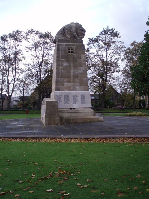
Lion Savages Eagle - geograph.org.uk - 267780.jpg - GeographBot

Grangemouth view - geograph.org.uk - 370602.jpg - GeographBot

ForthClyde Grangemouth.jpg - File Upload Bot (Magnus Manske)

End of the line at Grangemouth - geograph.org.uk - 418797.jpg - GeographBot

River Carron Breakwater - geograph.org.uk - 423596.jpg - GeographBot

River Carron at Low Tide - geograph.org.uk - 435992.jpg - GeographBot

River Grange(mouth) - geograph.org.uk - 436001.jpg - GeographBot

BowlsClub - geograph.org.uk - 542591.jpg - GeographBot

La Porte Precinct - geograph.org.uk - 542536.jpg - GeographBot

Museum and Library - geograph.org.uk - 542580.jpg - GeographBot

Police Station - geograph.org.uk - 542576.jpg - GeographBot

Converted aqueduct - geograph.org.uk - 567389.jpg - GeographBot

Car park, Polmont Wood - geograph.org.uk - 901649.jpg - GeographBot

Little Kerse - geograph.org.uk - 901645.jpg - GeographBot

Bowhouse play area - geograph.org.uk - 1095144.jpg - GeographBot

Bowhouse pumping station - geograph.org.uk - 1095158.jpg - GeographBot

Community Centre - geograph.org.uk - 1099302.jpg - GeographBot

Kersiebank Avenue, Grangemouth - geograph.org.uk - 1095152.jpg - GeographBot

Strowan Road - geograph.org.uk - 1096849.jpg - GeographBot

Industrial Grangemouth - geograph.org.uk - 1415479.jpg - GeographBot

Railway bordering the Jupiter Urban Wildlife Centre - geograph.org.uk - 1415470.jpg - GeographBot

Woodyard at Grangemouth - geograph.org.uk - 1415406.jpg - GeographBot

View towards Grangemouth - geograph.org.uk - 1443998.jpg - GeographBot

Bo'ness Road, Grangemouth - geograph.org.uk - 1478389.jpg - GeographBot

Cabin store, Dalgrain Road - geograph.org.uk - 1478414.jpg - GeographBot

Containers leaving Grangemouth - geograph.org.uk - 1478641.jpg - GeographBot

Flats, Kingseat Avenue - geograph.org.uk - 1476851.jpg - GeographBot

Flats, Kingseat Avenue - geograph.org.uk - 1476854.jpg - GeographBot

Flood relief channel, Grangemouth - geograph.org.uk - 1476828.jpg - GeographBot

Grangemouth High School, former site - geograph.org.uk - 1476849.jpg - GeographBot

Grangemouth High School - geograph.org.uk - 1476847.jpg - GeographBot

Grangemouth flood relief - geograph.org.uk - 1475916.jpg - GeographBot

Inchyra Road - geograph.org.uk - 1476835.jpg - GeographBot

Inchyra Road - geograph.org.uk - 1476842.jpg - GeographBot

Lodge Zetland - geograph.org.uk - 1478392.jpg - GeographBot

Rannoch Park - geograph.org.uk - 1478650.jpg - GeographBot

Wetland, Inchyra Grange - geograph.org.uk - 1476832.jpg - GeographBot

Entrance, Zetland Park - geograph.org.uk - 1627857.jpg - GeographBot

Hinged lamp post, Wholeflats Roundabout - geograph.org.uk - 1627850.jpg - GeographBot

Station Road, Grangemouth - geograph.org.uk - 1628466.jpg - GeographBot

Royal Air Force Fighter Command, 1939-1945 H9190.jpg - Ducksoup

Grangemouth, UK - panoramio.jpg - Panoramio upload bot

Horrid day at Grangemouth depot (geograph 2196779).jpg - EP111

Grangemouth, UK - panoramio (1).jpg - Panoramio upload bot

Grangemouth, UK - panoramio (2).jpg - Panoramio upload bot

Grangemouth, UK - panoramio (3).jpg - Panoramio upload bot

Helix Kelpie under construction seen from M9. - panoramio.jpg - Panoramio upload bot

Helix Kelpie under construction seen from M9. - panoramio (1).jpg - Panoramio upload bot

Helix Kelpie under construction seen from M9. - panoramio (2).jpg - Panoramio upload bot

Grangemouth, UK - panoramio (4).jpg - Panoramio upload bot

Grangemouth, UK - panoramio (5).jpg - Panoramio upload bot

Grangemouth, UK - panoramio (6).jpg - Panoramio upload bot

Grangemouth, UK - panoramio (7).jpg - Panoramio upload bot

Grangemouth, UK - panoramio (8).jpg - Panoramio upload bot

Grangemouth, UK - panoramio (10).jpg - Panoramio upload bot

Grangemouth, UK - panoramio (11).jpg - Panoramio upload bot

Grangemouth, UK - panoramio (12).jpg - Panoramio upload bot

Grangemouth, UK - panoramio (13).jpg - Panoramio upload bot

Grangemouth, UK - panoramio (14).jpg - Panoramio upload bot

Grangemouth, UK - panoramio (15).jpg - Panoramio upload bot

Grangemouth, UK - panoramio (16).jpg - Panoramio upload bot

Grangemouth, UK - panoramio (17).jpg - Panoramio upload bot

Grangemouth, UK - panoramio (18).jpg - Panoramio upload bot

Grangemouth, UK - panoramio (19).jpg - Panoramio upload bot

A tomb with a view - panoramio.jpg - Panoramio upload bot

Grangemouth, UK - panoramio (20).jpg - Panoramio upload bot

Ordnance Survey One-Inch Sheet 61 Falkirk & Lanark, Published 1966.jpg - Kognos

Ordnance Survey One-Inch Sheet 67 Stirling and Dunfermline, Published 1927.jpg - Kognos

From Dumyat looking towards Grangemouth (geograph 3766267).jpg - Bjh21

Oil Tanker Berth - geograph.org.uk - 2626559.jpg - GeographBot