Wikimedi'Òc
Modes d'emploi

Cet album fait partie des albums
Cet album photos contient les sous-albums suivants :


Medclim.png - Maphobbyist
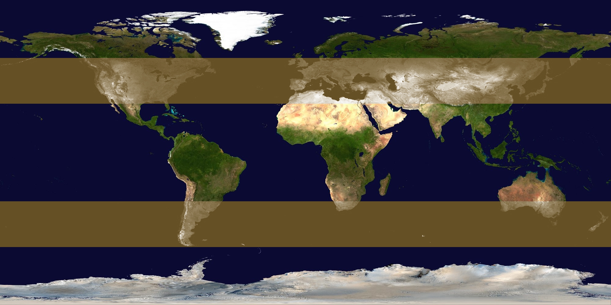
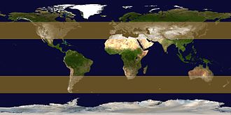
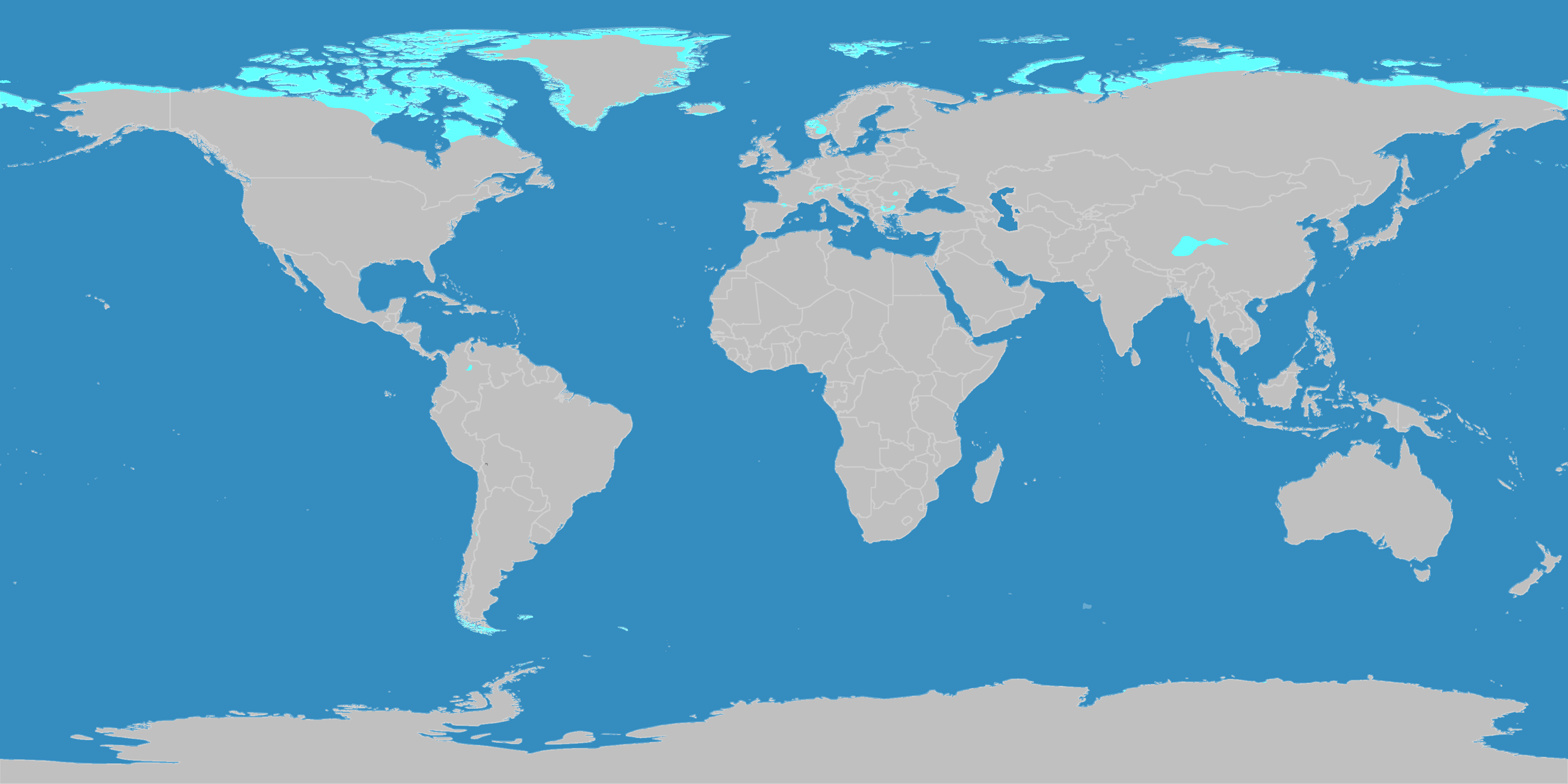
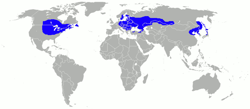
Extratropical formation areas.jpg - Titoxd

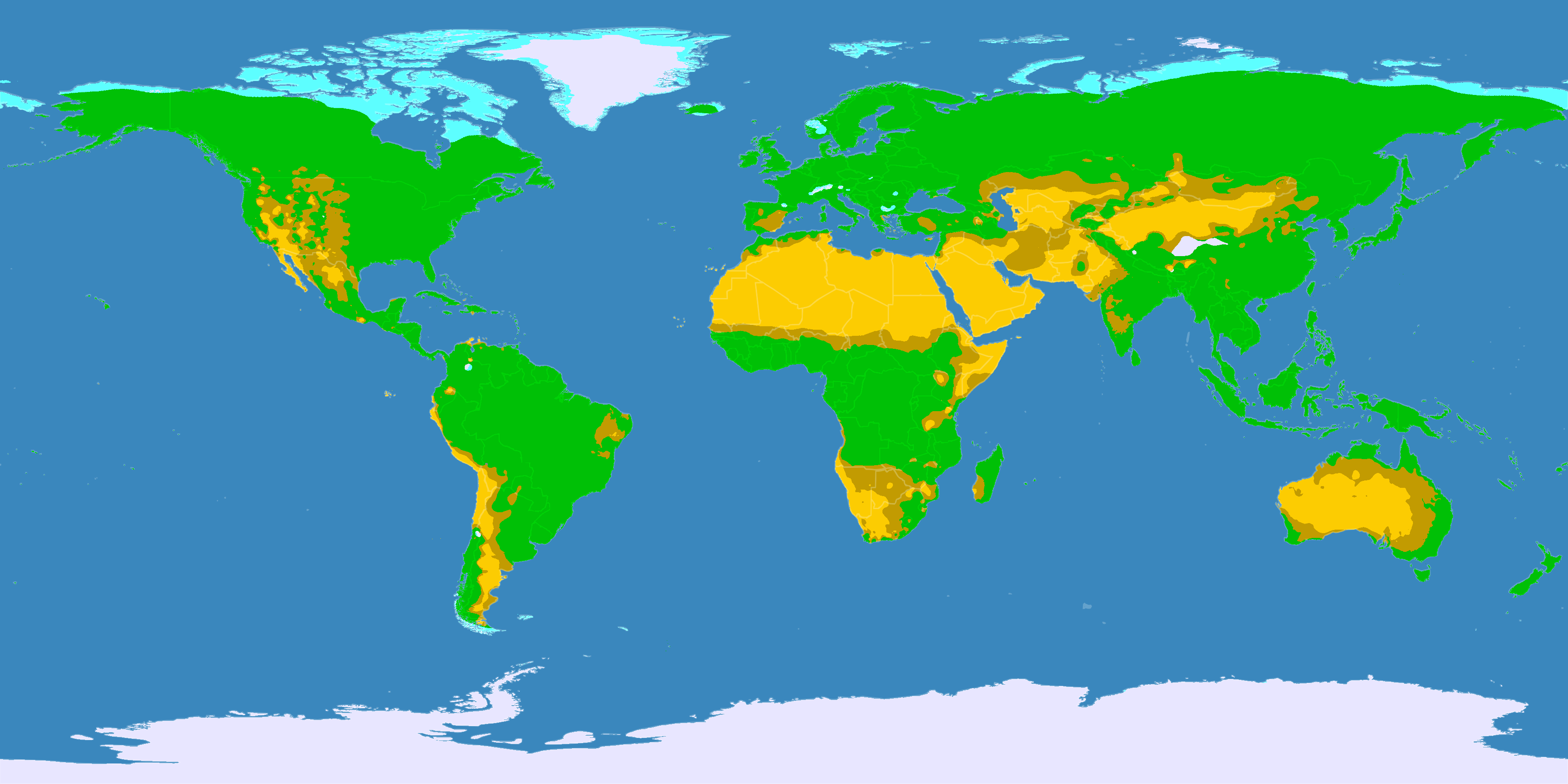
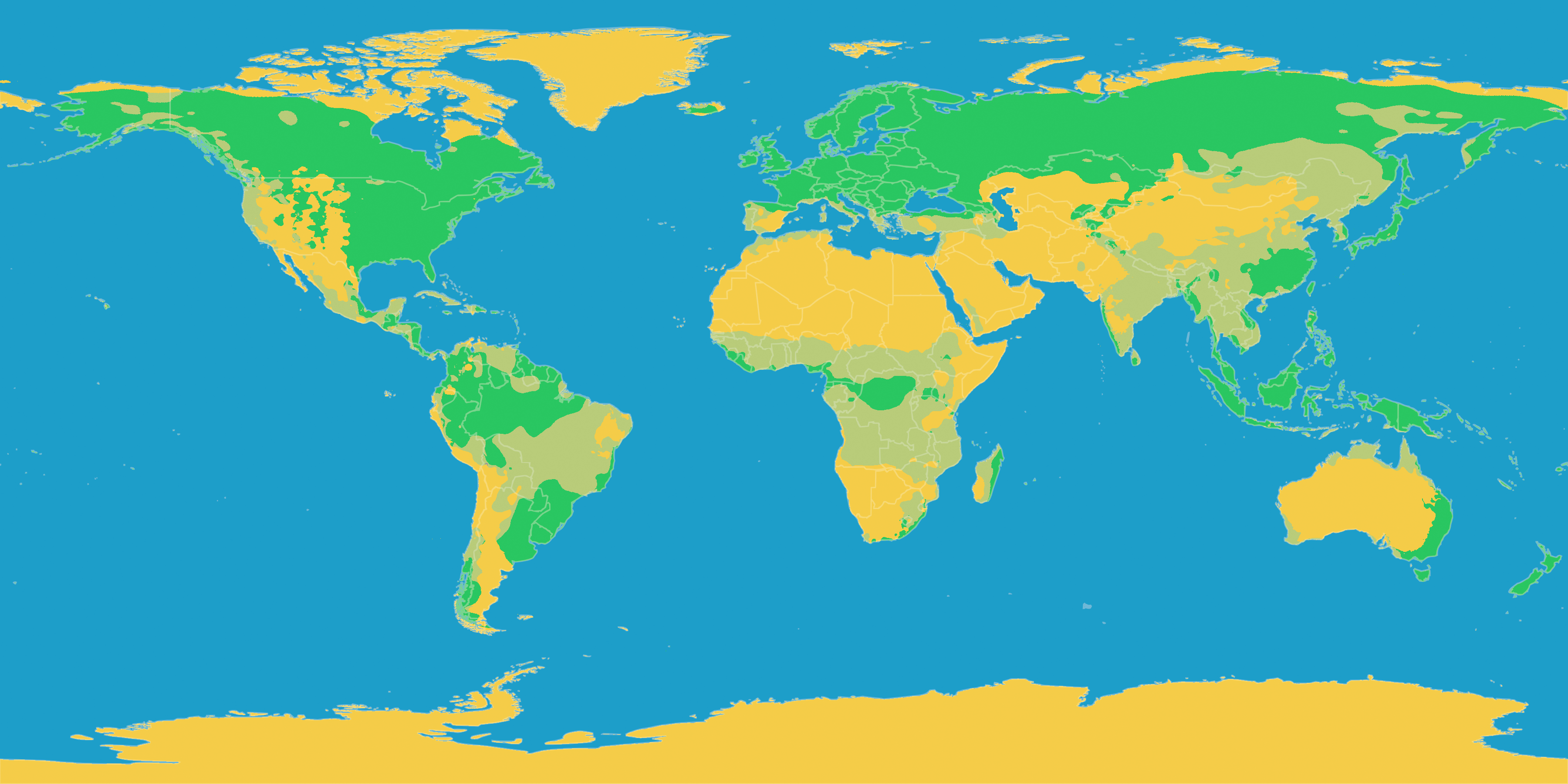
World map temperate.svg - M0tty
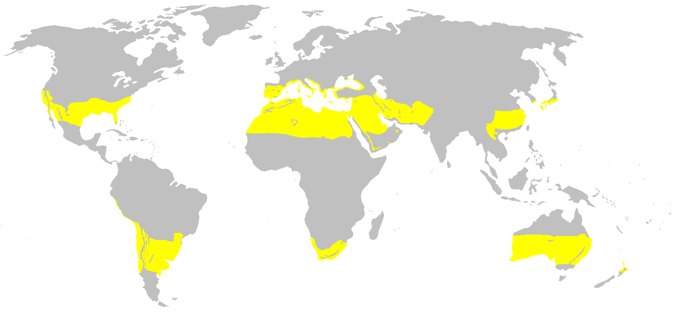
Klimagürtel-der-erde.png - Achim55

Klimagürtel-der-erde-boreale-zone.png - Maphobbyist
Klimagürtel-der-erde-eisklima.png - Maphobbyist

Klimagürtel-der-erde-gemäßigte-zone.png - Maphobbyist

Klimagürtel-der-erde-polargebiete.png - Maphobbyist

Klimagürtel-der-erde-subtropen.png - Maphobbyist

Klimagürtel-der-erde-tropen.png - Maphobbyist
Klimagürtel-der-erde-tundra.png - Maphobbyist

Klimagürtel-der-erde-warmgemäßigte-zone.png - Maphobbyist

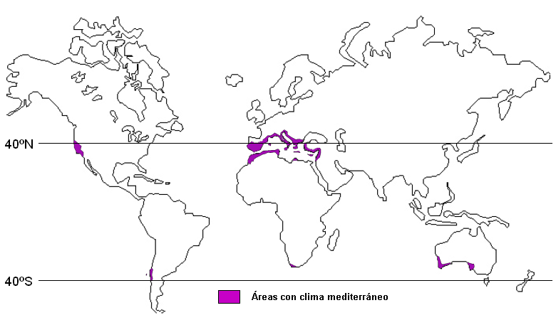
Mediterranian climate.jpg - Maphobbyist

Klimagürtel-der-erde.svg - Lortordermur

Köppen-geiger-hessd-2007.svg - Lortordermur

QI Hou Medeterainian.GIF - Maphobbyist
Trockenklimate.png - Maphobbyist

Köppen-vereinfacht.svg - Lortordermur

Temperate zone (PSF).png - AzaToth

Temperate zone (PSF).svg - AzaToth
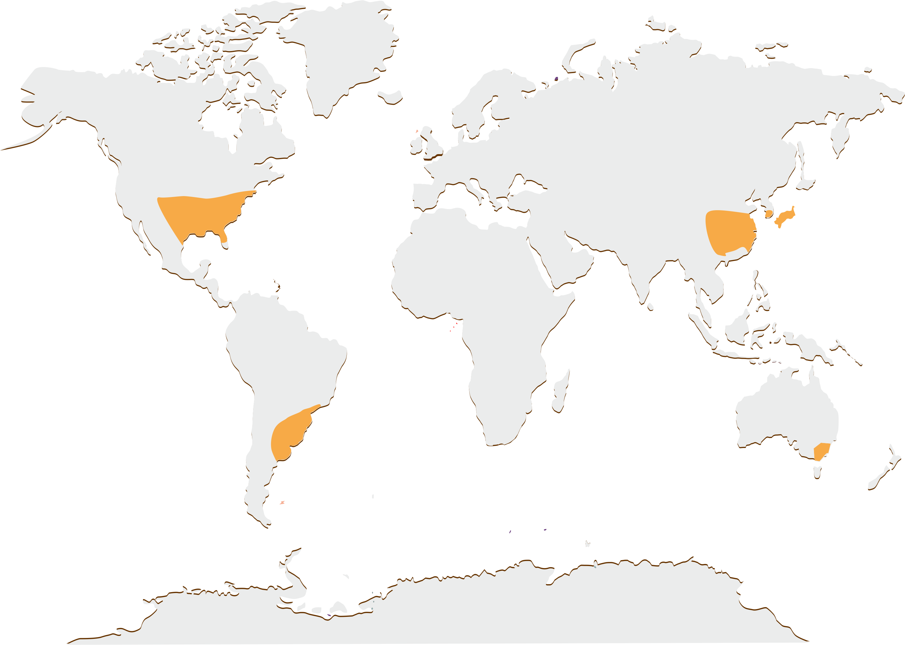
Subtropics.png - Carnby

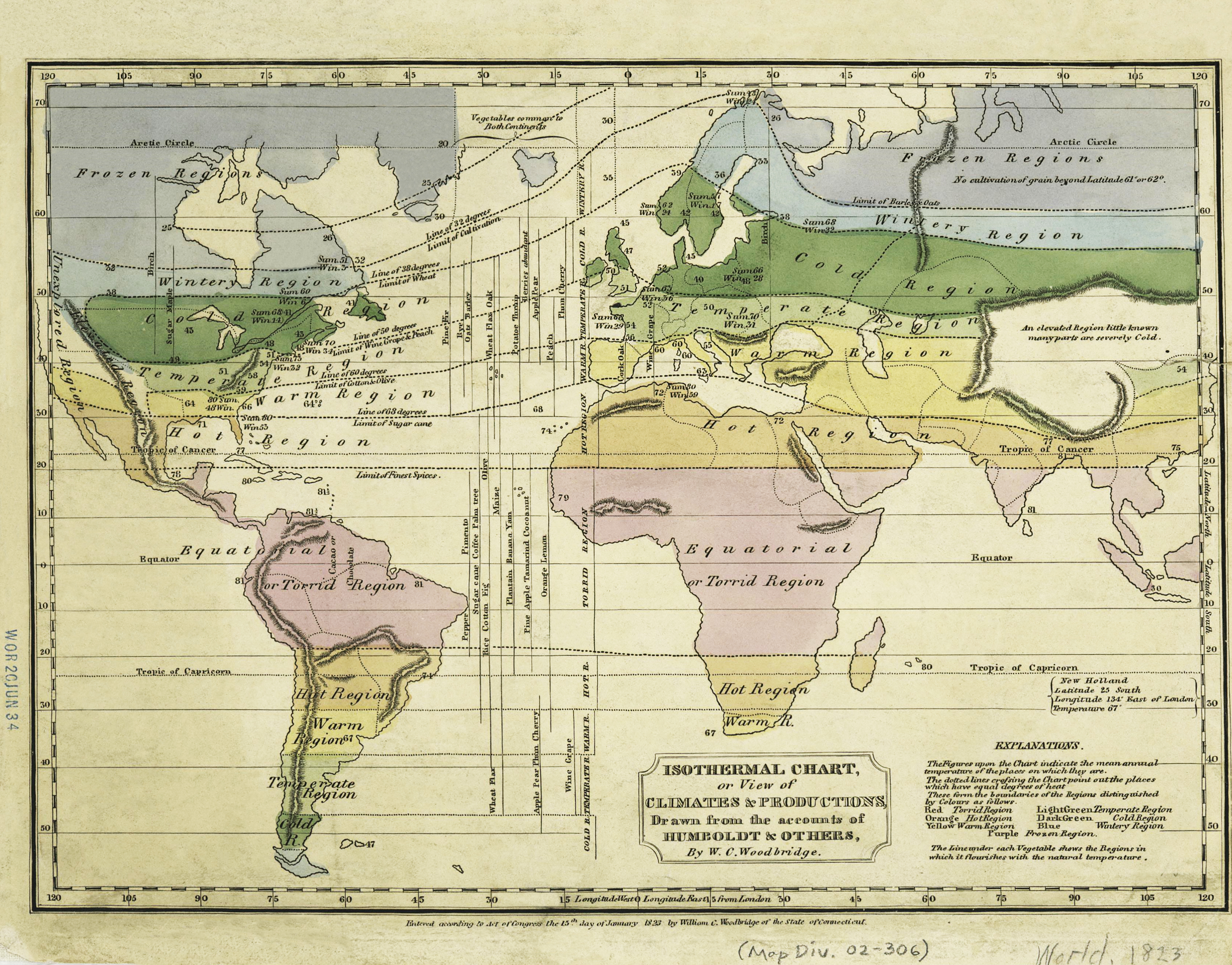
Woodbridge isothermal chart.jpg - Jujutacular
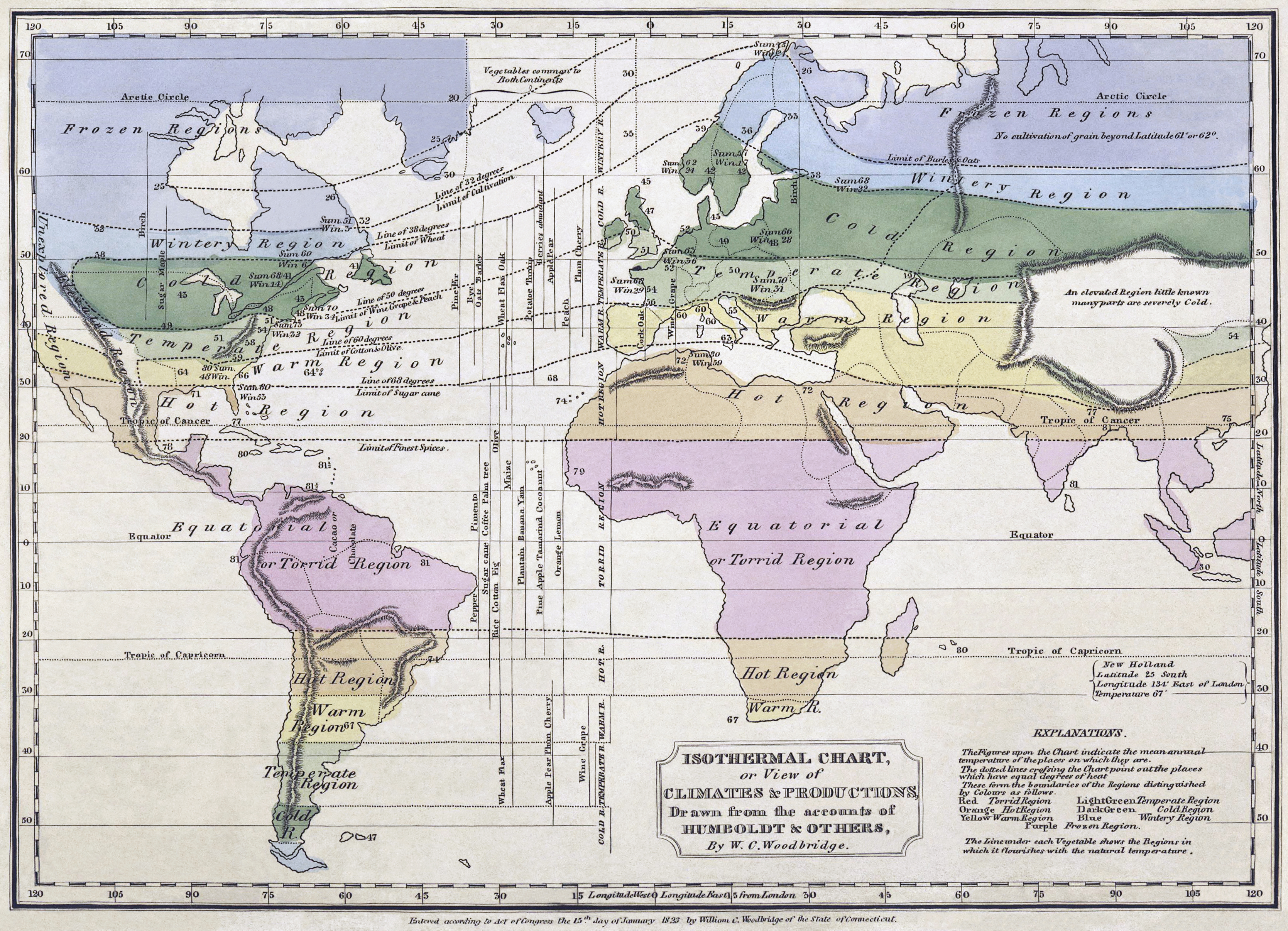
Woodbridge isothermal chart2.jpg - Jujutacular
Woodbridge isothermal chart3.jpg - Slick-o-bot

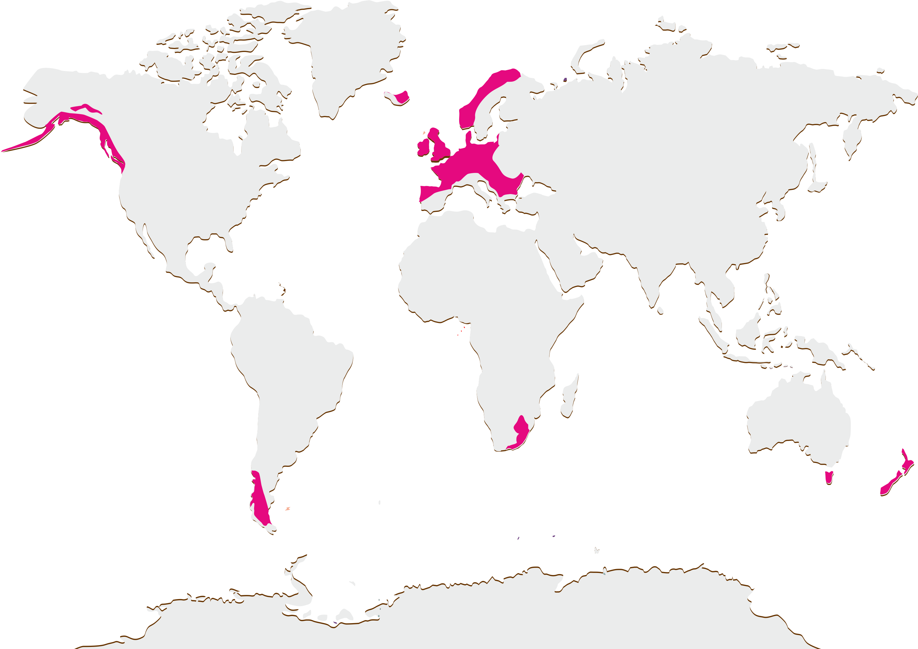
Wine regions with Mediterranean climates.jpg - Agne27~commonswiki
Humidcontinentalworld2.png - Aiyizo
Klimate-humidität.png - Fährtenleser
Med clim spanish script.png - Penarc

Precipitations.png - Carnby

Subtropical.png - Berkserker

Jyu.png - Simpson H

1861 Johnson Climate Map of the World w- Meteorology, Rainfall, and Plants - Geographicus - Meteorology-johnson-1862.jpg - BotMultichill

Flohn climate classification 1.png - Miyuki Meinaka
Flohn climate classification 2.png - Miyuki Meinaka

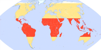
Tropical zones.png - Altaileopard
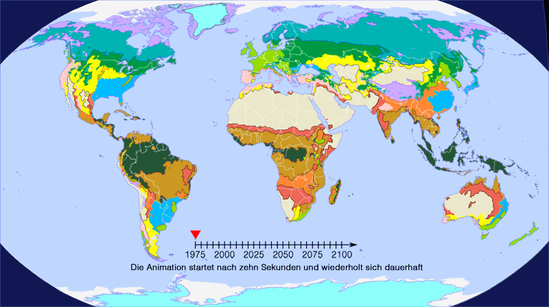
Klimazonen-Prognose.gif - Fährtenleser
Geozonen-animation.gif - Fährtenleser

Climat 2013 may.svg - Mattho69

Distribución do clima ecuatorial.png - Miguelcarricoba

Distribucion tropical chuvioso.png - Miguelcarricoba

Distribucion tropical seco.png - Cmdrjameson

Distribucion desertico.png - Miguelcarricoba
Distribucion oceanico.png - Miguelcarricoba

Distribucion continental.png - Miguelcarricoba

Distribucion mediterraneo.png - Miguelcarricoba
Distribucion subtropical.png - Miguelcarricoba

Distribucion polar.png - Miguelcarricoba

Distribucion alta montanha.png - Miguelcarricoba
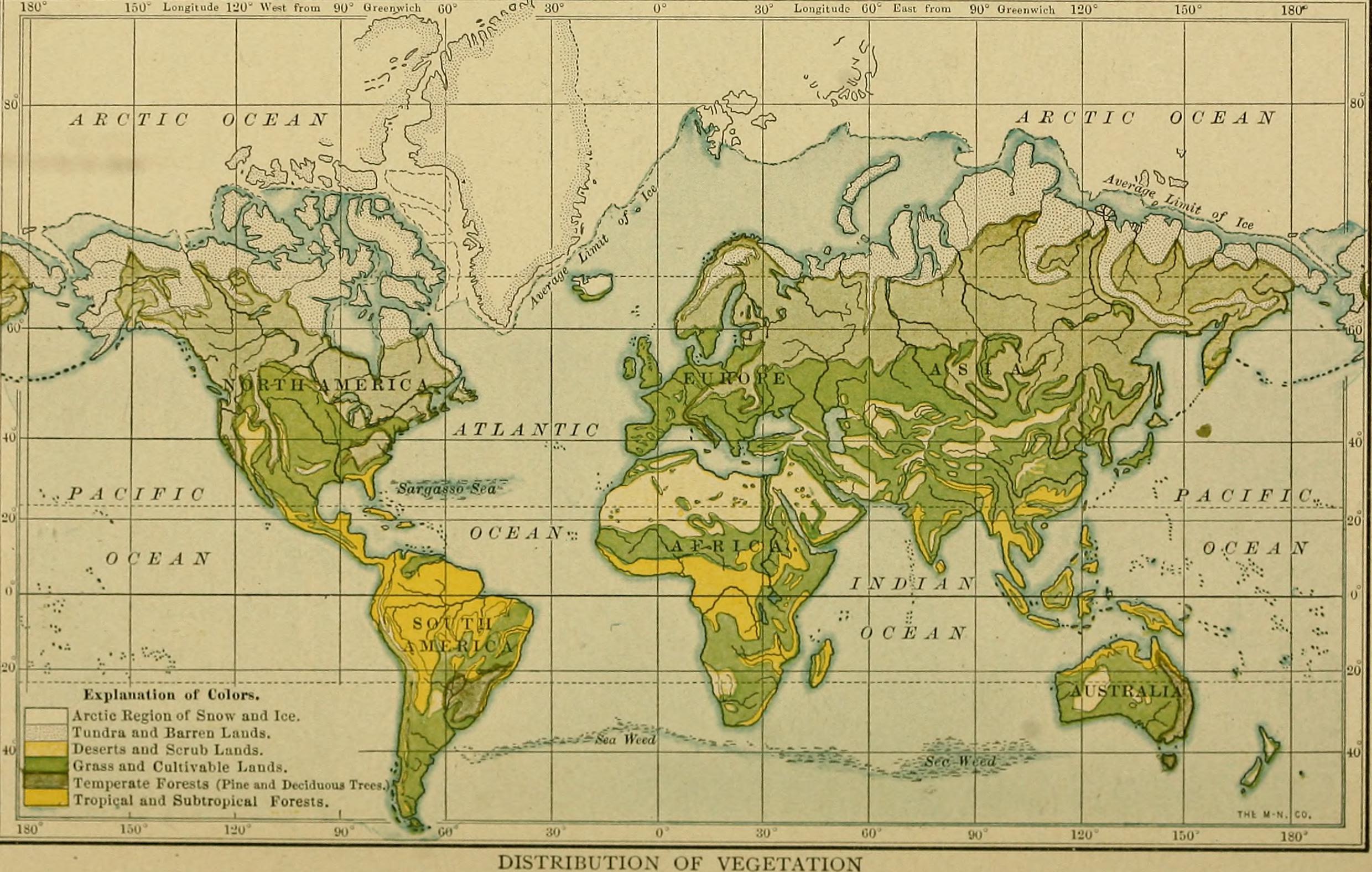
Elementary physical geography; (1908) (14597850430).jpg - SteinsplitterBot

ClimateMapWorld Arabic.png - Yuosaka

Planisfero Zone Climatiche.png - !Manihiki
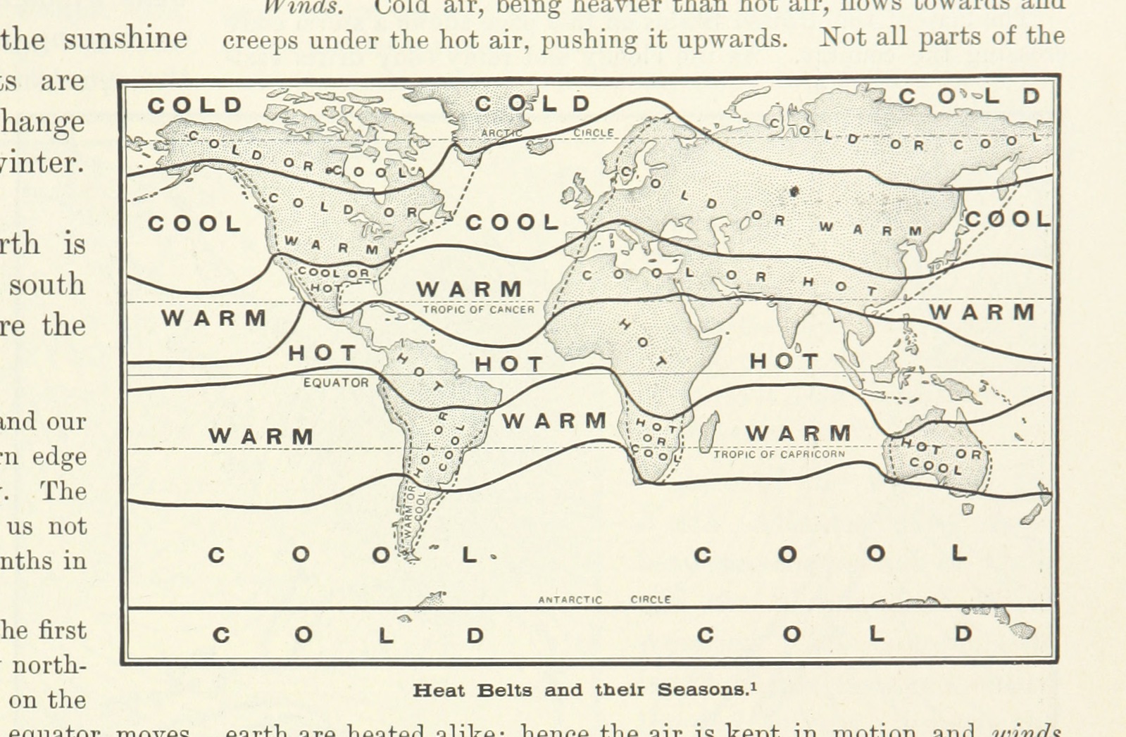
25 of 'Advanced Geography' (11288144385).jpg - Artix Kreiger 2

45 of 'Arnold's Geographical Handbooks' (11249505483).jpg - FlickreviewR 2

Koppen-Geiger Map A future.svg - NVergopolan

Koppen-Geiger Map Af future.svg - NVergopolan

Koppen-Geiger Map Am future.svg - NVergopolan

Koppen-Geiger Map Aw future.svg - NVergopolan

Koppen-Geiger Map B future.svg - NVergopolan

Koppen-Geiger Map BSh future.svg - NVergopolan

Koppen-Geiger Map BSk future.svg - NVergopolan

Koppen-Geiger Map BWh future.svg - NVergopolan

Koppen-Geiger Map BWk future.svg - NVergopolan

Koppen-Geiger Map C future.svg - NVergopolan

Koppen-Geiger Map Cfa future.svg - NVergopolan

Koppen-Geiger Map Cfb future.svg - NVergopolan

Koppen-Geiger Map Cfc future.svg - NVergopolan

Koppen-Geiger Map Csa future.svg - NVergopolan

Koppen-Geiger Map Csb future.svg - NVergopolan

Koppen-Geiger Map Csc future.svg - NVergopolan

Koppen-Geiger Map Cwa future.svg - NVergopolan

Koppen-Geiger Map Cwb future.svg - NVergopolan

Koppen-Geiger Map Cwc future.svg - NVergopolan

Koppen-Geiger Map D future.svg - NVergopolan

Koppen-Geiger Map Dfa future.svg - NVergopolan

Koppen-Geiger Map Dfb future.svg - NVergopolan

Koppen-Geiger Map Dfc future.svg - NVergopolan

Koppen-Geiger Map Dfd future.svg - NVergopolan

Koppen-Geiger Map Dsa future.svg - NVergopolan

Koppen-Geiger Map Dsb future.svg - NVergopolan

Koppen-Geiger Map Dsc future.svg - NVergopolan

Koppen-Geiger Map Dsd future.svg - NVergopolan

Koppen-Geiger Map Dwa future.svg - NVergopolan

Koppen-Geiger Map Dwb future.svg - NVergopolan

Koppen-Geiger Map Dwc future.svg - NVergopolan

Koppen-Geiger Map Dwd future.svg - NVergopolan

Koppen-Geiger Map E future.svg - NVergopolan

Koppen-Geiger Map EF future.svg - NVergopolan

Koppen-Geiger Map ET future.svg - NVergopolan

Koppen-Geiger Map World future.svg - NVergopolan

Köppen-Geiger climate classification (1980-2016).png - DeVos Max

Köppen-Geiger Climate Classification Map (2071–2100) no borders.png - TilmannR

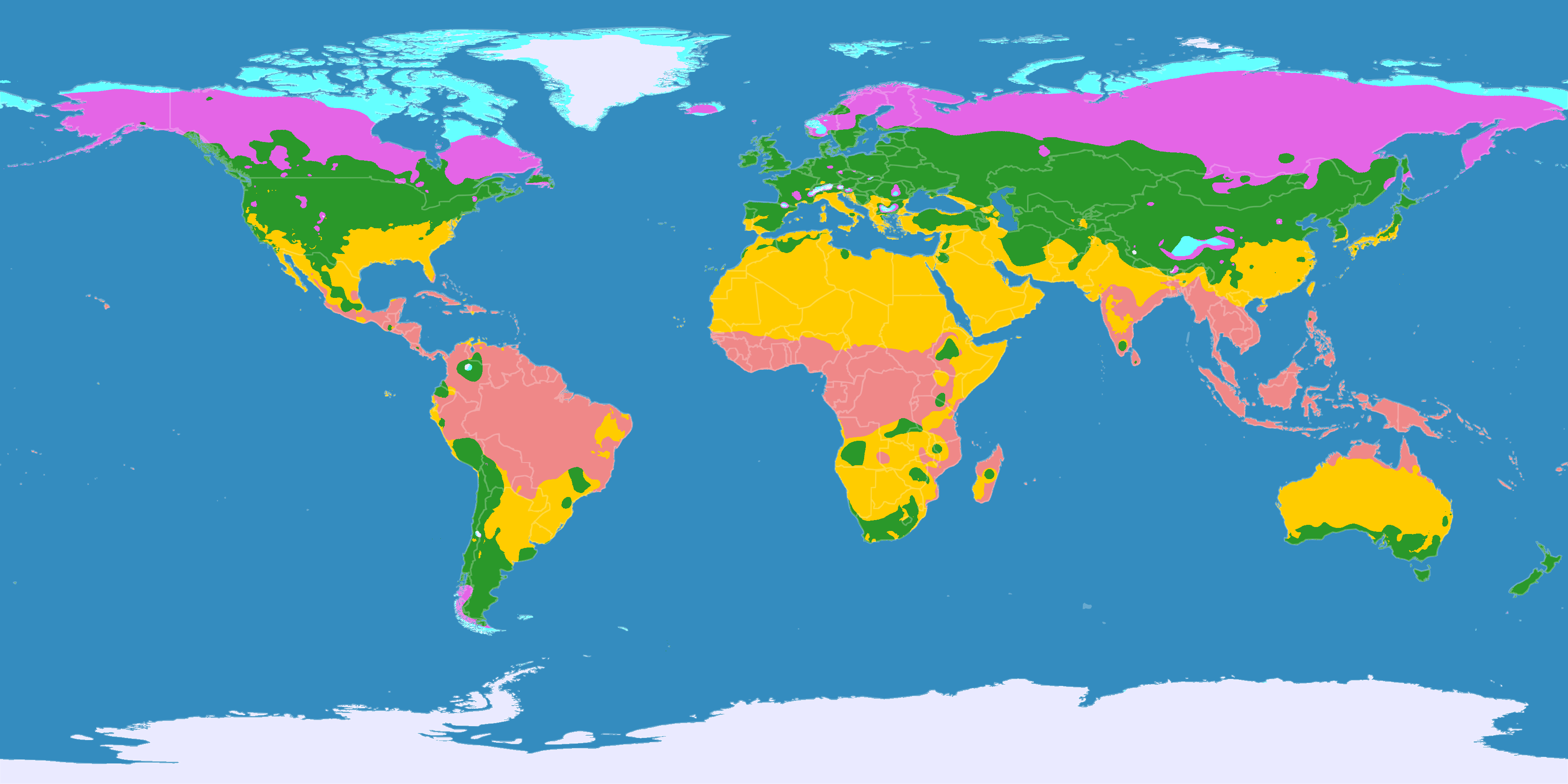
Beleuchtungszonen.png - Fährtenleser

World Map Biodiversity of Plants (1) © W. Barthlott, Lotus-Salvinia.de.jpg - Lotus Salvinia

World Map Biodiversity of Plants (grids) (2) © W. Barthlott, Lotus-Salvinia.de.jpg - Lotus Salvinia

Climate Zones, Scenario B2 2001 - 2025, Global (7242982676).jpg - Ser Amantio di Nicolao

Climate Zones, Scenario B1 2001 - 2025, Global (7242981050).jpg - Ser Amantio di Nicolao

Climate Zones, Scenario A2 2001 - 2025, Global (7242979108).jpg - Ser Amantio di Nicolao
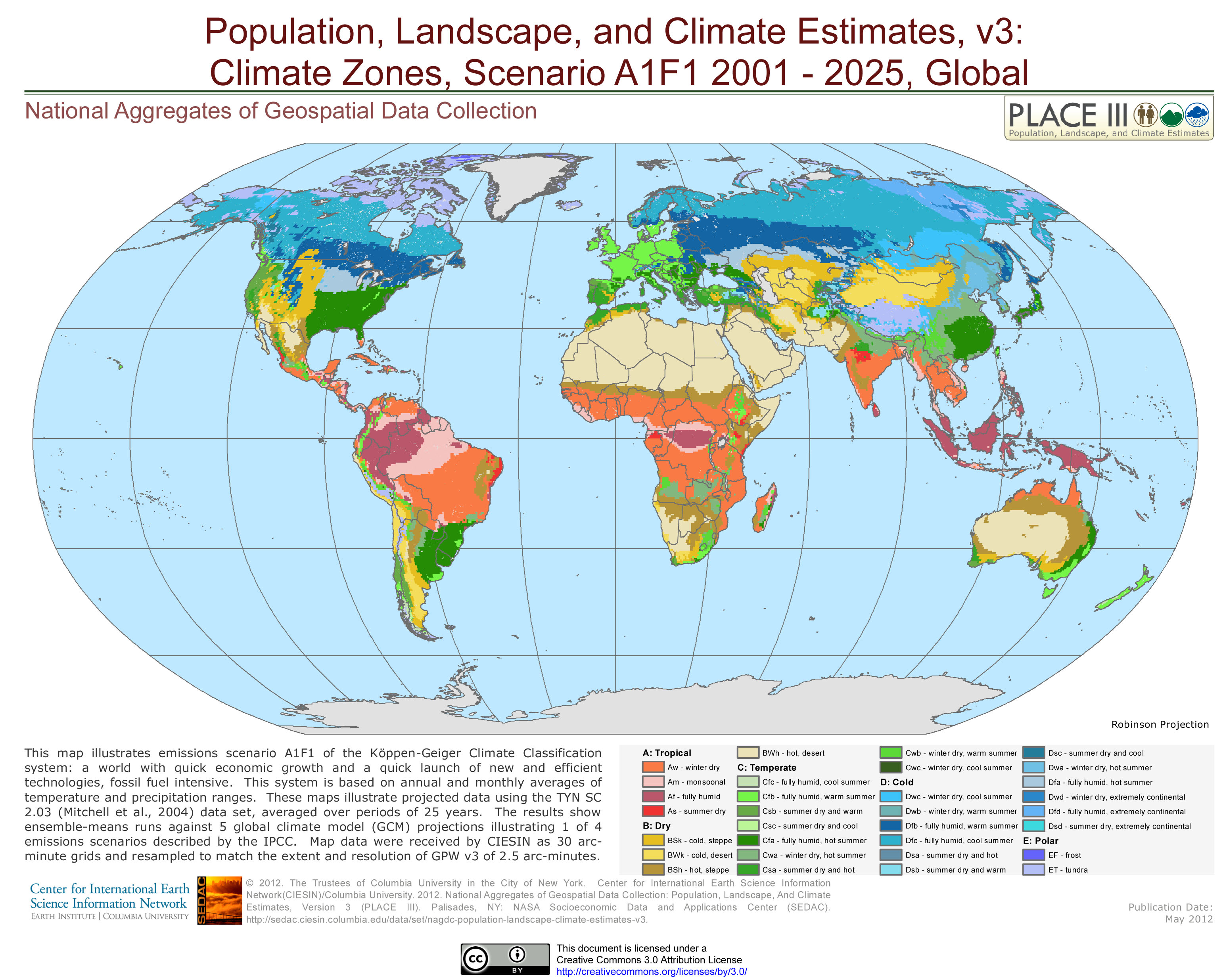
Climate Zones, Scenario A1F1 2001 - 2025, Global (7242978092).jpg - Ser Amantio di Nicolao
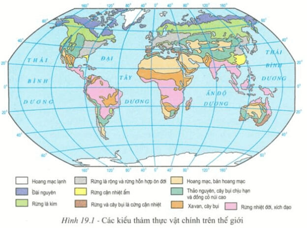
Ly-thuyet-dia-ly-lop-8-bai-21-1.jpg - NewUniverse

Ly-thuyet-dia-ly-lop-8-bai-21-2.jpg - NewUniverse

Ly-thuyet-dac-diem-khi-hau-viet-nam-00-1.png - NewUniverse

Klimate-nach-Kontinentalität,Siegmund&Frankenberg.png - Fährtenleser

Present and future worldwide Köppen-Geiger climate-zone classification maps.png - Teemu Leisti

Subpolar zone.png - Gumideck
Temperate zone.png - Gumideck

Polar zone.png - Gumideck

Climatic Chart of the World, Showing the Distribution of the Human Race and the Animal and Vegetable Kingdoms.jpg - Balkanique

Mappe-monde plani-spérique, physique, hydrographique, agricole et climatologique - composée et dressée par Le Gendre-Décluy, ingénieur - btv1b530935913.jpg - Gzen92Bot

Mappemonde planisphérique, physique, hydrographique, agricole et climatologique - composée et dressée par Le Gendre-Décluy, ingénieur - btv1b530633810.jpg - Gzen92Bot

Klimazonen (3 Modelle) und Makroklimate.png - Fährtenleser

Klimazonen (3 Modelle)- Polare Zone.png - Fährtenleser

Klimazonen- Polare Zone max.png - Fährtenleser

Klimazonen- Gemäßigte Zone max.png - Fährtenleser

Klimazonen- Subtropische Zone max.png - Fährtenleser

Klimazonen- Kaltgemäßigte Zone max.png - Fährtenleser

Klimazonen- Kühlgemäßigte Zone max.png - Fährtenleser
Klimazonen- Tropische Zone max.png - Fährtenleser

Klimazonen (3 Modelle)- Kaltgemäßigte Zone.png - Fährtenleser
Klimazonen (3 Modelle)- Kühlgemäßigte Zone.png - Fährtenleser

Klimazonen (3 Modelle)- Subtropische Zone.png - Fährtenleser

Klimazonen (3 Modelle)- Tropische Zone.png - Fährtenleser

Klimazonen- Unklare Subpolare Zone.png - Fährtenleser

Vergleich-Klimatyp-Cmsh.png - Fährtenleser

Klimazonen solar und thermisch.png - Fährtenleser

Humid and Arid climate world map, classification AI- UNEP, HI- Lobo et al (2023).png - Fährtenleser

Humid climate world map, classification Lobo et al (2023).png - Fährtenleser