Wikimedi'Òc
Modes d'emploi

Cet album fait partie des albums
Cet album photos contient les sous-albums suivants :


Crossbedding and fracturing in Entrada Sandstone.jpeg - Mav

Closeup of Organ Rock Shale.jpeg - Mav

Closeup of the Owl Rock member above the Capitol Reef Bed.jpg - Mav

Capital Reef satellite image.jpg - Slick-o-bot

Ken Leonard - Fisher Towers - IMAG0059.JPG - DaisyDaisy

Ken Leonard - Fisher Towers - Salt Dome P IMAG0067.JPG - DaisyDaisy

Horseshoe crab walkway in ancient mud.jpg - Jacopo Werther
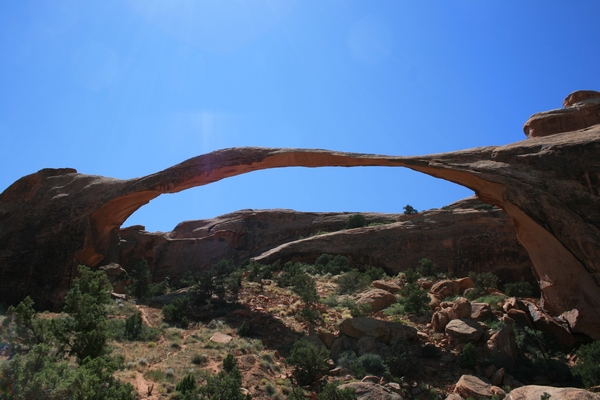
Landscape Arch di Tiziano Lombardi.jpg - Tizianol

Pinne2 di Tiziano Lombardi.jpg - Tizianol

Pinne di Tiziano Lombardi.jpg - Tizianol

La Sal Mountains Viewpoint di Tiziano Lombardi.jpg - Tizianol
Canyonlands National Park, Utah.jpg - TWO

CMF-dinos.JPG - File Upload Bot (Magnus Manske)

Anticline near Salt Lake City-750px.JPG - File Upload Bot (Magnus Manske)

Virgin River Canyon Recreation Area 3.jpg - Stan Shebs

CMF-oucrop.jpg - Rudolf Pohl
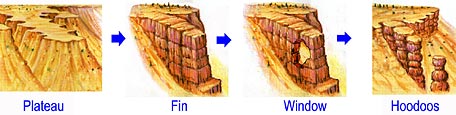
Hoodoo formation-Big.jpg - Sylfred1977

Sentinel Slide in Zion Canyon.jpg - Sylfred1977

Cockscomb cottonwood.jpg - Jo Weber

Tafoni in Little Wild Horse Canyon.jpg - Bdk

Hoodoos at Sunset Point in Bryce Canyon.jpg - Tricia Simpson

2010 Utah shakemap.jpg - Av9

Provo Canyon syncline.jpg - File Upload Bot (Magnus Manske)

PSM V07 D400 Horsehoe canyon.jpg - Ineuw

PSM V07 D402 Uinta mountains sectional image.jpg - Ineuw

PSM V07 D405 Northern slope of the uinta mountains.jpg - Ineuw

PSM V07 D407 Diaclinal valley.jpg - Ineuw

PSM V07 D409 A cataclinal valley.jpg - Ineuw
SwanPeakQuartziteOutcrop.jpg - Wilson44691

Dikes in black dragon canyon UT.JPG - Northisle

Tar seep raised edges ripple marks.JPG - Lldenke

Folded Rock Provo Canyon.JPG - File Upload Bot (Magnus Manske)
Geopetal.JPG - Citypeek

Megaripple.JPG - Citypeek

WasatchFault.JPG - Citypeek

PartingLineation.JPG - Citypeek

San juan river entrenched meanders.jpg - Finetooth

Karte der Navajo Volcanic Fields.jpg - Chumwa
View of folding of incompetent strata. Same as Z-205. - NARA - 520425.tif - US National Archives bot

View of folding of incompetent strata. Same as Z-205. - NARA - 520425.jpg - US National Archives bot

CROSS-BEDDED SANDSTONE, 3-LAKES CANYON, KANAB, UTAH - NARA - 524014.jpg - US National Archives bot

Diamictite Mineral Fork.JPG - BotMultichillT

Xenoliths Little Cottonwood Canyon.JPG - Jstuby
Metamorphic Aureole in the Henry Mountains.JPG - Random Tree
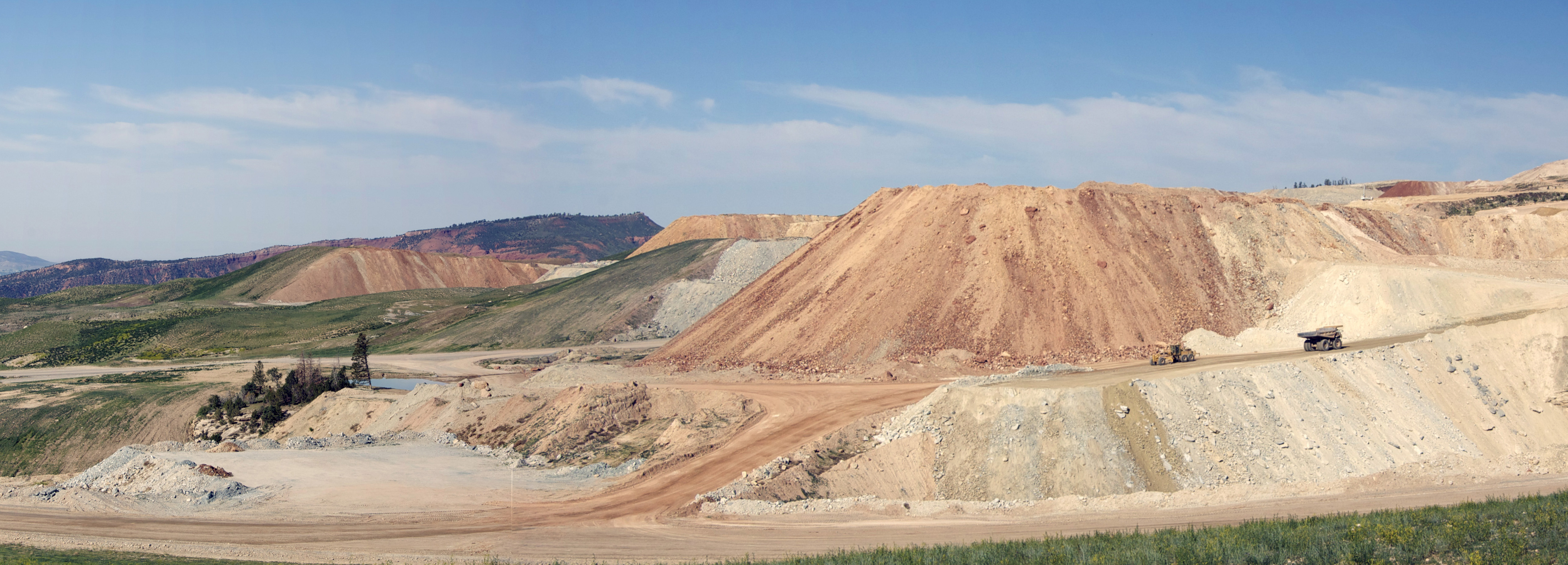
Phosphate Mine Panorama.jpg - Cropbot

USGS Stratigraphy.gif - Masaqui
Campsite, on west side of Wild Horse Butte (4058206553).jpg - File Upload Bot (Magnus Manske)
Hiking Towards the Escalante River (3685435362).jpg - File Upload Bot (Magnus Manske)

Fold in the Sandstone, Garfield County, Utah.jpg - File Upload Bot (Magnus Manske)

Oyster Reef (3684302191).jpg - File Upload Bot (Magnus Manske)

Sand and Sandstone (3685108438).jpg - File Upload Bot (Magnus Manske)

Sandstone near Yellow Rock (3685107794).jpg - File Upload Bot (Magnus Manske)

Sandstone near Yellow Rock (3684296517).jpg - File Upload Bot (Magnus Manske)

Sandstone near Yellow Rock (3685107470).jpg - File Upload Bot (Magnus Manske)

Cool formation in the Valley of the Gods (8228872416).jpg - File Upload Bot (Magnus Manske)

Gorgeous scenery on the way to The Needles (8227777201).jpg - File Upload Bot (Magnus Manske)

Majestic scenery close to The Canyons (8227777831).jpg - File Upload Bot (Magnus Manske)

Cool formation in The Needles (8228843612).jpg - File Upload Bot (Magnus Manske)

Great scenery outside of The Needles (8228844000).jpg - File Upload Bot (Magnus Manske)

Phallic looking rocks are all over the place in Arches (8226464124).jpg - File Upload Bot (Magnus Manske)

Reflection on the way back from Delicate Arch (8226465030).jpg - File Upload Bot (Magnus Manske)

Courthouse Towers in the morning sun (8225393979).jpg - File Upload Bot (Magnus Manske)

Corkscrews area of the Cottonwood Canyon Road (8120752613).jpg - File Upload Bot (Magnus Manske)

Orangish and white landscape in Zion (8078515841).jpg - File Upload Bot (Magnus Manske)

Massive promontory in Zion (8078516489).jpg - File Upload Bot (Magnus Manske)

Conflicting landscape in the eastern side of Zion (8078516553).jpg - File Upload Bot (Magnus Manske)

Folded Rock Layers at Taylor Creek Trail - Zion National Park.jpg - GeoWriter

Aftermath of the Rockville rockslide.JPG - Speednat

Tantalus Creek (?), Wayne County, Utah. Old Nos. 275, 423 - NARA - 517790.jpg - US National Archives bot

Colob Country. Southern Utah, the buttes in the right distance are the great buttes at entrance of - NARA - 517940.jpg - US National Archives bot
SanRafaelReefUT2.jpg - Ixfd64

CryptoBioticSoil.jpg - Ixfd64

St. george utah pic.JPG - Rcbutcher

Moab fault with vehicles for scale.JPG - Wilsonaj

Traverse Mountains (South Mountain), Draper and Alpine, Utah (67181504).jpg - INeverCry

Bingham Cross Section.PNG - Pi3.124

Bingham Cross Section Sulfides.PNG - Pi3.124

Bingham District Geology.PNG - Pi3.124

Bingham Silicate Alterations.PNG - Pi3.124

Bingham Geology.PNG - Pi3.124

Bingham Metal Zones.PNG - Pi3.124

Bingham Old Jordan Mine.PNG - Pi3.124

Bingham Highland Boy Mine.PNG - Pi3.124

Bingham Telegraph Mine.PNG - Pi3.124

Geology of Utah - Flickr - brewbooks.jpg - Josve05a

USGS Lisbon Valley map.png - Pi3.124

Just East of Needles B&W (5216750348).jpg - Hiàn (alt)

Limestones (Big Horse Limestone Member, Orr Formation, Middle Cambrian-Upper Cambrian boundary; Little Horse Canyon, House Range, Utah, USA) 2 (44837826135).jpg - Lu Brito

Limestones (Big Horse Limestone Member, Orr Formation, Cambrian; Little Horse Canyon, House Range, Utah, USA) (45026593624).jpg - Lu Brito

Mudcracks on base of sandstone bed (Kayenta Formation or Navajo Sandstone, Lower Jurassic; Potash-Poison Spider dinosaur tracksite, Williams Bottom, southwest of Moab, Utah, USA) 26 (32309969614).jpg - Rudolphous

Mudcracks on base of sandstone bed (Kayenta Formation or Navajo Sandstone, Lower Jurassic; Potash-Poison Spider dinosaur tracksite, Williams Bottom, southwest of Moab, Utah, USA) 34 (33113618556).jpg - Rudolphous

Utah - 100 2723 (3873399405).jpg - GeoWriter

Utah - 100 2742 (3874190758).jpg - GeoWriter

Utah - 100 3329 (3932869929).jpg - GeoWriter

Utah - 100 3408 (3932879419).jpg - GeoWriter

Utah - 100 3340 (3932871329).jpg - GeoWriter

Utah - 100 3470 (3933670086).jpg - GeoWriter

Utah - 100 3475 (3932889077).jpg - GeoWriter

Utah - Of Two Worlds (3932899727).jpg - GeoWriter

Utah - 100 3486 (3933674312).jpg - GeoWriter

Utah - 100 3527 (3933680874).jpg - GeoWriter
Jumpers on the titan (6274441428).jpg - GeoWriter

Base jumper on Castleton (6273919591).jpg - GeoWriter

Colorful walls (6274447086).jpg - GeoWriter

Slot canyon exit (6274449382).jpg - GeoWriter

Logan Canyon Scenic Byway - The Great Taffy Pull Sign - NARA - 7720212.jpg - US National Archives bot

Fault slickenlines (Morrison Formation, Upper Jurassic; Carnegie Quarry, Dinosaur National Monument, Utah, USA) 12 (48862118436).jpg - Ser Amantio di Nicolao

Fault slickenlines (Morrison Formation, Upper Jurassic; Carnegie Quarry, Dinosaur National Monument, Utah, USA) 16 (48862117666).jpg - Ser Amantio di Nicolao

Ripple marks in sandstone (Kayenta Formation or Navajo Sandstone, Lower Jurassic; Potash-Poison Spider dinosaur tracksite, Williams Bottom, west of Moab, Utah, USA) 3 (32375065343).jpg - Ser Amantio di Nicolao

Jurassic National Monument 2019.jpg - Tillman

Terracotta Warriors - Flickr - snowpeak.jpg - Red panda bot

General distribution of carnotite-bearing deposits in Four Corners region, 1952.png - Pbritti

Travertine-Crystal geyser.jpg - Carpenter, Kenneth

Travertine pearls.jpg - Carpenter, Kenneth
Old travertine.jpg - Carpenter, Kenneth
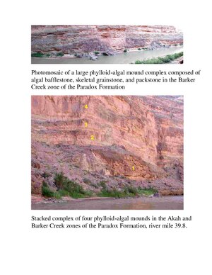
Photo algal mound (1).pdf - Trueblood786

Aplite vein cutting xenolith.jpg - Jstuby

Ophir Fm in Pegmatite vein 1 of 2.jpg - Jstuby

Ophir Fm in Pegmatite vein 2 of 2.jpg - Jstuby