Wikimedi'Òc
Modes d'emploi

Cet album fait partie des albums
Cet album photos contient les sous-albums suivants :


Morton Wasserspiegel.png - Andrew pmk~commonswiki

Yardang Lea-Yoakum Dunes.jpg - Duk

Uvalde columns.jpg - Urdangaray

Ouachita Mountains rock outcrop.jpg - Jo Weber

Hill 1900 LlanoEstacado.jpg - Leaflet

Threemile 1913 USGS.jpg - Leaflet

Palo Duro Canyon 2.jpg - FlickreviewR

EdwardsDisconformity.jpg - Wilson44691

Round Mountain 2008.jpg - Leaflet
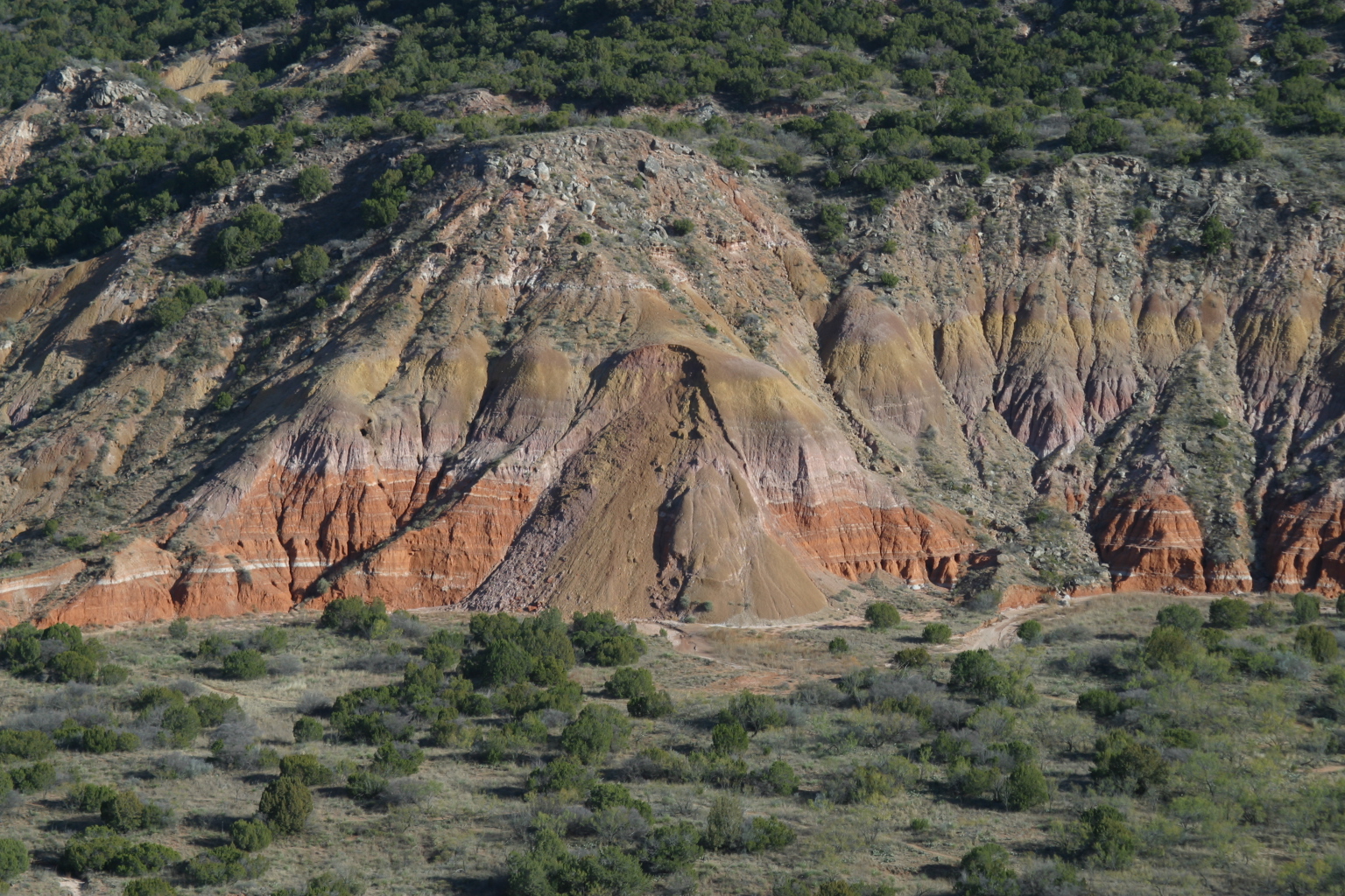
Mass Waste Palo Duro 2002.jpg - Leaflet
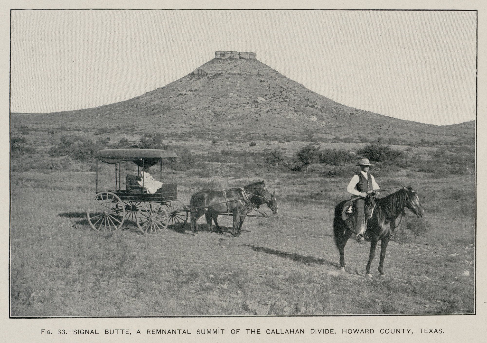
Signal Mountain TX 1900.jpg - Leaflet

WinkSink1.JPG - Ganitoid

Mount Bonnell 1889.jpg - Leaflet
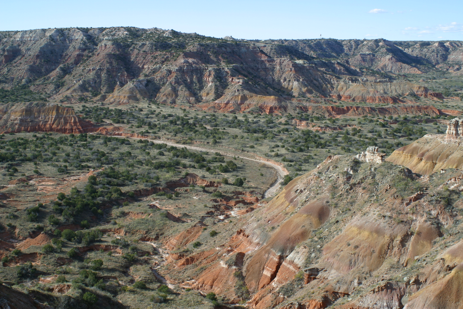
Palo Duro 2002.jpg - Leaflet
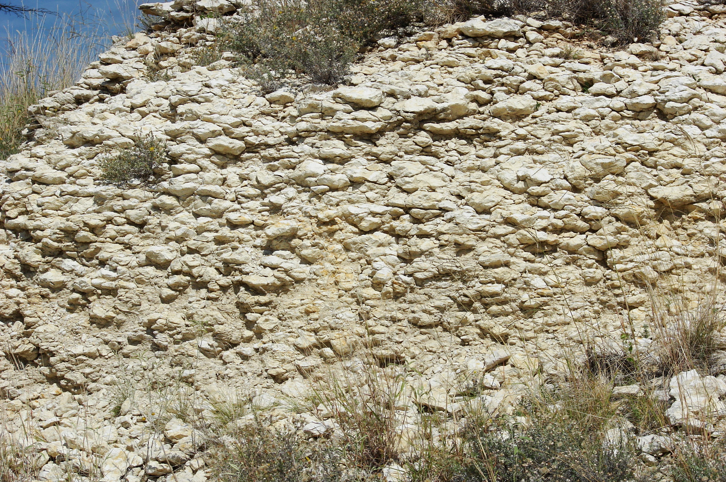
Caliche-5731.jpg - Loadmaster
Locality.jpg - Onepitch16

Marathon Uplift-Ouachita Orogen shaded relief.jpg - Kbh3rd

Solitario shaded relief - plain.jpg - Kbh3rd

Syncline.JPG - SreeBot
Haynesville Shale Map.pdf - Cristellaria
Long Point Fault SW Houston.JPG - Djmaschek

Long Point Fault NW Houston.JPG - Djmaschek

Long Point Fault at Memorial Houston.JPG - Djmaschek
Electricity transmission tower erection on the U.S. Route 90 in Texas 09.JPG - John Cummings
HorseshoeAtoll.jpg - Pi3.124

Horseshoe Atoll Stratigraphic sequence.jpg - Pi3.124

Greensand.jpg - Kelly

Texas 1950s drought.jpg - Iamozy
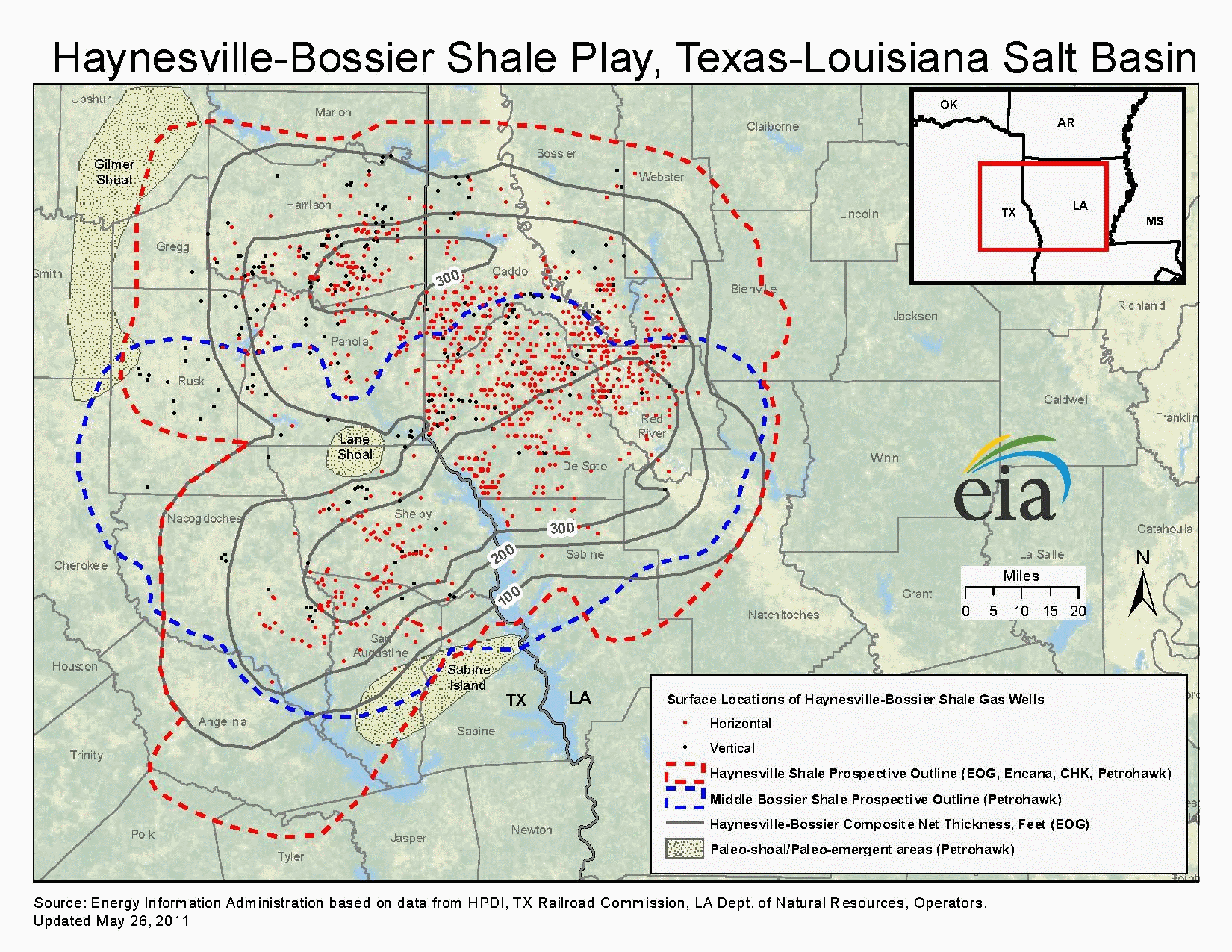
Haynesville Shale Map.png - Yassie

Utopia-tx(old-rock-store)2015.jpg - Darrylpearson

Ouachita Orogeny geologic map.png - Pi3.124
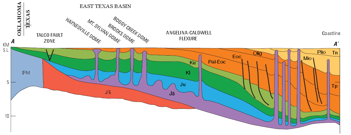
East Texas Basin cross section.png - Pi3.124

Edwards and Trinity Aquifers Map.png - Pi3.124

Skull Creek Seaway.png - Pi3.124
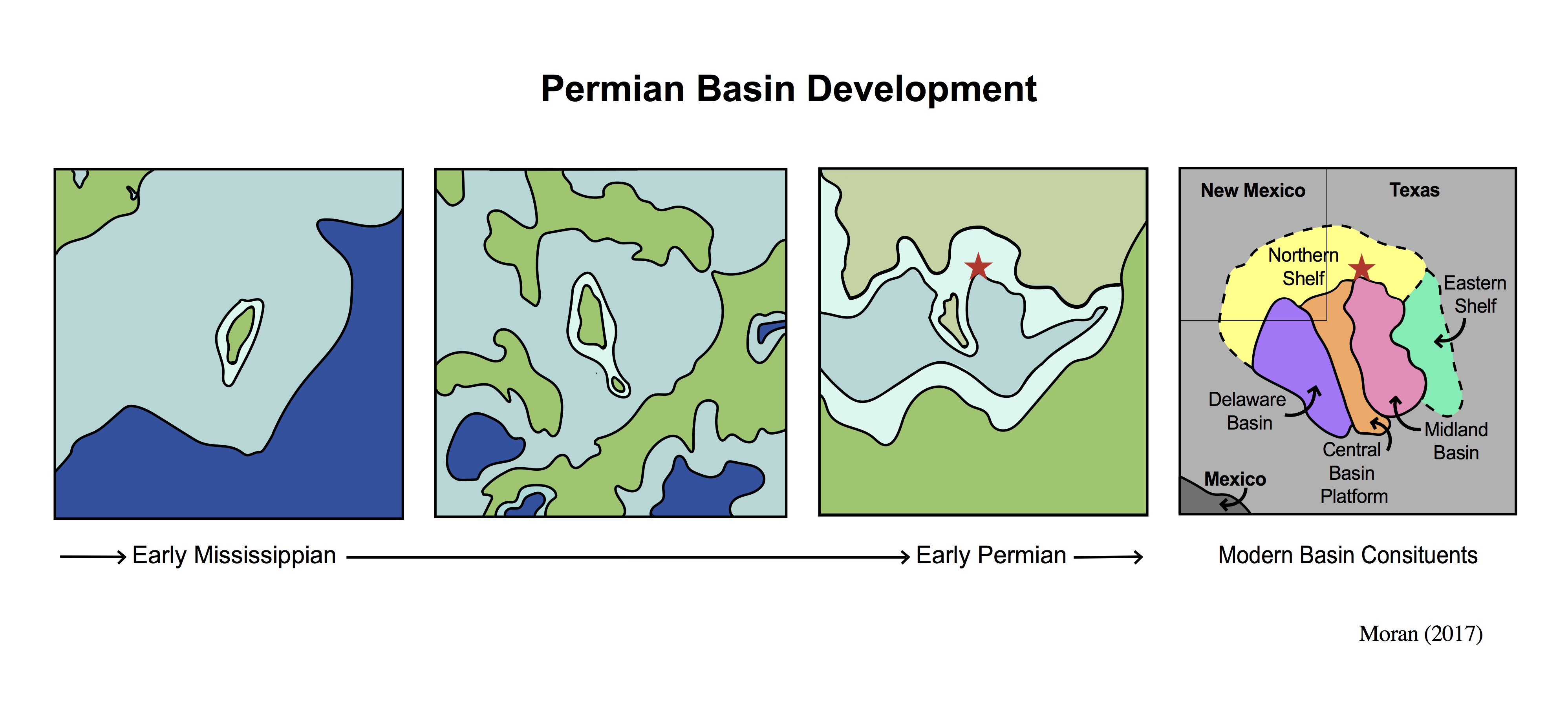
Basin Development.jpg - Mgmoran

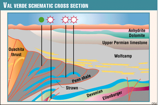
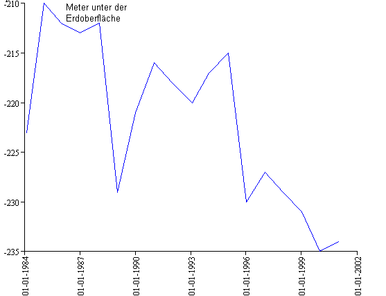
Val Verde Production.png - AllisonBarbato
Franklin Mountain rock.jpg - Megalibrarygirl

Depth to the top of the Eagle Ford formation in feet (14310887803).png - Ser Amantio di Nicolao
Field Notebook- Texas 1924, 1925 (IA fieldnotebookte00schua).pdf - Fæ

NASA Manned Spacecraft Center Astronauts Receiving Geological Training from NASA Geologists During a Field Trip to the Big Bend Area of West Texas - DPLA - ead2343f9321a43f961e5634f214ef48.jpg - DPLA bot

Gypsum dune, Salt Flat, Hudspeth County, Texas.jpg - Carpenter, Kenneth

Panorama of the Salt Flat, Hudspeth County, Texas.jpg - Carpenter, Kenneth

Cross-section of the playa sediments.jpg - Carpenter, Kenneth

Guadalupe Mountain reef to basin panorama.jpg - Carpenter, Kenneth

Geological chimney near Dolomite Point Road. (ff019289-155d-451f-677e-f8f9aa2792ec).gif - BMacZeroBot