Wikimedi'Òc
Modes d'emploi

Cet album fait partie des albums
Cet album photos contient les sous-albums suivants :


Philmont Scout Ranch Tyrannosaurus footprint.jpg - Conty

Northwest Escarpment Llano Estacado 2003.jpg - Leaflet

Rio Grande Gorge and Sangre de Cristos.jpg - File Upload Bot (Magnus Manske)
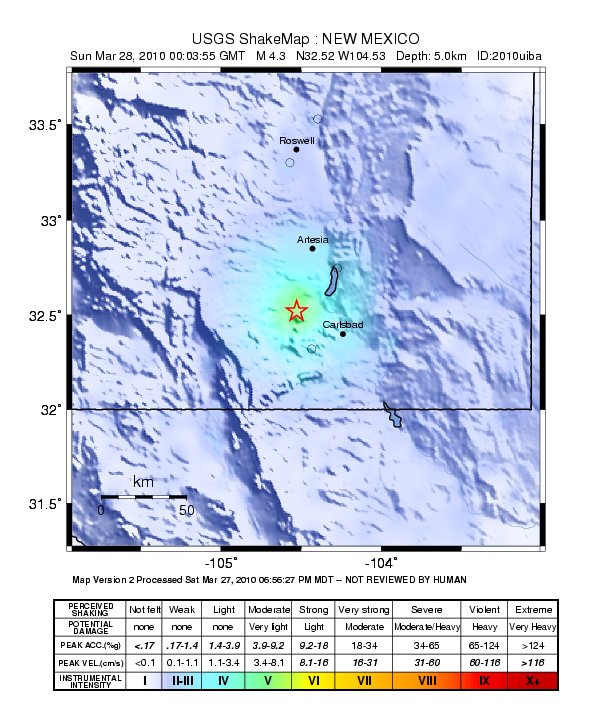
2010NewMexico.jpg - Av9

USBP and UTEP at Hunts Hole.JPG - MJCdetroit

West Mesa Albuquerque.jpg - File Upload Bot (Magnus Manske)

Karte der Navajo Volcanic Fields.jpg - Chumwa

Palisades Sill sign near Cimarron, NM Picture 2023.jpg - MGA73bot2
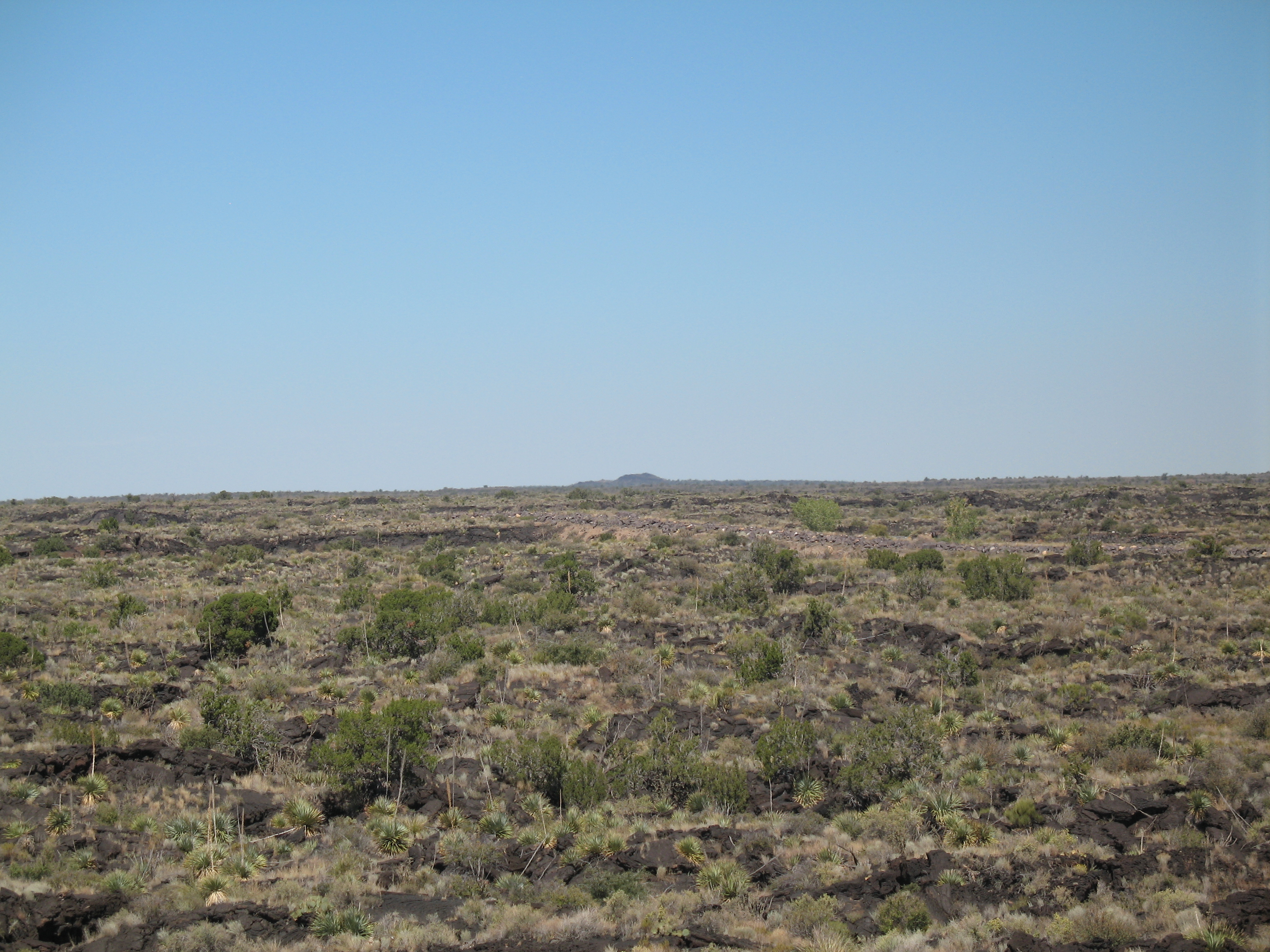
Carrizozo Malpais Overview.jpg - Marjaliisa

Hogback NM.jpg - BotMultichillT

Placerias vs. Redondasaurus.jpg - File Upload Bot (Magnus Manske)

04 Rock formation from Sky City Cultural Center.jpg - Beyond My Ken

USGS Stratigraphy.gif - Masaqui

Natural Kingman Turquoise, Maisels, Albuquerque NM.jpg - Rotatebot

A distant shot of the west mesa in new mexico.jpg - Fæ

(old No. 112)El Tintero, near Chaves New Mexico. The negative appears to have been damaged on right - NARA - 517758.jpg - US National Archives bot

(Old No. 122) Navajo Church near Fort Wingate, McKinley County, New Mexico. - NARA - 517770.jpg - US National Archives bot

(Old No. 127) Looking north along the Cretaceous hogbacks of the north end of the Zuni Uplift, west - NARA - 517775.jpg - US National Archives bot
Dikes thumb.jpg - Innotata

IridiumLayerKTBoundaryRatonNM.png - Expeditionradio

Ferricrete near Questa NM.jpg - Georgialh

Gyprock (Castile Formation, Upper Permian Eddy County, New Mexico.jpg - Tillman

6-50 very close to shiney blue-black glaze on top bedrock strata - panoramio.jpg - Panoramio upload bot

5-50 more close to see sharp edges of broken melted and glazed surfaces of top strata - panoramio.jpg - Panoramio upload bot

4-50 closer to ablated 1-2 m blocks of cracked, ablated bedrock strata, with melted surfaces and mineral glazes - panoramio.jpg - Panoramio upload bot

7-50 "pawprint" ablation depressions in blasted, cracked, melted, glazed bedrock - panoramio.jpg - Panoramio upload bot

8-50 close to pawprint surface ablation - panoramio.jpg - Panoramio upload bot

10-50 pawprints, wider view shifted to lower R - panoramio.jpg - Panoramio upload bot
9-50 pawprints, view shifted to R - panoramio.jpg - Panoramio upload bot

PIA21266 - 'Wing' Dike of Hardened Lava in New Mexico.jpg - PhilipTerryGraham

Kasha-Katuwe Tent Rocks National Monument, New Mexico USA - panoramio (40).jpg - Panoramio upload bot
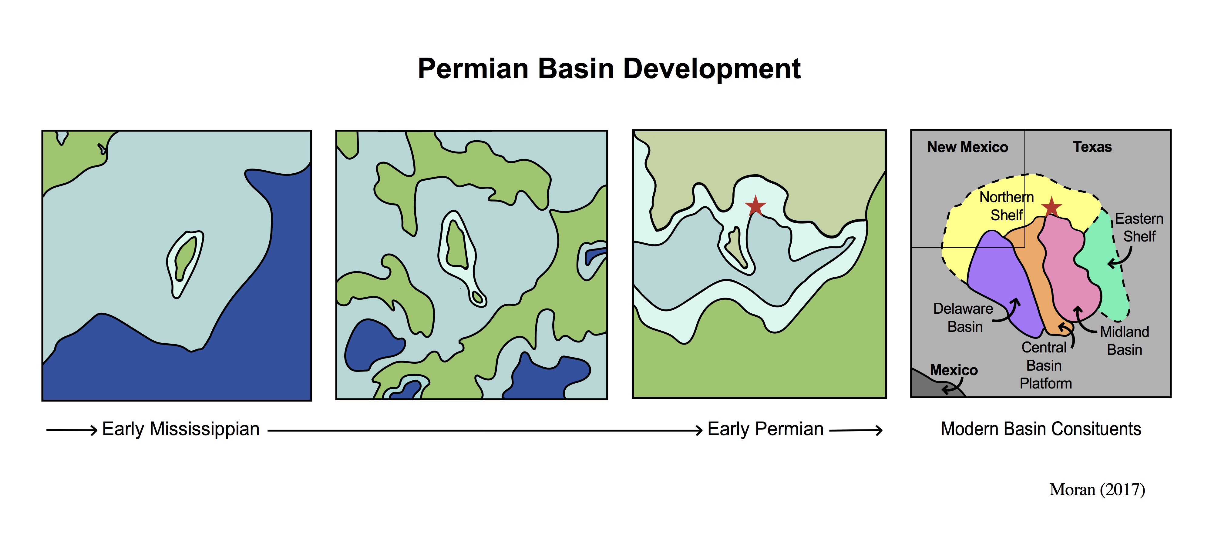
Basin Development.jpg - Mgmoran
Smoky-quartz-TUCQTZ09-03-arkenstone-irocks.png - Arkenstone-iRocks

Chalcedony-heulandite (Apache Creek, Catron County, New Mexico, USA) 1 (33896535194).jpg - Ser Amantio di Nicolao

Reverse fault in gyprock (Castile Formation, Upper Permian; State Line outcrop, southern Eddy County, New Mexico, USA) (15159863205).jpg - Ser Amantio di Nicolao

Steamboat Butte New Mexico.jpg - Kent G. Budge

Pilarsample.jpg - Kent G. Budge
Arroyo Penasco Group.jpg - Kent G. Budge

Pilar Formation outcrop.jpg - Kent G. Budge

Fruitland-Kirtland formation, Coal Creek, New Mexico by Nick Longrich.jpg - NickLongrich

Four windows cave.jpg - RTG
Preliminary field report of the United States Geological Survey of Colorado and New Mexico (IA preliminaryfield00haydrich).pdf - Fæ

General distribution of carnotite-bearing deposits in Four Corners region, 1952.png - Pbritti

PXL 20210404 204134482.MP(1).jpg - Hhamalainen

Geologic Map of New Mexico.png - Puckish pupfish

Geologic Map of New Mexico Explanation.png - Puckish pupfish
Cottonwood Lake.jpg - Carpenter, Kenneth

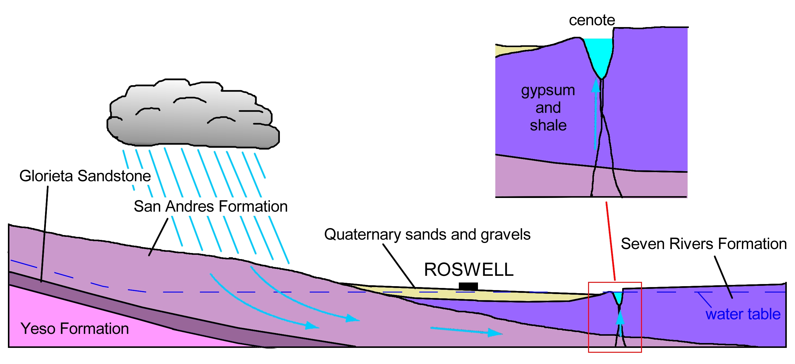
Figure 8 cenote.jpg - Carpenter, Kenneth
Devils Inkwell Cenote.jpg - Carpenter, Kenneth
Bottomless Lakes cenotes.jpg - Carpenter, Kenneth