Wikimedi'Òc
Modes d'emploi

Cet album fait partie des albums
Cet album photos contient les sous-albums suivants :


Cooperating Agencies Holmes & Narver, Inc. (29234953291).jpg - Vanished Account Byeznhpyxeuztibuo

Lituyanami.png - Anynobody~commonswiki
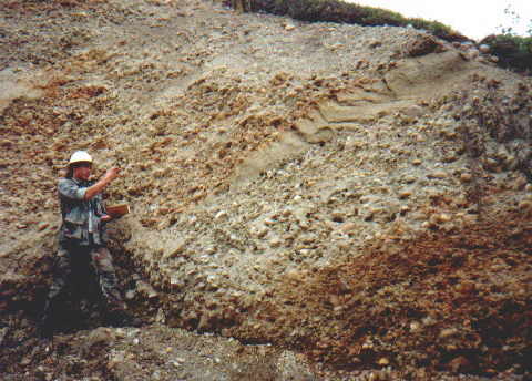
Alluvial Gravels at the Blue Ribbon Mine Alaska.jpg - File Upload Bot (Magnus Manske)
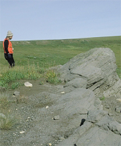
Anwr marsh creek.jpg - Work permit

Late Cretaceous Coast Mountains plate tectonics.jpg - Black Tusk

Rhyolitic vitrophyre.jpg - דקי

Redoubt Andesite.jpg - Flickr upload bot
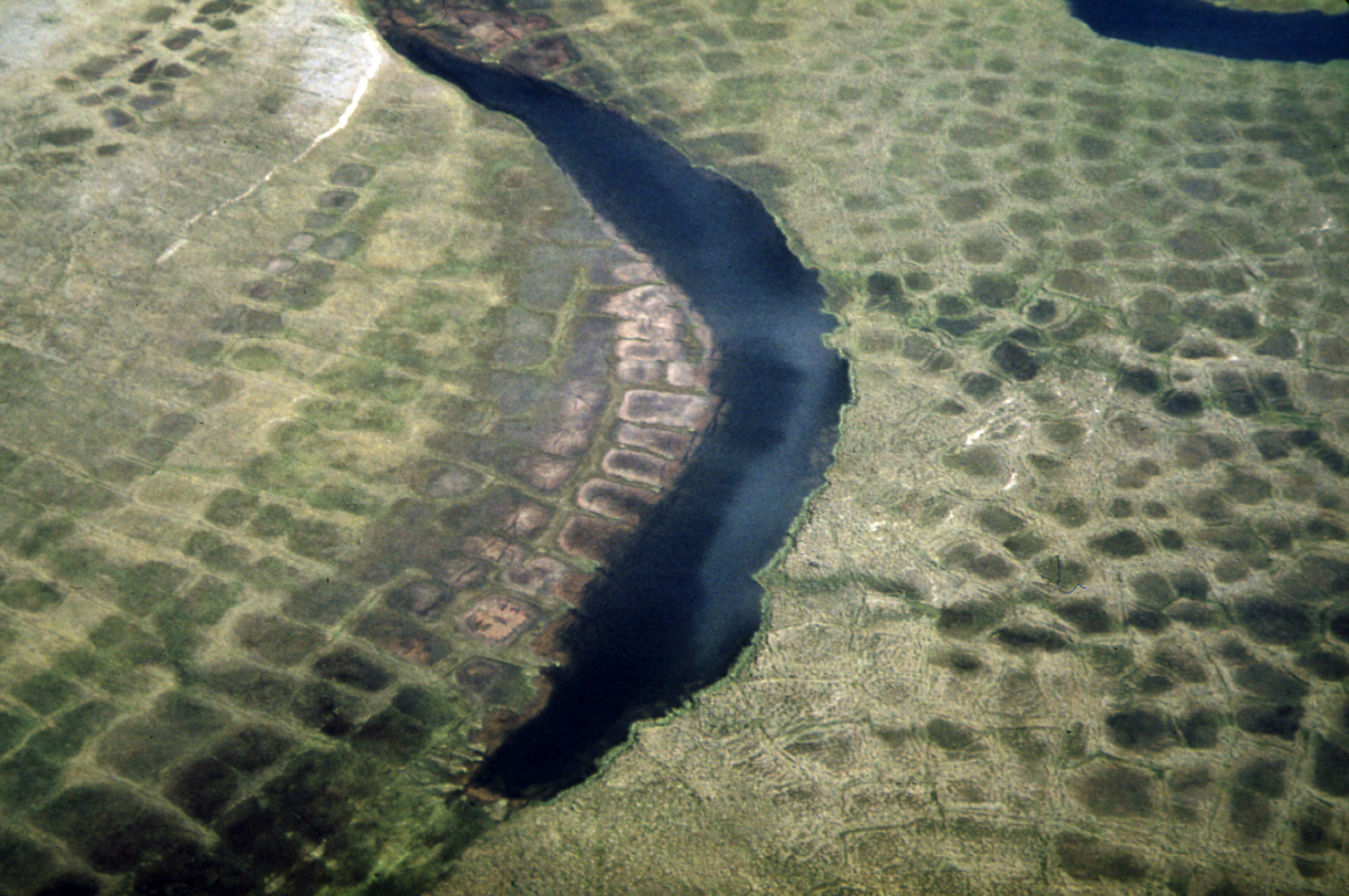
Alaska patterned ground 1973.jpg - Hohum
Frosty Volcano 3D.gif - Asybaris01
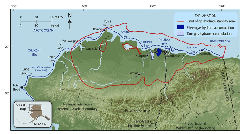
Overview of the Northern Alaska Gas Hydrate Total Petroleum System.png - GRID-Arendal

Overview of the major geologic and geographic features on the Alaska North Slope.png - GRID-Arendal
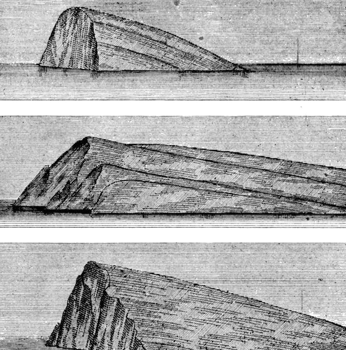
Page 331-cruiseofcorwin2.jpg - Mattisse

Page 339-cruiseofcorwin.jpg - Mattisse
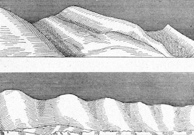
Page 347-cruiseofcorwin.jpg - Mattisse

Page 353-cruiseofcorwin.jpg - Mattisse

PATTERNED GROUND SHOWS ICE POLYGONS (LATTICE OUTLINES) AND TYPICAL SUMMER ARCTIC TUNDRA. PATTERNED GROUND, ICE... - NARA - 550392.jpg - US National Archives bot

PATTERNED GROUND, A RESULT OF MASSIVE ICE FORMATIONS, AND A SMALL STREAM DRAINING NORTHWARD FROM GALBRAITH LAKE - NARA - 550404.jpg - US National Archives bot

PATTERNED GROUND, A RESULT OF MASSIVE ICE FORMATIONS, AND A SMALL STREAM DRAINING NORTHWARD FROM GALBRAITH LAKE - NARA - 550405.jpg - US National Archives bot

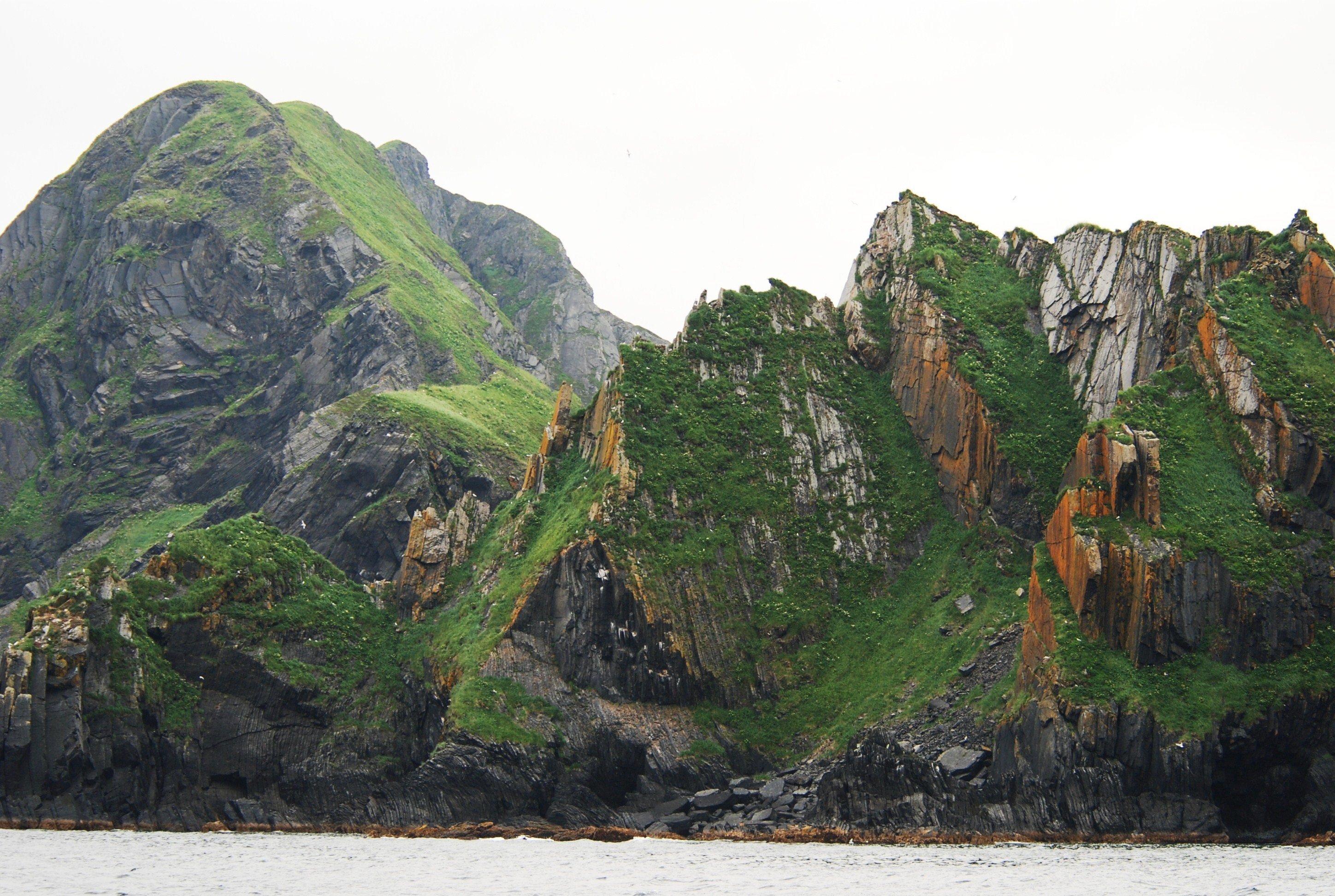
FOLDED HORIZONTAL STRATA IN THE BROOKS RANGE ON THE EAST SIDE OF THE ATIGUN VALLEY - NARA - 550423.jpg - US National Archives bot

1901. Showing rock formation-Northern Bank-Yukon River. - NARA - 297225.jpg - US National Archives bot

1901. Rock formation, Yukon River. - NARA - 297228.jpg - US National Archives bot

1901. Calico Bluff-Yukon River. - NARA - 297229.jpg - US National Archives bot

Line5060 - Flickr - NOAA Photo Library.jpg - Kobac

Line5056 - Flickr - NOAA Photo Library.jpg - Kobac

Line5055 - Flickr - NOAA Photo Library.jpg - Kobac

Line5065 - Flickr - NOAA Photo Library.jpg - Kobac

Line5088 - Flickr - NOAA Photo Library.jpg - Kobac
Line4627 - Flickr - NOAA Photo Library.jpg - Kobac

Line4635 - Flickr - NOAA Photo Library.jpg - Kobac

Old Volcano, Older Footprints, Aniakchak National Monument and Preserve - NASA Earth Observatory.jpg - Dzlinker

Alaska permafrost zones.jpg - Dankarl

Kanuti canyon river aerial.jpg - Fæ

Arches and Basins of the North Slope.jpg - Jytdog

Rock formations in Gates of the Arctic National Park.jpg - Mudflattop

Rolling hills (8029734742).jpg - File Upload Bot (Magnus Manske)

Asperity model - 4categories.png - As6022014

Calculated Travel Time Map for 1964 Alaska Tsunami.jpg - Ngdchazards

North Slope Stratigraphy.jpg - Hvanwy1

Gold-quartz-sulfide hydrothermal vein (O'Dea Vein or Irishman Vein, Late Cretaceous; Grant Mine, Fairbanks Mining District, Alaska, USA) 2 (17127134636).jpg - Natuur12

Mechanics of debris avalanching in shallow till soils of southeast Alaska (1970) (20385507400).jpg - SteinsplitterBot

Mechanics of debris avalanching in shallow till soils of southeast Alaska (1970) (20564543672).jpg - SteinsplitterBot

FMIB 41398 Typical miners' winter quarters on a mineralized gulch of the Yukon anticlinal The photograph is a view of Wolverine Gulch in.jpeg - BMacZeroBot
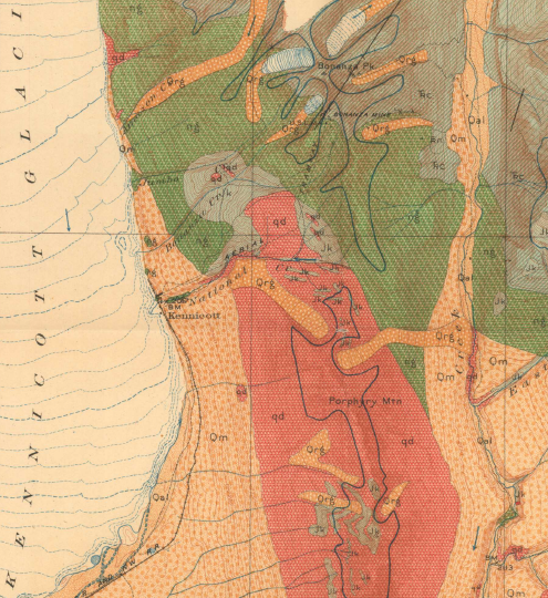
Bonanza Mine geologic map.PNG - Pi3.124
Bonanza mine Geologic Column.PNG - Pi3.124

Redoubt Volcano, Aleutian Range, Alaska, July 2015.jpg - Offnfopt

Yukon-Tanana terrane 0Ma.jpg - Fama Clamosa

USGS ANS OilProductionMap.jpg - Pgmou
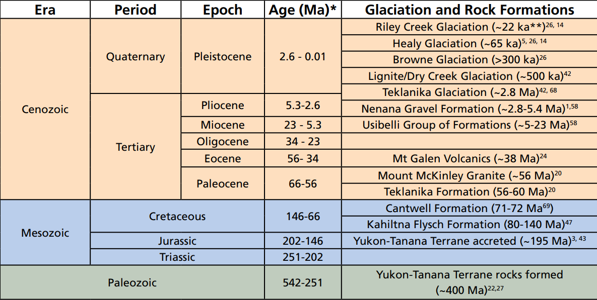
Denali National Park Geologic Time Scale.png - Pi3.124
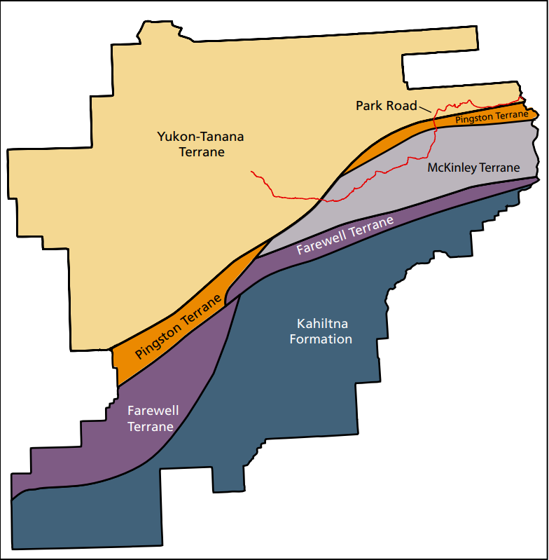
Denali National Park geologic Terranes.png - Pi3.124

Mud volcano - DPLA - c80be35eb0ca076166f0463fcba19e39.jpg - DPLA bot

Flora and Geology--St. Paul - DPLA - 3c83cc43e370af64f23b4a704e532783.JPG - DPLA bot

Flora and Geology--St. Paul - DPLA - 6a2529789f6fea62e24f1199022d7b31.JPG - DPLA bot

Conglomerate & slate (Wickersham Grit, Neoproterozoic-Cambrian; roadcut between Fox and Livengood, Alaska, USA) 2.jpg - Ser Amantio di Nicolao

Conglomerate & slate (Wickersham Grit, Neoproterozoic-Cambrian; roadcut between Fox and Livengood, Alaska, USA) 1.jpg - Ser Amantio di Nicolao

Serpentinite & metagabbro (Livengood Ophiolite, Early Cambrian; near Livengood, Alaska, USA).jpg - Ser Amantio di Nicolao

A backcountry ranger on fall Noatak River patrol checks for boaters on the water and falcons that might nest on these cliffs of (388ea822-1dd8-b71c-0766-21d8e634cdbf).jpg - BMacZeroBot

Tundra plants take refuge among rocks to find protection from harsh, dessicating winds in the high elevations of the Arctic. (c4f1b0ba-1dd8-b71c-07c1-7b0dc013e5b9).jpg - BMacZeroBot

Lichens have been growing on this undisturbed stone for decades. The black dots of crustose lichens almost make a picture. What (c4f6ffde-1dd8-b71c-0759-28e4e5f4d216).jpg - BMacZeroBot

A variety of lichen and moss with a variety of shapes and colors grows slowly and patiently on a rock in the backcountry (372de815-1dd8-b71c-076f-4d02b3674346).jpg - BMacZeroBot