Wikimedi'Òc
Modes d'emploi

Cet album fait partie des albums
Cet album photos contient les sous-albums suivants :
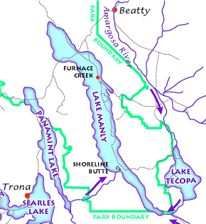


Lake Manly system.png - Ras67

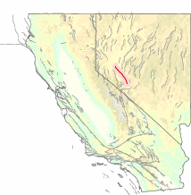
Pleistocene Lakes and Rivers of Mojave.png - Emerson7
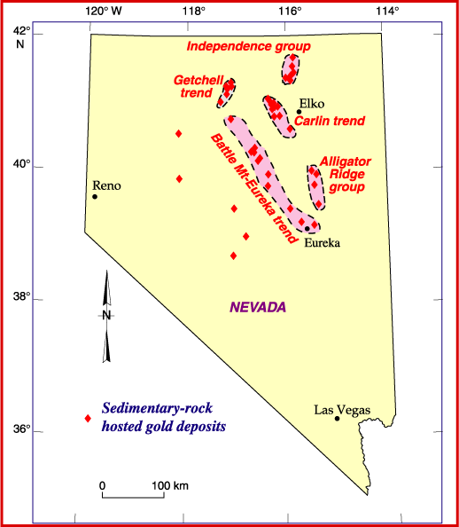
Sedimentary-rock hosted gold deposits in Nevada.gif - Tillman

Mesquite Nevada Geologic Map.gif - Eeekster
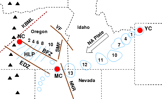
Newberry-Yellowstone tracks.png - J. Johnson
NVMap-doton-ToiyabeMtns.png - Gemini1980

Digital-elevation-map-nevada.gif - OgreBot

Columbia River Flood-Basalt Province.jpg - J. Johnson

CRB-Yellowstone mantle plume model.jpg - J. Johnson

Grouse Creek Block Location.jpg - Abenne1

Grouse Creek block location1.jpg - Abenne1
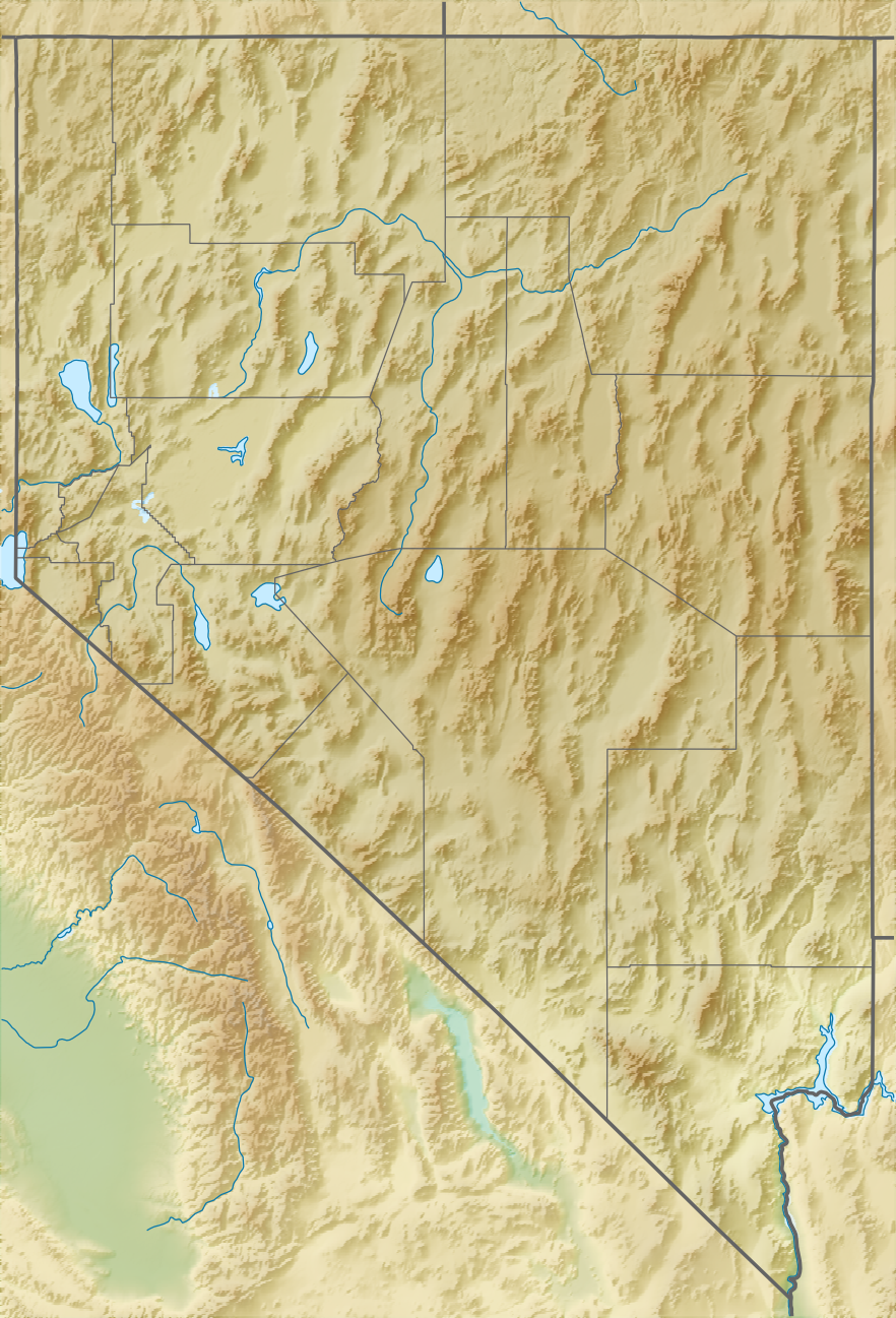
Relief map of U.S., Nevada.png - Ayane m

Ely Geology Part 2.PNG - Pi3.124

Ely Geology Part 1.PNG - Pi3.124

Geologic Map of Nevada 1978.jpg - Alternative Transport

USGS McDermitt caldera geologic map.png - Pi3.124

NPS great-basin-geologic-map.jpg - RKBot

NPS lake-mead-geologic-map.jpg - RKBot
USGS – Honey Lake fault zone.gif - Dawnseeker2000
USGS - Benton Springs fault system.gif - Dawnseeker2000
USGS – Pyramid Lake fault zone.gif - Dawnseeker2000

YeringtonBatholith geologicmap.png - Pi3.124

Geologic map of the Nevada Test Site - Atomic Testing Museum, Las Vegas 16.jpg - Missvain
Soil survey of northwest Elko County area, Nevada - parts of Elko and Eureka Counties (IA soilsurveyofnort00bowe).pdf - Fæ

Geological map of northwest USA showing Basin and Range faults and basalts and rhyolites up to17 Ma.png - SphericalSong

Railroad Valley Mineral Resources Map.png - Adsivils
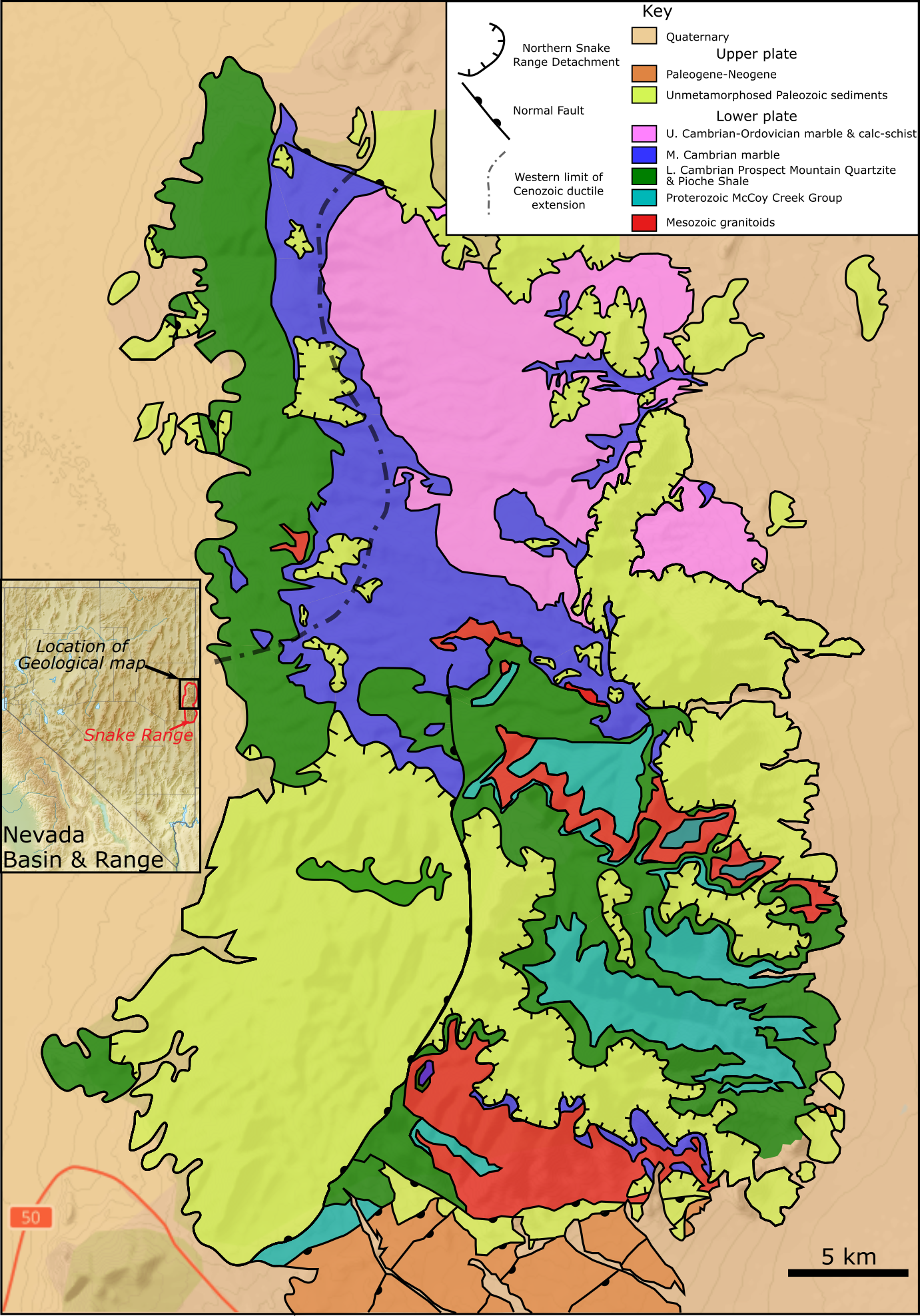
Northern Snake Range MCC map.png - Mikenorton
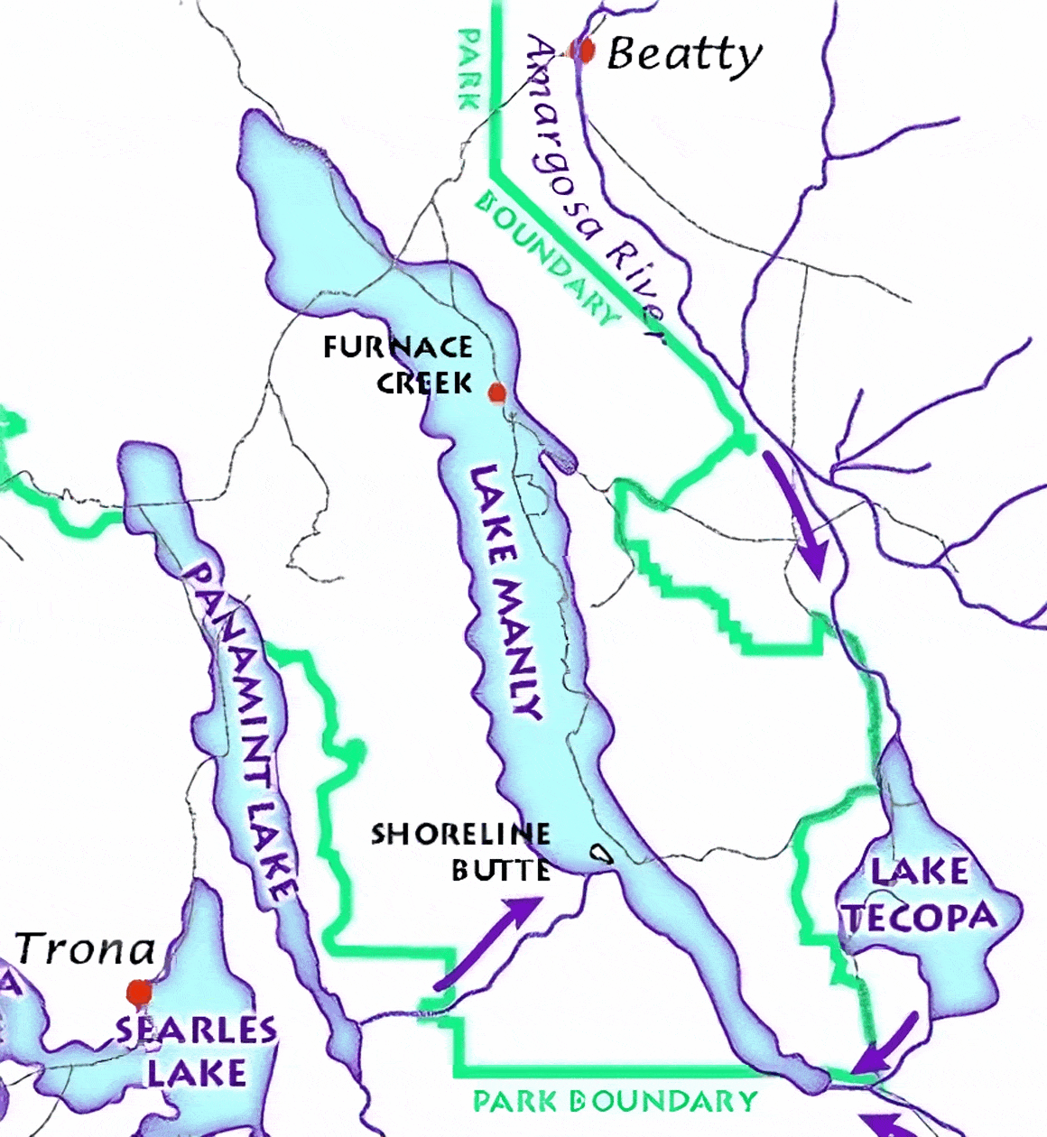
Lake Manly system.gif - Hike395