Wikimedi'Òc
Modes d'emploi

Cet album fait partie des albums
Cet album photos contient les sous-albums suivants :


The American journal of science (1889) (18150955105).jpg - SteinsplitterBot

Annual Reports of the Department of the Interior for the Fiscal Year Ended June 30, 1900-Twenty-First Annual Report of the United States Geological Society (1901) (14804443033).jpg - Fæ

NPS hot-springs-geologic-map.jpg - RKBot
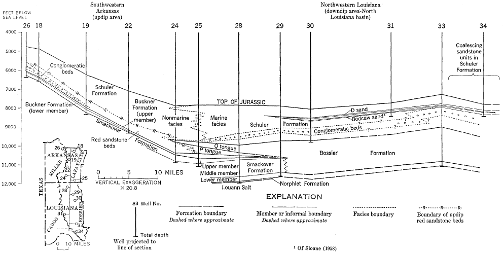
Smackover and Bossier Formations geologic cross section.png - Pi3.124

Smackover Formation areal extent.png - Pi3.124

363 of 'A history of the North-Western Editorial Excursion to Arkansas ... By T. B. Mills & Co' (11114777726).jpg - Artix Kreiger 2

365 of 'A history of the North-Western Editorial Excursion to Arkansas ... By T. B. Mills & Co' (11111698114).jpg - Artix Kreiger 2
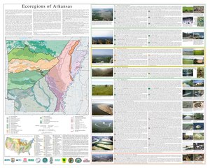
Level IV ecoregions, Arkansas.pdf - Brandonrush
Arkansas Valley ecoregion, Level III.png - Brandonrush
Surface geology, Buffalo River tributaries watershed - Marion, Newton, Pope, Searcy, and Van Buren counties, Arkansas LOC 92682560.tif - Fæ

Surface geology, Buffalo River tributaries watershed - Marion, Newton, Pope, Searcy, and Van Buren counties, Arkansas LOC 92682560.jpg - Fæ

Geologic map, Flat Bayou, portion of the Plum Bayou Watershed, Jefferson County, Arkansas LOC 85693531.jpg - Fæ
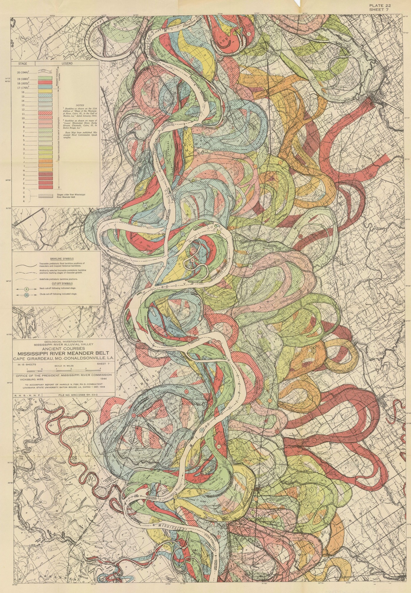
Meanders-Mississippi-maps-01.jpg - ManuRoquette

Meanders-Mississippi-maps-01 (cropped).jpg - Tibet Nation

Mississippi River (ASTER).jpg - OptimusPrimeBot