Wikimedi'Òc
Modes d'emploi

Cet album fait partie des albums
Cet album photos contient les sous-albums suivants :


Overgrown western ditch and rampart of Caer Digoll-Beacon Ring - geograph.org.uk - 7519672.jpg - GeographBot

'Isfryn' - geograph.org.uk - 7545463.jpg - GeographBot

Roadworks on the A490 - geograph.org.uk - 7577937.jpg - GeographBot

Entrance to Church House Farm - geograph.org.uk - 7615883.jpg - GeographBot

Four Crosses - geograph.org.uk - 7615884.jpg - GeographBot

St Mary's Church, Trelystan - geograph.org.uk - 7615885.jpg - GeographBot

Offa's Dyke Path - geograph.org.uk - 7615913.jpg - GeographBot

Fence with water trough - geograph.org.uk - 7615917.jpg - GeographBot

Edge of sloping field - geograph.org.uk - 7615920.jpg - GeographBot

Rosehill - geograph.org.uk - 7615923.jpg - GeographBot

Leaving Forden on Offa's Dyke Path - geograph.org.uk - 7615925.jpg - GeographBot

Approaching road junction in Forden - geograph.org.uk - 7615929.jpg - GeographBot

Field of stubble south of Forden - geograph.org.uk - 7615931.jpg - GeographBot

Gate on Offa's Dyke - geograph.org.uk - 7615937.jpg - GeographBot
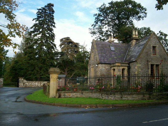
Lodge and drive to Leighton Hall - geograph.org.uk - 252085.jpg - GeographBot

Fron Farm - geograph.org.uk - 488987.jpg - GeographBot

Edderton Hall - geograph.org.uk - 553663.jpg - GeographBot

Crossing Gates, Fron Bank - geograph.org.uk - 575714.jpg - GeographBot

Camlad from Shiregrove Bridge - geograph.org.uk - 660211.jpg - GeographBot

Farm at Lower Leighton - geograph.org.uk - 811558.jpg - GeographBot

Road junction on road to Buttington - geograph.org.uk - 811557.jpg - GeographBot

Storm Damage Opposite Gunley Hall - geograph.org.uk - 819575.jpg - GeographBot

Towards Red House - geograph.org.uk - 819584.jpg - GeographBot

View over Afon Hafren valley to welshpool - geograph.org.uk - 811555.jpg - GeographBot

Green Wood - geograph.org.uk - 827074.jpg - GeographBot

Lane to B4388 - geograph.org.uk - 826737.jpg - GeographBot

Lane to Long Mountain - geograph.org.uk - 827061.jpg - GeographBot

Offa's Pool - geograph.org.uk - 827709.jpg - GeographBot

Outbuilding near Cwm Farm - geograph.org.uk - 826772.jpg - GeographBot

Part of The Leighton Estate - geograph.org.uk - 827706.jpg - GeographBot

View from Pant-y-bwch - geograph.org.uk - 827722.jpg - GeographBot

Steps through the Leighton Estate - geograph.org.uk - 835519.jpg - GeographBot

Turn right at the sycamore - geograph.org.uk - 835515.jpg - GeographBot

Across Offa's Pool - geograph.org.uk - 986538.jpg - GeographBot

Brick channel near Offa's Pool - geograph.org.uk - 986582.jpg - GeographBot

Brook entering Offa's Pool - geograph.org.uk - 986483.jpg - GeographBot

Corner of the dam on Offa's Pool - geograph.org.uk - 986509.jpg - GeographBot

Culvert over the brook - geograph.org.uk - 986324.jpg - GeographBot

Forest track, Leighton Park woods - geograph.org.uk - 987109.jpg - GeographBot

Forestry tractor - geograph.org.uk - 986262.jpg - GeographBot

Fungus by the lower pool - geograph.org.uk - 987104.jpg - GeographBot

Fungus in the wood - geograph.org.uk - 986744.jpg - GeographBot

Fungus on a tree stump - geograph.org.uk - 986468.jpg - GeographBot

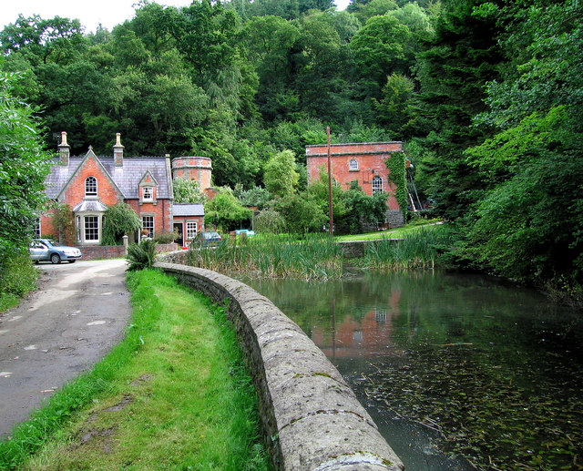
Lower pool in Leighton Park woods - geograph.org.uk - 986852.jpg - GeographBot

Lower pool in Leighton Park woods - geograph.org.uk - 986889.jpg - GeographBot
No view from Pant-y-Bwch - geograph.org.uk - 985744.jpg - GeographBot

Offa's Dyke path in Leighton Park woods - geograph.org.uk - 986252.jpg - GeographBot

Paddock near Cilcewydd - geograph.org.uk - 985454.jpg - GeographBot

Pant-y-Bwch - geograph.org.uk - 985757.jpg - GeographBot

Pasture near Pant-y-Bwch - geograph.org.uk - 985734.jpg - GeographBot

Pheasant feeding station - geograph.org.uk - 986449.jpg - GeographBot

Pool on the Leighton Estate - geograph.org.uk - 986014.jpg - GeographBot

Pool on the Leighton Estate - geograph.org.uk - 986224.jpg - GeographBot

Power lines through the forest - geograph.org.uk - 985755.jpg - GeographBot

Rolling near Pant-y-bwch - geograph.org.uk - 987717.jpg - GeographBot

Shaggy inkcap (Coprinus comatus) by the lower pool - geograph.org.uk - 987106.jpg - GeographBot

South east slope of Moel y Mab - geograph.org.uk - 987708.jpg - GeographBot

Steep wooded hillside - geograph.org.uk - 986273.jpg - GeographBot

The road to Cilcewydd - geograph.org.uk - 987725.jpg - GeographBot

Track around Offa's Pool - geograph.org.uk - 986294.jpg - GeographBot

Track in Leighton Park woods - geograph.org.uk - 987117.jpg - GeographBot

Welshpool in the mist - geograph.org.uk - 985748.jpg - GeographBot

Distant view of Long Mountain - geograph.org.uk - 1156214.jpg - GeographBot

Stained Grass Window^ - geograph.org.uk - 1225765.jpg - GeographBot

Time To Rest - geograph.org.uk - 1224890.jpg - GeographBot

Church Close Leighton - geograph.org.uk - 1321293.jpg - GeographBot

Downhill from Pant-y-Bwch - geograph.org.uk - 1321307.jpg - GeographBot

Footpath through Leighton Estate - geograph.org.uk - 1321301.jpg - GeographBot

River Camlad upstream of Pont-Y-Gaer - geograph.org.uk - 1320240.jpg - GeographBot

Road east from church - geograph.org.uk - 1321288.jpg - GeographBot

Road out of Leighton - geograph.org.uk - 1321296.jpg - GeographBot

Short Cross Road Junction - geograph.org.uk - 1321313.jpg - GeographBot
Transmitter Masts - geograph.org.uk - 1321316.jpg - GeographBot

River Camlad from road bridge - geograph.org.uk - 1368561.jpg - GeographBot

River Camlad looking north - geograph.org.uk - 1368555.jpg - GeographBot

The Gaer house - geograph.org.uk - 1368569.jpg - GeographBot

Weir on River Severn - geograph.org.uk - 1376692.jpg - GeographBot

Fields above River Severn - geograph.org.uk - 1398024.jpg - GeographBot

Gate and track across fields - geograph.org.uk - 1398027.jpg - GeographBot

Leighton Hall gateway - geograph.org.uk - 1398030.jpg - GeographBot

Road to Leighton - geograph.org.uk - 1398025.jpg - GeographBot
Houses near Leighton - geograph.org.uk - 1426472.jpg - GeographBot

Entrance gates near Church House - geograph.org.uk - 1512316.jpg - GeographBot

Farm near Edderton Hall - geograph.org.uk - 1515231.jpg - GeographBot

Footpath to Trelystan - geograph.org.uk - 1512321.jpg - GeographBot

Hedging along main road - geograph.org.uk - 1515228.jpg - GeographBot

Lane through Hem - geograph.org.uk - 1515224.jpg - GeographBot

Lane through the woods - geograph.org.uk - 1512324.jpg - GeographBot

Leighton estate - no entry - geograph.org.uk - 1512319.jpg - GeographBot

Meadow at Dolydd Hafren - geograph.org.uk - 1512336.jpg - GeographBot

Offa's Dyke path - geograph.org.uk - 1512326.jpg - GeographBot

Offa's Dyke path sign - geograph.org.uk - 1512330.jpg - GeographBot

Railway at Cilcewydd - geograph.org.uk - 1512378.jpg - GeographBot

Road to Leighton - geograph.org.uk - 1512384.jpg - GeographBot

The Lodge Leighton Estate - geograph.org.uk - 1515220.jpg - GeographBot

Track to Dolydd Hafren Nature Reserve - geograph.org.uk - 1512339.jpg - GeographBot

View down the hill - geograph.org.uk - 1512311.jpg - GeographBot

Woodlands Cross roads - geograph.org.uk - 1515223.jpg - GeographBot

Mixed species plantation - geograph.org.uk - 643952.jpg - GeographBot

Poplar tree plantation - geograph.org.uk - 643941.jpg - GeographBot

Severnside farm buildings - geograph.org.uk - 643830.jpg - GeographBot

Powys Wales communities - Forden with Leighton and Trelystan locator.png - Sionk

Pasture near Leighton, Powys - geograph.org.uk - 1921325.jpg - GeographBot

The Cock Hotel, Forden, Powys - geograph.org.uk - 1926876.jpg - GeographBot

Part of Offa's Dyke Path south of Forden - geograph.org.uk - 2060316.jpg - GeographBot

Offa's Dyke Path approaches Montgomery - geograph.org.uk - 2060332.jpg - GeographBot

B4381 across the River Severn - geograph.org.uk - 2093359.jpg - GeographBot

B4388 at Leighton - geograph.org.uk - 2093409.jpg - GeographBot
Memorial stone at Beacon Ring - geograph.org.uk - 2164298.jpg - GeographBot

Wind damage in Cwm Dingle - geograph.org.uk - 2164303.jpg - GeographBot

Line of trees at Leighton - geograph.org.uk - 2164310.jpg - GeographBot

Grid Service - geograph.org.uk - 2164779.jpg - GeographBot

Electricity substation near Forden - geograph.org.uk - 2193159.jpg - GeographBot

View southeast across England to Wales - geograph.org.uk - 2193183.jpg - GeographBot

Ditch on Hem Moor - geograph.org.uk - 2193310.jpg - GeographBot

Hem farms - geograph.org.uk - 2193327.jpg - GeographBot

Hem Crest and Hem Bank - geograph.org.uk - 2193368.jpg - GeographBot

High Oaks Lodge - geograph.org.uk - 2193378.jpg - GeographBot

Forden entrance sign - geograph.org.uk - 2404611.jpg - GeographBot
Gates to Leighton Hall - geograph.org.uk - 2570546.jpg - GeographBot

Bird hide at Dolydd Hafren - geograph.org.uk - 2605500.jpg - GeographBot

River Severn - geograph.org.uk - 2605504.jpg - GeographBot

Dolydd Hafren Nature Reserve carpark - geograph.org.uk - 2756451.jpg - GeographBot

Carpark at Dolydd Hafren Nature Reserve - geograph.org.uk - 2756455.jpg - GeographBot

Bird hide at the Dolydd Hafren Nature Reserve - geograph.org.uk - 2756462.jpg - GeographBot

Bird hide at Dolydd Hafren Nature Reserve - geograph.org.uk - 2756470.jpg - GeographBot

Inside the hide - geograph.org.uk - 2756477.jpg - GeographBot

River Rhiw-Afon Riw form the River Severn - geograph.org.uk - 2756486.jpg - GeographBot

The Cock Hotel in Forden - geograph.org.uk - 2939277.jpg - GeographBot

Old barn in Forden - geograph.org.uk - 2939284.jpg - GeographBot

The River Severn from Leighton Bridge - geograph.org.uk - 3155286.jpg - GeographBot

Leighton Bridge - geograph.org.uk - 3155290.jpg - GeographBot

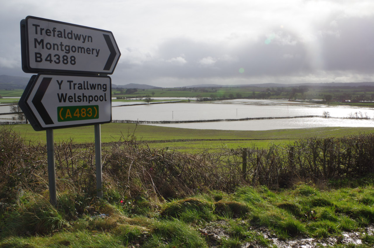
Flooded fields near Welshpool - geograph.org.uk - 3155304.jpg - GeographBot

Severn Valley flooding - geograph.org.uk - 3155318.jpg - GeographBot

The end of Leighton Road - geograph.org.uk - 3155323.jpg - GeographBot

Muddy fields at Lower Leighton - geograph.org.uk - 3155331.jpg - GeographBot

Lower Leighton Farm - geograph.org.uk - 3155343.jpg - GeographBot

The B4388 passing The White House - geograph.org.uk - 3155358.jpg - GeographBot

The B4388 near Leighton - geograph.org.uk - 3155365.jpg - GeographBot

Field of maize at Leighton - geograph.org.uk - 3155380.jpg - GeographBot

Lively young cattle at Leighton - geograph.org.uk - 3155386.jpg - GeographBot

Farm track in the Severn Valley - geograph.org.uk - 3155516.jpg - GeographBot

The estate of Leighton Hall - geograph.org.uk - 3155559.jpg - GeographBot

Cows in the Severn Valley - geograph.org.uk - 3155570.jpg - GeographBot

Severn Caravan Park - geograph.org.uk - 3155591.jpg - GeographBot
Long Mountain - Beacon Ring - geograph.org.uk - 3346329.jpg - GeographBot

Leighton Hall Summerhouse - geograph.org.uk - 3374424.jpg - GeographBot

Greenwood Lodge, Leighton Estate.jpg - Dave.Dunford

A490 near Rhyd-y-groes - geograph.org.uk - 3580993.jpg - GeographBot

Field next to the A490 - geograph.org.uk - 3581003.jpg - GeographBot

Upper Hem Farm - geograph.org.uk - 3581008.jpg - GeographBot

Double bends near Gunley Hall - geograph.org.uk - 3681435.jpg - GeographBot

Approaching entrance to Llwynyrhedydd - geograph.org.uk - 3681444.jpg - GeographBot

Looking south west from minor road near Woodlands - geograph.org.uk - 3724884.jpg - GeographBot

Looking south west from minor road near Woodlands - geograph.org.uk - 3724887.jpg - GeographBot

Arable fields in the Camlad valley - geograph.org.uk - 3724892.jpg - GeographBot

The lane near Woodlands - geograph.org.uk - 3724913.jpg - GeographBot

Poorly poplars - geograph.org.uk - 3724920.jpg - GeographBot

Poorly poplars - geograph.org.uk - 3724923.jpg - GeographBot

Sick looking oak leaves - geograph.org.uk - 3724926.jpg - GeographBot

Sick looking oak leaves - geograph.org.uk - 3724931.jpg - GeographBot

View ESE from minor road near Woodlands - geograph.org.uk - 3724950.jpg - GeographBot

View SE from minor road near Woodlands - geograph.org.uk - 3724965.jpg - GeographBot

Lane approaching Hem farms - geograph.org.uk - 3808448.jpg - GeographBot

Entrance to Upper Hem Farm - geograph.org.uk - 3808449.jpg - GeographBot

Flooding at Rhydwhyman - geograph.org.uk - 3843965.jpg - GeographBot

Lane to Marton - geograph.org.uk - 3844691.jpg - GeographBot
Camlad Valley in flood - geograph.org.uk - 3844711.jpg - GeographBot

Wind blown branches at Leighton church - geograph.org.uk - 3917252.jpg - GeographBot

Powis Castle - geograph.org.uk - 3917258.jpg - GeographBot

Welshpool seen across the flooded Severn from Leighton churchyard - geograph.org.uk - 3917264.jpg - GeographBot

Forden, The Cock Hotel - geograph.org.uk - 4074413.jpg - GeographBot

Field boundary near Forden - geograph.org.uk - 4074417.jpg - GeographBot

The path was difficult to follow - geograph.org.uk - 4074424.jpg - GeographBot

Will this rain ever stop - geograph.org.uk - 4074427.jpg - GeographBot

This rain is getting beyond a joke - geograph.org.uk - 4074434.jpg - GeographBot

It can't possibly get any wetter - geograph.org.uk - 4074438.jpg - GeographBot

Leighton Estate gates to the forest - geograph.org.uk - 4074441.jpg - GeographBot

Offa's Dyke National Trail near Offa's Pool - geograph.org.uk - 4074447.jpg - GeographBot

Offa's Dyke National Trail - geograph.org.uk - 4074450.jpg - GeographBot

Something's going to happen, don't know what though - geograph.org.uk - 4074455.jpg - GeographBot
Offa's Dyke Path passes a hillfort - geograph.org.uk - 4169279.jpg - GeographBot

Corndon Hill from A490 between Forden and Chirbury, 1951 - geograph.org.uk - 4235063.jpg - GeographBot

Church Hall, Forden - geograph.org.uk - 4241478.jpg - GeographBot

Farmyard, Leighton Farm Buildings - geograph.org.uk - 4262989.jpg - GeographBot

Barns, Leighton Farm Buildings - geograph.org.uk - 4263001.jpg - GeographBot

Leighton Farm Buildings - geograph.org.uk - 4271858.jpg - GeographBot

Leighton Farm Buildings - geograph.org.uk - 4271859.jpg - GeographBot

Leighton Farm Buildings - geograph.org.uk - 4271862.jpg - GeographBot

Remains of old dam, Offa's Pool, Long Mountain - geograph.org.uk - 4277201.jpg - GeographBot

High Bridge, Leighton - geograph.org.uk - 4308939.jpg - GeographBot

On Offa's Dyke Path near Pound House - geograph.org.uk - 4372183.jpg - GeographBot

Sign on Offa's Dyke Path - geograph.org.uk - 4372185.jpg - GeographBot

Pound House beside Offa's Dyke Path - geograph.org.uk - 4372189.jpg - GeographBot

On Offa's Dyke Path between Fordon and Montgomery - geograph.org.uk - 4372204.jpg - GeographBot

On Offa's Dyke Path looking southwards toward Montgomery - geograph.org.uk - 4372209.jpg - GeographBot

Bales in a field beside Offa's Dyke Path - geograph.org.uk - 4372214.jpg - GeographBot

Campsite beside Offa's Dyke Path in Forden - geograph.org.uk - 4372222.jpg - GeographBot

On Offa's Dyke Path in Forden - geograph.org.uk - 4372227.jpg - GeographBot

Property beside Offa's Dyke Path in Forden - geograph.org.uk - 4372231.jpg - GeographBot

ODP in Forden - geograph.org.uk - 4372233.jpg - GeographBot

View south-east off the train, towards Forden - geograph.org.uk - 4374725.jpg - GeographBot

Trees along the River Severn - geograph.org.uk - 4441734.jpg - GeographBot

Trees along the River Severn - geograph.org.uk - 4441737.jpg - GeographBot

River Severn - geograph.org.uk - 4441739.jpg - GeographBot

River Severn - geograph.org.uk - 4441742.jpg - GeographBot

River Severn through trees - geograph.org.uk - 4441743.jpg - GeographBot

River Severn through trees - geograph.org.uk - 4441927.jpg - GeographBot

Severnside Farm - geograph.org.uk - 4441928.jpg - GeographBot

Farmland, Severnside - geograph.org.uk - 4441929.jpg - GeographBot

Tree in a field - geograph.org.uk - 4441931.jpg - GeographBot

Farmland, Upper Munlyn - geograph.org.uk - 4441933.jpg - GeographBot

Farmland near Fflos - geograph.org.uk - 4441934.jpg - GeographBot

Edderton Hall, 1993 - geograph.org.uk - 4448435.jpg - GeographBot

Northward up Severn Valley to Welshpool, from Edderton Hall, 1993 - geograph.org.uk - 4448451.jpg - GeographBot

Ger Ffordun - Near Forden - geograph.org.uk - 4522585.jpg - GeographBot

Coed Parc Leighton Park Woods - geograph.org.uk - 4522608.jpg - GeographBot

Llyn bach - Small lake - geograph.org.uk - 4522637.jpg - GeographBot

Willows along the Severn, just upstream of Cilcewydd Bridge - geograph.org.uk - 4552275.jpg - GeographBot

Willows along the Severn, upstream of Cilcewydd Bridge - geograph.org.uk - 4552281.jpg - GeographBot

Severnside farm from the railway - geograph.org.uk - 4552719.jpg - GeographBot

The Grove, from a passing train - geograph.org.uk - 4553328.jpg - GeographBot

Ploughed field by the railway line - geograph.org.uk - 4553336.jpg - GeographBot

Ploughed fields south of Upper Munlyn - geograph.org.uk - 4553345.jpg - GeographBot

Straight road west of Rhyd-y-groes - geograph.org.uk - 4591831.jpg - GeographBot

Approaching crossroads near Four Crosses - geograph.org.uk - 4598257.jpg - GeographBot

Road junction at Four Crosses - geograph.org.uk - 4598258.jpg - GeographBot

Long Mountain road passing woodland near Cwm-Dugan - geograph.org.uk - 4598265.jpg - GeographBot

Approaching Cwm-dugan entrance - geograph.org.uk - 4598274.jpg - GeographBot

Across the fields from the barn near Short Cross - geograph.org.uk - 4598277.jpg - GeographBot

Road junction at Short Cross - geograph.org.uk - 4598281.jpg - GeographBot

Lane to Mulsop Farm - geograph.org.uk - 4598287.jpg - GeographBot

Lower Leighton Farm - geograph.org.uk - 4598331.jpg - GeographBot

Marton road from Sevenwells entrance - geograph.org.uk - 4598341.jpg - GeographBot

Start of footpath at Pant-y-bwch - geograph.org.uk - 4598346.jpg - GeographBot
Transmitters at Beacon Ring Fort - geograph.org.uk - 4604296.jpg - GeographBot
Track to transmitters from Short Cross - geograph.org.uk - 4604298.jpg - GeographBot

Tir amaethyddol ger Rhyd-y-Groes - Agricultural land near Rhyd-y-Groes - geograph.org.uk - 4605329.jpg - GeographBot

Two trees - geograph.org.uk - 4628976.jpg - GeographBot

Static home - geograph.org.uk - 4628978.jpg - GeographBot

Hedgeline - geograph.org.uk - 4628995.jpg - GeographBot

Farmland, Severn Valley - geograph.org.uk - 4629003.jpg - GeographBot

Offa's Dyke Path near Forden - geograph.org.uk - 4909142.jpg - GeographBot

On Offa's Dyke Path north of Forden village - geograph.org.uk - 4909149.jpg - GeographBot

Looking west from Offa's Dyke Path and Offa's Dyke itself just north of Forden - geograph.org.uk - 4909158.jpg - GeographBot

Primroses on the bank or verge beside the lane near Forden - geograph.org.uk - 4909167.jpg - GeographBot

The lane along Long Mountain - geograph.org.uk - 4910041.jpg - GeographBot

View from the lane on Long Mountain - geograph.org.uk - 4910053.jpg - GeographBot

Looking west from Offa's Dyke Path and Offa's Dyke itself just north of Forden - geograph.org.uk - 4910939.jpg - GeographBot

Pine trees on the edge of the Leighton Estate near Forden - geograph.org.uk - 4910960.jpg - GeographBot

Part of Offa's Dyke Path in Leighton Woods near Forden - geograph.org.uk - 4910977.jpg - GeographBot

On Offa's Dyke Path in the Leighton Estate north of Forden village - geograph.org.uk - 4911088.jpg - GeographBot

On Offa's Dyke Path in the Leighton Estate north of Forden village - geograph.org.uk - 4912234.jpg - GeographBot

On Offa's Dyke Path in the Leighton Estate north of Forden village - geograph.org.uk - 4912248.jpg - GeographBot

On Offa's Dyke Path in the Leighton Estate north of Forden village - geograph.org.uk - 4912257.jpg - GeographBot

Offa's Dyke Path in Leighton Woods north of Forden - geograph.org.uk - 4912404.jpg - GeographBot

Offa's Dyke Path fingerpost in Leighton Park Woods - geograph.org.uk - 4912422.jpg - GeographBot

Monkey-puzzle trees in Leighton Park Woods beside Offa's Dyke Path - geograph.org.uk - 4912439.jpg - GeographBot

Stepped section of Offa's Dyke Path in Leighton Woods - geograph.org.uk - 4912465.jpg - GeographBot

On Offa's Dyke Path in Leighton Park Woods - geograph.org.uk - 4912484.jpg - GeographBot

On Offa's Dyke Path in Leighton Park Woods - geograph.org.uk - 4912506.jpg - GeographBot

Pool beside Offa's Dyke Path in Leighton Woods - geograph.org.uk - 4912515.jpg - GeographBot

Snowdrops and snow beside the Offa's Dyke Path near the Leighton Park Estate - geograph.org.uk - 4912531.jpg - GeographBot

Pant-y-bwch farm beside Offa's Dyke Path - geograph.org.uk - 4912545.jpg - GeographBot

On Offa's Dyke Path above Welshpool near Pant-y-bwch farm - geograph.org.uk - 4912597.jpg - GeographBot

Snowy pasture - geograph.org.uk - 4912618.jpg - GeographBot

Pasture beside Philips's Gorse - geograph.org.uk - 4912640.jpg - GeographBot

Beside Philips's Gorse - geograph.org.uk - 4912661.jpg - GeographBot
Beacon Ring above Welshpool - geograph.org.uk - 4912674.jpg - GeographBot
Information board at Beacon Ring hillfort - geograph.org.uk - 4912693.jpg - GeographBot
TV mast at Beacon Ring hillfort above Welshpool - geograph.org.uk - 4912709.jpg - GeographBot
Offa's Dyke path at Cwmdingle Plantation near Beacon Ring hillfort - geograph.org.uk - 4913785.jpg - GeographBot

Road junction at Lower Leighton Farm near Welshpool - geograph.org.uk - 4915441.jpg - GeographBot

Part of Lower Leighton Farm - geograph.org.uk - 4915465.jpg - GeographBot

The B4381 into Welshpool approaching Leighton Bridge - geograph.org.uk - 4916715.jpg - GeographBot

Footbridge beside Leighton Bridge, over the River Severn at Welshpool - geograph.org.uk - 4916731.jpg - GeographBot

The River Severn - Afon Hafren at Leighton Bridge near Welshpool - geograph.org.uk - 4916745.jpg - GeographBot

Embankment beside the River Severn near Welshpool - geograph.org.uk - 4917270.jpg - GeographBot

Rabbit in the field - geograph.org.uk - 4917286.jpg - GeographBot

The bank of the River Severn at Welshpool in spring - geograph.org.uk - 4917301.jpg - GeographBot

Fields between the River Severn and Leighton near Welshpool - geograph.org.uk - 4917314.jpg - GeographBot

Drive to Gravel Lodge - geograph.org.uk - 4917318.jpg - GeographBot

View towards Leighton church tower - geograph.org.uk - 4917327.jpg - GeographBot

Property beside the road in Leighton near Welshpool - geograph.org.uk - 4918231.jpg - GeographBot

Approaching the Leighton Park Farm near Welshpool - geograph.org.uk - 4918257.jpg - GeographBot

House on the Leighton Park Farm complex - geograph.org.uk - 4918270.jpg - GeographBot

Driveway to Brook House at Leighton Park Farm - geograph.org.uk - 4918279.jpg - GeographBot

Buildings on the Leighton Park Estate near Welshpool - geograph.org.uk - 4918286.jpg - GeographBot

Man made cascades on the stream in the Leighton Park Estate - geograph.org.uk - 4918295.jpg - GeographBot
Clear felling in the woods of the Leighton Park Estate - geograph.org.uk - 4918302.jpg - GeographBot

Lake or pool on the Leighton Park Estate - geograph.org.uk - 4918312.jpg - GeographBot

Cottage in the woods - geograph.org.uk - 4918348.jpg - GeographBot

Roadside retail near Forden - geograph.org.uk - 4918354.jpg - GeographBot

Looking down the Camlad from the railway - geograph.org.uk - 5025534.jpg - GeographBot

Upper Munlyn from the railway - geograph.org.uk - 5026673.jpg - GeographBot

Holy Trinity church, Leighton - geograph.org.uk - 5244190.jpg - GeographBot

Section river bank on the River Severn near Berriew - geograph.org.uk - 5464511.jpg - GeographBot

The Hoare Stone - geograph.org.uk - 5501421.jpg - GeographBot

Church Hall at Forden - geograph.org.uk - 5538615.jpg - GeographBot

The Cock Hotel - geograph.org.uk - 5538616.jpg - GeographBot

Leighton, a well-hidden telephone box - geograph.org.uk - 5719089.jpg - GeographBot

Leighton, the telephone box - geograph.org.uk - 5719092.jpg - GeographBot

Forestry, Leighton Estate, 1988 - geograph.org.uk - 5770705.jpg - GeographBot

View towards Montgomery - geograph.org.uk - 5868748.jpg - GeographBot

Slopes of Long Mountain - geograph.org.uk - 5868750.jpg - GeographBot

Gunley - geograph.org.uk - 5868753.jpg - GeographBot

Longhorn cattle, Gunley - geograph.org.uk - 5868759.jpg - GeographBot

Parkland by Gunley Hall - geograph.org.uk - 5868762.jpg - GeographBot

It can't possibly get any drier - geograph.org.uk - 5869715.jpg - GeographBot

St Mary's Church, Trelystan - geograph.org.uk - 5869717.jpg - GeographBot

Badnage Wood - geograph.org.uk - 5870167.jpg - GeographBot

Trelystan - geograph.org.uk - 5870170.jpg - GeographBot

View over Welshpool - geograph.org.uk - 5870177.jpg - GeographBot

Sheep on Long Mountain - geograph.org.uk - 5870181.jpg - GeographBot

Woodland, Long Mountain - geograph.org.uk - 5870184.jpg - GeographBot

Trelystan to Leighton road - geograph.org.uk - 5870187.jpg - GeographBot

Signpost, Offa's Dyke path - geograph.org.uk - 5870188.jpg - GeographBot

Leighton - geograph.org.uk - 5870199.jpg - GeographBot

Field of Barley near Hem Farm - geograph.org.uk - 5966637.jpg - GeographBot

Field of Barley near Hem Farm - geograph.org.uk - 5966640.jpg - GeographBot

Field of Barley near Hem Farm - geograph.org.uk - 5966652.jpg - GeographBot

Hem Farm - geograph.org.uk - 5966761.jpg - GeographBot

Young maize by the road to Hem Farm - geograph.org.uk - 5966799.jpg - GeographBot

Track to Woodlands - geograph.org.uk - 5966829.jpg - GeographBot

Footpath^ - geograph.org.uk - 5966856.jpg - GeographBot

Looking across the field - geograph.org.uk - 5966878.jpg - GeographBot

Towards Forden - geograph.org.uk - 5966884.jpg - GeographBot

Towards Forden - geograph.org.uk - 5966886.jpg - GeographBot

St Michael's church, Forden - geograph.org.uk - 5966897.jpg - GeographBot

The Church of St Michael and All Angels, Forden - geograph.org.uk - 5966904.jpg - GeographBot

The Church of St Michael and All Angels, Forden - geograph.org.uk - 5966908.jpg - GeographBot

The Church of St Michael and All Angels, Forden - geograph.org.uk - 5966910.jpg - GeographBot

The Church of St Michael and All Angels, Forden - geograph.org.uk - 5966917.jpg - GeographBot

The Church of St Michael and All Angels, Forden - geograph.org.uk - 5966928.jpg - GeographBot

The Church of St Michael and All Angels, Forden - geograph.org.uk - 5966934.jpg - GeographBot

St Michael's church, Forden - geograph.org.uk - 5966936.jpg - GeographBot

The Church of St Michael and All Angels, Forden - geograph.org.uk - 5967044.jpg - GeographBot

The Church of St Michael and All Angels, Forden - geograph.org.uk - 5967053.jpg - GeographBot

The Church of St Michael and All Angels, Forden - geograph.org.uk - 5967063.jpg - GeographBot

The Church of St Michael and All Angels, Forden - geograph.org.uk - 5967073.jpg - GeographBot

The Church of St Michael and All Angels, Forden - geograph.org.uk - 5967084.jpg - GeographBot

The Church of St Michael and All Angels, Forden - geograph.org.uk - 5967098.jpg - GeographBot

The Church of St Michael and All Angels, Forden - geograph.org.uk - 5967118.jpg - GeographBot

The Church of St Michael and All Angels, Forden - geograph.org.uk - 5967119.jpg - GeographBot

The Church of St Michael and All Angels, Forden - geograph.org.uk - 5967124.jpg - GeographBot

The Church of St Michael and All Angels, Forden - geograph.org.uk - 5967125.jpg - GeographBot

Churchyard of the Church of St Michael and All Angels, Forden - geograph.org.uk - 5967132.jpg - GeographBot

Churchyard of the Church of St Michael and All Angels, Forden - geograph.org.uk - 5967140.jpg - GeographBot

Churchyard of the Church of St Michael and All Angels, Forden - geograph.org.uk - 5967149.jpg - GeographBot

Churchyard of the Church of St Michael and All Angels, Forden - geograph.org.uk - 5967150.jpg - GeographBot

Churchyard of the Church of St Michael and All Angels, Forden - geograph.org.uk - 5967165.jpg - GeographBot

Churchyard of the Church of St Michael and All Angels, Forden - geograph.org.uk - 5967175.jpg - GeographBot

Churchyard of the Church of St Michael and All Angels, Forden - geograph.org.uk - 5967194.jpg - GeographBot

Churchyard of the Church of St Michael and All Angels, Forden - geograph.org.uk - 5967199.jpg - GeographBot

Churchyard of the Church of St Michael and All Angels, Forden - geograph.org.uk - 5967204.jpg - GeographBot

Churchyard of the Church of St Michael and All Angels, Forden - geograph.org.uk - 5967210.jpg - GeographBot

Churchyard of the Church of St Michael and All Angels, Forden - geograph.org.uk - 5967213.jpg - GeographBot

Churchyard of the Church of St Michael and All Angels, Forden - geograph.org.uk - 5967221.jpg - GeographBot

Churchyard of the Church of St Michael and All Angels, Forden - geograph.org.uk - 5967223.jpg - GeographBot

Churchyard of the Church of St Michael and All Angels, Forden - geograph.org.uk - 5967225.jpg - GeographBot

Churchyard of the Church of St Michael and All Angels, Forden - geograph.org.uk - 5967229.jpg - GeographBot

Churchyard of the Church of St Michael and All Angels, Forden - geograph.org.uk - 5967233.jpg - GeographBot

Churchyard of the Church of St Michael and All Angels, Forden - geograph.org.uk - 5967310.jpg - GeographBot

Churchyard of the Church of St Michael and All Angels, Forden - geograph.org.uk - 5967324.jpg - GeographBot

War memorial, Forden - geograph.org.uk - 5967328.jpg - GeographBot

Field opposite the church, Forden - geograph.org.uk - 5967331.jpg - GeographBot

Field opposite the church, Forden - geograph.org.uk - 5967334.jpg - GeographBot

The Church of St Michael and All Angels, Forden - geograph.org.uk - 5967339.jpg - GeographBot

Stile onto footpath, Forden - geograph.org.uk - 5967341.jpg - GeographBot

Offa's Dyke embankment S of Forden - geograph.org.uk - 6013945.jpg - GeographBot

Offa's Dyke Path, E of Offa's View near Forden - geograph.org.uk - 6013951.jpg - GeographBot

On Offa's Dyke Path near Camlad crossing, Montgomery - geograph.org.uk - 6013956.jpg - GeographBot

Old Milestone by the A490, south of Cilcewydd - geograph.org.uk - 6048615.jpg - GeographBot

The Old Corn Mill - Cilcewydd - geograph.org.uk - 6148398.jpg - GeographBot

Junction on the A490 - geograph.org.uk - 6152349.jpg - GeographBot

The A490 near Shiregrove Bridge - geograph.org.uk - 6152351.jpg - GeographBot

Entering Forden - geograph.org.uk - 6154090.jpg - GeographBot

The A490 at Nantcribba Cottages - geograph.org.uk - 6154093.jpg - GeographBot

Forden - geograph.org.uk - 6154095.jpg - GeographBot

Cilcewydd - geograph.org.uk - 6154099.jpg - GeographBot

The A490 near Mount Pleasant - geograph.org.uk - 6154169.jpg - GeographBot

Footbridge crossing the Camlad - geograph.org.uk - 6236464.jpg - GeographBot

Court House, Ffordun - geograph.org.uk - 6236658.jpg - GeographBot

Pentre Farm - geograph.org.uk - 6236661.jpg - GeographBot

Weir on the Severn - geograph.org.uk - 6236665.jpg - GeographBot

Wales Powys Community Forden with Leighton and Trelystan map.svg - DankJae

Bridge over Afon Hafren - geograph.org.uk - 6586889.jpg - GeographBot

Ordnance Survey Cut Mark - geograph.org.uk - 6998351.jpg - GeographBot

St Mary the Virgin's Church - geograph.org.uk - 6998352.jpg - GeographBot

Ordnance Survey Cut Mark - geograph.org.uk - 6998353.jpg - GeographBot

Ordnance Survey Cut Mark - geograph.org.uk - 6998354.jpg - GeographBot

Ordnance Survey Cut Mark - geograph.org.uk - 6998355.jpg - GeographBot

Ordnance Survey Cut Mark - geograph.org.uk - 6998356.jpg - GeographBot

Ordnance Survey Cut Mark - geograph.org.uk - 6998357.jpg - GeographBot

Ordnance Survey Cut Mark - geograph.org.uk - 6998358.jpg - GeographBot

View from Powis Castle - geograph.org.uk - 7046171.jpg - GeographBot

Offa's Dyke Path through Cwmdingle Plantation - geograph.org.uk - 7114764.jpg - GeographBot
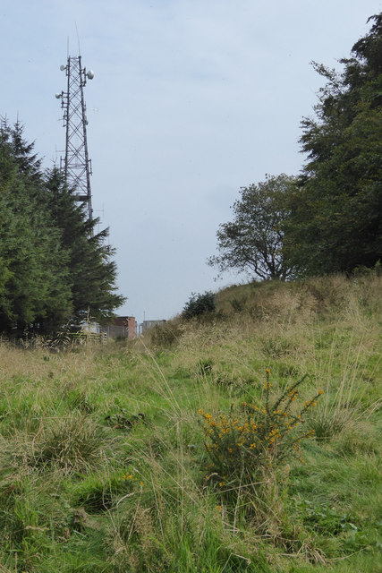
Telecommunications mast at Beacon Ring - geograph.org.uk - 7115440.jpg - GeographBot
Northern path to the summit of Caer Digoll-Beacon Ring - geograph.org.uk - 7115460.jpg - GeographBot
View of the Severn Valley from Caer Digoll-Beacon Ring - geograph.org.uk - 7115464.jpg - GeographBot
Memorial stone on Beacon Ring - geograph.org.uk - 7115470.jpg - GeographBot
Triangulation pillar on Beacon Ring - geograph.org.uk - 7115479.jpg - GeographBot
Pine and Beech trees on Beacon Ring - geograph.org.uk - 7115485.jpg - GeographBot
Offa's Dyke Path heading southwest from Beacon Ring - geograph.org.uk - 7115490.jpg - GeographBot

Offa's Dyke Path sign on Long Mountain - geograph.org.uk - 7115493.jpg - GeographBot
Caer Digoll-Beacon Ring - geograph.org.uk - 7115496.jpg - GeographBot

Offa's Dyke Path in Phillip's Gorse - geograph.org.uk - 7115497.jpg - GeographBot

Gate in Phillip's Gorse - geograph.org.uk - 7115792.jpg - GeographBot

Big bales at Pant-y-Bwch - geograph.org.uk - 7115794.jpg - GeographBot

Pool on the Leighton Estate - geograph.org.uk - 7115798.jpg - GeographBot

Offa's Dyke Path - geograph.org.uk - 7115799.jpg - GeographBot

Tall conifer in Leighton Estate plantation - geograph.org.uk - 7115804.jpg - GeographBot

Offa's Dyke Path in Leighton Estate woods - geograph.org.uk - 7115811.jpg - GeographBot

Track in Pole Plantation - geograph.org.uk - 7118457.jpg - GeographBot

Greenwood Lodge - geograph.org.uk - 7118458.jpg - GeographBot

Minor road between Trelystan and Kingswood - geograph.org.uk - 7118460.jpg - GeographBot

Offa's Dyke^ - geograph.org.uk - 7118501.jpg - GeographBot

Large house just outside Forden - geograph.org.uk - 7118508.jpg - GeographBot

Heritage Green - geograph.org.uk - 7118511.jpg - GeographBot

Fingerpost, Forden - geograph.org.uk - 7118514.jpg - GeographBot

The Cock Hotel, Forden - geograph.org.uk - 7118517.jpg - GeographBot

St Mary's Church, Forden - geograph.org.uk - 7118519.jpg - GeographBot

Ivy House - geograph.org.uk - 7118521.jpg - GeographBot

Pine Lodge, Leighton Hall Estate - geograph.org.uk - 7118523.jpg - GeographBot

Back Lodge, Leighton Estate - geograph.org.uk - 7118524.jpg - GeographBot

Gateway to Tudor Croft - geograph.org.uk - 7118527.jpg - GeographBot

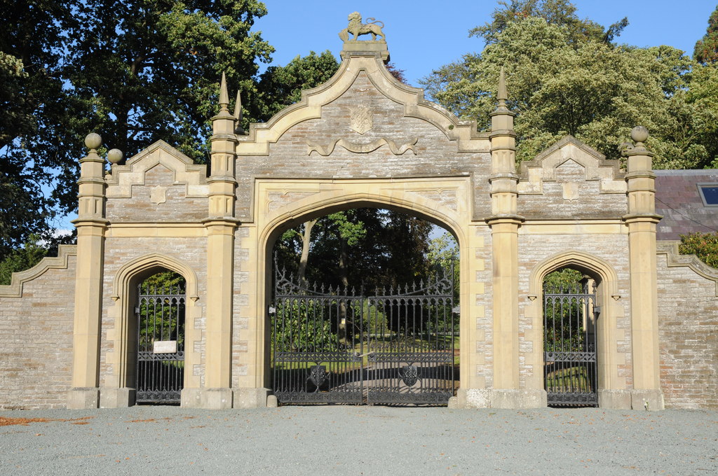
Archways, Gates and Forecourt Walls at the main entrance to Leighton Hall - geograph.org.uk - 7118533.jpg - GeographBot

Leighton Hall and its tower - geograph.org.uk - 7118535.jpg - GeographBot

B4388 south of Leighton - geograph.org.uk - 7118573.jpg - GeographBot

Tafalog - geograph.org.uk - 7118577.jpg - GeographBot

House on the B4388 - geograph.org.uk - 7118582.jpg - GeographBot

Church of the Holy Trinity, Leighton - geograph.org.uk - 7118584.jpg - GeographBot

Castle Court, Leighton - geograph.org.uk - 7118586.jpg - GeographBot

Playground near Leighton Village Hall - geograph.org.uk - 7118587.jpg - GeographBot

Leighton Village Hall - geograph.org.uk - 7118588.jpg - GeographBot

Lower Leighton Farm - geograph.org.uk - 7118590.jpg - GeographBot
Trees around Beacon Ring - geograph.org.uk - 7247327.jpg - GeographBot

Pond covered with duckweed - geograph.org.uk - 7247385.jpg - GeographBot

Remarkable wall on the Leighton estate - geograph.org.uk - 7247583.jpg - GeographBot

Forest road and bridleway heading north - geograph.org.uk - 7247761.jpg - GeographBot

Path junction north of Pentre Farm - geograph.org.uk - 7247938.jpg - GeographBot
Beacon Ring hillfort on the Long Mountain viewed from Walton Camp - geograph.org.uk - 7863939.jpg - GeographBot

Cambrian Line towards Welshpool at Cilcewydd - geograph.org.uk - 7883567.jpg - GeographBot

Strip of grazing between the A490 and the Cambrian Line - geograph.org.uk - 7884157.jpg - GeographBot

A490 heading south from Cilcewydd - geograph.org.uk - 7884158.jpg - GeographBot

Sheep grazing near Cil Cewydd Farm - geograph.org.uk - 7884159.jpg - GeographBot

Field entrance near Cil Cewydd Farm - geograph.org.uk - 7884160.jpg - GeographBot

Minor road towards the B4388 - geograph.org.uk - 7884161.jpg - GeographBot

Parkland near Back Lodge - geograph.org.uk - 7884163.jpg - GeographBot

Hawys - geograph.org.uk - 7884165.jpg - GeographBot

B4388 heading north - geograph.org.uk - 7884166.jpg - GeographBot

Grassland near Gwyn's Barn - geograph.org.uk - 7884167.jpg - GeographBot

B4388 besides woodland - geograph.org.uk - 7884170.jpg - GeographBot

Hillside grazing - geograph.org.uk - 7884172.jpg - GeographBot

B4388 towards Buttington - geograph.org.uk - 7884173.jpg - GeographBot

Lower Leighton Farm - geograph.org.uk - 7884175.jpg - GeographBot

B4388 towards Buttington - geograph.org.uk - 7884176.jpg - GeographBot

Maize crop and power lines, Leighton - geograph.org.uk - 7884177.jpg - GeographBot

B4381 towards Welshpool - geograph.org.uk - 7884179.jpg - GeographBot

Electricity distribution site, Leighton - geograph.org.uk - 7884181.jpg - GeographBot

Road junction, Lower Leighton Farm - geograph.org.uk - 7884851.jpg - GeographBot

Elizabeth II postbox on the A490, Cilcewydd - geograph.org.uk - 7886496.jpg - GeographBot

Cottages on the A490, Cilcewydd - geograph.org.uk - 7886498.jpg - GeographBot

Road near Leighton - geograph.org.uk - 7893143.jpg - GeographBot

Pond near Pant-y-bwch - geograph.org.uk - 7893536.jpg - GeographBot

Offa's Dyke signpost - geograph.org.uk - 7893540.jpg - GeographBot

Wall with old door - geograph.org.uk - 7893547.jpg - GeographBot

Holy Trinity Church, Leighton - geograph.org.uk - 7893573.jpg - GeographBot

Interior of Holy Trinity Church, Leighton - geograph.org.uk - 7893585.jpg - GeographBot

Autumn trees - geograph.org.uk - 7893630.jpg - GeographBot

Leighton from Pentre - geograph.org.uk - 7895198.jpg - GeographBot