Wikimedi'Òc
Modes d'emploi

Cet album fait partie des albums
Cet album photos contient les sous-albums suivants :


Purton Crossing - geograph.org.uk - 103393.jpg - GeographBot

Cock Lane - geograph.org.uk - 121155.jpg - GeographBot

Footpath to Cuckoo's Knob - geograph.org.uk - 121159.jpg - GeographBot

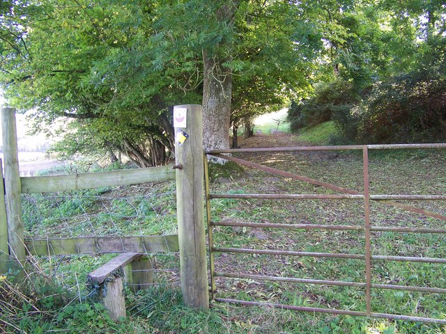
Footpath through Under Win Green - geograph.org.uk - 139961.jpg - GeographBot

Footpath into Maidford Clump. - geograph.org.uk - 150823.jpg - GeographBot

Harnham Slope, Salisbury - geograph.org.uk - 195440.jpg - GeographBot

Dinton Mill - geograph.org.uk - 267367.jpg - GeographBot

Path leading up to West Kennett Long Barrow - geograph.org.uk - 281997.jpg - GeographBot

Dogs Paradise - geograph.org.uk - 299681.jpg - GeographBot

Footpath to Croucheston - geograph.org.uk - 299253.jpg - GeographBot

Footpath to Flamstone Street - geograph.org.uk - 299346.jpg - GeographBot

Footpath to Revels Field - geograph.org.uk - 299368.jpg - GeographBot

Ford Through River Ebble - geograph.org.uk - 298907.jpg - GeographBot

Frosty Morning - geograph.org.uk - 297788.jpg - GeographBot

Lorenzo Trail - geograph.org.uk - 294629.jpg - GeographBot

Riverside Path - geograph.org.uk - 299343.jpg - GeographBot

Footpath to Bridge House - geograph.org.uk - 300041.jpg - GeographBot

Footpath to Croucheston - geograph.org.uk - 301119.jpg - GeographBot

Muddy Footpath - geograph.org.uk - 308498.jpg - GeographBot

Footpath, Morgans Vale - geograph.org.uk - 312780.jpg - GeographBot

Footpath Sign - geograph.org.uk - 311738.jpg - GeographBot

Footpath to Bishopstone - geograph.org.uk - 316063.jpg - GeographBot

Hedged Footpath - geograph.org.uk - 312841.jpg - GeographBot

Primrose Lane to Woodfalls Footpath - geograph.org.uk - 312848.jpg - GeographBot

Stile leading to Rowberry Farm - geograph.org.uk - 318758.jpg - GeographBot

Footpath to South Newton - geograph.org.uk - 326969.jpg - GeographBot

Footpath to South Newton Mill - geograph.org.uk - 326958.jpg - GeographBot

Path to St Michaels Church - geograph.org.uk - 329288.jpg - GeographBot

Footpath across Hamptworth Golf Course - geograph.org.uk - 331797.jpg - GeographBot

Footpath from Standlynch Farm through Trafalgar Park - geograph.org.uk - 330326.jpg - GeographBot

Footpath to Nunton - geograph.org.uk - 330544.jpg - GeographBot

Footpath to Privett Farm - geograph.org.uk - 330448.jpg - GeographBot

Parkland - geograph.org.uk - 342453.jpg - GeographBot

Downland Crossroads - geograph.org.uk - 350600.jpg - GeographBot

Flooded footpath - geograph.org.uk - 355596.jpg - GeographBot

Footpath from the Avon to Moot Lane - geograph.org.uk - 355611.jpg - GeographBot

Footpath in Grovely Wood - geograph.org.uk - 350701.jpg - GeographBot

Footpath junction, Broad Chalke - geograph.org.uk - 350155.jpg - GeographBot

Footpath to Broad Chalke from High Lane - geograph.org.uk - 350125.jpg - GeographBot

Looking towards Land Girl Plantation from the Ox Drove - geograph.org.uk - 350752.jpg - GeographBot

Muddy footpath in Broad Chalke - geograph.org.uk - 350164.jpg - GeographBot

Track to Mean Wood, Dean Hill - geograph.org.uk - 355795.jpg - GeographBot

Footpath and farmland sloping gently down from Pepperbox Hill to Whelpley Farm - geograph.org.uk - 368492.jpg - GeographBot

Footpath leaving Whelpley Farm going towards Whiteparish - geograph.org.uk - 368553.jpg - GeographBot

Footpath through the Wood - geograph.org.uk - 363064.jpg - GeographBot

Footpath to Choulston Farm - geograph.org.uk - 362635.jpg - GeographBot

Track Fork at Golden's Farm - geograph.org.uk - 378873.jpg - GeographBot

Footpath off Moor Lane - geograph.org.uk - 388375.jpg - GeographBot

Looking towards Pennings Farm - geograph.org.uk - 407453.jpg - GeographBot

Sign for the Avon Valley Path - geograph.org.uk - 403962.jpg - GeographBot

Path between fields to Lower Cowesfield Farm - geograph.org.uk - 452676.jpg - GeographBot

Footpath to Bake Farm - geograph.org.uk - 488909.jpg - GeographBot

Footpath through wheat, Clarendon Park - geograph.org.uk - 518766.jpg - GeographBot

Restricted byway near Odstock - geograph.org.uk - 653473.jpg - GeographBot

Restricted byway near Odstock - geograph.org.uk - 665258.jpg - GeographBot

Restricted byway near Odstock - geograph.org.uk - 665287.jpg - GeographBot

Mill leat, Sutton Mandeville Mill - geograph.org.uk - 737607.jpg - GeographBot

Footpath toward Homington Down - geograph.org.uk - 747049.jpg - GeographBot

Footpath toward Pigeon Hill - geograph.org.uk - 747091.jpg - GeographBot

Footpath toward the River Ebble - geograph.org.uk - 747015.jpg - GeographBot

Solitary Ash Tree - geograph.org.uk - 742292.jpg - GeographBot

Footpath by St James the Great church, Bratton - geograph.org.uk - 762205.jpg - GeographBot

Path by Creamery Cottage - geograph.org.uk - 790905.jpg - GeographBot

Stowell Park Footbridge 116, Kennet and Avon Canal - geograph.org.uk - 791286.jpg - GeographBot

Kissing gate, Dinton - geograph.org.uk - 845561.jpg - GeographBot

Overgrown footpath near Dinton - geograph.org.uk - 846230.jpg - GeographBot

The Kennet and Avon Canal, Woodborough - geograph.org.uk - 844147.jpg - GeographBot

The Kennet and Avon Canal, Woodborough - geograph.org.uk - 844158.jpg - GeographBot

Kennet and Avon canal on approach to Avoncliff Aqueduct - geograph.org.uk - 878319.jpg - GeographBot

Overgrown footpath near the River Avon - geograph.org.uk - 871158.jpg - GeographBot

Track into the danger area near Orcheston - geograph.org.uk - 874080.jpg - GeographBot

Kissing gate, West Winterslow - geograph.org.uk - 889146.jpg - GeographBot

Path in Moses Wood - geograph.org.uk - 888177.jpg - GeographBot

Permissive footpath near Old Wardour Castle - geograph.org.uk - 887383.jpg - GeographBot

South Hill Copse - geograph.org.uk - 887576.jpg - GeographBot

Wessex Ridgeway near Old Wardour Castle - geograph.org.uk - 887662.jpg - GeographBot

Church Path, Westbury - geograph.org.uk - 899017.jpg - GeographBot
Empty stone train at Patney bridge. - geograph.org.uk - 891113.jpg - GeographBot

Footpath, Barberry, Chilmark - geograph.org.uk - 891177.jpg - GeographBot

Alsesetting Copse, Sherrington Down near Sherrington - geograph.org.uk - 918364.jpg - GeographBot

Chilfinch Hanging near Chicklade - geograph.org.uk - 917203.jpg - GeographBot

Track, Ashley Wood near Fonthill House - geograph.org.uk - 912148.jpg - GeographBot

Clarendon Way, Salisbury - geograph.org.uk - 929004.jpg - GeographBot

Local train on the Portsmouth line - geograph.org.uk - 927110.jpg - GeographBot

South along the MandSWJR trackbed, Ogbourne Maizey - geograph.org.uk - 922439.jpg - GeographBot

Clarendon Way, Salisbury - geograph.org.uk - 930018.jpg - GeographBot

Track, Clarendon Estate - geograph.org.uk - 937837.jpg - GeographBot

Steps, Water Ditchampton - geograph.org.uk - 948504.jpg - GeographBot

Footpath to Sherrington - geograph.org.uk - 953275.jpg - GeographBot

Pasture and footpath near Little Snarlton Farm - geograph.org.uk - 969153.jpg - GeographBot

Path leading down from the railway bridge - geograph.org.uk - 962127.jpg - GeographBot

Clarendon Way - geograph.org.uk - 970637.jpg - GeographBot

Barns above Aldbourne - geograph.org.uk - 988304.jpg - GeographBot

Stile near Farley - geograph.org.uk - 983149.jpg - GeographBot

Track below Marridge Hill - geograph.org.uk - 988257.jpg - GeographBot

Between the Chutes - geograph.org.uk - 998266.jpg - GeographBot

Byway descending to Shalbourne - geograph.org.uk - 1014743.jpg - GeographBot

Sheepless Hill - geograph.org.uk - 1014665.jpg - GeographBot
Stile and gate, Marleycombe Hill - geograph.org.uk - 1010895.jpg - GeographBot

White Horse Trail, near Winterbourne Monkton - geograph.org.uk - 1010887.jpg - GeographBot

The old road from Fox Hill to Manor Farm - geograph.org.uk - 1021868.jpg - GeographBot

Path in Mean Wood - geograph.org.uk - 1053171.jpg - GeographBot

Fallen Apples - geograph.org.uk - 1083737.jpg - GeographBot

Path adjacent to Broome Manor Golf Course - geograph.org.uk - 1082425.jpg - GeographBot

Path adjacent to Broome Manor golf course - geograph.org.uk - 1082414.jpg - GeographBot

Path from Broome Manor Lane to Broome Manor Golf Complex - geograph.org.uk - 1082418.jpg - GeographBot

The new Spine Road Bridge and the Thames and Severn Canal - geograph.org.uk - 1082577.jpg - GeographBot

Gate and footpath sign, Jobbers Lane - geograph.org.uk - 1106532.jpg - GeographBot
Stile, north of Hampton - geograph.org.uk - 1130118.jpg - GeographBot

Towards Odstock - geograph.org.uk - 1148604.jpg - GeographBot

Imber Range Path near Heytesbury - geograph.org.uk - 1159617.jpg - GeographBot

Sign for the Imber Range Path - geograph.org.uk - 1159624.jpg - GeographBot

Knighton Hill Farm - geograph.org.uk - 1162442.jpg - GeographBot

Field path, Harnham - geograph.org.uk - 1170193.jpg - GeographBot

Footpath to Old Sarum - geograph.org.uk - 1179927.jpg - GeographBot

Public footpath sign - geograph.org.uk - 1184141.jpg - GeographBot

Public footpath, The Butts, Lydiard Millicent - geograph.org.uk - 1204437.jpg - GeographBot

Start of Smeathes Ridge - geograph.org.uk - 1204699.jpg - GeographBot

Track junction, Great Ridge - geograph.org.uk - 1202023.jpg - GeographBot

Wessex Ridgeway, Great Ridge - geograph.org.uk - 1202059.jpg - GeographBot

Wessex Ridgeway, Great Ridge - geograph.org.uk - 1202068.jpg - GeographBot
Wessex Ridgeway, Newtown - geograph.org.uk - 1201084.jpg - GeographBot

Wessex Ridgeway near Newtown - geograph.org.uk - 1201174.jpg - GeographBot

Letterage Copse and a footpath, near Hook Street - geograph.org.uk - 1213158.jpg - GeographBot
M4 eastbound south of Hook Street - geograph.org.uk - 1212977.jpg - GeographBot

Motorway, fence, footpath and farmland, Hook Street - geograph.org.uk - 1213007.jpg - GeographBot

Bridleway and footpath, Southgrove Copse - geograph.org.uk - 1229467.jpg - GeographBot

Bridleway and footpath junction, Southgrove Copse - geograph.org.uk - 1229518.jpg - GeographBot

Sign, near Southgrove Copse - geograph.org.uk - 1229507.jpg - GeographBot

The bridge at Thunder Brook - geograph.org.uk - 1221159.jpg - GeographBot

Wessex Ridgeway, Corton Down - geograph.org.uk - 1221082.jpg - GeographBot

Track through Battlelake Plantation - geograph.org.uk - 1234102.jpg - GeographBot

Track to Maplesale Farm, south-east of Minety - geograph.org.uk - 1234122.jpg - GeographBot

Track to the Purton road - geograph.org.uk - 1234105.jpg - GeographBot

Bridge over Semington Brook - geograph.org.uk - 1263486.jpg - GeographBot

Track in East Croft Coppice - geograph.org.uk - 1266775.jpg - GeographBot

Black Dog Woods, Dilton Marsh - geograph.org.uk - 1284697.jpg - GeographBot

Stile near Rudge - geograph.org.uk - 1284948.jpg - GeographBot
Beech Tree Walk Bridge - geograph.org.uk - 1302900.jpg - GeographBot

New Bridge - geograph.org.uk - 1302905.jpg - GeographBot

Witchcombe Lane near Great Cheverell - geograph.org.uk - 1303835.jpg - GeographBot

West along Cock Lane, near Ram Alley - geograph.org.uk - 1327280.jpg - GeographBot

Roadside path near Lacock Bridge - geograph.org.uk - 1337887.jpg - GeographBot

Path across Spye Park (2) - geograph.org.uk - 1342284.jpg - GeographBot

Path across Spye Park (3) - geograph.org.uk - 1342299.jpg - GeographBot

Path across Spye Park - geograph.org.uk - 1342256.jpg - GeographBot

The Public Footpath - geograph.org.uk - 1359075.jpg - GeographBot

Up the Old Chase Road byway, near Ogbourne St George - geograph.org.uk - 1358624.jpg - GeographBot

Footpath near Luckington - geograph.org.uk - 1382530.jpg - GeographBot

Footpaths near Luckington - geograph.org.uk - 1382560.jpg - GeographBot

Patney, Footpath near Home Farm - geograph.org.uk - 1397249.jpg - GeographBot

Woodborough, Footpath to Bottlesford - geograph.org.uk - 1398496.jpg - GeographBot

West Grafton, Footpath from East Grafton - geograph.org.uk - 1405165.jpg - GeographBot

West Grafton, Footpath to Suddene Park Farm - geograph.org.uk - 1405127.jpg - GeographBot

View to Hinton Downs - geograph.org.uk - 1421759.jpg - GeographBot
Stile, Cuckhold's Green - geograph.org.uk - 1435835.jpg - GeographBot

Stile and footpath near Great Hinton - geograph.org.uk - 1437675.jpg - GeographBot
Stile and footpath near Rockley - geograph.org.uk - 1435709.jpg - GeographBot

Stile and footpath near Worton - geograph.org.uk - 1434067.jpg - GeographBot

Farm track and footpath near Westfield Farm - geograph.org.uk - 1447615.jpg - GeographBot

Stile and footpath, Clyffe Pypard - geograph.org.uk - 1442694.jpg - GeographBot

Great Rose Lane, Blunsdon - geograph.org.uk - 1456117.jpg - GeographBot

Great Rose Lane - geograph.org.uk - 1456136.jpg - GeographBot

Shalbourne - Path - geograph.org.uk - 1450616.jpg - GeographBot

Chippenham footpath - geograph.org.uk - 1461756.jpg - GeographBot

Grazing, Compton Bassett - geograph.org.uk - 1463096.jpg - GeographBot

Kissing gate, Heytesbury - geograph.org.uk - 1479067.jpg - GeographBot

Underpass, Corton - geograph.org.uk - 1479506.jpg - GeographBot

Towpath, Kennet and Avon Canal - geograph.org.uk - 1483584.jpg - GeographBot

The Old Midford Lane reduced to a footpath - geograph.org.uk - 1537749.jpg - GeographBot

Lane to Harden's Farm - geograph.org.uk - 1545060.jpg - GeographBot

Jubilee Path, Barford St Martin - geograph.org.uk - 1551331.jpg - GeographBot

Looking W along footpath from The Street - geograph.org.uk - 1550464.jpg - GeographBot

Farmland, Charlton - geograph.org.uk - 1561742.jpg - GeographBot

Looking S along footpath to Lower Wraxall - geograph.org.uk - 1566660.jpg - GeographBot

Messy footpath near Barrow Street - geograph.org.uk - 1560056.jpg - GeographBot

Track and farmland, Collingbourne Kingston - geograph.org.uk - 1561757.jpg - GeographBot

Gate and stile near Barrow Street - geograph.org.uk - 1584716.jpg - GeographBot

Kissing gate to footpath across North Meadow - geograph.org.uk - 1584760.jpg - GeographBot

View across North Meadow National Nature Reserve - geograph.org.uk - 1584759.jpg - GeographBot

Haydon End Lane - geograph.org.uk - 1616366.jpg - GeographBot

Line of the old railway to Devizes - geograph.org.uk - 1620090.jpg - GeographBot

Plantation, Durrington Down - geograph.org.uk - 1622176.jpg - GeographBot

Gate post, Faulston Farm - geograph.org.uk - 1650717.jpg - GeographBot

Stile, Bishopstone Hollow - geograph.org.uk - 1653539.jpg - GeographBot

Stile, Bishopstone Hollow - geograph.org.uk - 1653666.jpg - GeographBot

Stile, Codford St Peter - geograph.org.uk - 1660836.jpg - GeographBot

Lock 62 from Bridge 99, Kennet and Avon Canal - geograph.org.uk - 1706475.jpg - GeographBot

Woodland edge, High Wood - geograph.org.uk - 1705807.jpg - GeographBot

Woodland path, Pits Wood - geograph.org.uk - 1704177.jpg - GeographBot

Woodland path, Pits Wood - geograph.org.uk - 1704192.jpg - GeographBot

Track in Bottom Coppice - geograph.org.uk - 648211.jpg - GeographBot

Track in woodland above Littlecote - geograph.org.uk - 648213.jpg - GeographBot

Track with beeches, Littlecote Park - geograph.org.uk - 648212.jpg - GeographBot

Footbridge over the River Ebble at Coombe Bissett.JPG - Simon Burchell

Fosse Way Wiltshire.jpg - Hogweard

Path to Silbury Hill - panoramio.jpg - Panoramio upload bot

Chalk path - panoramio.jpg - Panoramio upload bot

Chalk path - panoramio (1).jpg - Panoramio upload bot

Chalk path - panoramio (2).jpg - Panoramio upload bot

Footpath, Holt to Little Chalfield - panoramio.jpg - Panoramio upload bot

'The Hollow', Compton Chamberlayne.jpg - Richard Avery

'The Hollow', Compton Chamberlayne 2.jpg - Richard Avery

Access road to Dinton Mill.jpg - Richard Avery

Thames Path - geograph.org.uk - 2201809.jpg - GeographBot

Near Mortimer Street (28215976997).jpg - NoahLovesNesquick

Footpath around Old Sarum - geograph.org.uk - 4028011.jpg - GeographBot

Old Shaftesbury Drove - geograph.org.uk - 4049008.jpg - GeographBot

Foxmore Drove - geograph.org.uk - 4049378.jpg - GeographBot

Foxmore Drove - geograph.org.uk - 4049387.jpg - GeographBot

Foxmore Drove - geograph.org.uk - 4049584.jpg - GeographBot

Old Warum Way Map.png - Nick1nildram