Wikimedi'Òc
Modes d'emploi

Cet album fait partie des albums
Cet album photos contient les sous-albums suivants :


EEZ Cape Verde.png - Waldyrious

Nauru-EEZ-fr.svg - Kimdime

North sea eez.PNG - Inwind
ZERP.jpg - L84AD8~commonswiki

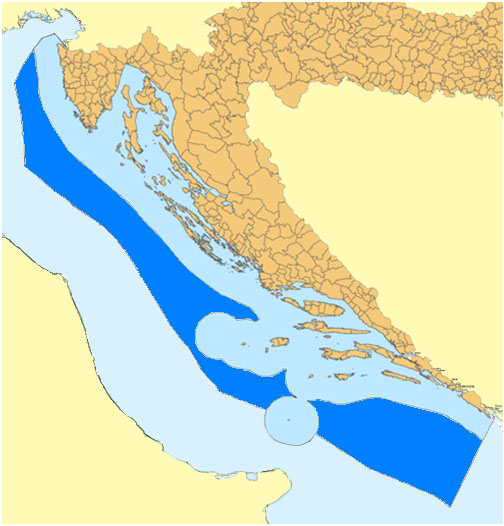
ZERP (Adriatic sea map).png - L84AD8~commonswiki

Socotra Rock location jpn.png - BetacommandBot
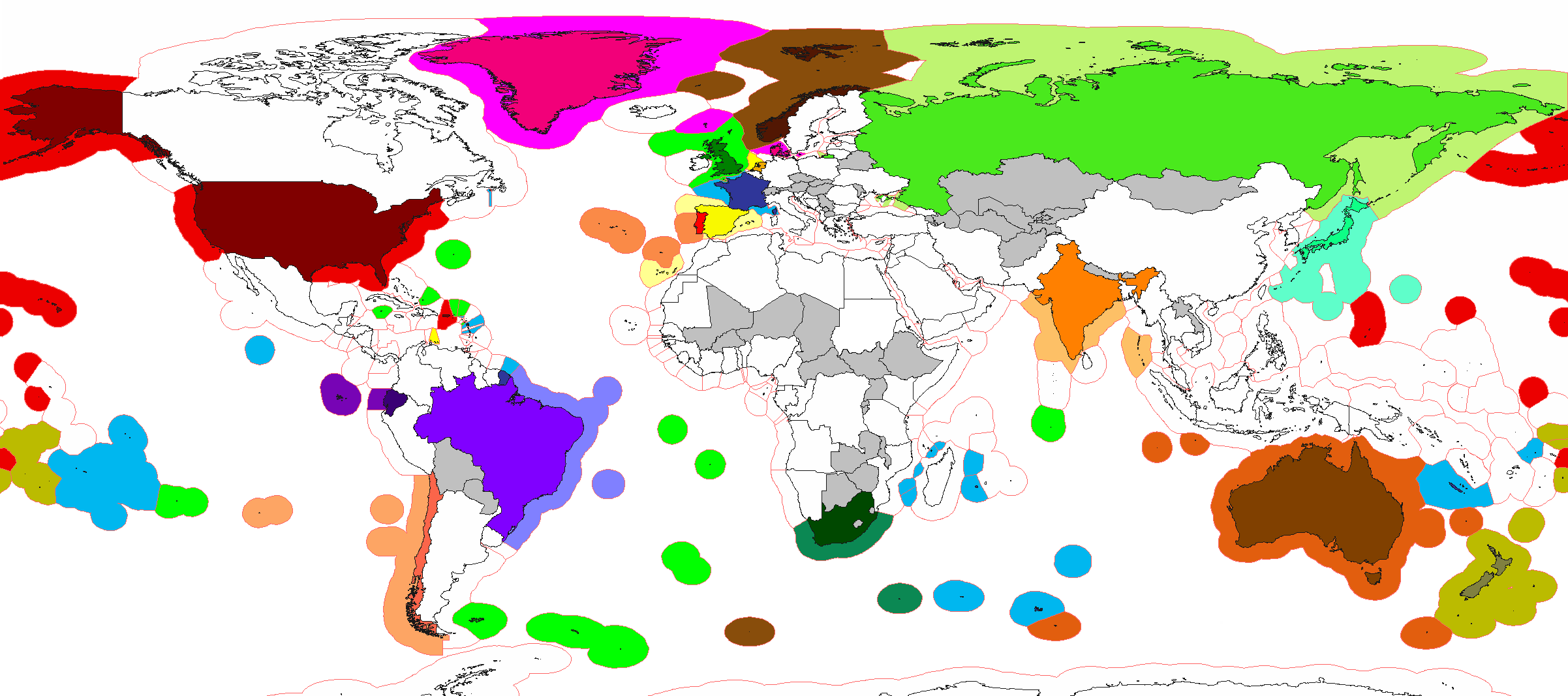
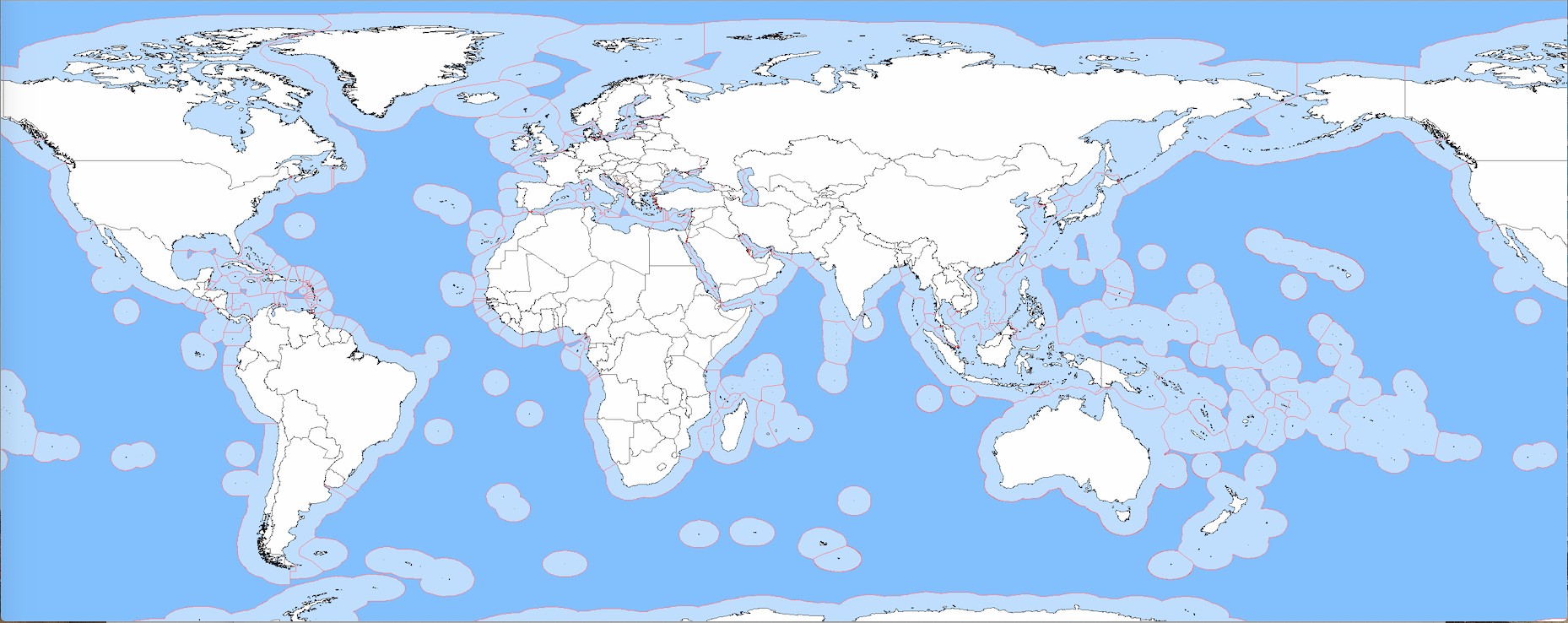
Exclusive Economic Zones World.png - Maphobbyist

Norway Exclusive Economic Zones.png - Maphobbyist

Linghai Jixian.png - Cq521

Exclusive Economic Zones Nulles.png - Che829
Exclusive Economic Zones World Pacific-centric.png - Maphobbyist

Exclusive Economic Zones World Americas-centric.png - Maphobbyist

Mapa del Caribe (límites marinos).png - Milenioscuro
ZEE FC.jpg - Irm2006

Indian Exclusive Economic Zones.PNG - Maphobbyist
WorldEEZ.png - Babelia
Barbados maritime.tiff - CaribDigita

Nordsee Wirtschaftszonen.png - File Upload Bot (Magnus Manske)

Maritime Claims of Peru and Ecuador.svg - GeoEvan

Exclusive Economic Zones - World.svg - SyntaxTerror

Territorial waters - Denmark.svg - Ratherous

Territorial waters - Norway.svg - Ratherous

Territorial waters - India.svg - Ratherous

Dutch Caribbean maritime boundaries.svg - Thayts

Ausschliessliche Wirtschaftszonen Schwarzes Meer.svg - Tentotwo

Black Sea relief location map with exclusive economic zones.svg - Tentotwo

Ausschliessliche Wirtschaftszonen Schwarzes Meer (Reliefkarte).svg - Rosenzweig
Zealandia EEZs.tif - Avenue

Rom.territ-waters.jpg - Julieta39
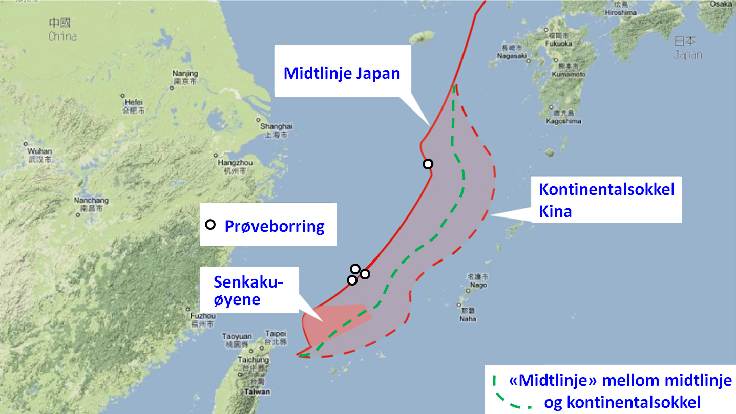
EEZ disputes in East China Sea NO.jpg - Gryphonis

Standard time zones of the world (2012, with Exclusive Economic Zones).svg - Poulpy

EEZ of Denmark.svg - Rbrausse

European Union maximum enlargement (with EEZ).PNG - Nelg

Mapa del Caribe (límites marinos).svg - Milenioscuro

Maritime Claims of Ecuador.svg - Milenioscuro

이어도-Ieodo (en-socotra rock).png - Trompe~commonswiki

Newfoundland Grand Banks and EEZ border.png - Jecowa

EEZ border between North Cyprus and Turkey.jpg - Alexyflemming

South China Sea vector.svg - ماني

Caribbean maritime boundaries map.svg - Thayts

Karte Kirchenprovinzen und Diözesen der Karibik.png - Chumwa

Mapa das Caraíbas (fronteiras marítimas).svg - Gameiro

Caribbean maritime boundaries map mk.svg - Bjankuloski06

South China Sea vector de.svg - Furfur

Islands and rocks UNCLOS.svg - Eurodollers

Islands and rocks UNCLOS CN.svg - Eurodollers

Рељефна карта Црног мора sr.svg - Ранко Николић

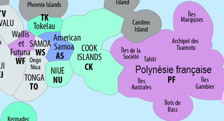
EEZ Oceania.svg - Kwamikagami

Territorial waters Oceania.png - Kingofthedead

Ausschliessliche Wirtschaftszonen Schwarzes Meer-es.svg - Rowanwindwhistler

Dutch Caribbean maritime boundaries with island names.svg - Chumwa
ZEE Sénégal (zone économique exclusive).jpg - Benj90

EEZs Pacific.png - Adam Dent

Mapa del Mar de Balboa (límites marinos).svg - Milenioscuro

Mapa del Mar Caribe (límites marinos).svg - Sémhur

Ausschliessliche Wirtschaftszonen Schwarzes Meer-uk.svg - Yakiv Gluck

Ausschliessliche Wirtschaftszonen Schwarzes Meer (Reliefkarte)-uk.svg - Yakiv Gluck

Nauru-EEZ-fr Workaround.svg - JoKalliauer

Rockall EEZ topographic map-en.svg - Liam na mara

Zonegrens benedenw nl.jpg - Poppo154

Overzicht grenzen bovenwinds 201806 1.jpg - Poppo154

Exclusive economic zone of North Korea.png - Finnusertop

Standard time zones of the world (2012, with Exclusive Economic Zones) EL.svg - Gts-tg

EEZ el.jpg - Compugraphs

Eastern Mediterranean EEZ conflicts.svg - Future Perfect at Sunrise
Indonesia-Exclusive-Economic-Zone.png - Artanisen

Thailand-Exclusive-Economic-Zone.png - User-duck

한국과 일본의 배타적 경제수역 명명백백.jpg - Mmbb

ID TW EEZ.svg - Afrogindahood
How the Lawyers Think—Maritime Zones and the International Law of the Sea.pdf - Balkanique

How the Lawyers Think—Maritime Zones and the International Law of the Sea.svg - Balkanique

Eastern Mediterranean EEZ conflicts-fr.svg - SyntaxTerror

Zones économiques exclusives accord de Nauru.png - Tpe.g5.stan

Greek and Cypriot EEZ.svg - Ακάλυπτος χώρος

Average wind speed 1995–2018 (based on the regional reanalysis COSMO-REA6) in the North Sea and Baltic Sea at 116 m height.png - FraKa
Italy-Exclusive-Economic-Zone-Map.png - Iktsokh

Οικόπεδα κυπριακής ΑΟΖ.jpg - Γκιώνης

Marine Environments & Legal Borders Within the Gulf of Mexico.png - Nbutler37

Die Definition der unterschiedlichen Meereszonen im Seevoelkerrecht.svg - Mrmw
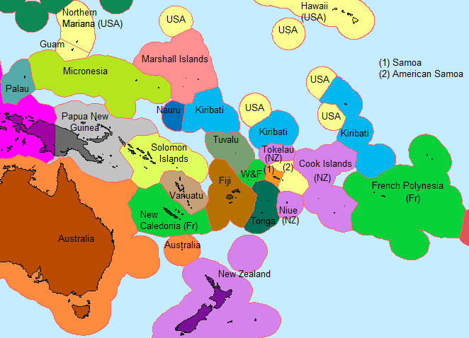
Oceania political map.png - ព្រះមហាក្សត្ររាជ

Caribbean maritime boundaries map zh.svg - 幺于
Accord de délimitation des frontières entre la France et la Nouvelle-Zélande.png - Edoirefaitdel'art

Niue EEZ division.svg - M.Bitton

Niue EEZ.svg - M.Bitton

South China Sea vector Chinese.svg - A11w1ss3nd

Zee200.jpg - Nemigo

Tonga and its borders (cropped).png - Skimel

Karte Kirchenprovinzen und Diözesen der Karibik Suriname Neutral.png - SurinameCentral

Rockall EEZ topographic map-hy.svg - O'micron

World lake concept - A theoretical division of the seabed, 1977.jpg - Babelia
Italy-Exclusive-Economic-Zone-Map (cropped).png - User-duck

EEZ Finland.png - Inehmo

Suomen aluemeri.png - Inehmo

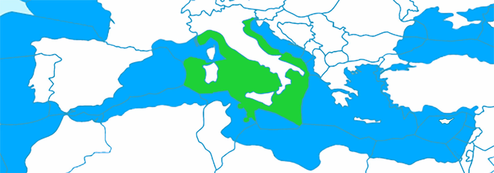
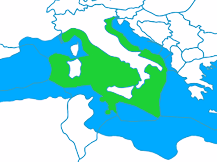
Carte Mediterranee 03.jpg - Nihil scimus

Mapa del Mar Caribe (límites marinos)-fr.svg - Sémhur
Correct Internationalwaters.png - Qualimac

Internationalwaters.png 10-01-2024.png - Maisrimer

Oceania grey background.png - Maisrimer

Oceania-map with EEZ.jpg - Maisrimer

Exclusive Economic Zones in the Black Sea.svg - WikiForMen

Maritime Zones under International Law.png - WikiTheContributor777

Continental shelf claims of Thailand in the Gulf of Thailand, 1973.png - Paul 012

Continental shelf claims of Cambodia, 1972 01.png - Paul 012

Overlapping continental shelf claims of Thailand and Cambodia.png - Paul 012