Wikimedi'Òc
Modes d'emploi

Cet album fait partie des albums
Cet album photos contient les sous-albums suivants :


Evacuation route sign - Hawaii.jpg - Kelapstick

East End US 41-FL 44 Multiplex (Sidewalk).JPG - DanTD

DC Street Sign - K Street NW.jpg - SchuminWeb

Constitution Avenue Sign.jpg - JSquish
Evacuation sign.jpg - CraigKelley62

2016-07-20 08 50 46 View north along Maryland State Route 2 (Solomons Island Road) at Lore Road in Solomons, Calvert County, Maryland.jpg - Famartin

GA Tsunami evac route.jpg - RightCowLeftCoast
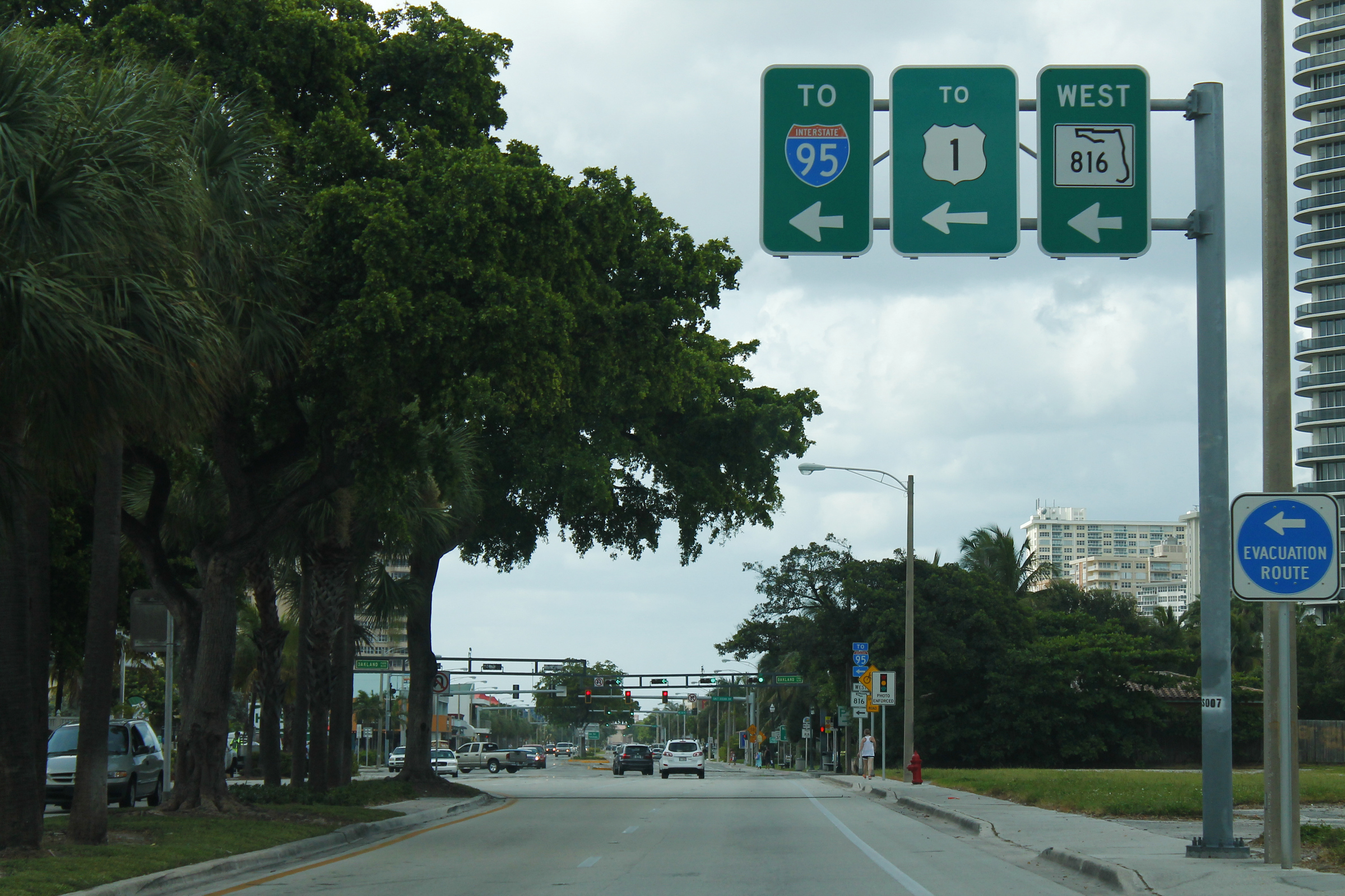
A1A North at FL 816 (39022774990).jpg - Tyler ser Noche

US 13 Business nb approaching US 13, Claymont, DE (2), March 2025.jpg - Mr. Matté

2020.06.06 DC People and Places, Washington, DC USA 158 82241.jpg - Tm

Lefferts Bl Qns td (2020-10-17) 132.jpg - Tdorante10

2020-11-11 08 06 38 View west along Burlington County Route 532 (Barnegat-Chatsworth Road) at Burlington County Route 563 (Main Street) in Woodland Township, Burlington County, New Jersey.jpg - Famartin

NB FL 441; Evacuation Route @ 90-point-7 FM-1.jpg - DanTD

NB FL 441 @ Rosalyn Avenue & Evacuation Route.jpg - DanTD

NB FL 441; Evacuation Route @ 90-point-7 FM-2.jpg - DanTD

NB FL 441; Evacuation Route @ Mobile Avenue.jpg - DanTD

Evacuation Route sign, Carrollton Avenue, New Orleans.jpg - Infrogmation

F Capodanno Bl Sand Ln td (2022-03-26) 05.jpg - Tdorante10

2022-06-23 16 45 38 View west along Maryland State Route 404 (Ocean Highway) just west of Maryland State Route 313 (Greensboro Road) and Maryland State Route 619 (Sixth Street) in Smith Landing, Caroline County, Maryland.jpg - Famartin

NY 395 nb past NY 7, 2023.jpg - Mr. Matté

2018-05-25 13 07 23 View north along New Jersey State Route 71 and west along Monmouth County Route 537 (Broad Street) at Monmouth Road-Eatontown Boulevard along the border of Oceanport and Eatontown in Monmouth County, New Jersey.jpg - Famartin

2014-08-27 10 58 06 Sign for westbound New Jersey Route 70 and the Coastal Evacuation Route at the Red Lion Circle.JPG - Famartin

2014-08-27 10 58 11 Sign for the Coastal Evacuation Route at the Red Lion Circle.JPG - Famartin

2018-10-04 14 34 17 View south along Atlantic County Route 638 (Brigantine Boulevard) between 12th Street and 11th Street in Brigantine, Atlantic County, New Jersey.jpg - Famartin
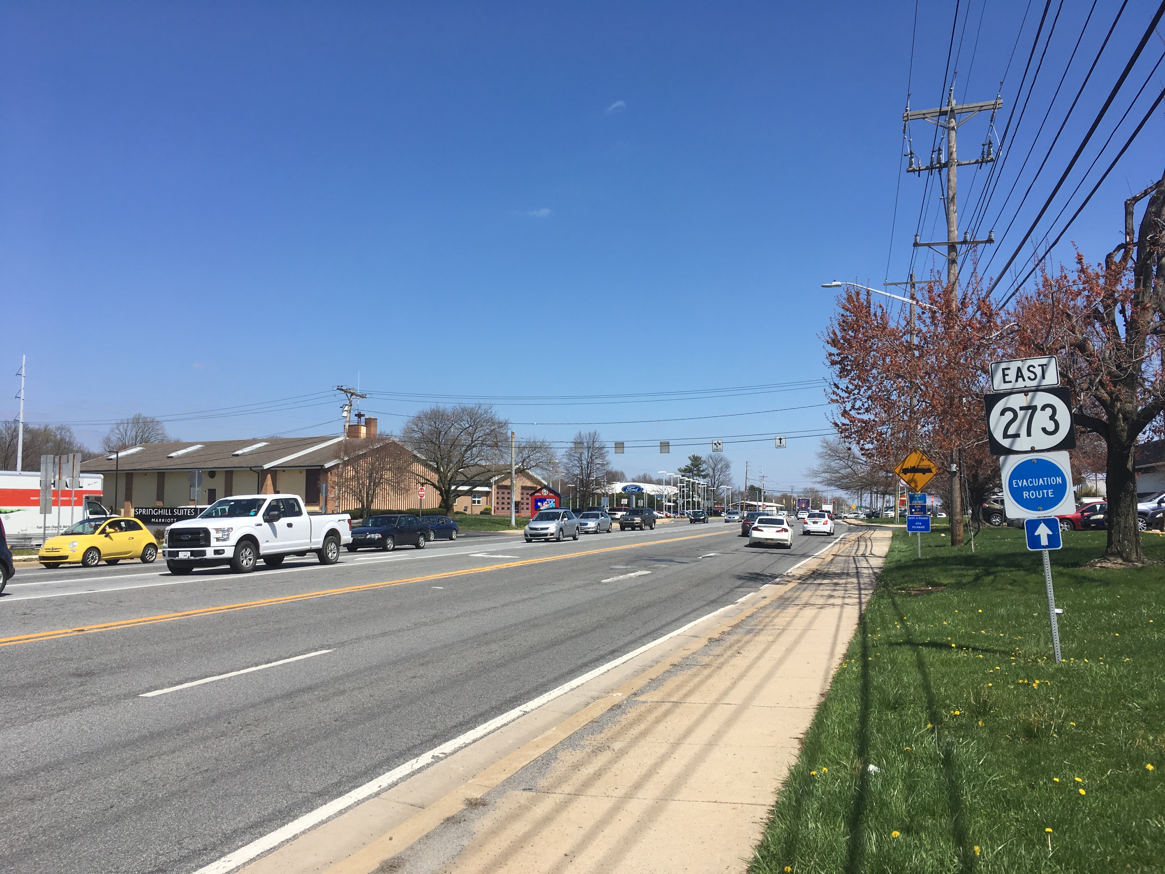
DE 273 EB past DE 2-DE 72.jpg - Dough4872

DE 273 EB shield past DE 2-DE 72.jpeg - Dough4872

DE 18-DE 404 WB past The Circle.jpeg - Dough4872

DE 18-DE 404 WB shields past The Circle.jpg - Dough4872

DE 18-DE 404 WB past North Bedford Street.jpeg - Dough4872

US 13 NB past DE 3.jpeg - Dough4872

2022-06-23 10 57 48 View west along Delaware State Route 26, Delaware State Route 30 and Delaware State Route 54 (Millsboro Highway) just west of Cypress Road and Pear Tree Road in Gumboro, Sussex County, Delaware.jpg - Famartin

2022-06-23 11 16 59 View west along Delaware State Route 54 (Cypress Road) at Cemetery Road in Selbyville, Sussex County, Delaware.jpg - Famartin

2022-06-23 11 24 47 View west along Delaware State Route 54 (Cemetery Road) at Pepper Road in Selbyville, Sussex County, Delaware.jpg - Famartin

2022-06-23 11 27 39 View west along Delaware State Route 54 (North Main Street) at Church Street in Selbyville, Sussex County, Delaware.jpg - Famartin

2022-06-23 11 35 41 View west along Delaware State Route 54 (Lighthouse Road) at Hudson Road in Selbyville, Sussex County, Delaware.jpg - Famartin

2022-06-23 12 07 24 View west along Delaware State Route 54 (Lighthouse Road) at Delcy Court just south of Fenwick Island in Sussex County, Delaware.jpg - Famartin

2022-06-23 14 00 31 View west along Delaware State Route 30 (Whitesville Road) at Delaware State Route 26 and Delaware State Route 54 (Millsboro Highway) in Gumboro, Sussex County, Delaware.jpg - Famartin

2022-07-07 12 40 54 View west along Delaware State Route 16 (Milton-Ellendale Highway) at Delaware State Route 30 and Delaware State Route 5 Alternate (Isaacs Road-Gravel Hill Road) in Reynolds Mill, Sussex County, Delaware.jpg - Famartin

2022-07-07 14 22 06 View west along Delaware State Route 404 (Seashore Highway) at Delaware State Route 18 (Cannon Road) in Cloverdale Crossroads, Sussex County, Delaware.jpg - Famartin

2022-07-07 15 14 02 View west along Delaware State Route 18 and Delaware State Route 404 (North Bedford Street) just west of U.S. Route 9 (The Circle) in Georgetown, Sussex County, Delaware.jpg - Famartin

2022-07-07 15 17 57 View west along Delaware State Route 18 and Delaware State Route 404 (Bridgeville Road) at North Bedford Street in Georgetown, Sussex County, Delaware.jpg - Famartin

2022-07-08 08 52 49 View north along U.S. Route 13 and west along Delaware State Route 20 (Sussex Highway) at Concord Road in Cherrytree Landing, Sussex County, Delaware.jpg - Famartin

2022-07-08 12 09 07 View west along Delaware State Route 20 (Zion Church Road) at Delaware State Route 54 (Lighthouse Road) in Keenwik Sound, Sussex County, Delaware.jpg - Famartin

2022-07-08 13 04 41 View west along Delaware State Route 26 (Garfield Parkway) at Delaware State Route 1 (Coastal Highway) in Bethany Beach, Sussex County, Delaware.jpg - Famartin

2022-07-08 13 36 41 View west along Delaware State Route 20 (Main Street) at Delaware State Route 26 (Clayton Street) in Dagsboro, Sussex County, Delaware.jpg - Famartin

2022-07-14 19 14 41 View north along Delaware State Route 30 (Cedar Creek Road) at Isaacs Road in Jefferson Crossroads, Sussex County, Delaware.jpg - Famartin

2022-07-15 12 26 14 View north along Delaware State Route 5 and Delaware State Route 23 (Indian Mission Road) at Delaware State Route 24 (John J Williams Highway) in Sherwood Forest, Sussex County, Delaware.jpg - Famartin

2022-07-16 12 27 12 View south along Delaware State Route 9 (Bayside Drive) at Delaware State Route 1 (Bay Road) in Dover, Kent County, Delaware.jpg - Famartin

2022-07-18 09 34 22 View north along Delaware State Route 1 (Korean War Veterans Memorial Highway) just north of Exit 160 in Christiana, New Castle County, Delaware.jpg - Famartin

2022-07-18 17 03 05 View north along Delaware State Route 15 and east along Delaware State Route 299 (Middletown-Warwick Road) at Level Road in Middletown, New Castle County, Delaware.jpg - Famartin

2022-07-19 12 48 53 View north along Delaware State Route 72 (Wrangle Hill Road) at Delaware State Route 9 (River Road) in Reybold, New Castle County, Delaware.jpg - Famartin

2022-07-19 15 53 06 View south along Delaware State Route 896 (South College Avenue) at Delaware State Route 4 (Christina Parkway) in Newark, New Castle County, Delaware.jpg - Famartin

2022-07-19 17 54 58 View south along Delaware State Route 72 (Liberty Avenue) just south of Delaware State Route 273 (Ogletown Road-East Main Street) and Delaware State Route 2 (Capitol Trail) in Newark, New Castle County, Delaware.jpg - Famartin

2022-07-24 16 52 07 View east along Delaware State Route 273 (Ogletown Road) at Delaware State Route 2 (Capitol Trail) and Delaware State Route 72 (Liberty Avenue) in Newark, New Castle County, Delaware.jpg - Famartin

DE 72 northbound past DE 9.jpg - File Upload Bot (Magnus Manske)

2022-07-07 18 50 29 View west along U.S. Route 9 and Delaware State Route 404 (Lewes-Georgetown Highway) at Delaware State Route 1 (Coastal Highway) in Five Points, Sussex County, Delaware.jpg - Famartin
2022-07-07 19 17 26 View west along U.S. Route 9 (West Market Street) at Delaware State Route 18 and Delaware State Route 404 (The Circle) in Georgetown, Sussex County, Delaware.jpg - Famartin

2022-07-08 08 46 36 View north along U.S. Route 13 (Sussex Highway) just north of U.S. Route 9 (County Seat Highway) in Laurel, Sussex County, Delaware.jpg - Famartin

2022-07-20 11 16 34 View north along U.S. Route 13 (DuPont Highway) just north of the exit for northbound Delaware State Route 1 (Korean War Veterans Memorial Highway) in Tybouts Corner, New Castle County, Delaware.jpg - Famartin

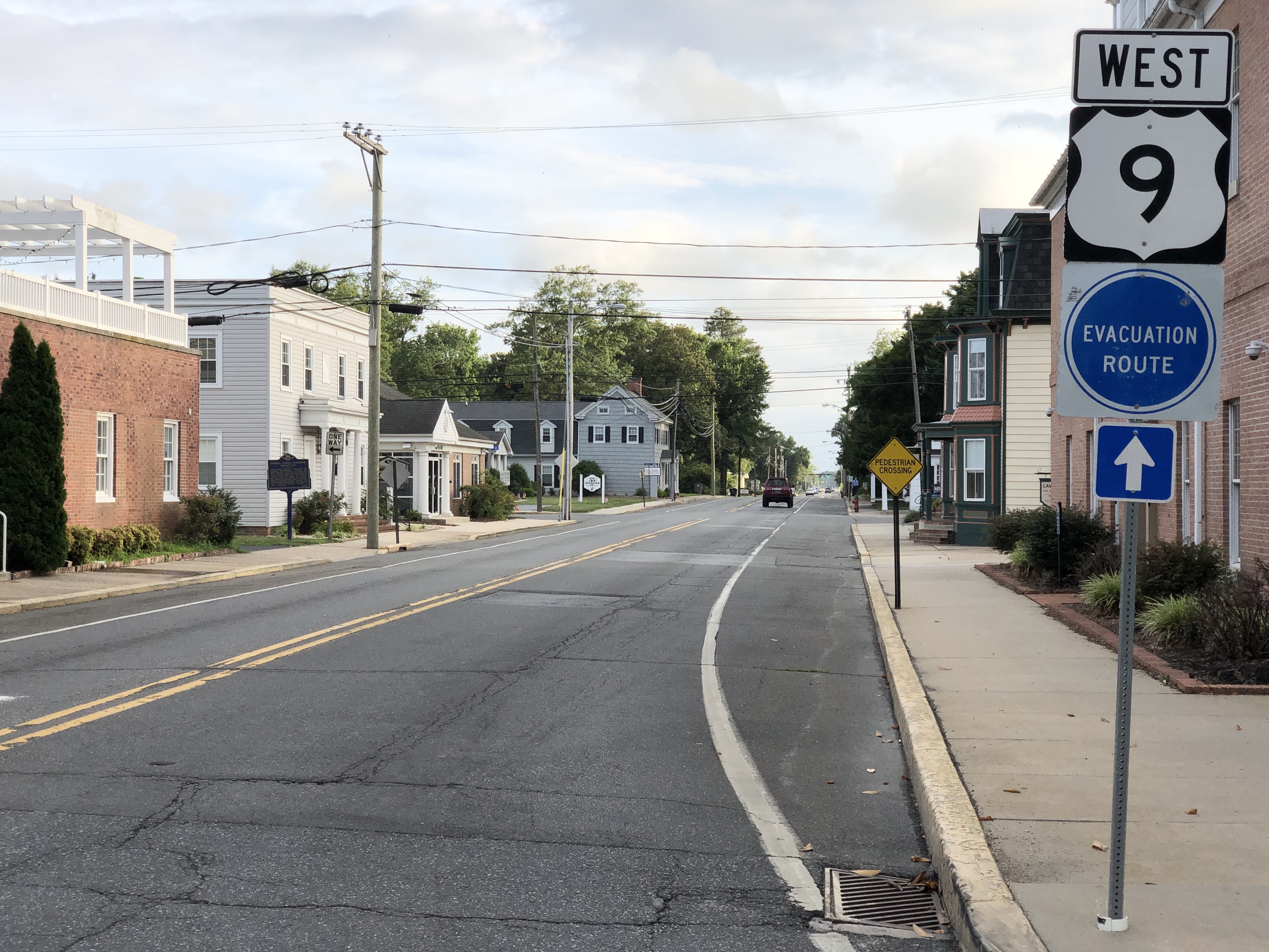
US 9 WB shield past The Circle.jpg - Dough4872

Cape May CR 623 WB past Cape May CR 656.jpeg - Dough4872

MUTCD EM1-1.svg - Mxn

FL300 northern terminus at US98.jpg - The Bushranger

US27 and US19 in Capps.jpg - The Bushranger