Wikimedi'Òc
Modes d'emploi

Cet album fait partie des albums
Cet album photos contient les sous-albums suivants :


Esholt Junction rail crash - 1892.jpg - Tagishsimon
Esholtmay2005.JPG - File Upload Bot (Magnus Manske)

Belmont Wood, Yeadon - geograph.org.uk - 11861.jpg - GeographBot

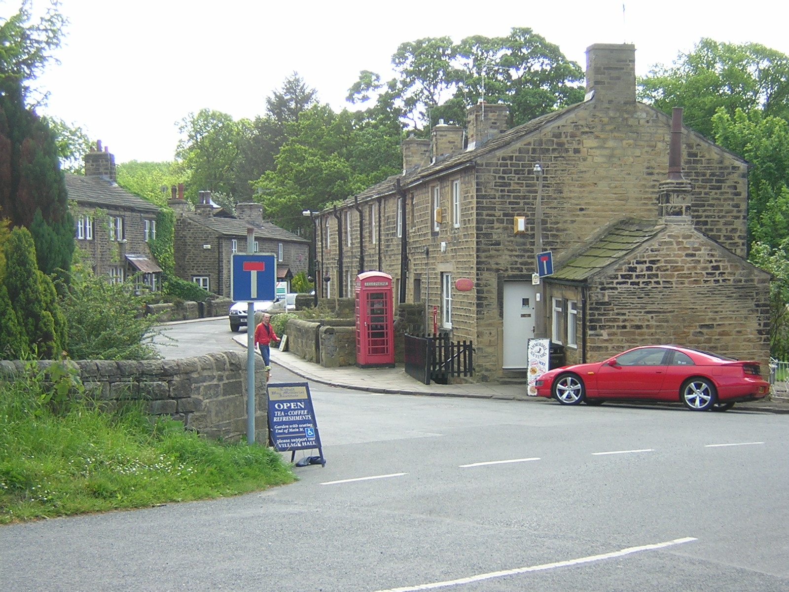
Esholt Village - geograph.org.uk - 13391.jpg - GeographBot

Jerrison Wood, Esholt - geograph.org.uk - 13393.jpg - GeographBot

Yeadon Gill, running through Gill Wood - geograph.org.uk - 11821.jpg - GeographBot

Field Locks - geograph.org.uk - 30857.jpg - GeographBot

Tong Park pond and cricket ground - geograph.org.uk - 32372.jpg - GeographBot

Canal reflections - geograph.org.uk - 276180.jpg - GeographBot

The Whitehouse looking SW - geograph.org.uk - 410411.jpg - GeographBot

Esholt Post Office - geograph.org.uk - 643141.jpg - GeographBot

Esholt village - geograph.org.uk - 643131.jpg - GeographBot

Home Farm at Esholt - geograph.org.uk - 752369.jpg - GeographBot

Spring at Esholt - geograph.org.uk - 752343.jpg - GeographBot

Hollins Hall Golf Course - geograph.org.uk - 761467.jpg - GeographBot

Cricket ground at Esholt - geograph.org.uk - 963186.jpg - GeographBot

Culverted stream, Station Road, Esholt - geograph.org.uk - 963153.jpg - GeographBot

End of the urban district - geograph.org.uk - 963215.jpg - GeographBot

The Katmandu Caravan Club - geograph.org.uk - 963193.jpg - GeographBot

Bridleway from Hollins Hill to Cunliffe Lane - geograph.org.uk - 996946.jpg - GeographBot

Chapel Lane - Esholt - geograph.org.uk - 996932.jpg - GeographBot

Old Hollings Hill - Esholt - geograph.org.uk - 996942.jpg - GeographBot

Playground - Church Lane, Esholt - geograph.org.uk - 996935.jpg - GeographBot

Pullan Lane - Esholt - geograph.org.uk - 996938.jpg - GeographBot

St Leonard's Farm Park - Station Road, Esholt - geograph.org.uk - 996941.jpg - GeographBot

Howgate - Albion Road, Idle - geograph.org.uk - 1059060.jpg - GeographBot

Howgate House Care Home - Howgate, Idle - geograph.org.uk - 1059057.jpg - GeographBot

Ghyll Beck - geograph.org.uk - 1776104.jpg - GeographBot
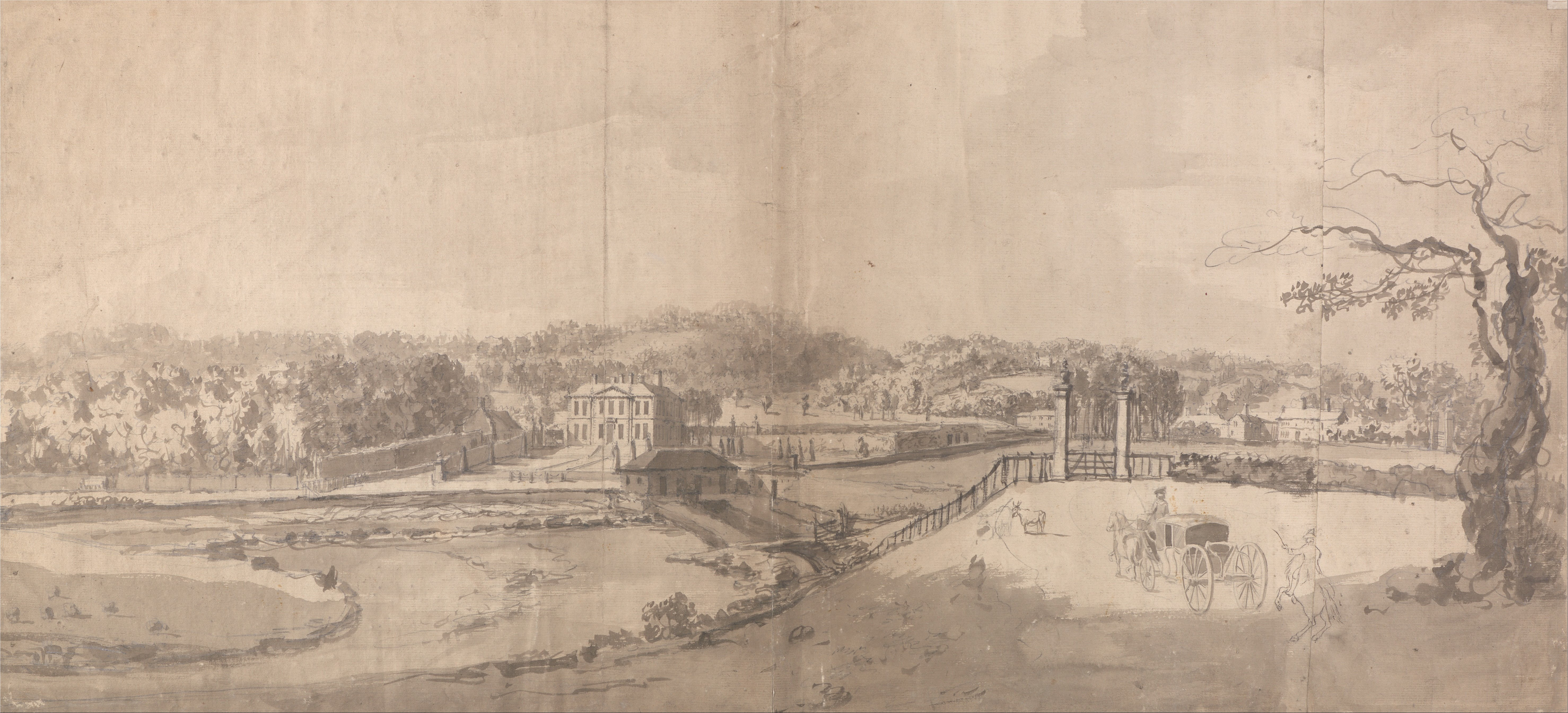
Samuel Scott - A View of the Estate at Esholt Hall, Yorkshire - Google Art Project.jpg - DcoetzeeBot

Field 3 Rise Lock, Leeds-Liverpool Canal, Esholt (geograph 2972155).jpg - Trappedinburnley

Field 3 Rise Locks, Esholt (geograph 3026690).jpg - Trappedinburnley

The mail comes to Esholt (2476284675).jpg - INeverCry

Pipeline Crossing Water - geograph.org.uk - 218310 (cropped).jpg - Saga City

Leeds and Liverpool Canal (2493921699).jpg - Sic19

Esholt (9988773653).jpg - Sic19

Esholt (30016799786).jpg - Sic19

Esholt Post Office (30098553475).jpg - Sic19

Esholt (30083617826).jpg - Sic19

Apperley Bridge to Esholt (33801692883).jpg - Sic19

Apperley Bridge to Esholt (33768915054).jpg - Sic19

Apperley Bridge to Esholt (34225991690).jpg - Sic19

Apperley Bridge to Esholt (34226341540).jpg - Sic19
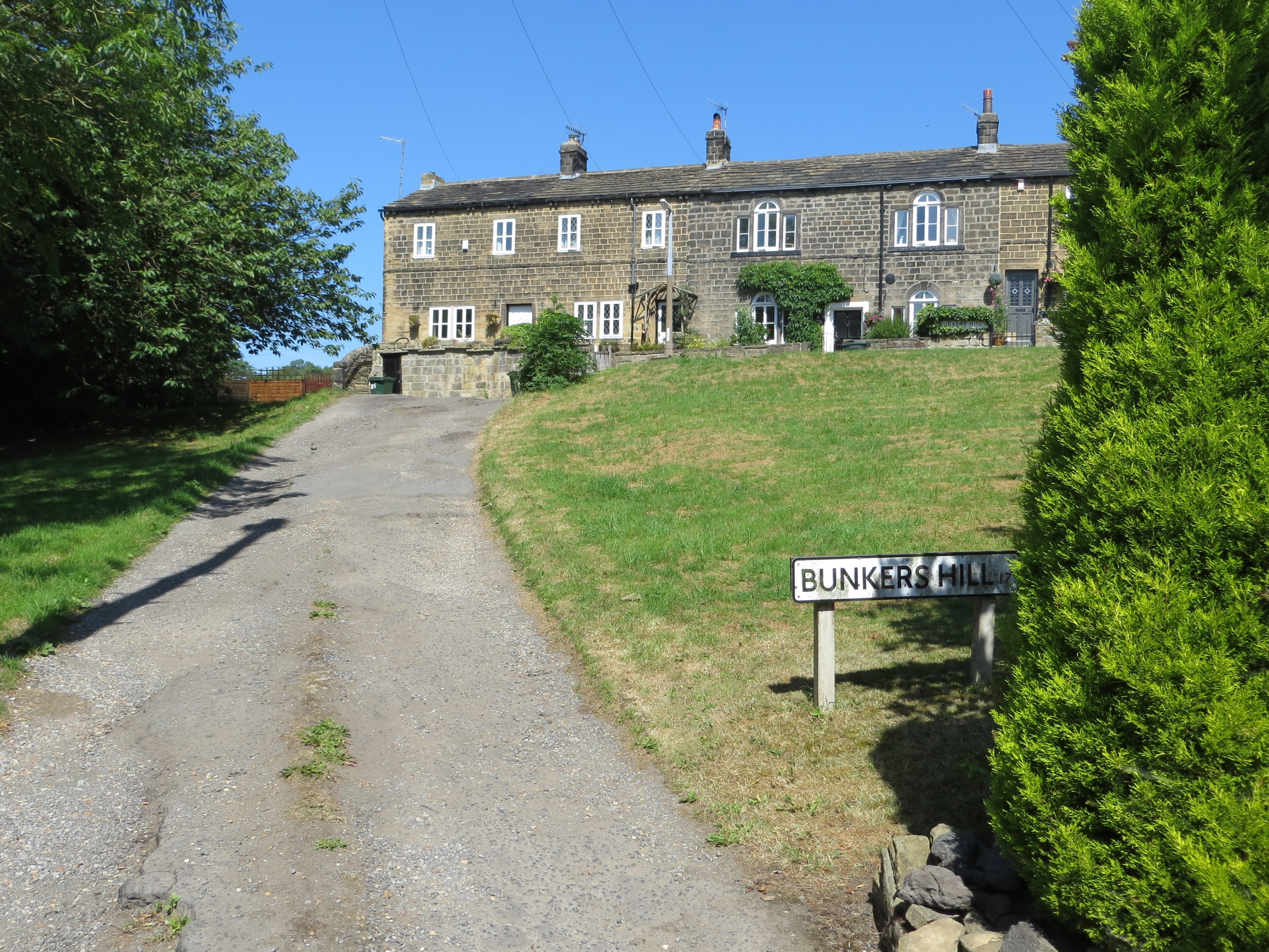
Bunkers Hill, Esholt.jpg - Geograph Update Bot

Walking along the Leeds to Liverpool Canal ^126 - geograph.org.uk - 2072778.jpg - GeographBot

Bridleway to Gill Lane, Yeadon - geograph.org.uk - 2261662.jpg - GeographBot

Bridleway past Esholt Sewage Works, Yeadon - geograph.org.uk - 2268495.jpg - GeographBot

View from railway bridge No.7, Yeadon - geograph.org.uk - 2268504.jpg - GeographBot

Track - Apperley Lane - geograph.org.uk - 2578805.jpg - GeographBot

Track - Apperley Lane - geograph.org.uk - 2578963.jpg - GeographBot

St Leonards Farm Park in Esholt - geograph.org.uk - 2663482.jpg - GeographBot

St Leonards Farm in Esholt - geograph.org.uk - 2663488.jpg - GeographBot

St Leonards Farm Park in Esholt - geograph.org.uk - 2663494.jpg - GeographBot

Stable at St Leonards Farm Park - geograph.org.uk - 2663499.jpg - GeographBot

The Old School House in Church Lane - geograph.org.uk - 2663567.jpg - GeographBot

The former village pump in Esholt - geograph.org.uk - 2663569.jpg - GeographBot

Yeadon Gill - Greenlea Road - geograph.org.uk - 2912260.jpg - GeographBot

The Railway Tunnel at Westfield, Yeadon on the Guiseley to Leeds Line - geograph.org.uk - 2947704.jpg - GeographBot

Ordnance Survey Cut Mark - geograph.org.uk - 3028956.jpg - GeographBot

Ordnance Survey Cut Mark - geograph.org.uk - 3029007.jpg - GeographBot

Ordnance Survey Cut Mark - geograph.org.uk - 3029028.jpg - GeographBot

Old milestone (geograph 6822966).jpg - Sic19

Construction at the water works - geograph.org.uk - 3529741.jpg - GeographBot

Esholt, Main Street - geograph.org.uk - 3544358.jpg - GeographBot

Esholt, Old Hollins Hill - geograph.org.uk - 3544379.jpg - GeographBot

Farmland near the River Aire - geograph.org.uk - 3805145.jpg - GeographBot

A View from Old Hollings Hill - geograph.org.uk - 3855058.jpg - GeographBot

Wharfedale Line in Spring Wood looking South - geograph.org.uk - 3855922.jpg - GeographBot

Track beside the Leeds-Ilkley Railway - geograph.org.uk - 3855927.jpg - GeographBot

Wide Track in Gill Wood - geograph.org.uk - 3855928.jpg - GeographBot

Bridleway leading to Apperley Bridge - geograph.org.uk - 3855929.jpg - GeographBot
Bridleway heading North from Apperley Bridge - geograph.org.uk - 3855933.jpg - GeographBot

Esholt Cricket Ground - geograph.org.uk - 4244899.jpg - GeographBot

Old pump and bench, village green, Esholt - geograph.org.uk - 4466613.jpg - GeographBot

Old Hall Farmhouse from village green, Esholt - geograph.org.uk - 4466619.jpg - GeographBot

Farm equipment in front of Old Hall Farmhouse, Esholt - geograph.org.uk - 4466624.jpg - GeographBot

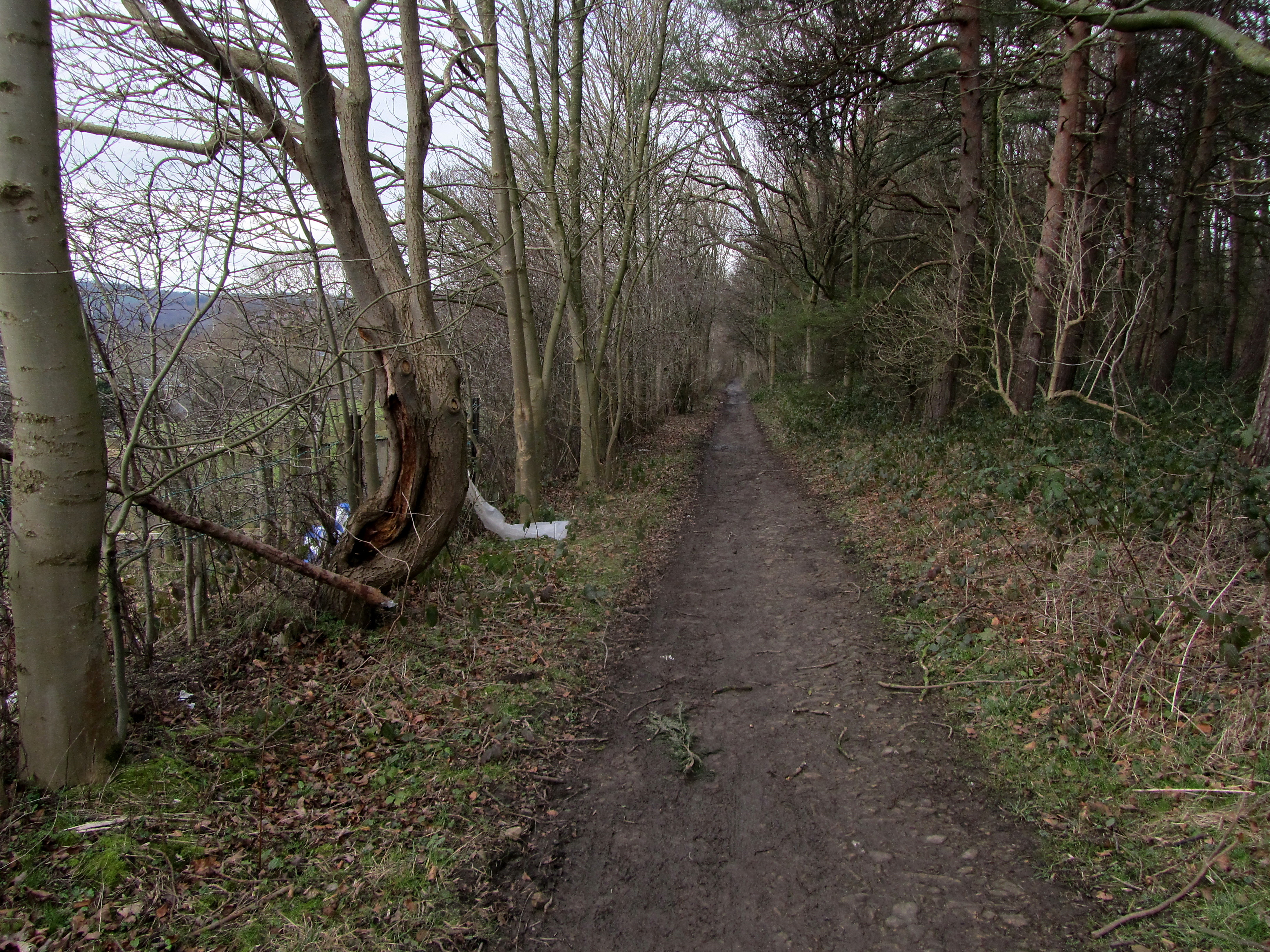
Path through woodland at Walk Hill - geograph.org.uk - 5050933.jpg - GeographBot

Power lines crossing the River Aire valley - geograph.org.uk - 5775064.jpg - GeographBot

Bluebells, Field Wood - geograph.org.uk - 6628425.jpg - GeographBot

Field Wood - geograph.org.uk - 6628434.jpg - GeographBot

Field by Leeds ^ Liverpool Canal - geograph.org.uk - 6628440.jpg - GeographBot

View from the Apperley Viaduct - geograph.org.uk - 6650604.jpg - GeographBot

Looking across the railway cutting in Hollins Wood - geograph.org.uk - 6651948.jpg - GeographBot

The bottom of Old Hollins Hill - geograph.org.uk - 6651991.jpg - GeographBot

Railway east of Lamb Springs - geograph.org.uk - 6652267.jpg - GeographBot

Yeadon Gill below Greenlea Road - geograph.org.uk - 6742523.jpg - GeographBot

Esholt cricket ground - geograph.org.uk - 6874469.jpg - GeographBot

Esholt cricket ground from above - geograph.org.uk - 6874645.jpg - GeographBot

Footpath from Esholt Lane to Cunliffe Lane, Esholt - geograph.org.uk - 6907853.jpg - GeographBot

Beck near St. Paul's Church, Esholt - geograph.org.uk - 7155001.jpg - GeographBot