Wikimedi'Òc
Modes d'emploi

Cet album fait partie des albums
Cet album photos contient les sous-albums suivants :
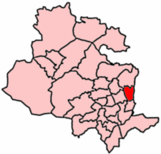


Eccleshill Ward 2004.png - MGSpiller
Dismantled railway - geograph.org.uk - 260316.jpg - GeographBot

Eccleshill Trig Pillar, 212 metres - geograph.org.uk - 373017.jpg - GeographBot

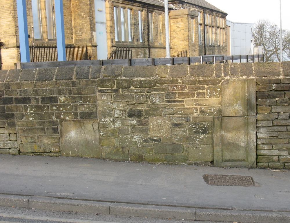
363-367 Idle Road - geograph.org.uk - 416170.jpg - GeographBot

Victoria Rangers ARLFC Ground - Harrogate Road - geograph.org.uk - 619328.jpg - GeographBot

Bank - geograph.org.uk - 639585.jpg - GeographBot

Crown Bowling Green - Stone Hall Road - geograph.org.uk - 639351.jpg - GeographBot

Lands Lane - off Norman Lane - geograph.org.uk - 639586.jpg - GeographBot

St Francis' Presbytery - Norman Lane - geograph.org.uk - 639594.jpg - GeographBot

The Manor House - Leeds Road, Eccleshill - geograph.org.uk - 639333.jpg - GeographBot

The Prospect - Stone Hall Road - geograph.org.uk - 639346.jpg - GeographBot

The Sycamores - Norman Lane - geograph.org.uk - 639590.jpg - GeographBot

R.S.Crooke and Co (Paper Sales) Ltd. Idle Road - geograph.org.uk - 1021003.jpg - GeographBot

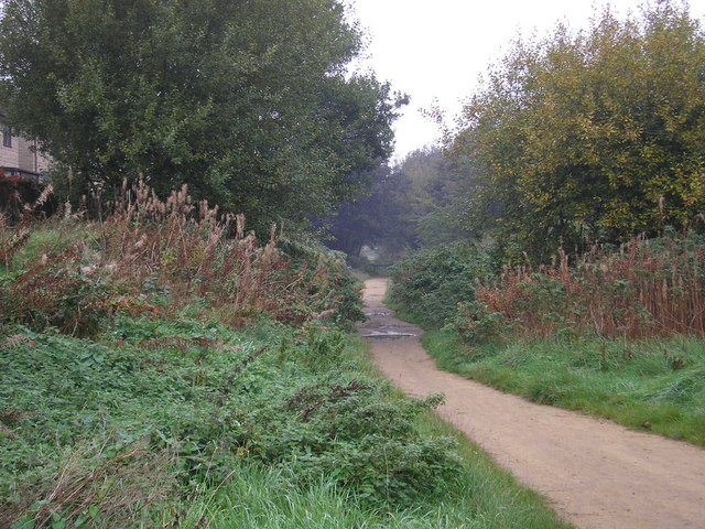
Former railway line - geograph.org.uk - 1147182.jpg - GeographBot

Ponies in the snow - geograph.org.uk - 1147173.jpg - GeographBot

Beckwith Drive - Harrogate Road - geograph.org.uk - 1289158.jpg - GeographBot

Pendragon - Lister Lane - geograph.org.uk - 1283933.jpg - GeographBot

Former Pilley's Mill, Eccleshill-1200.jpg - JohnYeadon

Monkey Bridge, Eccleshill-900.jpg - JohnYeadon
Eccleshill Hall gateposts-1000.jpg - JohnYeadon

Prospect Chapel Burial Ground.jpg - Stuffed cat
Medical Heritage Library (IA b20423330).pdf - Fæ
Report 1893 (IA b29189731).pdf - Fæ

31 Moorside Road, Eccleshill.jpg - Geograph Update Bot

Charnwood Centre - Charnwood Road - geograph.org.uk - 2195709.jpg - GeographBot

Driveway to The Park.Eccleshill - geograph.org.uk - 2260080.jpg - GeographBot

Footpath - Rockwell Lane - geograph.org.uk - 2371807.jpg - GeographBot

Path - Stonegate Road -Sandholme Drive - geograph.org.uk - 2372671.jpg - GeographBot

Path - Sandholme Drive-Stonegate Road - geograph.org.uk - 2372673.jpg - GeographBot

Levisham Close - Park Road - geograph.org.uk - 2373285.jpg - GeographBot

Playing Fields - near Eccleshill Community Hospital - geograph.org.uk - 2373533.jpg - GeographBot

Footpath - side of Eccleshill Community Hospital - geograph.org.uk - 2373550.jpg - GeographBot

Footpath - Javelin Close to Bradford Road - geograph.org.uk - 2381891.jpg - GeographBot

Footpath - Farm Hill Road to Norman Lane - geograph.org.uk - 2382002.jpg - GeographBot

Footpath - Norman Lane to Farm Hill Road - geograph.org.uk - 2382006.jpg - GeographBot

Ordnance Survey Cut Mark - geograph.org.uk - 2803993.jpg - GeographBot

Ordnance Survey Cut Mark - geograph.org.uk - 2804028.jpg - GeographBot

Cut benchmark on the former Hutton School - geograph.org.uk - 3909573.jpg - GeographBot

Cut bench mark on wall of sealed up urinal and lockup - geograph.org.uk - 3911365.jpg - GeographBot

Moorwell Place - geograph.org.uk - 4263720.jpg - GeographBot

Eccleshill Trig Pillar - geograph.org.uk - 5639201.jpg - GeographBot

OS Flush Bracket S4196 on Eccleshill Trig Pillar - geograph.org.uk - 5639207.jpg - GeographBot

Eccleshill Adventure Playground - geograph.org.uk - 6080413.jpg - GeographBot

Eccleshill recreation ground - geograph.org.uk - 6341464.jpg - GeographBot