Wikimedi'Òc
Modes d'emploi

Cet album fait partie des albums


A classic drumlin and inter-drumlin wetland near the highest point on the Dunmore Road - geograph.org.uk - 5163388.jpg - GeographBot

A couple of textbook examples of drumlins west of the B7 - geograph.org.uk - 2901921.jpg - GeographBot

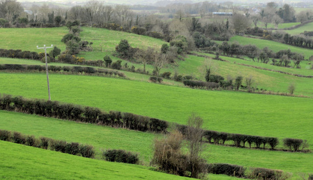
A drumlin on the north side of Saintfield Road, Ballygowan - geograph.org.uk - 3747601.jpg - GeographBot

Drumlin country (24) - geograph.org.uk - 1135785.jpg - GeographBot

Drumlin country (25) - geograph.org.uk - 1135826.jpg - GeographBot

Drumlin country (26) - geograph.org.uk - 1152427.jpg - GeographBot

Drumlin country (3) - geograph.org.uk - 171700.jpg - GeographBot

Drumlin country (32) - geograph.org.uk - 1773226.jpg - GeographBot

A whale back drumlin separating the middle section of Drumanaghan Road from the Demesne Road - geograph.org.uk - 4387340.jpg - GeographBot

Cattle on a drumlin slope on the north side of Ballysallagh Road - geograph.org.uk - 4145880.jpg - GeographBot

Drumlin by the Quoile, Downpatrick (May 2015) - geograph.org.uk - 4456573.jpg - GeographBot

Drumlin country (31) - geograph.org.uk - 1773089.jpg - GeographBot

Drumlin country (4) - geograph.org.uk - 172005.jpg - GeographBot

Drumlin country (29) - geograph.org.uk - 1462700.jpg - GeographBot

Hen Island Strangford Lough.jpg - Finnrind

Hill and mast north of Killyleagh - geograph.org.uk - 751775.jpg - GeographBot

Drumlin country (9) - geograph.org.uk - 296220.jpg - GeographBot

Drumlin country (18) - geograph.org.uk - 745737.jpg - GeographBot

Drumlin country (19) - geograph.org.uk - 748962.jpg - GeographBot

A classic drumlin between Abbacy Road and Lough Cowey - geograph.org.uk - 5500491.jpg - GeographBot

Cattle and drumlin, Ballynahinch - geograph.org.uk - 3164922.jpg - GeographBot

A dairy herd on a drumlin - geograph.org.uk - 3566957.jpg - GeographBot

A drumlin south of Loch Quarter Road - geograph.org.uk - 2498957.jpg - GeographBot

A drumlin west of the Ardaragh road - geograph.org.uk - 2894554.jpg - GeographBot

Drumlin landscape north of Whitehill Road - geograph.org.uk - 5443006.jpg - GeographBot

Drumlin on the north side of Whitehill Road - geograph.org.uk - 5440462.jpg - GeographBot

Drumlin hollow wetland north of the Ballydugan Road - geograph.org.uk - 3859040.jpg - GeographBot

Drumlin south of the Ballydugan Road - geograph.org.uk - 3859109.jpg - GeographBot

Area of drumlins south of the upper section of Glenloughan Road - geograph.org.uk - 3579156.jpg - GeographBot

Drumlins east of the Glenloughan Road - geograph.org.uk - 3578069.jpg - GeographBot

A section of the drumlin belt between the Mournes and the Slieve Croob range - geograph.org.uk - 4283557.jpg - GeographBot

Drumlins north of the B8 - geograph.org.uk - 1587241.jpg - GeographBot

Drumlin landscape east of Abbacy Road - geograph.org.uk - 5505873.jpg - GeographBot

Drumlin above the Killough Road - geograph.org.uk - 2747393.jpg - GeographBot

Drumlin and barley field near Dundonald - geograph.org.uk - 2526233.jpg - GeographBot

Drumlin country (33) - geograph.org.uk - 1880913.jpg - GeographBot

Drumlin country (34) - geograph.org.uk - 1888760.jpg - GeographBot

Drumlin country (35) - geograph.org.uk - 1888787.jpg - GeographBot

Drumlin country (37) - geograph.org.uk - 2114060.jpg - GeographBot

Drumlin country (38) - geograph.org.uk - 2168463.jpg - GeographBot

Drumlin country (39) - geograph.org.uk - 2480900.jpg - GeographBot

Drumlin country (40) - geograph.org.uk - 2762296.jpg - GeographBot

Drumlin field near Comber (4) - geograph.org.uk - 2770591.jpg - GeographBot

Drumlin field near Comber (3) - geograph.org.uk - 2762308.jpg - GeographBot

Drumlin near Comber (2) - geograph.org.uk - 2113958.jpg - GeographBot

Drumlin near Carryduff - geograph.org.uk - 1881216.jpg - GeographBot

Drumlin near Comber - geograph.org.uk - 1927970.jpg - GeographBot

Drumlin near Boardmills - geograph.org.uk - 1877777.jpg - GeographBot

Drumlin field near Comber (2) - geograph.org.uk - 2762155.jpg - GeographBot

Drumlin near Shrigley - geograph.org.uk - 2243977.jpg - GeographBot

Drumlin near Killyleagh - geograph.org.uk - 1862304.jpg - GeographBot

Drumlin near Strangford (1) - geograph.org.uk - 2502378.jpg - GeographBot

Drumlin near Katesbridge - geograph.org.uk - 1933943.jpg - GeographBot

Drumlin north west of Drumee Cemetery - geograph.org.uk - 1888406.jpg - GeographBot

Drumlin north of the Quarter Road - geograph.org.uk - 2744409.jpg - GeographBot

Drumlin near Comber (4) - geograph.org.uk - 2769547.jpg - GeographBot

Drumlin, Ballygowan-Saintfield (1) - geograph.org.uk - 2773142.jpg - GeographBot

Drumlin near Downpatrick (3) - geograph.org.uk - 2170999.jpg - GeographBot

Drumlins east of the Bann near Lenish Bridge - geograph.org.uk - 1972619.jpg - GeographBot

Drumlins in the Townland of Crobane - geograph.org.uk - 2073053.jpg - GeographBot

Drumlin, Ballygowan-Saintfield (2) - geograph.org.uk - 2773163.jpg - GeographBot

Drumlin near Ballynahinch - geograph.org.uk - 1877396.jpg - GeographBot

Drumlin near Downpatrick (2) - geograph.org.uk - 2170839.jpg - GeographBot

Drumlins near Crossgar - geograph.org.uk - 1905228.jpg - GeographBot

Drumlins near Newtownards (2) - geograph.org.uk - 2454579.jpg - GeographBot

Drumlins near Portaferry - geograph.org.uk - 2577819.jpg - GeographBot

Drumlin near Dundonald - geograph.org.uk - 2526369.jpg - GeographBot

Drumlin near Downpatrick - geograph.org.uk - 1950416.jpg - GeographBot

Drumlins north of the A2 - geograph.org.uk - 2184238.jpg - GeographBot

Drumlin near Lisburn - geograph.org.uk - 2727258.jpg - GeographBot

Drumlin near Strangford (2) - geograph.org.uk - 2502396.jpg - GeographBot

Drumlins near Saintfield - geograph.org.uk - 1877338.jpg - GeographBot

Drumlins west of Drumgooland Road - geograph.org.uk - 2506030.jpg - GeographBot

Drumlin west of the A2 Tyrella road - geograph.org.uk - 2159429.jpg - GeographBot

Drumlin, Downpatrick (2) - geograph.org.uk - 2144101.jpg - GeographBot

Drumlins near Loughbrickland (1) - geograph.org.uk - 1888597.jpg - GeographBot

Drumlins south of the Carrickinab Road - geograph.org.uk - 2164984.jpg - GeographBot

Drumlins near Glascar and Rathfriland - geograph.org.uk - 1944552.jpg - GeographBot

Drumlins near Newtownards (3) - geograph.org.uk - 2455841.jpg - GeographBot

Drumlins near Newtownards - geograph.org.uk - 2235899.jpg - GeographBot

Drumlin field near Comber (1) - geograph.org.uk - 2762129.jpg - GeographBot
Drumlin fields near Ballygowan - geograph.org.uk - 2772833.jpg - GeographBot

Drumlin landscape at Creeghduff - geograph.org.uk - 2307988.jpg - GeographBot

Drumlin and bogland north of the B8 - geograph.org.uk - 2073101.jpg - GeographBot

Drumlin top shelter belt above the Clonallon Road - geograph.org.uk - 5221759.jpg - GeographBot

Drumlin to the west of Carnacally Road - geograph.org.uk - 2859265.jpg - GeographBot

Drumlins south-west of Carnacally Road - geograph.org.uk - 2859694.jpg - GeographBot

Drumlin land between Ballysallagh Road and Dillin Road - geograph.org.uk - 4145911.jpg - GeographBot

Harvested drumlin land west of the Ballysallagh Road - geograph.org.uk - 4147270.jpg - GeographBot

Drumlin north of Ballysallagh Road - geograph.org.uk - 4143838.jpg - GeographBot