Wikimedi'Òc
Modes d'emploi

Cet album fait partie des albums
Cet album photos contient les sous-albums suivants :


Old Milestone on Whitesheet Hill, Berwick St John Parish - geograph.org.uk - 7673345.jpg - GeographBot

Old Wardour Castle - geograph.org.uk - 7772436.jpg - GeographBot

Grotto, Old Wardour Castle - geograph.org.uk - 7772444.jpg - GeographBot

Old Wardour Castle - geograph.org.uk - 7773671.jpg - GeographBot

Spiral staircase, Old Wardour Castle - geograph.org.uk - 7773680.jpg - GeographBot

Entrance to Wardour Castle - geograph.org.uk - 288822.jpg - GeographBot

Farmland north of Wardour - geograph.org.uk - 288835.jpg - GeographBot

Junction north of Wardour - geograph.org.uk - 288843.jpg - GeographBot

View from Wardour - geograph.org.uk - 288825.jpg - GeographBot

View of Bridzor Farm - geograph.org.uk - 288799.jpg - GeographBot

West End, Donhead St Andrew - geograph.org.uk - 299083.jpg - GeographBot

Downland below Beauchamp House - geograph.org.uk - 317798.jpg - GeographBot

Downland near Donhead St Andrew - geograph.org.uk - 317789.jpg - GeographBot

Stream in Donhead St Andrew - geograph.org.uk - 317803.jpg - GeographBot

Village street - outskirts of Donhead St Andrew - geograph.org.uk - 317795.jpg - GeographBot

The Foresters Arms, Donhead St Andrew - geograph.org.uk - 323771.jpg - GeographBot

White Sheet Hill continues south - geograph.org.uk - 335795.jpg - GeographBot

William and Ann (Wilkins) d. 1859 and 1845 resp. - geograph.org.uk - 334606.jpg - GeographBot

Escarpment from A30 - geograph.org.uk - 353378.jpg - GeographBot

Footpath in Park Copse - geograph.org.uk - 382793.jpg - GeographBot

Inside South Hill Copse - geograph.org.uk - 383518.jpg - GeographBot

Park Gate Farm - geograph.org.uk - 382784.jpg - GeographBot

Park Gate Farm yard - geograph.org.uk - 382789.jpg - GeographBot

Sheep grazing in front of Park Copse - geograph.org.uk - 382804.jpg - GeographBot

Smooth water on Park Pond - geograph.org.uk - 382778.jpg - GeographBot

South Hill Copse - geograph.org.uk - 382736.jpg - GeographBot

View of South Hill Copse - geograph.org.uk - 382825.jpg - GeographBot

Wardour Wood - geograph.org.uk - 382799.jpg - GeographBot

Barn on Hook Farm - geograph.org.uk - 391785.jpg - GeographBot

Cout Copse and farmland - geograph.org.uk - 391788.jpg - GeographBot

Cows grazing in Dengrove Bottom - geograph.org.uk - 392188.jpg - GeographBot

Dengrove Bottom - geograph.org.uk - 392159.jpg - GeographBot

Hook Farm - geograph.org.uk - 391651.jpg - GeographBot

Round Hill - geograph.org.uk - 391784.jpg - GeographBot

Round Hill from Hook Farm - geograph.org.uk - 391658.jpg - GeographBot

Track leading out of Dengrove Bottom - geograph.org.uk - 392176.jpg - GeographBot

View of Wessex Ridgeway leaving Donhead St Andrew - geograph.org.uk - 392190.jpg - GeographBot

Park Gate Farm - geograph.org.uk - 603675.jpg - GeographBot

Westfield Farm - geograph.org.uk - 603650.jpg - GeographBot

Meadow, Donhead St Andrew - geograph.org.uk - 830133.jpg - GeographBot

Bridleway near Ferne - geograph.org.uk - 859068.jpg - GeographBot

Permissive footpath near Old Wardour Castle - geograph.org.uk - 887383.jpg - GeographBot

Reservoir near South Hill Copse - geograph.org.uk - 887385.jpg - GeographBot

South Hill Copse - geograph.org.uk - 887576.jpg - GeographBot

Track junction, South Hill Copse - geograph.org.uk - 887578.jpg - GeographBot

Track near Old Wardour Castle - geograph.org.uk - 887630.jpg - GeographBot

Wessex Ridgeway near Old Wardour Castle - geograph.org.uk - 887662.jpg - GeographBot

George VI postbox and notice board, Donhead St Andrew - geograph.org.uk - 985612.jpg - GeographBot

George V postbox, Donhead St Andrew - geograph.org.uk - 1091927.jpg - GeographBot

Road junction, Donhead St Andrew - geograph.org.uk - 1091919.jpg - GeographBot

Weather vane, Donhead St Andrew - geograph.org.uk - 1091898.jpg - GeographBot

New hedge near Berwick St John - geograph.org.uk - 1183359.jpg - GeographBot

Alive and dead, Donhead st Andrew - geograph.org.uk - 1255430.jpg - GeographBot

Orange Hawkbit, Rowberry - geograph.org.uk - 1357131.jpg - GeographBot

Sign and junction, Rowberry - geograph.org.uk - 1356539.jpg - GeographBot

Permissive path, High Wood - geograph.org.uk - 1705796.jpg - GeographBot

Tree roots near Old Wardour Castle - geograph.org.uk - 1705746.jpg - GeographBot

Woodland edge, High Wood - geograph.org.uk - 1705807.jpg - GeographBot
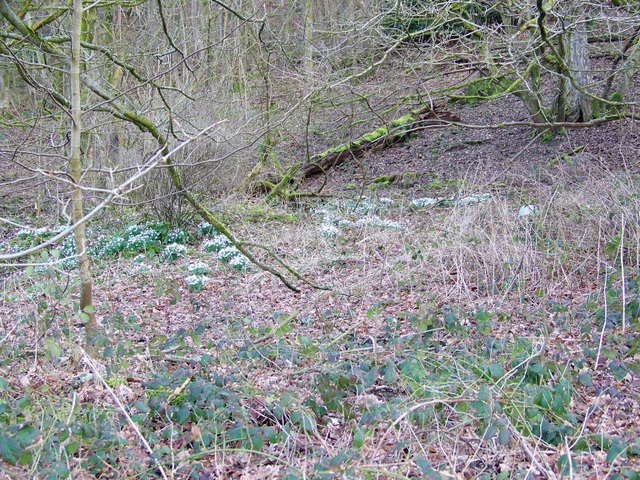
Snowdrops near Wardour Castle - geograph.org.uk - 1733449.jpg - GeographBot
Archway, Old Wardour 02.jpg - Simon Burchell

Archway, Old Wardour 01.jpg - Simon Burchell

Primroses, Wardour Woods - geograph.org.uk - 1808817.jpg - GeographBot

Milepost, Donhead St Andrew - geograph.org.uk - 2015762.jpg - GeographBot

Milepost, Donhead St Andrew - geograph.org.uk - 2015780.jpg - GeographBot

Donhead Telephone Exchange, Wilts - geograph.org.uk - 2366199.jpg - GeographBot

Cresswell's Pond, Wardour - geograph.org.uk - 2733565.jpg - GeographBot

Footpath, Wardour - geograph.org.uk - 2733592.jpg - GeographBot

Through the old bridge - geograph.org.uk - 2737799.jpg - GeographBot

Looking down - geograph.org.uk - 2737830.jpg - GeographBot

Looking up - geograph.org.uk - 2737835.jpg - GeographBot

Along the top - geograph.org.uk - 2737865.jpg - GeographBot

Herd of young bullocks - geograph.org.uk - 3005773.jpg - GeographBot

View across small pond in the Donheads - geograph.org.uk - 3261792.jpg - GeographBot

Layby on A30 near Donhead St. Andrew - geograph.org.uk - 3398960.jpg - GeographBot

Houses near Whitesand Cross - geograph.org.uk - 3490946.jpg - GeographBot

Donhead St. Andrew, postbox № SP7 121, Overway Lane - geograph.org.uk - 3499917.jpg - GeographBot

Donhead St. Andrew, postbox № SP7 88 and noticeboard, Lower Street - geograph.org.uk - 3499928.jpg - GeographBot

Donhead St. Andrew, postbox № SP7 36, New Road - geograph.org.uk - 3499934.jpg - GeographBot

Donhead St. Andrew, postbox № SP7 87 - geograph.org.uk - 3499938.jpg - GeographBot

Wardour, building by the lake - geograph.org.uk - 3500023.jpg - GeographBot

Donhead St. Andrew, phone box in Overway Lane - geograph.org.uk - 3500046.jpg - GeographBot

The bridge at Brook Waters - geograph.org.uk - 3550401.jpg - GeographBot

Lay-by by A30 at Whitesand Cross - geograph.org.uk - 3550406.jpg - GeographBot

A30 approaching junction at White Sheet quarry - geograph.org.uk - 3550418.jpg - GeographBot

Grotto near the Castle - geograph.org.uk - 4039025.jpg - GeographBot

Second Grotto - geograph.org.uk - 4039178.jpg - GeographBot

Graffiti on the wall - geograph.org.uk - 4039221.jpg - GeographBot

Looking out through the walls - geograph.org.uk - 4040612.jpg - GeographBot

Looking down to the Grotto - geograph.org.uk - 4040844.jpg - GeographBot

F Milles - geograph.org.uk - 4040963.jpg - GeographBot

Carved Arch - geograph.org.uk - 4041174.jpg - GeographBot

Chimney in the Kitchen - geograph.org.uk - 4041182.jpg - GeographBot

Out of the Window - geograph.org.uk - 4042098.jpg - GeographBot

An upper room - geograph.org.uk - 4042105.jpg - GeographBot

High Graffiti - geograph.org.uk - 4042112.jpg - GeographBot

Below the Castle - geograph.org.uk - 4042117.jpg - GeographBot

Grotto through the Window - geograph.org.uk - 4042217.jpg - GeographBot

Looking out the window - geograph.org.uk - 4042219.jpg - GeographBot

Narrow room - geograph.org.uk - 4042222.jpg - GeographBot

Looking out the entrance - geograph.org.uk - 4042327.jpg - GeographBot
Empty alcove - geograph.org.uk - 4042332.jpg - GeographBot

Sgt Grant - geograph.org.uk - 4042343.jpg - GeographBot

American Graffiti - geograph.org.uk - 4043442.jpg - GeographBot

Panoramic from the Castle - geograph.org.uk - 4043592.jpg - GeographBot

Higher View - geograph.org.uk - 4043593.jpg - GeographBot

Building in the Corner - geograph.org.uk - 4044016.jpg - GeographBot

Bluebells in the woods - geograph.org.uk - 4044029.jpg - GeographBot

Bottom of Brook Hill at Brook waters - geograph.org.uk - 4046213.jpg - GeographBot

Crossroads at Whitesand Cross - geograph.org.uk - 4046352.jpg - GeographBot

Approaching junction for Sands Farm - geograph.org.uk - 4046358.jpg - GeographBot

Lane near Higher Berrycourt - geograph.org.uk - 4565448.jpg - GeographBot

Path descending hillside near Hare Warren - geograph.org.uk - 4565453.jpg - GeographBot

View from the flanks of Win Green towards Higher Berrycourt - geograph.org.uk - 4565455.jpg - GeographBot

Cottage and house (geograph 5890827).jpg - Sic19

Direction Sign - Signpost near Rowberry House, Donhead St Andrew parish (geograph 6098704).jpg - Sic19

A30 heading west - geograph.org.uk - 5805604.jpg - GeographBot

A30 heading west - geograph.org.uk - 5805615.jpg - GeographBot

A30 heading west - geograph.org.uk - 5805621.jpg - GeographBot

Wardour Lake (3) - geograph.org.uk - 5890701.jpg - GeographBot

Wessex Ridgeway - geograph.org.uk - 5890813.jpg - GeographBot

Old Milepost by the A30, Whitesand Cross, Donhead St Andrew - geograph.org.uk - 6050710.jpg - GeographBot

In Milkwell - geograph.org.uk - 6394733.jpg - GeographBot

Mud and Manure by Green Lane - geograph.org.uk - 6394738.jpg - GeographBot

A View over Dengrove Bottom - geograph.org.uk - 6394952.jpg - GeographBot

Wessex Ridgeway descending towards Dengrove Bottom - geograph.org.uk - 6394955.jpg - GeographBot

Dengrove Farm - geograph.org.uk - 6394959.jpg - GeographBot

Wessex Ridgeway in Dengrove Bottom - geograph.org.uk - 6394961.jpg - GeographBot

Hernsham Street, Donhead St. Andrew - geograph.org.uk - 6394962.jpg - GeographBot

Wessex Ridgeway descending towards Pale Park Pond - geograph.org.uk - 6394964.jpg - GeographBot

Pale Park Pond - geograph.org.uk - 6394967.jpg - GeographBot

Wessex Ridgeway heading East towards Old Wardour - geograph.org.uk - 6394969.jpg - GeographBot

Wessex Ridgeway approaching Old Wardour Castle - geograph.org.uk - 6395392.jpg - GeographBot

The Wessex Ridgeway path entering Milkwell - geograph.org.uk - 6403428.jpg - GeographBot

Shepherd's Lane north of Milkwell - geograph.org.uk - 6403438.jpg - GeographBot

Looking down Dengrove Hill to Dengrove Bottom - geograph.org.uk - 6403444.jpg - GeographBot

Entering the park of Wardour castle - geograph.org.uk - 6403455.jpg - GeographBot

Farmland and plantations in the Wardour Castle park - geograph.org.uk - 6403458.jpg - GeographBot

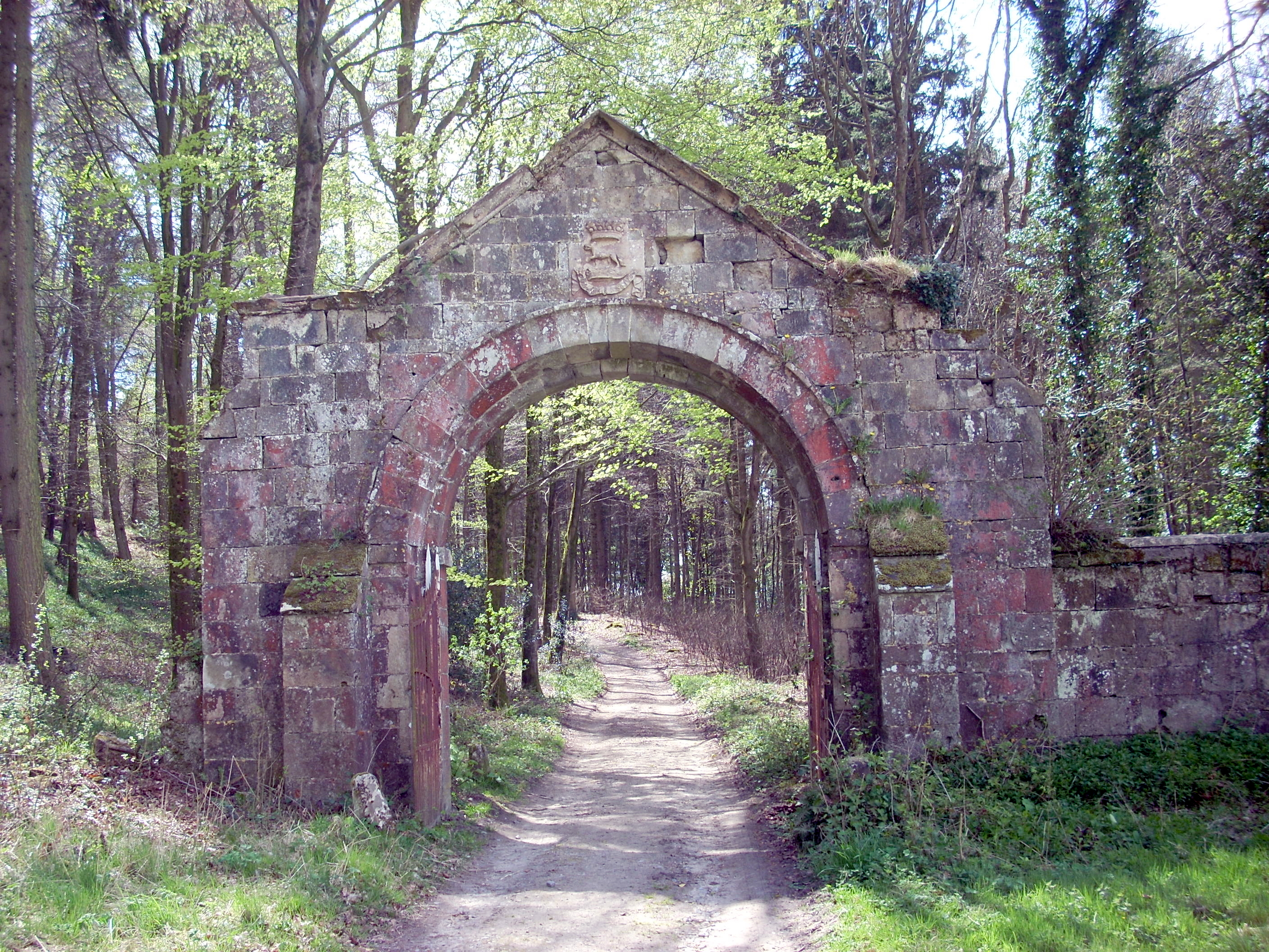
Archway over former entrance to Wardour - geograph.org.uk - 6403472.jpg - GeographBot

'Old' Wardour castle - geograph.org.uk - 6403483.jpg - GeographBot

Old Wardour Castle near Shaftesbury - geograph.org.uk - 6472749.jpg - GeographBot

Old Wardour Castle near Shaftesbury - geograph.org.uk - 6472752.jpg - GeographBot

White Sheet Hill, Donhead St Andrew - geograph.org.uk - 6514399.jpg - GeographBot

The A30, Donhead St Andrew - geograph.org.uk - 6514401.jpg - GeographBot

Brook Hill by Whitesand Cross - geograph.org.uk - 6530909.jpg - GeographBot

The A30 near Donhead St Andrew - geograph.org.uk - 6530910.jpg - GeographBot

Direction Sign – Signpost - geograph.org.uk - 6542734.jpg - GeographBot

Lane passing Ricketts Mill - geograph.org.uk - 6569812.jpg - GeographBot

Water passing under former mill - geograph.org.uk - 6569814.jpg - GeographBot

White Sheet Hill, seen from the A30 - geograph.org.uk - 6569819.jpg - GeographBot

Old Wardour Castle, from the hillside above - geograph.org.uk - 6570508.jpg - GeographBot

Old Wardour Castle - geograph.org.uk - 6570511.jpg - GeographBot

Former gatehouse, Old Wardour Castle - geograph.org.uk - 6570522.jpg - GeographBot

Track approaching Old Wardour Castle - geograph.org.uk - 6570524.jpg - GeographBot

Track near Cresswell's Pond - geograph.org.uk - 6570527.jpg - GeographBot

Lake, as seen from Old Wardour Castle - geograph.org.uk - 6570534.jpg - GeographBot

Path between fields above Old Wardour Castle - geograph.org.uk - 6570541.jpg - GeographBot

Woodland boundary above Old Wardour Castle - geograph.org.uk - 6570544.jpg - GeographBot

Valley view from Britmore Lane - geograph.org.uk - 6570778.jpg - GeographBot

Newly cut field on White Sheet Hill - geograph.org.uk - 6571599.jpg - GeographBot

Harvesting below White Sheet Hill - geograph.org.uk - 6571607.jpg - GeographBot

Downland view toward Arundell Farm - geograph.org.uk - 6571612.jpg - GeographBot

Small wood on western slope of White Sheet Hill - geograph.org.uk - 6571616.jpg - GeographBot

Harvesting near Ferne Lodge - geograph.org.uk - 6571618.jpg - GeographBot

Tractor and trailer waiting for the harvester - geograph.org.uk - 6571621.jpg - GeographBot

Harvester going round the end of a row - geograph.org.uk - 6571623.jpg - GeographBot

Harvest dust storm - geograph.org.uk - 6571624.jpg - GeographBot

Old Wardour Castle, Partially collapsed grotto built by Josiah Lane in 1792 - geograph.org.uk - 6977803.jpg - GeographBot

Old Wardour Castle, Partially collapsed grotto built by Josiah Lane in 1792 - geograph.org.uk - 6977805.jpg - GeographBot

Old Wardour Castle, Partially collapsed grotto built by Josiah Lane in 1792 (detail) - geograph.org.uk - 6977816.jpg - GeographBot

Old Wardour Castle, Partially collapsed grotto built by Josiah Lane in 1792 (detail) - geograph.org.uk - 6977817.jpg - GeographBot

Old Wardour Castle, North eastern aspect - geograph.org.uk - 6977821.jpg - GeographBot

Old Wardour Castle, The towering c14th facade - geograph.org.uk - 6977827.jpg - GeographBot

Old Wardour Castle, The towering c14th facade - geograph.org.uk - 6977829.jpg - GeographBot

Old Wardour Castle, Partially collapsed grotto built by Josiah Lane in 1792 from the castle entrance - geograph.org.uk - 6977843.jpg - GeographBot

'The Castle', Milkwell - geograph.org.uk - 7196495.jpg - GeographBot

Track to Twelve Acre Copse, Ansty Coombe - geograph.org.uk - 7201225.jpg - GeographBot

Avenue, Ferne - geograph.org.uk - 7318653.jpg - GeographBot

Ox Drove near Win Green - geograph.org.uk - 7319426.jpg - GeographBot

Scarp, Win Green - geograph.org.uk - 7319428.jpg - GeographBot

Sheep, Win Green - geograph.org.uk - 7319429.jpg - GeographBot

Higher Barrycourt - geograph.org.uk - 7319430.jpg - GeographBot

Wardour Park - geograph.org.uk - 7371907.jpg - GeographBot

Old Milestone in South Hill Copse by A30 - geograph.org.uk - 7844734.jpg - GeographBot

House at Whitesand Cross - geograph.org.uk - 7850972.jpg - GeographBot

A30 near Donhead st Andrew - geograph.org.uk - 7851003.jpg - GeographBot

A30 near White Sheet Hill - geograph.org.uk - 7851004.jpg - GeographBot

Grotto, Old Wardour Castle - geograph.org.uk - 7861833.jpg - GeographBot

Grotto, Old Wardour Castle - geograph.org.uk - 7861838.jpg - GeographBot

Grotto, Old Wardour Castle - geograph.org.uk - 7862140.jpg - GeographBot

Old Wardour Castle - geograph.org.uk - 7862916.jpg - GeographBot

Windows, Old Wardour Castle - geograph.org.uk - 7863497.jpg - GeographBot

Grotto, Old Wardour Castle - geograph.org.uk - 7863503.jpg - GeographBot

Lake seen from Old Wardour Castle - geograph.org.uk - 7863517.jpg - GeographBot

Lake seen from Old Wardour Castle - geograph.org.uk - 7863808.jpg - GeographBot

Old Wardour Castle - geograph.org.uk - 7863826.jpg - GeographBot

Old Wardour Castle - geograph.org.uk - 7864404.jpg - GeographBot

Privy opposite Old Wardour House on south west corner of Bailey Walls - geograph.org.uk - 7864575.jpg - GeographBot

Old Wardour Castle - geograph.org.uk - 7864820.jpg - GeographBot

Larch, Old Wardour Castle - geograph.org.uk - 7864938.jpg - GeographBot

Grotto, Old Wardour Castle - geograph.org.uk - 7865862.jpg - GeographBot

New Road, Donhead St Andrew - geograph.org.uk - 7865878.jpg - GeographBot

A30 at Brook Waters - geograph.org.uk - 7866090.jpg - GeographBot