Wikimedi'Òc
Modes d'emploi

Cet album fait partie des albums
Cet album photos contient les sous-albums suivants :


Ford, Devil's Water, Embley - geograph.org.uk - 58534.jpg - GeographBot

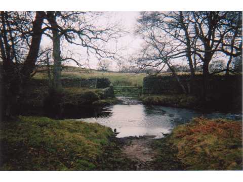
Ford, Peth Foot - geograph.org.uk - 58493.jpg - GeographBot

Irish bridge, Devil's Water - geograph.org.uk - 58486.jpg - GeographBot

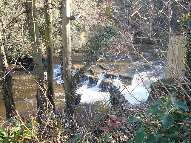
Devil's Water, near Corbridge - geograph.org.uk - 124353.jpg - GeographBot

Devil's Water, near Hexham - geograph.org.uk - 124352.jpg - GeographBot

The Devil's Water - geograph.org.uk - 168394.jpg - GeographBot

Mouth of Devils Water as it reaches River Tyne - geograph.org.uk - 248427.jpg - GeographBot

Devil's Water downstream from Linnels Bridge - geograph.org.uk - 608291.jpg - GeographBot

The Devil's Water, near Dukesfield smelt mill - geograph.org.uk - 611085.jpg - GeographBot

Waterfall on Devil's Water near Linnels Bridge - geograph.org.uk - 698918.jpg - GeographBot

Devil's Water - geograph.org.uk - 795967.jpg - GeographBot

Renny's Barn and the valley of the Devil's Water - geograph.org.uk - 875979.jpg - GeographBot

Folly Farm and the valley of the Devil's Water - geograph.org.uk - 882174.jpg - GeographBot

Upper Devils Water in low water - geograph.org.uk - 1189877.jpg - GeographBot

Bridleway and Embley Bank - geograph.org.uk - 1262690.jpg - GeographBot

Bridleway leading to Devil's Water - geograph.org.uk - 1262679.jpg - GeographBot

Devil's Water - geograph.org.uk - 1260684.jpg - GeographBot

Devil's Water - geograph.org.uk - 1262498.jpg - GeographBot

Devil's Water - geograph.org.uk - 1262503.jpg - GeographBot

Devil's Water - geograph.org.uk - 1262670.jpg - GeographBot

Devil's Water - geograph.org.uk - 1262684.jpg - GeographBot

Devil's Water - geograph.org.uk - 1264580.jpg - GeographBot

Devil's Water - geograph.org.uk - 1264637.jpg - GeographBot

Devil's Water - geograph.org.uk - 1264669.jpg - GeographBot

Devil's Water - geograph.org.uk - 1264679.jpg - GeographBot
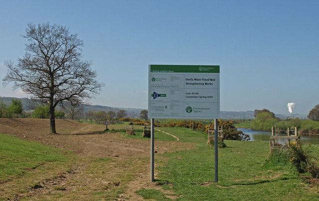
Devil's Water Flood Wall - geograph.org.uk - 1260739.jpg - GeographBot

Devil's Water and Redlead Mill - geograph.org.uk - 1264662.jpg - GeographBot

Field near Devil's Water - geograph.org.uk - 1262493.jpg - GeographBot

Footbridge near Redlead Mill - geograph.org.uk - 1264657.jpg - GeographBot

Footbridge over Devil's Water - geograph.org.uk - 1264574.jpg - GeographBot

Ford, Devil's Water, near Embley - geograph.org.uk - 1264550.jpg - GeographBot

Ford and footbridge, Devil's Water - geograph.org.uk - 1264642.jpg - GeographBot

Rock outcrop, Embley Bank - geograph.org.uk - 1264567.jpg - GeographBot

The Devil's Water from Linnels bridge - geograph.org.uk - 1409168.jpg - GeographBot

Driveway to Nunsbrough House - geograph.org.uk - 1543835.jpg - GeographBot

Ford at Peth Foot - geograph.org.uk - 1556166.jpg - GeographBot

Linnelswood Bridge - geograph.org.uk - 1556168.jpg - GeographBot

A695 Road Bridge at Dilston over the Devil's Water - geograph.org.uk - 1716468.jpg - GeographBot

Lord's Bridge, Devils Water, Dilston - geograph.org.uk - 1710426.jpg - GeographBot

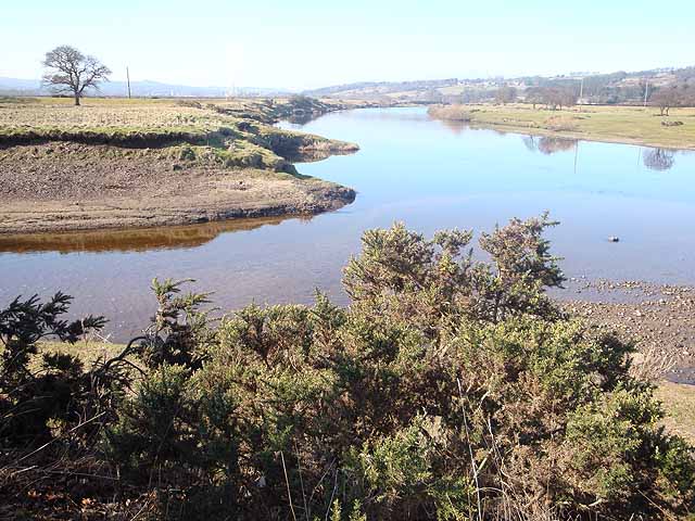
Confluence of the Devil's Water with the Tyne - geograph.org.uk - 1723415.jpg - GeographBot

Confluence of the Devil's Water with the Tyne - geograph.org.uk - 1723416.jpg - GeographBot

Devil's Water - geograph.org.uk - 1723405.jpg - GeographBot

Devil's Water - geograph.org.uk - 1723414.jpg - GeographBot

Devil's Water - geograph.org.uk - 1723417.jpg - GeographBot

Dilston Weir and Fish Ladder on Devil's Water - geograph.org.uk - 1721058.jpg - GeographBot
Confluence of the Devil's Water with the Tyne - geograph.org.uk - 1736789.jpg - GeographBot

Devil's Water - geograph.org.uk - 1736767.jpg - GeographBot
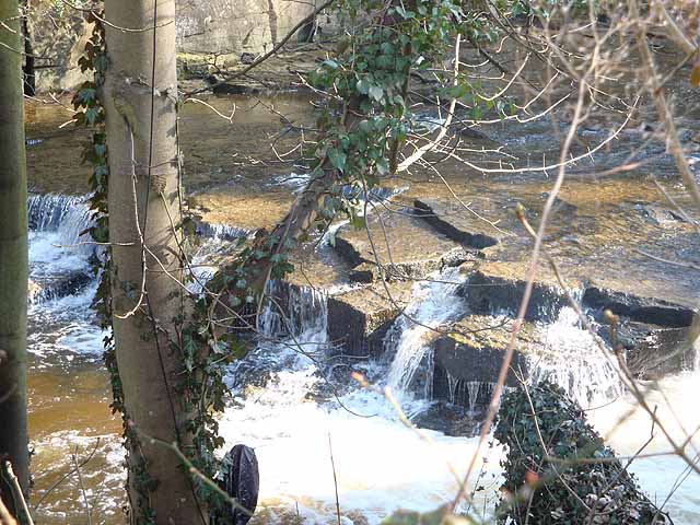
Falls on the Devil's Water - geograph.org.uk - 1736773.jpg - GeographBot
Falls on the Devil's Water - geograph.org.uk - 1736775.jpg - GeographBot

Devil's Water from Linnels Bridge - geograph.org.uk - 2118328.jpg - GeographBot

Devil's Water - geograph.org.uk - 3191416.jpg - GeographBot

Devil's Water, Linnels - geograph.org.uk - 4892029.jpg - GeographBot