Wikimedi'Òc
Modes d'emploi

Cet album fait partie des albums
Cet album photos contient les sous-albums suivants :


Whitehall1799.jpg - Merchbow~commonswiki

FutureCambridgeHouse1799 edited.jpg - Merchbow~commonswiki
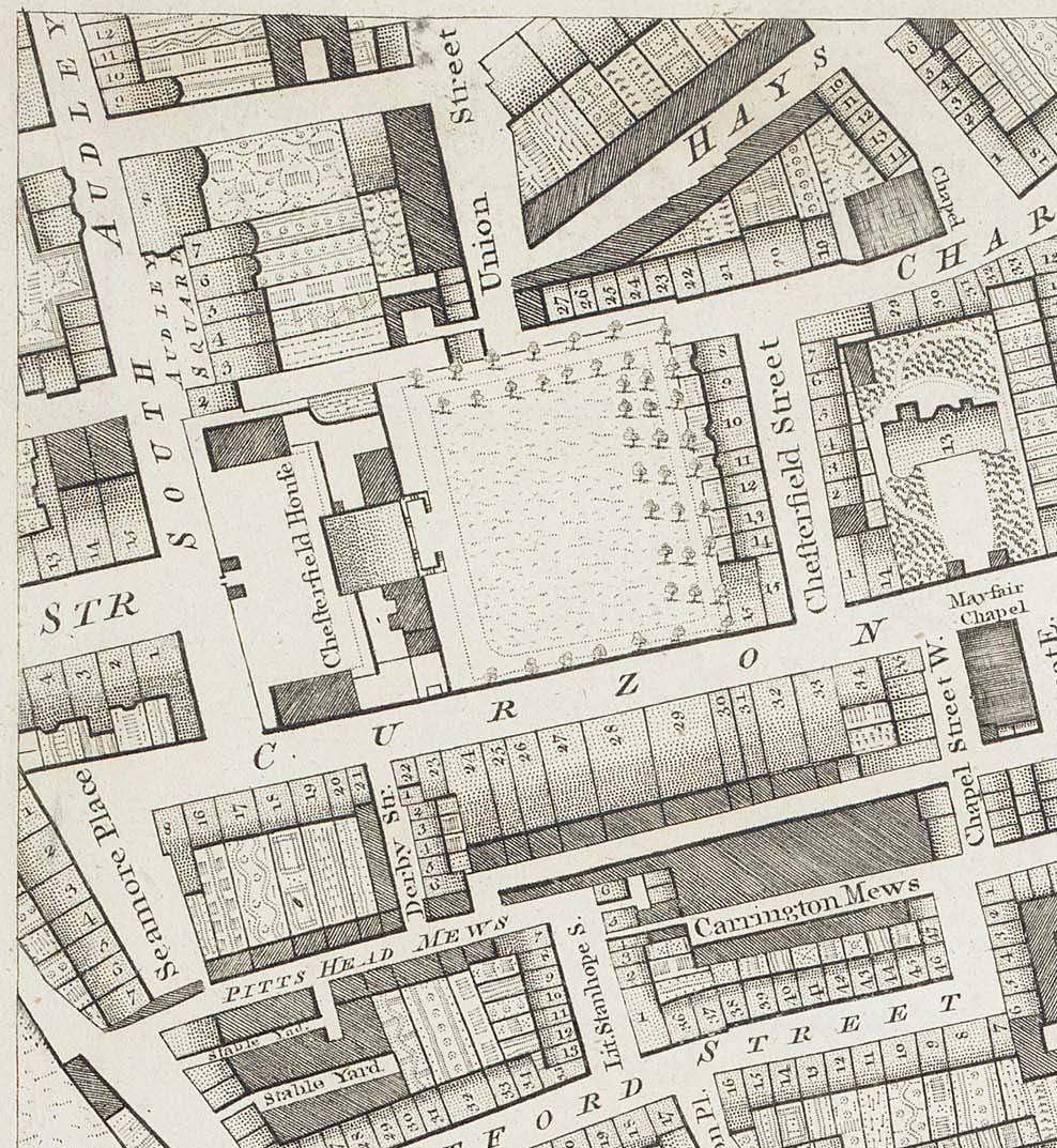
ChesterfieldHouse1799.jpg - Merchbow~commonswiki

St James's Square 1799.jpg - Merchbow~commonswiki
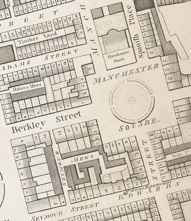
Manchester Square 1799 edited.jpg - Merchbow~commonswiki

Extract from John Carey Map of Middlesex 1793.png - Lcarsdata
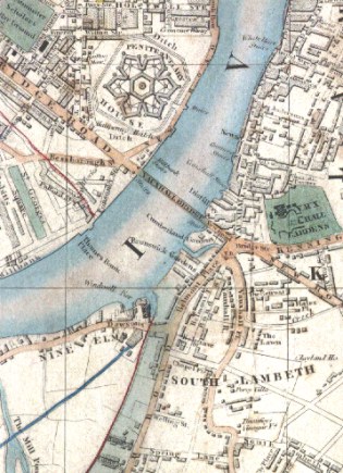
Vauxhall 1847 Joseph Cross map detail.jpg - Jheald
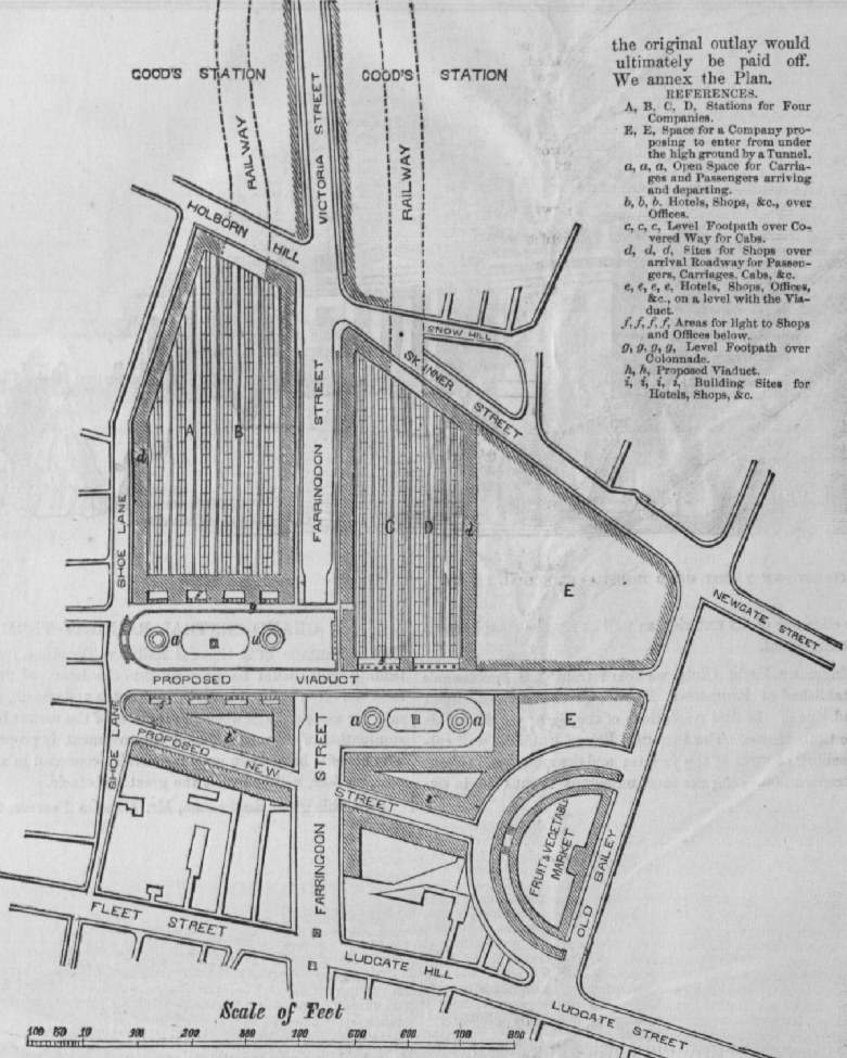
Proposed Central Railway Terminus.png - DavidCane

Morden map 1944.jpg - File Upload Bot (Magnus Manske)

Environs of London Davies map 1841.jpg - Asteuartw

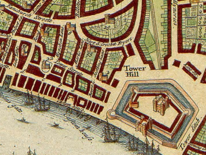
Londinium Augusta, Stukeley, 1766.jpg - Inductiveload

Bowles 1775.jpg - SilkTork

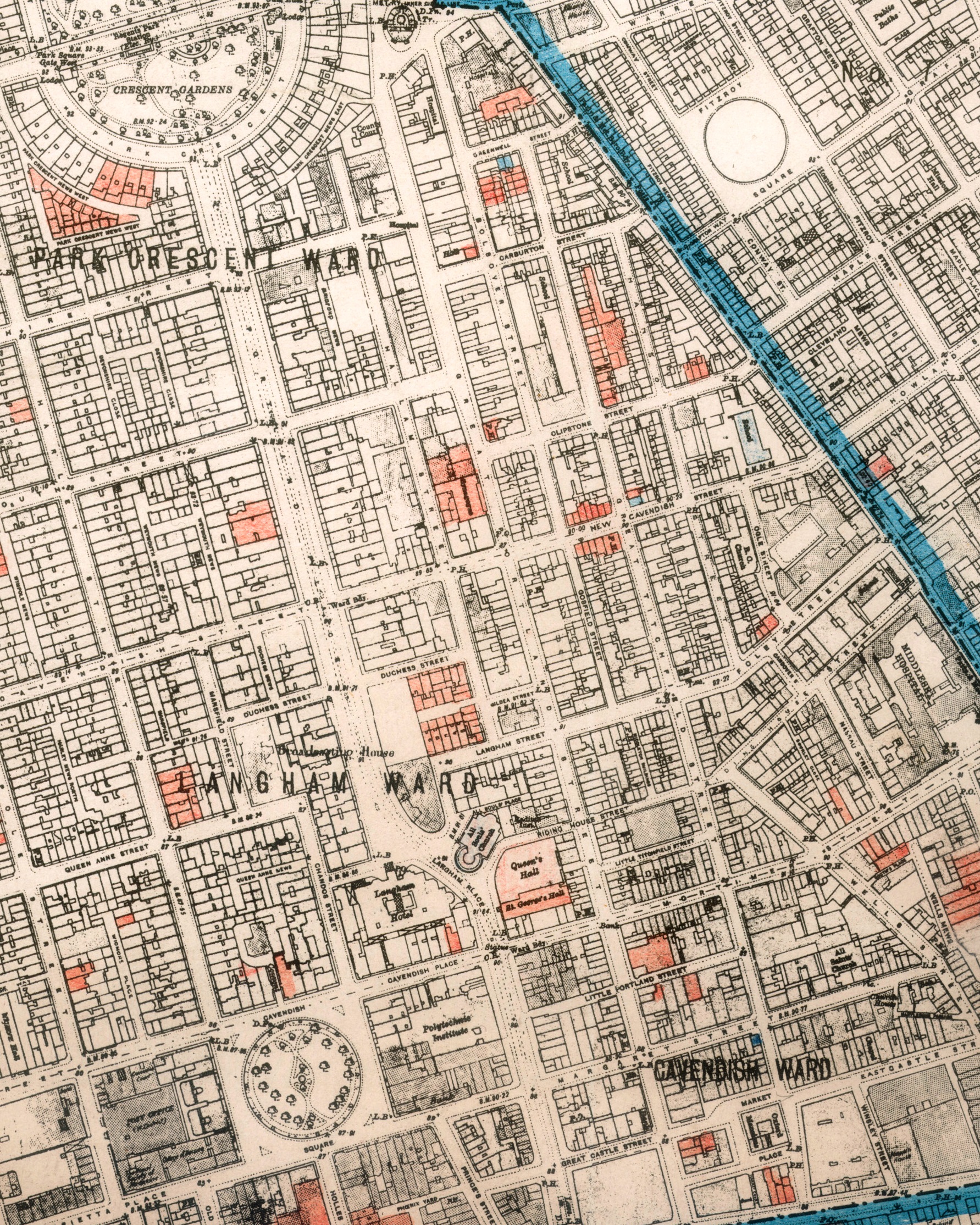
Horwood Great Portland Street circa 1793.jpg - Portlandvillage
Air Raid Damage Map - East Marylebone.jpg - Portlandvillage

Horwood map 1799 St Martins Westminster.jpg - Andrew Dalby

Bankside - the Bear Garden and the Rose Theatre - Norden's Map of London, 1593.png - Tagishsimon

The Kensington Hippodrome, 1841.png - Asteuartw
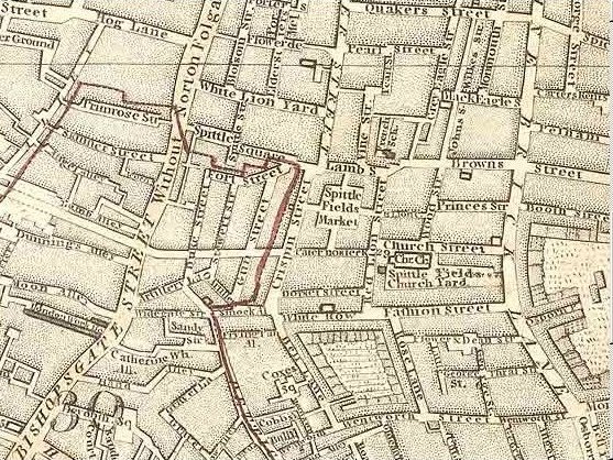
Map of Spitalfields Area - 1787.jpg - Clavileno
Beare Lane, London from Hollar's map.jpg - Philafrenzy
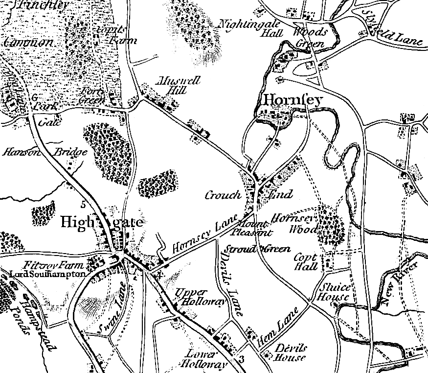
Map- Stroud Green, London 1786.jpg - BD2412

King's Bench Prison and Horsemonger Lane Gaol from 1833 Schmollinger map.jpg - Yeeno

Bomb damage map Milford Lane (July 1944) and Temple (Dec 1940).jpg - Philafrenzy

London and Westminster improved, illustrated by plans Fleuron T138431-7.png - Fæ

London and Westminster improved, illustrated by plans Fleuron T138431-8.png - Fæ

London and Westminster improved, illustrated by plans Fleuron T138431-12.png - Fæ

London and Westminster improved, illustrated by plans Fleuron T138431-14.png - Fæ

The history of London from its foundation to the present time- Containing I Fleuron T100031-26.png - Fæ

Portland Road, Notting Hill, Ordnance Survey map 1960s.jpg - Philafrenzy

South London Map 1800.jpg - Zeku

Barking-map-1777.jpg - Kuohatti

City of London Bomb Damage Map Wood Street and Milk Street.jpg - Philafrenzy
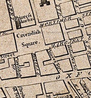
Cavendish Square and environs, 1764.jpg - Belbury

Plate 1 An actual survey of the great post-roads between London and Edinburgh (cropped).jpg - Philafrenzy
Horwood Blackwall.jpg - MIDI

Tithe Map 2 Edit.jpg - Colin Potter 20

London and its environs (1844).jpg - Colin Potter 20
Limehouse Cut at the beginning of the 19th century.jpg - Ttocserp
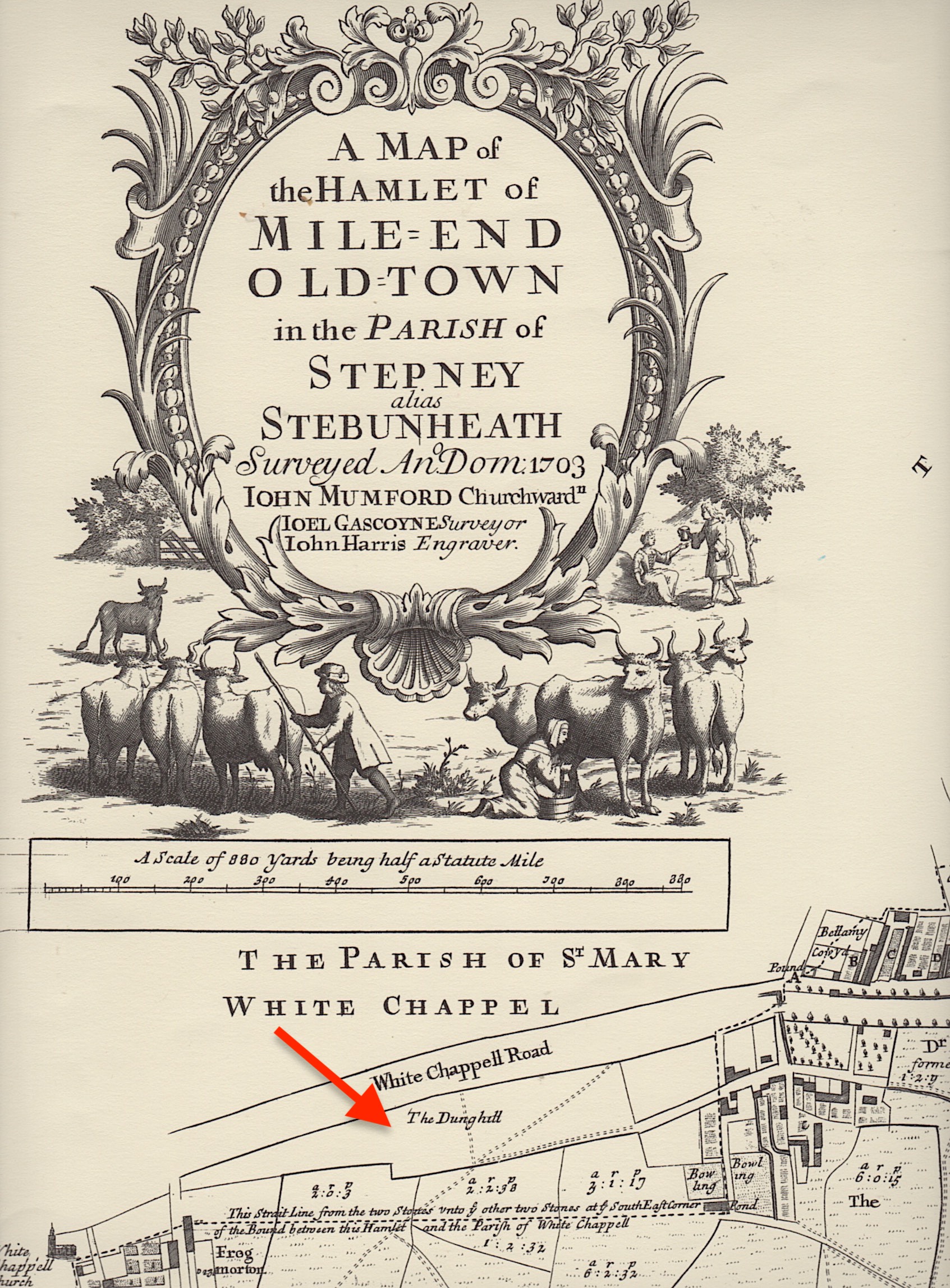
Gascoyne's map of 1703 Mile End (fragment).jpg - Ttocserp

Fragment of Cary's map, 1795, showing location of Whitechapel Mount.png - Ttocserp

Gascoyne 1703 - Whitechapel Mount.jpg - Ttocserp

Gacoyne's chart shop, Wapping.jpg - Ttocserp

Gascoyne's Stepney (church).jpg - Ttocserp

Joel Gascoyne's Spitalfields.jpg - Ttocserp

Joel Gascoyne's Limehouse.jpg - Ttocserp

Norden 1593 Lambeth Marsh.jpg - Ttocserp

Lambeth Marsh 1739.jpg - Ttocserp

Primrose Hill 1841.png - Rcsprinter123

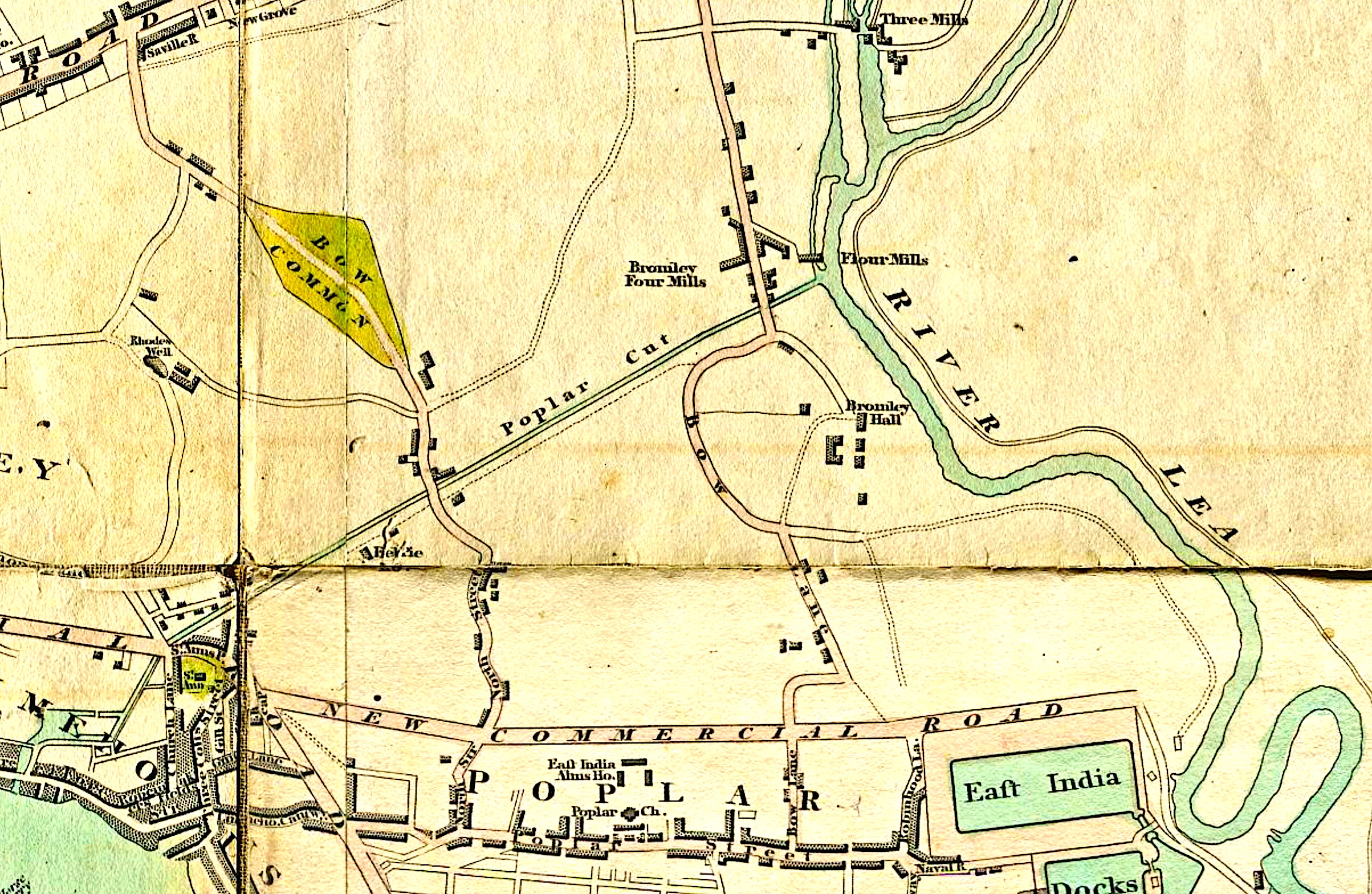
Poplar Gut 1703.jpg - Ttocserp

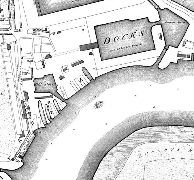
Port of London in 1661.jpg - Ttocserp

Noble Street and surrounding area Bombing, mapped in 1945.png - Jamzze

Map showing the Great Conduit, 1642.jpg - Belbury
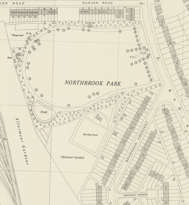
NorthbrookPark1944OSmap.jpg - Carlwev

Plan showing the extent of the Great Fire in Cornhill in 1748.jpg - JustForCommons

Edward Stanford 1904 (detail).jpg - Ttocserp

Smith's New Map of London (1816).jpg - ObserverGroup
London 1724.jpg - LlywelynII

Battersea railways - Macaulay 1863.jpg - Verbarson

Battersea railways - Macaulay 1859.jpg - Verbarson

Thamesis Descriptio IoD.png - Ttocserp

London and Westminster improved, illustrated by plans Fleuron T138431-3.png - Fæ

IV.14 (Screenshot 2024-12-17 at 19-02-27 HamView map Ordnance Survey London (1915- Numbered sheets) Acton Chiswick St Nicholas Hammersmith) - Ordnance Survey 25 inch England and Wales 1841-1952.png - SpeedoWarrior123

London - Shepherd's Bush - White City - Bacon's Up to Date Map of London 1912.jpg - Eweht

Limehouse Cut, Weller 1868.png - Ttocserp