Wikimedi'Òc
Modes d'emploi

Cet album fait partie des albums
Cet album photos contient les sous-albums suivants :


Creek running through Fiddletown, California.jpg - Flickr upload bot

Amador City, CA, Creek - panoramio.jpg - Panoramio upload bot

San Leandro Creek redwoods during rainstorm.jpg - Peter J. Caprio

Walking Through Wilson Creek (Unsplash).jpg - Fæ

CALIFORNIA--NEAR KLAMATH - NARA - 542844.jpg - US National Archives bot

Garrapata Beach from Garrapata Trail 01.jpg - Jmabel

River-in-Big-Pine-CA.jpg - Niceley

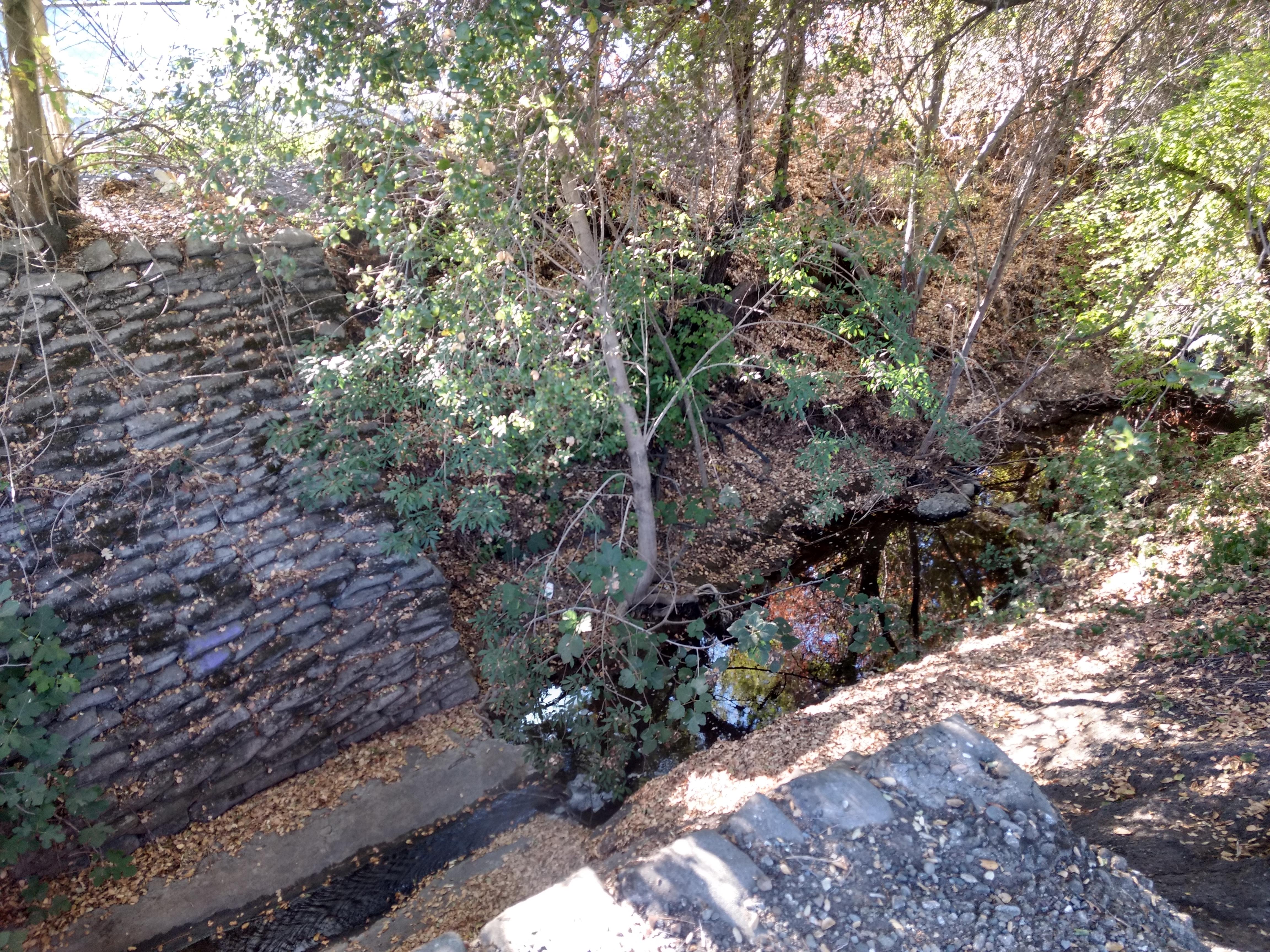
La Crescenta District. Eagle-Sheilds Channel. View north from Mayfield Avenue showing a covered section in the... - NARA - 295327.jpg - YiFeiBot

Beth Lefebvre- Ukiah Field Office- Cache Creek Cowboy Camp (53862614712).jpg - OptimusPrimeBot

Canyon Creek.jpg - ToshaDuncan

Pfsf Ldac opening.jpg - H-stt

Martis Creek Lake and Dam summer.jpg - DanMS

Bluff Creek and Playa Vista.jpg - Downtowngal

Bierstadt Albert Campfire Site Yosemite.jpg - Jeangagnon
Malibu Creek dry bed.jpg - Überraschungsbilder

Marin Creek.jpg - Jfire

Prairie Creek Redwoods - Waterfall on Rhododendron Trail.jpg - Owen
Rattlesnake creek.jpg - Marcia Wright~commonswiki
Ishi lowermillcreek.jpg - Marcia Wright~commonswiki

PrairieCreekLongShot.jpg - Nebakanezer

PrairieCreekRiverBend.jpg - Nebakanezer

La Ballona KAP 7.jpg - Joelorama

Bridge Scream.jpg - Eethove
Running North by burnintree.jpg - Tahoenathan

Lagunitas Creek in Samuel P. Taylor State Park.jpg - Optigan13

CrkCleanup.jpg - Lindylc09
Sanmateocreek-after.jpg - Shannon1

FEMA - 43252 - Damaged Road in California.jpg - BotMultichillT

Fallen Redwood in Adobe Creek.jpg - Schmiebel

Purisima Creek above O'Keefe Lane with water & alders Aug. 29, 2010.jpg - Schmiebel

Erosion from loss of riparian vegetation Hidden Villa 2010.jpg - Schmiebel

Hidden Villa bridge 2010.jpg - Schmiebel
Chino Creek downstream from Central Avenue.jpeg - Shannon1

Yellow and greenish trees plus creek landscape.jpg - AerobicFox
Pismo Beach Creek taken at Addie Vacation Townhomes 10x72.jpg - IPismo
Marshall Creek, Ben Lomond, CA.jpg - File Upload Bot (Magnus Manske)

Bear Creek Joins San Francisquito Creek July 2011.jpg - Schmiebel

Fish Ladder Los Trancos Creek 2011.jpg - Schmiebel

Ballona-Centinela.jpg - Cromagnom
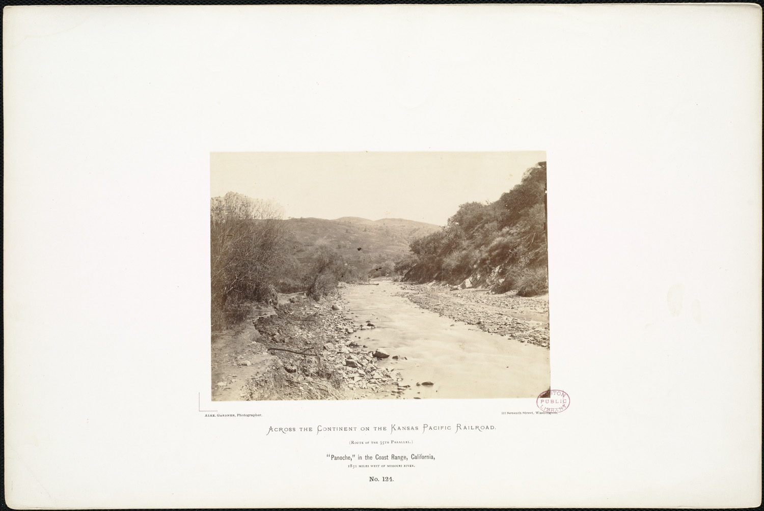
'Panoche,' in the Coast Range, California, 1,850 miles west of Missouri River. (Boston Public Library).jpg - Flickr upload bot

Hayfork Creek.jpg - Jsayre64
La Crescenta District. Eagle-Sheilds Channel. View north from Mayfield Avenue showing a covered section in the... - NARA - 295327.tif - US National Archives bot

Permanente Creek.jpg - BillShepp

Permanente Creek weir.jpg - BillShepp

San Lorenzo Creek Trail sign Hayward.jpg - Mercurywoodrose

San Lorenzo Creek and bridge downtown Hayward.jpg - Mercurywoodrose
San Lorenzo Creek downtown Hayward.jpg - Mercurywoodrose

MILL CREEK ENTRANCE - NARA - 542537.jpg - US National Archives bot

POLLUTED CREEK - NARA - 542582.jpg - US National Archives bot

Southern California - NARA - 543466.jpg - US National Archives bot

Aqua Caliente Reservation - NARA - 298622.jpg - US National Archives bot

Manzanar Relocation Center, Manzanar, California. Evacuee children enjoying a hot summer afternoon . . . - NARA - 538079.jpg - US National Archives bot

Manzanar Relocation Center, Manzanar, California. Evacuee children enjoying a hot summer afternoon . . . - NARA - 538081.jpg - US National Archives bot

The-rindge.jpg - Bulwersator

Rancheria creek.jpg - SsuPreserves

Upper Black Rock Falls.jpg - File Upload Bot (Magnus Manske)

Upper Falls.jpg - File Upload Bot (Magnus Manske)
ComptonCreekFromWallStreet20120929.jpg - Craigdietrich

General Creek at Sugar Pine Point State Park.jpg - DimiTalen

Berryessa Creek Park Bridge.jpg - LPS.1

Canyon Creek (3622580349).jpg - File Upload Bot (Magnus Manske)

Malibu Canyon.JPG - Churnice

NRCSCA00004 - California (523)(NRCS Photo Gallery).jpg - Smallbot
NRCSCA00004 - California (523)(NRCS Photo Gallery).tif - Smallbot

NRCSCA00005 - California (525)(NRCS Photo Gallery).jpg - Smallbot
NRCSCA00005 - California (525)(NRCS Photo Gallery).tif - Smallbot

'Dry Arroyo, California' by D. Howard Hitchcock, 1910.jpg - Hiart

A creek in Burlingame.jpeg - Harmonywriter

La Crescenta District. Eagle-Shields channel. View north from the junction of Montrose and Pennsylvania Avenues. The... - NARA - 295326.jpg - YiFeiBot

PrairieCreekUnderstory.png - Thewellman

PrairieCreekFlagging.png - Thewellman

PrairieCreekRedwood.png - Thewellman

Carbonara Ck meet B40.JPG - ChrisGualtieri

Goleta Beach (2013) 18.JPG - Nandaro

Mammoth Lakes (November 2009) 01.JPG - Nandaro

McArthur-Burney Falls Memorial SP Burney Creek.jpg - Tortie tude
Bell Creek.jpg - Magnolia677

Below the Falls in the Arroyo Seco, near Pasadena, ca.1900 (CHS-4664).jpg - Fæ

Bull creek north from victory.jpg - Junkyardsparkle
Clear Creek, Siskiyou Wilderness.jpg - Jsayre64

CALIFORNIA--BIG CREEK - NARA - 542594.jpg - US National Archives bot

Wildcat Creek in 2011.jpg - Flickr upload bot

Beaver Lodge on Tulucay Creek, Napa River tributary May 2014.jpg - Schmiebel
ELEVATION VIEW OF WEST SIDE OF BRIDGE, 1932 SECTION, LOOKING WEST TO EAST FROM CREEK BED - Rowdy Creek Bridge, Spanning Rowdy Creek at Fred Haight Drive, Smith River, Del Norte HAER CAL,8-SMIRI,1-9.tif - Fæ
ELEVATION VIEW OF WEST SIDE OF BRIDGE, 1931 SECTION, LOOKING WEST TO EAST FROM CREEK BED - Rowdy Creek Bridge, Spanning Rowdy Creek at Fred Haight Drive, Smith River, Del Norte HAER CAL,8-SMIRI,1-8.tif - Fæ
ELEVATION NORTHEAST BY 30 DEGREES, WEST SECTIONS OF SPAN COVERED BY OVERGROWTH - Honey Run Bridge, Spanning Butte Creek, bypassed section of Honey Run Road (originally Carr Hill HAER CA-312-19 (CT).tif - Fæ
PERSPECTIVE MID SPAN SECTION, SOUTHWEST BY 230 DEGREES - Honey Run Bridge, Spanning Butte Creek, bypassed section of Honey Run Road (originally Carr Hill Road), Paradise, Butte County, HAER CA-312-17.tif - Fæ
ELEVATION UPSTREAM SIDE, SOUTH SOUTHWEST BY 200 DEGREES - Honey Run Bridge, Spanning Butte Creek, bypassed section of Honey Run Road (originally Carr Hill Road), Paradise, Butte County, HAER CA-312-16.tif - Fæ
ELEVATION 200 DEGREES SOUTH SOUTHWEST - Honey Run Bridge, Spanning Butte Creek, bypassed section of Honey Run Road (originally Carr Hill Road), Paradise, Butte County, CA HAER CA-312-15.tif - Fæ
Oblique view of the west side of Cottonwood Creek Bridge, facing southeast from the north bank of the creek. - Cottonwood Creek Bridge, Spanning Cottonwood Creek on Road 28, Madera, HAER CA-325-3.tif - Fæ
View of the northern portion of the east side of Cottonwood Creek Bridge, facing west. - Cottonwood Creek Bridge, Spanning Cottonwood Creek on Road 28, Madera, Madera County, CA HAER CA-325-11.tif - Fæ
Oblique view of the east side of Cottonwood Creek Bridge, facing facing southwest from the north bank. - Cottonwood Creek Bridge, Spanning Cottonwood Creek on Road 28, Madera, Madera HAER CA-325-10.tif - Fæ
View of the east side of Cottonwood Creek Bridge, facing west from the south bank of the creek - Cottonwood Creek Bridge, Spanning Cottonwood Creek on Road 28, Madera, Madera County, CA HAER CA-325-8.tif - Fæ
Oblique view a portion of the east side of Cottonwood Creek Bridge, facing southwest from the south bank. - Cottonwood Creek Bridge, Spanning Cottonwood Creek on Road 28, Madera, Madera HAER CA-325-9.tif - Fæ

Permanente Creek in Mountain View.jpg - Runner1928

Permanente Creek Trail sign.jpg - Runner1928

Permanente Creek Trail sign and Google building.jpg - Runner1928

Google Gate Bridge.jpg - Runner1928

Permanente Creek bridge, Mountain View.jpg - Runner1928

Douglas-Creek-near-Stanislaus-National-Forest,-California.jpg - Gazebo

San Carpóforo Creek.jpg - Polylerus

Metrolink Trestles Beach.jpg - Andrewaronoshn

USA-Eastman-Canyon-Creek.JPG - Wahn

Creek in old growth redwood forest.jpg - Wilfredor

Creek (15919832738).jpg - Wilfredor

Hare Canyon Creek (8613081678).jpg - Wilfredor

Hare Canyon Creek (8613083124).jpg - Wilfredor

Creek (8045351649).jpg - Wilfredor

California fish and game (19891368664).jpg - SteinsplitterBot

California fish and game (19892243323).jpg - Faebot

Bulletin of the Department of Geology of the University of California (1896) (20453883591).jpg - SteinsplitterBot

FMIB 39544 Fifth Falls, Coyote Creek, 200 yards above the fourth falls; height, 30 feet.jpeg - BMacZeroBot

FMIB 39548 Whitney Falls in Whitney Creek just below Crabtree Meadow.jpeg - BMacZeroBot

FMIB 39551 Natural bridge over small tributary of Volcano Creek just above first crossing of the trail The creek has cut its way through.jpeg - BMacZeroBot

FMIB 39562 Langley's Camp and small lakes at end of horse trail, base of Mount Whitney The Tarns are the headwaters of Whitney Creek.jpeg - BMacZeroBot

FMIB 39566 Fourth falls in Coyote Creek Trout are found above and belowthese falls.jpeg - BMacZeroBot

FMIB 39573 Coyote Creek, showing second and third (Broder) falls These are about 250 feet above the first falls The second falls is 50 feet.jpeg - BMacZeroBot

FMIB 39575 Whitney Creek as it enters Crabtree Meadow.jpeg - BMacZeroBot
Draft Clear Creek management plan and environmental assessment (1985) (20996108115).jpg - SteinsplitterBot

Rustic Creek, Pacific Palisades.jpg - Innotata

Bulletin of the Bureau of Fisheries (1905) (14763766984).jpg - Fæ

Pfeiffer-Redwood Creek - Stierch 2.jpg - Missvain

Fertile rock - panoramio.jpg - Panoramio upload bot

Little Chico Creek.jpg - FastilyClone

Ventura Fish and Wildlife Office- Before (4686598900).jpg - Ser Amantio di Nicolao

Ventura Fish and Wildlife Office- During (4685963039).jpg - Ser Amantio di Nicolao

Ventura Fish and Wildlife Office- After (4686595214).jpg - Ser Amantio di Nicolao

Ventura Fish and Wildlife Office- Before (4685963031).jpg - Ser Amantio di Nicolao

San Geronimo Creek, California.jpg - Gorthian

Lagunitas Creek.jpg - Gorthian

DGP ToneMap (10316545706).jpg - Mliu92

Trout Creek Truckee.jpg - Jsayre64

Gasquet, California - Patrick Creek 05.jpg - Jmabel

Sunrise, Clark Creek, Burney Falls,CA 9-06 (24378907543).jpg - James Allison

Rock Creek at East Fork Campground. - panoramio.jpg - Panoramio upload bot

Rancheria Creek - panoramio.jpg - Panoramio upload bot

Eureka Cyn Road Bridge. - panoramio.jpg - Panoramio upload bot

Grouse Creek - panoramio.jpg - Panoramio upload bot

Creek alongside abandoned railroad - panoramio.jpg - Panoramio upload bot

At The Back Of Donnell - panoramio.jpg - Panoramio upload bot
Near Pyramid Reservoir, CA, View S, Stream Course, 2011 - panoramio.jpg - Panoramio upload bot

Lyons Creek Dry - panoramio.jpg - Panoramio upload bot

Lyons Creek Rock - panoramio.jpg - Panoramio upload bot

Lost Man Creek - panoramio.jpg - Panoramio upload bot

Lost Man Creek - panoramio (1).jpg - Panoramio upload bot

Ledgewood Creek - panoramio.jpg - Panoramio upload bot

View of Llagas Creek from bridge on Oak Glen Ave, March 2017.jpg - Wahn

View of Little Uvas Creek near bridge on Uvas Road, March 2017.jpg - Wahn

Uvas creek near Sveadal, California, Jan 2017.png - Uvaseastman

Bridge over Los Gatos Creek - panoramio.jpg - Panoramio upload bot
Mariposa Creek.jpg - LaurentianShield

Burnt Corral Creek - panoramio.jpg - Panoramio upload bot

Kern County, CA, USA - panoramio (67).jpg - Panoramio upload bot

Tuolumne County, CA, USA - panoramio (19).jpg - Panoramio upload bot

Tuolumne County, CA, USA - panoramio (20).jpg - Panoramio upload bot

Cow Creek Shasta County California.jpg - Cmguy777

Lassen Peak looking south.jpg - Milonica

Matilija Creek.jpg - Shannon1

170209-FS-Sierra-AO-003 (32044140344).jpg - OceanAtoll

170209-FS-Sierra-AO-004 (32044140494).jpg - OceanAtoll

Yellowhammer Creek in the Emigrant Wilderness (8411606769).jpg - OceanAtoll

San Vicente (5199911548).jpg - OceanAtoll

SLO Creek March 1969 (28392920774).jpg - OceanAtoll

Honcut Creek floodplain, North side of Honcut Creek, Aug 1952 (26790383721).jpg - OceanAtoll

Strawberry Creek (19101349761).jpg - OceanAtoll

Garrapata Creek California 2006 02.jpg - Dpalma01

Garrapata Creek California 2006 01.jpg - Dpalma01

Calera Creek California 2006 01.jpg - Dpalma01

Garrapata Creek California 2006 04.jpg - Dpalma01
Garrapata Creek California 2006 03.jpg - Dpalma01
Red Hills (42598104702).jpg - MarginalCost
Hale creek los altos.jpg - Inklein

Creek (140443105).jpeg - Rodrigo.Argenton

Stuck In The Middle (140444085).jpeg - Rodrigo.Argenton

Slippery slope creek crossing.jpg - Northamerica1000

Glen Echo Creek Oakland.jpg - EponineBunnyKickQueen

Glen Echo Creek culvert Oakland.jpg - EponineBunnyKickQueen

Kingsmen creek cal lutheran.png - Webcorrectorr

Glen Echo Creek Park culvert.jpg - EponineBunnyKickQueen
Glen Echo Creek in park.jpg - EponineBunnyKickQueen

Lake Nacimiento, Ca.jpg - TarynLessi

Hale Creek at Marilyn Drive Mountain View.jpg - Dicklyon

Hale Creek outflow of Neary Quarry.jpg - Dicklyon
Neary Quarry pano.jpg - Dicklyon

Neary Quarry.jpg - Dicklyon

Bear Creek at Mountain Home Rd.jpg - Dicklyon

Bear Creek below Mountain Home Road.jpg - Dicklyon

Dry Creek exiting under Mountain Home Road Woodside.jpg - Dicklyon

San Luis Obispo Creek in downtown SLO.jpg - ECTran71

Extended view of Little Cholame Creek.jpg - RandenBanuelos

Atascadero Creek (25359535254).jpg - Awkwafaba

Yurok Geography (Waterman) map 6.png - Noahedits

Yurok Geography (Waterman) map 7.png - Noahedits

Yurok Geography (Waterman) map 8.png - Noahedits

Branciforte Creek Bridge.jpg - Mutante
Japanese American woman and children in creek of California on 3 July 1942, from- Manzanar Relocation Center, Manzanar, California. Evacuees enjoying the creek which flows along the . . . - NARA - 538087 (cropped).tif - Tibet Nation

Creek Cleanup.jpg - Akcbfly
Flow of the Heart.jpg - Akcbfly

The Prosperity of Nature.jpg - Akcbfly

Rock Search.jpg - Akcbfly

Kit Carson Creek.jpg - RightCowLeftCoast

Stone Creek.jpg - RightCowLeftCoast

Upper Islais Creek in Glen Canyon.jpg - Dicklyon

Sapwi Trails Thousand Oaks May 2019 018.jpg - King of Hearts

View from Arana Gulch Bridge.jpg - Dicklyon

Fall Leaves (9958030844).jpg - NeoMeesje

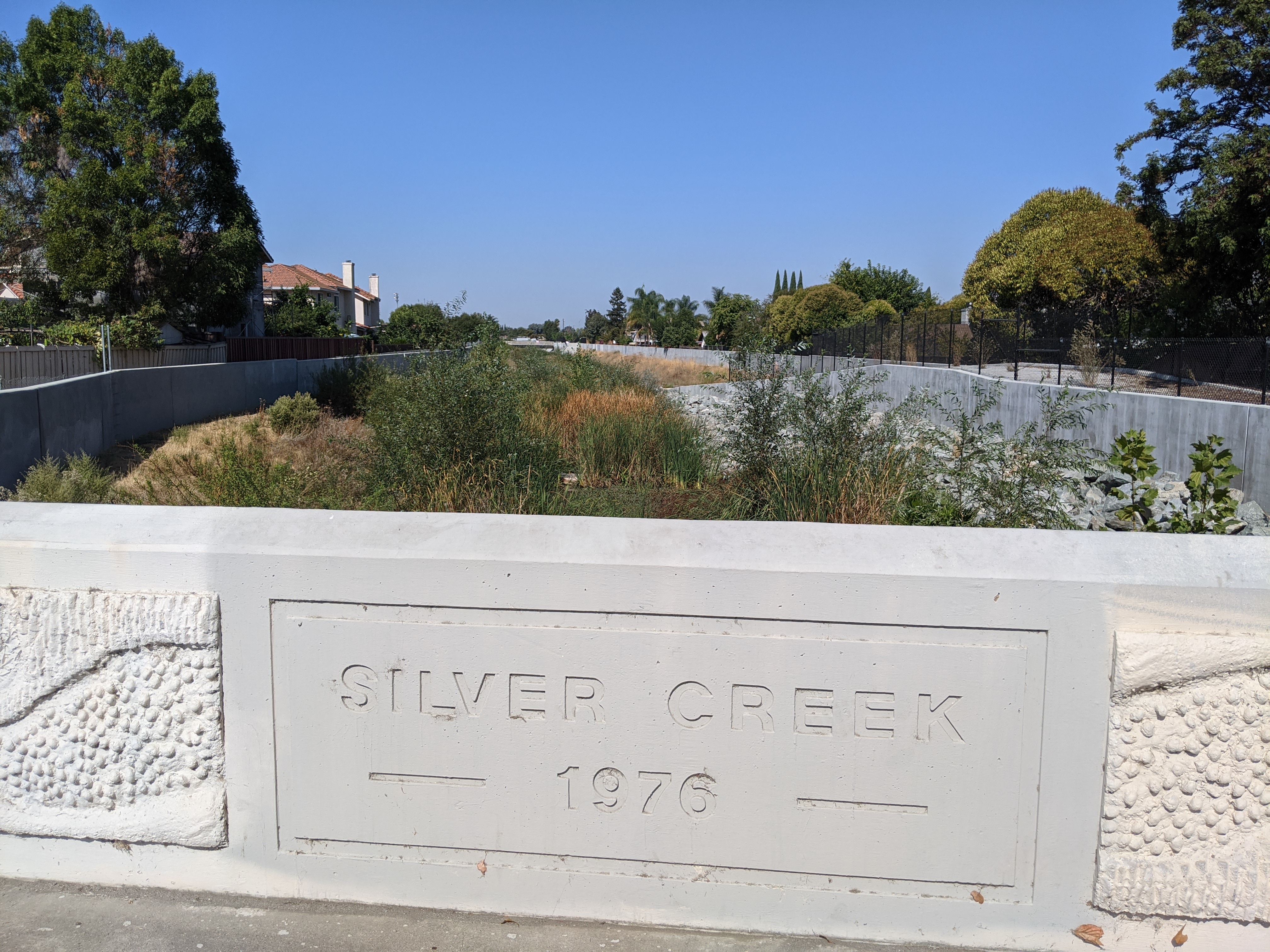
Miguelita or Lower Silver Creek at 101.jpg - Dicklyon

Miguelita Creek from Alum Rock Road.jpg - Dicklyon

Miguelita Creek goes under Fairway Drive.jpg - Dicklyon

Miguelita or Lower Silver Creek confluence with Coyote Creek.jpg - Dicklyon
Lower Silver Creek draining from Lake Cunningham Regional Park.jpg - Dicklyon

Lower Silver Creek at Babb Creek confluence, Silver Ave.jpg - Dicklyon
Lower Silver Creek at Cunningham Ave.jpg - Dicklyon

ArroyoLasPositas.jpg - Lights and freedom

DoolanCanyon.jpg - Lights and freedom

Temescal Creek Culvert at the Chabot Tennis Courts.jpg - Mingwei.Samuel

Panoche Creek Abstract (21842762793).jpg - English Roger

Panoche Creek Abstract (22463937675).jpg - English Roger

Panoche Creek Abstract (22276237908).jpg - English Roger

Panoche Creek Context (22277101999).jpg - English Roger

Panoche Creek Abstract (22437800786).jpg - English Roger

Panoche Creek Abstract (22437794726).jpg - English Roger

Panoche Creek Abstract (22463796905).jpg - English Roger

Panoche Creek Abstract (22437811106).jpg - English Roger

Panoche Creek Abstract (22474763471).jpg - English Roger

Prefumo Creek (summer).jpg - Mx. Granger
Stream in Brookside Los Angeles 2.jpg - Downtowngal

Bluff Creek, Playa Vista.jpg - Jengod

Silver King Creek Humboldt-Toiyabe NF Rachel Van Horne (51770825890).jpg - ToyitomaOda

Tomales Bay Trailhead - January 2023 - Sarah Stierch 12.jpg - Missvain

Valley View Trail - April 2023 - Sarah Stierch 04.jpg - Missvain
Valley View Trail - April 2023 - Sarah Stierch 05.webm - Missvain

Bean Creek - Mount Hermon,CA - 2023.jpg - Gronamous

Callahan Creek.jpg - Peter J. Caprio

Los Gatos Creek above Coalinga.jpg - Dicklyon

Iron Horse Regional Trail 1.jpg - Mx. Granger

Walnut Creek from the Iron Horse Trail.jpg - Mx. Granger

Iron Horse Trail banner Walnut Creek.jpg - Mx. Granger

Willow Creek in Folsom, CA.jpg - Cooltey

Fivemile creek 1.jpg - Mrfoogles

Orrs Creek on Bush Street.jpg - IHazACatNamedMax

Caples Creek, El Dorado County, California.jpg - Jsayre64