Wikimedi'Òc
Modes d'emploi

Cet album fait partie des albums
Cet album photos contient les sous-albums suivants :
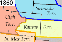


Wpdms kansas nebraska utah territories 1860 idx.png - Wars

1862 Johnson Map of California, Nevada, Utah, Colorado, New Mexico and Arizona - Geographicus - CANMUT-johnson-1862.jpg - BotMultichillT

Clark & Co. territorial gold half eagle obverse.jpg - Wehwalt
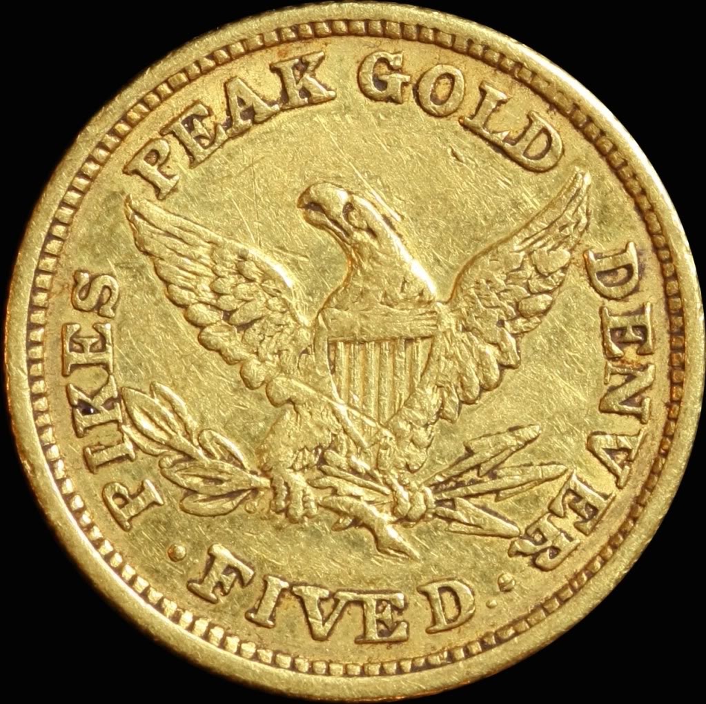
Clark & Co. territorial gold half eagle reverse.jpg - Wehwalt

1860 colorado territory map.png - Rcsprinter123
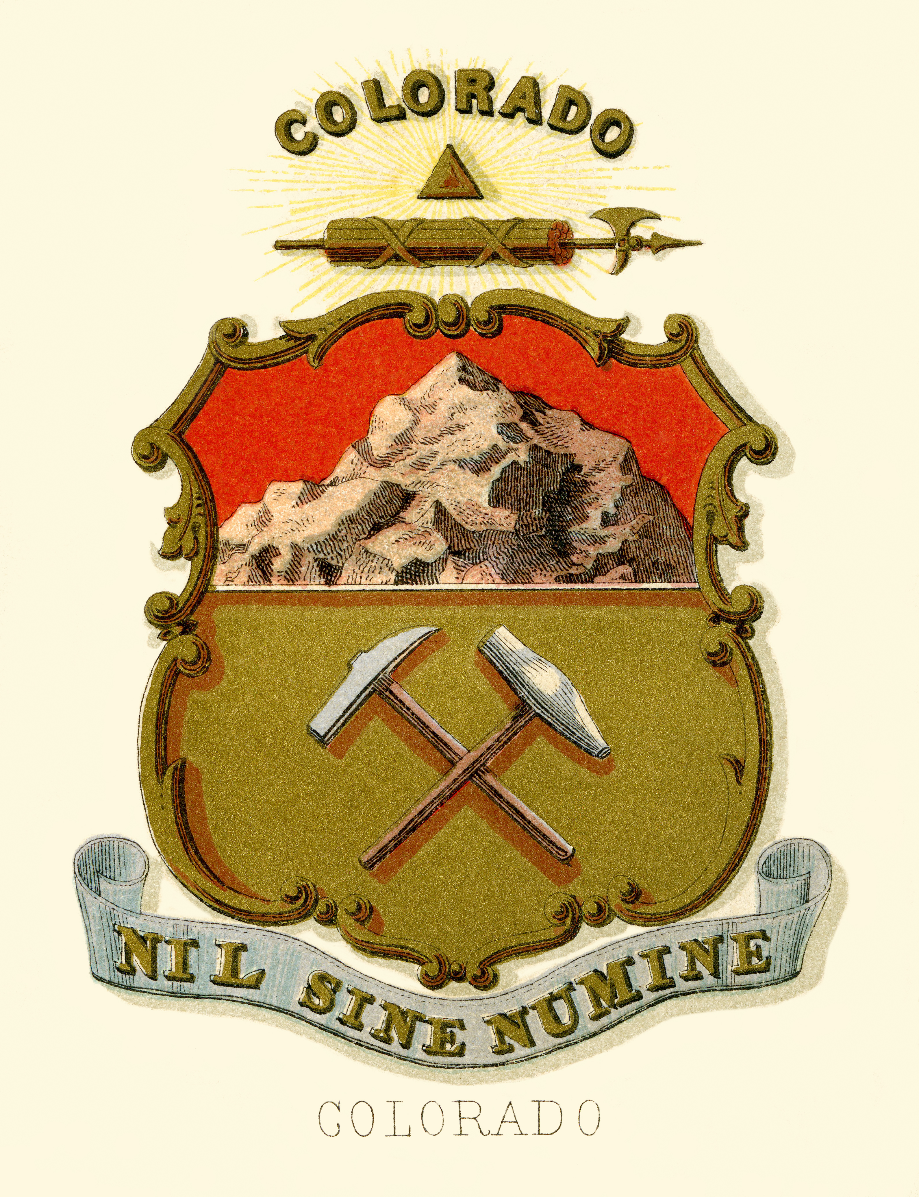
Colorado state coat of arms (illustrated, 1876).jpg - Godot13

Mariano Medina.jpg - CaroleHenson

Map of Colorado Territory - NARA - 23812162.jpg - US National Archives bot
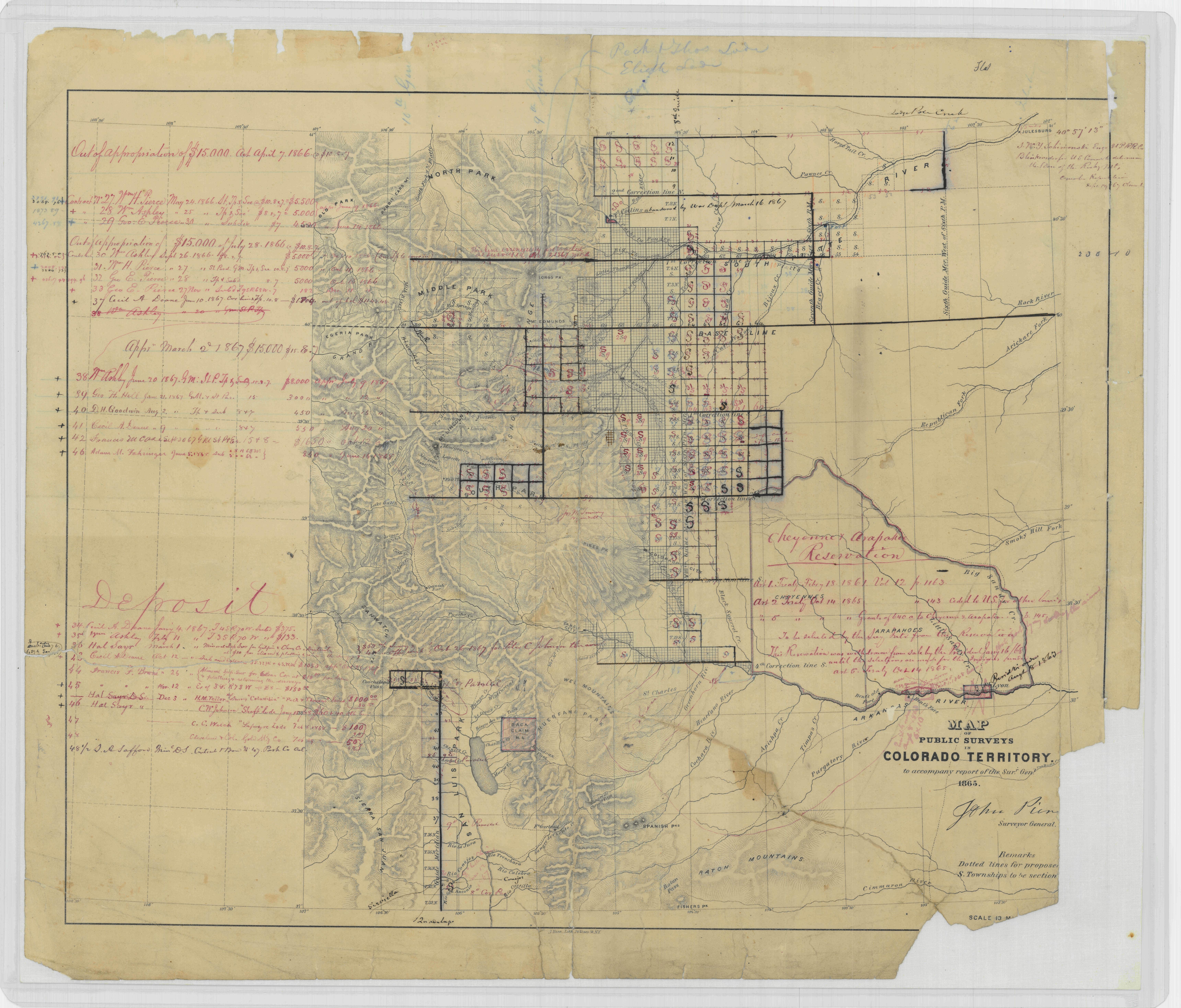
Map of Public Surveys In Colorado Territory - NARA - 23812218.jpg - US National Archives bot

Map of Public Surveys In Colorado Territory - NARA - 23812251.jpg - US National Archives bot

Map of the Territory of Colorado Showing the Extent of the Public Surveys - NARA - 23812254.jpg - SteinsplitterBot

Colorado Territory in 1861, showing acquisitions.png - Paptilian

Map of Colorado Territory - DPLA - 932ef8c896be1de660571df98784ed2f.jpg - DPLA bot

Map of Colorado Territory, United States - DPLA - 6f1933128ed8b5cb38084a2e7ae991d7.jpg - DPLA bot

Map of Colorado territory, shewing (sic) the system of parks - DPLA - 83dead53320d1c87fa55b9669b4721e5.jpg - DPLA bot

Map of Colorado territory compiled from government maps & actual surveys, made in 1861. - DPLA - 85d04ac3d453e60a89ce4ac228d24365.jpg - DPLA bot

Map of Colorado Territory embracing the Central Gold Region - DPLA - 72a0ecf36a88e3a161713a723bdbf55f.jpg - DPLA bot

Map of Colorado Territory to accompany Hollisters "Mines of Colorado" corrected from the Public Surveys of 1866 - DPLA - 1442bb7cf6554da54c32ac812521094b.jpg - DPLA bot

Map of public surveys in Colorado territory to accompany report of the Surveyor General - DPLA - fbdcc2485ba136755be815ee165ae272.jpg - DPLA bot

Map of public surveys in Colorado Territory to accompany a report of the surveyor gen. 1863. - DPLA - ebf6c93ee4302bff81952ac33e07d87e.jpg - DPLA bot

Map of Colorado Territory to accompany Hollisters "Mines of Colorado" corrected from the Public Surveys of 1866 - DPLA - 1327f8e1b2767e77e04a967f3a2f979d.jpg - DPLA bot

Map of Colorado territory - DPLA - 33c32c12ab7326b8d55643eddae45eee.jpg - DPLA bot

Map of Colorado Territory - DPLA - 818495a8bb53d34e59edf52943a600c3.jpg - DPLA bot

John Evans with daughter Josephine, c. 1859.png - Pbritti

1860 Colorado Territory map.svg - Rcsprinter123
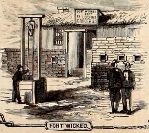
Fort Wicked by James F. Gookins (Harper's Weekly, October 13, 1867).jpg - Jengod

A new map of the principal routes to the gold region of Colorado Territory - DPLA - 79556fffeafe6cac079392a4191dda5d.jpg - DPLA bot

Map State of Colorado, USA, main roads with numbers, colored counties with names SVG.svg - Kirill Shrayber