Wikimedi'Òc
Modes d'emploi

Cet album fait partie des albums
Cet album photos contient les sous-albums suivants :


Quill dormant vulcano.jpg - BotMultichill

Lower Town Sint Eustatius.jpg - Invertzoo

Sint Eustatius runway.jpg - Whellebrand

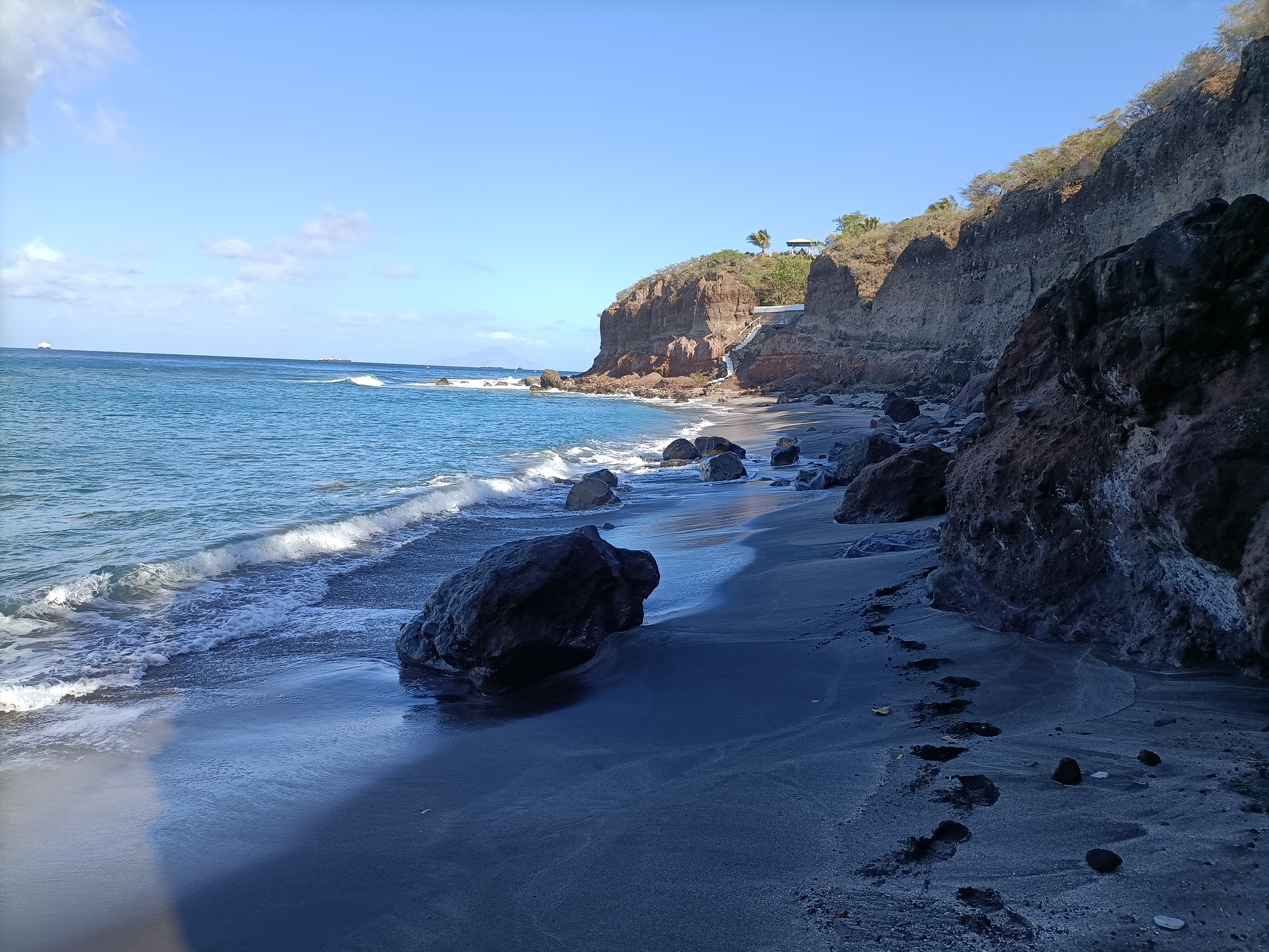
Statia Coastline looking at Saba - panoramio.jpg - Panoramio upload bot
View from our hotel (8610805844).jpg - Ymnes

De kust van Sint Eustatius. In de verte H.M. kruiser De Ruyter voor anker, Bestanddeelnr 252-4062.jpg - Mr.Nostalgic

Quill dormant vulcano (cropped).jpg - Ymnes

De kust van Sint-Eustatius, Bestanddeelnr 252-8316.jpg - Mr.Nostalgic

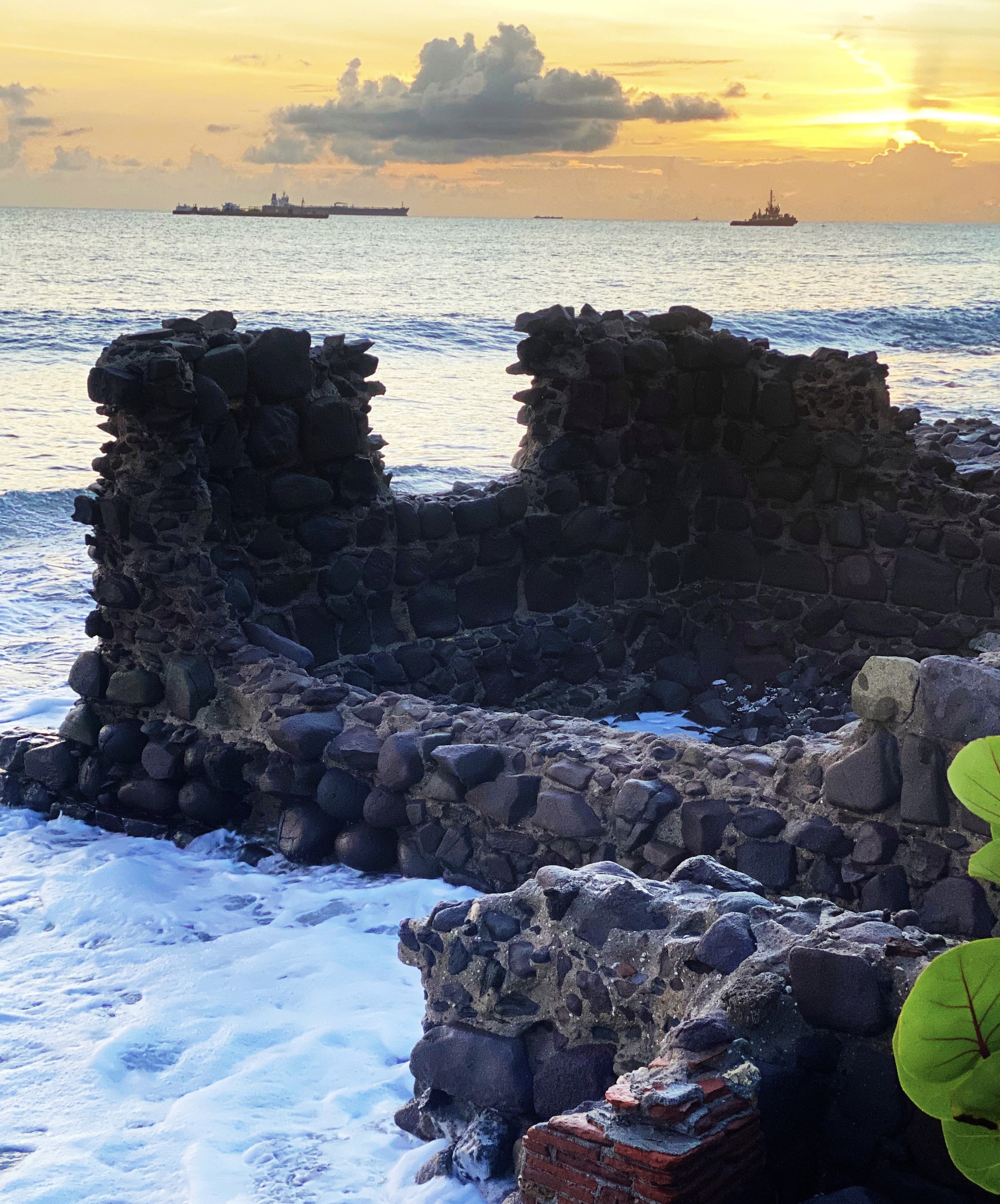
De ruine van een bolwerK op St. Eustatius, Bestanddeelnr 935-1258.jpg - Mr.Nostalgic

De kust van Sint Eustatius, Bestanddeelnr 252-4039.jpg - Mr.Nostalgic

De kust bij Sint Eustatius, Bestanddeelnr 252-3969.jpg - Mr.Nostalgic

Collectie Nationaal Museum van Wereldculturen TM-20030064 Resten Fort Oranje aan de kustvlakte Sint Eustatius Boy Lawson (Fotograaf).jpg - DDJJ

Collectie Nationaal Museum van Wereldculturen TM-20030069 Gezicht op Saint Kitts gezien vanaf Sint Eustatius Sint Eustatius Boy Lawson (Fotograaf).jpg - DDJJ

Collectie Nationaal Museum van Wereldculturen TM-20030077 Overzicht op bebouwing Sint Eustatius Boy Lawson (Fotograaf).jpg - DDJJ

Collectie Nationaal Museum van Wereldculturen TM-20030088 Gezicht op resten van pakhuizen, gezien vanaf Fort Oranje Sint Eustatius Boy Lawson (Fotograaf).jpg - DDJJ

Collectie Nationaal Museum van Wereldculturen TM-20030094 Drenkplaats voor vee aan een brakwaterbron nabij kust. Sint Eustatius Boy Lawson (Fotograaf).jpg - DDJJ

Collectie Nationaal Museum van Wereldculturen TM-4765-151 Kustgezicht op St. Eustatius Sint Eustatius.jpg - DDJJ

Collectie NMvWereldculturen, TM-10021242, Repronegatief 'Een landingsbaai met landinwaarts een aantal woningen aan de kust van Sint Eustatius, op de achtergrond is het eiland Saba te zie', fotograaf niet bekend, 1947.jpg - Riezelaar

Collectie NMvWereldculturen, TM-60060990, Foto 'Gezicht vanuit Fort Oranje op Sint Eustatius richting het eiland Saba', fotograaf niet bekend, 1947.jpg - Riezelaar
KITLV A725 - De Benedenstad bij Oranjestad op Sint Eustatius, nog voor de aanleg van de landingspier, KITLV 44406.tiff - Mr.Nostalgic
KITLV A725 - De Benedenstad bij Oranjestad op Sint Eustatius, nog voor de aanleg van de landingspier, KITLV 44407.tiff - Mr.Nostalgic

Volcano The Quill.jpg - Statia lover

View of The Quill.jpg - Statia lover

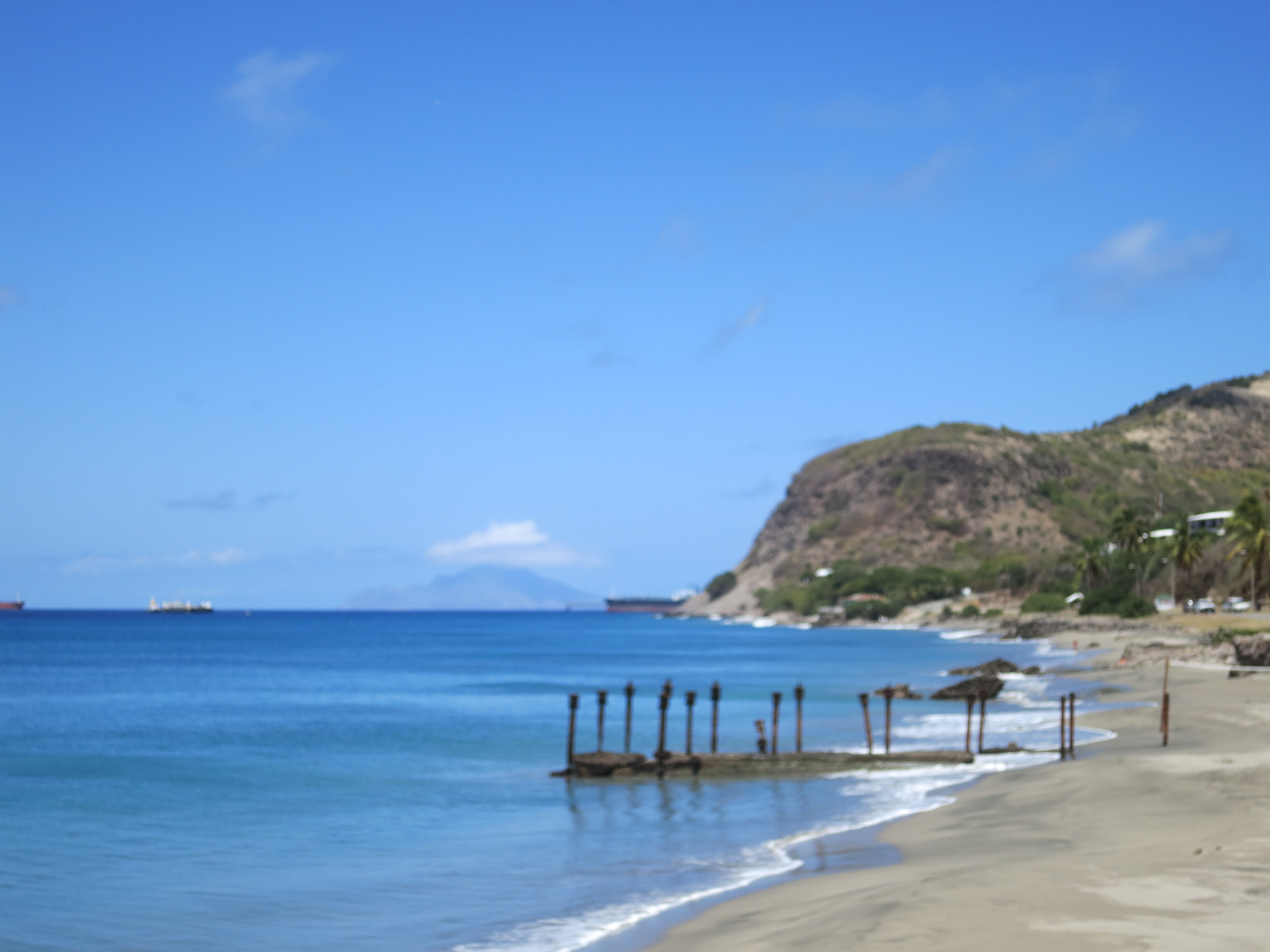
Zeelandia beach.jpg - Statia lover

Cliffs Zeelandia.jpg - Statia lover

Zeelandia cliffs.jpg - Statia lover
Fort — cannons.jpg - Cmesa86

Fort 2 — cannons.jpg - Cmesa86

Turtle monument.jpg - Cmesa86

Warehouse at the sea.jpg - Denniz1972

Oven at crooks.jpg - Mazingastatia

Ruins of Crooks Castle.jpg - Mazingastatia

Gallowsbay.jpg - Kev2486

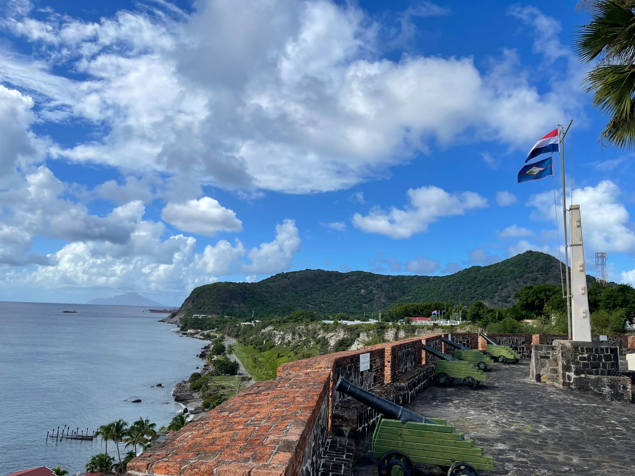
St. Eustatius Fort.jpg - Arubangirl
The Ruins Lower Town.jpg - Statiasnaps

Around Fort the Windt, Sint Eustatius (St.Kitts in the background) (1).jpg - GIS Statia

Around Fort the Windt, Sint Eustatius (St.Kitts in the background) (2).jpg - GIS Statia

Atlantic coastline, Sint Eustatius (2).jpg - GIS Statia

Atlantic coastline, Sint Eustatius (1).jpg - GIS Statia

Beach and ruins near Fort Amsterdam, Sint Eustatius (2).jpg - GIS Statia

Beach and ruins near Fort Amsterdam, Sint Eustatius (3).jpg - GIS Statia
Canon on the Atlantic Side cliff, Sint Eustatius (2).jpg - GIS Statia

Coastline, Caribbean side, past Stuco, Sint Eustatius (1).jpg - GIS Statia
Coastline, Caribbean side, past Stuco, Sint Eustatius (2).jpg - GIS Statia

Donkeys near the Atlantic Coast, Sint Eustatius.jpg - GIS Statia

Foundations of a small defensive post, Atlantic Side, Sint Eustatius (1).jpg - GIS Statia

Foundations of a small defensive post, Atlantic Side, Sint Eustatius (2).jpg - GIS Statia

Foundations of a small defensive post, Atlantic Side, Sint Eustatius (3).jpg - GIS Statia

Foundations of a small defensive post, Atlantic Side, Sint Eustatius (4).jpg - GIS Statia

Plantation demarcation line, Sint Eustatius (1).jpg - GIS Statia

Road to Whitewall, Sint Eustatius.jpg - GIS Statia

Ruin of a factory near Mansion and Franchleaf road, Sint Eustatius (24).jpg - GIS Statia

Ruin of a large building along the Caribbean coast, past Stuco, Sint Eustatius.jpg - GIS Statia

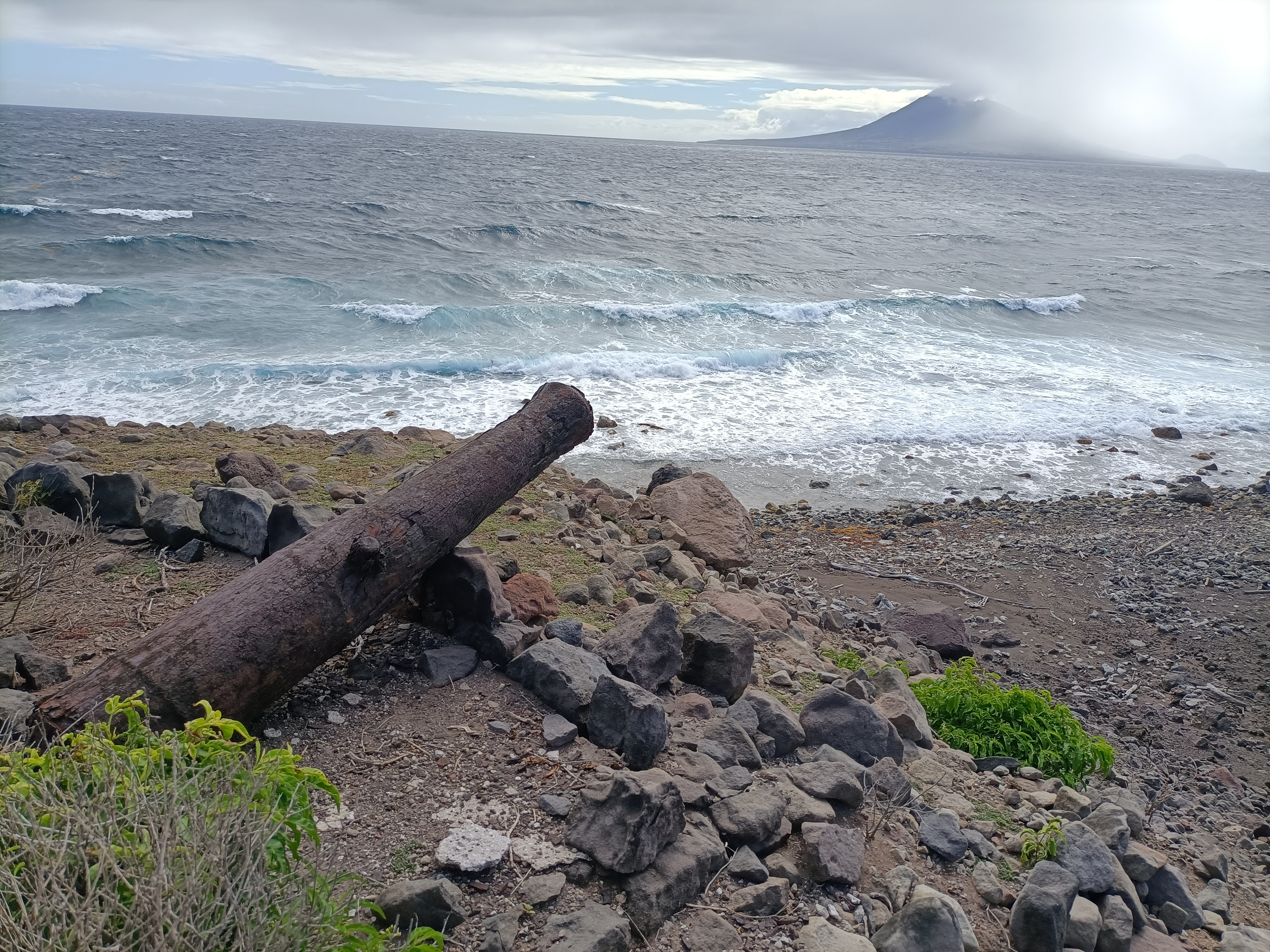
Ruin of an old defensive post, Atlnatic side, Sint Eustatius.jpg - GIS Statia

Ruins of a small defensive post and guardshouse, Zeelandia side, Sint Eustatius (1).jpg - GIS Statia

Ruins of a small defensive post and guardshouse, Zeelandia side, Sint Eustatius (2).jpg - GIS Statia

The donkeys of Sint Eustatius.jpg - GIS Statia

Fort Oranje, shot from the fort, Oranjestad, Sint Eustatius.jpg - GIS Statia

Remains of a heritage wall on the Atlantic coast of Sint Eustatius.jpg - GIS Statia

View from the cliff on the Atlantic coast of Sint Eustatius.jpg - GIS Statia

Cliffs on the Atlantic side of the island of Sint Eustatius.jpg - GIS Statia

English Quarter, ruin of a plantation building, Sint Eustatius (3).jpg - GIS Statia

Path along the heritage walls, English Quarter, Sint Eustatius.jpg - GIS Statia

Stone plantation demarcation on the Atlantic coast of Sint Eustatius.jpg - GIS Statia

Old demarcation line between two plantations on the Atlantic side of the island Sint Eustatius.jpg - GIS Statia