Wikimedi'Òc
Modes d'emploi

Cet album fait partie des albums
Cet album photos contient les sous-albums suivants :


Crossway Farm, Clehonger - geograph.org.uk - 149730.jpg - GeographBot

Fishing Pool, Clehonger - geograph.org.uk - 149720.jpg - GeographBot

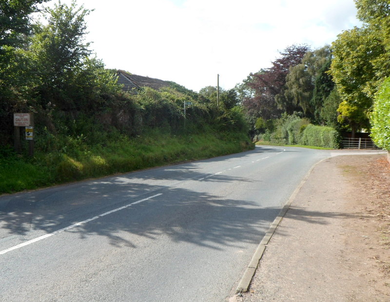
The B4349 passing through Clehonger - geograph.org.uk - 149725.jpg - GeographBot

Fishing pool, Bulmers Angling Club - geograph.org.uk - 888352.jpg - GeographBot

Footpath to Hunderton - geograph.org.uk - 888355.jpg - GeographBot

Kissing gate to footpath by fishing pool - geograph.org.uk - 888356.jpg - GeographBot

View across a barley field - geograph.org.uk - 888342.jpg - GeographBot

Wheat field with shower approaching - geograph.org.uk - 888350.jpg - GeographBot

Wheatfield, Clehonger - geograph.org.uk - 888346.jpg - GeographBot

Anglers packing-up for the day - geograph.org.uk - 908698.jpg - GeographBot

B4349 at Clehonger - geograph.org.uk - 908731.jpg - GeographBot

European White Water Lily, Nymphaea alba - geograph.org.uk - 908710.jpg - GeographBot

Fishing pond - geograph.org.uk - 908700.jpg - GeographBot

Footpath to Clehonger Court - geograph.org.uk - 908687.jpg - GeographBot

Parallel roads - geograph.org.uk - 908723.jpg - GeographBot

Potato crop - geograph.org.uk - 905266.jpg - GeographBot

Track to Dunan - geograph.org.uk - 905272.jpg - GeographBot

Village housing, Clehonger - geograph.org.uk - 908727.jpg - GeographBot

Perryhill Farm - geograph.org.uk - 919805.jpg - GeographBot

Road to Perryhill Farm - geograph.org.uk - 919806.jpg - GeographBot

Ruckhall Mill and cottages - geograph.org.uk - 919804.jpg - GeographBot

View across Belmont Park - geograph.org.uk - 919814.jpg - GeographBot

Armorial Bearings of the AUBREY family of Clehonger, Herefordshire.png - Rs-nourse

Armorial Bearings of the PROSSER family of Belmont, Clehonger, Herefordshire.png - Rs-nourse

Armorial Bearings of the WELLINGTON family of Haywood Lodge, Clehonger, Herefordshire.png - Rs-nourse

Armorial Bearings of the WHITMORE family of The Haywood, Clehonger, Herefordshire.png - Rs-nourse

Hereford Primary Care Trust offices, Belmont - geograph.org.uk - 2471403.jpg - GeographBot

Golf club car park - geograph.org.uk - 2471411.jpg - GeographBot

Road to Clehonger - geograph.org.uk - 2471433.jpg - GeographBot

Lane heading towards Belmont - geograph.org.uk - 2471440.jpg - GeographBot

Field next to the B4349 - geograph.org.uk - 2471454.jpg - GeographBot

Lane joining the B4349 and the A465 - geograph.org.uk - 2471462.jpg - GeographBot

Bus stop on the A465 at Belmont - geograph.org.uk - 2472803.jpg - GeographBot

River Wye, Breinton Springs - geograph.org.uk - 2535516.jpg - GeographBot

A465 near Webtree - geograph.org.uk - 2954527.jpg - GeographBot

A465 northbound - geograph.org.uk - 2954535.jpg - GeographBot

Ruckhall Wood - geograph.org.uk - 3103421.jpg - GeographBot

Footpath to Clehonger - geograph.org.uk - 3273851.jpg - GeographBot

Old Milestone, B4349, near Bowley Farm, Clehonger (geograph 6044166).jpg - Sic19

Old Milepost by the B4352, Cagebrook House, Clehonger parish (geograph 6072760).jpg - Sic19

Old Milepost by the B4349, (geograph 6045486).jpg - Sic19

Western boundary of Clehonger - geograph.org.uk - 3643446.jpg - GeographBot

Cattle chiropodist, Clehonger - geograph.org.uk - 3645659.jpg - GeographBot

Bowley B^B, Clehonger - geograph.org.uk - 3645664.jpg - GeographBot

A Clehonger orchard - geograph.org.uk - 3645667.jpg - GeographBot

Croft Road bus stop and shelter, Clehonger - geograph.org.uk - 3645676.jpg - GeographBot

B4349 approaches B4352 junction in Clehonger - geograph.org.uk - 3645679.jpg - GeographBot

Junction of the B4349 and B4352 in Clehonger - geograph.org.uk - 3645683.jpg - GeographBot

Distances from Clehonger - geograph.org.uk - 3645690.jpg - GeographBot

Birch Meadow, Clehonger - geograph.org.uk - 3645695.jpg - GeographBot

Birch Hill Road, Clehonger - geograph.org.uk - 3646311.jpg - GeographBot

Intersection of Gosmore Road and Birch Hill Road, Clehonger - geograph.org.uk - 3646318.jpg - GeographBot

Village Hall, Clehonger - geograph.org.uk - 3646349.jpg - GeographBot

The Seven Stars near Clehonger - geograph.org.uk - 3646392.jpg - GeographBot

Petanque and boules area outside The Seven Stars, Clehonger - geograph.org.uk - 3646411.jpg - GeographBot

Entrance to Bowling Green Farm, Clehonger - geograph.org.uk - 3647207.jpg - GeographBot
Caution - pedigree cattle crossing, Bowling Green Farm, Clehonger - geograph.org.uk - 3647215.jpg - GeographBot

Left turn for Ruckhall and Clehonger Church - geograph.org.uk - 3647220.jpg - GeographBot

Church Road Clehonger - geograph.org.uk - 3647225.jpg - GeographBot

Electricity substation in Church Road Clehonger - geograph.org.uk - 3647226.jpg - GeographBot

The Old Vicarage Guest House, Clehonger - geograph.org.uk - 3647230.jpg - GeographBot

Noticeboard shelter and litter bin at the edge of a fishing pool in Clehonger - geograph.org.uk - 3647254.jpg - GeographBot

Bulmers Angling Club notice, Clehonger - geograph.org.uk - 3647264.jpg - GeographBot

Lychgate, Church of All Saints, Clehonger - geograph.org.uk - 3647277.jpg - GeographBot

Eastern boundary of Clehonger - geograph.org.uk - 3647313.jpg - GeographBot

Lane from the B4349 to A465 SW of Belmont - geograph.org.uk - 3647331.jpg - GeographBot

B4349 approaches the A465 junction near Belmont - geograph.org.uk - 3647336.jpg - GeographBot

Eastern end of the B4349 near Belmont - geograph.org.uk - 3647338.jpg - GeographBot

Give way at the A465 junction near Belmont - geograph.org.uk - 3647340.jpg - GeographBot

3 miles to Hereford - geograph.org.uk - 3647364.jpg - GeographBot

A465 through Newton Coppice near Belmont - geograph.org.uk - 3648079.jpg - GeographBot

Ruckhall Lane, Belmont - geograph.org.uk - 3648090.jpg - GeographBot

Entrance to Hedley Lodge and Belmont Abbey near Hereford - geograph.org.uk - 3648125.jpg - GeographBot

Ruckhall Lane, Belmont - geograph.org.uk - 3648131.jpg - GeographBot

Wye Valley NHS Trust, Belmont - geograph.org.uk - 3648154.jpg - GeographBot

Parish Hall, Belmont - geograph.org.uk - 3648267.jpg - GeographBot

The fishing pool at Old Clehonger - geograph.org.uk - 3724670.jpg - GeographBot

Farmland near Old Clehonger - geograph.org.uk - 3724673.jpg - GeographBot

Minor road to Ruckhall - geograph.org.uk - 4434965.jpg - GeographBot

Webtree Hundred in An Accurate Map of Hereford Shire Divided into its Hundreds, Emanuel Bowen... 1755 pub. I. Tinney.jpg - Acabashi

Water pump near the Cage Brook - geograph.org.uk - 5804040.jpg - GeographBot

Belmont Village Hall - geograph.org.uk - 5905831.jpg - GeographBot

The Village of Belmont - geograph.org.uk - 5905864.jpg - GeographBot

Belmont Abbey - geograph.org.uk - 5907539.jpg - GeographBot

Window inside Belmont Abbey (South Chapel) - geograph.org.uk - 5911895.jpg - GeographBot

Window inside Belmont Abbey (South Chapel) - geograph.org.uk - 5911898.jpg - GeographBot

Belmont Abbey (South Aisle) - geograph.org.uk - 5911932.jpg - GeographBot

Window inside Belmont Abbey (South Aisle) - geograph.org.uk - 5911943.jpg - GeographBot

Window inside Belmont Abbey (Chancel) - geograph.org.uk - 5911952.jpg - GeographBot
Memorial inside Belmont Abbey (North Transept) - geograph.org.uk - 5912095.jpg - GeographBot

Window inside Belmont Abbey (North Aisle) - geograph.org.uk - 5912098.jpg - GeographBot

Window inside Belmont Abbey (South Aisle) - geograph.org.uk - 5912117.jpg - GeographBot

Window inside Belmont Abbey (Nave) - geograph.org.uk - 5912711.jpg - GeographBot

Window inside Belmont Abbey (North Aisle) - geograph.org.uk - 5912817.jpg - GeographBot

Hereford Cathedral (Viewed from Belmont Abbey) - geograph.org.uk - 5912896.jpg - GeographBot

The City of Hereford - geograph.org.uk - 5912935.jpg - GeographBot

Broomy Hill Water Tower (Hereford) - geograph.org.uk - 5912940.jpg - GeographBot

Belmont Abbey - geograph.org.uk - 5912946.jpg - GeographBot

Belmont Village Hall - geograph.org.uk - 5912958.jpg - GeographBot

Belmont Village Hall - geograph.org.uk - 5912964.jpg - GeographBot

Belmont Abbey - geograph.org.uk - 5912950.jpg - GeographBot

Ordnance Survey Cut Mark - geograph.org.uk - 6127689.jpg - GeographBot

Ordnance Survey Cut Mark - geograph.org.uk - 6127695.jpg - GeographBot

Public footpath to Hereford (Clehonger) - geograph.org.uk - 6843440.jpg - GeographBot

Information shelter at Clehonger - geograph.org.uk - 6843443.jpg - GeographBot

Lychgate at All Saints church (Clehonger) - geograph.org.uk - 6843455.jpg - GeographBot

Information board at All Saints church (Clehonger) - geograph.org.uk - 6843457.jpg - GeographBot

Information board at All Saints church (Clehonger) - geograph.org.uk - 6843459.jpg - GeographBot

Church Cottage (Clehonger) - geograph.org.uk - 6843463.jpg - GeographBot

All Saints church (Clehonger) - geograph.org.uk - 6843487.jpg - GeographBot

Window outside All Saints church (Chancel ^ Clehonger) - geograph.org.uk - 6843499.jpg - GeographBot

All Saints church (Bell tower ^ Clehonger) - geograph.org.uk - 6843520.jpg - GeographBot

All Saints church (Porch ^ Clehonger) - geograph.org.uk - 6843533.jpg - GeographBot

All Saints church (Bell tower ^ Clehonger) - geograph.org.uk - 6843538.jpg - GeographBot

All Saints church (Bell tower and porch ^ Clehonger) - geograph.org.uk - 6843541.jpg - GeographBot

Tree at All Saints church (Clehonger) - geograph.org.uk - 6843542.jpg - GeographBot

Trees at All Saints church (Clehonger) - geograph.org.uk - 6843543.jpg - GeographBot

All Saints church (Clehonger) - geograph.org.uk - 6843545.jpg - GeographBot

The Old Vicarage (Clehonger) - geograph.org.uk - 6843549.jpg - GeographBot

House in Clehonger - geograph.org.uk - 6843550.jpg - GeographBot

Houses in Clehonger - geograph.org.uk - 6843552.jpg - GeographBot

Churchyard at All Saints church (Clehonger) - geograph.org.uk - 6843583.jpg - GeographBot

All Saints church (Bell tower ^ Clehonger) - geograph.org.uk - 6843588.jpg - GeographBot

The village of Clehonger - geograph.org.uk - 6843590.jpg - GeographBot

All Saints church (Clehonger) - geograph.org.uk - 6843595.jpg - GeographBot

All Saints church (War memorial ^ Clehonger) - geograph.org.uk - 6843598.jpg - GeographBot

Belmont Abbey (Viewed from Clehonger) - geograph.org.uk - 6843600.jpg - GeographBot

View to Hereford Cathedral - geograph.org.uk - 7089638.jpg - GeographBot

Road passing Belmont Abbey - geograph.org.uk - 7089642.jpg - GeographBot

Belmont Abbey - geograph.org.uk - 7089657.jpg - GeographBot

Belmont Abbey - geograph.org.uk - 7089659.jpg - GeographBot

Interior of Belmont Abbey - geograph.org.uk - 7089662.jpg - GeographBot

Farmland at Belmont - geograph.org.uk - 7089664.jpg - GeographBot

Farmland opposite Belmont Abbey - geograph.org.uk - 7089667.jpg - GeographBot

Farmland at Clehonger - geograph.org.uk - 7089672.jpg - GeographBot

View to Belmont Hotel - geograph.org.uk - 7089674.jpg - GeographBot

Ruckhall Lane and Belmont Abbey - geograph.org.uk - 7089677.jpg - GeographBot

Belmont Abbey - geograph.org.uk - 7089679.jpg - GeographBot

All Saints Church, Clehonger - geograph.org.uk - 7089683.jpg - GeographBot

All Saints church, Clehonger - geograph.org.uk - 7090454.jpg - GeographBot

Field opposite Clehonger Court - geograph.org.uk - 7090458.jpg - GeographBot

Belmont Abbey glass - geograph.org.uk - 7321241.jpg - GeographBot

Belmont Abbey, Herefordshire - geograph.org.uk - 7359121.jpg - GeographBot

St Michael Church, Belmont - geograph.org.uk - 7359128.jpg - GeographBot

St. George Statue, Belmont Abbey - geograph.org.uk - 7359132.jpg - GeographBot

Inside Belmont Abbey - geograph.org.uk - 7656719.jpg - GeographBot

War memorial at Belmont Abbey - geograph.org.uk - 7656722.jpg - GeographBot

Window inside Belmont Abbey - geograph.org.uk - 7656723.jpg - GeographBot

Belmont Abbey - geograph.org.uk - 7656724.jpg - GeographBot

Cross at Belmont Abbey - geograph.org.uk - 7656726.jpg - GeographBot

Path at Belmont Abbey - geograph.org.uk - 7656727.jpg - GeographBot

Graves at Belmont Abbey - geograph.org.uk - 7656730.jpg - GeographBot

Belmont Abbey - geograph.org.uk - 7656736.jpg - GeographBot

Lychgate at Belmont Abbey - geograph.org.uk - 7656738.jpg - GeographBot

Churchyard at Belmont Abbey - geograph.org.uk - 7656740.jpg - GeographBot

Lane at Belmont - geograph.org.uk - 7656741.jpg - GeographBot

Belmont Abbey - geograph.org.uk - 7656743.jpg - GeographBot

Trees at Belmont Abbey - geograph.org.uk - 7656746.jpg - GeographBot

Bus shelter on the Hereford-Abergavenny road - geograph.org.uk - 7656905.jpg - GeographBot

Church of All Saints, Clehonger - geograph.org.uk - 7657479.jpg - GeographBot

Church of All Saints, Clehonger - geograph.org.uk - 7657480.jpg - GeographBot

Preaching cross, Clehonger Church - geograph.org.uk - 7657482.jpg - GeographBot

The A465 - geograph.org.uk - 7657490.jpg - GeographBot