Wikimedi'Òc
Modes d'emploi

Cet album fait partie des albums
Cet album photos contient les sous-albums suivants :


The Mary Rose, Cheslyn Hay - geograph.org.uk - 252455.jpg - GeographBot

Bed of the Wyrley Branch Canal - geograph.org.uk - 278081.jpg - GeographBot

Causeway over the canal - geograph.org.uk - 278111.jpg - GeographBot

Footbridge over the Wyrley Branch Canal - geograph.org.uk - 278074.jpg - GeographBot

Housing adjacent to the Wyrley Branch Canal - geograph.org.uk - 278101.jpg - GeographBot

Quarry on Warstone Road - geograph.org.uk - 278116.jpg - GeographBot

Towpath of Wyrley Branch Canal - geograph.org.uk - 278063.jpg - GeographBot

Unofficial entrance - geograph.org.uk - 278092.jpg - GeographBot

Wet quarry - geograph.org.uk - 278718.jpg - GeographBot

The Raz (Reservoir), Cheslyn Hay - geograph.org.uk - 489138.jpg - GeographBot
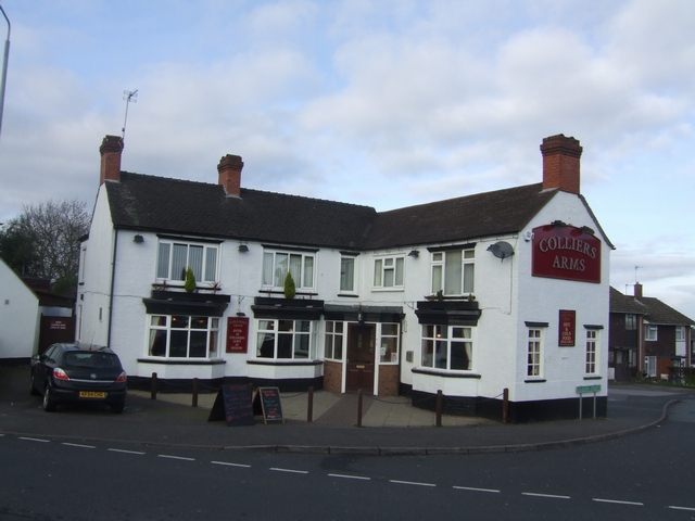
Colliers Arms - geograph.org.uk - 669105.jpg - GeographBot

Forest of Mercia Way - geograph.org.uk - 669116.jpg - GeographBot

Forest of Mercia Way - geograph.org.uk - 669138.jpg - GeographBot

Salem Church Sunday School - geograph.org.uk - 669087.jpg - GeographBot

Police Station - geograph.org.uk - 735950.jpg - GeographBot

Cheslyn Hay Community and Sports Club - geograph.org.uk - 1219572.jpg - GeographBot

New Inns, Cheslyn Hay - geograph.org.uk - 1219568.jpg - GeographBot

The Talbot, Cheslyn Hay - geograph.org.uk - 1219733.jpg - GeographBot

The White Horse, Cheslyn Hay - geograph.org.uk - 1219730.jpg - GeographBot

The Woodman Inn, Brock Road, Cheslyn Hay - geograph.org.uk - 1219752.jpg - GeographBot

14 and 16 Dundalk Lane, Cheslyn Hay.jpg - Geograph Update Bot

Driveway near Cheslyn Hay at dusk - geograph.org.uk - 2178316.jpg - GeographBot

Monuments in the cemetery - geograph.org.uk - 2178336.jpg - GeographBot

War Memorial at Cheslyn Hay - geograph.org.uk - 2178343.jpg - GeographBot

Station Road Cheslyn Hay - geograph.org.uk - 2178384.jpg - GeographBot

Looking down the B4156, Cheslyn Hay - geograph.org.uk - 2454704.jpg - GeographBot

M6 Toll Road, taken from the Cheslyn Hay bridge - geograph.org.uk - 2454721.jpg - GeographBot

M6 Toll Road 2002, from Cheslyn Hay bridge - geograph.org.uk - 2454736.jpg - GeographBot

Rail Bridge on Station Street, Cheslyn Hay - geograph.org.uk - 2642371.jpg - GeographBot

New Inns, Station Street, Cheslyn Hay - geograph.org.uk - 2642378.jpg - GeographBot

Shops on the One-Way System, Cheslyn Hay - geograph.org.uk - 2642810.jpg - GeographBot

From Grassmere Court to the B4156, Cheslyn Hay - geograph.org.uk - 2642820.jpg - GeographBot

Saredon Road Overbridge, M6 (Toll) - geograph.org.uk - 2654770.jpg - GeographBot

Walkmill Lane Bridge, M6 (Toll) - geograph.org.uk - 2659449.jpg - GeographBot

Lakeside Plaza - geograph.org.uk - 2659453.jpg - GeographBot

Footbridge, M6 (Toll) - geograph.org.uk - 2659462.jpg - GeographBot

Railway bridge over the M6 (Toll) - geograph.org.uk - 2659464.jpg - GeographBot

M6 Toll near Bridgtown - geograph.org.uk - 2825056.jpg - GeographBot

Saredon Road roundabout ahead - geograph.org.uk - 3002476.jpg - GeographBot

A460 east near Lodge Farm - geograph.org.uk - 3002480.jpg - GeographBot

Works by the M6 Toll - geograph.org.uk - 3195405.jpg - GeographBot

Pylons and Bridges from the M6 Toll - geograph.org.uk - 3195407.jpg - GeographBot

M6 Toll Road Approaching Saredon Road Bridge - geograph.org.uk - 3668726.jpg - GeographBot

The Midland Expressway - M6 Toll - geograph.org.uk - 3668764.jpg - GeographBot

M6 Toll Road, Mill Lane Bridge and Lakeside Plaza, Cannock Industrial Centre - geograph.org.uk - 3668772.jpg - GeographBot

Railway Bridge over The M6 Toll Road, Churchbridge - geograph.org.uk - 3668779.jpg - GeographBot

Rush hour on the M6 Toll - geograph.org.uk - 3870769.jpg - GeographBot

M6 Toll passing factories - geograph.org.uk - 4564035.jpg - GeographBot

Bridge and Lakeside Plaza from M6 Toll - geograph.org.uk - 4564037.jpg - GeographBot

OS benchmark - Cheslyn Hay, gatepost on Saredon Road - geograph.org.uk - 4847629.jpg - GeographBot

Moons Lane approaching Dundalk Lane - geograph.org.uk - 5452419.jpg - GeographBot

On the corner of Low Street - geograph.org.uk - 5453015.jpg - GeographBot

Wolverhampton Road joins the Saredon Road - geograph.org.uk - 5453018.jpg - GeographBot

OS benchmark - Cheslyn Hay, 39 Wolverhampton Road - geograph.org.uk - 5453019.jpg - GeographBot

The Wolverhampton Road, just outside Cheslyn Hay - geograph.org.uk - 5453022.jpg - GeographBot

Station Street, Cheslyn Hay - geograph.org.uk - 6078452.jpg - GeographBot

A J Sellman, funeral directors - geograph.org.uk - 6078454.jpg - GeographBot

The New Inns, Cheslyn Hay - geograph.org.uk - 6078457.jpg - GeographBot

Bridge on Station Street - geograph.org.uk - 6078459.jpg - GeographBot

OS benchmark - Great Wyrley, Station Street railway bridge - geograph.org.uk - 6078460.jpg - GeographBot

The Salem Church Sunday School in Cheslyn Hay - geograph.org.uk - 6081780.jpg - GeographBot

Industrial estate on Landywood Lane - geograph.org.uk - 6088229.jpg - GeographBot

Works on Landywood Lane, Great Wyrley - geograph.org.uk - 6374149.jpg - GeographBot

Salem Church Sunday School in Cheslyn Hay - geograph.org.uk - 6374152.jpg - GeographBot

Rosewood Park, Cheslyn Hay - geograph.org.uk - 6374154.jpg - GeographBot

Businesses on High Street, Cheslyn Hay - geograph.org.uk - 6374156.jpg - GeographBot

War Memorial, Cheslyn Hay - geograph.org.uk - 6374157.jpg - GeographBot

The New Inns, Cheslyn Hay - geograph.org.uk - 6374159.jpg - GeographBot

Station Street (B4156), Cheslyn Hay - geograph.org.uk - 6374161.jpg - GeographBot

George V postbox on Station Street, Cheslyn Hay - geograph.org.uk - 6374284.jpg - GeographBot

Garage on Station Street, Cheslyn Hay - geograph.org.uk - 6374286.jpg - GeographBot

Lakeside Plaza, Bridgtown, from the westbound M6 Toll - geograph.org.uk - 7322541.jpg - GeographBot

Houses on Westbourne Avenue Landywood backing onto the railway - geograph.org.uk - 7991836.jpg - GeographBot