Wikimedi'Òc
Modes d'emploi

Cet album fait partie des albums
Cet album photos contient les sous-albums suivants :


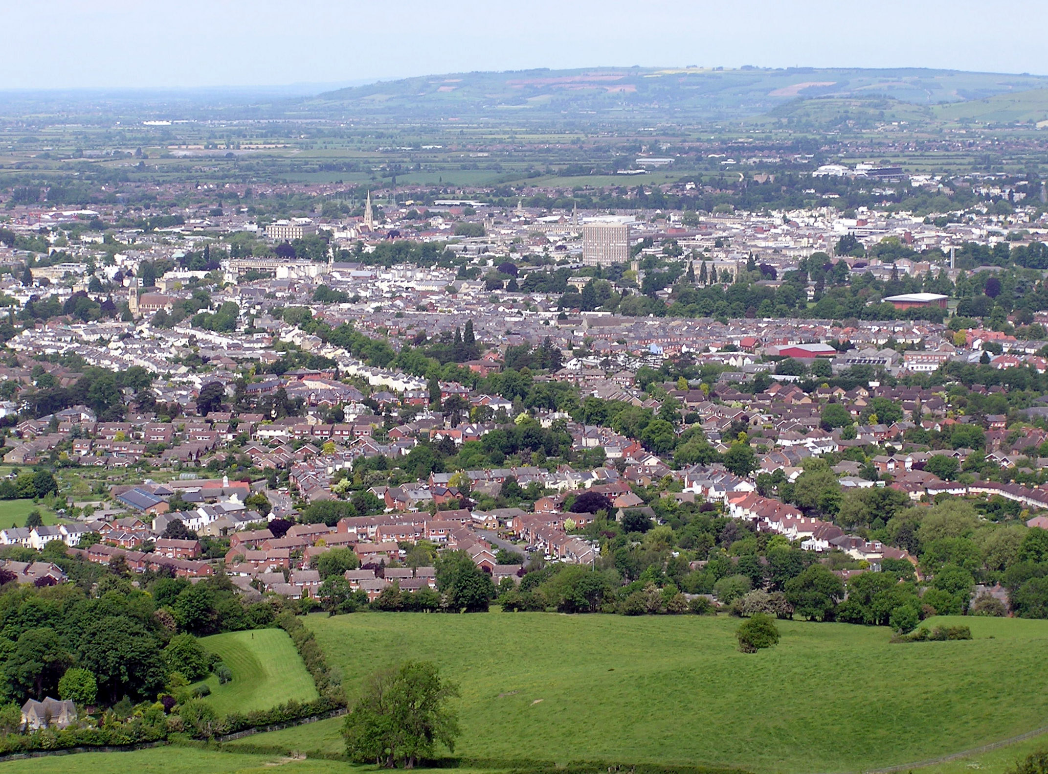
Cheltenham.from.leckhampton.arp.jpg - Arpingstone

Cheltenham by Richard Dighton.jpg - Dcoetzee
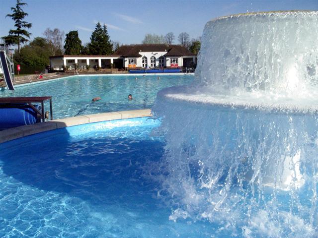
Sandford Parks Lido 2005.jpg - File Upload Bot (Magnus Manske)

Prestocheltenham.jpg - Ubcule
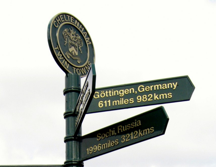
GottingenSign.JPG - Jongleur100

SochiSign.jpg - Jongleur100

Cotswold Bowl Ten Pin Bowling Lanes - geograph.org.uk - 5332.jpg - GeographBot

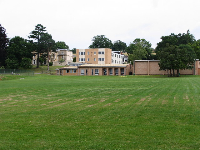
Dean Close School - geograph.org.uk - 5330.jpg - GeographBot

St Benedict's College - geograph.org.uk - 5333.jpg - GeographBot

Hales, Hewlett, Priors Road and Harp Hill Junction - geograph.org.uk - 36387.jpg - GeographBot

Lower Slopes of Aggs Hill - geograph.org.uk - 40735.jpg - GeographBot

Sixways, Charlton Kings - geograph.org.uk - 33388.jpg - GeographBot
St.Edwards Preparatory and Junior School, Charlton Kings - geograph.org.uk - 33391.jpg - GeographBot

Paddy-power-sign.jpg - Joeljkennedy

Bourton Hill Farm - geograph.org.uk - 255907.jpg - GeographBot

Bridleway opposite Furzehill Wood - geograph.org.uk - 255929.jpg - GeographBot

Cold Aston road junction with the Fosse Way - geograph.org.uk - 257678.jpg - GeographBot

Cotswold farmland south east of Cold Aston - geograph.org.uk - 258324.jpg - GeographBot
Cottages in the village of Sherborne - geograph.org.uk - 257084.jpg - GeographBot

Farmland by Coldmoor Coppice - geograph.org.uk - 256220.jpg - GeographBot

Farmland on Broadmoor - geograph.org.uk - 256944.jpg - GeographBot

Farmland to the south of Elmbank Farm - geograph.org.uk - 258325.jpg - GeographBot

Field to the east of Washpool Wood - geograph.org.uk - 255943.jpg - GeographBot

Gate into farmland in Sherborne Brook valley - geograph.org.uk - 257831.jpg - GeographBot

Hill Barn - geograph.org.uk - 255917.jpg - GeographBot

Restricted Byway to Clapton-on-the-Hill - geograph.org.uk - 256007.jpg - GeographBot

Roadside barn on Kineton Hill - geograph.org.uk - 254917.jpg - GeographBot

Sheep grazing near Kinetonhill Farm - geograph.org.uk - 254893.jpg - GeographBot

Sheep grazing near Moor's Copse - geograph.org.uk - 255991.jpg - GeographBot

Sherborne Brook - geograph.org.uk - 257080.jpg - GeographBot

Illustration at page 50, Folk-lore, volume 4, 1893.png - Cygnis insignis

Track to long barrow - geograph.org.uk - 277002.jpg - GeographBot

By Westfield Farm - geograph.org.uk - 283102.jpg - GeographBot

Chalk Hill Cottage - geograph.org.uk - 280842.jpg - GeographBot

Condicote Lane - geograph.org.uk - 280905.jpg - GeographBot

Entrance to Ash Farm near Icomb - geograph.org.uk - 280062.jpg - GeographBot

Farm track beside New Covert - geograph.org.uk - 283103.jpg - GeographBot

Former Quarry - geograph.org.uk - 280836.jpg - GeographBot

Gate and bridleway - geograph.org.uk - 280049.jpg - GeographBot

Jubilee Seat - geograph.org.uk - 288691.jpg - GeographBot

Meadow Farm - geograph.org.uk - 280921.jpg - GeographBot

Montpellier Walk and the caryatids - geograph.org.uk - 288715.jpg - GeographBot

Nosehill Farm - geograph.org.uk - 280834.jpg - GeographBot

Oxleaze viewed through quarry plant - geograph.org.uk - 283096.jpg - GeographBot

Queen's Hotel - geograph.org.uk - 288794.jpg - GeographBot

River Dikler - geograph.org.uk - 280938.jpg - GeographBot

The Imperial Fountain - geograph.org.uk - 288679.jpg - GeographBot
At the start of the lane to Oxpens Farm - geograph.org.uk - 293442.jpg - GeographBot

Calcot - geograph.org.uk - 293953.jpg - GeographBot

Corner of a field by the A40 at New Barn Farm - geograph.org.uk - 293452.jpg - GeographBot

Cotswold wall and broken gate - geograph.org.uk - 296552.jpg - GeographBot

Crossroads at Calcot - geograph.org.uk - 293955.jpg - GeographBot

Footpath starts here - geograph.org.uk - 296548.jpg - GeographBot

Hangman's Stone - geograph.org.uk - 293444.jpg - GeographBot

Hawthorns on a hillock - geograph.org.uk - 293896.jpg - GeographBot

Nearing the A40 - geograph.org.uk - 293457.jpg - GeographBot

Roadside snack bar on the A40 - geograph.org.uk - 293453.jpg - GeographBot

Sheep House Farm - geograph.org.uk - 296546.jpg - GeographBot

Site of the long barrow^ - geograph.org.uk - 293898.jpg - GeographBot

The A40, Cheltenham left, Oxford right - geograph.org.uk - 293451.jpg - GeographBot

The A40 - geograph.org.uk - 293449.jpg - GeographBot

The entrance to Crickley Barrow Farm - geograph.org.uk - 296549.jpg - GeographBot

Tree plantation - geograph.org.uk - 293959.jpg - GeographBot

Winter copse - geograph.org.uk - 293447.jpg - GeographBot

Barn near Tagmoor Farm - geograph.org.uk - 308472.jpg - GeographBot

Bourton Hill Farm - geograph.org.uk - 308468.jpg - GeographBot

Footpath to the Windrush - geograph.org.uk - 308800.jpg - GeographBot

Lane to Bourton - geograph.org.uk - 308436.jpg - GeographBot

Lane to Clapton - geograph.org.uk - 308806.jpg - GeographBot

Monarch's Way - geograph.org.uk - 308396.jpg - GeographBot

Muddy Monarch's Way - geograph.org.uk - 308420.jpg - GeographBot

New plantation - geograph.org.uk - 308457.jpg - GeographBot

Bridge abutment - geograph.org.uk - 322461.jpg - GeographBot

Course of former railway line - geograph.org.uk - 322491.jpg - GeographBot

Looking up the lane - geograph.org.uk - 322470.jpg - GeographBot

A straight road - geograph.org.uk - 376058.jpg - GeographBot

Between Blackington Copse and Mill Copse - geograph.org.uk - 376071.jpg - GeographBot

Blackthorn blossom (close-up) - geograph.org.uk - 376094.jpg - GeographBot

Blackthorn blossom - geograph.org.uk - 376092.jpg - GeographBot

Bridleway - geograph.org.uk - 376082.jpg - GeographBot

Deer near Burfordhill Copse - geograph.org.uk - 376097.jpg - GeographBot

Farm track - geograph.org.uk - 376086.jpg - GeographBot

Footpath and Foulwell Copse - geograph.org.uk - 376102.jpg - GeographBot

Ploughed bridleway - geograph.org.uk - 376084.jpg - GeographBot
Tracking deer - geograph.org.uk - 376098.jpg - GeographBot

Footpath heading North-East - geograph.org.uk - 387388.jpg - GeographBot

Road past Little Rissington Airfield - geograph.org.uk - 382273.jpg - GeographBot

Towards Furzehill Wood - geograph.org.uk - 387397.jpg - GeographBot

Lypiatt Street - geograph.org.uk - 426311.jpg - GeographBot

Gloucester Road, Cheltenham - geograph.org.uk - 435057.jpg - GeographBot

Field margin, Colesbourne, Gloucestershire - geograph.org.uk - 444570.jpg - GeographBot

Free range chickens at Aston Farm - geograph.org.uk - 447407.jpg - GeographBot

Reservoir in a field of barley - geograph.org.uk - 447615.jpg - GeographBot

House at Martin's Hill - geograph.org.uk - 451185.jpg - GeographBot

Stow rugby club - geograph.org.uk - 451179.jpg - GeographBot

QEFM chelt radio.jpg - Raymond Pearson

One of the Listening Stones in Hester's Way Park - geograph.org.uk - 588340.jpg - GeographBot

The Listening Stones - geograph.org.uk - 588329.jpg - GeographBot

The Listening Stones - geograph.org.uk - 588335.jpg - GeographBot

Marshy land near Westcote Brook - geograph.org.uk - 594816.jpg - GeographBot

Parkland in Benhall - geograph.org.uk - 625661.jpg - GeographBot
View north from Hartley Hill - geograph.org.uk - 638761.jpg - GeographBot

Cheltenham viewed from Hartley Hill - geograph.org.uk - 654118.jpg - GeographBot

Coldwell Bottom - geograph.org.uk - 652987.jpg - GeographBot
Earthworks on Leckhampton Hill - geograph.org.uk - 654216.jpg - GeographBot

Lilley Brook Golf Club, Cheltenham - geograph.org.uk - 654075.jpg - GeographBot

The Cotswold Way on Hartley Hill - geograph.org.uk - 654069.jpg - GeographBot

The Cotswold Way on Hartley Hill - geograph.org.uk - 654082.jpg - GeographBot

Tree in Coldwell Bottom - geograph.org.uk - 652976.jpg - GeographBot
Cheltenham Crematorium - geograph.org.uk - 670230.jpg - GeographBot

Farm fields looking towards Shurdington - geograph.org.uk - 677954.jpg - GeographBot

Town Hall Box Office - geograph.org.uk - 680978.jpg - GeographBot

Playground - geograph.org.uk - 705285.jpg - GeographBot

New Development, Oakley - geograph.org.uk - 864462.jpg - GeographBot

Restaurant, Cheltenham - geograph.org.uk - 862971.jpg - GeographBot
Towards St Marks - geograph.org.uk - 862972.jpg - GeographBot

Former gas works site - geograph.org.uk - 871347.jpg - GeographBot

Albert Road - geograph.org.uk - 881377.jpg - GeographBot

Art exhibition, Imperial Gardens, Cheltenham - geograph.org.uk - 884807.jpg - GeographBot

Chester Walk from St Mary's Churchyard, Cheltenham - geograph.org.uk - 885812.jpg - GeographBot

Phone box on Albert Road - geograph.org.uk - 881381.jpg - GeographBot

Roundabout, Fiddlers Green Lane - geograph.org.uk - 880959.jpg - GeographBot
Sandford Park, Cheltenham - geograph.org.uk - 888113.jpg - GeographBot

Sandford Park - geograph.org.uk - 888129.jpg - GeographBot

Sub-station, Springbank - geograph.org.uk - 880963.jpg - GeographBot

The Cambray, Cheltenham - geograph.org.uk - 888103.jpg - GeographBot
The River Chelt - geograph.org.uk - 888125.jpg - GeographBot

Municipal Gardens, Cheltenham - geograph.org.uk - 955955.jpg - GeographBot

View towards Montpellier - geograph.org.uk - 991190.jpg - GeographBot

Thirlestaine Hall - geograph.org.uk - 1013938.jpg - Geograph Update Bot

A417 to Gloucester - geograph.org.uk - 1070154.jpg - GeographBot

If it rains any more... - geograph.org.uk - 1083317.jpg - GeographBot

Inside Beechwood Shopping Centre - geograph.org.uk - 1083329.jpg - GeographBot

The cricket ground. - geograph.org.uk - 1086982.jpg - GeographBot

Cheltenham, Promenade, The Lodge - geograph.org.uk - 1096990.jpg - GeographBot

Approaching Rapsgate Farm - geograph.org.uk - 1105351.jpg - GeographBot

A frosty morning in Cox's Meadow - geograph.org.uk - 1129952.jpg - GeographBot

Andover Road, Norwood Road Junction - geograph.org.uk - 1127416.jpg - GeographBot

Asquith Road Allotments - geograph.org.uk - 1124526.jpg - GeographBot

Bath Parade during the July 2007 floods - geograph.org.uk - 1122941.jpg - GeographBot

Bath Terrace Car Park, Cheltenham - geograph.org.uk - 1127552.jpg - GeographBot

Charlton Park Gate - geograph.org.uk - 1122982.jpg - GeographBot
Churchill Industrial Estate, Churchill Road - geograph.org.uk - 1124491.jpg - GeographBot

Cox's Meadow during the July 2007 floods - geograph.org.uk - 1122927.jpg - GeographBot

Cox's meadow flood storage basin. - geograph.org.uk - 1122919.jpg - GeographBot

Great Norwood Street - geograph.org.uk - 1127439.jpg - GeographBot

Hays Cottages Almshouses, Naunton Park - geograph.org.uk - 1124524.jpg - GeographBot

Naunton Crescent - geograph.org.uk - 1127291.jpg - GeographBot

Naunton Lane looking south west - geograph.org.uk - 1127271.jpg - GeographBot

Naunton Park Gardens - geograph.org.uk - 1124519.jpg - GeographBot

Naunton Park Playing Fields and Playground - geograph.org.uk - 1124522.jpg - GeographBot
Naunton Park Road - geograph.org.uk - 1124529.jpg - GeographBot

Old Bath Road bridge over the River Chelt during the July 2007 floods - geograph.org.uk - 1122932.jpg - GeographBot

Old Bath Road to Mead Road footpath - geograph.org.uk - 1122974.jpg - GeographBot

Park Place looking north from Ashford Road - geograph.org.uk - 1126298.jpg - GeographBot

Sandford Park (east end) during the July 2007 floods - geograph.org.uk - 1122938.jpg - GeographBot

The Norwood Roundabout - geograph.org.uk - 1124488.jpg - GeographBot

The Park near Moorend Park Road - geograph.org.uk - 1127237.jpg - GeographBot

Thirlestaine Hall main entrance - geograph.org.uk - 1122968.jpg - GeographBot

View across the Promenade, Cheltenham - geograph.org.uk - 1121468.jpg - GeographBot

Waitrose Fountains - geograph.org.uk - 1122894.jpg - GeographBot

Whitecross Square - geograph.org.uk - 1127287.jpg - GeographBot

Painswick Road, Cheltenham (northern end) - geograph.org.uk - 1132215.jpg - GeographBot

Parkland Road, Cheltenham - geograph.org.uk - 1132270.jpg - GeographBot

A wintery Coldwell Bottom - geograph.org.uk - 1156360.jpg - GeographBot

Tewkesbury Road, Cheltenham 1 - geograph.org.uk - 1187351.jpg - GeographBot

Tewkesbury Road, Cheltenham 2 - geograph.org.uk - 1187353.jpg - GeographBot

A4015, Cheltenham - geograph.org.uk - 1224237.jpg - GeographBot

Flowers for sale - geograph.org.uk - 1224233.jpg - GeographBot
Packing up the market stalls - geograph.org.uk - 1224117.jpg - GeographBot

There's always one - geograph.org.uk - 1224149.jpg - GeographBot

View along North Street, A46 - geograph.org.uk - 1224101.jpg - GeographBot

Government offices, Parabola Road - geograph.org.uk - 1336309.jpg - GeographBot

Junction of Malvern Place with Malvern Road - geograph.org.uk - 1336280.jpg - GeographBot

Roundabout at the junction of Bayshill Road and Parabola Road - geograph.org.uk - 1336299.jpg - GeographBot

Well Place meets Christchurch Road - geograph.org.uk - 1336253.jpg - GeographBot

Semi-detached houses, Gloucester Road - geograph.org.uk - 1381947.jpg - GeographBot

The Courtyard shops - geograph.org.uk - 1381909.jpg - GeographBot

The Garden Cafe, Montpellier Gardens - geograph.org.uk - 1381922.jpg - GeographBot

Childrens' play area, Sports Club, Tewkesbury Road - geograph.org.uk - 1408641.jpg - GeographBot

Clubhouse, Tewkesbury Road - geograph.org.uk - 1408663.jpg - GeographBot

The Cobblers Corner - geograph.org.uk - 1468775.jpg - GeographBot

After a storm... - geograph.org.uk - 1500832.jpg - GeographBot

Bluebells on road to Coombe End - geograph.org.uk - 1509343.jpg - GeographBot

Buzzard cloaking its prey - geograph.org.uk - 1500827.jpg - GeographBot

Telltale puff of smoke - geograph.org.uk - 1508429.jpg - GeographBot

"The Salt Way" towards Winstone - geograph.org.uk - 1515818.jpg - GeographBot

Boxing Day sunrise at Southbury - geograph.org.uk - 1511300.jpg - GeographBot

Bridleway towards Colesbourne - geograph.org.uk - 1519896.jpg - GeographBot

Bridleway towards Pinswell crossing the Colesbourne to Hilcot road - geograph.org.uk - 1519907.jpg - GeographBot

Shurdington road, Bath road junction - geograph.org.uk - 1550930.jpg - GeographBot

Cleevelands Drive, Cheltenham - geograph.org.uk - 1569577.jpg - GeographBot

Dunalley Street, Cheltenham - geograph.org.uk - 1569492.jpg - GeographBot

Shadows in Cheltenham Bus Station - geograph.org.uk - 1639786.jpg - GeographBot

The Brewery, Cheltenham 1 - geograph.org.uk - 1638923.jpg - GeographBot

The Brewery, Cheltenham 2 - geograph.org.uk - 1638929.jpg - GeographBot

Grobmalzonka.jpg - Quodvultdeus
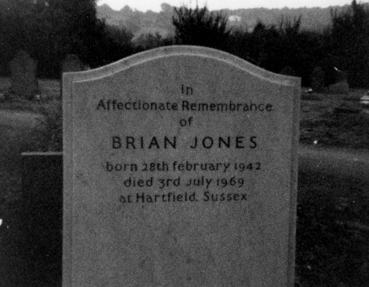
Brian jones grave.jpg - Jeanne boleyn~commonswiki

Adam Henson at Cheltenham, Cotswolds, England-14Jan2010.jpg - File Upload Bot (Magnus Manske)

Promenade looking towards Hight Street Cheltenham England.jpg - Dzlinker

Promenade looking towards Queens Hotel Cheltenham England.jpg - Dzlinker

CTLFC Squad 2012-13.jpg - Ctlfc

Cheltenhamtwp 04.JPG - Peetlesnumber1

Cheltenham from Leckhampton Hill.jpg - Nilfanion

Devil's Chimney and Cheltenham.jpg - Nilfanion

Ordnance Survey Drawings - Cheltenham (OSD 172).jpg - LibraryBot

Escaped Elephants - Cheltenham Town Center.jpeg - Stalkadam

Charles Henry Mackintosh Grave.jpg - OgreBot

Promenade looking towards Queen's Hotel, Cheltenham, England-LCCN2002696529.jpg - Fæ
Promenade looking towards Queen's Hotel, Cheltenham, England-LCCN2002696529.tif - Fæ

Trade card for J. G. Bevan and Company Wellcome L0001151.jpg - Fæ

King George III taking the waters at Cheltenham. Coloured aq Wellcome L0025125.jpg - Fæ

An advertisment for a pharmacist using scientific equipment Wellcome V0012465.jpg - Fæ

People strolling in Old Well Walk, Cheltenham. Line engravin Wellcome V0012475.jpg - Fæ

Opiel Villas, Chalybeate Spa and Imperial Square, Cheltenham Wellcome V0012476.jpg - Fæ

The grounds of the 'original' Cheltenham spa, Cheltenham. Li Wellcome V0012478.jpg - Fæ

People gathering at the promenade and pump room, Cheltenham. Wellcome V0012482.jpg - Fæ

The promenade, Cheltenham. Steel engraving. Wellcome V0012486.jpg - Fæ

The promenade leading up to Montpellier Spa, Cheltenham. Par Wellcome V0012487.jpg - Fæ

The well walk at Cheltenham. Engraving by J. Springsguth. Wellcome V0020119.jpg - Fæ
Dean Close School Logo.jpg - Win0922

New flats on the old Coliseum cinema site (geograph 3075350).jpg - Sumita Roy Dutta

Terry Wogan at Cheltenham Literature Festival.jpg - WikiPedant

Cheltenham from Leckhampton Hill (6973).jpg - KTC

Cheltenham from Leckhampton Hill (6977).jpg - KTC

Cheltenham from Leckhampton Hill (6978).jpg - KTC

Houses in Leckhampton from Leckhampton Hill (6974).jpg - KTC

Cheltenham and Tewkesbury from Leckhampton Hill (6966).jpg - KTC

Cheltenham and the Malverns from Leckhampton Hill (6962).jpg - KTC

Cheltenham and the Malverns from Leckhampton Hill (6971).jpg - KTC

Cheltenham from Leckhampton Hill (6970).jpg - KTC
Male Hairy-footed Bee. Anthophora plumipes - Flickr - gailhampshire.jpg - Josve05a

P1050214 - Flickr - gailhampshire.jpg - Josve05a

Cheltenham Cruikshank.jpg - Racconish

Nemophora scabiosella . Adelidae - Flickr - gailhampshire.jpg - Josve05a

Battledown Trading Estate, Cheltenham (geograph 4199422).jpg - Rodw

Cricket in Bourton - panoramio.jpg - Panoramio upload bot

Notgrove Barrow - panoramio.jpg - Panoramio upload bot
Notgrove Barrow - panoramio (1).jpg - Panoramio upload bot

Saxman, Cheltenham (33304984002).jpg - Davey2010

Paddy Power balloon arch, Cheltenham (33420135096).jpg - Davey2010

A429 through Oxfordshire, Oxfordshire - panoramio.jpg - Panoramio upload bot

Certificate of twinning link.jpg - SKas

Old Petrol Pump outside The Plough Inn, Ford - panoramio.jpg - Panoramio upload bot

Cheltenham - panoramio.jpg - Panoramio upload bot

Cheltenham - panoramio (6).jpg - Panoramio upload bot

Cheltenham - panoramio (7).jpg - Panoramio upload bot

Cheltenham - panoramio (13).jpg - Panoramio upload bot

Dragon and Onion lamp post.jpg - David Tallboys

Cambray Place.jpg - LukesCreativeHouse
Berkeley Place By Night.jpg - Embedded Data Bot
Berkeley Place Transitions Between Night and Day.jpg - Embedded Data Bot

Mill cottage 3.jpg - R ferroni2000

Mill cottage 1.jpg - R ferroni2000

Mill cottage.jpg - R ferroni2000
Jessica Bellhouse of Cotswold Grange.jpg - Maypm

John Waddingham circa 1860.jpg - Maypm

Ordnance Survey One-Inch Sheet 143 Gloucester & Malvern, Published 1946.jpg - Kognos

Ordnance Survey One-Inch Sheet 157 Swindon, Published 1940.jpg - Kognos

Ordnance Survey One-Inch Sheet 144 Cheltenham and Evesham, Published 1953.jpg - Kognos

Ordnance Survey One-Inch Sheet 143 Gloucester & Malvern, Published 1953.jpg - Kognos

Ordnance Survey One-Inch Sheet 144 Cheltenham & Evesham, Published 1946.jpg - Kognos

Woodland Path Ham Wood (182221013).jpeg - Rodrigo.Argenton

Ordnance Survey One-Inch Sheet 143 Gloucester & Malvern, Published 1968.jpg - Kognos

Ordnance Survey One-Inch Sheet 144 Cheltenham & Evesham, Published 1968.jpg - Kognos

Kate Chruscicka.jpg - Peter Glyn

Brandon House (geograph 4775078).jpg - Plucas58

HFF iron work - Flickr - Orchids love rainwater.jpg - Wereldburger758

Ordnance Survey One-Inch Sheet 92 Gloucester & Forest of Dean, Published 1919.jpg - Kognos

Marchants Optare Solo KX14 FJO , Royal Well Bus Station Cheltenham 16.3.18 (25991792467).jpg - Matlin

Pittville Park.jpg - Pricejb

In loving memory of the K6 - geograph.org.uk - 2221973.jpg - GeographBot

Imperial Square Gardens (29849015218).jpg - Ham II

Sandford Park (42815751785).jpg - Ham II

Sandford Park (43671953292).jpg - Ham II

Synagogue Lane, Cheltenham - road sign (3830872025).jpg - Ham II

Synagogue Lane, Cheltenham - road sign (3831669432).jpg - Ham II
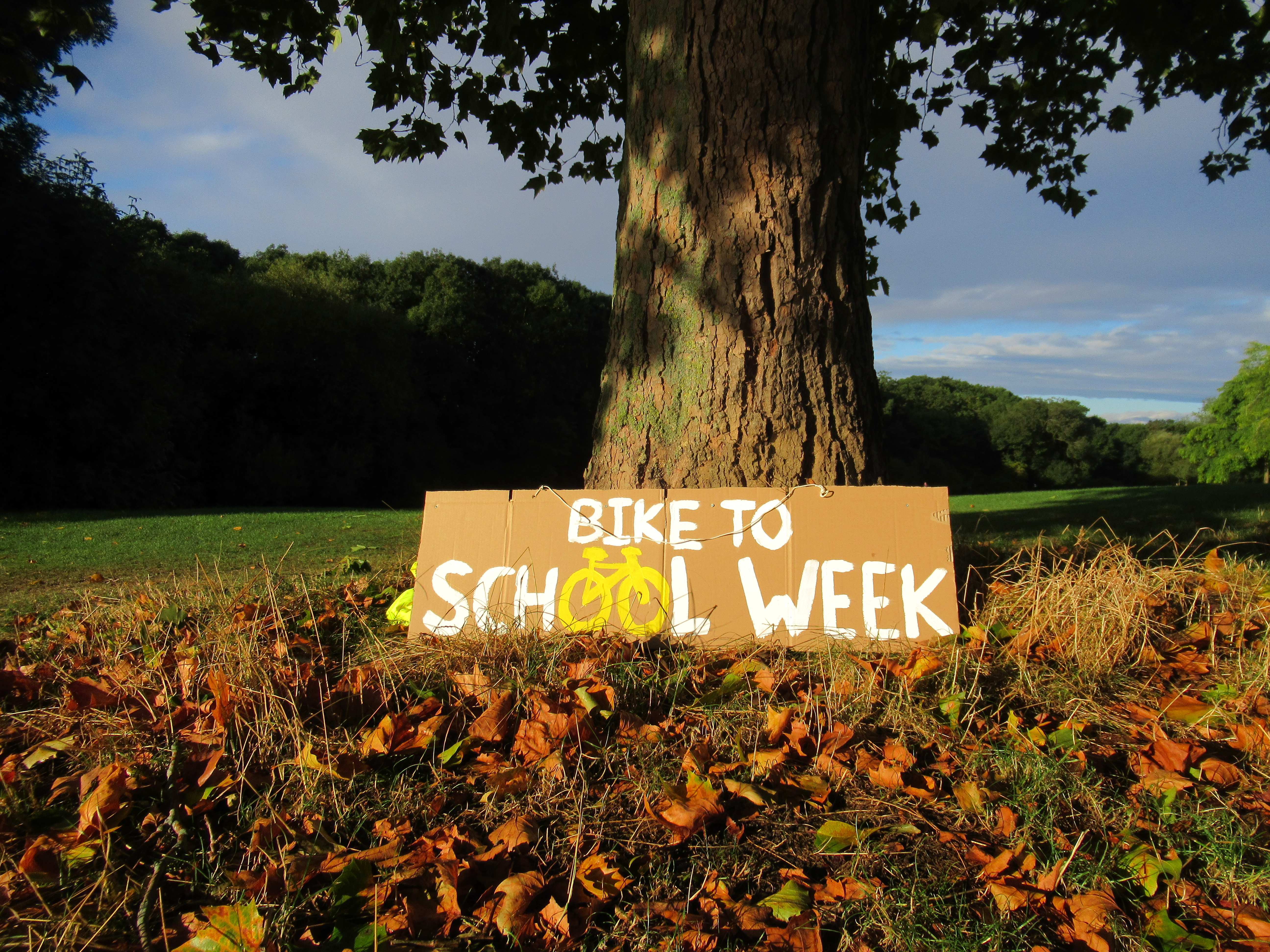
Bike to School Week sign, Benhall, Cheltenham.jpg - TheLivesAroundUs

Chiildren's Play Equipment, Benhall Park, Cheltenham, UK.jpg - TheLivesAroundUs

Recycling Bins, Cheltenham, UK.jpg - TheLivesAroundUs

Cheltenham OSM 03.png - Ccmpg

Mature Tree in Benhall, Cheltenham at sunset.jpg - TheLivesAroundUs
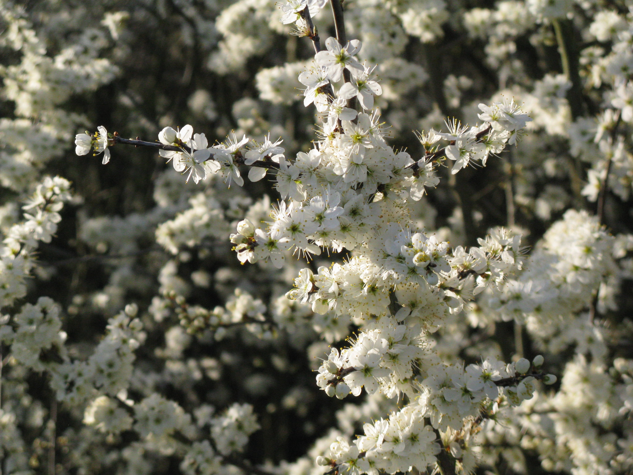
Prunus spinosa Hedge in Flower.jpg - TheLivesAroundUs

Oak tree bark in Benhall Woods.jpg - TheLivesAroundUs

Old Milestone, A40 Cheltenham (geograph 6969141).jpg - Sic19

Standing deadwood with Woodpecker holes, Benhall Park, Cheltenham.jpg - TheLivesAroundUs

Natural Play Equipment in Benhall Park, Cheltenham.jpg - TheLivesAroundUs

Capt' Gorgeous - 41668606864.jpg - Oxyman

Capt' Gorgeous - 28519005268.jpg - Oxyman

Capt' Gorgeous - 40583881720.jpg - Oxyman

Blason de Cheltenham.svg - Electrix-Frog

Target Dossier for Bishop's Cleeve, Gloucestershire, England - DPLA - 5075a2f7c1ab3e7f6a87cf9f2f5deacc (page 1).jpg - DPLA bot

Panorama of Cheltenham.jpg - Britishperson25

Vodafone site on a Cheltenham corner - geograph.org.uk - 5518975.jpg - GeographBot

Copper Beech tree, Montpellier Gardens, Cheltenham.jpg - Billabong25
Cheltenham en gb.ogg - Simonc111

Stormhank653 oli 20240103.jpg - Lupe

Stormhank653 oli 20190130.jpg - Lupe

Cambray Place, Cheltenham (geograph 7343989).jpg - Chocolateediter

Cambray Place, Cheltenham (geograph 7343984).jpg - Chocolateediter

Cheltenham Borough Council 2024.svg - RandomEditsForWhenIRemember

Cheltenham UK ward map 2024.svg - Into oblivion
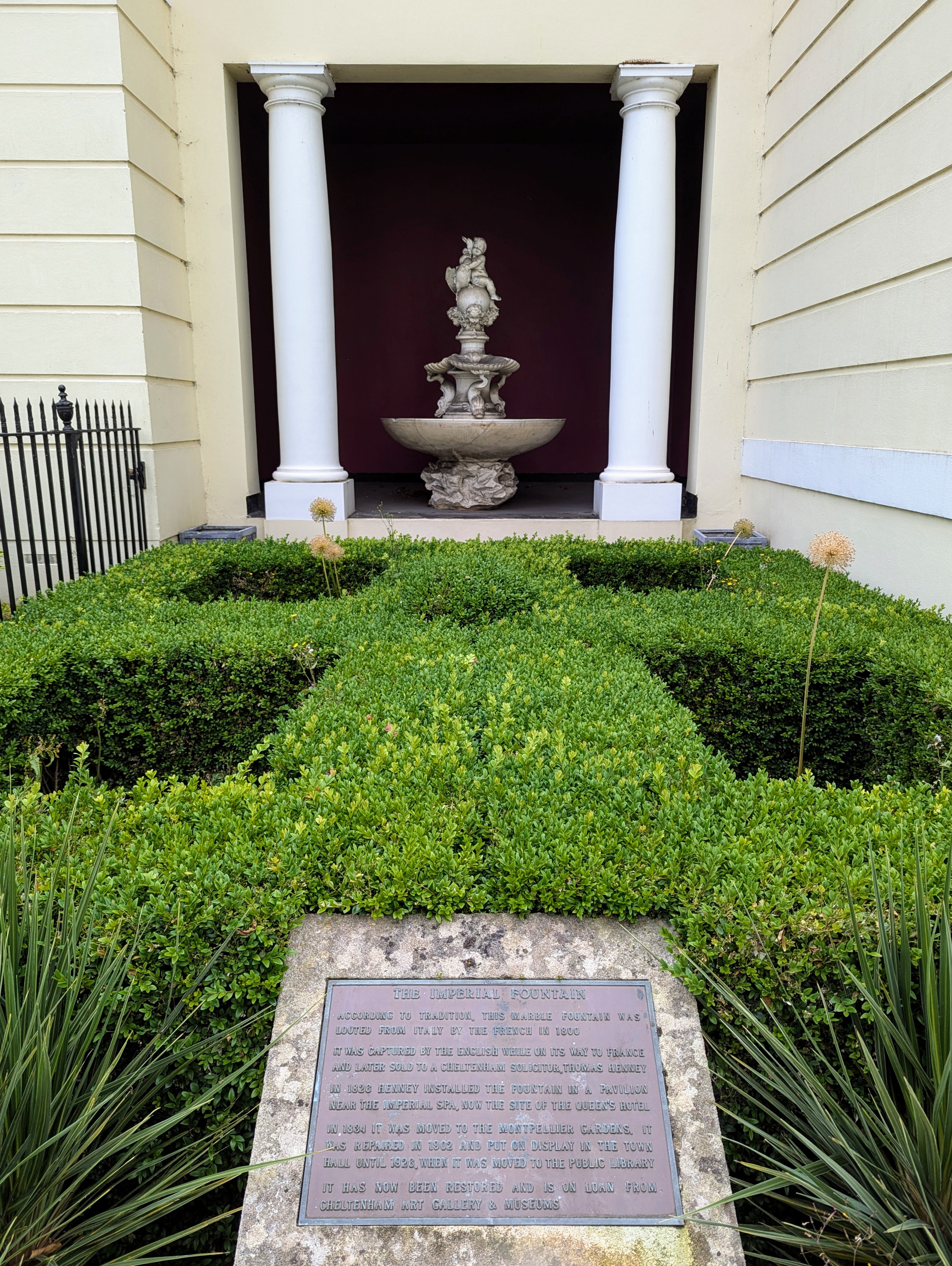
Imperial Fountain in Cheltenham.jpg - DIaNyf8q

Adam Henson, 2010 (cropped).jpg - Sulov Jondauss 76