Wikimedi'Òc
Modes d'emploi

Cet album fait partie des albums
Cet album photos contient les sous-albums suivants :


Cattle grid on the A939 - geograph.org.uk - 6018325.jpg - GeographBot

Cattle grid (scotland) overview.jpeg - Akinom

Cattle grid (scotland) close up.jpeg - Rotatebot

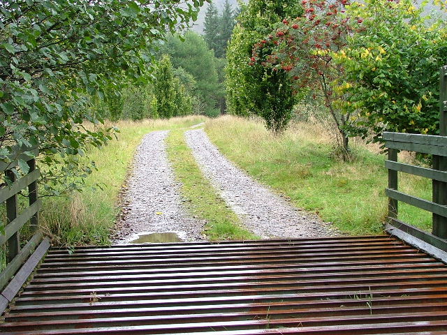
Cattle Grid - geograph.org.uk - 2895.jpg - GeographBot

Cattle Grid and Gate on road in Glen Buckie - geograph.org.uk - 48891.jpg - GeographBot

Cattle Grid on the Cleadale Road - geograph.org.uk - 41893.jpg - GeographBot

Cattle grid, Assynt - geograph.org.uk - 55805.jpg - GeographBot

Cattle grid on Affric track - geograph.org.uk - 57794.jpg - GeographBot

Cattle Grid and Tanwell Woods - geograph.org.uk - 78851.jpg - GeographBot

Cattle Grid and long view towards Ecclaw - geograph.org.uk - 75268.jpg - GeographBot

Cattle grid on the Musdale road - geograph.org.uk - 105326.jpg - GeographBot

Cattle grid on the Auchrobert to Logan Reservoir road - geograph.org.uk - 128586.jpg - GeographBot

Footpath at foot of Moorfoot Hills - geograph.org.uk - 128650.jpg - GeographBot

Frostineb road. - geograph.org.uk - 137155.jpg - GeographBot

Cattle Grid on B709 below Crosslee Rigg - geograph.org.uk - 156129.jpg - GeographBot

Cattle grid, B709 - geograph.org.uk - 153784.jpg - GeographBot

Balhomish Farm Road - geograph.org.uk - 166715.jpg - GeographBot

Here beginneth the hillside - geograph.org.uk - 112226.jpg - GeographBot

Cattle grid at the edge of the forest - geograph.org.uk - 175576.jpg - GeographBot

Cattle grid on the Affric road - geograph.org.uk - 170075.jpg - GeographBot

Cattle Grid at Gress - geograph.org.uk - 194269.jpg - GeographBot

Cattlegrid, Blackhaugh - geograph.org.uk - 198502.jpg - GeographBot

Cattle Grid on Pentland Road - geograph.org.uk - 206730.jpg - GeographBot

Cattle grid - geograph.org.uk - 205854.jpg - GeographBot

North Tolsta Village Gateway - geograph.org.uk - 194136.jpg - GeographBot

Attadale House driveway - geograph.org.uk - 216755.jpg - GeographBot

Cattle Grid Near Garchew - geograph.org.uk - 216012.jpg - GeographBot

Cattle Grid, Langwell Lodge Road, Strathcanaird - geograph.org.uk - 233579.jpg - GeographBot

Cattle Grid, Near Balchladich - geograph.org.uk - 238179.jpg - GeographBot

Cattle grid - geograph.org.uk - 249784.jpg - GeographBot

Cattle grid on eastern approach to Little Aitnoch. - geograph.org.uk - 253570.jpg - GeographBot
Driveway to Tullich House - geograph.org.uk - 252376.jpg - GeographBot

Cattle grid, Foresthill Strip. - geograph.org.uk - 269288.jpg - GeographBot

Cattle grid at the summit of the Kendoon to Moniaive road - geograph.org.uk - 267434.jpg - GeographBot

Glen Feshie cattle grid - geograph.org.uk - 269009.jpg - GeographBot

Stop^ Who goes there^ - geograph.org.uk - 263010.jpg - GeographBot

Cattle grid, Hunt Law - geograph.org.uk - 273277.jpg - GeographBot

Denny Muir from Doups Farm road - geograph.org.uk - 281415.jpg - GeographBot
The track to Howburn - geograph.org.uk - 328087.jpg - GeographBot

Another cattle grid. - geograph.org.uk - 356233.jpg - GeographBot

Cattle grid - geograph.org.uk - 356230.jpg - GeographBot

At the Cattle Grid - geograph.org.uk - 372644.jpg - GeographBot

Cattle Grid - geograph.org.uk - 377780.jpg - GeographBot

Cattle Grid at Brundeanlaws - geograph.org.uk - 382197.jpg - GeographBot

Cattle grid - geograph.org.uk - 395897.jpg - GeographBot

Cattle Grid at Wester Clune - geograph.org.uk - 419733.jpg - GeographBot

Cattle Grid at Haughend - geograph.org.uk - 420448.jpg - GeographBot

Cattle grid - geograph.org.uk - 435126.jpg - GeographBot

Cattle grid on B976 - geograph.org.uk - 443238.jpg - GeographBot

Cattle grid - geograph.org.uk - 466000.jpg - GeographBot

Cattle grid - geograph.org.uk - 466102.jpg - GeographBot

Elevated cattle grid - geograph.org.uk - 466641.jpg - GeographBot

Cattle grid at Knock - geograph.org.uk - 473200.jpg - GeographBot
Colonsay Cattle Grid - geograph.org.uk - 474085.jpg - GeographBot

Road to Mains of Kinmuck - geograph.org.uk - 470305.jpg - GeographBot

A cattle grid at Balnacoil - geograph.org.uk - 484976.jpg - GeographBot

Cattle Grid - geograph.org.uk - 483712.jpg - GeographBot

Cattle Grid - geograph.org.uk - 487693.jpg - GeographBot

Cattle Grid at the head of Dunrobin Glen - geograph.org.uk - 486669.jpg - GeographBot

Cattle grid - geograph.org.uk - 484358.jpg - GeographBot

Cattle grid - geograph.org.uk - 484446.jpg - GeographBot

Cattle grid - geograph.org.uk - 485844.jpg - GeographBot

Cattle grid - geograph.org.uk - 485864.jpg - GeographBot

Cattle grid on a single track road. - geograph.org.uk - 481713.jpg - GeographBot

Kilcalm entrance to Gordonbush Lodge - geograph.org.uk - 484570.jpg - GeographBot

Cattle grid - geograph.org.uk - 493995.jpg - GeographBot

Cattle Grid on Road to Loch Teacus - geograph.org.uk - 511685.jpg - GeographBot

Cattle Grid adjacent to ruins of Corseglass School - geograph.org.uk - 528292.jpg - GeographBot

Cattle grid - geograph.org.uk - 522003.jpg - GeographBot

The road from Sundhope Farm at Whitrope Edge - geograph.org.uk - 522281.jpg - GeographBot

Cattle grid protecting entrance to forest - geograph.org.uk - 532710.jpg - GeographBot

Cattle Grid at Aird Uig. - geograph.org.uk - 574080.jpg - GeographBot

Cattle grid on the B6362 - geograph.org.uk - 579010.jpg - GeographBot
A pristine cattle grid - geograph.org.uk - 584702.jpg - GeographBot

Cattle grid - geograph.org.uk - 585861.jpg - GeographBot

Cattle grid on the road from Corsock Bridge to Glaisters - geograph.org.uk - 586641.jpg - GeographBot

Cattle grid on the road to Achsinegar - geograph.org.uk - 582881.jpg - GeographBot

Fairlie Moor Cattle Grid - geograph.org.uk - 581693.jpg - GeographBot

Fairlie Moor Cattle Grid - geograph.org.uk - 581728.jpg - GeographBot

Fairlie Moor Cattle Grid - geograph.org.uk - 581738.jpg - GeographBot

Cattle grid, Old Langtonlees - geograph.org.uk - 597376.jpg - GeographBot

Cattle grid at entrance to Arecleoch Forest - geograph.org.uk - 597364.jpg - GeographBot

County boundary - geograph.org.uk - 597214.jpg - GeographBot

Strathnaver, cattle grid on the B871 - geograph.org.uk - 596775.jpg - GeographBot

Cattle grid high on the Lammermuir Hills - geograph.org.uk - 619546.jpg - GeographBot

Cattle grid on the road to Claigan - geograph.org.uk - 652651.jpg - GeographBot

Red Paint at Mountblairy - geograph.org.uk - 706697.jpg - GeographBot

Cattle Grid - geograph.org.uk - 724682.jpg - GeographBot

Cattle grid and dyke in upper Glen Lyon - geograph.org.uk - 727339.jpg - GeographBot

Kiln Hill Burn - geograph.org.uk - 723054.jpg - GeographBot

On the way to Ballachlaven Farm - geograph.org.uk - 753909.jpg - GeographBot

Cattle Grid - geograph.org.uk - 765444.jpg - GeographBot

Gateway on sheep farm track - geograph.org.uk - 765308.jpg - GeographBot

Not the end of the road, Ardlussa - geograph.org.uk - 767259.jpg - GeographBot

Cattle Grid Near Gorten Farm - geograph.org.uk - 773367.jpg - GeographBot

Cattle Grid Near Kinloid - geograph.org.uk - 772505.jpg - GeographBot

Cattle Grid on Road North of Tarbet - geograph.org.uk - 777873.jpg - GeographBot

Cattle Grid on the Road to Duartbeg - geograph.org.uk - 777753.jpg - GeographBot

Cattle grid - geograph.org.uk - 770279.jpg - GeographBot

Cattle grid across the road - geograph.org.uk - 803955.jpg - GeographBot

Cattle Grid in Glen Avon - geograph.org.uk - 905714.jpg - GeographBot

Cycling hazards - geograph.org.uk - 915681.jpg - GeographBot

Cattle grid - geograph.org.uk - 926916.jpg - GeographBot

Cattle pen at Losgaintir - geograph.org.uk - 925834.jpg - GeographBot

"......OK, OK, I'm going......." - geograph.org.uk - 984216.jpg - GeographBot

Cattle grid in the B8009 - geograph.org.uk - 1120591.jpg - GeographBot

Cattle Grid - geograph.org.uk - 1187422.jpg - GeographBot

Cattle grid near Drumbeg - geograph.org.uk - 1260851.jpg - GeographBot

Old Largs Road - geograph.org.uk - 1419224.jpg - GeographBot

Cattle grid near Earlside Farm - geograph.org.uk - 1429897.jpg - GeographBot

Eriskay causeway - geograph.org.uk - 1435591.jpg - GeographBot

Cattle Grid near Craigshinnie Bridge - geograph.org.uk - 1440951.jpg - GeographBot

Cattle grid at Old Mountbenger Tollhouse - geograph.org.uk - 1447298.jpg - GeographBot

Cattle grid at Over Bohespic - geograph.org.uk - 1440475.jpg - GeographBot

Cattle grid on the A837 - geograph.org.uk - 1446956.jpg - GeographBot

Berneray causeway - geograph.org.uk - 1467269.jpg - GeographBot

Cattle grid at Vaul - geograph.org.uk - 1460301.jpg - GeographBot

Cattle grid on the B8068 - geograph.org.uk - 1460281.jpg - GeographBot

Cattle Grid at Braebuster - geograph.org.uk - 1483900.jpg - GeographBot

Cattle Grid with Ward Hill in the background - geograph.org.uk - 1483915.jpg - GeographBot

Cattle Grid - geograph.org.uk - 1493610.jpg - GeographBot

Cattle grid near Baledmund Farm - geograph.org.uk - 1496438.jpg - GeographBot

Cattle grid on track to Ballochan - geograph.org.uk - 1493055.jpg - GeographBot

Cattle grid on track to Birse Castle - geograph.org.uk - 1493069.jpg - GeographBot

Cattle Grid on road from Loch Ettrick. - geograph.org.uk - 1503798.jpg - GeographBot

Cattle grid on B797 to Wanlockhead - geograph.org.uk - 1503852.jpg - GeographBot

A cattle grid on the road to Caddonhead Farm - geograph.org.uk - 1518620.jpg - GeographBot

Cattle grid - geograph.org.uk - 1511535.jpg - GeographBot

Cottage entrance and cattle grid Orasaigh - geograph.org.uk - 1511436.jpg - GeographBot

Cattle grid on the B709 - geograph.org.uk - 1542779.jpg - GeographBot

Cattle grid - geograph.org.uk - 1552475.jpg - GeographBot

Cattle Grid and little bridge over March sike - geograph.org.uk - 1578742.jpg - GeographBot

Cattle grid at Killantringan - geograph.org.uk - 1725840.jpg - GeographBot

Fairburn Estate access gate to the Orrin Reservoir road (geograph 5255396).jpg - Bjh21

Deer stalking season, Glen Orrin (geograph 5940902).jpg - Bjh21

Cattle grid on the road to Fersit - geograph.org.uk - 2429089.jpg - GeographBot

Sheep killed by cattle grid - geograph.org.uk - 2812428.jpg - GeographBot

Eriskay Causeway - geograph.org.uk - 4120956.jpg - GeographBot

Track to Port Logan - geograph.org.uk - 4461315.jpg - GeographBot

Track to Port Logan - geograph.org.uk - 4461327.jpg - GeographBot

Track to Port Logan - geograph.org.uk - 4461353.jpg - GeographBot

Cattle grid at Horsecraig - geograph.org.uk - 4970834.jpg - GeographBot

Caution^ Lambs - geograph.org.uk - 6159241.jpg - GeographBot

Cattlegrid on the A837 towards Lairg - geograph.org.uk - 7359190.jpg - GeographBot