Wikimedi'Òc
Modes d'emploi

Cet album fait partie des albums
Cet album photos contient les sous-albums suivants :


Sheep by the railway - geograph.org.uk - 232968.jpg - GeographBot

Castlethorpe - geograph.org.uk - 299704.jpg - GeographBot

Castlethorpe Mill - geograph.org.uk - 299123.jpg - GeographBot

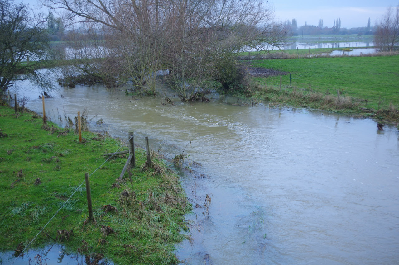
River Tove - geograph.org.uk - 299091.jpg - GeographBot

Happy Campers - geograph.org.uk - 439448.jpg - GeographBot

Home Farm - geograph.org.uk - 439460.jpg - GeographBot

Route 6 - geograph.org.uk - 437874.jpg - GeographBot

Rusty Water Tower - geograph.org.uk - 437871.jpg - GeographBot

West Coast Mainline - geograph.org.uk - 437879.jpg - GeographBot

Wide Track - geograph.org.uk - 439491.jpg - GeographBot

Castlethorpe Cottage - geograph.org.uk - 446366.jpg - GeographBot

Castlethorpe School - geograph.org.uk - 446345.jpg - GeographBot

Railway Arch - geograph.org.uk - 446406.jpg - GeographBot

Railway Bank and Arch - geograph.org.uk - 446414.jpg - GeographBot

The River Ouse - geograph.org.uk - 446294.jpg - GeographBot

Old Chapel, Castlethorpe - geograph.org.uk - 1038932.jpg - GeographBot

Path to Footbridge, Castlethorpe - geograph.org.uk - 1038938.jpg - GeographBot

South Street. Castlethorpe - geograph.org.uk - 1038921.jpg - GeographBot

Snowscene north of Castlethorpe - geograph.org.uk - 2239662.jpg - GeographBot

A line of trees leading away from the West Coast Main Line - geograph.org.uk - 2239666.jpg - GeographBot

West Coast Main Line passes through Castlethorpe - geograph.org.uk - 2239673.jpg - GeographBot

West Coast Main Line passes through a cutting, Castlethorpe - geograph.org.uk - 2239681.jpg - GeographBot

Snowscene by the West Coast Main Line near Lodge Farm - geograph.org.uk - 2245021.jpg - GeographBot

Snowscene south of Lodge Farm - geograph.org.uk - 2245028.jpg - GeographBot

Castlethorpe Village Hall - geograph.org.uk - 2382767.jpg - GeographBot

Large Wheat field near Castlethorpe - geograph.org.uk - 2496302.jpg - GeographBot

Large crop field near Lincoln Lodge - geograph.org.uk - 2496306.jpg - GeographBot

Large field of Oilseed Rape - geograph.org.uk - 2496314.jpg - GeographBot

Oilseed Rape near Gordon's Lodge - geograph.org.uk - 2496317.jpg - GeographBot

Wolverton Road - geograph.org.uk - 2677256.jpg - GeographBot

National cycle route No 6 - geograph.org.uk - 2677262.jpg - GeographBot

Drive and footpath to Lower Balney Grounds - geograph.org.uk - 2679085.jpg - GeographBot

Farmland by the West Coast Main Line - geograph.org.uk - 2738316.jpg - GeographBot

Farmland near Castlethorpe - geograph.org.uk - 2738323.jpg - GeographBot

Farmland, Lincoln Lodge - geograph.org.uk - 2738326.jpg - GeographBot

Farmland by the West Coast Main Line - geograph.org.uk - 2738332.jpg - GeographBot

Farmland by the West Coast Main Line - geograph.org.uk - 2738335.jpg - GeographBot

Farmland by the West Coast Main Line - geograph.org.uk - 2738337.jpg - GeographBot

Farmland near New Farm - geograph.org.uk - 2738338.jpg - GeographBot

Lake near Chantry Farm - geograph.org.uk - 2850546.jpg - GeographBot

Chantry Farm - geograph.org.uk - 2850550.jpg - GeographBot

Grange Farm - geograph.org.uk - 2850552.jpg - GeographBot

Hungate End Farm - geograph.org.uk - 2850557.jpg - GeographBot

Farmland near Lodge Farm - geograph.org.uk - 2855059.jpg - GeographBot

Industrial units, Lodge Farm - geograph.org.uk - 2855065.jpg - GeographBot

Farmland view - geograph.org.uk - 2855072.jpg - GeographBot

Farmland by the West Coast Main Line - geograph.org.uk - 2855074.jpg - GeographBot

Foot tunnel under the west coast main line - geograph.org.uk - 2915070.jpg - GeographBot

Path across the fields towards Cosgrove - geograph.org.uk - 2915076.jpg - GeographBot

Footplank on the Cosgrove path - geograph.org.uk - 2915087.jpg - GeographBot

Village shop - geograph.org.uk - 2953390.jpg - GeographBot

Road to Hanslope and the village sign - geograph.org.uk - 2953391.jpg - GeographBot

Path to the Medieval fortifications - geograph.org.uk - 2953393.jpg - GeographBot

Church tower from the earthworks - geograph.org.uk - 2953395.jpg - GeographBot

War memorial - geograph.org.uk - 2953396.jpg - GeographBot

Stone bus shelter - geograph.org.uk - 2953397.jpg - GeographBot

Path to Wolverton - geograph.org.uk - 2953400.jpg - GeographBot

Cycle route number 6 - geograph.org.uk - 2953401.jpg - GeographBot

Houses on the Haversham road - geograph.org.uk - 2953402.jpg - GeographBot

Carrington Arms - geograph.org.uk - 2953411.jpg - GeographBot

Path to Castlethorpe by Upper Balney Grounds - geograph.org.uk - 3122650.jpg - GeographBot

Path to Lower Balney Grounds - geograph.org.uk - 3122653.jpg - GeographBot

Fields south of Hungate End, from the railway - geograph.org.uk - 3343666.jpg - GeographBot

Grove of trees by Lincoln Grounds - geograph.org.uk - 3493963.jpg - GeographBot

Track to Higham Cross - geograph.org.uk - 3493967.jpg - GeographBot

Bridge over the West Coast mainline with assorted masts - geograph.org.uk - 3493974.jpg - GeographBot

A finger of forest amid the arable - geograph.org.uk - 3493992.jpg - GeographBot

The drive to Lincoln Lodge - geograph.org.uk - 3494000.jpg - GeographBot

Lincoln Lodge Farm and business units - geograph.org.uk - 3494003.jpg - GeographBot

A little lake on a Tove tributary - geograph.org.uk - 3494010.jpg - GeographBot

Little used footpath - geograph.org.uk - 3494015.jpg - GeographBot

New Farm from the Circular Ride - geograph.org.uk - 3494019.jpg - GeographBot

Cross paths - geograph.org.uk - 3494023.jpg - GeographBot

Milton Keynes Boundary Walk meets the circular ride - geograph.org.uk - 3494026.jpg - GeographBot

Milton Keynes Boundary Walk and the West Coast mainline - geograph.org.uk - 3494030.jpg - GeographBot

Hanslope Circular Ride - geograph.org.uk - 3494036.jpg - GeographBot

Circular Ride goes by the beef - geograph.org.uk - 3494038.jpg - GeographBot

Sheltered corridor for the Circular Ride - geograph.org.uk - 3494041.jpg - GeographBot

Large field by the WCML - geograph.org.uk - 3634934.jpg - GeographBot

Mast by the WCML - geograph.org.uk - 3634938.jpg - GeographBot

Lodge Farm - geograph.org.uk - 3634941.jpg - GeographBot

Castlethorpe Cutting - geograph.org.uk - 3634950.jpg - GeographBot

Castlethorpe Cutting - geograph.org.uk - 3634954.jpg - GeographBot

Bridge over the WCML - geograph.org.uk - 3634958.jpg - GeographBot

Cutting near Castlethorpe - geograph.org.uk - 3634966.jpg - GeographBot

View from the WCML - geograph.org.uk - 3634970.jpg - GeographBot

Footbridge, WCML - geograph.org.uk - 3634972.jpg - GeographBot

Farmland by the WCML - geograph.org.uk - 3634978.jpg - GeographBot

Farmland by the WCML - geograph.org.uk - 3634983.jpg - GeographBot

Hungate End Farm - geograph.org.uk - 3634985.jpg - GeographBot

Railway cutting, Pindon Manor Farm - geograph.org.uk - 3639991.jpg - GeographBot

Chantry Farm - geograph.org.uk - 3639996.jpg - GeographBot

Farming landscape - geograph.org.uk - 3640004.jpg - GeographBot

Lake near Chantry Farm - geograph.org.uk - 3872776.jpg - GeographBot

Chantry Farm - geograph.org.uk - 3872778.jpg - GeographBot

Hungate End Farm - geograph.org.uk - 3872829.jpg - GeographBot

Extensive farmland - geograph.org.uk - 3872830.jpg - GeographBot

Farmland by the mainline - geograph.org.uk - 3872840.jpg - GeographBot

Farmland on the edge of Castlethorpe - geograph.org.uk - 3872843.jpg - GeographBot

Countryside by the Mainline - geograph.org.uk - 3872866.jpg - GeographBot

St.Simon ^ St.Jude's church - geograph.org.uk - 4109745.jpg - GeographBot

Castle motte - geograph.org.uk - 4109760.jpg - GeographBot

Castle bailey - geograph.org.uk - 4109765.jpg - GeographBot

St.Simon ^ St.Jude's church - geograph.org.uk - 4109772.jpg - GeographBot

Castlethorpe First School - geograph.org.uk - 4109778.jpg - GeographBot

Fox Covert Lane - geograph.org.uk - 4109907.jpg - GeographBot

West Coast Mainline - geograph.org.uk - 4109915.jpg - GeographBot

NCN route 6 - geograph.org.uk - 4109921.jpg - GeographBot

Disused water tower - geograph.org.uk - 4109949.jpg - GeographBot

Gorilla graffiti - geograph.org.uk - 4109956.jpg - GeographBot

Farmland near Lincoln Lodge - geograph.org.uk - 4343720.jpg - GeographBot

Extensive Farmland - geograph.org.uk - 4360347.jpg - GeographBot

A very big field - geograph.org.uk - 4360350.jpg - GeographBot

Lincoln Lodge - geograph.org.uk - 4360354.jpg - GeographBot

Lincoln Lodge Cottage - geograph.org.uk - 4360355.jpg - GeographBot

Farmland by the East Coast Main Line - geograph.org.uk - 4360357.jpg - GeographBot

Farmland - geograph.org.uk - 4360359.jpg - GeographBot

Farmland and hedges - geograph.org.uk - 4360363.jpg - GeographBot

Business Units at Lodge Farm - geograph.org.uk - 4542234.jpg - GeographBot

Fields and Paths by the WCML - geograph.org.uk - 4542241.jpg - GeographBot

Bus heading along Wolverton Road - geograph.org.uk - 4741843.jpg - GeographBot

Milton Keynes Boundary Walk crossing farmland - geograph.org.uk - 4742736.jpg - GeographBot

View across the River Tove valley - geograph.org.uk - 4742742.jpg - GeographBot

Farmland in the River Tove valley - geograph.org.uk - 4742749.jpg - GeographBot

Country lane to the village of Ashton - geograph.org.uk - 4742750.jpg - GeographBot

Castlethorpe Mill viewed from the Grand Union Canal - geograph.org.uk - 4745966.jpg - GeographBot

National Cycle Route 6 - geograph.org.uk - 4761442.jpg - GeographBot

Large field - geograph.org.uk - 4765318.jpg - GeographBot

Field near Castlethorpe - geograph.org.uk - 4765320.jpg - GeographBot

Farmland, Hungate - geograph.org.uk - 4765322.jpg - GeographBot

Midlands countryside - geograph.org.uk - 4765325.jpg - GeographBot

Midlands farmland - geograph.org.uk - 4765326.jpg - GeographBot

Farmland by the West Coast Main Line - geograph.org.uk - 4765327.jpg - GeographBot

In a cutting, West Coast Main Line - geograph.org.uk - 4853643.jpg - GeographBot

Fallow field - geograph.org.uk - 4853651.jpg - GeographBot

Narrow field - geograph.org.uk - 4853653.jpg - GeographBot

Hedge and headland strip - geograph.org.uk - 4853654.jpg - GeographBot

A very large field - geograph.org.uk - 4853703.jpg - GeographBot

Farmland near Castlethorpe - geograph.org.uk - 4853705.jpg - GeographBot

Farmland by the West Coast Main Line - geograph.org.uk - 4853707.jpg - GeographBot

Farmland by WCML - geograph.org.uk - 4916886.jpg - GeographBot

Lodge Farm Business Park - geograph.org.uk - 4916892.jpg - GeographBot

In Castlethorpe Cutting - geograph.org.uk - 4916897.jpg - GeographBot

Farmland by WCML - geograph.org.uk - 4916899.jpg - GeographBot

Farmland - geograph.org.uk - 4916904.jpg - GeographBot

Track to Grange Farm - geograph.org.uk - 4916909.jpg - GeographBot

Grange Farm - geograph.org.uk - 4916911.jpg - GeographBot

Grange Farm - geograph.org.uk - 4916914.jpg - GeographBot

In a cutting, WCML - geograph.org.uk - 4916920.jpg - GeographBot

Lincoln Lodge Farm from the railway - geograph.org.uk - 5042903.jpg - GeographBot

Flying Scotsman by Lodge Farm business park - geograph.org.uk - 5346726.jpg - GeographBot

Arable landscape - geograph.org.uk - 5366799.jpg - GeographBot

Hedges and strips - geograph.org.uk - 5366800.jpg - GeographBot

Fields with Castlethorpe in the distance - geograph.org.uk - 5387896.jpg - GeographBot

Arriving into Castlethorpe from the south - geograph.org.uk - 5387927.jpg - GeographBot

Road towards Milton Leys farm. Part of Hanslope Circular ride. - geograph.org.uk - 5387932.jpg - GeographBot

Castlethorpe. Green at the junction of Station Rd and North St - geograph.org.uk - 5387937.jpg - GeographBot

Castlethorpe village shop - geograph.org.uk - 5387947.jpg - GeographBot

Carrington Arms, Castlethorpe - geograph.org.uk - 5387954.jpg - GeographBot

South Street Castlethorpe, western end - geograph.org.uk - 5387964.jpg - GeographBot

Remains of Castlethorpe station with northbound Pendolino - geograph.org.uk - 5387983.jpg - GeographBot

St Simon and St Judes, Castlethorpe - geograph.org.uk - 5387990.jpg - GeographBot

Castlethorpe war memorial - geograph.org.uk - 5387998.jpg - GeographBot

South St Castlethorpe, north end - geograph.org.uk - 5388006.jpg - GeographBot

Cycle network route 6 at Castlethorpe - geograph.org.uk - 5388009.jpg - GeographBot

Path from Haversham approaching Castlethorpe - geograph.org.uk - 5388015.jpg - GeographBot

Path from Castlethorpe to Haversham - geograph.org.uk - 5388020.jpg - GeographBot

Cycle route 6 bridge over the railway near Castlethorpe - geograph.org.uk - 5388024.jpg - GeographBot

Seat by the railway bridge near Castlethorpe - geograph.org.uk - 5388029.jpg - GeographBot

Castlethorpe water tower - geograph.org.uk - 5388040.jpg - GeographBot

Railway bridge near Lodge farm - geograph.org.uk - 5388046.jpg - GeographBot

Path towards River Tove - geograph.org.uk - 5388048.jpg - GeographBot

Disused bridge under the railway - geograph.org.uk - 5388052.jpg - GeographBot

Footbridge over River Great Ouse. - geograph.org.uk - 5388154.jpg - GeographBot

Castlethorpe Water Tower - geograph.org.uk - 5708449.jpg - GeographBot

Long narrow field - geograph.org.uk - 5708461.jpg - GeographBot

The Great Ouse and Cosgrove Leisure Park - geograph.org.uk - 6014282.jpg - GeographBot
River Tove, Castlethorpe - geograph.org.uk - 6325515.jpg - GeographBot

Top of Station Road, Castlethorpe - geograph.org.uk - 6326718.jpg - GeographBot

Castlethorpe Village Hall - geograph.org.uk - 6335998.jpg - GeographBot

Castlethorpe Road Junction - geograph.org.uk - 6336005.jpg - GeographBot

Otley Farm - geograph.org.uk - 6502897.jpg - GeographBot

Lodge Farm Business Park - geograph.org.uk - 6502903.jpg - GeographBot

Mature hedge - geograph.org.uk - 6502904.jpg - GeographBot

Farmland by WCML - geograph.org.uk - 6502908.jpg - GeographBot

Farmland by WCML - geograph.org.uk - 6712275.jpg - GeographBot

Lodge Farm Business Park - geograph.org.uk - 6712278.jpg - GeographBot

A fine mature hedge - geograph.org.uk - 6712285.jpg - GeographBot

Grange Farm - geograph.org.uk - 6720784.jpg - GeographBot

Rolling farmland - geograph.org.uk - 6720785.jpg - GeographBot

Path crossing field - geograph.org.uk - 6755177.jpg - GeographBot

Farmland, Lincoln Lodge - geograph.org.uk - 6755185.jpg - GeographBot

Castlethorpe Water Tower - geograph.org.uk - 6755186.jpg - GeographBot

Hedge in winter - geograph.org.uk - 7176929.jpg - GeographBot

Grange Farm - geograph.org.uk - 7176941.jpg - GeographBot

Pond - geograph.org.uk - 7176943.jpg - GeographBot

Train near Pindon End - geograph.org.uk - 7199629.jpg - GeographBot

Pond - geograph.org.uk - 7569061.jpg - GeographBot

Grange Farm - geograph.org.uk - 7569068.jpg - GeographBot

Grange Farm - geograph.org.uk - 7569071.jpg - GeographBot