Wikimedi'Òc
Modes d'emploi

Cet album fait partie des albums
Cet album photos contient les sous-albums suivants :


Map of the mines, canals, and rail roads owned or controlled by the Lehigh Coal & Navigation Co. - (Lehigh and Wyoming valleys, Pennsylvania). LOC 95685710.tif - Fæ

Caemmerswalde 2009-April-010.JPG - Sporttasche

Delaware and Hudson Canal Map.png - JimIrwin

Rodriguez Canal 1861.gif - Infrogmation

1865 Jongkind Kleiner Seine-Kanal bei Meudon anagoria.JPG - Anagoria

Potomac Aqueduct Bridge (canal).JPG - Tim1965

Dover Mills, on the James River and Kanawha Canal, Virginia; Rocketts Landing, Richmond, Virginia (17115241280).jpg - Fæ

Guide-book of the Central railroad of New Jersey, and its connections through the coal-fields of Pennsylvania (1864) (14758989065).jpg - SteinsplitterBot
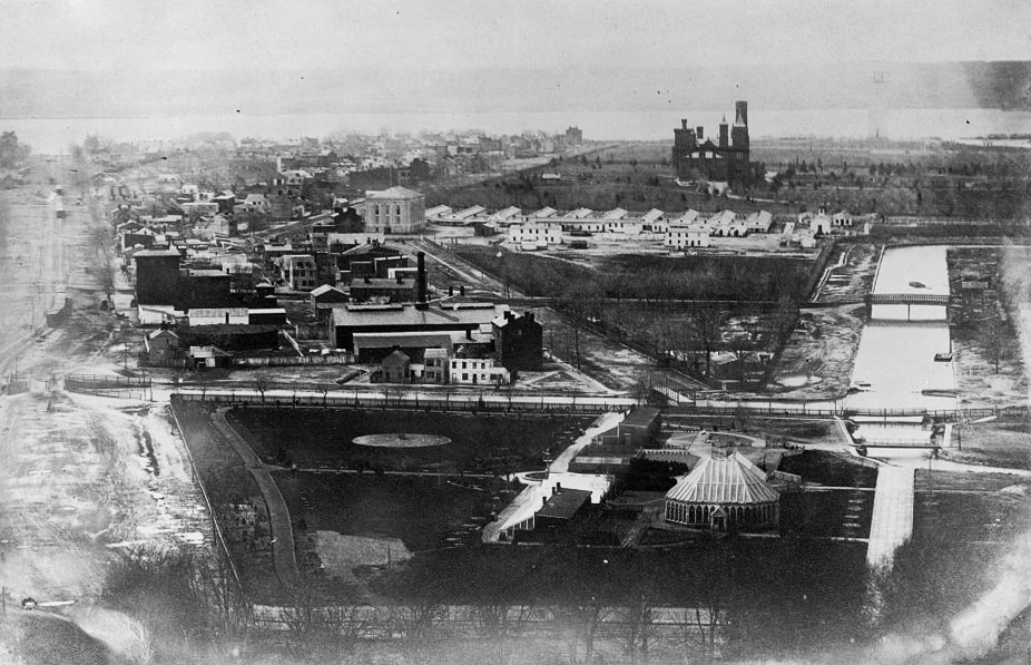
South National Mall Washington DC 1863.jpg - Tim1965
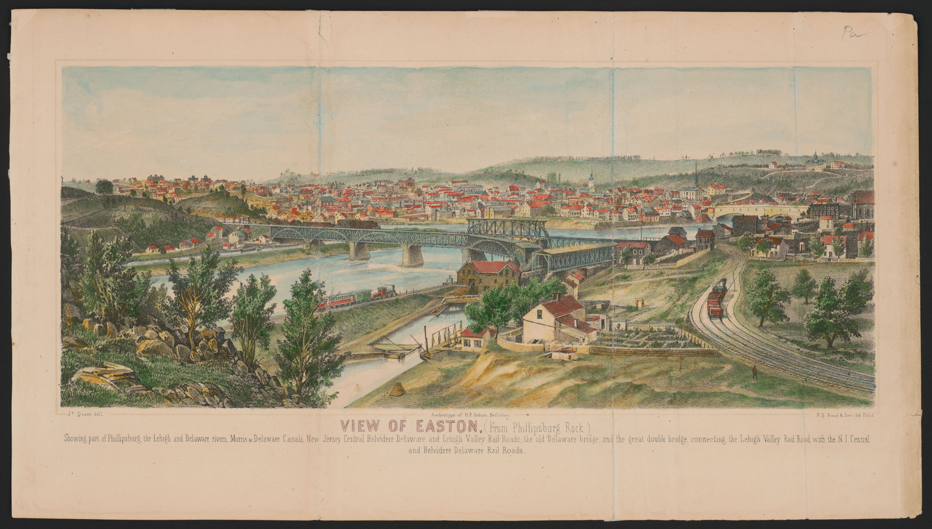
View-of-Easton (Osborn).jpg - Mackensen

View of Easton, (from Phillipsburg Rock) - ambrotype of H.P. Osborn, Bethlehem ; Js. Queen del. ; P.S. Duval & Son's lith. Philad. LCCN2013651027.jpg - Fæ

Plan of Battle of South Mills. Dismal Swamp Canal, N.C. LOC gvhs01.vhs00080.jpg - Fæ

LC-DIG-PPMSCA-22503 (20297422718).jpg - Hiàn (alt)

Map of the mines, canals, and rail roads owned or controlled by the Lehigh Coal & Navigation Co. - (Lehigh and Wyoming valleys, Pennsylvania). LOC 95685710.jpg - Fæ

Major's Hill and canal locks.JPG - Skeezix1000