Wikimedi'Òc
Modes d'emploi

Cet album fait partie des albums
Cet album photos contient les sous-albums suivants :


The ribbon cutting (69126231-155d-451f-67e5-b9fa037da590).jpg - BMacZeroBot

A crosswalk at 2nd street and Valle de Oro Trail in Albuquerque, NM (0d072335-36a8-4160-9456-253dd928b62f).JPG - BMacZeroBot

A kestral was rescued at the Valle de Oro Trail in Albuquerque, NM (ded4d914-0352-453a-aebe-47e7cc851065).JPG - BMacZeroBot

A marker at Onate Crossing in El Paso, TX (7296a39d-c6f4-4d26-ba39-d7307342e1ed).JPG - BMacZeroBot

A new trail is being built at the Valle de Oro Trail in Albuquerque, NM (dcbf7943-4a65-49b7-8eae-bd032a361578).JPG - BMacZeroBot

Wide open fields line the Valle de Oro Trail near Albuquerque, NM (6ef0bab2-1b80-4756-ba5d-a838625ec308).JPG - BMacZeroBot

The front archway doors at the San Miguel Mission in Socorro, NM (166d97af-6bf8-4a07-809c-71003521e702).JPG - BMacZeroBot

The view from Yost Draw looking NorthEast in Sierra County, NM (2179d14d-a4d5-492a-a0ec-4a2427e8c84a).JPG - BMacZeroBot

A top layer is applied to a gravel base at the Valle de Oro Trail in Albuquerque, NM (2d6a9ac4-648f-41b3-87f4-c56099c0271e).JPG - BMacZeroBot

A view of the Onate Crossing Monument looking towards Juerez, Mexico from El Paso, Texas (5d0e5a80-e9e1-498a-b6bc-4c27864cdb82).JPG - BMacZeroBot

Agua Fria Road at Romero Street in Santa Fe, NM (7eaa68cc-786b-4eb0-a368-3cf2af83f5ae).JPG - BMacZeroBot

An adobe wall surrounds the Onate Crossing park in El Paso, TX (6edbaba0-ef80-4b89-984c-76c1f3cf812e).JPG - BMacZeroBot

Inscriptions from early road construction are still visible on a rock face at La Bajada Mesa near Santa Fe, NM (498398ed-ce57-487a-8f12-05e70421463e).JPG - BMacZeroBot

Markers at Onate Crossing in El Paso, TX (f88cd7e6-42b2-41b6-9989-553f36e7d55f).JPG - BMacZeroBot

NTIR Sign entering the Historic Village of Agua Fria in Santa fe, NM (efde6b0c-fff1-402f-a2df-9c36a4dc53bd).JPG - BMacZeroBot

Starting out along the retracement (original section of) trail. (6914746a-155d-451f-679d-52800d20edee).jpg - BMacZeroBot

The U.S. Border fence looking into Juarez, Mexico from El Paso, TX (71d4069a-e471-4222-90f2-b73e28f99e94).JPG - BMacZeroBot

FortSeldenStateMonumentEntrance.jpg - Df206
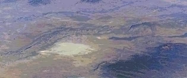
CroppedLargeISS008-E-5616.jpg - Dicklyon
ELCA-logo.jpg - H-stt

Isleta Boulevard southbound, South Valley NM.jpg - Faolin42

El Camino Real de Tierra Adentro NHT (9445536658).jpg - Wilfredor

Texas Historical Marker for The Camino Real in El Paso.jpg - Pi3.124

El Camino Real - A Jogger Alongside El Camino Real - NARA - 7718294.jpg - US National Archives bot

El Camino Real - A Truck Driving El Camino Real - NARA - 7718293.jpg - US National Archives bot

El Camino Real - El Camino Real from an Intersecting Street - NARA - 7718299.jpg - US National Archives bot

El Camino Real - Home of Auto Racing on El Camino Real - NARA - 7718283.jpg - US National Archives bot

El Camino Real - Intersecting Streets - NARA - 7718298.jpg - US National Archives bot

El Camino Real - Junction on the El Camino Real - NARA - 7718296.jpg - US National Archives bot

El Camino Real - La Casa de los Abuelos - NARA - 7718302.jpg - US National Archives bot

El Camino Real - North of Albuquerque - NARA - 7718303.jpg - US National Archives bot

El Camino Real - Racecar on Driveway Gate - NARA - 7718284.jpg - US National Archives bot

El Camino Real - Red Truck Near a Byway Sign - NARA - 7718297.jpg - US National Archives bot

El Camino Real - Residential Areas on El Camino Real - NARA - 7718295.jpg - US National Archives bot

An El Camino Real de Tierra Adentro National Historic Trail, walking trail in Santa Fe, NM (09d52c19-1944-4ffb-8076-6948d4f847fd).JPG - BMacZeroBot

The Camino Real marker outside of El Paso, TX (0a40423c-9a86-47aa-9332-7b1c8044f606).JPG - BMacZeroBot

NTIR Staff performs outreach at the El Camino Real de Tierra Adentro National Historic Trail in the Historic Village of Agua (105722cc-7fdb-4d60-b277-e055b9407c00).JPG - BMacZeroBot

Visitors walk the El Camino Real de Tierra Adentro National Historic Trail in the Historic Village of Agua Fria in Santa Fe, NM (15cba46e-3f66-4279-9536-86a2e69741c1).JPG - BMacZeroBot

An El Camino Real de Tierra Adentro National Historic Trail, Historic Route NTIR Sign near railroad tracks in El Paso, TX (16727921-f4a9-4951-aeee-8469613e1045).JPG - BMacZeroBot

The Valle de Oro Trail running adjacent to 2nd Street in Albuquerque, NM (1b7f2def-32db-481c-b4e2-482773f91644).JPG - BMacZeroBot

The Valle de Oro Trail running adjacent to 2nd street and railroad tracks in Albuquerque, NM (254ff1bf-7e2b-4697-8086-e6759d91799c).JPG - BMacZeroBot

A city road marks the El Camino Real de Tierra Adentro National Historic Trail in San Elizario, TX (298cc7f6-9239-4585-9997-3140349380b0).JPG - BMacZeroBot

Crowds attend a new sign unveiling at the El Camino Real de Tierra Adentro National Historic Trail in the Historic Village of (3ab50154-0938-4c59-8713-b141e2a67aad).JPG - BMacZeroBot

Children's artwork depicting the El Camino Real de Tierra Adentro National Historic Trail in Albuquerque, NM (4abe2456-3497-46ee-beee-c164ceded3cb).JPG - BMacZeroBot

An El Camino Real de Tierra Adentro National Historic Trail, walking trail in Agua Fria, NM (4ac0dea7-08e2-447d-9737-fc37b1664953).JPG - BMacZeroBot

NTIR Staff poses for a photo at the sign unveiling at the El Camino Real de Tierra Adentro National Historic Trail in the (504ec84c-b861-4ab9-8be7-452dc813c67a).JPG - BMacZeroBot

The Auga Fria Road entrance of the El Camino Real de Tierra Adentro National Historic Trail retracement in Santa Fe County, NM (64622b1a-d110-428a-ad63-517279d054c6).JPG - BMacZeroBot

El Camino Real de Tierra Adentro ruts and swales at La Cieneguilla trailhead off Airport Road in Santa Fe, NM (66db9f0a-ee20-439b-9ba9-c4815d205ec7).JPG - BMacZeroBot

Irrigation channels run beneath Escondida Road near Pueblito Point in Socorro County, NM (674e4863-06f3-4ef5-8e34-e857d816f222).JPG - BMacZeroBot

An El Camino Real de Tierra Adentro National Historic Trail, Historic Route NTIR Sign near a bridge in El Paso, TX (6a6e3fcb-d530-4364-b7ee-35dc76d0de6a).JPG - BMacZeroBot

NTIR Staff and citizens walk the Camino Real de Tierra Adentro National Historic Trail in the Historic Village of Agua Fria in (6a8f47a9-d846-4cad-86d6-64400bf81dc4).JPG - BMacZeroBot

Ring structures of black basalt along the El Camino Real de Tierra Adentro National Historic Trail outside of Truth or (78874451-0840-45e7-abee-b1045aac657c).JPG - BMacZeroBot

An El Camino Real de Tierra Adentro National Historic Trail marker on a rock base at Onate Crossing in El Paso, TX (7a46e626-7626-41f1-a74c-b9e883dc111f).JPG - BMacZeroBot

El Camino Real de Tierra Adentro ruts and swales in a pasture at La Cieneguilla trailhead off Airport Road in Santa Fe, NM (8355a407-b85d-4a59-ab16-3374b800cc8a).JPG - BMacZeroBot

A wayside and NTIR Sign along the El Camino Real de Tierra Adentro National Historic Trail, walking trail in Santa Fe, NM (8583d619-6573-4b7b-9332-d6a598dbf510).JPG - BMacZeroBot

A close up view of an El Camino Real de Tierra Adentro National Historic Trail, Historic Route NTIR Sign near a railroad in El (8cbd19d6-934c-4092-81f1-663629380177).JPG - BMacZeroBot

NTIR Staff poses for a photo at the new sign unveiling at the El Camino Real de Tierra Adentro National Historic Trail in the (95f6e5b8-b62b-41c5-9bcd-eb2cb2ac75ba).JPG - BMacZeroBot

An El Camino Real de Tierra Adentro National Historic Trail, Historic Route NTIR Sign in El Paso, TX (9e9f4f7c-a9ed-4d73-82d6-509cff7f0a82).JPG - BMacZeroBot

The El Camino Real de Tierra Adentro National Historic Trail, Valle de Oro Trail segment in Albuquerque, NM (c2cc9825-fa60-416f-aaf6-a25b3a26e35f).JPG - BMacZeroBot

A dry wash cuts through the landscape on the El Camino Real de Tierra Adentro National Historic Trail that runs outside of Truth (e8a44398-a460-4168-ab5c-b215a53ff20c).JPG - BMacZeroBot

An El Camino Real de Tierra Adentro National Historic Trail NTIR Sign on an interpretive trail in Santa Fe, NM (f9410e38-d0c4-47df-b91d-674b6ac59660).JPG - BMacZeroBot