Wikimedi'Òc
Modes d'emploi

Cet album fait partie des albums
Cet album photos contient les sous-albums suivants :


Moel y Faen Summit - geograph.org.uk - 7459625.jpg - GeographBot

Panno Near the Summit of Moel y Gaer - geograph.org.uk - 7459668.jpg - GeographBot

Spring and House Remains - geograph.org.uk - 7460501.jpg - GeographBot

Lambs Hiding Away - geograph.org.uk - 7460508.jpg - GeographBot

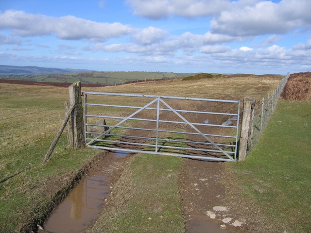
Unusual Gate and Distressing Teddy - geograph.org.uk - 7460511.jpg - GeographBot

Junction of road and bridleway - geograph.org.uk - 7474357.jpg - GeographBot

Bridleway approaching small valley - geograph.org.uk - 7474362.jpg - GeographBot

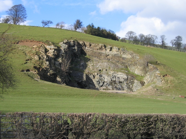
Quarrying remains - geograph.org.uk - 7474365.jpg - GeographBot

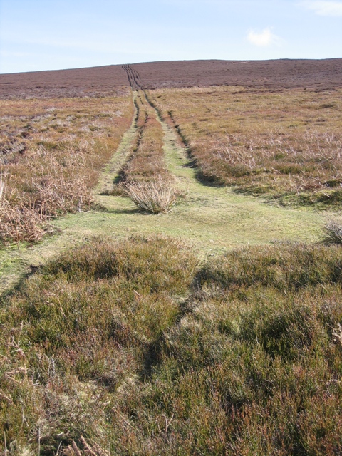
Bridleway through bracken - geograph.org.uk - 7591556.jpg - GeographBot

Road grit not needed in the September 2023 heatwave - geograph.org.uk - 7591559.jpg - GeographBot

The road to Bryneglwys - geograph.org.uk - 138442.jpg - GeographBot

Track to Pentre Farm, near Bryneglwys - geograph.org.uk - 180557.jpg - GeographBot

A Muddy Track Junction - geograph.org.uk - 354440.jpg - GeographBot

Afternoon Shadows and a Fence - geograph.org.uk - 354949.jpg - GeographBot

Ancient Hedge Line and Footpath - geograph.org.uk - 354080.jpg - GeographBot

Ancient Hedge Line below Llantysilio Mountain - geograph.org.uk - 354199.jpg - GeographBot

Ancient Track? - geograph.org.uk - 354353.jpg - GeographBot

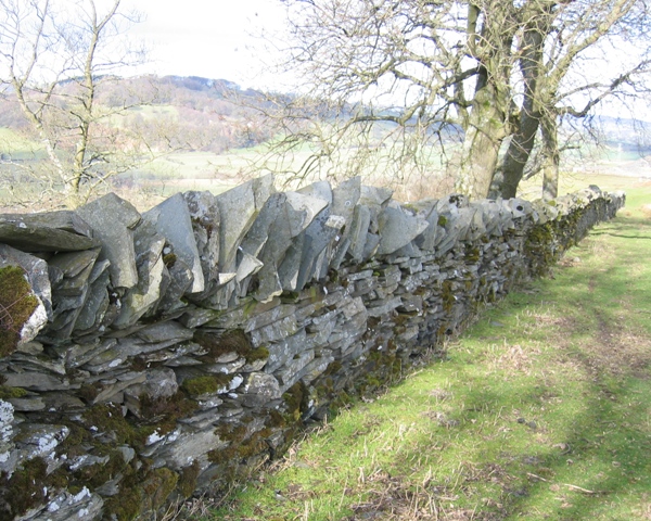
Ancient Wall Line - geograph.org.uk - 354203.jpg - GeographBot

Bench Mark Rock and Pasture at Bwlch y Groes - geograph.org.uk - 358377.jpg - GeographBot

Bench Mark on rock at Bwlch y Groes - geograph.org.uk - 358356.jpg - GeographBot

Bridleway Junction - geograph.org.uk - 355056.jpg - GeographBot

Bridleway Junction below Moel y Gaer - geograph.org.uk - 354270.jpg - GeographBot

Bridleway from Plas Norway - geograph.org.uk - 354223.jpg - GeographBot

Bridleway near Pen-bedw - geograph.org.uk - 354359.jpg - GeographBot

Bridleway near Pen-bedw - geograph.org.uk - 354366.jpg - GeographBot

Bridleway near Pen-bedw - geograph.org.uk - 354453.jpg - GeographBot

Bridleway to Bwlch y Groes - geograph.org.uk - 355806.jpg - GeographBot

Bridleway to Plas Norway - geograph.org.uk - 354219.jpg - GeographBot

Bwlch y Groes - geograph.org.uk - 358524.jpg - GeographBot

Bwlch y Groes on Llantysilio Mountain - geograph.org.uk - 358341.jpg - GeographBot

Cast Iron Field Roller - geograph.org.uk - 354403.jpg - GeographBot

Cast Iron Field Roller near Pen-Bedw - geograph.org.uk - 354391.jpg - GeographBot

Clwydian Way and Bridleway - geograph.org.uk - 355073.jpg - GeographBot

Dam in Disused Quarry - geograph.org.uk - 357500.jpg - GeographBot
Field Gate at Bwlch y Groes - geograph.org.uk - 358416.jpg - GeographBot

Flattened Quarry Boundary Fence - geograph.org.uk - 354137.jpg - GeographBot

Footpath past Pen -y-bryn Farmhouse - geograph.org.uk - 354513.jpg - GeographBot

Footpath to Hafod-lwyd - geograph.org.uk - 354038.jpg - GeographBot

Gwern-brain-uchaf - geograph.org.uk - 352458.jpg - GeographBot

Gwern-brain-uchaf - geograph.org.uk - 354091.jpg - GeographBot

Hairpin Bend below Llantysilio Mountain - geograph.org.uk - 354122.jpg - GeographBot

High Point and Parish Boundary on Llantysilio Mountain - geograph.org.uk - 358579.jpg - GeographBot

High Point and Parish Boundary on Llantysilio Mountain - geograph.org.uk - 358580.jpg - GeographBot

Inscribed Stone by Lake on Llantysilio Mountain - Reverse - geograph.org.uk - 358786.jpg - GeographBot

Inscribed Stone by Lake on Llantysilio Mountain - geograph.org.uk - 356177.jpg - GeographBot

Inscribed Stone by Lake on Llantysilio Mountain - geograph.org.uk - 358780.jpg - GeographBot

Iron Bedstead and Fence - geograph.org.uk - 355100.jpg - GeographBot

Lake on Llantysilio Mountain - geograph.org.uk - 356165.jpg - GeographBot
Landrover Track to Moel Morfydd - geograph.org.uk - 358429.jpg - GeographBot

Llantysilio Mountain and Parish Boundary - geograph.org.uk - 358575.jpg - GeographBot

Minor Road Corner near Ty-cerrig - geograph.org.uk - 351545.jpg - GeographBot

Moorland below Moel y Gamelin and a Pair of Buzzards - geograph.org.uk - 357478.jpg - GeographBot

New Stile and Gate on the Clwydian Way - geograph.org.uk - 355087.jpg - GeographBot

Odd Corner in the Boundary Fence - geograph.org.uk - 354346.jpg - GeographBot

Off Road Cycle Route - geograph.org.uk - 354427.jpg - GeographBot

Old Barn at Pen-y-bryn - geograph.org.uk - 352470.jpg - GeographBot
Old Quarry by the A5104 - geograph.org.uk - 356280.jpg - GeographBot

Old Stone Gatepost and Wall - geograph.org.uk - 354983.jpg - GeographBot
Old Stone Wall - geograph.org.uk - 354220.jpg - GeographBot

Old and New Roads at Morfydd - geograph.org.uk - 355849.jpg - GeographBot

On the Clwydian Way above Bryneglwys - geograph.org.uk - 354928.jpg - GeographBot

Open Access Boundary near Bryneglwys. - geograph.org.uk - 358468.jpg - GeographBot

Open Access Boundary near Bryneglwys - geograph.org.uk - 358498.jpg - GeographBot

Outflow of the Small Lake on Llantysilio Mountain - geograph.org.uk - 359951.jpg - GeographBot
Parish Boundary and Fence Line at Bwlch y Groes - geograph.org.uk - 358405.jpg - GeographBot

Private Track to Pen-bedw - geograph.org.uk - 354379.jpg - GeographBot

Remains of Quarry Buildings below Llantysilio Mountain - geograph.org.uk - 354154.jpg - GeographBot

Remains of Quarry Buildings below Llantysilio Mountain ^2 - geograph.org.uk - 354193.jpg - GeographBot

Ruined Quarry Buildings - geograph.org.uk - 357510.jpg - GeographBot

Ruins of Quarry Buildings - geograph.org.uk - 357506.jpg - GeographBot

Sheep Pasture and Moorland - geograph.org.uk - 354317.jpg - GeographBot

Sheltered Valley in Llantysilio Mountain - geograph.org.uk - 358997.jpg - GeographBot

Small Lake on Llantysilio Mountain - geograph.org.uk - 359037.jpg - GeographBot

Small Lake on Llantysilio Mountain - geograph.org.uk - 359048.jpg - GeographBot

Small Quarry near Bryneglwys - geograph.org.uk - 358447.jpg - GeographBot

Stream Crossing below Moel y Gamelin - geograph.org.uk - 354261.jpg - GeographBot

Stream Crossing near Moel y Gamelin - geograph.org.uk - 354327.jpg - GeographBot

Stream Crossing near Pen-bedw - geograph.org.uk - 354372.jpg - GeographBot

Stream Northeast of Moel Truan - geograph.org.uk - 356292.jpg - GeographBot

Stream Valley near Gwern-brain-uchaf - geograph.org.uk - 354061.jpg - GeographBot

Stream and Quarry Workings - geograph.org.uk - 351535.jpg - GeographBot

Stream near the A5104 - geograph.org.uk - 352608.jpg - GeographBot
Stream on Llantysilio Mountain - geograph.org.uk - 354225.jpg - GeographBot

The Ruined Pen-y-bryn Farmhouse - geograph.org.uk - 354477.jpg - GeographBot

Track Junction at Pen-y-bryn Farm - geograph.org.uk - 354587.jpg - GeographBot

Track Junction below Llantysilio Mountain - geograph.org.uk - 354218.jpg - GeographBot

Track Junction near Moel y Gaer - geograph.org.uk - 354221.jpg - GeographBot

Track and Old Stone Wall - geograph.org.uk - 355029.jpg - GeographBot

Track to Bryneglwys - geograph.org.uk - 352574.jpg - GeographBot

Track to Ty-cerrig - geograph.org.uk - 351552.jpg - GeographBot

Tractor Track near Gwern-brain-uchaf - geograph.org.uk - 354105.jpg - GeographBot

Field Gate and Hedge Lines - geograph.org.uk - 364030.jpg - GeographBot

Field Gate and Pylon near Bryneglwys - geograph.org.uk - 363990.jpg - GeographBot

Hedge Line and Pylon - geograph.org.uk - 364002.jpg - GeographBot

Hedge Line in the Afon Morwynion Valley - geograph.org.uk - 364040.jpg - GeographBot

Minor Road near Bryneglwys - geograph.org.uk - 363984.jpg - GeographBot

Minor Road to Bryneglwys - geograph.org.uk - 363997.jpg - GeographBot

Moorland on Llantysilio Mountain, Vivod Mountain and Jet Fighter - geograph.org.uk - 360020.jpg - GeographBot

Moorland on Llantysilio Mountain - geograph.org.uk - 362844.jpg - GeographBot

Moorland on Llantysilio Mountain and the River Dee Valley - geograph.org.uk - 362799.jpg - GeographBot

Old Hedge Line near Ty-isaf - geograph.org.uk - 364063.jpg - GeographBot

Pastureland near Bryneglwys - geograph.org.uk - 364047.jpg - GeographBot

Small Quarry near Bryneglwys - geograph.org.uk - 363999.jpg - GeographBot

Stream and Hedges at Morfydd - geograph.org.uk - 364936.jpg - GeographBot

Stream and hedges at Morfydd - geograph.org.uk - 364972.jpg - GeographBot

Track on Llantysilio Mountain - geograph.org.uk - 360050.jpg - GeographBot

Track on Llantysilio Mountain - geograph.org.uk - 360143.jpg - GeographBot

Trackway at Morfydd - geograph.org.uk - 364957.jpg - GeographBot

Rough Pasture. - geograph.org.uk - 561108.jpg - GeographBot

New Housing at Bryneglwys - geograph.org.uk - 798540.jpg - GeographBot

Pond near Tal y Bidwal Fawr - geograph.org.uk - 798538.jpg - GeographBot

Fron Goch Ucha - geograph.org.uk - 802134.jpg - GeographBot

Minor road north of Bryneglwys - geograph.org.uk - 802132.jpg - GeographBot

Pen-y-Brynia on ridge near Llanelidan - geograph.org.uk - 1116871.jpg - GeographBot

Ruined farm of Nant near Bryneglwys Denbighshire - geograph.org.uk - 1116851.jpg - GeographBot

The original water supply for Nant - geograph.org.uk - 1119409.jpg - GeographBot

Bluebell woods - geograph.org.uk - 1282092.jpg - GeographBot

Gorse and bluebells - geograph.org.uk - 1282121.jpg - GeographBot

Landslip or small quarry by the Bryneglwys to Carog road - geograph.org.uk - 1579692.jpg - GeographBot

View down the valley - geograph.org.uk - 1579705.jpg - GeographBot

Bridlepath up the hill - geograph.org.uk - 1659511.jpg - GeographBot

The parting of the ways - geograph.org.uk - 1659487.jpg - GeographBot
Looking down towards Blaen Yale - geograph.org.uk - 1660720.jpg - GeographBot

Oaks to the left Ashes to the right - geograph.org.uk - 1660813.jpg - GeographBot

The lane to Blaen Yale - geograph.org.uk - 1660749.jpg - GeographBot

The lane towards Tŷ-isaf - geograph.org.uk - 1660769.jpg - GeographBot

The start of gully erosion - geograph.org.uk - 1660737.jpg - GeographBot

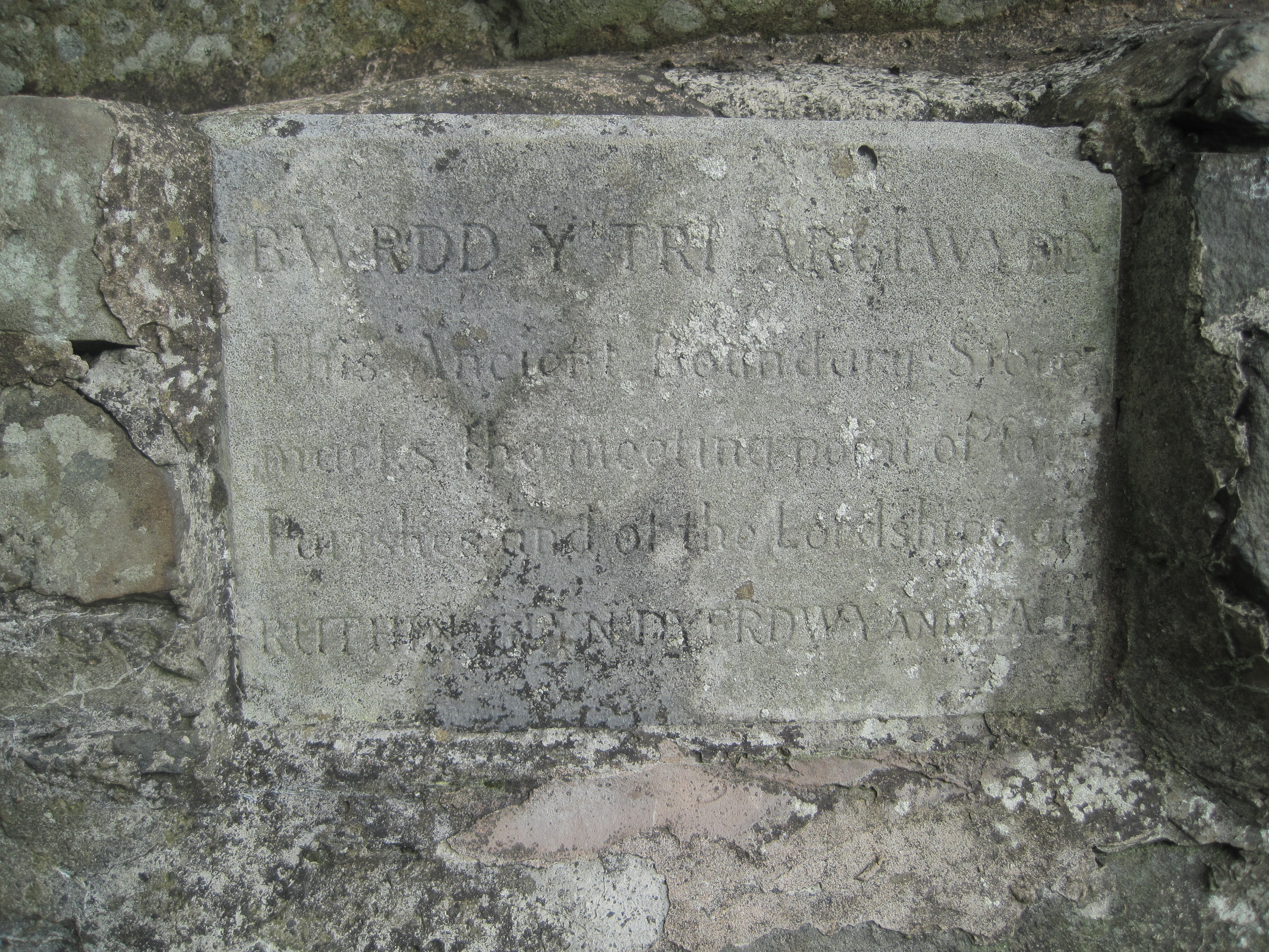
Bwrdd y Tri Arglwydd Bryneglwys Sir Ddinbych Cymru 03.JPG - Llywelyn2000
Bwrdd y Tri Arglwydd Bryneglwys Sir Ddinbych Cymru 02.JPG - Llywelyn2000

Bwrdd y Tri Arglwydd Bryneglwys Sir Ddinbych Cymru 01.JPG - Llywelyn2000

Bwrdd y Tri Arglwydd Bryneglwys Sir Ddinbych Cymru 05.JPG - Llywelyn2000

Bwrdd y Tri Arglwydd Bryneglwys Sir Ddinbych Cymru 04.JPG - Llywelyn2000

Bwrdd y Tri Arglwydd Bryneglwys Sir Ddinbych Cymru 06.JPG - Llywelyn2000

Bwrdd y Tri Arglwydd Bryneglwys Sir Ddinbych Cymru 13.JPG - Llywelyn2000

Bwrdd y Tri Arglwydd Bryneglwys Sir Ddinbych Cymru 07.JPG - Llywelyn2000

Bwrdd y Tri Arglwydd Bryneglwys Sir Ddinbych Cymru 08.JPG - Llywelyn2000

Bwrdd y Tri Arglwydd Bryneglwys Sir Ddinbych Cymru 10.JPG - Llywelyn2000

Bwrdd y Tri Arglwydd Bryneglwys Sir Ddinbych Cymru 09.JPG - Llywelyn2000

Bwrdd y Tri Arglwydd Bryneglwys Sir Ddinbych Cymru 11.JPG - Llywelyn2000

Bwrdd y Tri Arglwydd Bryneglwys Sir Ddinbych Cymru 12.JPG - Llywelyn2000

Maen melin yn Eglwys Tysilio Sant; Gardd II* 40fed ganrif..JPG - Llywelyn2000

Bryneglwys village sign - geograph.org.uk - 1893088.jpg - GeographBot

View near Bryneglwys - geograph.org.uk - 1893101.jpg - GeographBot

Road from Bryneglwys - geograph.org.uk - 1893114.jpg - GeographBot

Footpath through heather, blaeberry & blow grass - geograph.org.uk - 1898852.jpg - GeographBot

Bridleway towards Moel-y-Faen - geograph.org.uk - 1898936.jpg - GeographBot

Wet spot on the bridleway - geograph.org.uk - 1898969.jpg - GeographBot

Heather bales as shooting butts - geograph.org.uk - 1899260.jpg - GeographBot

Heather moor management - geograph.org.uk - 1899347.jpg - GeographBot

Dilapidated barns on the A5104 near Plâs yn Iâl - geograph.org.uk - 2163881.jpg - GeographBot

View towards the Llantysilio Mountains - geograph.org.uk - 2163897.jpg - GeographBot

Small upland farm steading - geograph.org.uk - 2936452.jpg - GeographBot

Track leading to Cae-du - geograph.org.uk - 2938767.jpg - GeographBot

A5104 looking west - geograph.org.uk - 3003120.jpg - GeographBot

A5104 near Plas-yn-Yale - geograph.org.uk - 3003123.jpg - GeographBot

A5104 at Ty-Mawr - geograph.org.uk - 3003127.jpg - GeographBot

A5104 at Glan-yr-Afon - geograph.org.uk - 3003136.jpg - GeographBot

A5104 at Bryneglwys village boundary - geograph.org.uk - 3003140.jpg - GeographBot

A5104 north of Bryneglwys - geograph.org.uk - 3003143.jpg - GeographBot

A5104 near Pentre Isaf - geograph.org.uk - 3003151.jpg - GeographBot

A5104 crossroads looking west - geograph.org.uk - 3004274.jpg - GeographBot

A5104 looking west - geograph.org.uk - 3004300.jpg - GeographBot

Bryn yr Orsedd - geograph.org.uk - 3299358.jpg - GeographBot

The A5104 - geograph.org.uk - 3392423.jpg - GeographBot

Ty-Mawr - geograph.org.uk - 3392431.jpg - GeographBot

The A5104 approaching Ty-Mawr - geograph.org.uk - 3392435.jpg - GeographBot

Entering Bryneglwys - geograph.org.uk - 3392482.jpg - GeographBot

The A5104 at Glan-yr-Afon - geograph.org.uk - 3392485.jpg - GeographBot

The A5104 - geograph.org.uk - 3392505.jpg - GeographBot

The A5104 near Pentre - geograph.org.uk - 3392511.jpg - GeographBot

A5104 near Efail Blaen Yale - geograph.org.uk - 3392518.jpg - GeographBot

Under the Electric Cables on the A5104 - geograph.org.uk - 3392524.jpg - GeographBot

Could it be the first of many - geograph.org.uk - 3405283.jpg - GeographBot

Along the ridge - geograph.org.uk - 3405286.jpg - GeographBot

Bridleway at the edge of the moor - geograph.org.uk - 3545267.jpg - GeographBot

Gate at Bwlch y Groes - geograph.org.uk - 3545272.jpg - GeographBot

A path crosses the Clwydian Way - geograph.org.uk - 3545277.jpg - GeographBot

Farmland above Llandegla - geograph.org.uk - 3628293.jpg - GeographBot

View to the Clwydian Hills - geograph.org.uk - 3628304.jpg - GeographBot

Farmland above Nant y Garth Pass - geograph.org.uk - 3628308.jpg - GeographBot

View to Rhoslydan Farm - geograph.org.uk - 3628326.jpg - GeographBot

Woodland near Llandegla - geograph.org.uk - 3645707.jpg - GeographBot

Rhos Afr - geograph.org.uk - 5112580.jpg - GeographBot

Moel-y-faen - geograph.org.uk - 5112734.jpg - GeographBot

Plas Norway - geograph.org.uk - 5114500.jpg - GeographBot

Plas-yn-Rhos - geograph.org.uk - 5114538.jpg - GeographBot

A5104 - geograph.org.uk - 5114564.jpg - GeographBot

Ty-helyg - geograph.org.uk - 5114574.jpg - GeographBot

The view from Moel y Gamelin - geograph.org.uk - 5344461.jpg - GeographBot

Walkers descending from the cairn on Moel y Gamelin - geograph.org.uk - 5344465.jpg - GeographBot

Footpath marker near Plas Norway - geograph.org.uk - 5344489.jpg - GeographBot

Walkers take bridleway below Llantysilio Mountain - geograph.org.uk - 5344508.jpg - GeographBot

Stone gatepost near Tan y foel - geograph.org.uk - 5344522.jpg - GeographBot

Stile near Tan y foel - geograph.org.uk - 5344528.jpg - GeographBot

View from the western rampart of Moel y Gaer hill fort - geograph.org.uk - 5347036.jpg - GeographBot

Descending Moel y Faen - geograph.org.uk - 5746678.jpg - GeographBot

Heather-covered rampart of Moel-y-Gaer hill fort - geograph.org.uk - 5746697.jpg - GeographBot

A blackened mountain - geograph.org.uk - 5910973.jpg - GeographBot

Trees in early autumn - geograph.org.uk - 5922280.jpg - GeographBot

Old Milestone by the A5104, Bryneglwys parish - geograph.org.uk - 6056200.jpg - GeographBot

Old Milestone by the A5104, Cae-Madog-Isaf, Bryneglwys parish - geograph.org.uk - 6072617.jpg - GeographBot

Pivot bench mark on Pont Bryneglwys east parapet - geograph.org.uk - 6090768.jpg - GeographBot

Llwybr Ceffyl Plas Norway - Plas Norway bridleway - geograph.org.uk - 6092098.jpg - GeographBot

Llwybr ceffyl Tan y Foel - Tan y Foel bridleway - geograph.org.uk - 6092108.jpg - GeographBot

Llwybr Ceffyl Tan y Foel - Tan y Foel bridleway - geograph.org.uk - 6092115.jpg - GeographBot

Llwybr ceffyl Tan y Foel - Tan y Foel bridleway - geograph.org.uk - 6092123.jpg - GeographBot

Ceuffordd ger Pen-y-cae - A hollow way near Pen-y-cae - geograph.org.uk - 6092127.jpg - GeographBot

Llwybr yn cwrdd a heol - A path joining a road - geograph.org.uk - 6092134.jpg - GeographBot

Tuag at Foel y Gaer - Towards Moel y Gaer - geograph.org.uk - 6092240.jpg - GeographBot

Moel y Faen - geograph.org.uk - 6092276.jpg - GeographBot

Old Milestone by the A5104, west of Bryneglwys - geograph.org.uk - 6102868.jpg - GeographBot

Bridleway from Bwlch Y Groes - geograph.org.uk - 6128607.jpg - GeographBot

Farm road to Pen Bedw Farm - geograph.org.uk - 6135093.jpg - GeographBot

Minor road near Bryneglwys - geograph.org.uk - 6135095.jpg - GeographBot

Bwlch y Groes - geograph.org.uk - 6146975.jpg - GeographBot

Gate and cattle grid on Llantysilio Mountain - geograph.org.uk - 6146978.jpg - GeographBot

The New Inn, Bryneglwys - geograph.org.uk - 6146987.jpg - GeographBot

Ty'n y Wern Farm, Bryneglwys - geograph.org.uk - 6146990.jpg - GeographBot

Village Shop, Bryneglwys - geograph.org.uk - 6146999.jpg - GeographBot

Bryneglwys village school - geograph.org.uk - 6147005.jpg - GeographBot

Afon Morwyn near the A5104 - geograph.org.uk - 6147663.jpg - GeographBot

Farmland east of Gwyddelwern - geograph.org.uk - 6147668.jpg - GeographBot

Farmland north of Llanelidan - geograph.org.uk - 6147671.jpg - GeographBot

Bikers heading south towards Corwen on the A5104 - geograph.org.uk - 6247296.jpg - GeographBot

Flat Covert, on the north bank of Afon Morwynian - geograph.org.uk - 6247813.jpg - GeographBot

View south-east across Nant Caemawr - geograph.org.uk - 6247820.jpg - GeographBot

Route of the footpath from Caemawr to Pentrebwlch - geograph.org.uk - 6247824.jpg - GeographBot

A5104 climbing to a 330 metre spot height at Caemawr - geograph.org.uk - 6247828.jpg - GeographBot

Wales Denbighshire Community Bryneglwys map.svg - DankJae

Minor road between the A542 and the A5104 - geograph.org.uk - 6386321.jpg - GeographBot

Nant Hafod Lwyd - geograph.org.uk - 6386323.jpg - GeographBot

Farm track to Gwern-brain Uchaf - geograph.org.uk - 6386425.jpg - GeographBot

Plas Norway - geograph.org.uk - 6386436.jpg - GeographBot

Bridleway on Gribin Oernant - geograph.org.uk - 6386442.jpg - GeographBot

Former slate quarry on Llantysilio Mountain - geograph.org.uk - 6386444.jpg - GeographBot

Steep hill with ancient hedgerow - geograph.org.uk - 6386445.jpg - GeographBot

Farm track to Ty Cerrig - geograph.org.uk - 6386454.jpg - GeographBot

Deep gully running north from Plas Norway - geograph.org.uk - 6386458.jpg - GeographBot

View north from the slopes of Moel y Faen - geograph.org.uk - 6388167.jpg - GeographBot

Old field boundary - geograph.org.uk - 6388174.jpg - GeographBot

Path running N from col, W of Moel y Gamelin - geograph.org.uk - 6844679.jpg - GeographBot

Path running N from col, W of Moel y Gamelin - geograph.org.uk - 6844680.jpg - GeographBot

Path skirting northern slope of Moel y Gamelin, ^ W of Plas Norway - geograph.org.uk - 6844682.jpg - GeographBot

Lane junction near Blaen Yale Farm - geograph.org.uk - 6977043.jpg - GeographBot

Farm road to Bryn Tangor - geograph.org.uk - 7142982.jpg - GeographBot

Minor road near Bryneglwys - geograph.org.uk - 7142994.jpg - GeographBot

The summit of Moel y Faen - geograph.org.uk - 7153660.jpg - GeographBot

Path on the summit of Moel y Faen - geograph.org.uk - 7153672.jpg - GeographBot

A5104 near Pentre - geograph.org.uk - 7388915.jpg - GeographBot

A5104 towards Chester - geograph.org.uk - 7388919.jpg - GeographBot

View to Moel y Gaer hillfort in the Llantysilio Hills - geograph.org.uk - 7837646.jpg - GeographBot

Path to Moel y Gaer - geograph.org.uk - 7838271.jpg - GeographBot

Moel y Gamelin from the path up Moel y Gaer - geograph.org.uk - 7838276.jpg - GeographBot

Distant view to the Vale of Clwyd from Moel y Gaer in the Llantysilio Hills - geograph.org.uk - 7838280.jpg - GeographBot

The Jubilee Tower on Moel Famau viewed from Moel y Gaer in the Llantysilio Hills - geograph.org.uk - 7838287.jpg - GeographBot

On top of Moel y Gaer in summer - geograph.org.uk - 7838290.jpg - GeographBot

On the summit of Moel y Gaer in summer - geograph.org.uk - 7838296.jpg - GeographBot

View to Moel Morfydd from the top of Moel y Gaer - geograph.org.uk - 7838299.jpg - GeographBot

Path between Moel y Gaer and Moel Morfydd - geograph.org.uk - 7838322.jpg - GeographBot

Walker with a dog on Moel Morfydd - geograph.org.uk - 7838345.jpg - GeographBot

Walker ascending to the summit of Moel Morfydd - geograph.org.uk - 7838355.jpg - GeographBot

Walker at the summit of Moel Morfydd - geograph.org.uk - 7838370.jpg - GeographBot

Summit of Moel Morfydd from the summit of Moel y Gaer - geograph.org.uk - 7838373.jpg - GeographBot

Heather in summer of Moel y Gaer - geograph.org.uk - 7838375.jpg - GeographBot

Two walkers on the summit of Moel y Gamelin - geograph.org.uk - 7838378.jpg - GeographBot

Summer scene in the Llantysilio Hills - geograph.org.uk - 7838380.jpg - GeographBot

View back to Moel y Gaer and Moel Gamelin in summer - geograph.org.uk - 7838384.jpg - GeographBot

Approaching the summit trig on Moel Morfydd - geograph.org.uk - 7838388.jpg - GeographBot

View westward from the top of Moel Morfydd - geograph.org.uk - 7838404.jpg - GeographBot

Path through heather moorland on Moel Morfydd - geograph.org.uk - 7841273.jpg - GeographBot

Path through heather moorland below Moel Morfydd - geograph.org.uk - 7841279.jpg - GeographBot

Trig on Moel Morfydd - geograph.org.uk - 7958652.jpg - GeographBot

View west from Moel y Gamelin - geograph.org.uk - 7958670.jpg - GeographBot

Moel-y-faen quarries from above - geograph.org.uk - 7958673.jpg - GeographBot