Wikimedi'Òc
Modes d'emploi

Cet album fait partie des albums
Cet album photos contient les sous-albums suivants :


Cyclist on the Bristol & Bath Railway Path, Oldland - geograph.org.uk - 4889208.jpg - GeographBot

The Bath & Bristol Railway Path, north of Bitton Station - geograph.org.uk - 4890285.jpg - GeographBot

Cycle route heading into the park - geograph.org.uk - 7531977.jpg - GeographBot

Cyclist on the Bristol and Bath cycleway - geograph.org.uk - 7531980.jpg - GeographBot
Station Road Fishponds.jpg - Weirdoldhattie

Bristol-Bath Cyclepath 08.jpg - Mattbuck

Lawrence Hill railway station MMB 03.jpg - File Upload Bot (Magnus Manske)

Bristol MMB «92 Easton Road.jpg - File Upload Bot (Magnus Manske)
Saltford - junction of cycle routes - geograph.org.uk - 47265.jpg - GeographBot

Cyclists on Saltford Railway Bridge, River Avon - geograph.org.uk - 180975.jpg - GeographBot
River Avon, Kelston Park Railway Bridge - geograph.org.uk - 180805.jpg - GeographBot

Kelston Park, from across valley.jpg - Rwendland

Bristol to Bath Cycle Path - geograph.org.uk - 483428.jpg - GeographBot

Park Railway Bridge over the River Avon - geograph.org.uk - 547548.jpg - GeographBot

Bristol-Bath Railway Path - geograph.org.uk - 615951.jpg - GeographBot

The Bristol and Bath Railway Path through a park in Newtown - geograph.org.uk - 685612.jpg - GeographBot

Bridge over the cycle path - geograph.org.uk - 877250.jpg - GeographBot

Centurion drinking sculpture - geograph.org.uk - 1720812.jpg - GeographBot

St. Ivel Way Footbridge - geograph.org.uk - 1720801.jpg - GeographBot

Bridge over Bristol and Bath Railway Path - geograph.org.uk - 1755125.jpg - GeographBot

Bridge over the Avon, Kelston Park - geograph.org.uk - 1771320.jpg - GeographBot

Railway line view towards Lawrence Hill 2 2012 - Flickr - Greater Bristol Metro Rail.jpg - タチコマ robot

Corston MMB 02 River Avon.jpg - Mattbuck

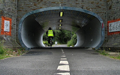
Petestrian Tunnel to Rodway Hill Common. - panoramio.jpg - Panoramio upload bot

Cycleway in snow. - panoramio.jpg - Panoramio upload bot

Warmley, Bristol, UK - panoramio.jpg - Panoramio upload bot

Siston Hill Footbridge. - panoramio.jpg - Panoramio upload bot

Former Railway Bridge over the River Avon - panoramio.jpg - Panoramio upload bot

Bath, UK - panoramio (6).jpg - Panoramio upload bot

2017 at Lawrence Hill - the abandoned north end.JPG - Geof Sheppard

Ridley Avenue Bridge (geograph 3010873).jpg - Mattbuck

Bridge Road Bridge (geograph 3010868).jpg - Mattbuck

Rodway Common Bridge (geograph 3002081).jpg - Mattbuck

Rodway Hill Bridge (geograph 3002052).jpg - Mattbuck

Teewell Hill bridge widening (geograph 4387800).jpg - Mattbuck

Charnhill Footbridge (geograph 3010866).jpg - Mattbuck

Teewell Hill Bridge (geograph 3010861).jpg - Mattbuck

Bristol and Bath Railway Path.svg - RaviC

Bristol to Bath Cycle Path (49055421581).jpg - Matlin

Cycle Path, Bristol (48995895618).jpg - Matlin

Bristol Bath Railway (5673371377).jpg - Matlin

Cycle route milepost, Saltford - geograph.org.uk - 1845628.jpg - GeographBot

Bristol-Bath Railway Path - geograph.org.uk - 1854336.jpg - GeographBot

Bristol ^ Bath Railway Path, The Dings - geograph.org.uk - 2163663.jpg - GeographBot

On the Bristol-Bath railway path near Eastville - geograph.org.uk - 2252789.jpg - GeographBot

'Twisted Arch' by Cod Steaks - geograph.org.uk - 2255159.jpg - GeographBot

Mountain bike damage on the cycle path - geograph.org.uk - 2255183.jpg - GeographBot

Bristol ^ Bath Railway Path - geograph.org.uk - 2255855.jpg - GeographBot

Bristol ^ Bath Railway Path - geograph.org.uk - 2255876.jpg - GeographBot

Cyclepath by Whitehall Road, Easton - geograph.org.uk - 2915528.jpg - GeographBot

Bristol ^ Bath Railway Path - geograph.org.uk - 2915668.jpg - GeographBot

Bristol ^ Bath Railway Path, Whitehall - geograph.org.uk - 2915777.jpg - GeographBot

Bristol ^ Bath Railway Path near Rose Green - geograph.org.uk - 2915819.jpg - GeographBot

Bridges over the Bristol ^ Bath Railway Path - geograph.org.uk - 2915890.jpg - GeographBot

Footbridge, Ridgeway - geograph.org.uk - 2915914.jpg - GeographBot

Bristol ^ Bath Railway Path at Ridgeway - geograph.org.uk - 2915932.jpg - GeographBot

Footpath and cycleway crossing Bristol's ringroad - geograph.org.uk - 2933591.jpg - GeographBot

Thicket Avenue Bridge - geograph.org.uk - 3010858.jpg - GeographBot

Kingsland Road Bridge - geograph.org.uk - 3142332.jpg - GeographBot

Turn right for The Dings - geograph.org.uk - 3383037.jpg - GeographBot

Cyclist on the Bristol ^ Bath Railway Path - geograph.org.uk - 3383052.jpg - GeographBot

Cyclist on the Bristol and Bath Railway Path - geograph.org.uk - 3383069.jpg - GeographBot

Gated entrance to Packers Allotment - geograph.org.uk - 3383077.jpg - GeographBot

Disused railway bridge over Rose Green Road - geograph.org.uk - 3402094.jpg - GeographBot

Cycling on the railway line - geograph.org.uk - 3890695.jpg - GeographBot

Newbridge Railway Bridge (No 207), from the north-west - geograph.org.uk - 4483738.jpg - GeographBot

Looking upstream to Saltford Railway Bridge (No 210) - geograph.org.uk - 4483940.jpg - GeographBot

Avon bridge for cycleway, former railway - geograph.org.uk - 4745929.jpg - GeographBot

River Avon from former railway bridge - geograph.org.uk - 4745957.jpg - GeographBot

Cycleway bridge over track to Kelston - geograph.org.uk - 4746005.jpg - GeographBot

Bridge over the River Avon - geograph.org.uk - 4969028.jpg - GeographBot

Disused railway bridge over the river Avon - geograph.org.uk - 5184379.jpg - GeographBot

Marker at St Anne's school - geograph.org.uk - 5285994.jpg - GeographBot

Bitton railway mile marker - geograph.org.uk - 5329200.jpg - GeographBot

Disused railway bridge crosses the River Avon - geograph.org.uk - 5329266.jpg - GeographBot

Bristol and Bath Railway Path - geograph.org.uk - 5424580.jpg - GeographBot

Bristol and Bath Railway Path by Whitehall Road - geograph.org.uk - 5424587.jpg - GeographBot

Bristol and Bath Railway Path - geograph.org.uk - 5426004.jpg - GeographBot

Former railway track to Bristol - geograph.org.uk - 5426013.jpg - GeographBot

Start of railway path - geograph.org.uk - 5456123.jpg - GeographBot

Railway path in Newtown - geograph.org.uk - 5456124.jpg - GeographBot

Railway crosses the railway - geograph.org.uk - 5456132.jpg - GeographBot

A4 bridge over Bristol and Bath cycle path - geograph.org.uk - 5472072.jpg - GeographBot

Bristol and Bath cycle path crossing River Avon near Kelston Park - geograph.org.uk - 5472077.jpg - GeographBot

River Avon from Bristol and Bath cycle path - geograph.org.uk - 5472079.jpg - GeographBot

Bristol and Bath cycle path crossing River Avon at Saltford - geograph.org.uk - 5472098.jpg - GeographBot

Bristol and Bath cycle path crossing River Avon - geograph.org.uk - 5472153.jpg - GeographBot

Redfield Edge footbridge - geograph.org.uk - 5472181.jpg - GeographBot

Dramway Footpath bridge - geograph.org.uk - 5472198.jpg - GeographBot

Cycle route crossing a farm bridge - geograph.org.uk - 5472314.jpg - GeographBot

Cycle route sign near Saltford - geograph.org.uk - 5472316.jpg - GeographBot

Bridge over River Avon at Saltford - geograph.org.uk - 5472317.jpg - GeographBot

Bristol and Bath cycle path in Tennant's Wood - geograph.org.uk - 5473348.jpg - GeographBot

Bristol and Bath cycle path passing Tennant's Wood - geograph.org.uk - 5473358.jpg - GeographBot

Old Railway Bridge - geograph.org.uk - 5510725.jpg - GeographBot

The Bristol and Bath Railway Path - geograph.org.uk - 5568230.jpg - GeographBot

Bridge over the River Avon - geograph.org.uk - 5568251.jpg - GeographBot

Bristol and Bath Railway Path - geograph.org.uk - 5568607.jpg - GeographBot

Bristol and Bath Railway Path - geograph.org.uk - 5568618.jpg - GeographBot

Bristol and Bath Railway Path - geograph.org.uk - 5568651.jpg - GeographBot

The Bristol and Bath Railway Path - geograph.org.uk - 5570016.jpg - GeographBot

The end of the line - geograph.org.uk - 5570034.jpg - GeographBot

Spanning the Avon near Mickle Mead - geograph.org.uk - 5610209.jpg - GeographBot

Keeping the link - geograph.org.uk - 5922783.jpg - GeographBot

Cycle route signpost on Siston Common - geograph.org.uk - 5922784.jpg - GeographBot

Dated graffiti - geograph.org.uk - 5922786.jpg - GeographBot

Old bridge on Siston Common - geograph.org.uk - 5923821.jpg - GeographBot

Bristol to Bath cycleway, on the old railway track - geograph.org.uk - 6028112.jpg - GeographBot

Bristol to Bath cycleway, on the old railway track - geograph.org.uk - 6028113.jpg - GeographBot

Cycle paths and cycle signs - geograph.org.uk - 6028114.jpg - GeographBot

Bridge over the river Avon on the Bristol and Bath Railway Path - geograph.org.uk - 6028128.jpg - GeographBot

Bristol and Bath Railway Path on the bridge over the Avon - geograph.org.uk - 6028129.jpg - GeographBot

River Avon - geograph.org.uk - 6028133.jpg - GeographBot

Shallows Railway Bridge - geograph.org.uk - 6042686.jpg - GeographBot

Bristol and Bath Railway Path at Saltford - geograph.org.uk - 6600161.jpg - GeographBot

Bridge over the Railway Path - geograph.org.uk - 6600166.jpg - GeographBot

Bridge, carrying disused railway line over Rose Green Road - geograph.org.uk - 6873148.jpg - GeographBot

Bristol and Bath Railway path - geograph.org.uk - 6873179.jpg - GeographBot

Bridge over the Ring Road at Siston Common - geograph.org.uk - 6902979.jpg - GeographBot

The bridge on Bridge Road - geograph.org.uk - 6999548.jpg - GeographBot

Bitton Railway Bridge over the River Avon - geograph.org.uk - 7035406.jpg - GeographBot

The path from Kingsland Road Bridge - geograph.org.uk - 7234572.jpg - GeographBot

Bristol and Bath Railway Line, View Looking Towards Bristol From Fishponds.jpg - Mordhau

Bridge between the two tunnels - geograph.org.uk - 7276157.jpg - GeographBot

Bridge over former railway cutting, Two Tunnels Greenway - geograph.org.uk - 5735805.jpg - GeographBot

Bridge over the greenway (1) - geograph.org.uk - 5812555.jpg - GeographBot

Bridge over the greenway (2) - geograph.org.uk - 5812556.jpg - GeographBot