Wikimedi'Òc
Modes d'emploi

Cet album fait partie des albums
Cet album photos contient les sous-albums suivants :


Columbus-Robeson County Line on U.S. Route 74 - 01.jpg - DiscoA340

Columbus-Robeson County Line on U.S. Route 74 - 02.jpg - DiscoA340

Columbus-Robeson County Line.jpg - DiscoA340

Great Pee Dee River seen from U.S. Route 74 - 01.jpg - DiscoA340

Bridge of North Toe River in Newland.jpg - Washuotaku
Neuse River Bridge.jpeg - Urdangaray

North Carolina Mountains (Nantahala Bridge) 2004.jpg - File Upload Bot (Magnus Manske)

Old Cullowhee Road Today.jpg - RichardKenni

Old Cullowhee Bridge.jpg - RichardKenni

Valley River Bridge on U.S. Highway 19 - NARA - 279727.jpg - US National Archives bot

Walking bridge over the Oconaluftee River, Cherokee, NC IMG 5147.JPG - Billy Hathorn

Camelback bridge from below.jpg - Ggpauly

Montreat College students under the Needmore foot bridge (5149478018).jpg - File Upload Bot (Magnus Manske)
VIEW OF BRIDGE FROM SOUTHEAST - North Carolina Route 1314 Bridge, Spanning Toe River, Relief, Mitchell County, NC HAER NC,100-REL.V,1-1.tif - Fæ
VIEW OF BRIDGE, FROM SOUTHEAST, SHOWING CAMELBACK PORTION - North Carolina Route 1314 Bridge, Spanning Toe River, Relief, Mitchell County, NC HAER NC,100-REL.V,1-2.tif - Fæ
VIEW OF BRIDGE, FROM SOUTHEAST, SHOWING PRATT PORTION - North Carolina Route 1314 Bridge, Spanning Toe River, Relief, Mitchell County, NC HAER NC,100-REL.V,1-3.tif - Fæ
VIEW OF BRIDGE FROM THE EAST - North Carolina Route 1314 Bridge, Spanning Toe River, Relief, Mitchell County, NC HAER NC,100-REL.V,1-4.tif - Fæ
BARREL VIEW FROM MID-WAY EAST TRUSS, LOOKING EAST TO WEST - North Carolina Route 1314 Bridge, Spanning Toe River, Relief, Mitchell County, NC HAER NC,100-REL.V,1-5.tif - Fæ
VIEW OF BRIDGE FOOTING AND RAILING, FROM NORTHWEST - North Carolina Route 1314 Bridge, Spanning Toe River, Relief, Mitchell County, NC HAER NC,100-REL.V,1-6.tif - Fæ
DETAIL VIEW OF TRUSS - North Carolina Route 1314 Bridge, Spanning Toe River, Relief, Mitchell County, NC HAER NC,100-REL.V,1-7.tif - Fæ
Linville Falls Recreation Area. The Linville River Bridge is the only span to have the intradii or underside of the arches faced in stone. Looking south-southwest. - Blue Ridge HAER NC,11-ASHV.V,2-150.tif - Fæ
Swannanoa River Bridge. This concrete box girder bridge, built in 1966, crosses both the Swannanoa River, Norfolk and Southern Railroad, and interstate 40. Bridge is HAER NC,11-ASHV.V,2-178.tif - Fæ
Publicity photo of the Linville River Bridge. Publicity photo of the Linville River Bridge. - Blue Ridge Parkway, Between Shenandoah National Park and Great Smoky Mountains, HAER NC,11-ASHV.V,2-238.tif - Fæ

SB BL-95 NC over Cape Fear River Bridge.jpg - DanTD
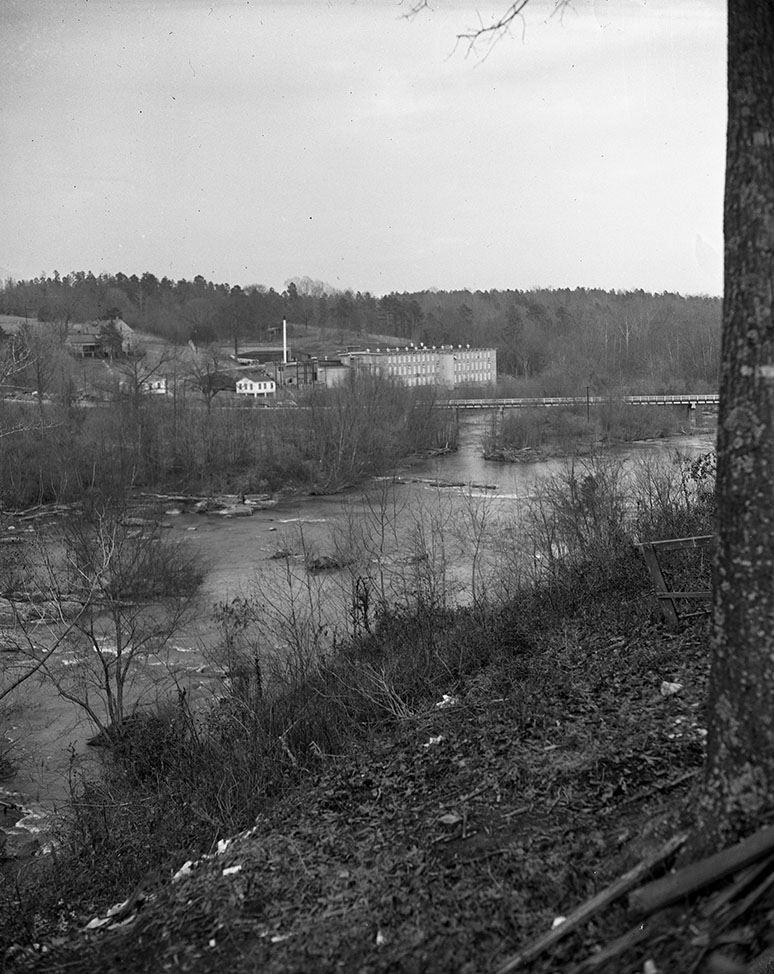
C. January 1951 (26801651080).jpg - Fæ
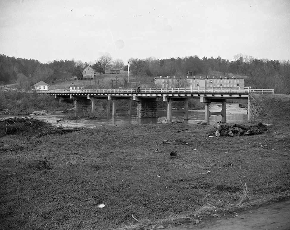
C. January 1951 (27042796856).jpg - Fæ

C. January 1951 (26801651150).jpg - Fæ

Mebane Bridge in Eden, North Carolina 03.jpg - Indy beetle

Catawba River seen from I-85.jpg - DiscoA340

Catawba River seen from I-40.jpg - DiscoA340

Catawba River seen from I-40 2.jpg - DiscoA340

Downtown Jax NC New River.jpg - Hammerattack
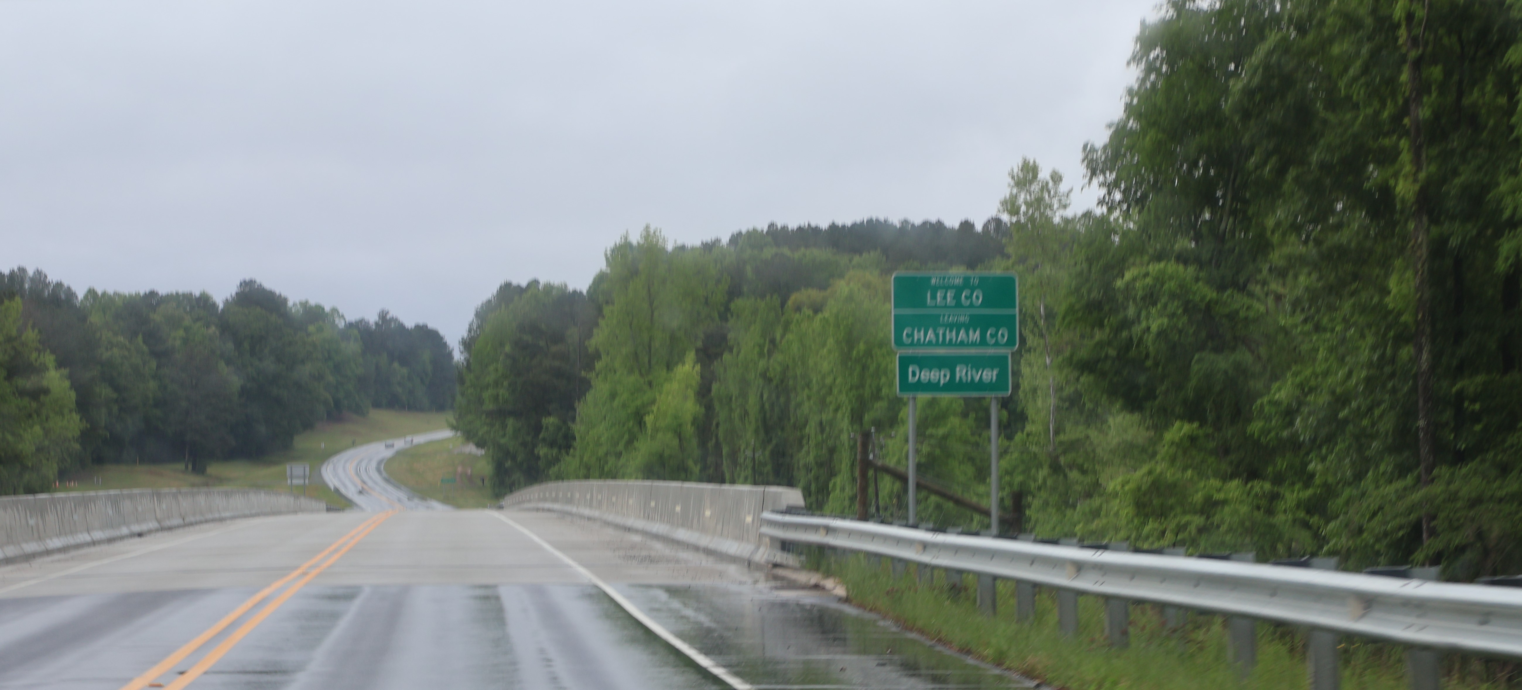
Chatham-Lee County Line.jpg - DiscoA340

One of the suspension bridges over the Cane River in Yancey County, NC.jpg - WWWHHHHYYYYYY

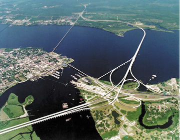
Interstate 95 052906 066.jpg - Ser Amantio di Nicolao

Interstate 95 - North Carolina - 8589979640.jpg - Ser Amantio di Nicolao