Wikimedi'Òc
Modes d'emploi

Cet album fait partie des albums
Cet album photos contient les sous-albums suivants :


The M4, Bray - geograph.org.uk - 814590.jpg - File Upload Bot (Magnus Manske)

Bray Marina - geograph.org.uk - 107422.jpg - GeographBot

Houses at Bray - geograph.org.uk - 94876.jpg - GeographBot

M4 Motorway near Bray - geograph.org.uk - 157207.jpg - GeographBot

BrayBerks01.JPG - Motmit

Works on the Thames at Bray Lock - geograph.org.uk - 383277.jpg - GeographBot

Ferry Road - geograph.org.uk - 515633.jpg - GeographBot
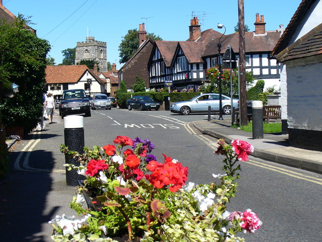
High Street, Bray - geograph.org.uk - 515613.jpg - GeographBot
Bray - not fat ducks. - geograph.org.uk - 601045.jpg - GeographBot

Exclusive restaurant - geograph.org.uk - 601023.jpg - GeographBot

Farmland and footpath, Braywoodside - geograph.org.uk - 797999.jpg - GeographBot
Farmland and houses, Braywoodside - geograph.org.uk - 799153.jpg - GeographBot

Farmland and oak, Braywoodside - geograph.org.uk - 799183.jpg - GeographBot

Pasture, Braywoodside - geograph.org.uk - 797987.jpg - GeographBot

Pasture, Braywoodside - geograph.org.uk - 799044.jpg - GeographBot

Pasture, Braywoodside - geograph.org.uk - 799047.jpg - GeographBot

The Drift Road, Braywoodside - geograph.org.uk - 799177.jpg - GeographBot

The Drift Road, Braywoodside - geograph.org.uk - 799207.jpg - GeographBot

Moneyrow Green, Holyport - geograph.org.uk - 814839.jpg - GeographBot

Plant area at Wyevale - geograph.org.uk - 937121.jpg - GeographBot

Wyevale Garden Centre, Dedworth, Windsor - geograph.org.uk - 937119.jpg - GeographBot

Riverside at Bray - geograph.org.uk - 948401.jpg - GeographBot

Riverside at Bray - geograph.org.uk - 948408.jpg - GeographBot

The Cut by Bray Marina - geograph.org.uk - 948421.jpg - GeographBot

Bray, High Street - geograph.org.uk - 976690.jpg - GeographBot

Bray Bridge - geograph.org.uk - 976942.jpg - GeographBot

Maidenhead Flood Relief Channel between Bray and Bray Wick - geograph.org.uk - 975137.jpg - GeographBot

River Thames near Bray - geograph.org.uk - 976857.jpg - GeographBot

The Cut near Bray - geograph.org.uk - 977123.jpg - GeographBot
Moneyrow Green, The B3024 road at Gad Bridge - geograph.org.uk - 1032727.jpg - GeographBot

Moneyrow Green - geograph.org.uk - 1032761.jpg - GeographBot
Moneyrow Green - geograph.org.uk - 1032790.jpg - GeographBot

The Cut near Bray - geograph.org.uk - 1035253.jpg - GeographBot

Royal Blue Coaches - geograph.org.uk - 1079350.jpg - GeographBot

Gravel Conveyor - geograph.org.uk - 1472245.jpg - GeographBot

Bray Lock - geograph.org.uk - 1500917.jpg - GeographBot

M4 Motorway - geograph.org.uk - 1500923.jpg - GeographBot

Wyevale Garden Centre in Windsor - geograph.org.uk - 1519974.jpg - GeographBot

Eward Elgar Plaque.jpg - Marchaos~commonswiki

Bray (NBY 443379).jpg - Fæ

Corn Stooks by Bray Church.jpg - Wrjohnson1

Path in the wheat field - geograph.org.uk - 1959831.jpg - GeographBot

Crossing the Thames at Dorney Reach - geograph.org.uk - 2182826.jpg - GeographBot

Windsor Marina - geograph.org.uk - 2215214.jpg - GeographBot

Steamship Streatley, Windsor Marina - geograph.org.uk - 2216096.jpg - GeographBot

Village pond - geograph.org.uk - 2253593.jpg - GeographBot

Bare trees by the pond - geograph.org.uk - 2253600.jpg - GeographBot

Felled tree - geograph.org.uk - 2253605.jpg - GeographBot

Track near Thimble Farm - geograph.org.uk - 2253612.jpg - GeographBot

Connecting path - geograph.org.uk - 2253969.jpg - GeographBot

Rough ground - geograph.org.uk - 2253974.jpg - GeographBot

Tall Cypress trees - geograph.org.uk - 2253980.jpg - GeographBot

Large barn near Gadbridge Farm - geograph.org.uk - 2253988.jpg - GeographBot

A 404(M) approaching the M4 junction - geograph.org.uk - 2377187.jpg - GeographBot

Bray, Berkshire - geograph.org.uk - 2406908.jpg - GeographBot

Bray, Berkshire - geograph.org.uk - 2406911.jpg - GeographBot

Riverfront houses on the Thames at Maidenhead - geograph.org.uk - 2495849.jpg - GeographBot

Luxury cruiser moored at a riverside garden at Bray - geograph.org.uk - 2495857.jpg - GeographBot

The riverside at Bray - geograph.org.uk - 2495867.jpg - GeographBot

The New Thames Bridge at Dorney Reach - geograph.org.uk - 2495888.jpg - GeographBot

Monkey Island - geograph.org.uk - 2495902.jpg - GeographBot

Crane at Bray Marina - geograph.org.uk - 2495924.jpg - GeographBot

Oakley Court Hotel - geograph.org.uk - 2496163.jpg - GeographBot

Thamesside house at Dedworth - geograph.org.uk - 2496167.jpg - GeographBot

Baglady near Maidenhead - geograph.org.uk - 2546820.jpg - GeographBot

House overlooking the Thames - geograph.org.uk - 2546832.jpg - GeographBot

River Thames and Bray - geograph.org.uk - 2546846.jpg - GeographBot

The New Thames Bridge, near Bray - geograph.org.uk - 2547355.jpg - GeographBot

River Thames near Monkey Island - geograph.org.uk - 2547366.jpg - GeographBot

River Thames near Boveney - geograph.org.uk - 2547717.jpg - GeographBot

At Ruddles Pool - geograph.org.uk - 2556090.jpg - GeographBot

Windsor Marina - geograph.org.uk - 2556101.jpg - GeographBot

Windsor Marina Entrance - geograph.org.uk - 2556111.jpg - GeographBot

Oakley Court Hotel - geograph.org.uk - 2556123.jpg - GeographBot

Boat by Oakley Court Hotel - geograph.org.uk - 2556135.jpg - GeographBot

Boating on the Thames - geograph.org.uk - 2556144.jpg - GeographBot

Boat by Queen's Eyot - geograph.org.uk - 2556156.jpg - GeographBot

Queen of the Thames - geograph.org.uk - 2556166.jpg - GeographBot

Bray Marina - geograph.org.uk - 2556196.jpg - GeographBot

The New Queen of the Thames - geograph.org.uk - 2556216.jpg - GeographBot

Line of Sight to Windsor - geograph.org.uk - 2556233.jpg - GeographBot

Boat at Monkey Island - geograph.org.uk - 2556252.jpg - GeographBot

New Thames Bridge - geograph.org.uk - 2557671.jpg - GeographBot

M4 approaches Monkey Island Lane overbridge - geograph.org.uk - 2570744.jpg - GeographBot

Windsor Forest - geograph.org.uk - 2659615.jpg - GeographBot

Windsor Forest - geograph.org.uk - 2659621.jpg - GeographBot

Windsor Forest - geograph.org.uk - 2659624.jpg - GeographBot

Windsor Forest - geograph.org.uk - 2659632.jpg - GeographBot

Windsor Forest - geograph.org.uk - 2659641.jpg - GeographBot

Windsor Forest - geograph.org.uk - 2659649.jpg - GeographBot

Fifield Road - geograph.org.uk - 2660211.jpg - GeographBot

Field near Dedworth - geograph.org.uk - 2662042.jpg - GeographBot

Field near Dedworth - geograph.org.uk - 2662052.jpg - GeographBot

Footpath, Dedworth - geograph.org.uk - 2662060.jpg - GeographBot

Dedworth, Windsor - geograph.org.uk - 2662074.jpg - GeographBot

Oakley Green Road - geograph.org.uk - 2662090.jpg - GeographBot

Tarbay Lane - geograph.org.uk - 2662096.jpg - GeographBot

Oak Trees - geograph.org.uk - 2662100.jpg - GeographBot

Golden October - geograph.org.uk - 2663513.jpg - GeographBot

Hedgerow Oak - geograph.org.uk - 2663522.jpg - GeographBot

Oakley Green - geograph.org.uk - 2663546.jpg - GeographBot

Farmland, Bray - geograph.org.uk - 2680134.jpg - GeographBot

Farmland, Bray - geograph.org.uk - 2680148.jpg - GeographBot

Farmland, Bray - geograph.org.uk - 2680152.jpg - GeographBot

Village centre, Bray - geograph.org.uk - 2819694.jpg - GeographBot

Public slipway, Bray - geograph.org.uk - 2841142.jpg - GeographBot

Britain in Bloom - geograph.org.uk - 2841150.jpg - GeographBot

Bray Lake - geograph.org.uk - 2868218.jpg - GeographBot

Jetty in Bray Lake - geograph.org.uk - 2868223.jpg - GeographBot

River Thames by Dorney - geograph.org.uk - 2877411.jpg - GeographBot

Underneath the Arches - geograph.org.uk - 2877448.jpg - GeographBot

How the Other Half Lives - geograph.org.uk - 2877514.jpg - GeographBot

River Thames at Fishery - geograph.org.uk - 2877549.jpg - GeographBot

Dedworth Road passes the Greene Oak - geograph.org.uk - 3011168.jpg - GeographBot

B3024 passes Braywood Cricket Ground - geograph.org.uk - 3014780.jpg - GeographBot

B3024 crossroads with Fifield Lane ^ Road - geograph.org.uk - 3014795.jpg - GeographBot

B3024 passes The Sun and Stars - geograph.org.uk - 3015165.jpg - GeographBot

B3024 passes The Jolly Gardener - geograph.org.uk - 3015174.jpg - GeographBot

A330 south of Foxley Green Farm - geograph.org.uk - 3015182.jpg - GeographBot

A330 junction with A3024 - geograph.org.uk - 3015189.jpg - GeographBot

Village War Memorial - geograph.org.uk - 3057135.jpg - GeographBot

M4 near Bray - geograph.org.uk - 3209797.jpg - GeographBot

M4 near Bray - geograph.org.uk - 3209816.jpg - GeographBot

Abandoned Motorway - geograph.org.uk - 3256960.jpg - GeographBot

The A308(M) - geograph.org.uk - 3256972.jpg - GeographBot

River Thames - geograph.org.uk - 3271360.jpg - GeographBot

M4, half mile to J8-9 - geograph.org.uk - 3358290.jpg - GeographBot

M4, slip road, J8-9 - geograph.org.uk - 3358297.jpg - GeographBot

M4 roadsign - geograph.org.uk - 3358310.jpg - GeographBot

Approaching Bray Weir - geograph.org.uk - 3415373.jpg - GeographBot

River Thames and a boathouse - geograph.org.uk - 3415378.jpg - GeographBot

New way over old - geograph.org.uk - 3415513.jpg - GeographBot

Oakley Court Hotel from the 'Thames Path' - geograph.org.uk - 3415522.jpg - GeographBot

M4 south of Bray - geograph.org.uk - 3418698.jpg - GeographBot

M4 ascends Thames crossing - geograph.org.uk - 3418706.jpg - GeographBot

The River Thames and the Oakley Court Hotel - geograph.org.uk - 3442317.jpg - GeographBot

The River Thames and Queen's Eyot - geograph.org.uk - 3442346.jpg - GeographBot

Under the M4 bridge across the River Thames - geograph.org.uk - 3442371.jpg - GeographBot

Oak Tree - geograph.org.uk - 3489057.jpg - GeographBot

Church Lane - geograph.org.uk - 3489058.jpg - GeographBot

Church Lane track - geograph.org.uk - 3489062.jpg - GeographBot

View from Hogoak Lane - geograph.org.uk - 3494775.jpg - GeographBot

Buttercup field - geograph.org.uk - 3497799.jpg - GeographBot

The long field - geograph.org.uk - 3497803.jpg - GeographBot

Braywood cricket ground - geograph.org.uk - 3497805.jpg - GeographBot

Fifield House - geograph.org.uk - 3497810.jpg - GeographBot

An amazing sight - geograph.org.uk - 3497820.jpg - GeographBot

Fifield Road - geograph.org.uk - 3497825.jpg - GeographBot

B3024 junction - geograph.org.uk - 3498235.jpg - GeographBot

The Fifield - geograph.org.uk - 3498243.jpg - GeographBot

Old brick walls - geograph.org.uk - 3498246.jpg - GeographBot

Forest Green Road - geograph.org.uk - 3498248.jpg - GeographBot

Footpath sign - geograph.org.uk - 3498253.jpg - GeographBot

End of the path - geograph.org.uk - 3498257.jpg - GeographBot

Banham Farm - geograph.org.uk - 3498266.jpg - GeographBot

Hedgerow oaks - geograph.org.uk - 3498465.jpg - GeographBot

Footpath to Braywood - geograph.org.uk - 3498474.jpg - GeographBot

Up the hill - geograph.org.uk - 3498487.jpg - GeographBot

Braywood drive - geograph.org.uk - 3498496.jpg - GeographBot

Fenceline near Braywood - geograph.org.uk - 3498502.jpg - GeographBot

Footpath and paddocks - geograph.org.uk - 3498510.jpg - GeographBot

Drift Road - geograph.org.uk - 3498524.jpg - GeographBot

Farmland near New Lodge - geograph.org.uk - 3498554.jpg - GeographBot

Drift Road - geograph.org.uk - 3498564.jpg - GeographBot

Single oak - geograph.org.uk - 3498579.jpg - GeographBot

Drift Road - geograph.org.uk - 3498588.jpg - GeographBot

Fallow ground - geograph.org.uk - 3498595.jpg - GeographBot

Open grassland - geograph.org.uk - 3498603.jpg - GeographBot

Fifield Lane - geograph.org.uk - 3499099.jpg - GeographBot

Footpath, Wakers Farm - geograph.org.uk - 3499104.jpg - GeographBot

Field boundary - geograph.org.uk - 3499111.jpg - GeographBot

Footpath, Wakers farm - geograph.org.uk - 3499242.jpg - GeographBot

Drift Road - geograph.org.uk - 3499250.jpg - GeographBot

Monkey Island Lane Bridge, M4 - geograph.org.uk - 3529658.jpg - GeographBot

Slip road J8-9, M4 - geograph.org.uk - 3529661.jpg - GeographBot

A308(M) - geograph.org.uk - 3529673.jpg - GeographBot

A308 into Maidenhead - geograph.org.uk - 3529675.jpg - GeographBot

M4, J8-9 - geograph.org.uk - 3529684.jpg - GeographBot

M4 1 mile to junction 8-9 - geograph.org.uk - 3617425.jpg - GeographBot

M4 over the A308 bridge - geograph.org.uk - 3617447.jpg - GeographBot

M4 exit to junctions 8-9 - geograph.org.uk - 3617492.jpg - GeographBot

M4 westbound, junction 8-9 bridge - geograph.org.uk - 3617513.jpg - GeographBot

M4 footbridge - geograph.org.uk - 3617545.jpg - GeographBot

Orange Way after Wiltshire (434) - geograph.org.uk - 3630766.jpg - GeographBot

Orange Way after Wiltshire (435) - geograph.org.uk - 3630774.jpg - GeographBot

Orange Way after Wiltshire (436) - geograph.org.uk - 3630786.jpg - GeographBot

Orange Way after Wiltshire (437) - geograph.org.uk - 3630793.jpg - GeographBot

Orange Way after Wiltshire (438) - geograph.org.uk - 3630809.jpg - GeographBot

Orange Way after Wiltshire (439) - geograph.org.uk - 3630828.jpg - GeographBot

Orange Way after Wiltshire (440) - geograph.org.uk - 3630868.jpg - GeographBot

Orange Way after Wiltshire (441) - geograph.org.uk - 3630880.jpg - GeographBot

Orange Way after Wiltshire (442) - geograph.org.uk - 3630908.jpg - GeographBot

Orange Way after Wiltshire (444) - geograph.org.uk - 3631002.jpg - GeographBot

Orange Way after Wiltshire (445) - geograph.org.uk - 3631005.jpg - GeographBot

M4, westbound - geograph.org.uk - 3649390.jpg - GeographBot

M4 passing Little Thrift Wood - geograph.org.uk - 3649393.jpg - GeographBot

Windsor Road going under the M4 motorway - geograph.org.uk - 3665557.jpg - GeographBot

Roundabout at junction 8-9 on the M4, Maidenhead - geograph.org.uk - 3665559.jpg - GeographBot

Starting to fill up - geograph.org.uk - 3682651.jpg - GeographBot

Car park B - Legoland - geograph.org.uk - 3682858.jpg - GeographBot

Railings, streetlights, roadsigns - geograph.org.uk - 3697347.jpg - GeographBot

Wrought iron gates - geograph.org.uk - 3697385.jpg - GeographBot

Driving range nets at Bird's Hill Golf Centre - geograph.org.uk - 3697431.jpg - GeographBot

Private^ So^ - geograph.org.uk - 3871748.jpg - GeographBot

Big Gates to Waste Land - geograph.org.uk - 3878039.jpg - GeographBot

M4 eastbound - geograph.org.uk - 3883834.jpg - GeographBot

M4 east bound - geograph.org.uk - 3883842.jpg - GeographBot

M4 eastbound - geograph.org.uk - 3883853.jpg - GeographBot

Footpath, Legoland - geograph.org.uk - 3938834.jpg - GeographBot
Legoland overflow car park - geograph.org.uk - 3938848.jpg - GeographBot

Green tunnel - geograph.org.uk - 3938854.jpg - GeographBot

Legoland backlot - geograph.org.uk - 3939825.jpg - GeographBot

Footpath, Legoland - geograph.org.uk - 3939828.jpg - GeographBot

Footpath waymarker - geograph.org.uk - 3939835.jpg - GeographBot

The meadow, Legoland - geograph.org.uk - 3939837.jpg - GeographBot

Gateways, Legoland - geograph.org.uk - 3939843.jpg - GeographBot

Eton Dorney from the air - geograph.org.uk - 3989755.jpg - GeographBot

Eton Dorney from the air - geograph.org.uk - 3989757.jpg - GeographBot

Bray Lake from the air - geograph.org.uk - 3989764.jpg - GeographBot

Old Beams cottages - geograph.org.uk - 4101629.jpg - GeographBot

Access road to Mount Skippets Farm - geograph.org.uk - 4101633.jpg - GeographBot

Oak tree near Mount Skippets Farm - geograph.org.uk - 4101639.jpg - GeographBot

Footbridge between fields - geograph.org.uk - 4101642.jpg - GeographBot

Footpath junction - geograph.org.uk - 4101647.jpg - GeographBot

Harvester at work - geograph.org.uk - 4101658.jpg - GeographBot

Drift Road - geograph.org.uk - 4101660.jpg - GeographBot

Bridge over the Bourne - geograph.org.uk - 4101663.jpg - GeographBot

New barns, Gadbridge Farm - geograph.org.uk - 4101963.jpg - GeographBot

Footpath diversion, Mount Skippets Farm - geograph.org.uk - 4101964.jpg - GeographBot

Footpath diversion, Mount Skippets Farm - geograph.org.uk - 4101965.jpg - GeographBot

Bridge over a drain - geograph.org.uk - 4101967.jpg - GeographBot

Tramline in the wheat - geograph.org.uk - 4101970.jpg - GeographBot

Footpath across the fields - geograph.org.uk - 4101973.jpg - GeographBot

Farm access road - geograph.org.uk - 4101976.jpg - GeographBot

Footbridge over drain - geograph.org.uk - 4101989.jpg - GeographBot

Footpath near Mount Skippets Farm - geograph.org.uk - 4102115.jpg - GeographBot

Footpath near Gadridge Farm - geograph.org.uk - 4102120.jpg - GeographBot

The B3024, Forest Green - geograph.org.uk - 4102125.jpg - GeographBot

Footpath along field edge - geograph.org.uk - 4102481.jpg - GeographBot

Farm access road - geograph.org.uk - 4102487.jpg - GeographBot

Overgrown footbridge - geograph.org.uk - 4102494.jpg - GeographBot

Windsor and Maidenhead , The M4 Motorway - geograph.org.uk - 4225790.jpg - GeographBot

Houses by the River Thames in Water Oakley - geograph.org.uk - 4264790.jpg - GeographBot

Boats moored by the Willows Riverside Park - geograph.org.uk - 4264792.jpg - GeographBot

Windsor Marina - geograph.org.uk - 4264795.jpg - GeographBot

Eton Excelsior Rowing Club - geograph.org.uk - 4264796.jpg - GeographBot

The grounds of the Oakley Court Hotel by the River Thames - geograph.org.uk - 4264799.jpg - GeographBot

Dedworth Road at the junction of Oakley Green Road - geograph.org.uk - 4459813.jpg - GeographBot

Oakley Green Road - geograph.org.uk - 4459966.jpg - GeographBot

Houses on Paley Street - geograph.org.uk - 4460410.jpg - GeographBot

Ornate houses on Oakley Green Road - geograph.org.uk - 4460532.jpg - GeographBot

Forest Green at the junction of Ascot Road - geograph.org.uk - 4460758.jpg - GeographBot

House on Oakley Green Road - geograph.org.uk - 4461828.jpg - GeographBot

M4, Ascot Road Bridge - geograph.org.uk - 4462761.jpg - GeographBot

Eastbound M4 near Bray - geograph.org.uk - 4462766.jpg - GeographBot

Eastbound M4, DLS B43.3 - geograph.org.uk - 4462772.jpg - GeographBot

M4 near Bray - geograph.org.uk - 4462781.jpg - GeographBot

Eastbound M4 approaching Junctions 8-9 - geograph.org.uk - 4481333.jpg - GeographBot

Eastbound M4, Bridge at Junction 8-9 - geograph.org.uk - 4481345.jpg - GeographBot

Westbound M4 near Bray - geograph.org.uk - 4485052.jpg - GeographBot

Westbound M4 approaching Junction 8-9 - geograph.org.uk - 4485057.jpg - GeographBot

Westbound M4, Ascot Road Bridge - geograph.org.uk - 4485161.jpg - GeographBot

Westbound M4, Exit at Holyport Interchange - geograph.org.uk - 4485165.jpg - GeographBot

Westbound M4, Exit Sliproad at Junction 8-9 (Holyport) - geograph.org.uk - 4485170.jpg - GeographBot

Lake near Bray - geograph.org.uk - 4495266.jpg - GeographBot

Tree lined lake - geograph.org.uk - 4495293.jpg - GeographBot

Beside the lake - geograph.org.uk - 4495300.jpg - GeographBot

Bray Court - geograph.org.uk - 4495307.jpg - GeographBot

Bray Marina - geograph.org.uk - 4498016.jpg - GeographBot

The Braywick Roundabout, Maidenhead - geograph.org.uk - 4567641.jpg - GeographBot

Oakley Green Road at the junction of the A308 - geograph.org.uk - 4609203.jpg - GeographBot

Birds of a Feather ^ - geograph.org.uk - 4647067.jpg - GeographBot

M4, westbound - geograph.org.uk - 4812067.jpg - GeographBot

M4 footbridge - geograph.org.uk - 4812077.jpg - GeographBot

High Street, Bray - geograph.org.uk - 4862409.jpg - GeographBot

A308 Windsor Road - geograph.org.uk - 4862411.jpg - GeographBot

A308 Windsor Road at Fifield Road - geograph.org.uk - 4862412.jpg - GeographBot

A308 at Oakley Court Hotel entrance - geograph.org.uk - 4862413.jpg - GeographBot

A308 Windsor Road near Water Oakley - geograph.org.uk - 4865189.jpg - GeographBot

A404(M) Footbridge - geograph.org.uk - 4911908.jpg - GeographBot

Bray Lock - geograph.org.uk - 5109896.jpg - GeographBot

Footbridge, M4 - geograph.org.uk - 5219425.jpg - GeographBot

The River Thames near Bray Marina - geograph.org.uk - 5273842.jpg - GeographBot

Polo Pitch near Foxley Green Farm - geograph.org.uk - 5398208.jpg - GeographBot

Footpath towards Moneyrow Green - geograph.org.uk - 5398222.jpg - GeographBot

House and Paddock near Foxley Green Farm - geograph.org.uk - 5398438.jpg - GeographBot

Sporting Green near Little Foxley - geograph.org.uk - 5398452.jpg - GeographBot

Path to Little Foxley - geograph.org.uk - 5398582.jpg - GeographBot

Field next to Long Lane Farm - geograph.org.uk - 5399322.jpg - GeographBot

Track heading North from Long Lane Farm - geograph.org.uk - 5399330.jpg - GeographBot

Bridleway Entrance to Long Lane Farm - geograph.org.uk - 5399335.jpg - GeographBot

Edge of Large field near Long Lane Farm - geograph.org.uk - 5399339.jpg - GeographBot

Houses at Haws Hill Farm - geograph.org.uk - 5400879.jpg - GeographBot

Farm Track near Hornbuckle Farm - geograph.org.uk - 5403129.jpg - GeographBot

Farm Track near Cruch Lane - geograph.org.uk - 5403133.jpg - GeographBot

View towards Pickins Park - geograph.org.uk - 5403246.jpg - GeographBot

Runners at Maidenhead parkrun - geograph.org.uk - 5407759.jpg - GeographBot

Bray - House on Monkey Island Lane - geograph.org.uk - 5424050.jpg - GeographBot

Bray - New Estate in Monkey Island Lane - geograph.org.uk - 5424275.jpg - GeographBot

Bray - Mixture of Building Styles - geograph.org.uk - 5424311.jpg - GeographBot

Converted Farm Buildings near Fifield - geograph.org.uk - 5424729.jpg - GeographBot

Hidden House next to Horse Farm - geograph.org.uk - 5424736.jpg - GeographBot

Access Road to Pinto Fields Farm - geograph.org.uk - 5424739.jpg - GeographBot

Elaborate Gate House to New Lodge - geograph.org.uk - 5424769.jpg - GeographBot

Crown Estate Cottages - geograph.org.uk - 5424779.jpg - GeographBot

Forbe's Ride in Windsor Forest - geograph.org.uk - 5425149.jpg - GeographBot

Forbe's Ride in Windsor Forest - geograph.org.uk - 5425154.jpg - GeographBot

Bridleway Goes Around Legoland Carpark - geograph.org.uk - 5439615.jpg - GeographBot

Dedworth - Squires Garden Centre - geograph.org.uk - 5442491.jpg - GeographBot

Oakley Court Hotel Entrance - geograph.org.uk - 5442496.jpg - GeographBot

Oakley Green Cemetery - geograph.org.uk - 5442500.jpg - GeographBot

Fields near Meadow Lane Farm - geograph.org.uk - 5442508.jpg - GeographBot

Junction 8-9 on M4 from air, 2001 - geograph.org.uk - 5568946.jpg - GeographBot

Windsor and Maidenhead , M4 Motorway - geograph.org.uk - 5726398.jpg - GeographBot

Windsor and Maidenhead , M4 Motorway - geograph.org.uk - 5726399.jpg - GeographBot

Windsor and Maidenhead , M4 Motorway - geograph.org.uk - 5726406.jpg - GeographBot

Windsor and Maidenhead , M4 Motorway - geograph.org.uk - 5726408.jpg - GeographBot

Windsor and Maidenhead , M4 Motorway - geograph.org.uk - 5726409.jpg - GeographBot

Windsor and Maidenhead , M4 Motorway - geograph.org.uk - 5726411.jpg - GeographBot

Windsor and Maidenhead , M4 Motorway - geograph.org.uk - 5726412.jpg - GeographBot

Windsor and Maidenhead , M4 Motorway - geograph.org.uk - 5726414.jpg - GeographBot

Windsor and Maidenhead , M4 Motorway - geograph.org.uk - 5726415.jpg - GeographBot

B3024 at Cedars Farm - geograph.org.uk - 5738839.jpg - GeographBot

Bridleway to Holyport - geograph.org.uk - 5739295.jpg - GeographBot

Bridleway near Coningsby Farm - geograph.org.uk - 5739324.jpg - GeographBot

Monitoring Borehole on a Landfill - geograph.org.uk - 5739438.jpg - GeographBot

Track off Coningsby Lane - geograph.org.uk - 5741558.jpg - GeographBot

Grassland near the Motorway - geograph.org.uk - 5770657.jpg - GeographBot

The Waterside, Bray - geograph.org.uk - 5871239.jpg - GeographBot

Windsor and Maidenhead , Grassy Field - geograph.org.uk - 5898875.jpg - GeographBot

River Thames - geograph.org.uk - 5910309.jpg - GeographBot

The Oakly Court Hotel - geograph.org.uk - 5910311.jpg - GeographBot

Built in 1870 - geograph.org.uk - 5962919.jpg - GeographBot

Bridge over The Cut - geograph.org.uk - 5962946.jpg - GeographBot

Fishery Road, Bray - geograph.org.uk - 5963789.jpg - GeographBot

Corner of The Rushes - geograph.org.uk - 5963793.jpg - GeographBot

At the Fat Duck Restaurant - geograph.org.uk - 5964381.jpg - GeographBot

River Thames at Bray - geograph.org.uk - 5964813.jpg - GeographBot

Abuse on the Bridge - geograph.org.uk - 6025070.jpg - GeographBot

Roller by the track - geograph.org.uk - 6025172.jpg - GeographBot

B3024, Forest Green - geograph.org.uk - 6025757.jpg - GeographBot

Footpath and Horse Track - geograph.org.uk - 6025761.jpg - GeographBot

Path over the M4 - geograph.org.uk - 6026308.jpg - GeographBot

Great Thrift Wood - geograph.org.uk - 6073794.jpg - GeographBot

A330 towards Maidenhead - geograph.org.uk - 6177975.jpg - GeographBot

A330 towards Maidenhead - geograph.org.uk - 6177980.jpg - GeographBot

A330 towards Maidenhead - geograph.org.uk - 6177982.jpg - GeographBot

Slow on A330 towards Maidenhead - geograph.org.uk - 6177986.jpg - GeographBot

A330 Ascot Road - geograph.org.uk - 6177992.jpg - GeographBot

A330 Ascot Road - geograph.org.uk - 6178001.jpg - GeographBot

Cox Green , The A404(M) - geograph.org.uk - 6268116.jpg - GeographBot

Bray , M4 Motorway - geograph.org.uk - 6268120.jpg - GeographBot

M4 crosses A308 Windsor Road - geograph.org.uk - 6423720.jpg - GeographBot

A308 Windsor Road - geograph.org.uk - 6423723.jpg - GeographBot

A308 Windsor Road - geograph.org.uk - 6423729.jpg - GeographBot

A308 Windsor Road - geograph.org.uk - 6423730.jpg - GeographBot

A308 Windsor Road - geograph.org.uk - 6423731.jpg - GeographBot

Cricket match on Bray Cricket Ground - geograph.org.uk - 6558183.jpg - GeographBot

The Fifield Inn - geograph.org.uk - 6563844.jpg - GeographBot

Flowers at the Bus Stop - geograph.org.uk - 6563906.jpg - GeographBot

Entrance to Ferndale Park - geograph.org.uk - 6563910.jpg - GeographBot

New Lodge - geograph.org.uk - 6563934.jpg - GeographBot

New Gate to New Lodge - geograph.org.uk - 6563945.jpg - GeographBot

Countryside near Fifield - geograph.org.uk - 6563957.jpg - GeographBot

Haws Hill Court - geograph.org.uk - 6563964.jpg - GeographBot

Houses near Haws Hill Farm - geograph.org.uk - 6563973.jpg - GeographBot

Towards the Odd Hill - geograph.org.uk - 6564154.jpg - GeographBot

Wheat Field, Mount Skippetts Farm - geograph.org.uk - 6564160.jpg - GeographBot

Holliday's Plain - geograph.org.uk - 6600740.jpg - GeographBot

Grass verge by A308 - geograph.org.uk - 6675983.jpg - GeographBot

Grass verge, A308 - geograph.org.uk - 6675985.jpg - GeographBot

Roadsign, A308 - geograph.org.uk - 6675988.jpg - GeographBot

Grounds of Oakley Court Hotel - geograph.org.uk - 6675991.jpg - GeographBot

Entrance to Oakley Court Hotel - geograph.org.uk - 6675992.jpg - GeographBot

Road to Down Place Farm - geograph.org.uk - 6675993.jpg - GeographBot

Down Place - geograph.org.uk - 6675995.jpg - GeographBot

Track to Brayfields Farm - geograph.org.uk - 6675998.jpg - GeographBot

Monkey Island Lane - geograph.org.uk - 6676000.jpg - GeographBot

Estate, Holyport - geograph.org.uk - 6676001.jpg - GeographBot

Westbrook - geograph.org.uk - 6676005.jpg - GeographBot

Tithe Barn Drive - geograph.org.uk - 6676009.jpg - GeographBot

Court Close - geograph.org.uk - 6676013.jpg - GeographBot

Bray Court - geograph.org.uk - 6676014.jpg - GeographBot

B3028, A308 junction - geograph.org.uk - 6676016.jpg - GeographBot

A308 on large roundabout - geograph.org.uk - 6676019.jpg - GeographBot

Roundabout, Windsor Rd, A308 - geograph.org.uk - 6676020.jpg - GeographBot

Emperor of India - geograph.org.uk - 6676026.jpg - GeographBot

On the eastbound M4 at the A330 bridge - geograph.org.uk - 6939866.jpg - GeographBot

Road works on B3024, Forest Green - geograph.org.uk - 6974612.jpg - GeographBot

B3024 Forest Green - geograph.org.uk - 6974615.jpg - GeographBot

B3024 Oakley Green Road - geograph.org.uk - 6974616.jpg - GeographBot

Road junction, Oakley Green - geograph.org.uk - 6974624.jpg - GeographBot

High Street, Bray - geograph.org.uk - 6974633.jpg - GeographBot

Looking along Church Lane towards St Michael's - geograph.org.uk - 7089583.jpg - GeographBot

Oakley Green Cemetery, early February 2022 - geograph.org.uk - 7089586.jpg - GeographBot

Junction of Monkey Island Court and Monkey Island Lane - geograph.org.uk - 7091011.jpg - GeographBot

Touchen End Farm, early February 2022 - geograph.org.uk - 7091026.jpg - GeographBot

Looking eastwards along Forest Green Road - geograph.org.uk - 7092366.jpg - GeographBot

Bray, The Hind's Head - geograph.org.uk - 7095193.jpg - GeographBot

Looking west-northwest along the A308 - geograph.org.uk - 7095201.jpg - GeographBot

The Holyport Interchange - geograph.org.uk - 7132353.jpg - GeographBot

Holyport , M4 Motorway - geograph.org.uk - 7219254.jpg - GeographBot

Bray , M4 Motorway - geograph.org.uk - 7219256.jpg - GeographBot

Farmland, Bray - geograph.org.uk - 7346387.jpg - GeographBot

Bray Cemetery chapel - geograph.org.uk - 7396496.jpg - GeographBot

Entrance to Oakley Green Cemetery - geograph.org.uk - 7398121.jpg - GeographBot

A308 Windsor Road - geograph.org.uk - 7697624.jpg - GeographBot

Fifield Road - geograph.org.uk - 7698182.jpg - GeographBot

Cement works on Monkey Island Lane - geograph.org.uk - 7698240.jpg - GeographBot

Scrubby grassland by Monkey Island Lane - geograph.org.uk - 7698268.jpg - GeographBot

The Cut - geograph.org.uk - 7698272.jpg - GeographBot

River Thames at Dorney Reach - geograph.org.uk - 7698291.jpg - GeographBot

Ornamental land by Monkey Island Lane - geograph.org.uk - 7698311.jpg - GeographBot

Monkey Island Lane - geograph.org.uk - 7698329.jpg - GeographBot

Pond near Bray - geograph.org.uk - 7698334.jpg - GeographBot

Trees planted by the M4 - geograph.org.uk - 7698668.jpg - GeographBot

Prepared field near Bray - geograph.org.uk - 7698672.jpg - GeographBot

High Street, Bray - geograph.org.uk - 7699006.jpg - GeographBot

Village green in Bray - geograph.org.uk - 7699026.jpg - GeographBot

The Cut - geograph.org.uk - 7699037.jpg - GeographBot

Green Way near Bray Wick - geograph.org.uk - 7699046.jpg - GeographBot