Wikimedi'Òc
Modes d'emploi

Cet album fait partie des albums
Cet album photos contient les sous-albums suivants :


Boston 1871 map RevereHouse detail.jpg - M2545
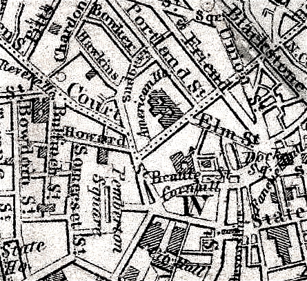
Boston 1842 BowdoinSquare area.jpg - M2545
Boston 1871 Walling BrattleStreet area.jpg - M2545

2885438724 BowdoinSt Boston.jpg - M2545

1828 ElmSt map Boston BPL11089.png - M2545

1803 Cornhill Boston byCarleton BPL10934 detail.png - M2545

2010 BowdoinSt Boston2.jpg - M2545

2010 BowdoinSt Boston8.jpg - M2545

1818 cow BostonDailyAdvertiser Nov3.png - M2545
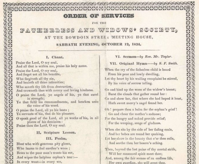
1834 BowdoinStChurch Boston.png - M2545

1845 Wilkes BowdoinSt Boston.png - M2545

1816 furniture BowdoinSt BostonDailyAdvertiser April17.png - M2545

Sanborn Fire Insurance Map from Boston (1867), Sheet 11.jpg - Ro4444

Atlas of the city of Boston - city proper - plate 4 (19673506558).jpg - Fæ

Atlas of the city of Boston - city proper - plate 10 (19835336926).jpg - Fæ

Atlas of the city of Boston - city proper - plate 21 (19673531210).jpg - Fæ

Boston Bowdoin St n von Ashburton Pl 9667 20190503.jpg - Karlunun

1888 map of the Granary Burying Ground plate 21 from Atlas of the city of Boston (cropped).jpg - Ooligan

Duck Boat South End Sarah (53828951686).jpg - Ethanmlong
Student carried Massachusetts Cannabis Decriminalization sign through Beacon Hill days before 2008 Election Day (53828951631).jpg - Ethanmlong

Signs for 2008 Election (53829283589).jpg - Ethanmlong
Bottom of Beacon Hill (53814100543).jpg - Ethanmlong

Newspaper Boxes at the corner of Bowdoin and Ashburton Place (53813131019).jpg - Ethanmlong

Bowdoin Street entrance to the Massachusetts State House (53813016653).jpg - Ethanmlong