Wikimedi'Òc
Modes d'emploi

Cet album fait partie des albums
Cet album photos contient les sous-albums suivants :


Cumnor Hill - geograph.org.uk - 95774.jpg - GeographBot

Westminster College Sports Centre - geograph.org.uk - 102654.jpg - GeographBot

Hinksey Floods - geograph.org.uk - 309119.jpg - GeographBot

Pylons Lead the Way to Oxford - geograph.org.uk - 436444.jpg - GeographBot

Bridleway to Harcourt Hill - geograph.org.uk - 872847.jpg - GeographBot

Seacourt Stream - geograph.org.uk - 872839.jpg - GeographBot

Alley to the fields - geograph.org.uk - 1103464.jpg - GeographBot

Entrance to the playing field - geograph.org.uk - 1103455.jpg - GeographBot

Parting of ways - geograph.org.uk - 1103443.jpg - GeographBot

Playground in the corner - geograph.org.uk - 1103320.jpg - GeographBot

Shortcut to the path - geograph.org.uk - 1103447.jpg - GeographBot

The bridge over Bulstake - geograph.org.uk - 1103311.jpg - GeographBot

Seacourt Stream, Botley - geograph.org.uk - 1220099.jpg - GeographBot

Full of weeds - geograph.org.uk - 1407003.jpg - GeographBot

Bus stop on West Way - geograph.org.uk - 1510158.jpg - GeographBot

Graffiti covered changing rooms off Arnold's Way - geograph.org.uk - 1510135.jpg - GeographBot

Hinksey Stream - geograph.org.uk - 1512039.jpg - GeographBot

Hinksey Stream - geograph.org.uk - 1512041.jpg - GeographBot

Houses on North Hinksey Lane - geograph.org.uk - 1512040.jpg - GeographBot

McDonald's restaurant in Botley - geograph.org.uk - 1510161.jpg - GeographBot
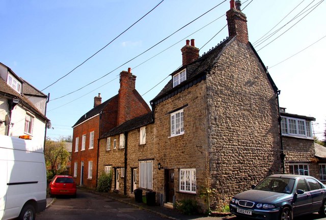
Old Botley houses - geograph.org.uk - 1510167.jpg - GeographBot

Old Botley houses - geograph.org.uk - 1510168.jpg - GeographBot

Our Lady Of The Rosary Catholic Church in Botley - geograph.org.uk - 1510122.jpg - GeographBot

Access road to the estate - geograph.org.uk - 1634826.jpg - GeographBot

Botley Road flyover - geograph.org.uk - 1632754.jpg - GeographBot

Chapel along the road - geograph.org.uk - 1632738.jpg - GeographBot

Curtis industrial estate - geograph.org.uk - 1633497.jpg - GeographBot

Further up the road - geograph.org.uk - 1634822.jpg - GeographBot

Graffiti on the wall - geograph.org.uk - 1632761.jpg - GeographBot

Grate on the culvert - geograph.org.uk - 1634830.jpg - GeographBot

Heading to Botley - geograph.org.uk - 1632682.jpg - GeographBot

Hinksey Business Centre - geograph.org.uk - 1633190.jpg - GeographBot

Housing over the road - geograph.org.uk - 1632767.jpg - GeographBot

In front of the school - geograph.org.uk - 1632768.jpg - GeographBot

Junction on the road - geograph.org.uk - 1632966.jpg - GeographBot

Looking past the bank - geograph.org.uk - 1632968.jpg - GeographBot

McDonald's carpark - geograph.org.uk - 1633183.jpg - GeographBot

Minns industrial estate - geograph.org.uk - 1632699.jpg - GeographBot

Old Botley - geograph.org.uk - 1633185.jpg - GeographBot

Parting of ways - geograph.org.uk - 1633149.jpg - GeographBot

Post box on the corner - geograph.org.uk - 1633180.jpg - GeographBot

Pub entrance - geograph.org.uk - 1634843.jpg - GeographBot

Pylon across the stream - geograph.org.uk - 1634845.jpg - GeographBot

Railings by the dtch - geograph.org.uk - 1634834.jpg - GeographBot

Road to Cumnor - geograph.org.uk - 1633137.jpg - GeographBot

Road to North Hinksey - geograph.org.uk - 1634814.jpg - GeographBot

Road to the park - geograph.org.uk - 1632758.jpg - GeographBot

School up the road - geograph.org.uk - 1632771.jpg - GeographBot

Seacourt Hall - geograph.org.uk - 1632961.jpg - GeographBot

Seacourt Stream - geograph.org.uk - 1632679.jpg - GeographBot

Side of the chapel - geograph.org.uk - 1632749.jpg - GeographBot

Stream by the pub - geograph.org.uk - 1632687.jpg - GeographBot

Westway to the lights - geograph.org.uk - 1633178.jpg - GeographBot

Wine shop on Westway - geograph.org.uk - 1633171.jpg - GeographBot

The former Carpenters Arms, Botley, Oxfordshire, Nov 2012.jpg - File Upload Bot (Magnus Manske)

Oswald Rayner.jpg - Ras67

Eynsham Road, Dean Court - geograph-1799132.jpg - Geograph Update Bot

Looking north with the Thames to the west - panoramio.jpg - Panoramio upload bot

Looking south onto the Thames - panoramio.jpg - Panoramio upload bot

Cripley Road - geograph.org.uk - 2535091.jpg - GeographBot

The Bulstake Stream - geograph.org.uk - 2880076.jpg - GeographBot

Cripley Road - Botley Road - geograph.org.uk - 3601369.jpg - GeographBot

Play Area - Botley Park - geograph.org.uk - 3601457.jpg - GeographBot

Recreation Ground - Botley Park - geograph.org.uk - 3601463.jpg - GeographBot

Sports Area - Botley Park - geograph.org.uk - 3601467.jpg - GeographBot

Tennis Courts - Botley Park - geograph.org.uk - 3601470.jpg - GeographBot

Footpath through allotments - Botley Road - geograph.org.uk - 3601481.jpg - GeographBot

Cripley Place - Cripley Road - geograph.org.uk - 3605263.jpg - GeographBot

Cripley Road - viewed from Abbey Road - geograph.org.uk - 3605266.jpg - GeographBot

Cripley Place - Abbey Road - geograph.org.uk - 3605284.jpg - GeographBot

North Hinksey - South View - 20220916143957.jpg - SmithKevin

North Hinksey - South View - 20220917095648.jpg - SmithKevin

Sun on the Flood - geograph.org.uk - 3871884.jpg - GeographBot

Duke Street - geograph.org.uk - 3999837.jpg - GeographBot

Garages on Duke Street - geograph.org.uk - 4002552.jpg - GeographBot

New Botley recreation ground - geograph.org.uk - 4003301.jpg - GeographBot

Duke Street, Oxford - geograph.org.uk - 4212670.jpg - GeographBot

Pasture south of the Bulstake Stream - geograph.org.uk - 4237112.jpg - GeographBot

This way to River Hotel, Oxford - geograph.org.uk - 4243792.jpg - GeographBot

South side of Bullstake Close, Oxford - geograph.org.uk - 4333373.jpg - GeographBot

Johnsons of Oxford - geograph.org.uk - 4333433.jpg - GeographBot

Binsey Lane - geograph.org.uk - 4352783.jpg - GeographBot

Electricity sub station - geograph.org.uk - 4352789.jpg - GeographBot

Golf range - geograph.org.uk - 4352796.jpg - GeographBot

Demolition of the former MFI and Halfords building - geograph.org.uk - 4424617.jpg - GeographBot

West side of Botley Park - geograph.org.uk - 4426208.jpg - GeographBot

Bridge over the Bulstrake Stream - geograph.org.uk - 4862056.jpg - GeographBot

Flats on Binsey Lane - geograph.org.uk - 4865526.jpg - GeographBot

View across the Bulstake Stream - geograph.org.uk - 5359824.jpg - GeographBot

Benchmark and gaugeboard on Bulstake Stream bridge - geograph.org.uk - 5712286.jpg - GeographBot

Bridge taking Binsey Lane over Bulstake Stream - geograph.org.uk - 5712295.jpg - GeographBot

Benchmark on Binsey Lane Bridge abutment - geograph.org.uk - 5712326.jpg - GeographBot

New Botley Recreation Ground - geograph.org.uk - 5855563.jpg - GeographBot

Path along the edge of New Botley recreation ground - geograph.org.uk - 5855913.jpg - GeographBot

Alexandra Road seen from New Botley recreation ground - geograph.org.uk - 5855916.jpg - GeographBot

Car park, corner of New Botley recreation ground, Ferry Hinksey Road - geograph.org.uk - 5855929.jpg - GeographBot

Binsey Lane, 2007 floods - geograph.org.uk - 5856609.jpg - GeographBot

Oatlands Road - geograph.org.uk - 5856683.jpg - GeographBot

New Botley recreation ground, path - geograph.org.uk - 5856685.jpg - GeographBot

Path along the edge of New Botley recreation ground - geograph.org.uk - 5856688.jpg - GeographBot

View from bridge over Bulstake Stream (New Botley recreation ground) - geograph.org.uk - 5856694.jpg - GeographBot

King George's playing field, New Botley - geograph.org.uk - 5856697.jpg - GeographBot

Lane leading from King George's playing field to Duke Street - geograph.org.uk - 5856699.jpg - GeographBot

Duke Street - geograph.org.uk - 5856702.jpg - GeographBot

King George's playing field, New Botley - geograph.org.uk - 5856703.jpg - GeographBot

Lamarsh Road and Earl Street in the distance - geograph.org.uk - 5856706.jpg - GeographBot

Lamarsh Road (at Brock Grove) - geograph.org.uk - 5856708.jpg - GeographBot

Lamarsh Road from Botley Road, 2007 floods - geograph.org.uk - 5856754.jpg - GeographBot

West Oxford Community Primary School (formerly West Oxford First School) - geograph.org.uk - 5863722.jpg - GeographBot

Path from Ferry Hinksey Road to Osney Island - geograph.org.uk - 5863724.jpg - GeographBot

Houses on Prestwich Place, New Botley - geograph.org.uk - 6270006.jpg - GeographBot

Binsey Lane - bridge over Bulstake Stream - geograph.org.uk - 6270596.jpg - GeographBot

Path beside Oatlands Recreation Ground - geograph.org.uk - 6340233.jpg - GeographBot

Bridge over Bulstake Stream - geograph.org.uk - 6606806.jpg - GeographBot

Allotments by the River Thames - geograph.org.uk - 6803107.jpg - GeographBot

Allotments by the River Thames - geograph.org.uk - 6803294.jpg - GeographBot

Helen Road, Oxford - geograph.org.uk - 6903979.jpg - GeographBot