Wikimedi'Òc
Modes d'emploi

Cet album fait partie des albums
Cet album photos contient les sous-albums suivants :


Bridleway and Fog - geograph.org.uk - 264474.jpg - GeographBot

Hens and River - geograph.org.uk - 264475.jpg - GeographBot

Misty Morning Path - geograph.org.uk - 264473.jpg - GeographBot

Muddy Path - geograph.org.uk - 264476.jpg - GeographBot

Burton on Trent - geograph.org.uk - 274626.jpg - GeographBot

Bushton - geograph.org.uk - 276320.jpg - GeographBot

Hilltop Farm. Anslow - geograph.org.uk - 276325.jpg - GeographBot

Poplars Farm, Anslow - geograph.org.uk - 276323.jpg - GeographBot

The Bell Inn, Anslow - geograph.org.uk - 276321.jpg - GeographBot

The Old Mission Church, Anslow - geograph.org.uk - 276327.jpg - GeographBot

Klondyke Mill - geograph.org.uk - 291634.jpg - GeographBot

Stapenhill Viaduct - geograph.org.uk - 293766.jpg - Geograph Update Bot

Bridge over Lin Brook - geograph.org.uk - 308271.jpg - GeographBot

Coachhouse near to Orgreave Hall - geograph.org.uk - 307463.jpg - GeographBot

Interior of Second World War air raid shelter - geograph.org.uk - 308267.jpg - GeographBot

Tutbury Fire Station - geograph.org.uk - 306673.jpg - GeographBot

Flooded Pasturelands - geograph.org.uk - 319776.jpg - GeographBot

Parkland at Okeover Hall - geograph.org.uk - 327410.jpg - GeographBot

Winter on the Trent - geograph.org.uk - 320946.jpg - GeographBot

A50 near Uttoxeter - geograph.org.uk - 354407.jpg - GeographBot

A522 at Deadman's Green - geograph.org.uk - 354350.jpg - GeographBot

Barn Croft at Dods Leigh - geograph.org.uk - 354307.jpg - GeographBot

Broadoak Farm near Bramshall - geograph.org.uk - 354380.jpg - GeographBot

Buildings at Fole Farm - geograph.org.uk - 354358.jpg - GeographBot

Cockley Wood and marshy ground - geograph.org.uk - 359337.jpg - GeographBot

Excavators on Parade - geograph.org.uk - 354450.jpg - GeographBot

Farm buildings at Park Hall. - geograph.org.uk - 354328.jpg - GeographBot

Farmland near Withington - geograph.org.uk - 354349.jpg - GeographBot

Farmyard at Potts Lane, Kingstone - geograph.org.uk - 354367.jpg - GeographBot

Footbridge over a stream - geograph.org.uk - 358573.jpg - GeographBot

Ford near Combridge - geograph.org.uk - 354489.jpg - GeographBot

Grindley Farm House - geograph.org.uk - 354336.jpg - GeographBot
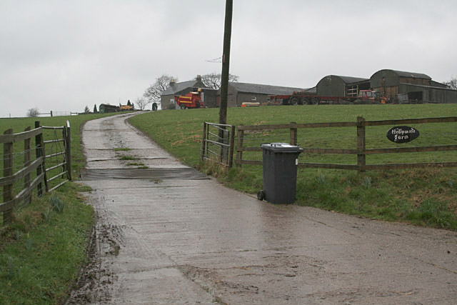
Hollywood Farm near Beamhurst - geograph.org.uk - 354398.jpg - GeographBot

Hothill Lane near Withington - geograph.org.uk - 354345.jpg - GeographBot

In the Blithe Valley. - geograph.org.uk - 359278.jpg - GeographBot

JCB World Parts Centre near Uttoxeter - geograph.org.uk - 354394.jpg - GeographBot

Junction of Old Uttoxeter Road, Crakemarsh - geograph.org.uk - 354456.jpg - GeographBot

Kingstone Wood - geograph.org.uk - 354364.jpg - GeographBot

Leese Hill - geograph.org.uk - 354370.jpg - GeographBot

Lower Nobut - geograph.org.uk - 354354.jpg - GeographBot
National Grid transmission line near Uttoxeter - geograph.org.uk - 354389.jpg - Rotatebot

Pale Platts Farm - geograph.org.uk - 354418.jpg - GeographBot

Park View Farm near Lower Loxley, Uttoxeter - geograph.org.uk - 354374.jpg - GeographBot

Pigeonhay Lane and Banktop Farm near Bramshall - geograph.org.uk - 354377.jpg - GeographBot

Roman Road near Woottons - geograph.org.uk - 354447.jpg - GeographBot

Sergeants Crossing near Bramshall - geograph.org.uk - 354376.jpg - GeographBot

Snak Shak at Chartley - geograph.org.uk - 354314.jpg - GeographBot

Steep hill at Leigh Bank - geograph.org.uk - 354312.jpg - GeographBot

The Derby to Stoke railway at Bent's Farm Bridge - geograph.org.uk - 354324.jpg - GeographBot

The end of Hook Lane - geograph.org.uk - 354441.jpg - GeographBot

Townend Farm at Beamhurst - geograph.org.uk - 354383.jpg - GeographBot

Tree and Hide Near Yoxall Lodge - geograph.org.uk - 356402.jpg - GeographBot

Uttoxeter Road, Kingstone - geograph.org.uk - 354386.jpg - GeographBot

Watery Lane near Beamhurst - geograph.org.uk - 354396.jpg - GeographBot

Bridge and Path - geograph.org.uk - 367680.jpg - GeographBot

Bridleway to Alder Moor - geograph.org.uk - 367670.jpg - GeographBot
Dew pond on the Weaver Hills - geograph.org.uk - 364961.jpg - GeographBot

East View Mayfield - geograph.org.uk - 363220.jpg - GeographBot

JCB Test Track - geograph.org.uk - 366161.jpg - GeographBot

Mile Stone,Wallash - geograph.org.uk - 362928.jpg - GeographBot

Owens Bank Horizon - geograph.org.uk - 367684.jpg - GeographBot

Road to Castle Hayes - geograph.org.uk - 367712.jpg - GeographBot

Shotwood Hill - geograph.org.uk - 367674.jpg - GeographBot

Tom Moors Cottage Farm - geograph.org.uk - 362946.jpg - GeographBot

Triangulation pillar on the Weaver Hills - geograph.org.uk - 364938.jpg - GeographBot

Wallash Mayfield - geograph.org.uk - 362807.jpg - GeographBot

Wallash Mayfield - geograph.org.uk - 362938.jpg - GeographBot
Wooton Lake - geograph.org.uk - 366167.jpg - GeographBot

Yerley Farm - geograph.org.uk - 362864.jpg - GeographBot

Yerley Farmhouse - geograph.org.uk - 362856.jpg - GeographBot

Birchwood Park - geograph.org.uk - 376528.jpg - GeographBot

Cottage remains - geograph.org.uk - 376475.jpg - GeographBot

Field Gate - geograph.org.uk - 376453.jpg - GeographBot

Field access bridge over Hilton Brook - geograph.org.uk - 377114.jpg - GeographBot

Hilton Brook - geograph.org.uk - 377108.jpg - GeographBot

Pool near Egginton - geograph.org.uk - 377118.jpg - GeographBot

Pool near River Dove - geograph.org.uk - 377143.jpg - GeographBot

Close up of wall section - geograph.org.uk - 381730.jpg - GeographBot

Duckpond adjacent to Michael's Lane - geograph.org.uk - 382576.jpg - GeographBot

End of the Road - geograph.org.uk - 381014.jpg - GeographBot

Etwall Road, near Egginton - geograph.org.uk - 381071.jpg - GeographBot

Footpath near Parkgate - geograph.org.uk - 382581.jpg - GeographBot

Hole Farm - geograph.org.uk - 381023.jpg - GeographBot

JCB Training Area - geograph.org.uk - 381011.jpg - GeographBot

Organic Turkey Farming - geograph.org.uk - 381049.jpg - GeographBot

Parkgate Cottages on Hay Lane - geograph.org.uk - 382583.jpg - GeographBot

Part of a Cabbage Field - geograph.org.uk - 381017.jpg - GeographBot

Planting the next crop - geograph.org.uk - 381033.jpg - GeographBot

Road and Footpath Junction - geograph.org.uk - 381063.jpg - GeographBot

Stile and Stonewall - geograph.org.uk - 381719.jpg - GeographBot

Tree and wall - geograph.org.uk - 381727.jpg - GeographBot

Wildhay Lane near Wootton - geograph.org.uk - 382569.jpg - GeographBot

A rather ineffective gate - geograph.org.uk - 396145.jpg - GeographBot

Black Swan on the River Churnet - geograph.org.uk - 397030.jpg - GeographBot

Blount's Green, Uttoxeter - geograph.org.uk - 396215.jpg - GeographBot
Creighton hamlet - geograph.org.uk - 396253.jpg - GeographBot

Creighton hamlet - geograph.org.uk - 396254.jpg - GeographBot

Diggers at sunset - geograph.org.uk - 397042.jpg - GeographBot

Dove Valley near Marchington - geograph.org.uk - 396367.jpg - GeographBot

Entering the housing estate - geograph.org.uk - 396685.jpg - GeographBot

Farm drive to Spring Green at Netherland Green, Uttoxeter - geograph.org.uk - 396329.jpg - GeographBot

Farmland near Bearsbrook - geograph.org.uk - 396051.jpg - GeographBot

Farmland near Birch Cross - geograph.org.uk - 396343.jpg - GeographBot

Farmland near Dod's Leigh - geograph.org.uk - 395994.jpg - GeographBot

Farmland with Newlands Farm - geograph.org.uk - 396299.jpg - GeographBot

Field gate, Green Lane, Marchington - geograph.org.uk - 396376.jpg - GeographBot

Field pond, Checkley - geograph.org.uk - 396151.jpg - GeographBot

Fields above Checkley - geograph.org.uk - 396159.jpg - GeographBot

Footbridge, Green Lane, Marchington - geograph.org.uk - 396374.jpg - GeographBot

Footpath, stile and old seed drill near Scounslow Green - geograph.org.uk - 396237.jpg - GeographBot

Footpath near Dod's Leigh - geograph.org.uk - 395985.jpg - GeographBot

Footpath to Stapenhill - geograph.org.uk - 396648.jpg - GeographBot

Game rearing sheds in Round Wood near Caverswall - geograph.org.uk - 396139.jpg - GeographBot

Gamekeeper's cottage - geograph.org.uk - 396108.jpg - GeographBot

Gorsty Hill - geograph.org.uk - 396319.jpg - GeographBot

Green Lane Crossing, Marchington - geograph.org.uk - 396391.jpg - GeographBot

Green Lane Crossing, Marchington - geograph.org.uk - 396398.jpg - GeographBot

Green Lane Crossing, Marchington - geograph.org.uk - 396402.jpg - GeographBot

Hall Flats - geograph.org.uk - 396406.jpg - GeographBot

Looking towards Tean Leys - geograph.org.uk - 395997.jpg - GeographBot

Lower Leasow near Blount's Green, Uttoxeter - geograph.org.uk - 396205.jpg - GeographBot

Moat, near Scounslow Green - geograph.org.uk - 396227.jpg - GeographBot

Moat, near Scounslow Green - geograph.org.uk - 396232.jpg - GeographBot

Model Dairy Farm - geograph.org.uk - 396693.jpg - GeographBot

North Plantation, above Upper Tean - geograph.org.uk - 396100.jpg - GeographBot

Paulet High School and sports field - geograph.org.uk - 396676.jpg - GeographBot

Pointhorne - geograph.org.uk - 396223.jpg - GeographBot

Stapenhill High point - geograph.org.uk - 396728.jpg - GeographBot

Stapenhill uphill - geograph.org.uk - 396634.jpg - GeographBot

Stile, looking towards Denstone College - geograph.org.uk - 396280.jpg - GeographBot

The other end of the footpath - geograph.org.uk - 396128.jpg - Rotatebot

View towards Toot Hill (marked by the twin trees on the skyline, centre of picture) - geograph.org.uk - 396188.jpg - GeographBot

Woodford - geograph.org.uk - 396350.jpg - GeographBot

A511 Tutbury to Burton road - geograph.org.uk - 400857.jpg - GeographBot

Brankley Farm - geograph.org.uk - 400887.jpg - GeographBot

Bridleway near Anslow - geograph.org.uk - 402987.jpg - Rotatebot

Byrkley Park - geograph.org.uk - 400303.jpg - GeographBot

Classic tween-wars ribbon development - geograph.org.uk - 402982.jpg - GeographBot

Colourful hedgerow, Rolleston Park - geograph.org.uk - 400956.jpg - GeographBot

Deanery Farm - geograph.org.uk - 400970.jpg - GeographBot

Deanery Farm - geograph.org.uk - 402967.jpg - Rotatebot

Deepcut Road, off Stubby Lane - geograph.org.uk - 402930.jpg - GeographBot

Duffield Lane, on Needwood Forest - geograph.org.uk - 402942.jpg - GeographBot

Farmland near Rolleston on Dove - geograph.org.uk - 400848.jpg - GeographBot

Field boundary - geograph.org.uk - 401044.jpg - GeographBot

Fields looking to Rough Hays - geograph.org.uk - 401186.jpg - GeographBot

Fields near Anslow - geograph.org.uk - 400901.jpg - GeographBot

Folly Hall - geograph.org.uk - 402919.jpg - GeographBot

Footpath near Woodlane - geograph.org.uk - 402917.jpg - Rotatebot

Ford at Far Hoarcross - geograph.org.uk - 402905.jpg - GeographBot

Hadley Street, Weaverslake, Yoxall - geograph.org.uk - 402897.jpg - GeographBot

Hoar Cross Hall grounds - geograph.org.uk - 402894.jpg - GeographBot

Ladysmith Farm - geograph.org.uk - 402753.jpg - GeographBot

Lane leading to Lount Farm - geograph.org.uk - 400871.jpg - GeographBot

New plantation at Eland Wood, Needwood Forest - geograph.org.uk - 402925.jpg - GeographBot

Oak-lined lane, Whitewood. - geograph.org.uk - 402937.jpg - GeographBot

Oilseed Rape by Rolleston Park farm - geograph.org.uk - 400694.jpg - GeographBot

Oilseed rape crop beside Craythorne Road - geograph.org.uk - 401059.jpg - GeographBot

Opus - JCB lakes - geograph.org.uk - 400017.jpg - GeographBot

Parson's Brake - geograph.org.uk - 400308.jpg - GeographBot

Ploughed field near Bannister's Hollies - geograph.org.uk - 400985.jpg - GeographBot

Pond and hedgerow near Stockley Park - geograph.org.uk - 401031.jpg - GeographBot

Pond and path near Anslow - geograph.org.uk - 400920.jpg - GeographBot

Pool near Stockley Park - geograph.org.uk - 401007.jpg - GeographBot

Rangemore Hall Mews - geograph.org.uk - 400287.jpg - GeographBot

Redbank Farm - geograph.org.uk - 402903.jpg - GeographBot

Rolleston Park - geograph.org.uk - 400794.jpg - GeographBot

Stoneyford - geograph.org.uk - 402911.jpg - GeographBot

Stretton Community School - geograph.org.uk - 400852.jpg - GeographBot

Water House - geograph.org.uk - 400881.jpg - GeographBot

Well-maintained footpath near Lount Farm - geograph.org.uk - 400824.jpg - GeographBot

Woods on the Dunstall estate - geograph.org.uk - 400953.jpg - GeographBot

Yew Tree Farm, Maker Lane - geograph.org.uk - 402761.jpg - GeographBot

Casting out - geograph.org.uk - 417436.jpg - GeographBot

Footpath to Hadley End - geograph.org.uk - 419881.jpg - GeographBot
Lane to Field House Farm - geograph.org.uk - 419869.jpg - GeographBot

Looking across the track - geograph.org.uk - 417368.jpg - GeographBot

Seventy Bridge - geograph.org.uk - 413486.jpg - GeographBot

The train now standing - geograph.org.uk - 417388.jpg - GeographBot

A southern section of Meadow Lane - geograph.org.uk - 423011.jpg - GeographBot

Closed - geograph.org.uk - 425626.jpg - GeographBot

End of the path - geograph.org.uk - 428159.jpg - GeographBot

End of the road - geograph.org.uk - 428164.jpg - GeographBot

Footpath off Bondfield Lane - geograph.org.uk - 425058.jpg - GeographBot

Green as grass - geograph.org.uk - 425630.jpg - GeographBot

Growing fast - geograph.org.uk - 425619.jpg - GeographBot

New plantation off Bondfield Lane - geograph.org.uk - 425055.jpg - GeographBot

Road junction, Morrey - geograph.org.uk - 425024.jpg - GeographBot

The A38 - geograph.org.uk - 428171.jpg - GeographBot

Yoxhall Meadow Woods - geograph.org.uk - 425002.jpg - GeographBot

Entrance To Kevin Quarry - geograph.org.uk - 437389.jpg - GeographBot

Footpath junction - geograph.org.uk - 436953.jpg - GeographBot

Bridleway through the woods - geograph.org.uk - 442119.jpg - GeographBot

Bridleway near Great Gate - geograph.org.uk - 458844.jpg - GeographBot

Bridleway near to Denstone College - geograph.org.uk - 458839.jpg - GeographBot

Chapel at Winnothdale - geograph.org.uk - 458876.jpg - GeographBot

Micklin Farm - geograph.org.uk - 458853.jpg - GeographBot

Chicken coops - geograph.org.uk - 462731.jpg - GeographBot

Farm lane near Sudbury Station - geograph.org.uk - 462713.jpg - GeographBot
Footpath From Nursery Farm - geograph.org.uk - 467550.jpg - GeographBot

Geese and grass - geograph.org.uk - 462720.jpg - GeographBot

Hayfield and Barn - geograph.org.uk - 462727.jpg - GeographBot

Hobb Lane - geograph.org.uk - 467625.jpg - GeographBot

Near Kingstone - geograph.org.uk - 467627.jpg - GeographBot

Nursery Farm, Heatley - geograph.org.uk - 467551.jpg - GeographBot

Sudbury signal box and railway cottages. - geograph.org.uk - 462735.jpg - GeographBot

Sudbury signal box and the Derby to Stoke railway - geograph.org.uk - 462739.jpg - GeographBot

The Edge of Bagot Forest - geograph.org.uk - 467623.jpg - GeographBot

Track From High Farm - geograph.org.uk - 467624.jpg - GeographBot

Fields Near Upper Callowhill - geograph.org.uk - 472514.jpg - GeographBot

Footpath Near Upper Callowhill - geograph.org.uk - 472513.jpg - GeographBot

Upper Callowhill - geograph.org.uk - 472156.jpg - GeographBot

Houses between the Church and the Shrewsbury Arms - geograph.org.uk - 489695.jpg - GeographBot

Kingstone School from the Churchyard - geograph.org.uk - 489696.jpg - GeographBot

Shrewsbury Arms - geograph.org.uk - 489681.jpg - GeographBot

Cook's Coppice - geograph.org.uk - 511439.jpg - GeographBot

Down to Tad Brook - geograph.org.uk - 511507.jpg - GeographBot

Fire Watch Tower - geograph.org.uk - 511454.jpg - GeographBot

From Kingstone Wood to Bagot Forest - geograph.org.uk - 511528.jpg - GeographBot
Clearing in the wood - geograph.org.uk - 520155.jpg - GeographBot

Looking towards Floyer's Coppice - geograph.org.uk - 520148.jpg - GeographBot

North-west from the tower - geograph.org.uk - 545120.jpg - GeographBot

Footpath in Brown's Coppice - geograph.org.uk - 582322.jpg - GeographBot

River Blithe - geograph.org.uk - 595885.jpg - GeographBot

River Blithe scene - geograph.org.uk - 595878.jpg - GeographBot

Jinny Nature Trail - geograph.org.uk - 627204.jpg - GeographBot

The River Dove in full flow - geograph.org.uk - 632648.jpg - GeographBot

Carlsberg Tetley Brewery from an EasyJet - geograph.org.uk - 673143.jpg - GeographBot

Wooden Bridge - geograph.org.uk - 677662.jpg - GeographBot

Gate and track - geograph.org.uk - 738078.jpg - GeographBot
Bridleway between Bushton and Anslow - geograph.org.uk - 770063.jpg - GeographBot

Kevin Quarry - geograph.org.uk - 779073.jpg - GeographBot

Agricultural summerhouse - geograph.org.uk - 1136609.jpg - GeographBot

Along Newton Hurst Lane. - geograph.org.uk - 1136624.jpg - GeographBot

Approaching Heatley Green - geograph.org.uk - 1136648.jpg - GeographBot

A Path Under The A50 - geograph.org.uk - 1196674.jpg - GeographBot

Footpath Near Marchington - geograph.org.uk - 1404001.jpg - GeographBot

Bass Meadow Burton upon Trent - geograph.org.uk - 1423601.jpg - GeographBot

Cereals beside the road - geograph.org.uk - 1441807.jpg - GeographBot

The B5234 - geograph.org.uk - 1440296.jpg - GeographBot

'New for Old' - geograph.org.uk - 1451669.jpg - GeographBot

Centenary Woodland - geograph.org.uk - 1454040.jpg - GeographBot

Uttoxeter 1921.JPG - Coolguy22468

Trash bins in Staffordshire, United Kingdom.jpg - Flickr upload bot

MUDBATH.DEEPER THAN IT LOOKS. - panoramio.jpg - Panoramio upload bot
LONG MORNING SHADOW, MOUNTAIN BIKING. - panoramio.jpg - Panoramio upload bot

RIVER TRENT, BRANSTON. - panoramio.jpg - Panoramio upload bot

RIVER TRENT. BRANSTON. - panoramio (1).jpg - Panoramio upload bot

RIVER TRENT, CANADIAN GEESE FLY OVER. - panoramio.jpg - Panoramio upload bot

RIVER TRENT PATH, CANADIAN GEESE. - panoramio.jpg - Panoramio upload bot

RIVER TRENT NEAR WALTON - panoramio.jpg - Panoramio upload bot

BATTLESTEAD HILL, TATENHILL. - panoramio.jpg - Panoramio upload bot

TATENHILL COMMON. - panoramio.jpg - Panoramio upload bot

MISTY TATENHILL LOCK - panoramio.jpg - Panoramio upload bot

MISTY TATENHILL LOCK - panoramio (1).jpg - Panoramio upload bot

RIVER TRENT , OVERGOWN PATH - panoramio.jpg - Panoramio upload bot

BATTLESTEAD HILL, TATENHILL. - panoramio (1).jpg - Panoramio upload bot

UK East Staffordshire Council 2019.svg - ToxicOranges

Hilton at St George's Park, Burton Upon Trent.jpg - Frombowen

East Staffordshire UK ward map 2023.svg - Into oblivion